


TOPO Hiking | CLIMBING7.COM
Publié le
 Partager sur WhatsApp
 Partager sur Twitter
Partager sur Instagram
Partager sur Twitter
Partager sur Instagram

 Partager sur Facebook
 Imprimer le topo
 Laisser un commentaire
This weekend we discovered a great trekking loop to dominate and explore the Wadi Naqab, which winds from Ras Al Khaimah towards the border with Oman. Already traversed in its lower section for the approach to the Red Wall, a sporty and trad climbing sector, the upper part of Wadi Naqab reveals a little more, with a very steep final section and a white corridor almost reminiscent of Wadi Tiwi in Oman. The trek was improvised from the last possible parking area and climbs up the eastern flank to reach the ridge that literally overlooks the wadi, opposite the Red Wall. After following a marked path upwards, we reach a small high-altitude village before descending just above the true entrance to the wadi, a little higher up. Small potholes filled with water, polished white rock and a cul de sac at the foot of a waterfall. All that remains is to discover what lies above, and perhaps plan a descent of this canyon, which remains one of the most beautiful in the Emirates.
❱❱ Technical summary
Type ✦ Hiking
Location ✦ Wadi Naqab
Region ✦ Ras Al Khaimah
Country ✦ United Arab Emirates
Difficulty ✦ MD
Duration ✦ 4h to 5h
Interest ✦ ★★
❱❱ Access to the place
From Ras AL Khaimah, take the E18 road heading due south towards RAK airport. Turn off at a Toyota building (GPS 25.72036, 55.98323). Follow the road, then turn right at a fork in the road (the road on the right forms a large hump with a speed bump). At the end of the straight, turn left and follow the road to its end. You enter the Wadi Naqab.
The track is good at first, but gradually deteriorates in the wadi bed. Much further on, after the last houses, there's a nice sandy bivouac area on a bend. You can continue for a while longer, then stop in a small depression in the wadi. It's impossible to go any further. This is the starting point for the hike.
❱❱ Map & topo
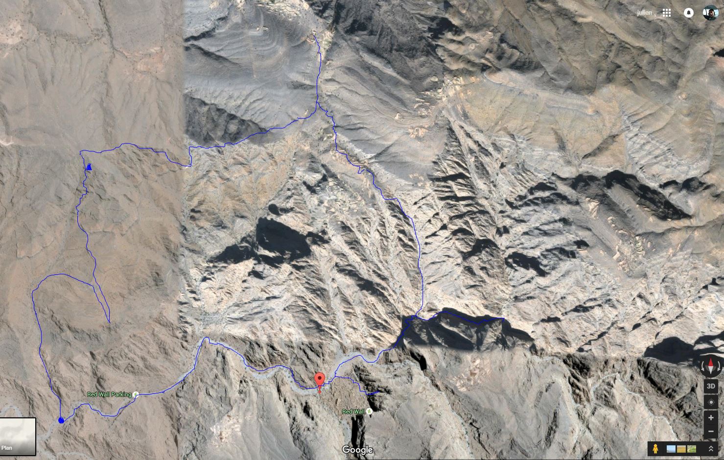
❱❱ Itinéraire
Immediate, as part 1 starts directly from the parking lot.
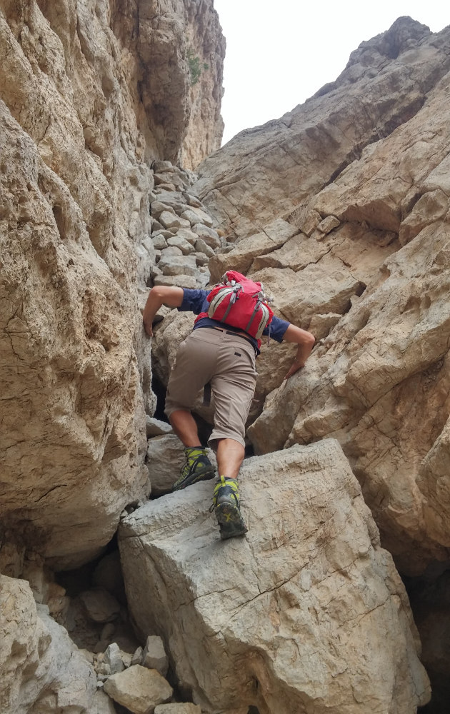
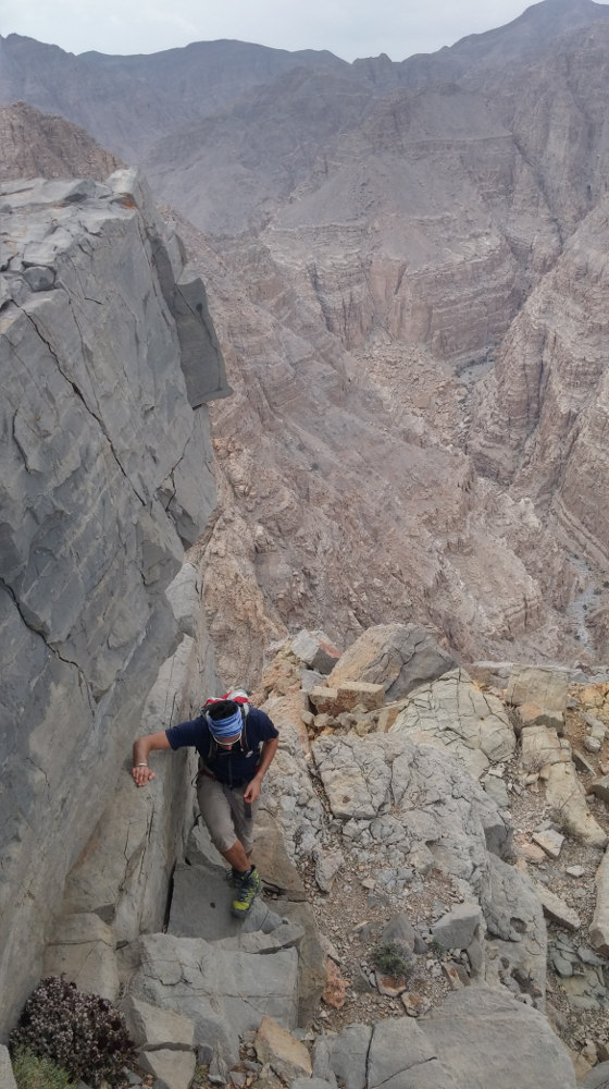
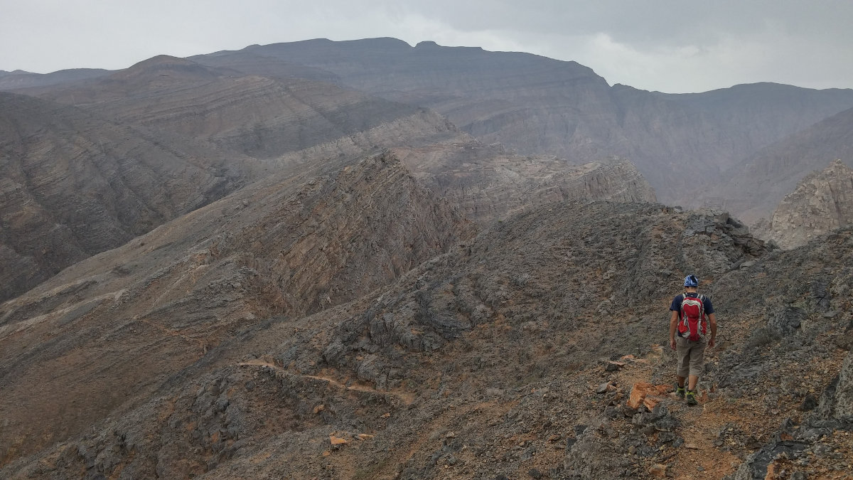
From the parking lot, head left up the narrow gully that rises to the northeast. Follow the dry torrent bed, there are a few IV steps, but they're not too bad. There are also a few Bedouin steps. Higher up, it opens up and, still following the main bed, you turn right, due north, to finally climb up and reach the ridge.
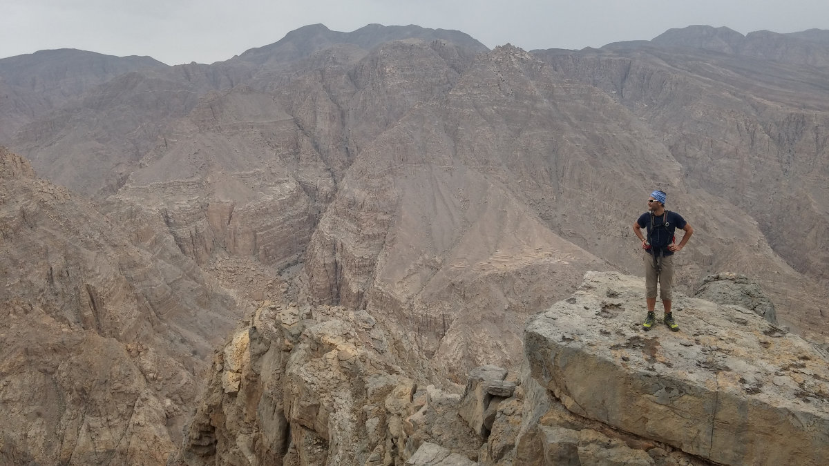
There's a wonderful view over the wadi and, at the very bottom, you can see the tiny Red Wall. The folded rock gives off orange-red hues. Continue upwards to the highest peak. You have to improvise a route to get there, with a few exposed IV+ steps at the end on a rock that's not very good... Ojo! At the summit, a fine view of RAK and the coastline (except today, as it's raining, but you can guess).
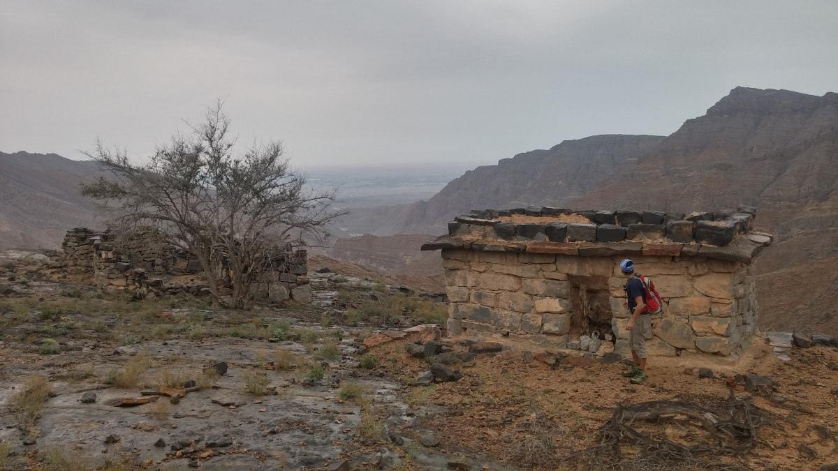
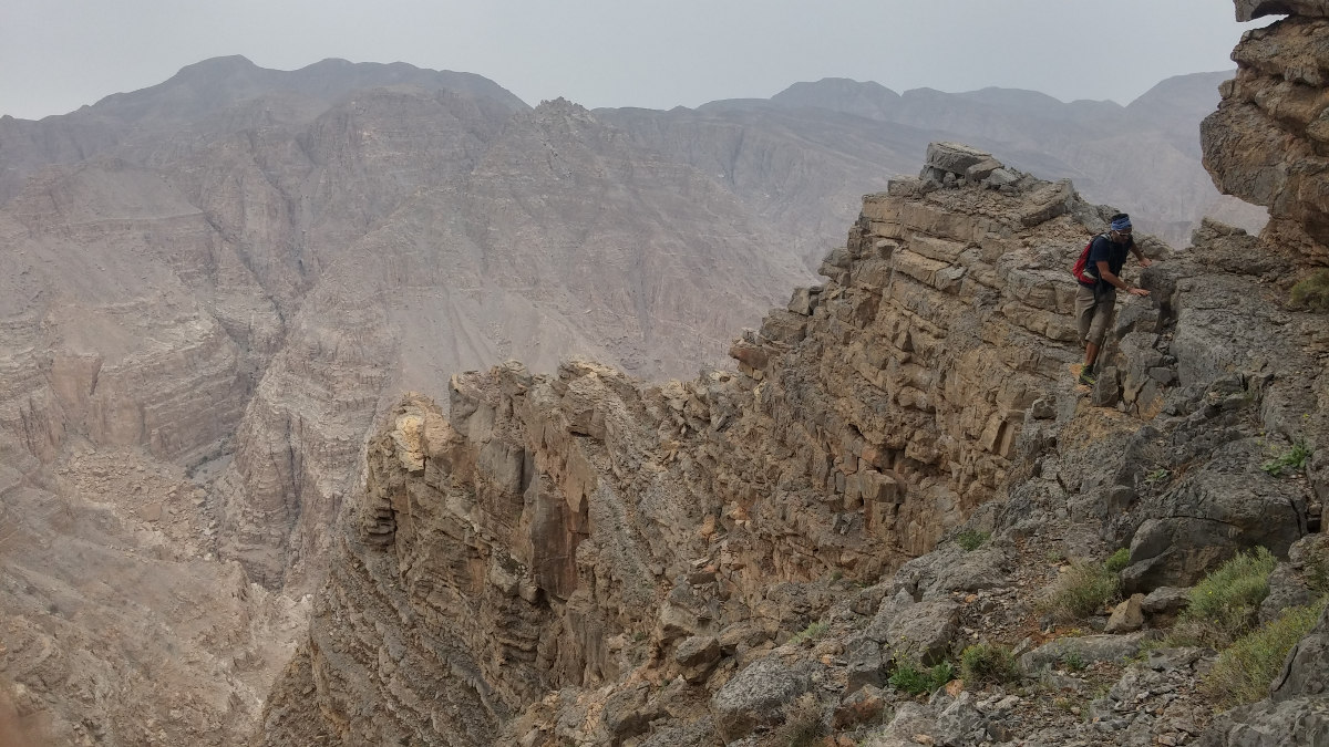
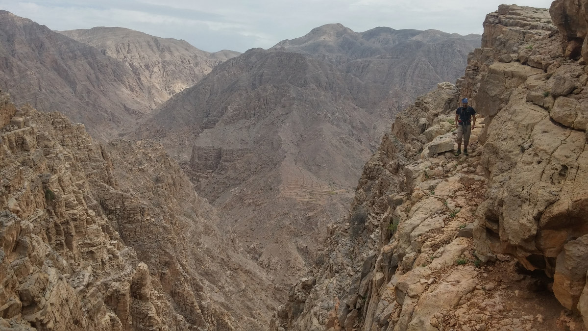
Descend a little to the east and pick up a well-marked path with yellow and then pink dots. Head north, staying on the ridges. In the distance, you can see the terraces and houses of a village that you'll reach fairly quickly. A little further on, there's also a village on the left with pretty terraces of green grass today... hard to believe we're in the Emirates in April!
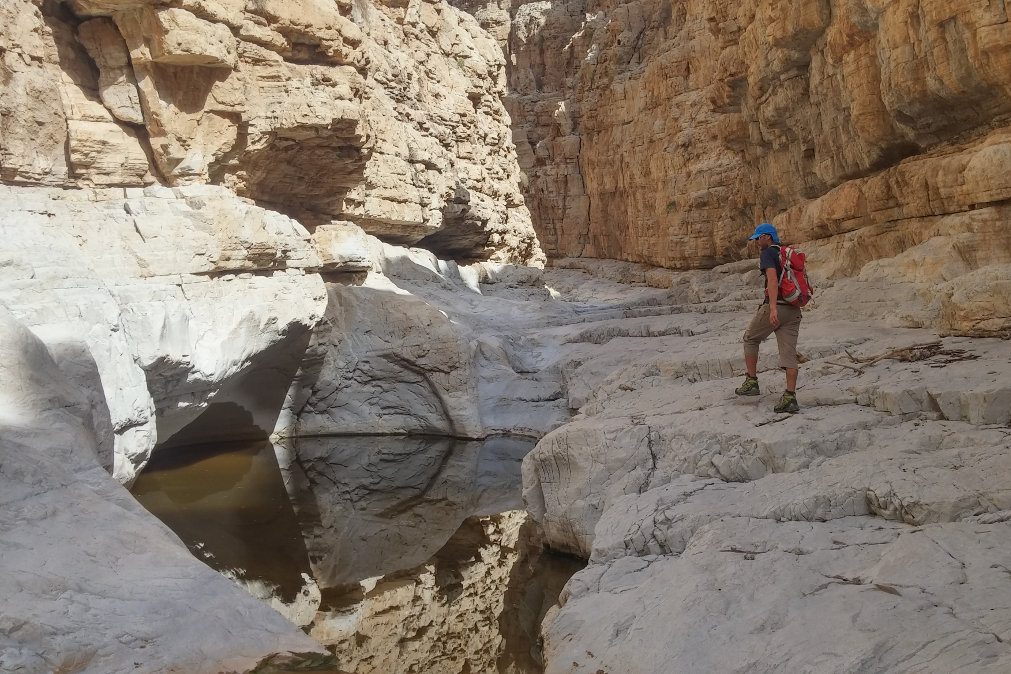
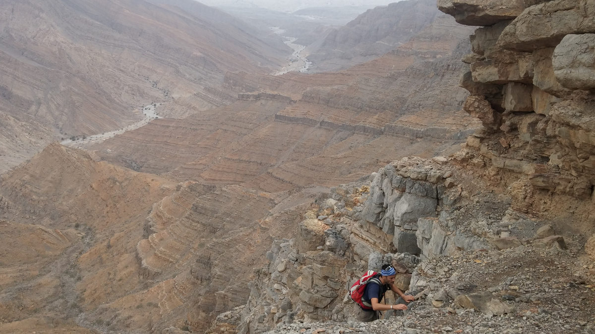
Cross the village and climb up to the other side. Pass a fairly steep, narrow gully, continue on a ledge and finally take a slightly less steep, wider gully. Descend it without too much difficulty, with a few de-escalations all the same. At the bottom, there's a large impassable waterfall (and even a second one that you can guess). We're 100m above the Naqab riverbed.
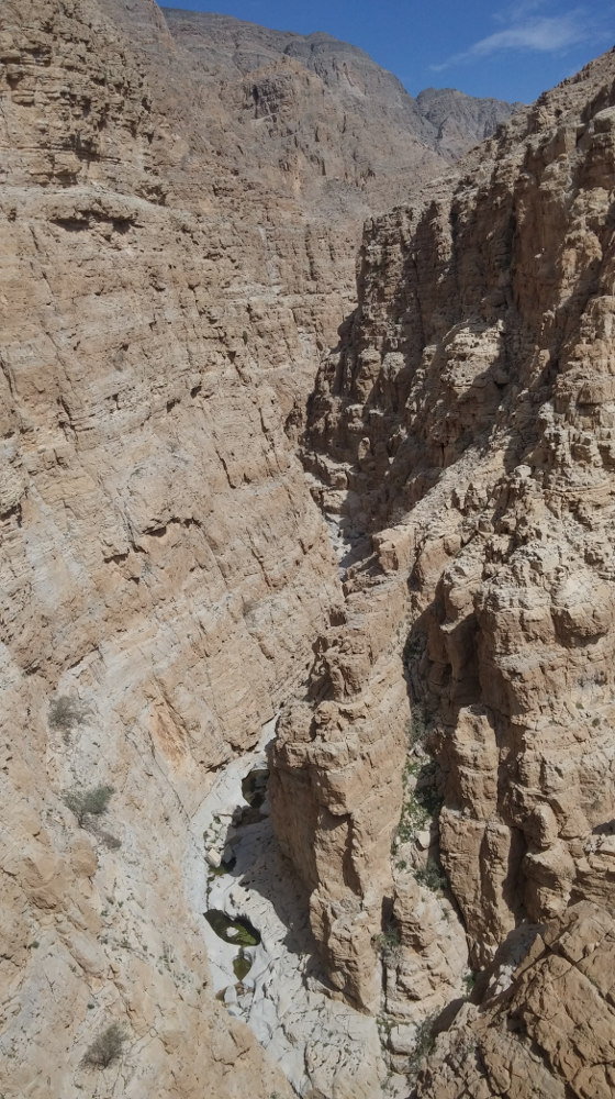
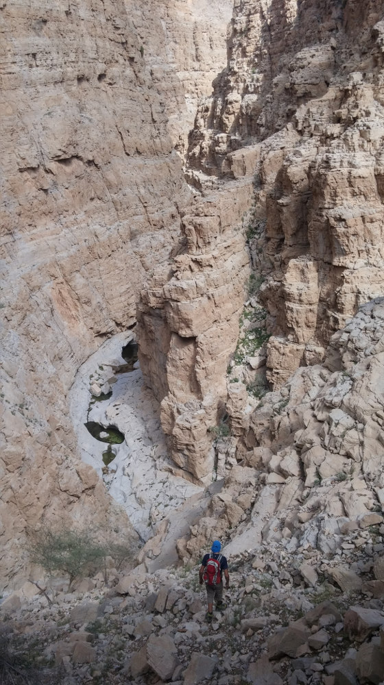
The solution is to cross a little to the left (north) to find 2 easy descent options. We took the one on the left to discover the splendid Wadi Naqab, Tiwi's distant cousin. In the couloir, you can walk a little further up the whitewashed edges to reach the bottom, in the water and at the foot of an impassable narrow waterfall.
Retrace your steps and continue to follow the bed of the wadi. There are still a few waterfalls, but these can be bypassed using the side ledges. Then back along the wadi bed, continuing to use the system of ledges on the right (see Red Wall topo).


Leave a Reply