


TOPO Hiking | CLIMBING7.COM
Publié le
 Partager sur WhatsApp
 Partager sur Twitter
Partager sur Instagram
Partager sur Twitter
Partager sur Instagram

 Partager sur Facebook
 Imprimer le topo
 Laisser un commentaire
Passing along the western side of Cap Corse, a little below Venturi, you can stop off at the little village of Pinu, whose cala below the road is well worth a visit. Above it, as you leave the forest, you reach the ridges offering a lovely panorama of the coast before descending to the Genoese Seneca tower. Thanks to V and F, who welcomed and guided us, we were able to discover this wild and seldom-visited route for a beautiful hike on the heights of Cap Corse.
❱❱ Technical summary
Type ✦ Hiking
Location ✦ Pinu
Region ✦ Cap Corse
Country ✦ France
Length ✦ 13kms
Elevation gain ✦ 650m
Difficulty ✦ MD
Duration ✦ 3h30 to 4h
Interest ✦ ★
❱❱ Access to the place
From Bastia, drive up the east side on the D80, then turn left further up to reach Pino via the D180 and the mountain road. Park in the village at the Bar des Platanes.
❱❱ Map & topo
❱❱ Itinéraire
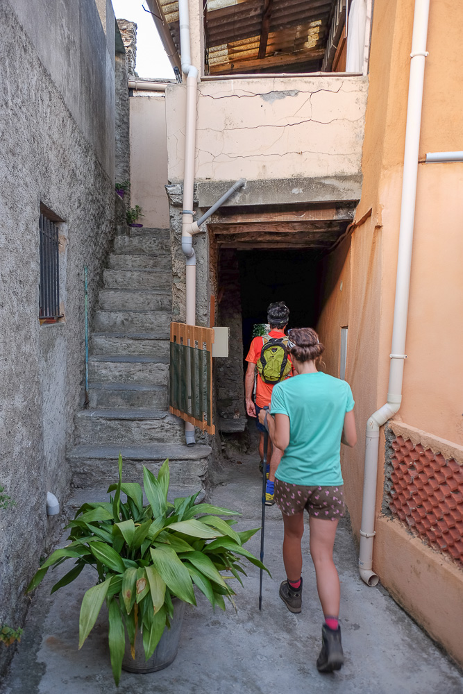
Immediately. Take the stairs at the fountain, in the bend after the Bar des Platanes, and climb up to cross the village and exit into the woods.
Medium-altitude trek at around 700m, but fairly long (13 kms approx.). No real difficulty except for the itinerary for the ascent, which is not obvious and not really marked out. On the ridge, the path is better marked and you join a red trail near the Seneca tower. Allow around 4 hours to complete the loop from the village of Pino.
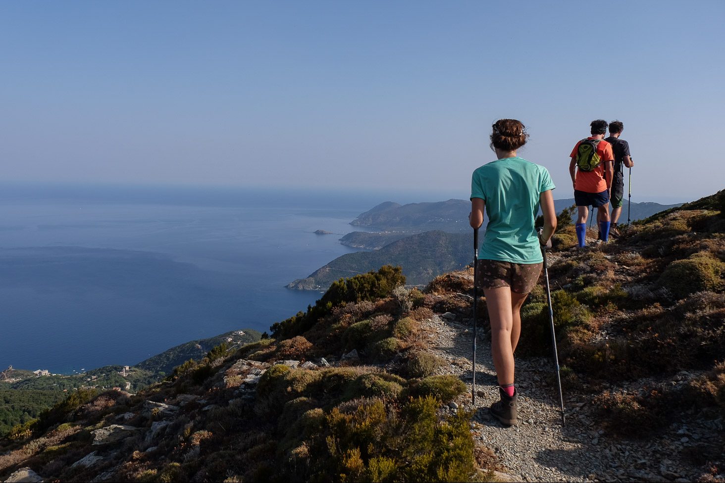
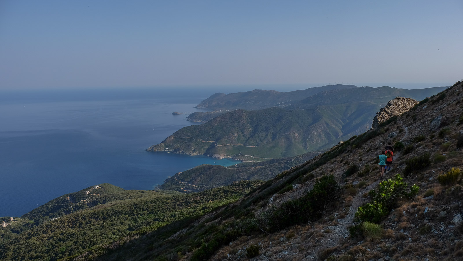
Follow a more or less marked path through the woods. Higher up, you emerge from the forest with your first view of the coast behind you. Continue up the ridge to reach the Gubietta summit (730m) within sight. This is where the Pinu crest trail begins.
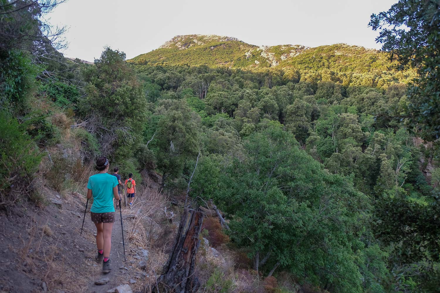
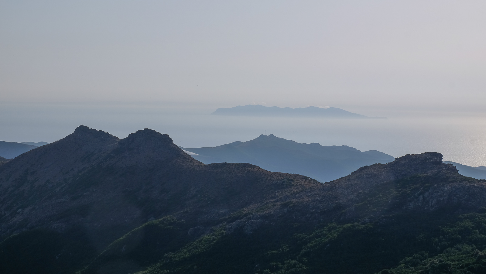
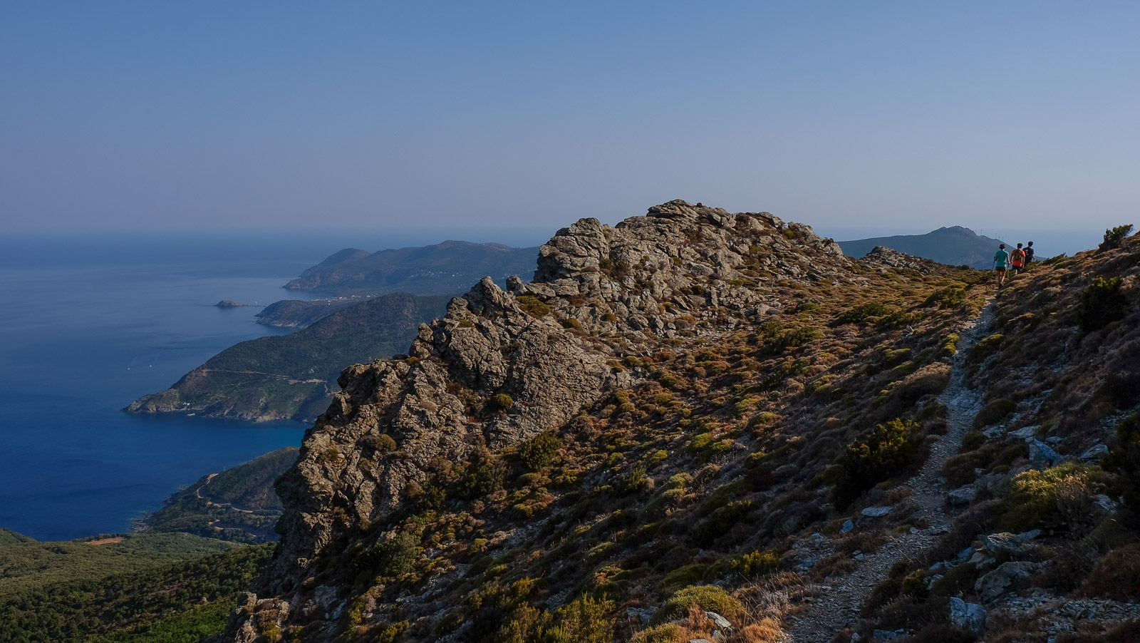
Descend from the summit on the opposite side to find a yellow-marked path in the pass between this summit and the next, which again goes into the woods. This is the start of a fairly long traverse on the flank under a veritable tunnel of vegetation. At the exit, the path climbs out of the scrubland and follows the ridges, with views on both sides. There are cairns. The path then passes to the right of another small summit before winding along the ridge or left flank. The panoramic views of the east coast are magnificent.
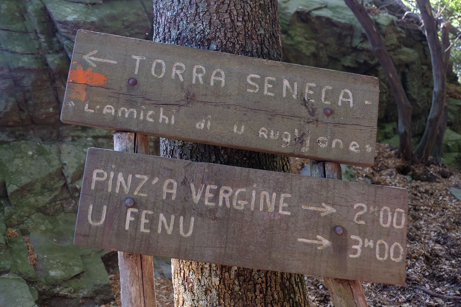
At the very end of this path, a Genoese tower stands out, the Seneca Tower. Reach it by descending through the woods. From here, descend again along the red-marked path to reach the Seneque gite a little further down (parking lot). End of the ridge.
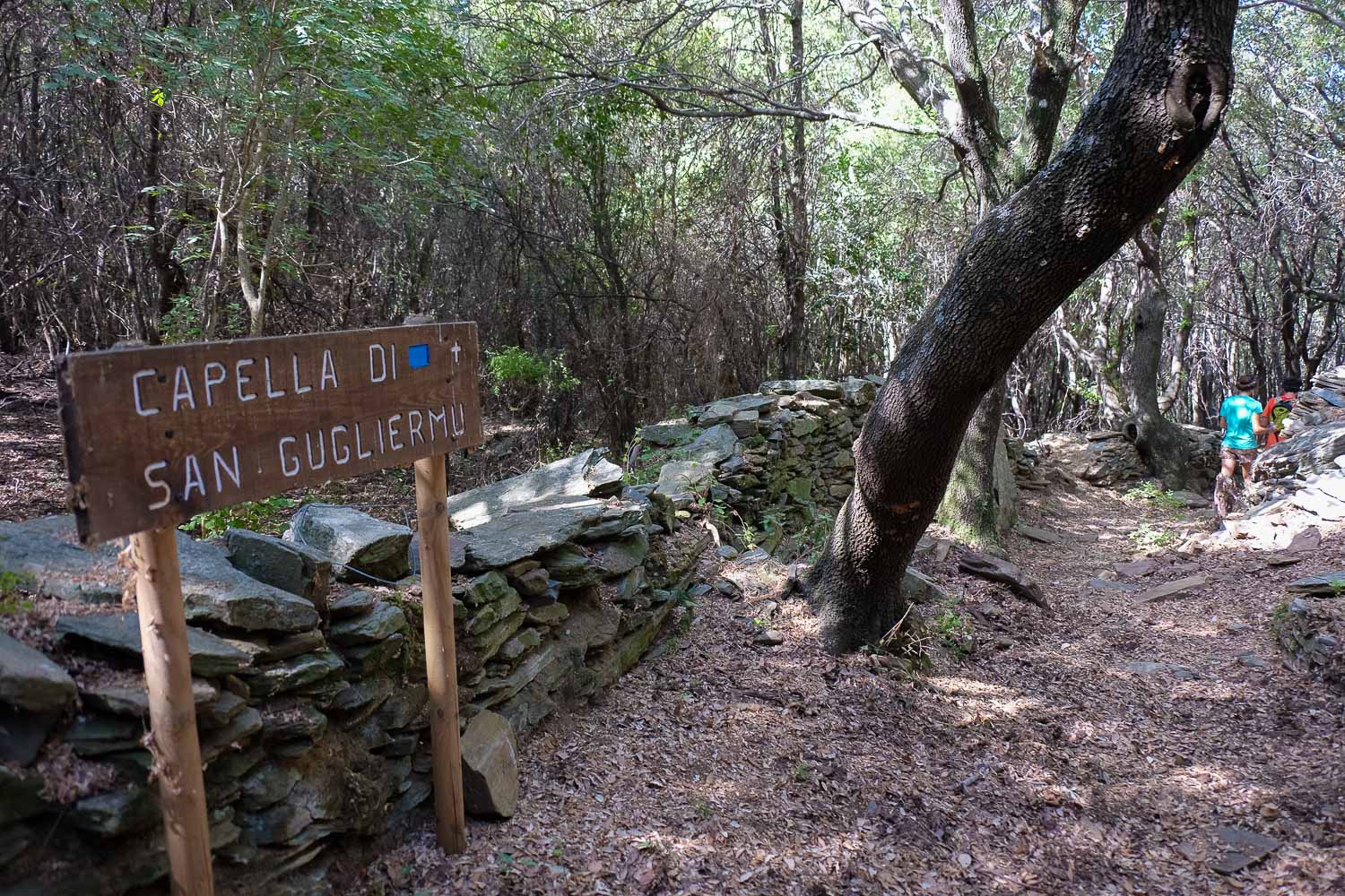
Take the road and quickly branch off onto a red path to the right, which will cut a hairpin bend. At the bottom, take the road down, then left again on a wide track. Descend through the woods to a clearing, where, shifting slightly to the left, you catch a small path marked with blue dots along a low stone wall. Follow it all the way down through the Pinu highlands to the Bar des Platanes.


Leave a Reply