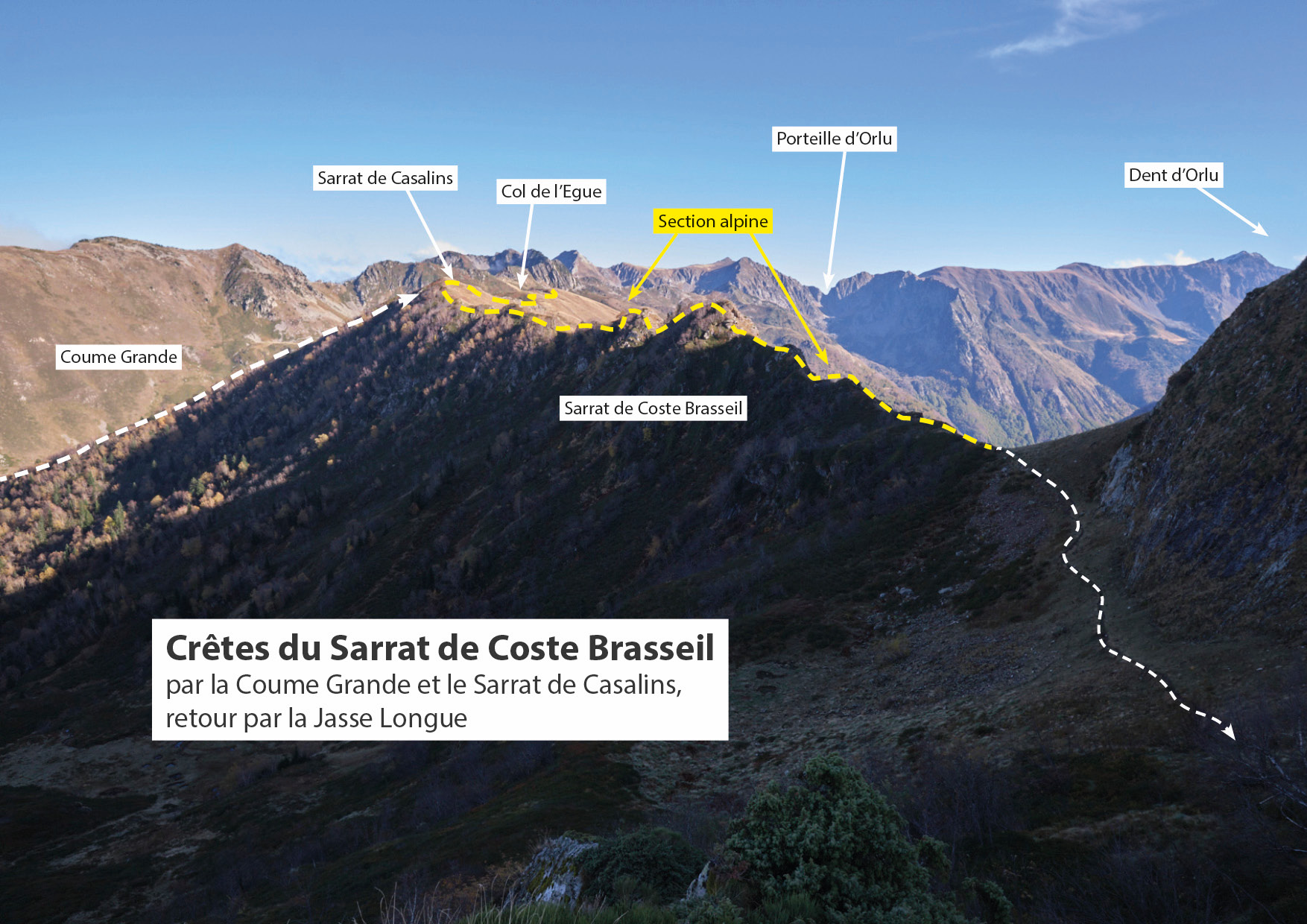
The hiking loop proposed from Coume Grande gives access to the ridges of Sarrat de Casalins and Sarrat de Coste Brasseil, with spectacular aerial and panoramic views over the valley and the Dent d'Orlu. The majority of the route is off-piste, and includes an alpine section that requires good reading and sure-footedness to avoid spooking yourself. The ascent of Pic de Brasseil or Dent d'Orlu can be an additional option on the route before returning via La Jasse and the Cabane Longue stream. An excellent route for experienced hikers who are comfortable with steep, exposed terrain.
❱❱ Technical summary
■ Departure point: Parking de la Coume Grande, Ascou, Ariège (09)
■ Type of route: high-mountain loop hike, alpine section
■ Distance: 12 km
■ Cumulative elevation gain: +850 m
■ Cumulative negative altitude gain: -850 m
■ Estimated total time: 4h to 5h ■ Min and max altitude: 1340 m / 2080 m
■ Marking: none except on the section from the foot of the Dent d'Orlu to the Jasse de Cabane Longue (PR). Trails fairly visible.
■ Equipment in place: none
■ Equipment required: useful GPS track.
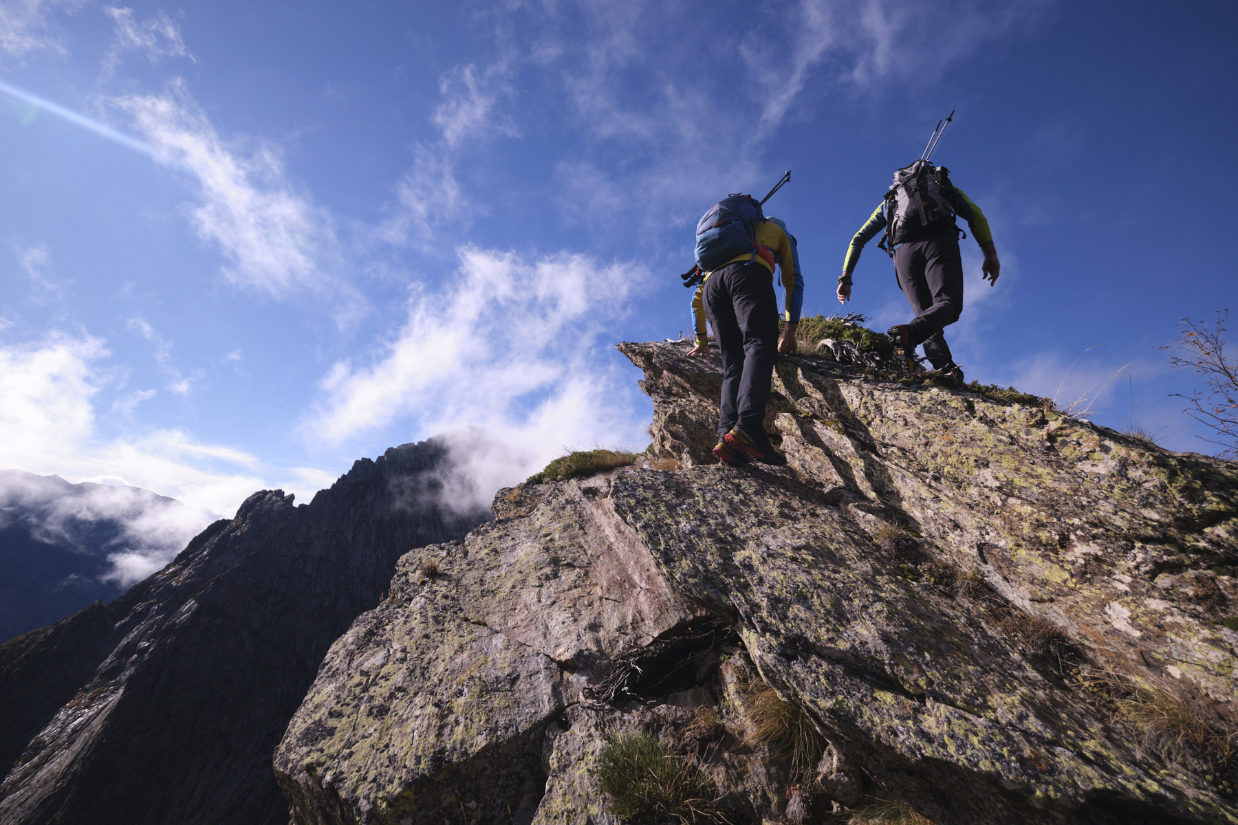
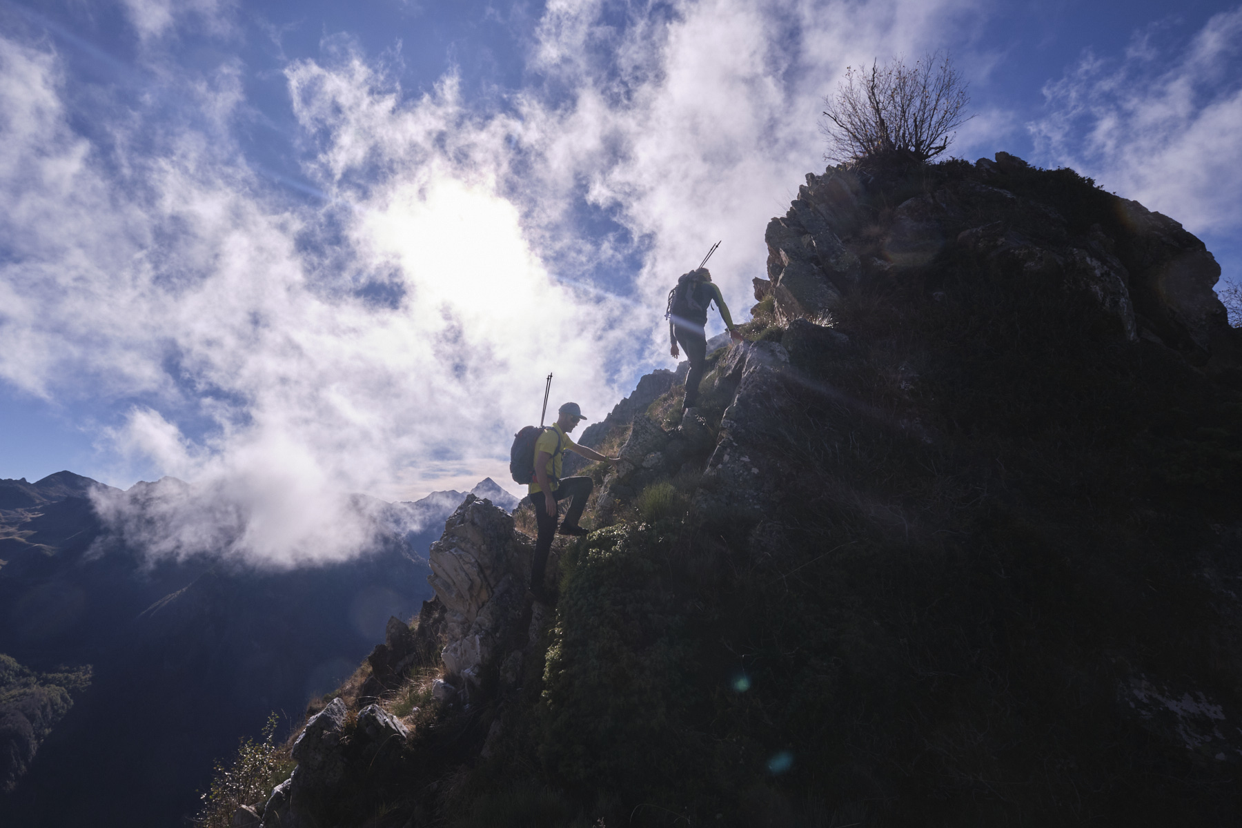
Difficulties: the final section of the Sarrat de Coste Brasseil ridges is aerial, with a few exposed passages to be climbed or unclimbed with care (II max).
❱❱ Access to the place
From Ax-les-Thermes on the N20, climb towards the Col du Chioula and follow the signs for Ascou-Pailhères. Pass the village of Ascou, then Goulours and Lavail. Continue on the road towards the Col d'Ascou-Pailhères, and at the first left-hand hairpin bend, park on the right on the large stony flat.
❱❱ Map & topo
The itinerary at the top of Coume Grande and on the way back from Jasse de la Cabane Longue is indicative.
Part 1: Up the Coume Grande to below the Col de l'Egue (2090m, 2h)
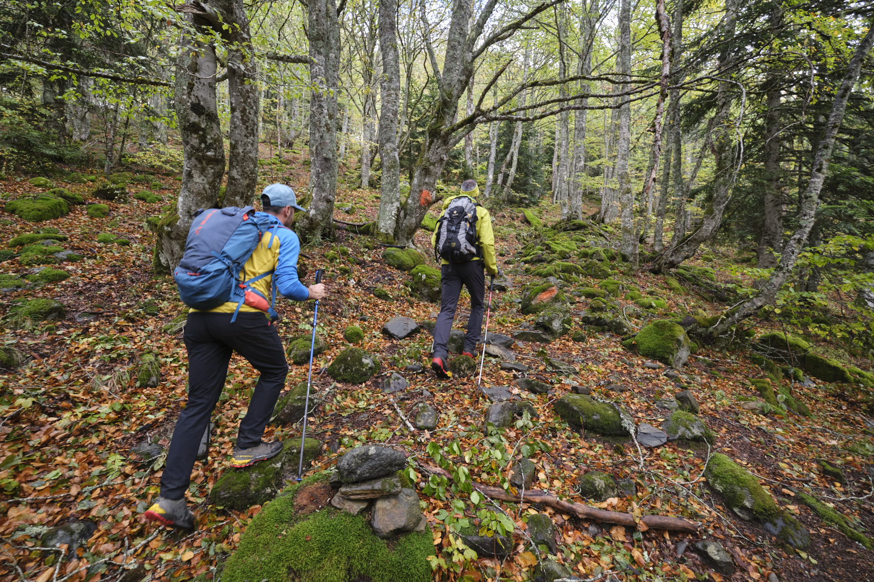
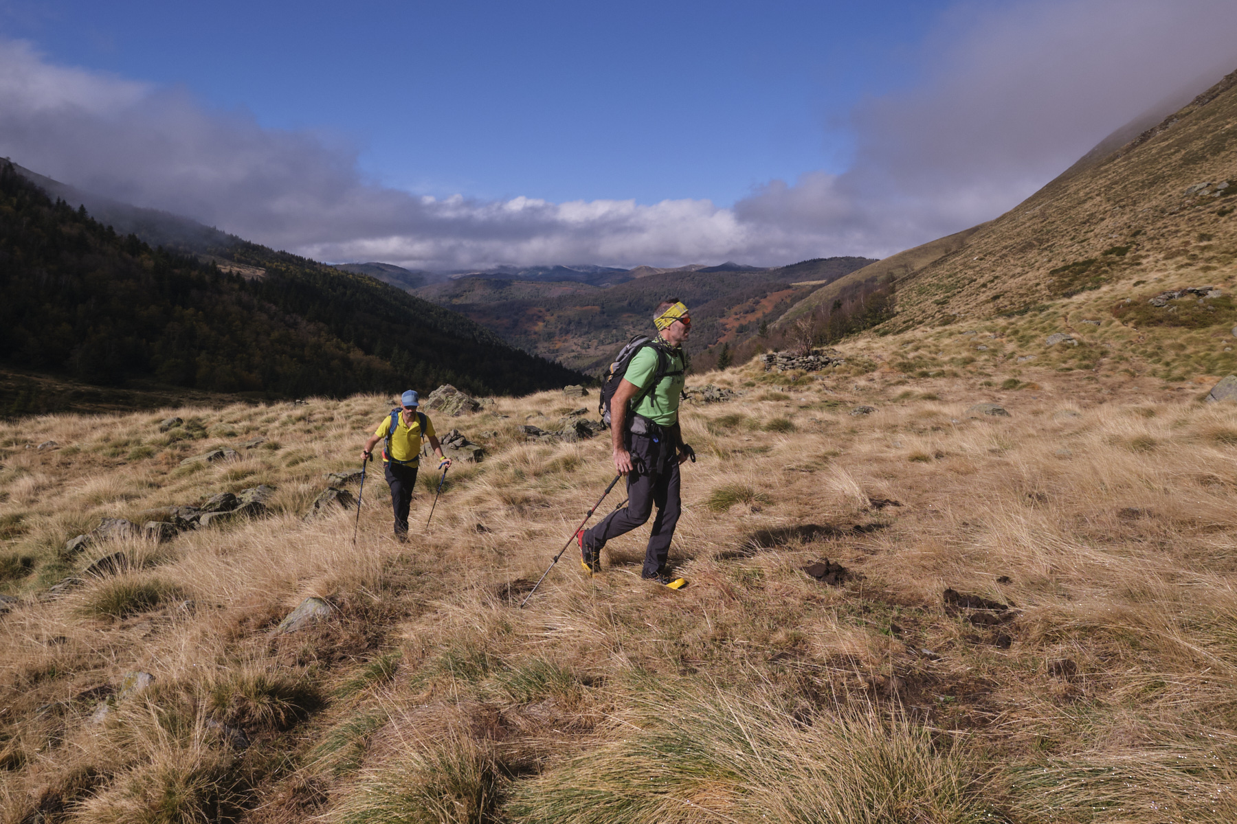
From the parking lot, descend to the bed of the Coume Grande stream, cross the ford and walk along the wide track that slopes gently up to the Jasse de Libeseil. Here, the main track descends to the right and crosses the stream. Leave it and continue straight ahead through the grassy field to find an unmarked but clearly visible forest path. Follow this path, always staying on the right bank of the stream (i.e. on the left as you go up).
At one point, the path bends uphill to the left, and we find red/pink markings on the trees and a few cairns pointing the way. Finally, we leave the forest on gispet and grassy slopes to emerge higher up on a flat at the Orri de Gabensa.
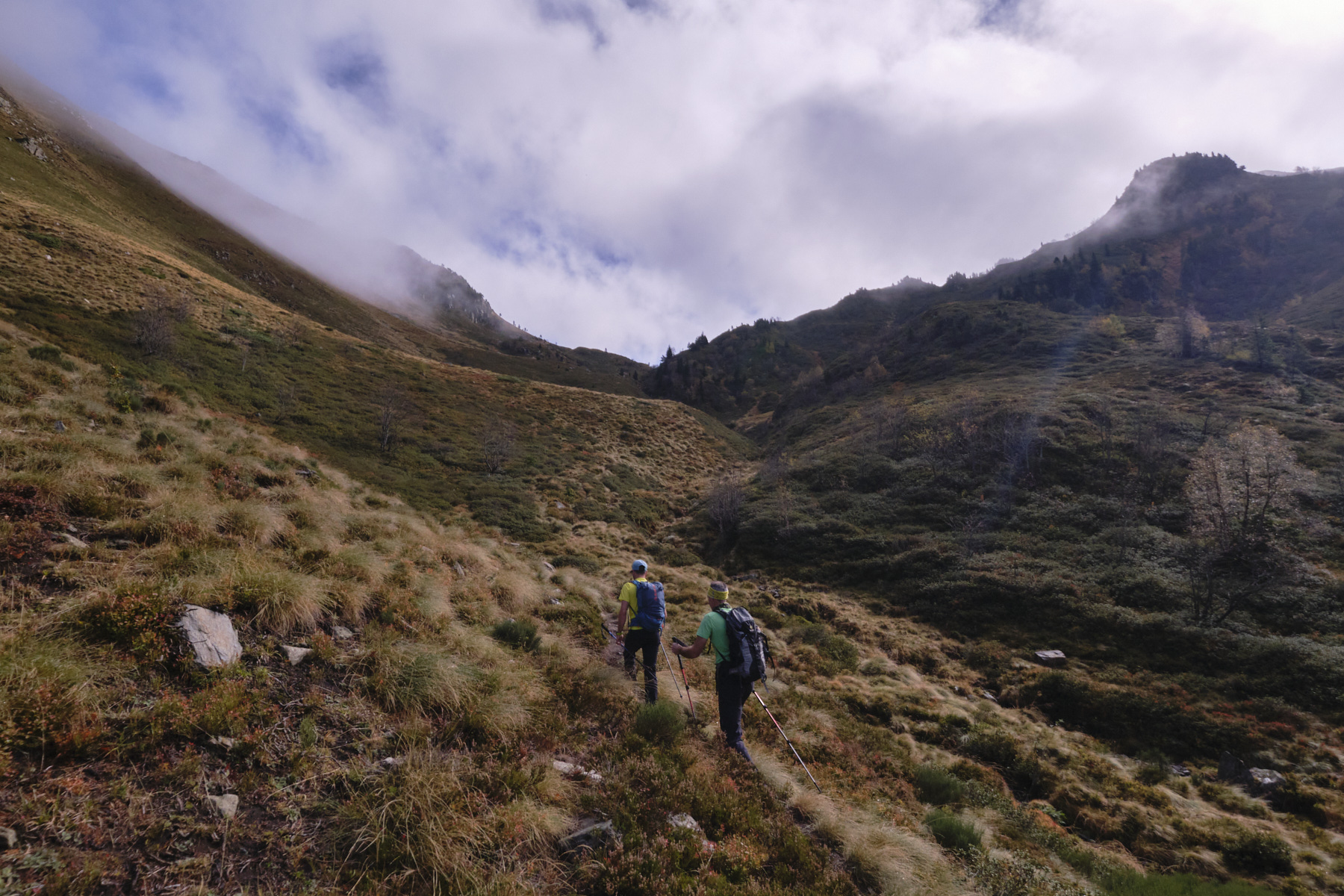
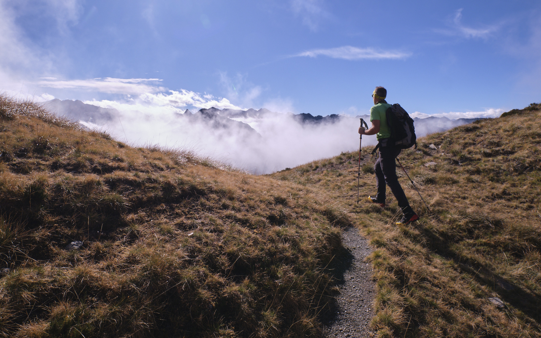
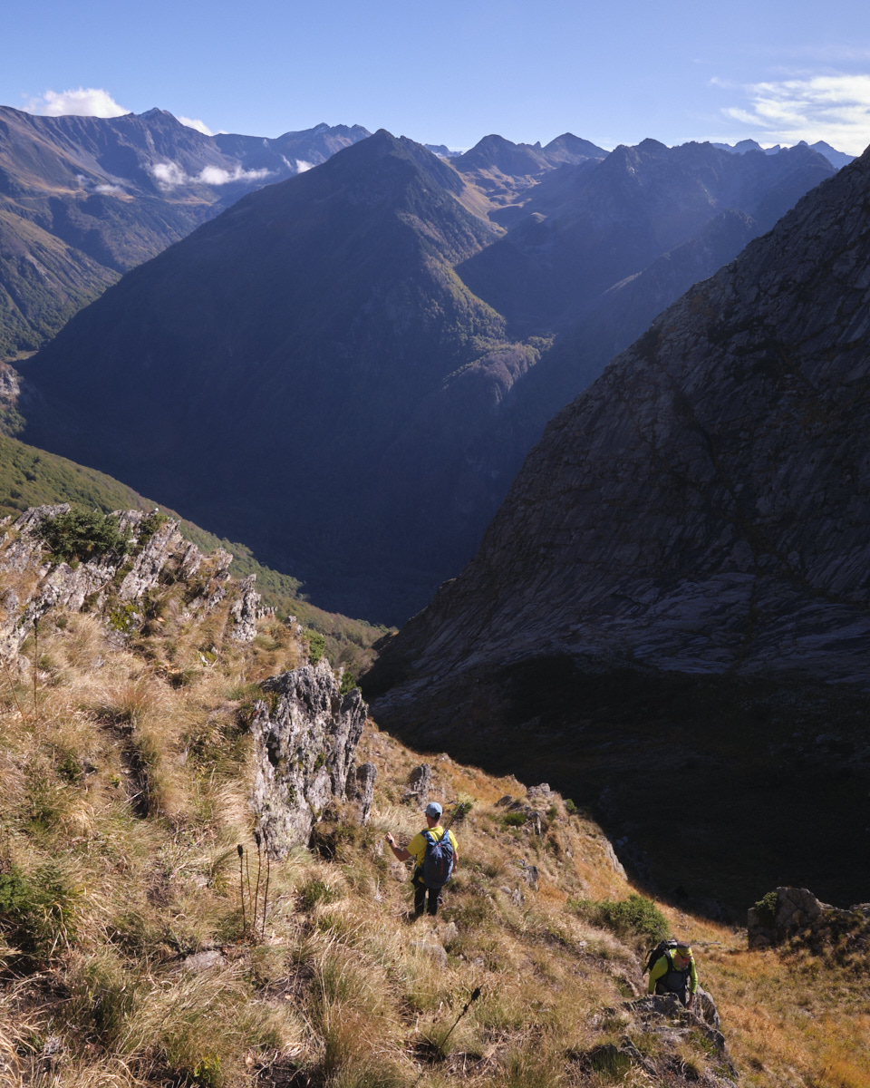
The path, though not very visible from the Orri, continues up a steeper slope to climb along the stream and emerge above it onto a long upper jasse with Le Roc de Bragues on the left and the pass in your sights. The itinerary is not well defined, but by navigating at sight, we reach the ridges without any great difficulty after a last short steep climb. We're not yet at the Col de l'Egue, higher up and to the left, but at the start of the Sarrat de Casalins ridge.
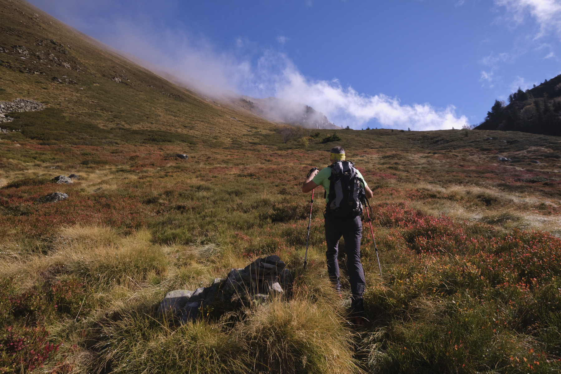
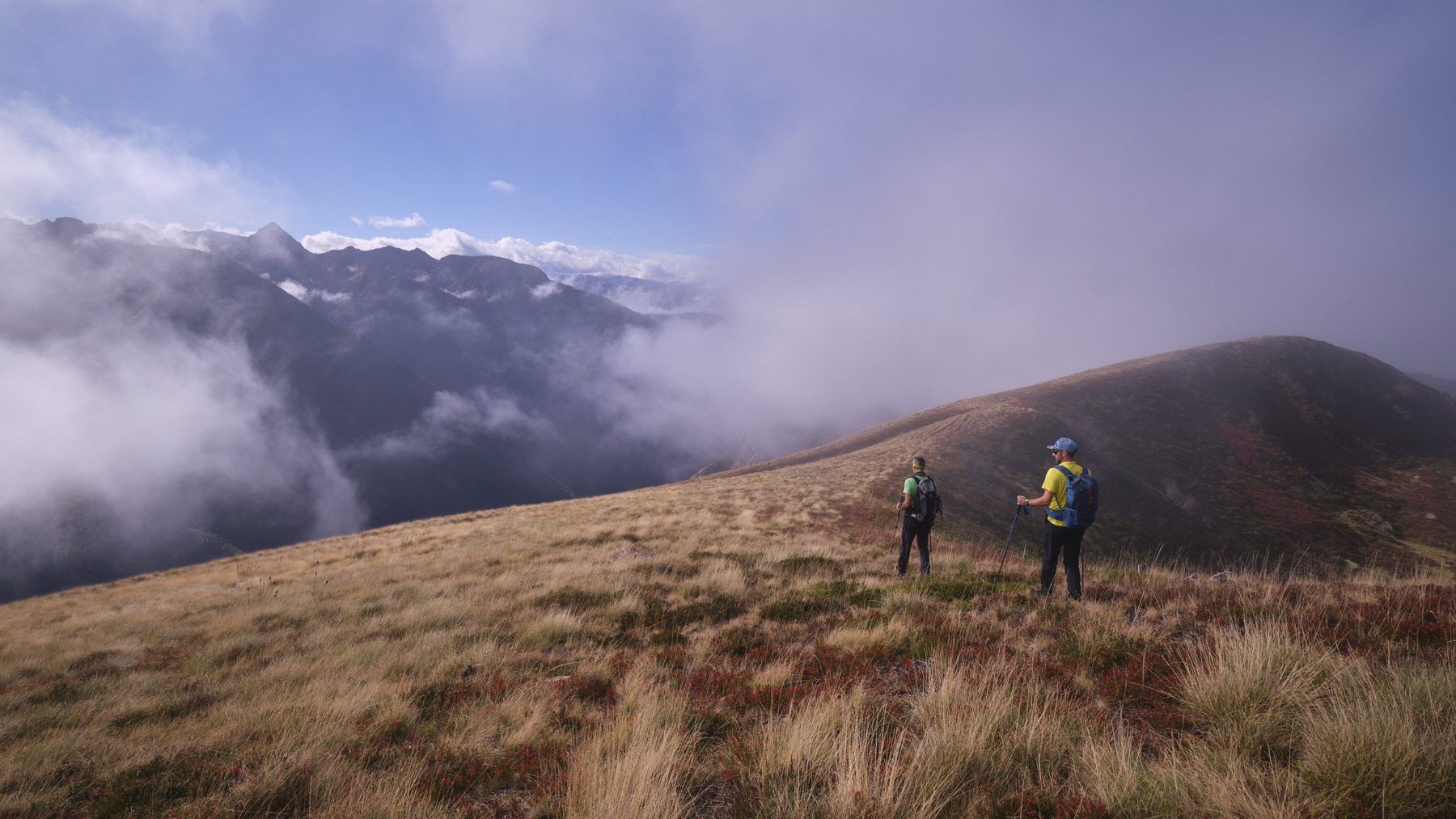
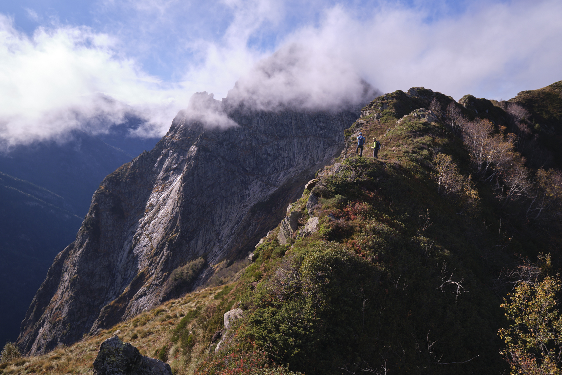
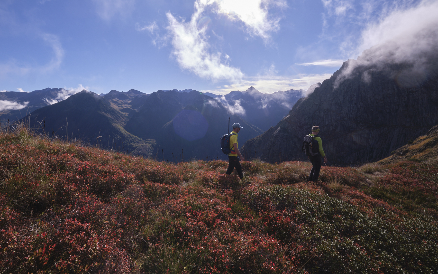
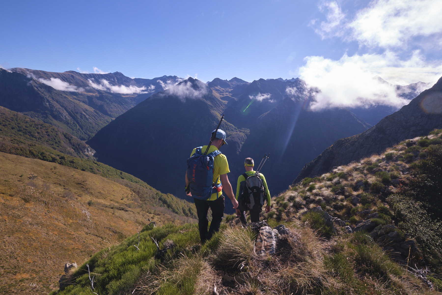
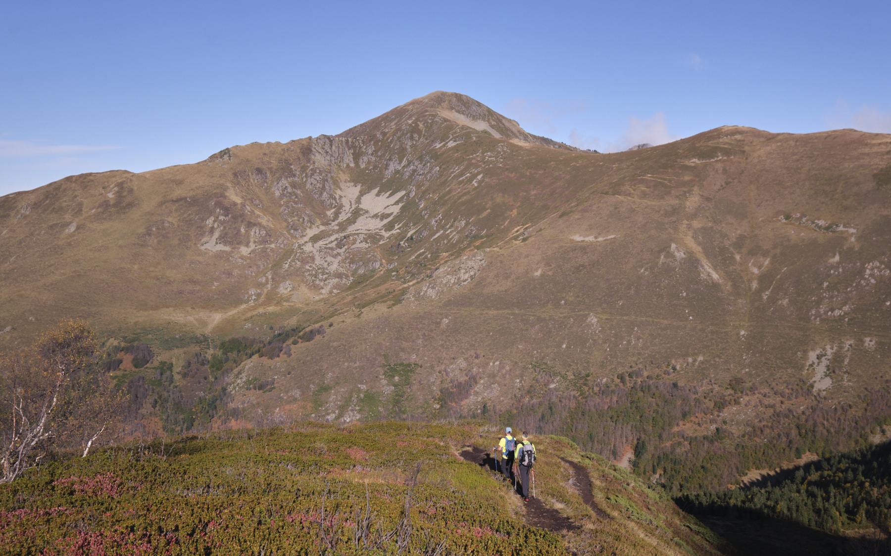
Part 2: The ridges of Sarrat de Casalins and Coste Brasseil (2092m, 1h30)
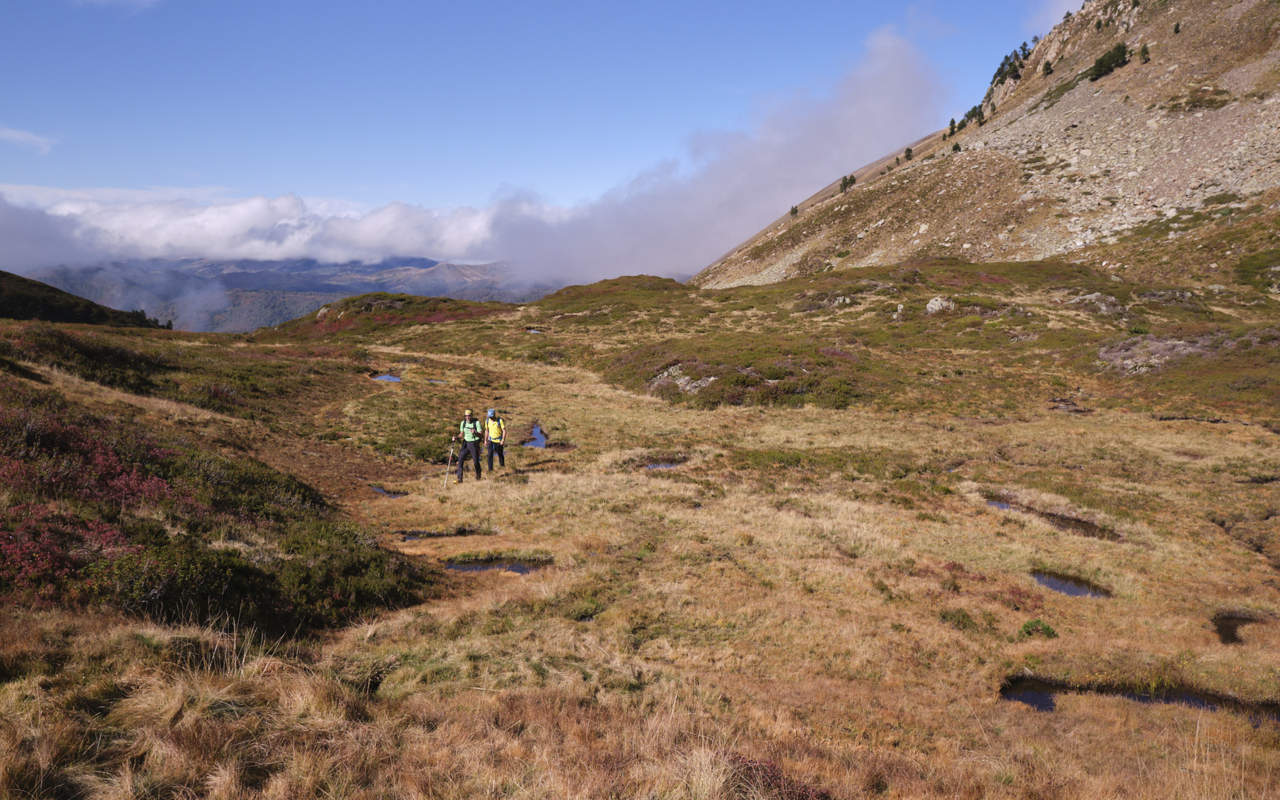
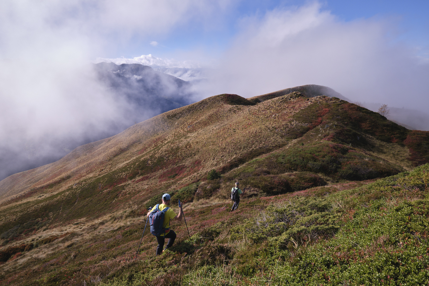
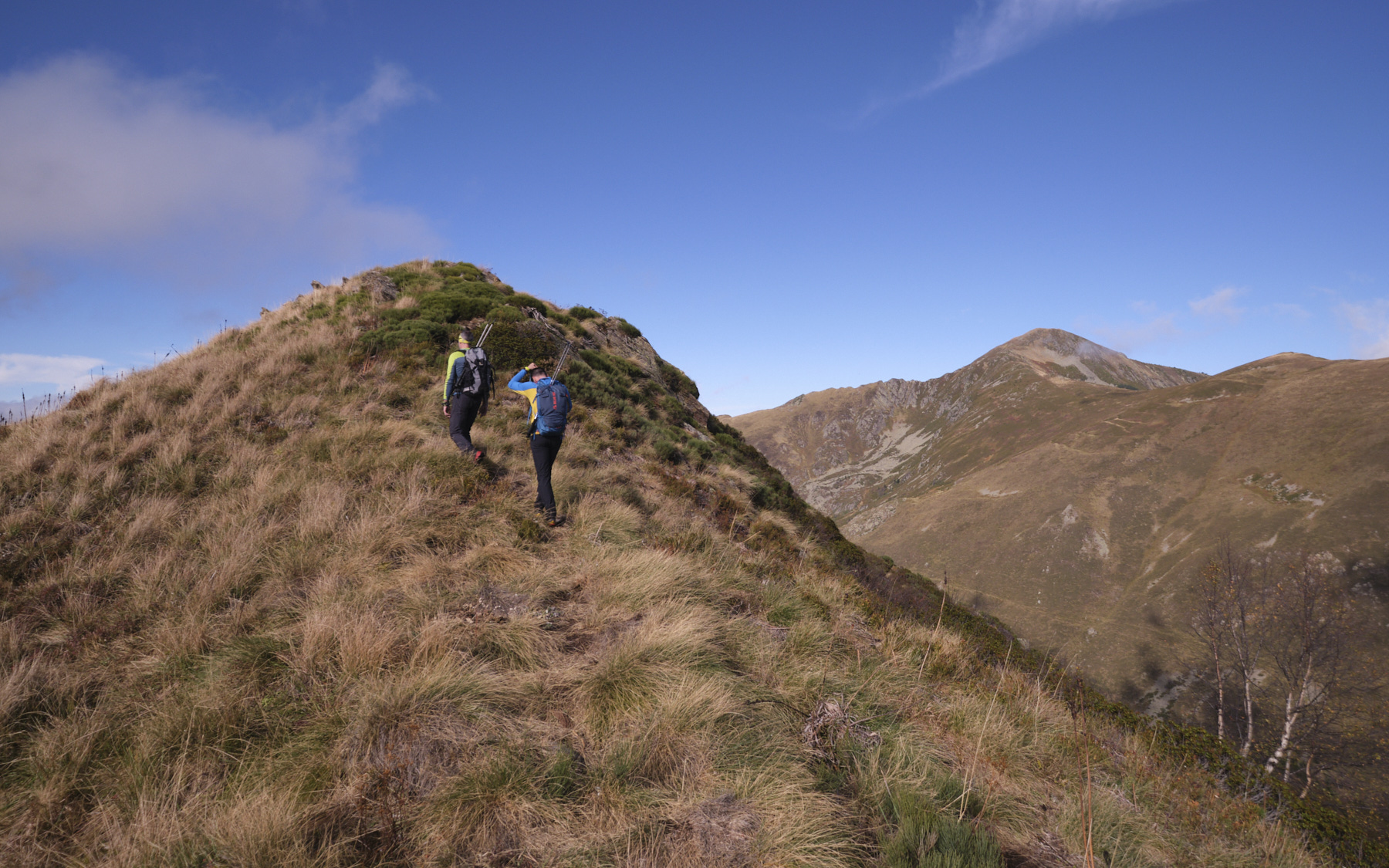
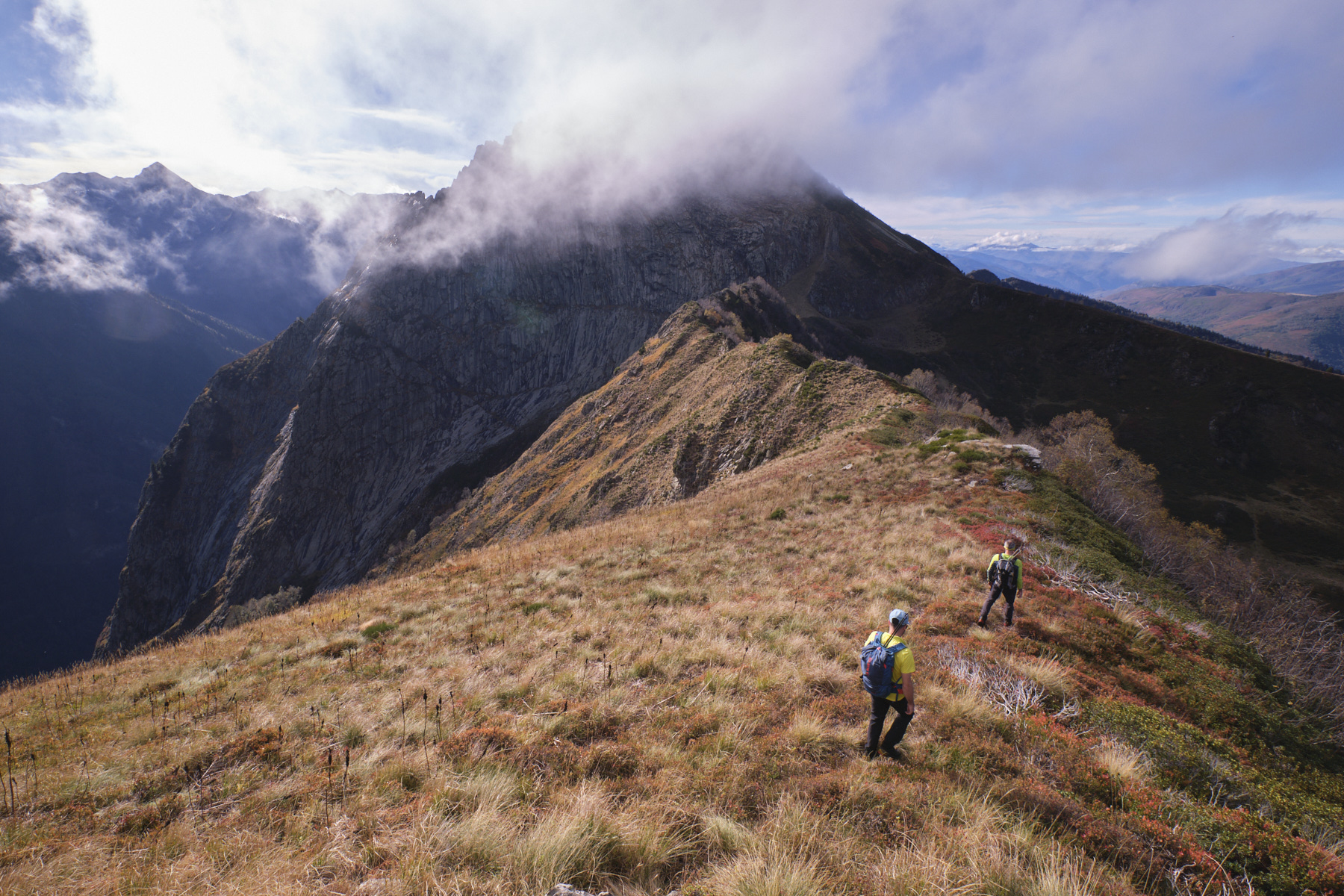
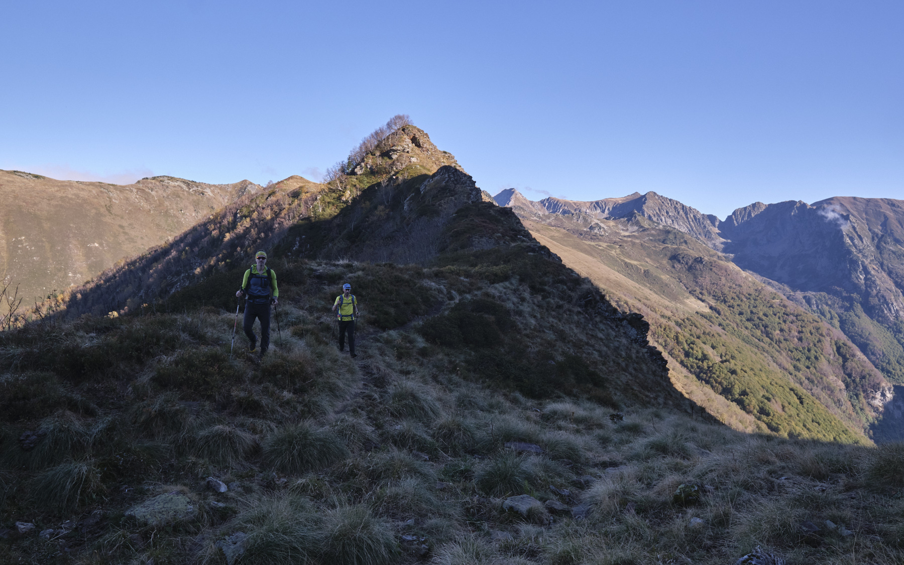
This time, head due west towards the Dent. There is a marked but unmarked path that follows the ridges. The first part isn't difficult, as the ridges are wide and rounded, although you can have fun staying as close as possible to the edge of the crest. It's hilly, descending in places and then climbing again to get over small bumps. The views over the Orlu valley to the south and the Coume Grande and beyond to the north are exceptional.
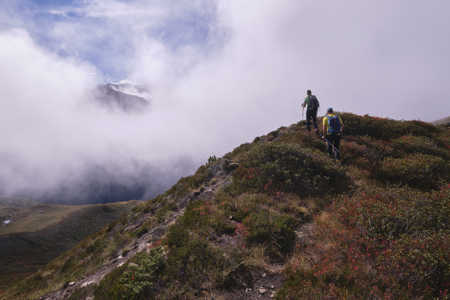
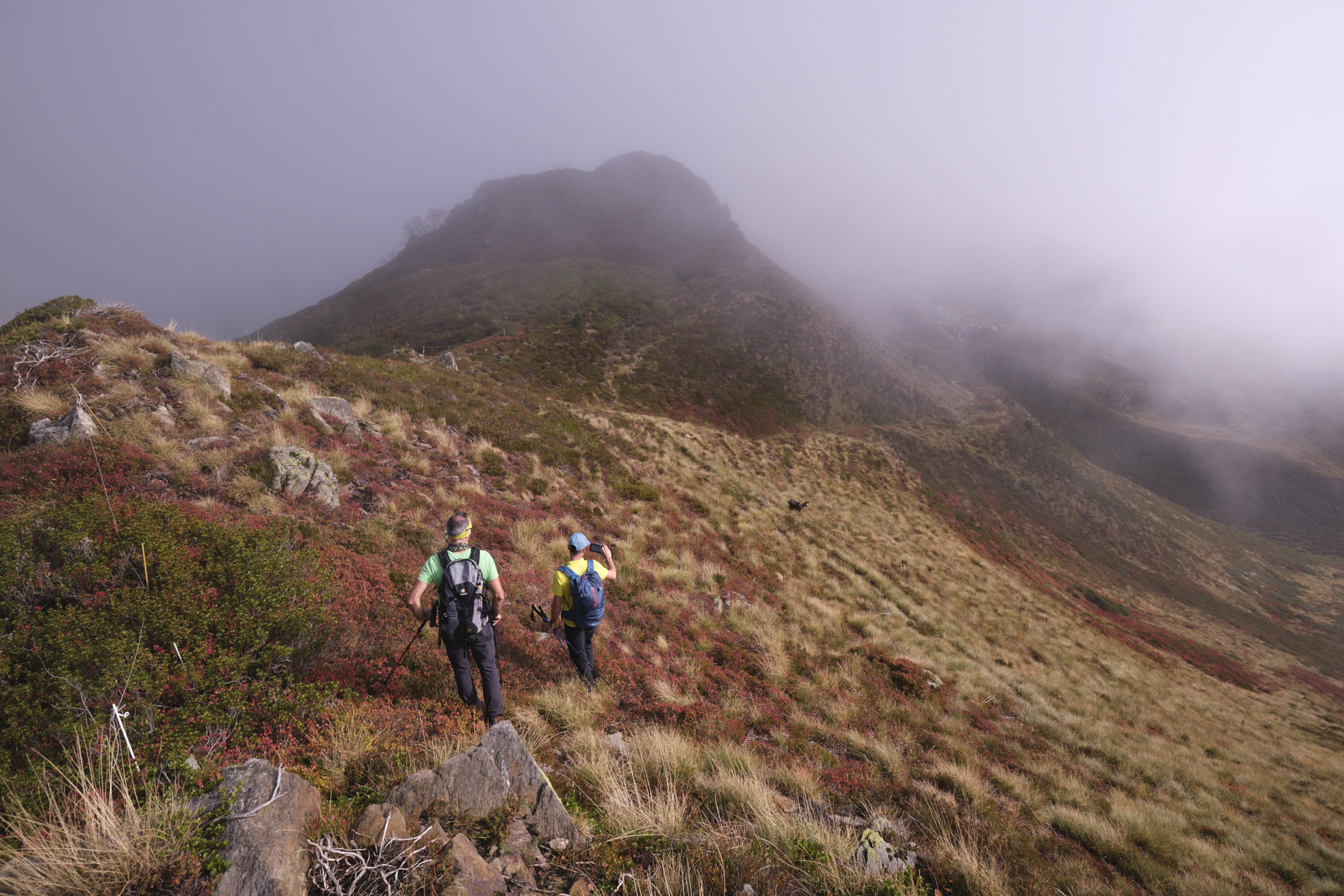
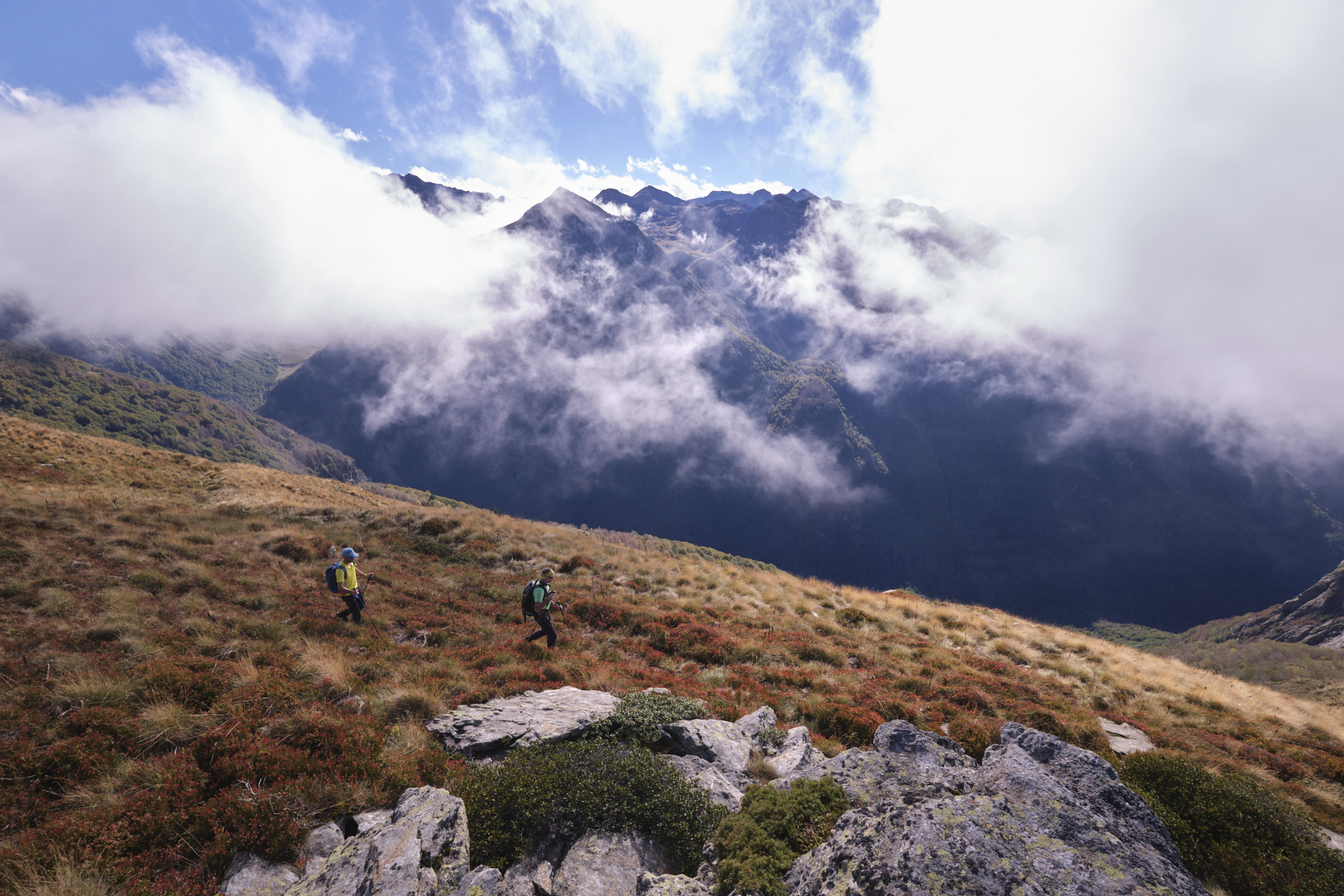
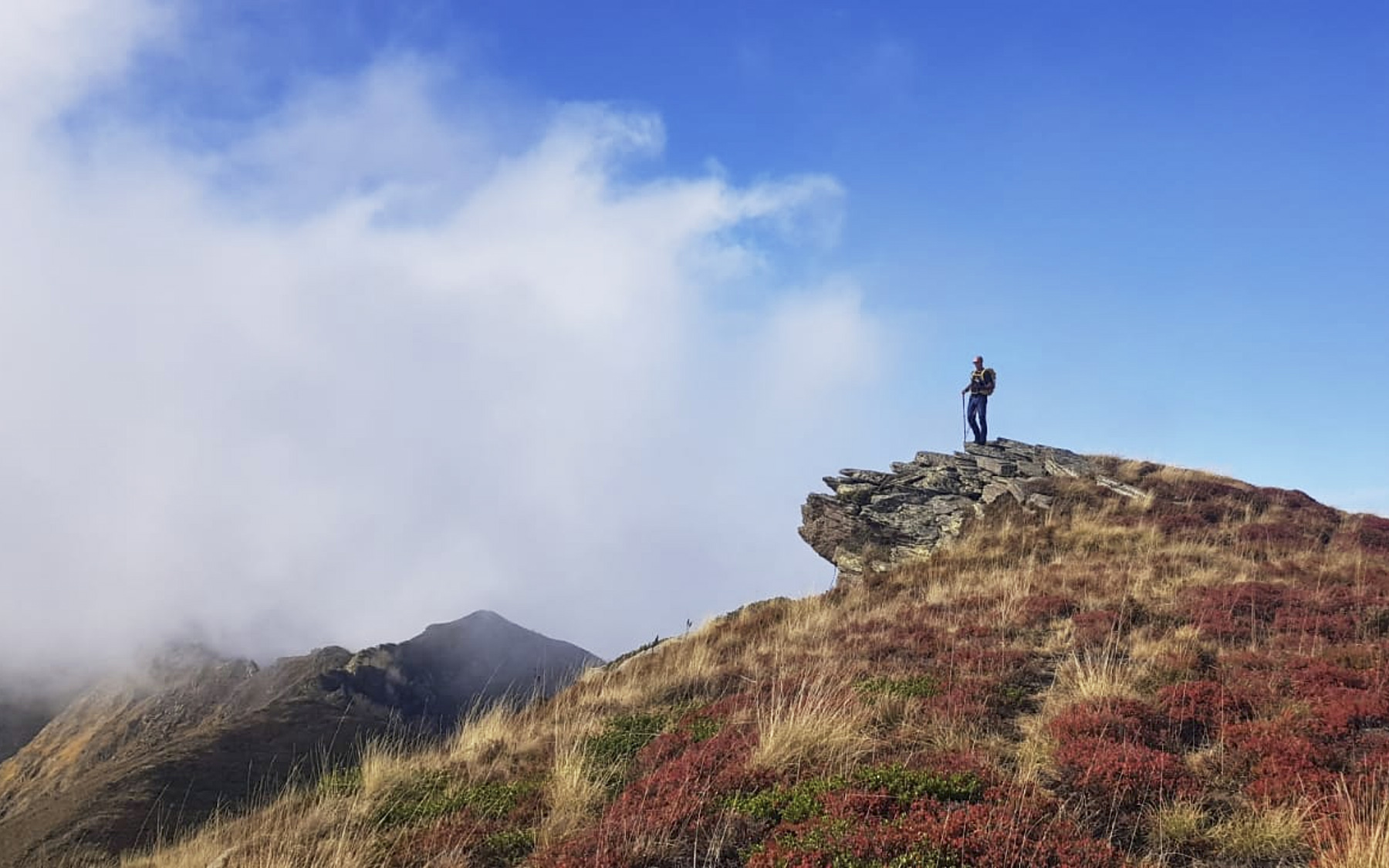
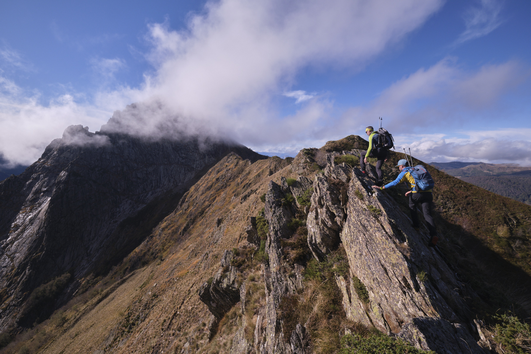
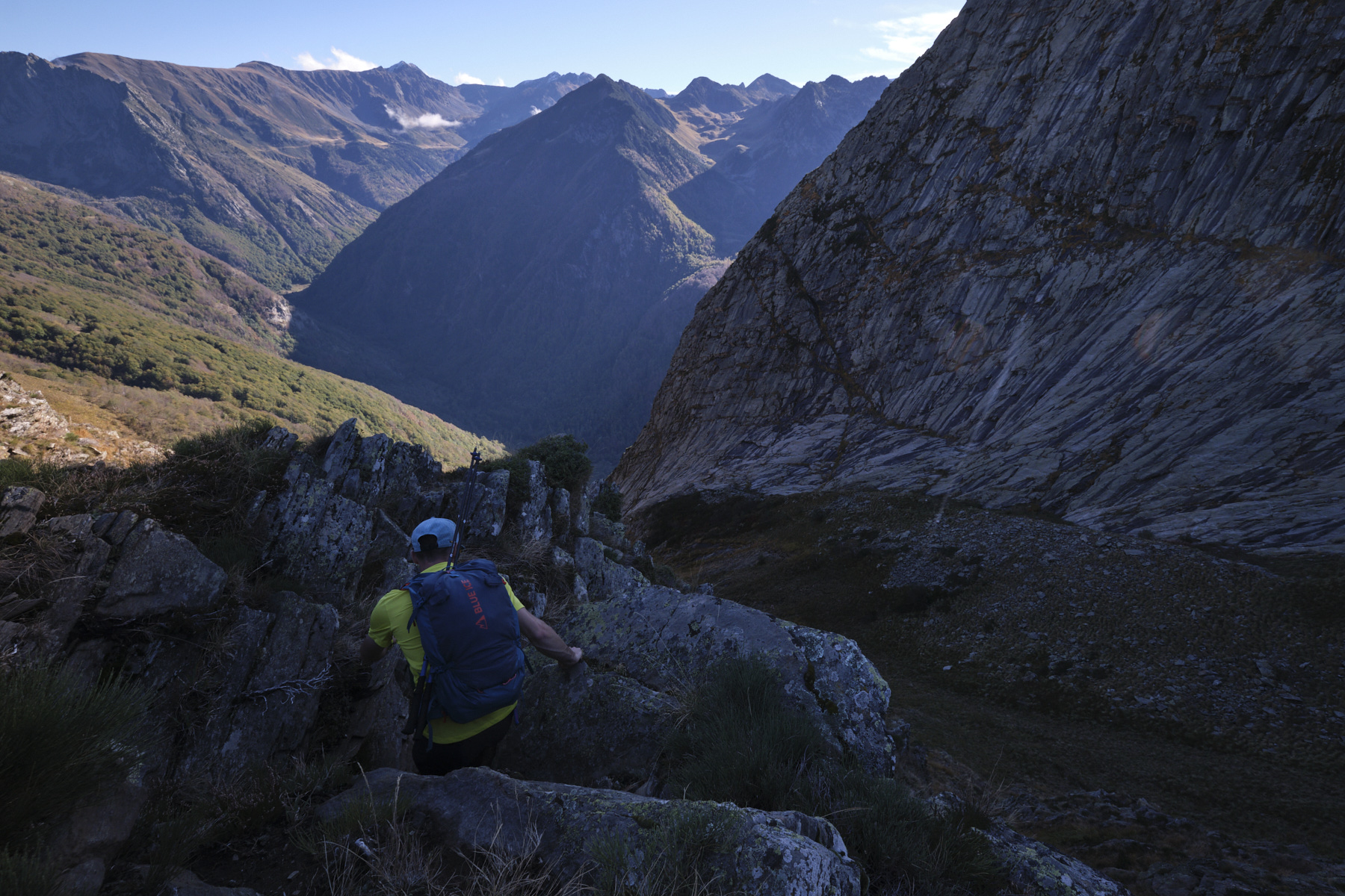
We pass from the Sarrat de Casalins to the Sarrat de Coste Brasseil as we approach the Dent. Once on the last summit on the ridge, you can see the final, more alpine section yet to be climbed. This final section demands more attention, with aerial passages and some impressive climbs/descents. Nothing too difficult, but you have to put your hands down and in some places it's steep and exposed. When you can't stay on the edge, the route always avoids the less steep south-facing slope.
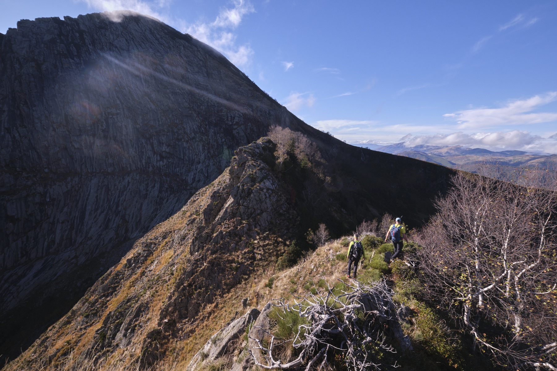
Finally, after a final de-escalation, we reach the eastern base of the Dent d'Orlu over a small pass that allows us to switch from north to south.
Part 3: Return to the Coume Grande parking lot via the Jasse de Cabane Longue (1h to 1h30)
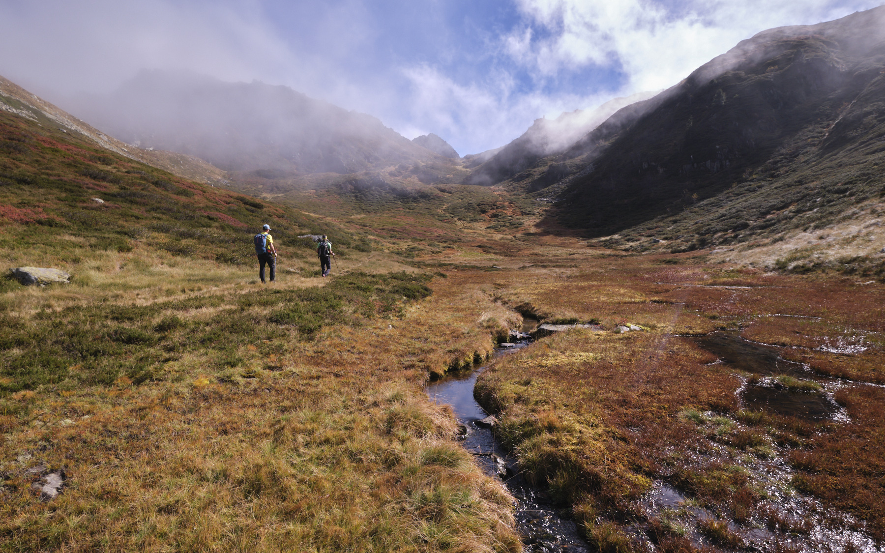
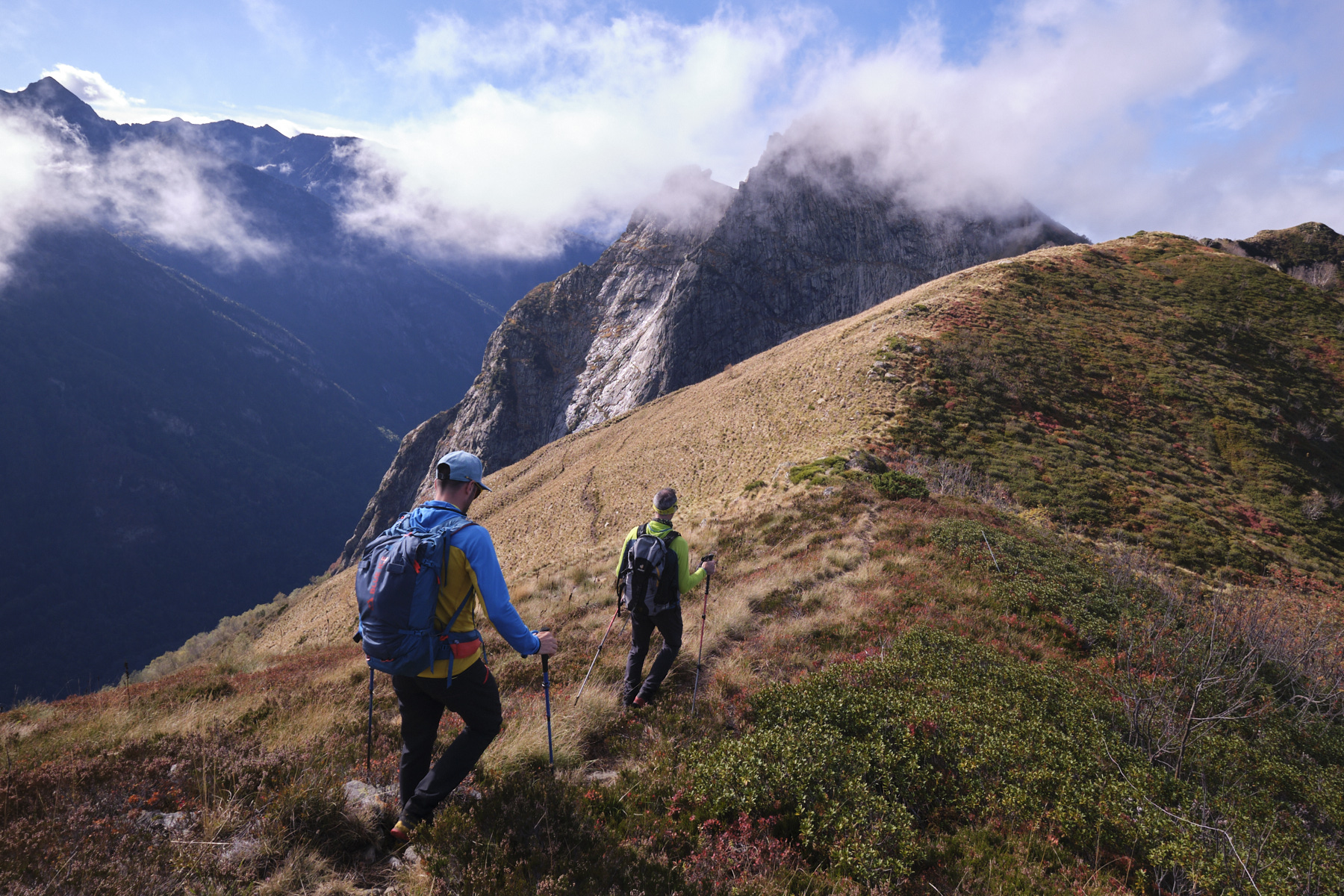
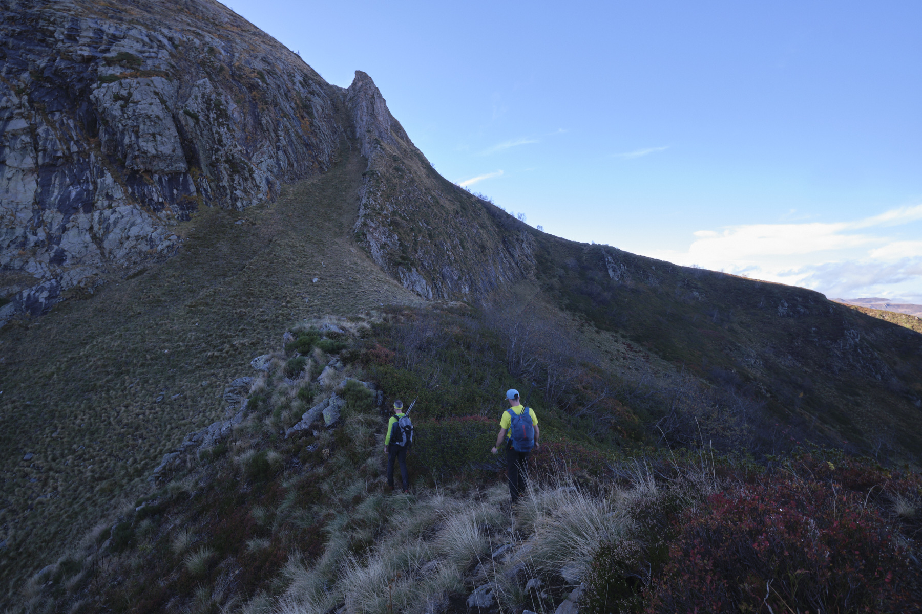
From the small pass, cross under the walls of the Dent d'orlu on the path that climbs up to join the classic PR path approaching the Dent. Follow this PR path north along a pretty rounded ridge, the top of Sarrat de la Llau, with Tarbésou in front of us. The PR path then swings eastwards and winds down the forested slopes to the Jasse de Cabane Longue.
Before exiting the Jasse (clearing) and crossing the Cabane Longue stream, turn right into the forest. The trail is not very visible, except in places. Basically, you have to improvise as best you can, always staying on the right bank of the stream. Further down, you come to a sort of old track or wide forest path. Follow it downhill, then upwards around the northern end of the Sarrat de la Llau ridge. Finally, the path descends to the bottom of the Coume grande. Cross the stream over a log bridge. You're now very close to the starting parking lot.


 Partager sur WhatsApp
 Partager sur Twitter
Partager sur Instagram
Partager sur Twitter
Partager sur Instagram

 Partager sur Facebook
 Imprimer le topo
 Laisser un commentaire

![2017-08-01_10-56-03 [Crête de Pinu]](https://climbing7.com/wp-content/uploads/2017/09/2017-08-01_10-56-03-crc3aate-de-pinu-e1580117578105-1024x683.jpg "The Pinu ridges, Cap Corse")


Leave a Reply