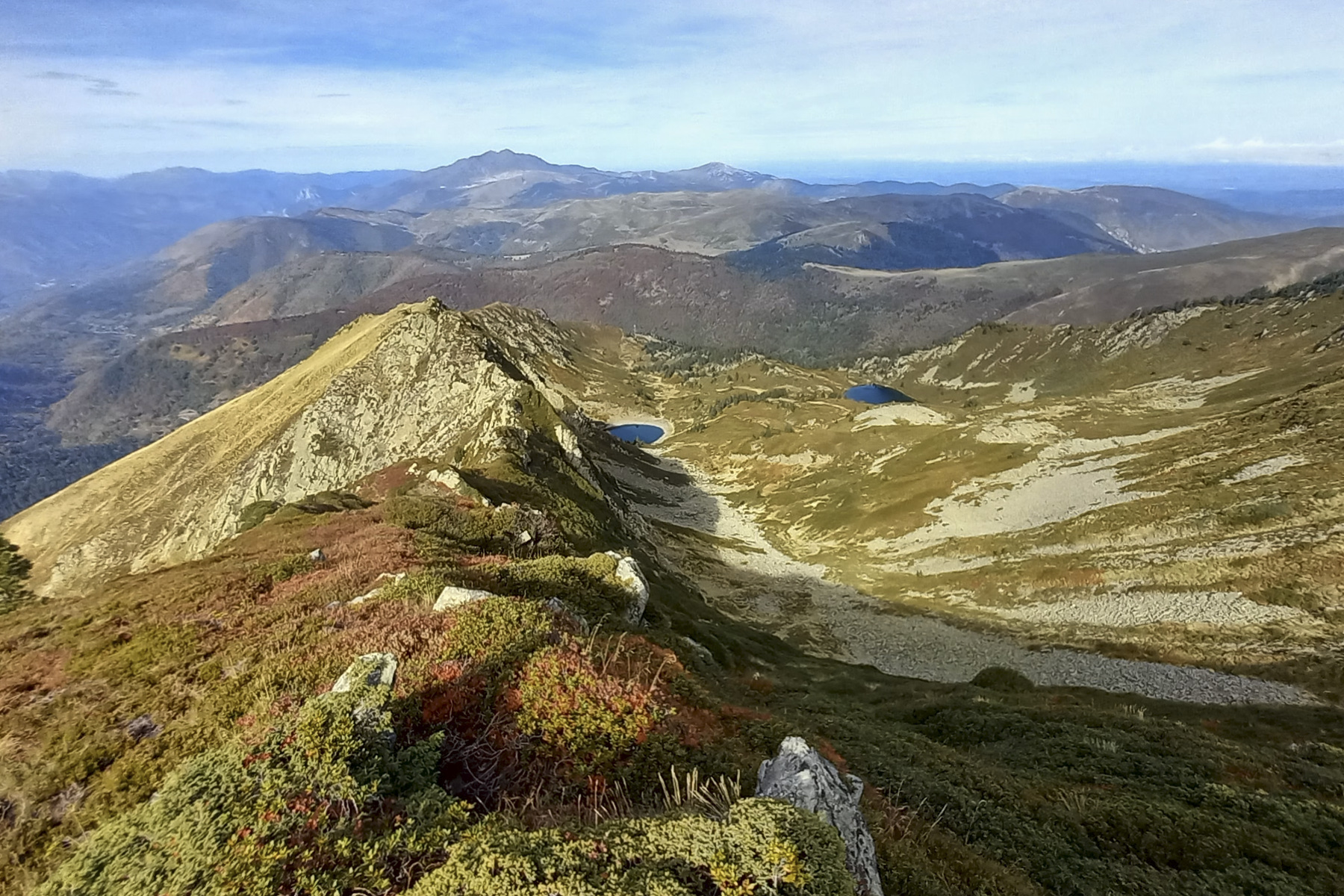
Here's an original, unusual and wild way to climb to the summit of Pic du Tarbésou. And with good reason, as the route on the Sarrat de la Bauzeille is aerial and includes a finale on a very narrow ridge with many sections to negotiate on very exposed terrain. Overlooking the beautiful Bauzeille ponds, the route joins the ridges of the Sarrat des Escales to finish at the summit of Tarbésou, with splendid views over the Rabassoles ponds. The return journey is improvised without too much difficulty, returning via the étangs de Bauzeille, to complete a spectacular outing reserved for very experienced hikers.
❱❱ Technical summary
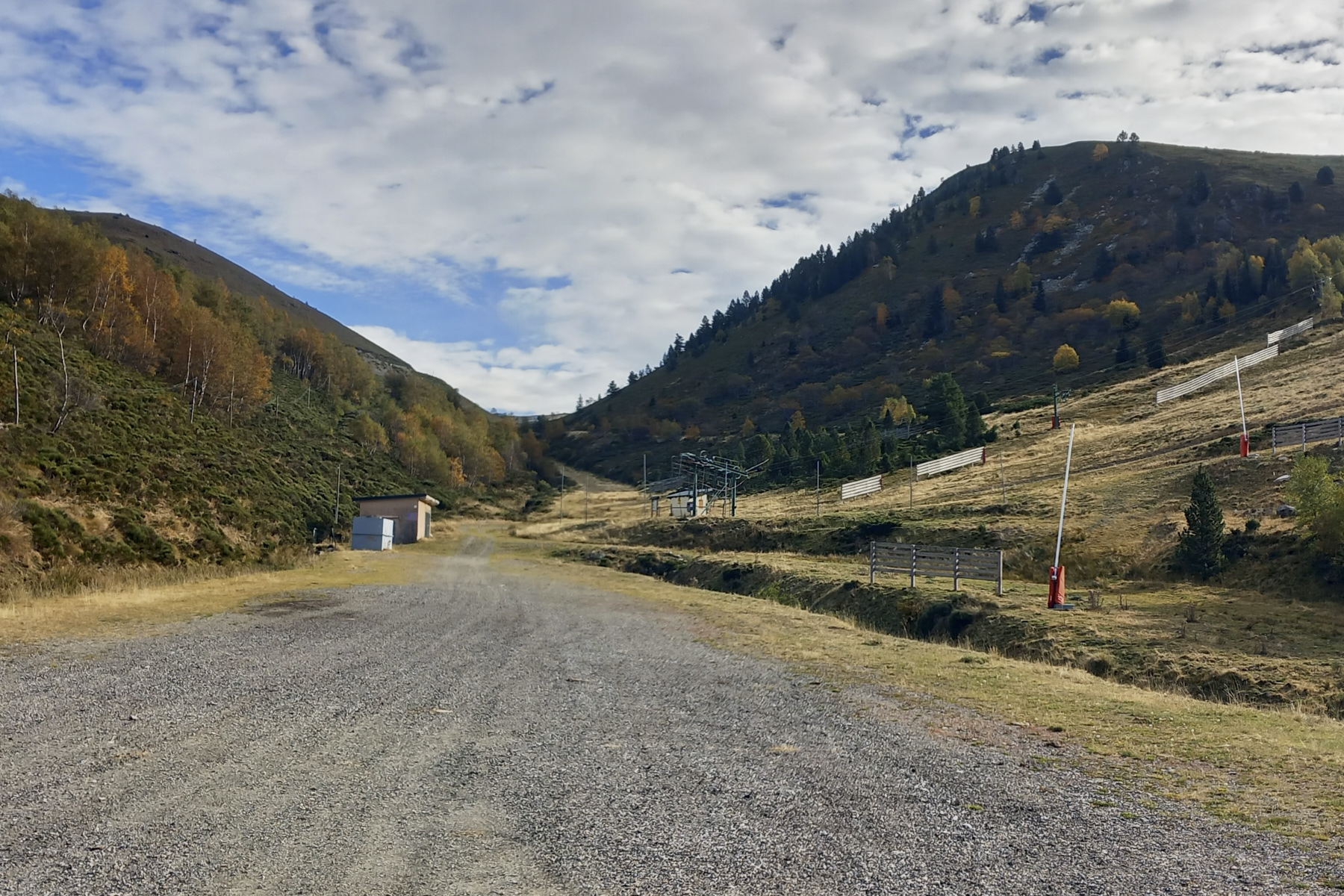
■ S tarting point: Parking du Mounégou, Ascou-Pailhères ski resort, Ariège
■ Type of route: high mountain loop hike, exposed alpine section
■ Distance: 9 km
■ Cumulative elevation gain: +760 m
■ Cumulative negative altitude gain: -760 m
■ Estimated total time: 4h to 5h ■ Min and max altitude: 1696 m / 2364 m
■ Marking: no, combination of trail, cairns, obvious off-trail
■ Equipment in place: none
■ Equipment required: useful GPS track, roping equipment if necessary
Difficulties: the main difficulty lies in the 50m ridge on the final section of the Sarrat de la Bauzeille. No II, III max, but above all very tricky passages on steep, exposed terrain on the south-facing slope.
❱❱ Access to the place
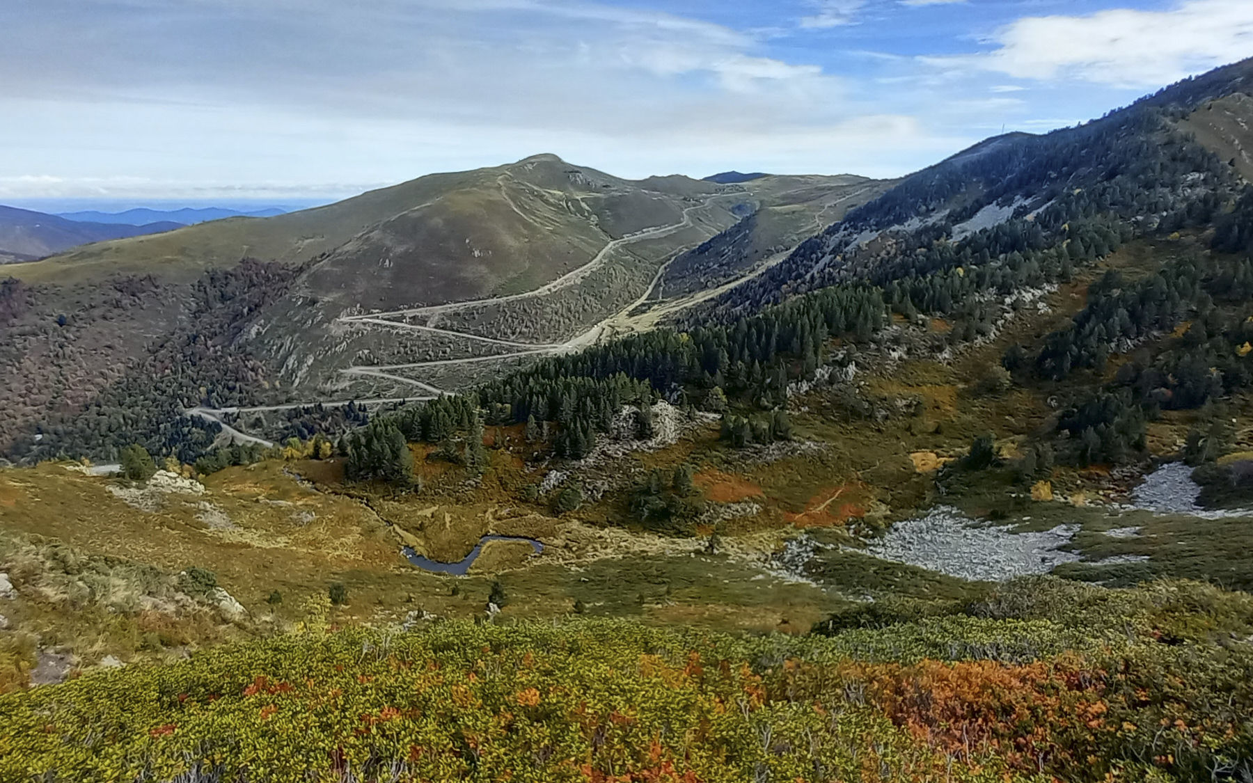
From the N20 at Ax-les-Thermes, take the D613 up towards Le Chioula and the Ascou-Pailhères resort. 4 kms further up, fork right onto the D25 and drive through Ascou. Continue on this road, passing through the hamlet of Goulours on the edge of the small lake, then Lavail further on. Follow the road towards the Col de Pailhères. Pass the ski resort and at the 5th bend, park in the large parking lot at the Mounégou ski lift.
❱❱ Map & topo
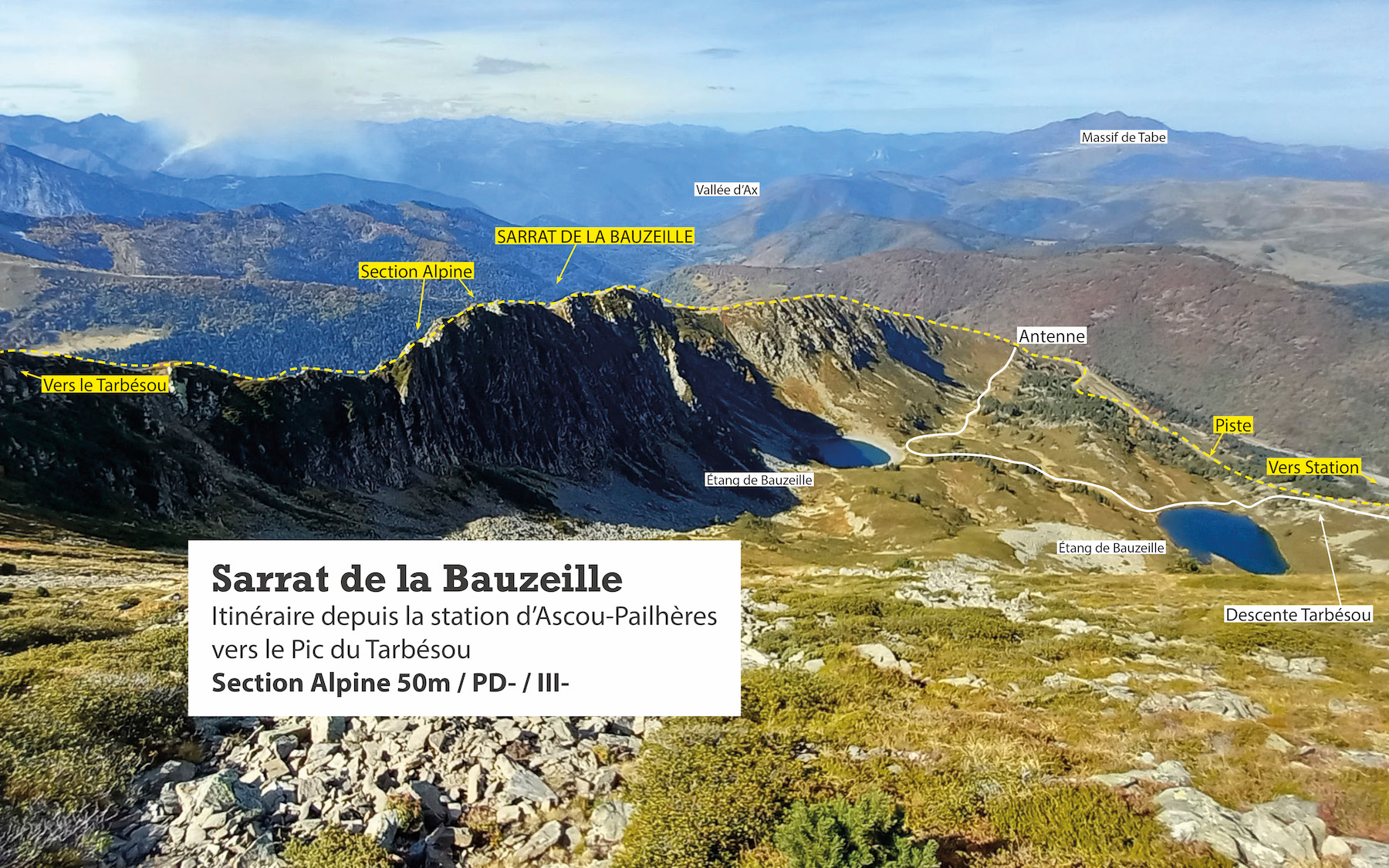
The routes over the Sarrat de la Bauzeille and down the Tarbésou ridges towards the ponds are indicative.
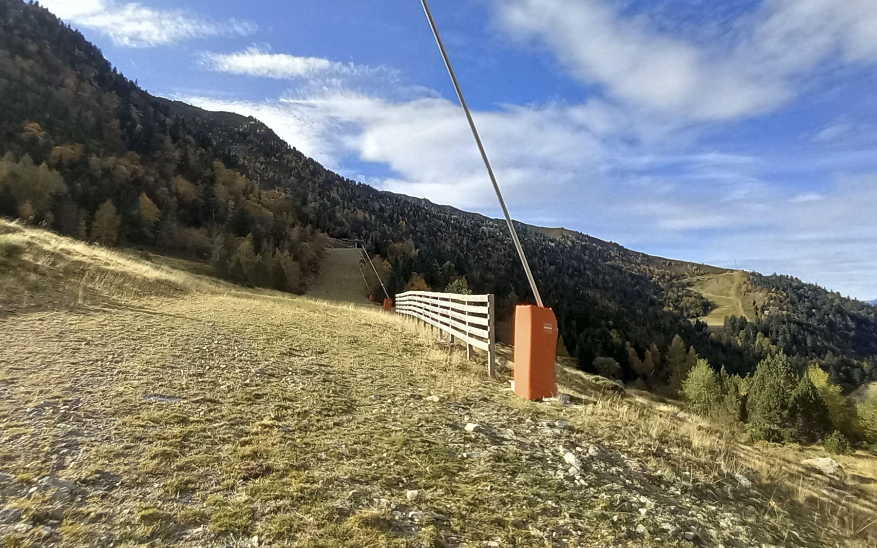
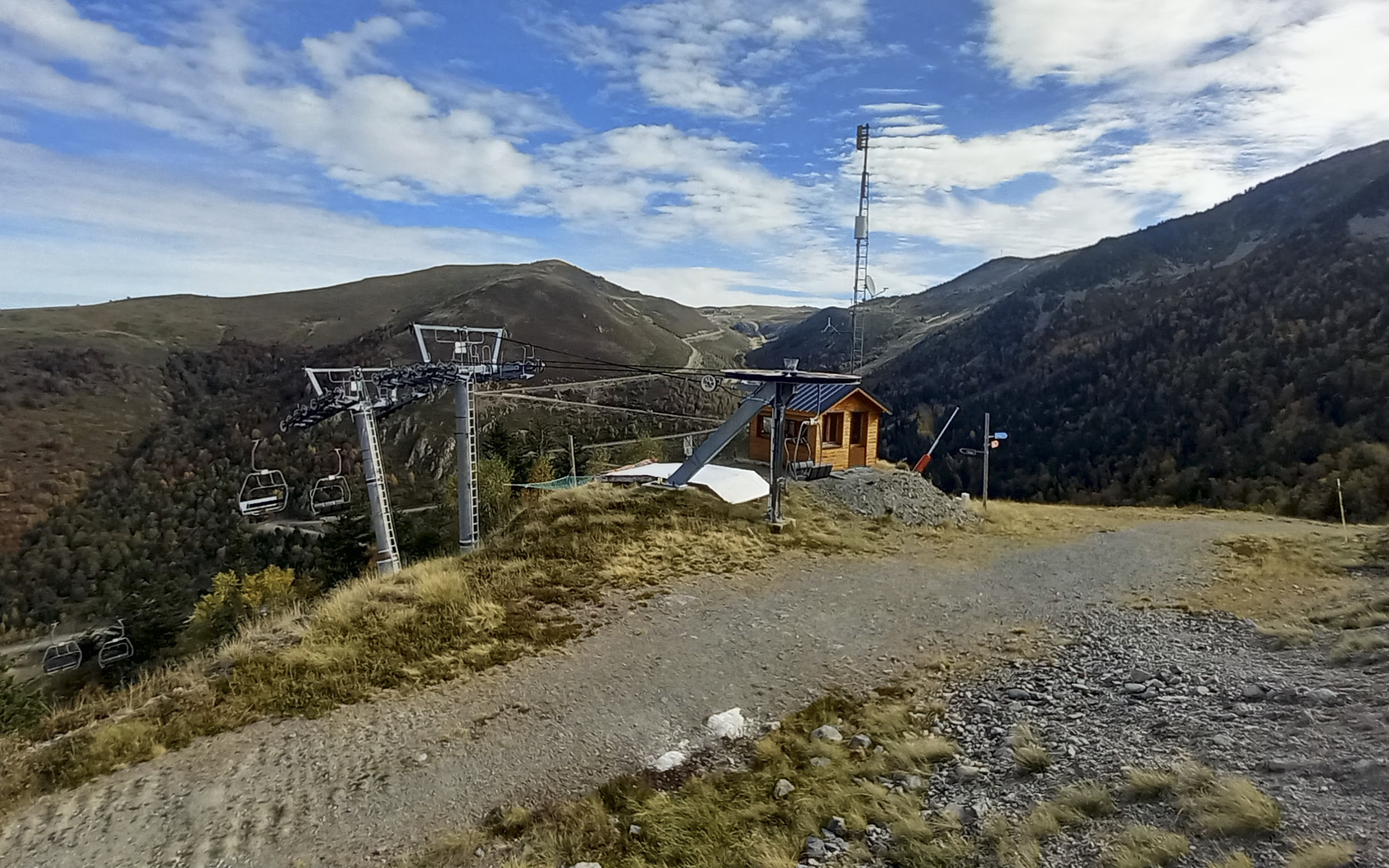
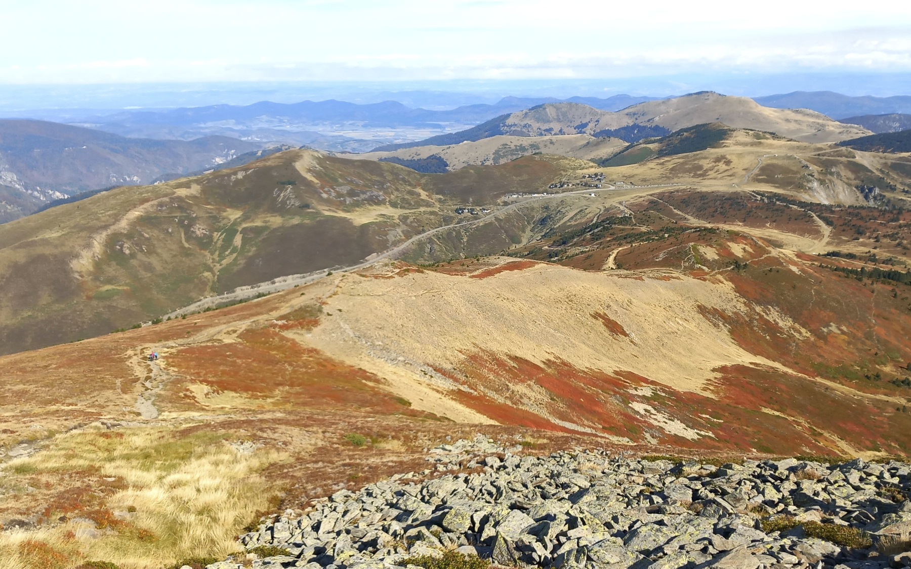
Section 1: from the Mounégou parking lot to the arrival of the Orri chairlift (1795m, 30')
Go to the bottom of the parking lot and turn left around the Mounégou ski lift hut. Then take the stony track that climbs to the right, heading south and then west. You'll pass the Andorra ski lift arrival point, then the track drops down again, skirting a water basin in the Jasse de l'Orri to the right, then climbing steeply upwards to finish at 1795m at the Orri chairlift arrival point.
Part 2: the Sarrat de la Bauzeille ridge (2176m, 1h30)
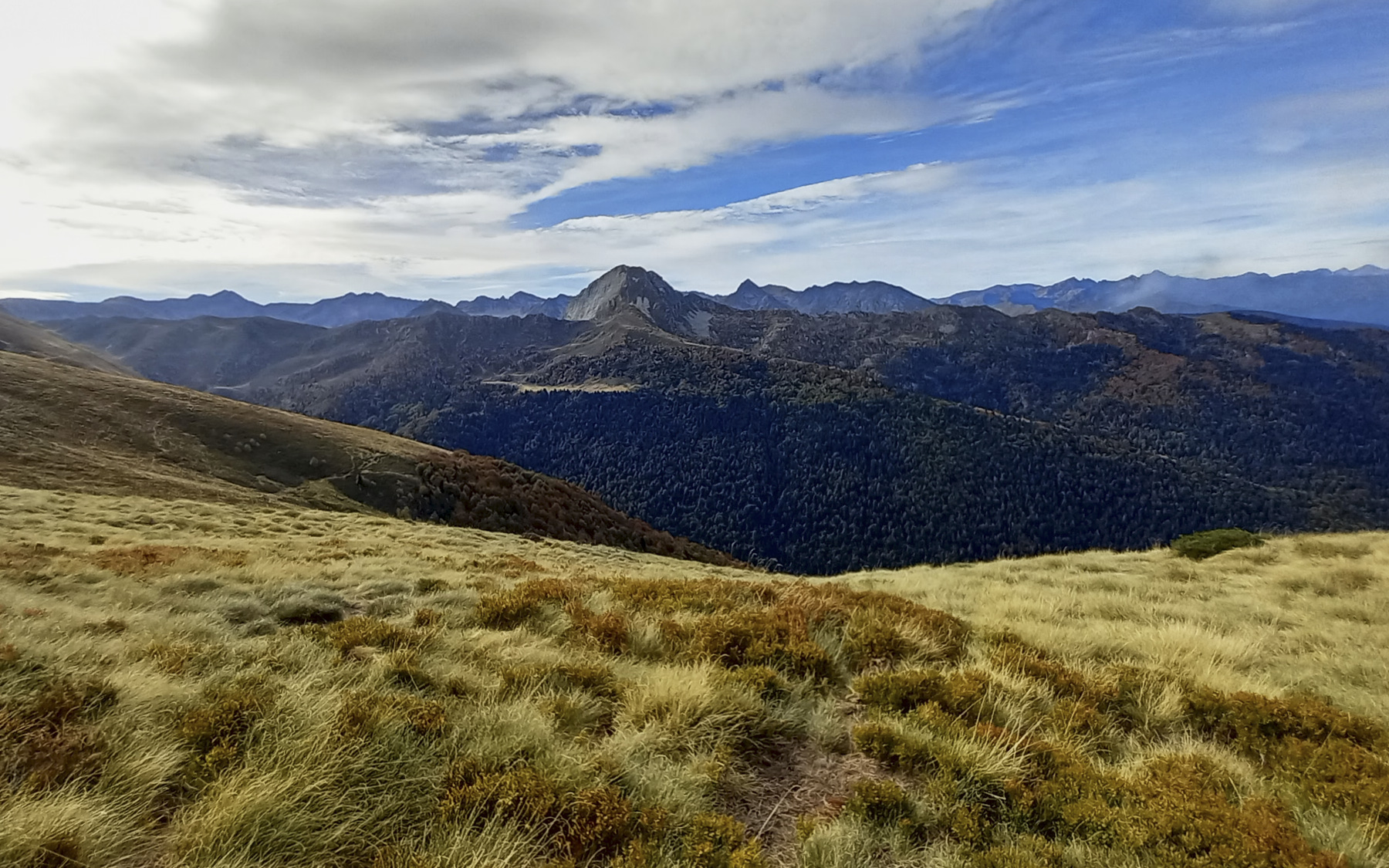
Just before the arrival hut, climb the clearly visible path that leads straight to the antenna. From the antenna, leave the return path from the Bauzeille ponds on your left (unmarked but visible) and look for an inconspicuous path leading up to the south. Follow this or another path upwards, climbing diagonally until you reach a grassy shoulder with a magnificent view of the Dent d'Orlu and the Coume Grande. From here, head straight up the slope, aiming for the edge of the ridge. There's no continuous path, but it's obvious and easy.
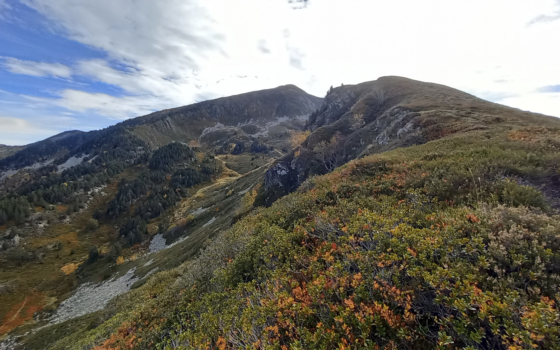
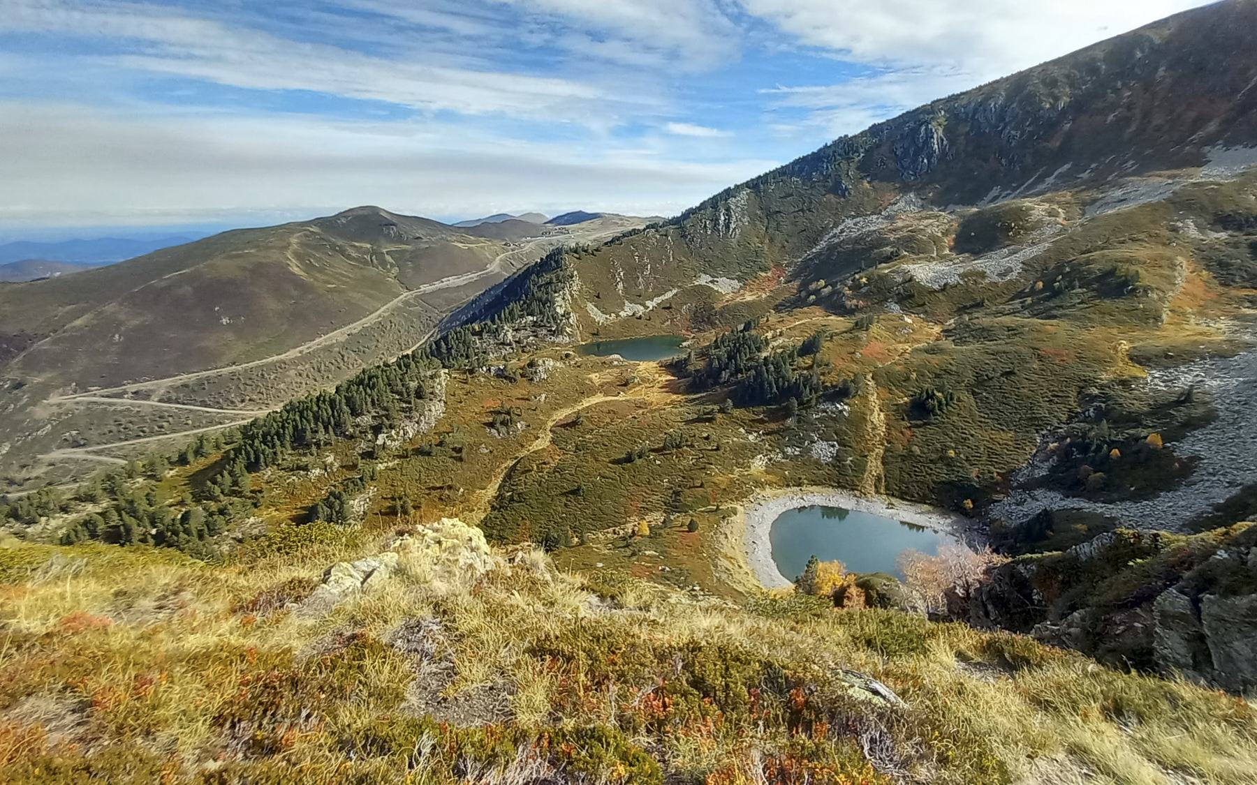
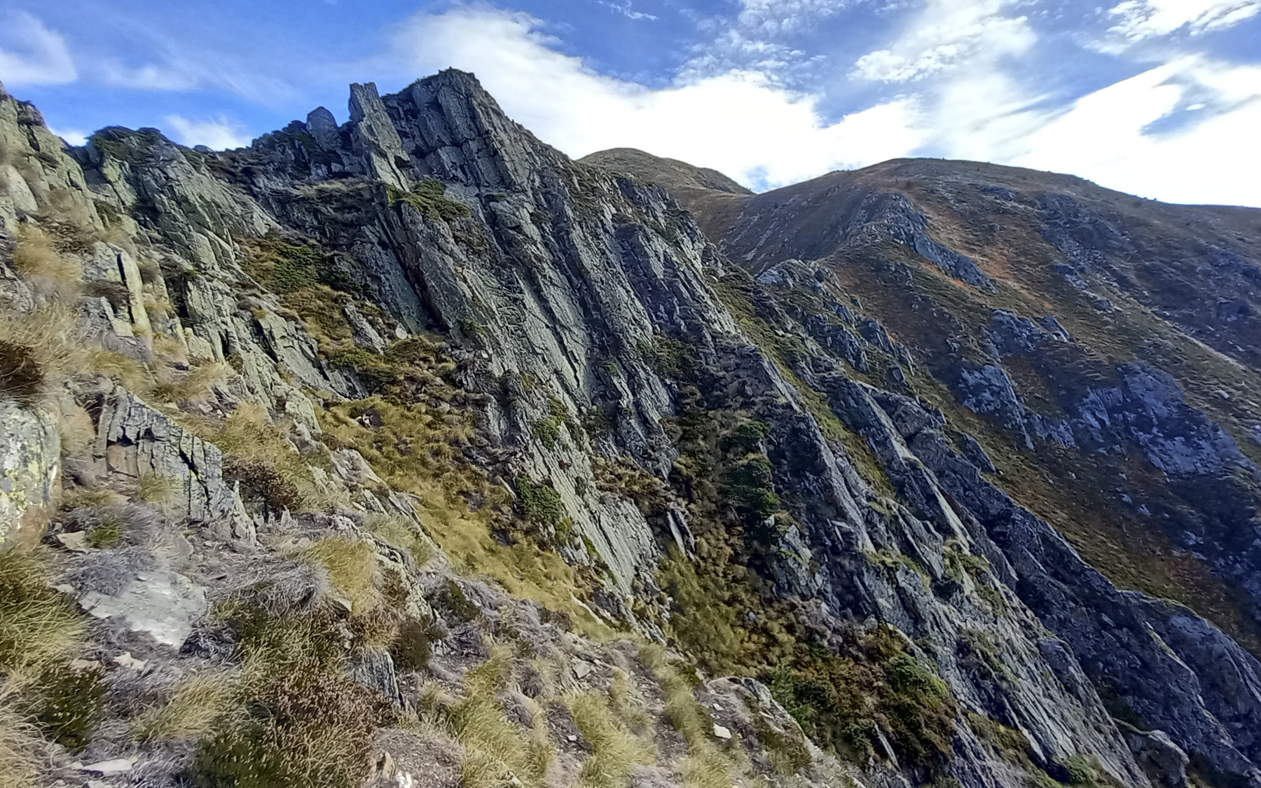
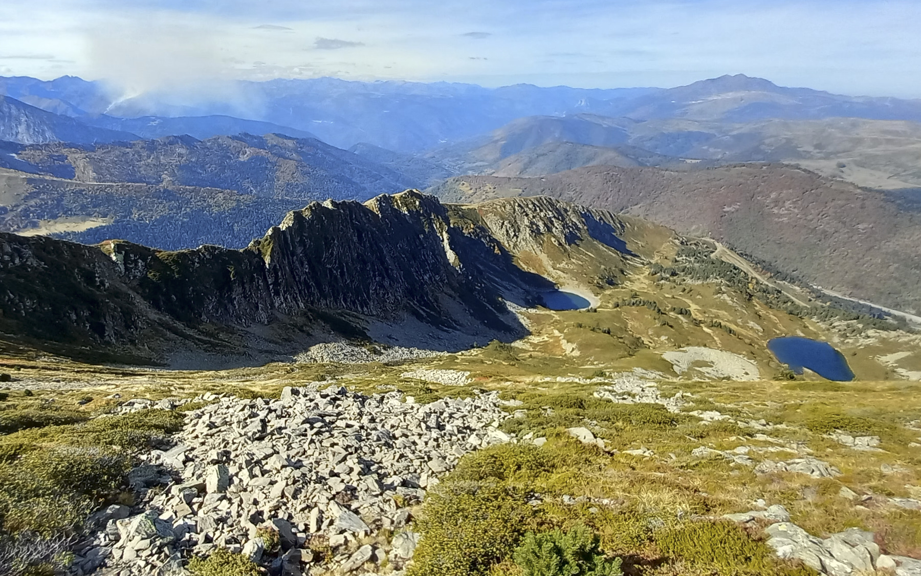
You gradually reach the edge of the walls on the north-east side, with a plunging view over the valley leading to the Bauzeille ponds. Continue climbing along the edge on a fairly well-marked path to reach the first rocky ledges along the Sarrat. Alternate between flat stretches of grass and easy boulder climbing.
The Sarrat gradually curves towards Tarbésou and you finally reach the final section. Here, try to stay on the edge of the ridge (not always possible!), which is more impressive, with a few steps of II or III climbing - but which allows you to avoid the steep, unstable and tricky south-facing slope. The alpine section is not very long, but very delicate and exposed. Use ropes if necessary and progress with a taut rope.
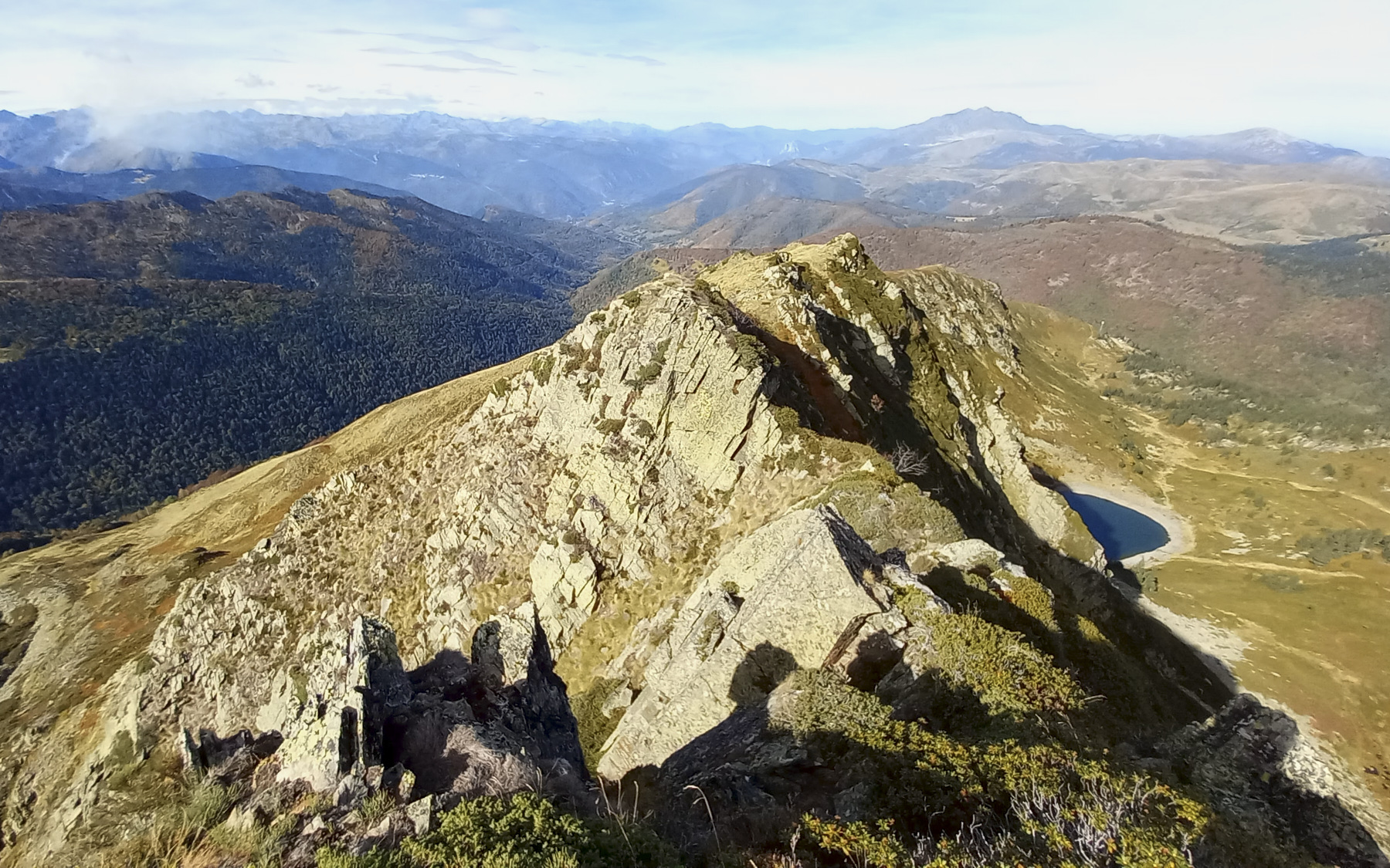
Finally, after the last difficulty, the ridge becomes progressively rounder and wider. You still have to climb up a little to leave the Sarrat de la Bauzeille for good, and reach the end of the Sarrat des Escales, below the head of Tarbésou.
Part 3: Pic du Tarbésou (2364m) and descent to the Bauzeille ponds (1780m, 1h)
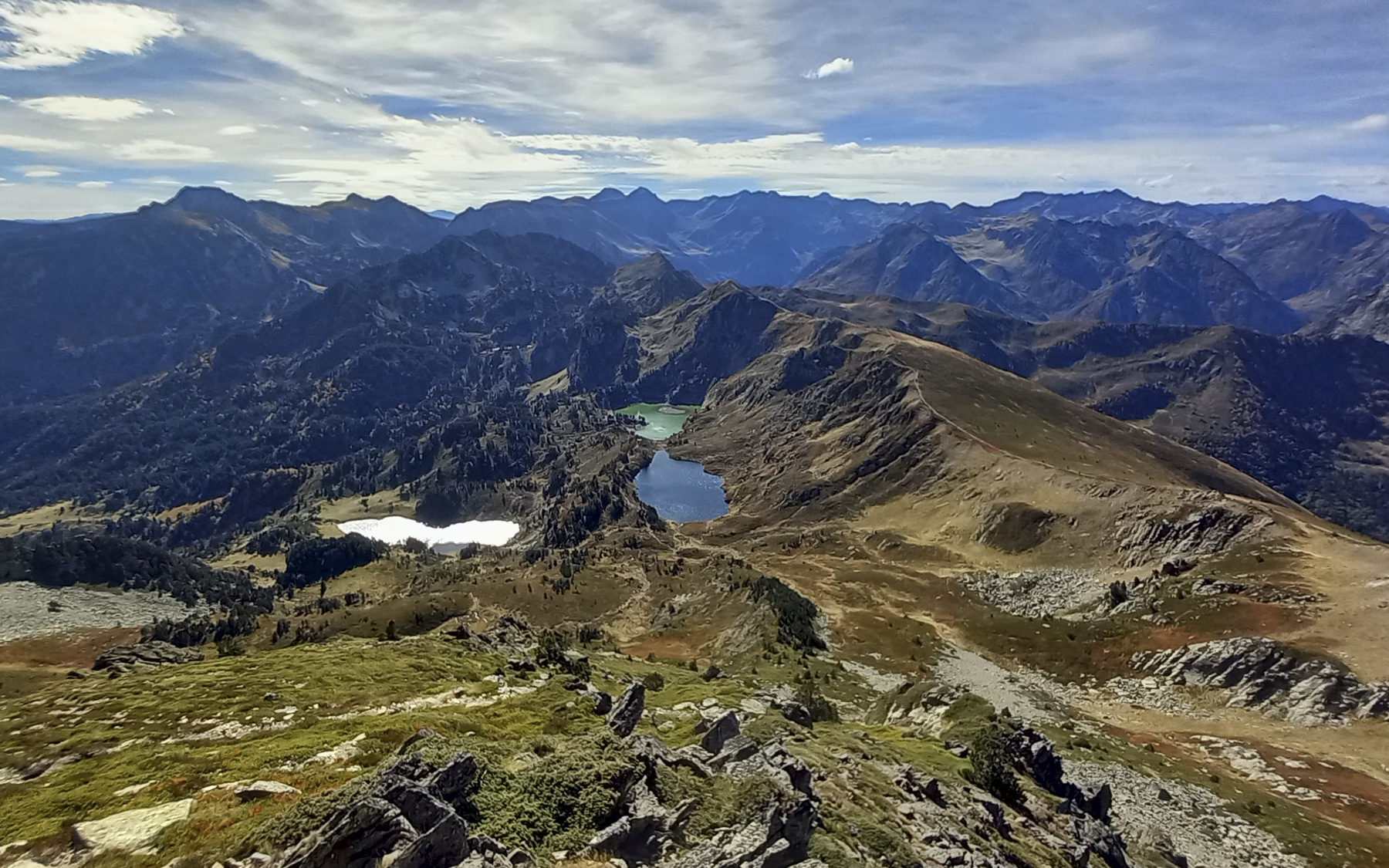
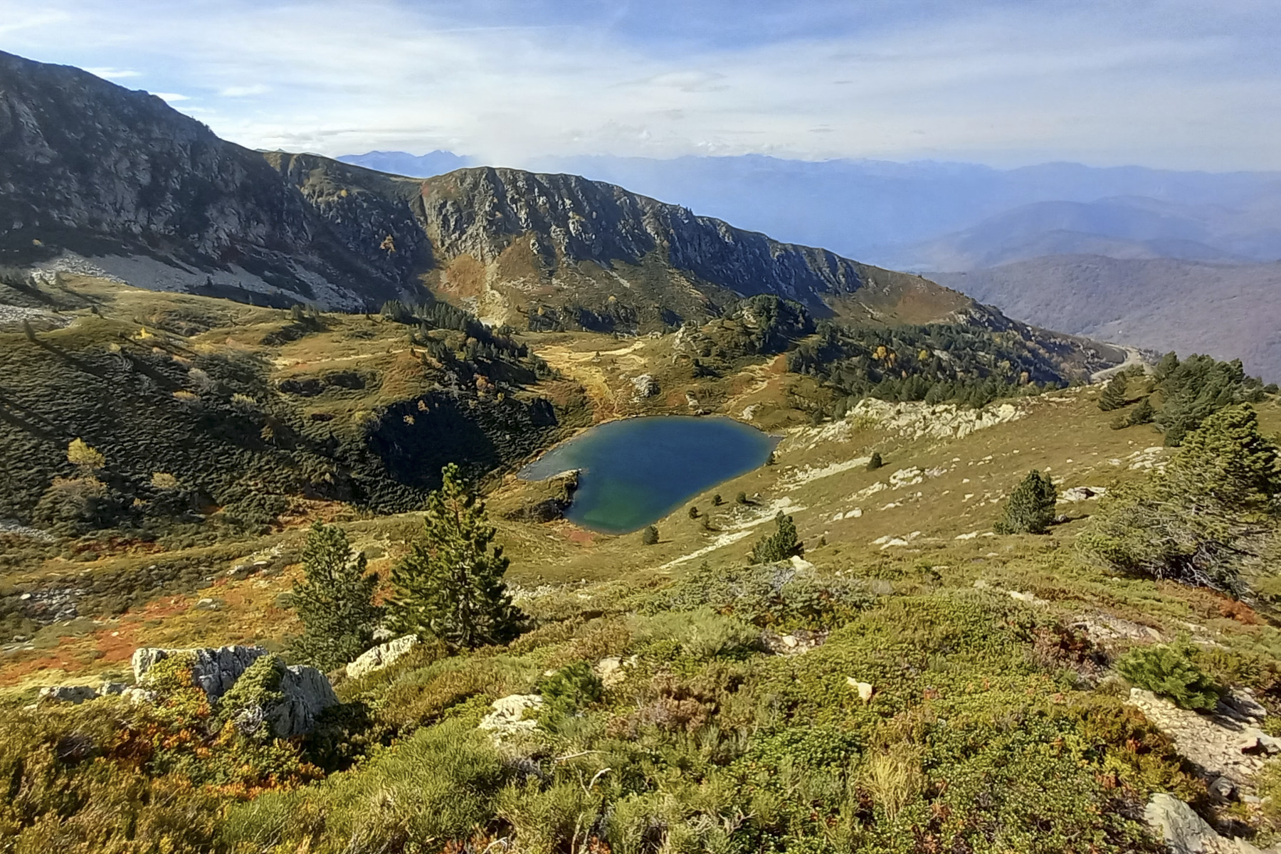
Steep ascent to the summit of Pic du Tarbésou. Magical views to the south over the incredibly colorful Etangs de Rabassoles. From the summit, start the descent northwards on the classic path and a little further down, cut off the path on the slope to find a well-marked and cairned path below (huge cairns!). Follow this path northwards, passing under the Mounégou ridge.
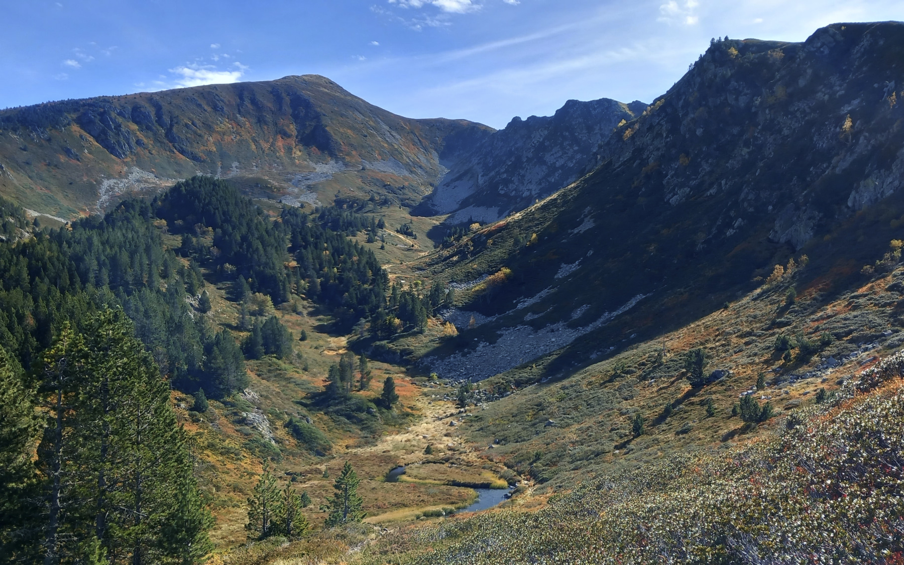
You can see the ridge as it descends to reach the northernmost pond on the right. Leave the cairned path at its flattest point and cut off off-trail towards the first fir trees to find a faint but map-marked path further down.
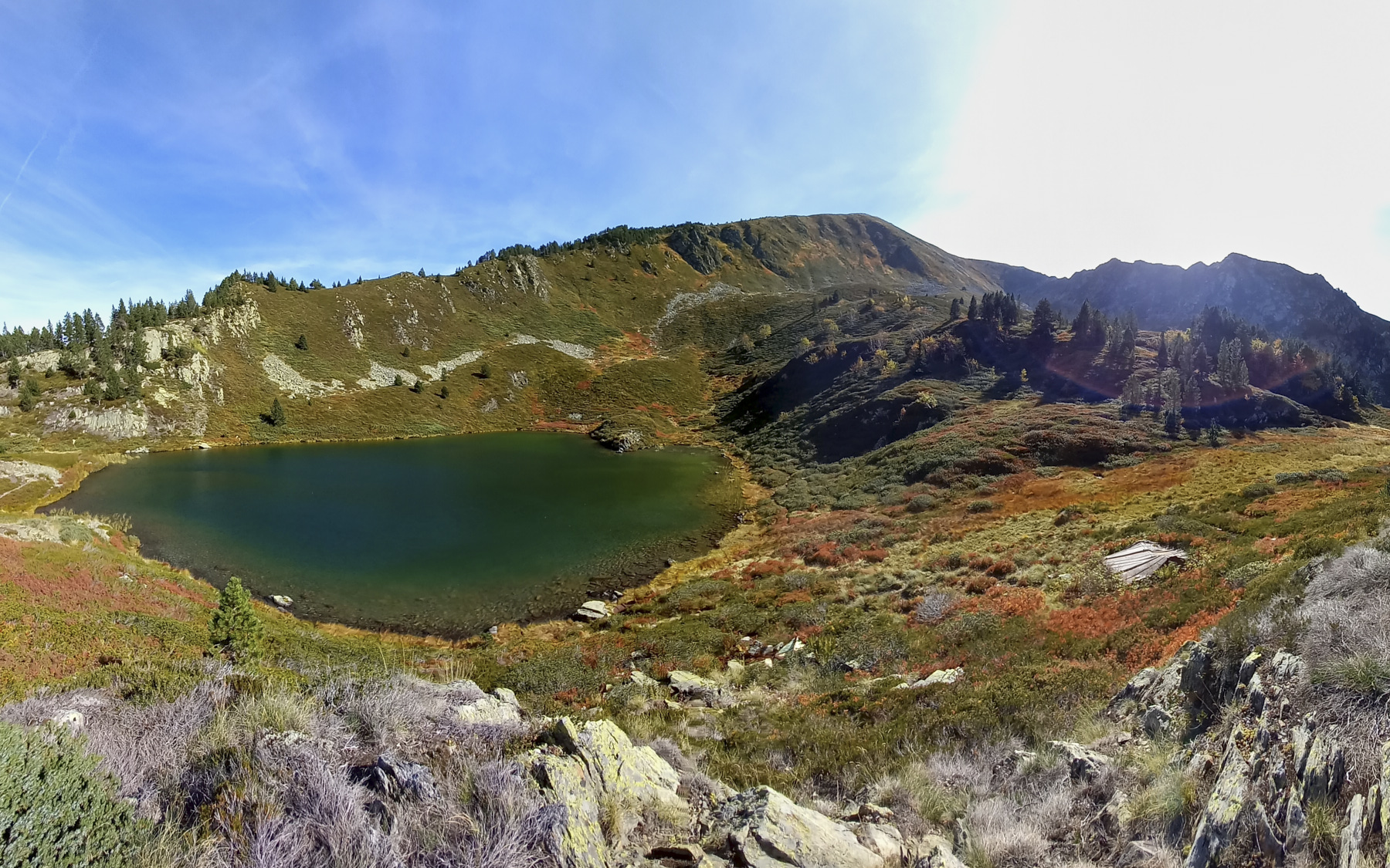
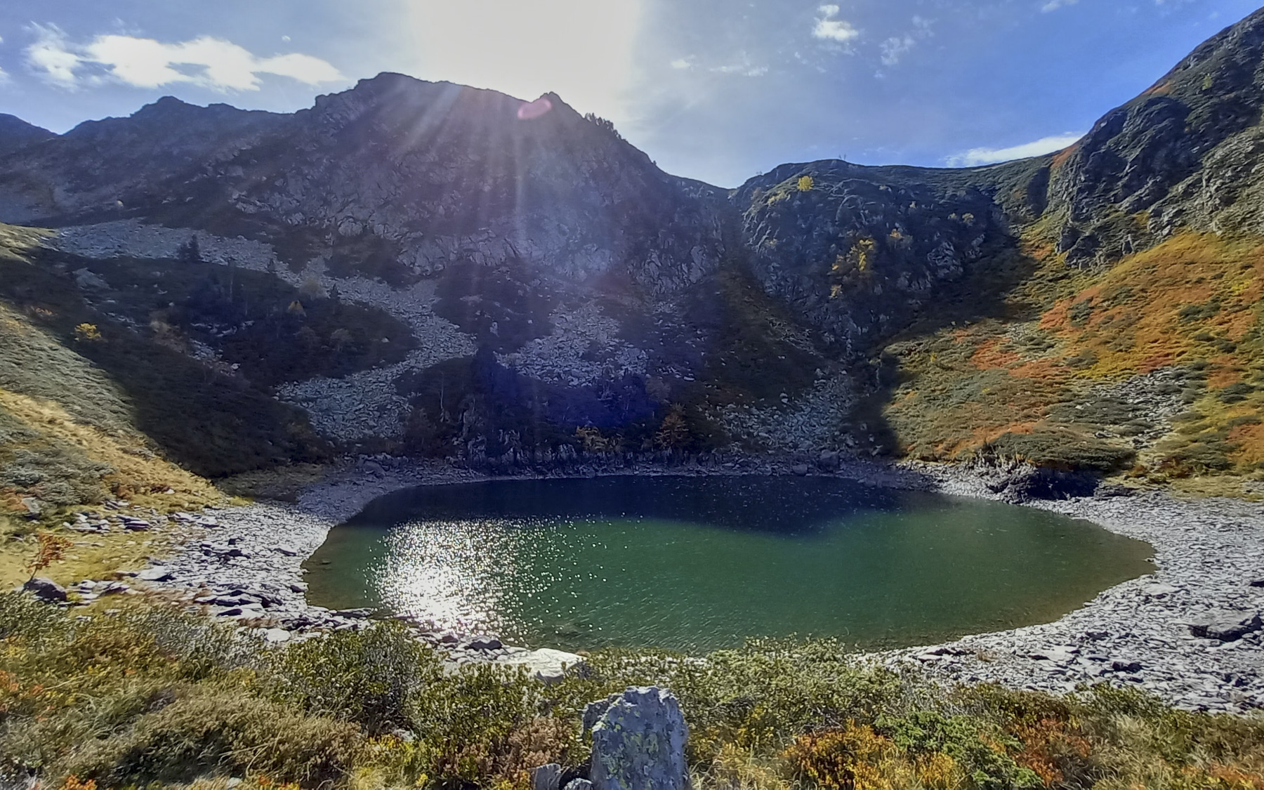
Follow this path between the fir trees without difficulty, then at the end descend to reach the banks of the pond. Walk along it, then cross a grassy flat to discover the second pond exactly below the Sarrat de la Bauzeille.
Section 4: from the Bauzeille ponds to the Mounégou parking lot (1795m, 45')
From the second pond, take the moderately visible path heading north-west along a small stream. We wind our way through the fir trees to cross this small valley without difficulty. At the end, climb up a little to pass a shoulder and follow the path back to the starting antenna. All that remains is to retrace the outward trail in the opposite direction to the Mounégou parking lot.


 Partager sur WhatsApp
 Partager sur Twitter
Partager sur Instagram
Partager sur Twitter
Partager sur Instagram

 Partager sur Facebook
 Imprimer le topo
 Laisser un commentaire


Leave a Reply