Overlooking the Lac de Serre-Ponçon, with views over both the Durance and Ubaye valleys, the Pic de Morgon and its cirque attract the crowds. An accessible summit offering exceptional panoramic views. Today's hike takes in all the ridges of the Morgon cirque, from the Pic de Morgon to the Pic de Charance, via the Tête de la Vieille. The route is long and aerial, with a number of tricky sections, including an exposed (but avoidable) climbing section. The off-trail route follows the ridge as best it can, steep on the inland side and gentler on the Ubaye side, to almost circle the cirque and return to the starting point. A nice option, more demanding but wilder and away from the summer crowds.
❱❱ Technical summary
■ S tarting point: Grand Clot parking lot, Boscodon valley, Savine-le-Lac, Hautes Alpes (05)
■ Type of route: high-mountain loop hike, committed ridge route
■ Distance: 15 km
■ Cumulative elevation gain: +970 m
■ Cumulative negative altitude gain: -970 m
■ Estimated total time: 5h30 to 6h30 ■ Min and max altitude: 1660 m / 2381 m
■ S ignposts: yellow PR, off signposted ridge paths
■ Equipment in place: small passage equipped with a railing at the start of the ridges
■ Equipment required: useful GPS track
Difficulties: aerial ridge route with some fairly narrow sections, several passages on unstable terrain, some tricky de-escalations. The section to be climbed before the Tête de la Vieille is not very hard (IV) but very exposed. It can be avoided by going around the pillar to the right.
❱❱ Access to the place
On the N94 between Savines-le-Lac and Embrun, just before Crots, turn onto the route de Boscodon towards the abbey. Just after the abbey, turn right towards the Grand Clot parking lot. Cross the Colombier torrent over a small bridge and the road becomes a stony track in average condition. Follow the long, winding track up to the Grand Clot parking lot at 1670m altitude. Start of the hike.
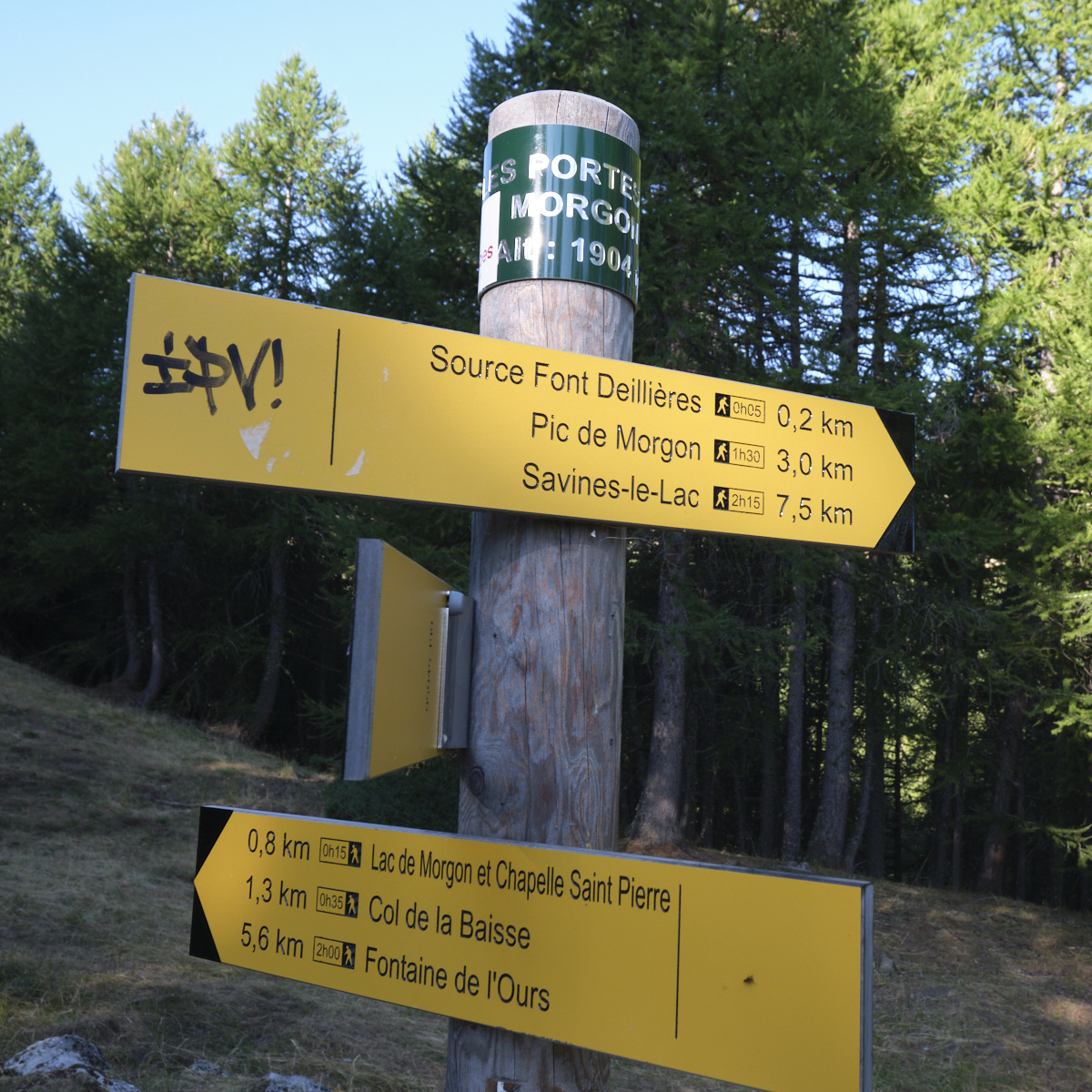
From the parking lot, take the trail up through the forest to Les Portes de Morgon, at 1904m, at the entrance to the valley. You can cut off at several points to avoid having to follow all the twists and turns of the track. At this point, you'll find the fork to the Pic de Morgon on the right and the arrival point of the return trail from the lake and the Col de la Baisse.
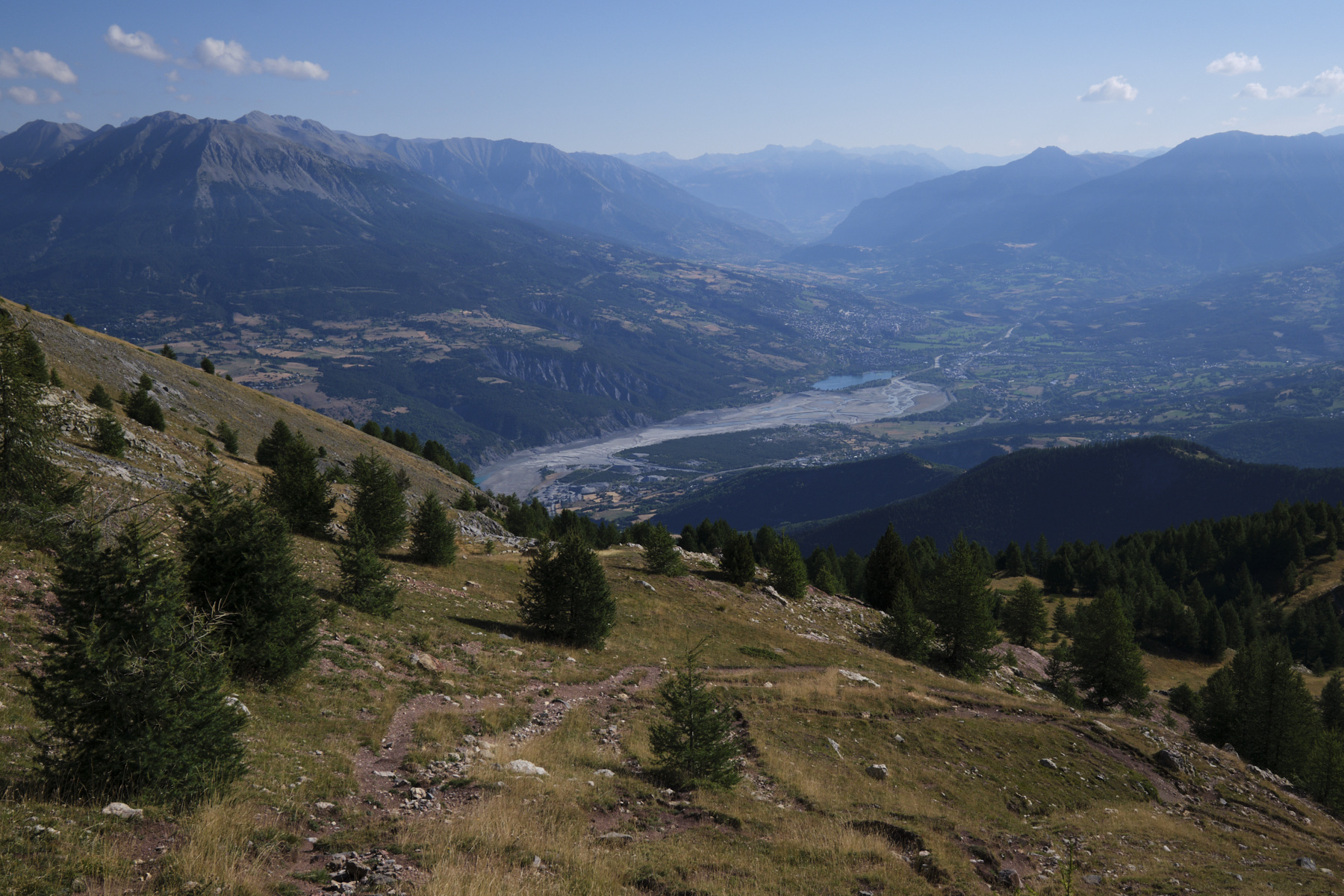
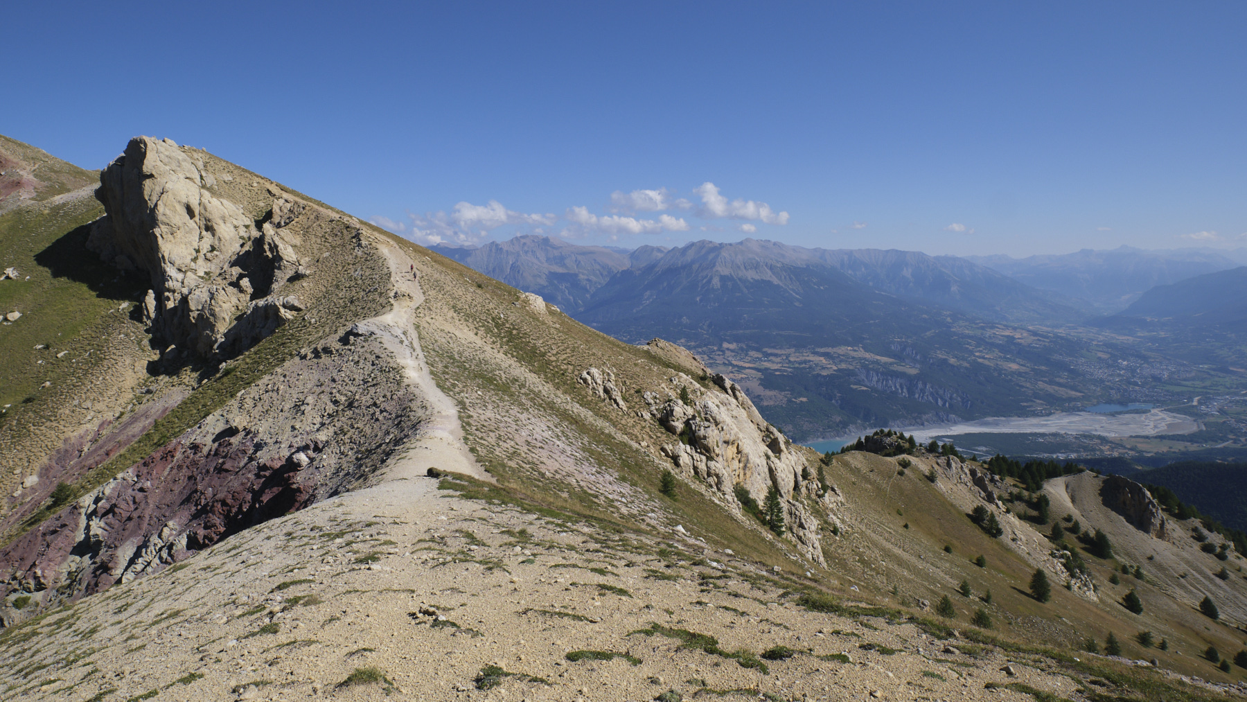
From here, the path to the peak has recently been modified. It used to pass through the interior of the valley, which is now restricted as it is an access to the shepherd's hut. The new path skirts around the forest on the right before climbing up to the flat area below the summit of Pic de Morgon (explanatory sign at the start). The final section climbs steeply upwards through stony, purplish areas before heading off to join the Morgon north ridge, from where the first views of Lac de Serre-Ponçon can be seen. Then it's back up to the ridge to climb easily to the summit of Pic de Morgon. Exceptional panoramic view of the lake and Céüse and Dévoluy in the distance.
Part 2: The crests, Tête de la Vieille (2381m, 1h30 to 2h)
Descend from the summit, aiming for the ridges that wind slightly southwards. The route to follow is obvious. This first section is marked in yellow. We pass several small bumps, which are already quite airy, especially on the right-hand side, and there's even a small passage equipped with a railing to cross a steep section. The trail then descends slightly to a small pass where the yellow path leads down to the lake. We continue straight on.
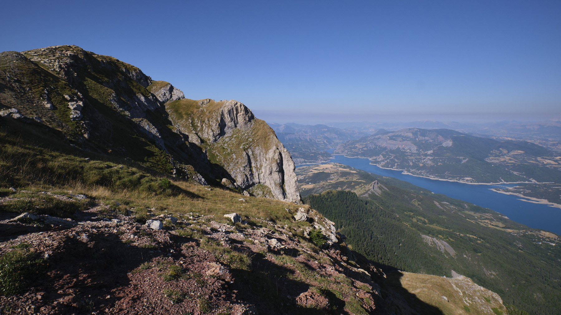
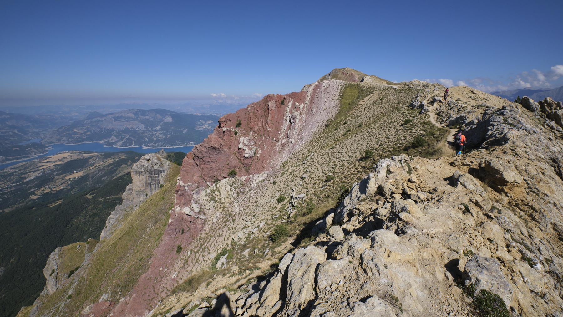
We climb upwards, passing a first hump and then a second with spectacular ridges carpeted with millions of tiny pieces of rock in shades of yellow and purplish-red. The pillar of the big walls approaches, and to reach it, keep as close as possible to the edge of the ridge or cut eastwards on steep slopes. At the last pass, you can clearly see the path which skirts around to the right, avoiding the section to be climbed. If you continue straight on, you'll reach the base of the pillar, where you can also make out a possible bypass on a small grassy ledge flush with the wall on the west side.
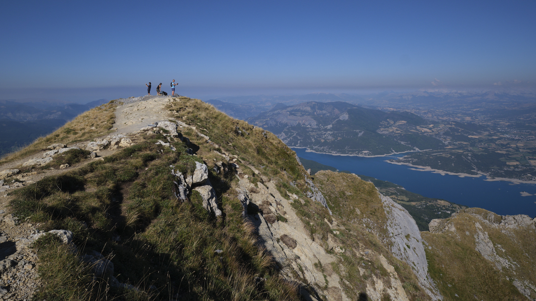
If you take the climbing option, the first large rectangular boulders are to be climbed either on the west side (1 step of expo de-escalation?), or on the east side, which seemed easier to me. An improvised climb then follows on the east side, with a few exposed III/IV pitches, before returning to the pillar's axis and finding a small grassy ledge above the pillar (photo on one). The last steps (II/III) have to be climbed between grass and boulders to reach the summit. Walk along the ridges to quickly reach the summit of Tête de la Vieille 2381m.
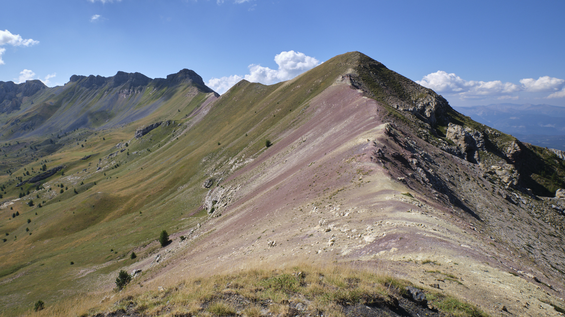
Part 3: Pic de Charance, Col de la Baisse and return (2316m, 1h30 to 2h30)
It's a long way to the Pic de Charance on the other side of the cirque. Cut the first bumps on grassy terraces above the Ubaye. It descends to a first pass and to continue, avoid the rocky section by skirting to the right and improvising an ascent a little further along the ridge (small cairns). We climb again, crossing rocky promontories with a tricky descent to reach a second, wide, grassy col. Climb up to this summit, which is not yet the Pic de Charance.
Keep going until you come down again and climb the slope one last time, this time to the Pic de Charance cross. Behind it, you can appreciate the whole of the day's route, from the Portes de Morgon to the Pic and all the ridges via the Tête de la Vieille.
From the summit of the Pic de Charance, descend northwards on a path between the fir trees to reach the Col de la Baisse in around 20'. Turn left to return to the valley, following the wide, signposted path. You pass the lake, which dries up in summer, and come back to Portes de Morgon at the end. All that remains is to descend the forest track to the departure parking lot.


 Partager sur WhatsApp
 Partager sur Twitter
Partager sur Instagram
Partager sur Twitter
Partager sur Instagram

 Partager sur Facebook
 Imprimer le topo
 Laisser un commentaire


![2017-08-01_10-56-03 [Crête de Pinu]](https://climbing7.com/wp-content/uploads/2017/09/2017-08-01_10-56-03-crc3aate-de-pinu-e1580117578105-1024x683.jpg "The Pinu ridges, Cap Corse")


Leave a Reply