


TOPO Hiking | CLIMBING7.COM
Publié le
 Partager sur WhatsApp
 Partager sur Twitter
Partager sur Instagram
Partager sur Twitter
Partager sur Instagram

 Partager sur Facebook
 Imprimer le topo
 Laisser un commentaire

For a first-time hiker on Reunion Island, the Remparts trail leading to the Grand Bénare peak is a great option for a breathtaking view of some of the island's highlights: cirque de Mafate, cirque de Cilaos, Piton des Neiges and Piton de la Fournaise. The main attraction of this aerial hike is the panoramic view of the center of the island that you can enjoy all the way to the summit. Today, the weather is perfect, with sparkling views and verdant landscapes. Spring is here.
❱❱ Technical summary
Type ✦ Hiking
Location ✦ Maïdo
Region ✦ Centre-Ouest
Country ✦ La Réunion
Length ✦ 18kms
Vertical drop ✦ 700m
Difficulty ✦ MD
Max altitude ✦ 2898m
Duration ✦ 5h30 to 6h
Interest ✦ ★
❱❱ Access to the place
From Saint-Paul, climb towards Bois Rouge, Le Guillaume and Petite France to take the Maïdo road and park at the final parking lot.
❱❱ Map & topo
❱❱ Itinéraire
From the parking lot, walk a short distance down the cement road (sentier de la glacière), then turn left to climb the sentier des remparts, marked with white and yellow lines.
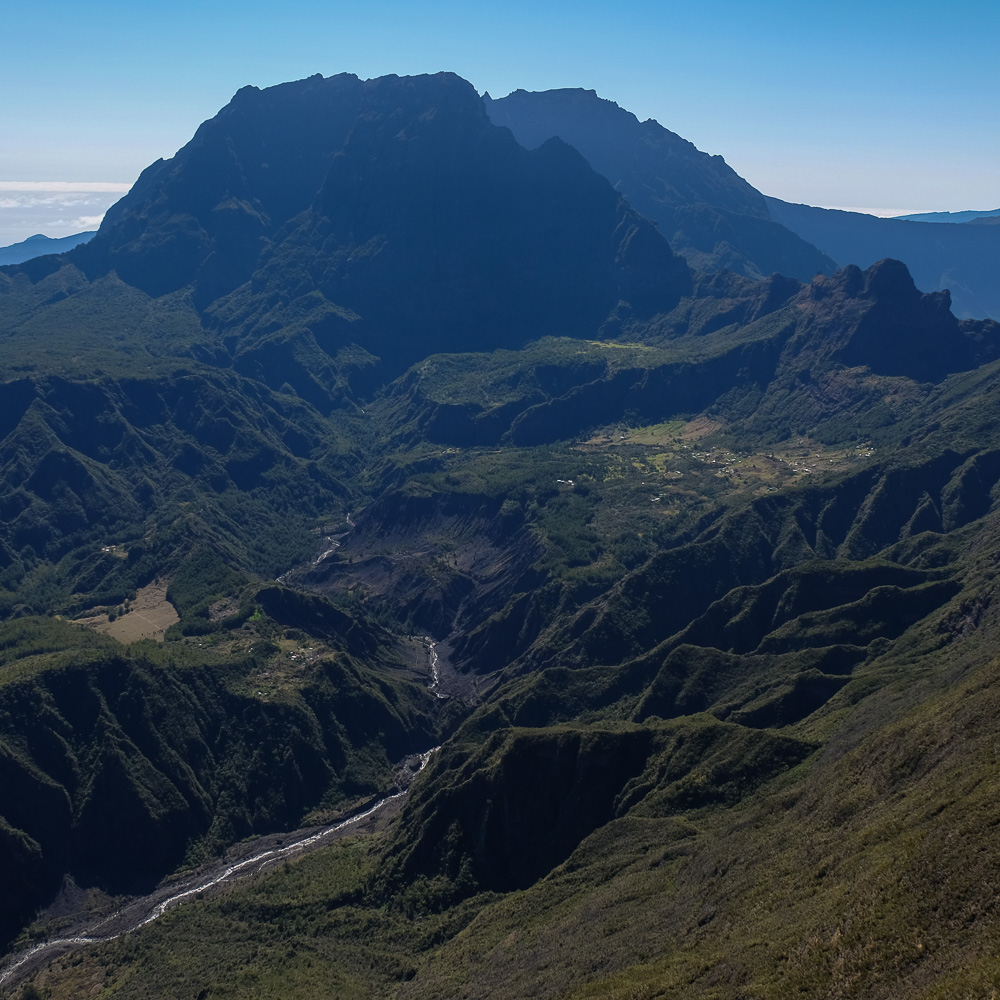
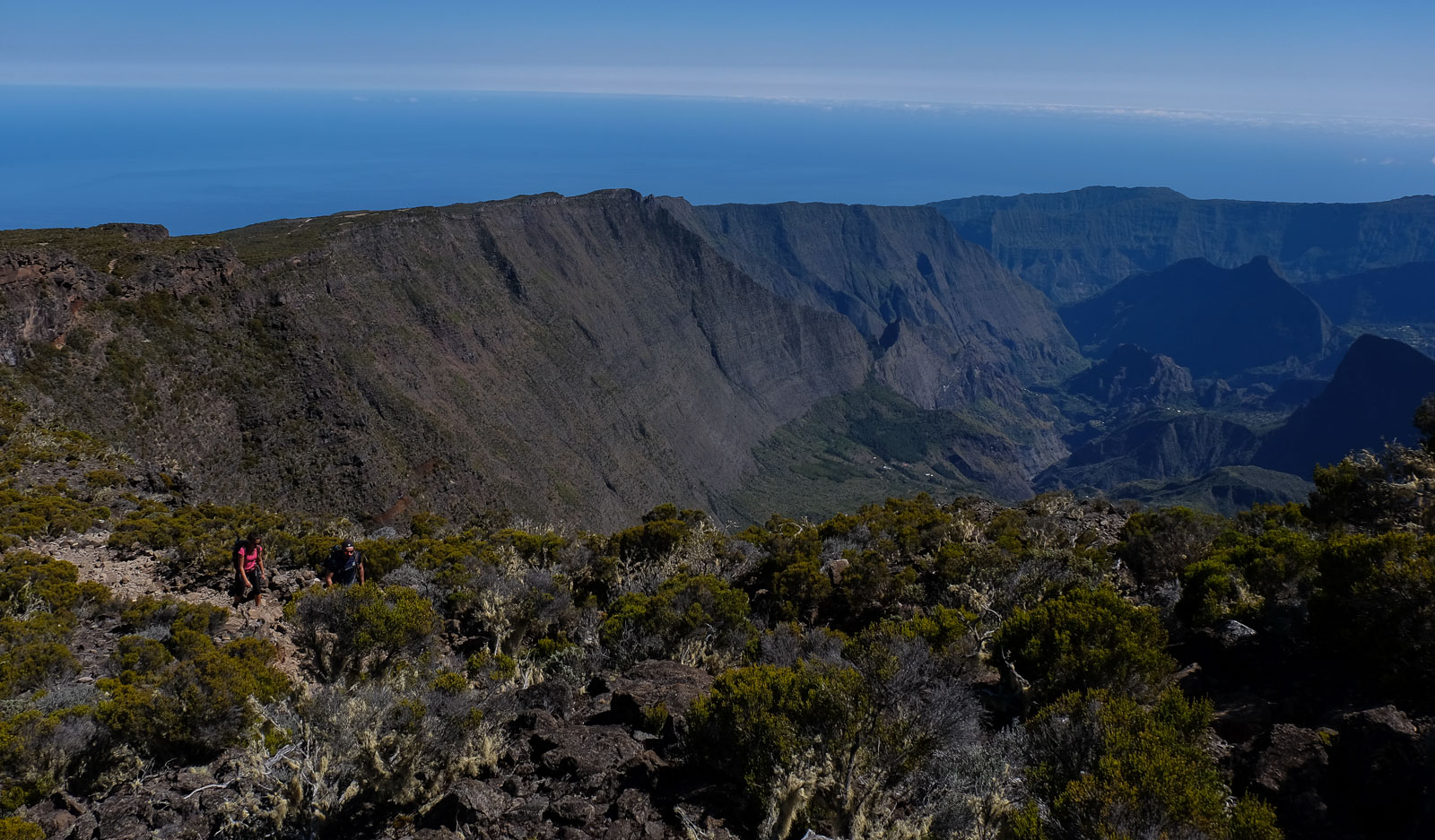
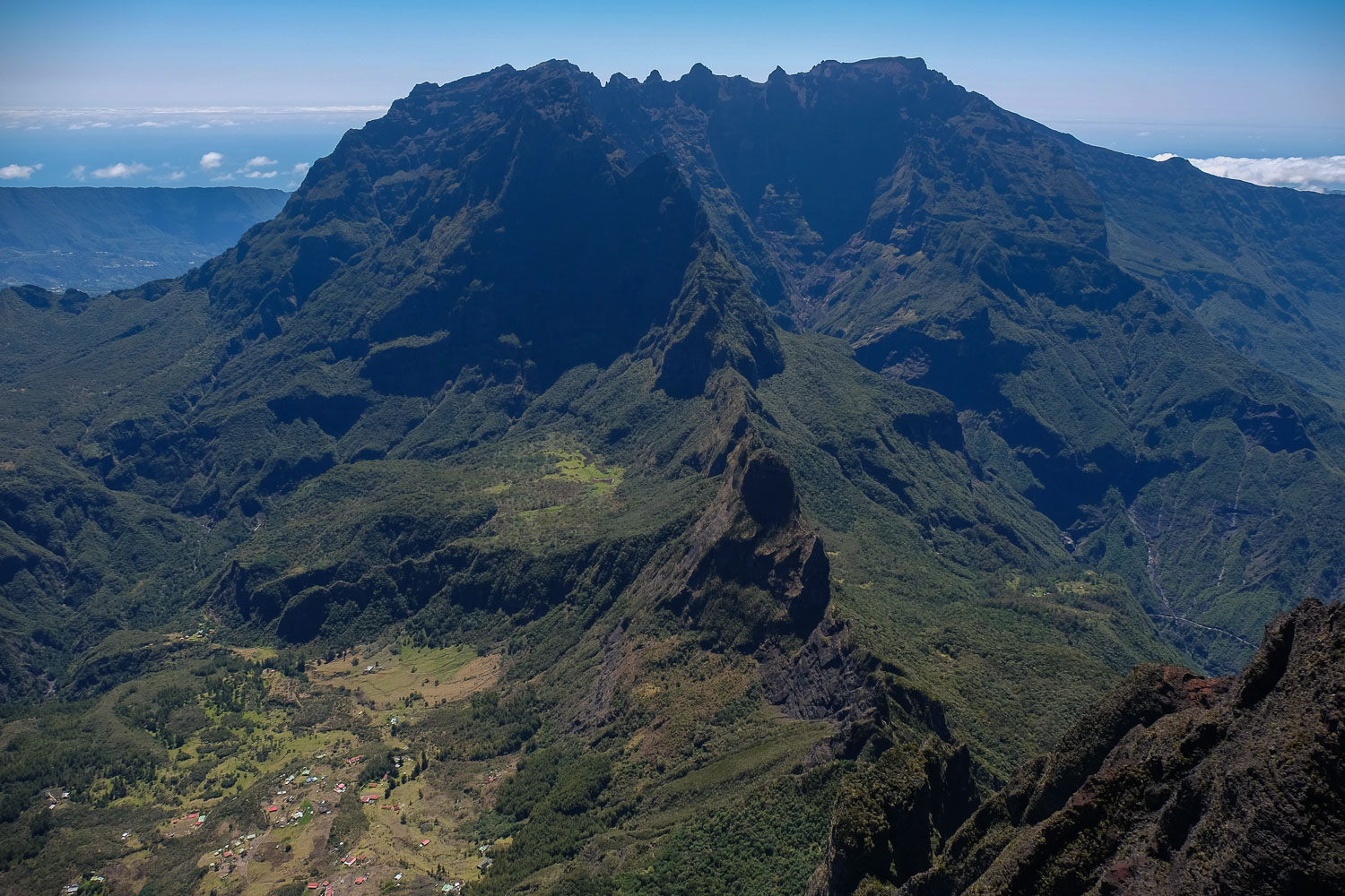
Sentier des remparts skirts the cirque de Mafate, ending at the summit of the Grand Bénare peak at almost 3000m (2898m). The main interest lies in the climb along the edge of the cirque de Mafate, with splendid views of the Piton des Neiges and the cirque de Cilaos. An obvious and well-marked itinerary on both the outward and return journey. The 18 km and 700 m ascent at over 2,500 m altitude make this a moderately difficult trek.
The Remparts trail more or less follows the edge of the depression, forming a sort of giant wall around the cirque de Mafate. Very uneven and rocky, the ascent is gradual but seems long, putting a strain on the legs. In places, it's steeper, before dropping back down to the Grand Bénare summit antenna.
The views are superb all the way up, the perspective widening as you climb until you reach the panoramic viewpoint encompassing the cirque de Mafate and cirque de Cilaos. In the background, on the south side, the Piton de la Fournaise emerges from the mist.
Almost as long. To avoid simply turning around, about a third of the way down, you can head west towards the Glacière path. This gives you a bird's-eye view of Saint Paul and the lagoon. The wide trail back to the parking lot remains long and monotonous.


![2017-08-01_10-56-03 [Crête de Pinu]](https://climbing7.com/wp-content/uploads/2017/09/2017-08-01_10-56-03-crc3aate-de-pinu-e1580117578105-1024x683.jpg "The Pinu ridges, Cap Corse")

Leave a Reply