


TOPO Hiking | CLIMBING7.COM
Publié le
 Partager sur WhatsApp
 Partager sur Twitter
Partager sur Instagram
Partager sur Twitter
Partager sur Instagram

 Partager sur Facebook
 Imprimer le topo
 Laisser un commentaire

The Matterhorn is no legend. There really is something special about this mountain, and the Höhbalmen Trail is certainly the best way to discover it, to admire it again and again in all its splendor. The route is varied, quite demanding in terms of distance and elevation gain, with fantastic panoramas of the local 4000m range. It even manages to make you forget all about Zermatt, the winter sports industry and its hordes of tourists. A trek to remember, while waiting to tackle the eastern slab of the pyramid to reach the mythical summit of the Matterhorn!
❱❱ Technical summary
Type ✦ Hiking
Location ✦ Zermatt
Region ✦ Valais
Country ✦ Switzerland
Length ✦ 20kms
Difference in altitude ✦ 1200m
Difficulty ✦ MD
Max altitude ✦ 2745m
Duration ✦ 5h to 6h
Interest ✦ ★★★
❱❱ Access to the place
From Vierge, head towards Täsch and Zermatt. Once in Täsch, the road is closed to tourists. To reach Zermatt, either take the train or hop in a cab for about the same price (currently 7 or 8 Swiss francs one way).
❱❱ Map & topo
❱❱ Itinéraire
From the train station or cab rank, walk up the main street, past the church and a little further on, you'll find an alleyway off to the right. A sign indicates Alterhaupt Edelweiss. Go up the alley and after a few dozen metres, fork right again to start the trekking path.
The trek forms a loop with an outward journey at altitude and a return that follows the same itinerary but at a much lower altitude. The difficulty lies in the distance and the fairly significant altitude difference, as there are no technical or exposed passages. The route is well signposted in red and white and easy to follow all the way.
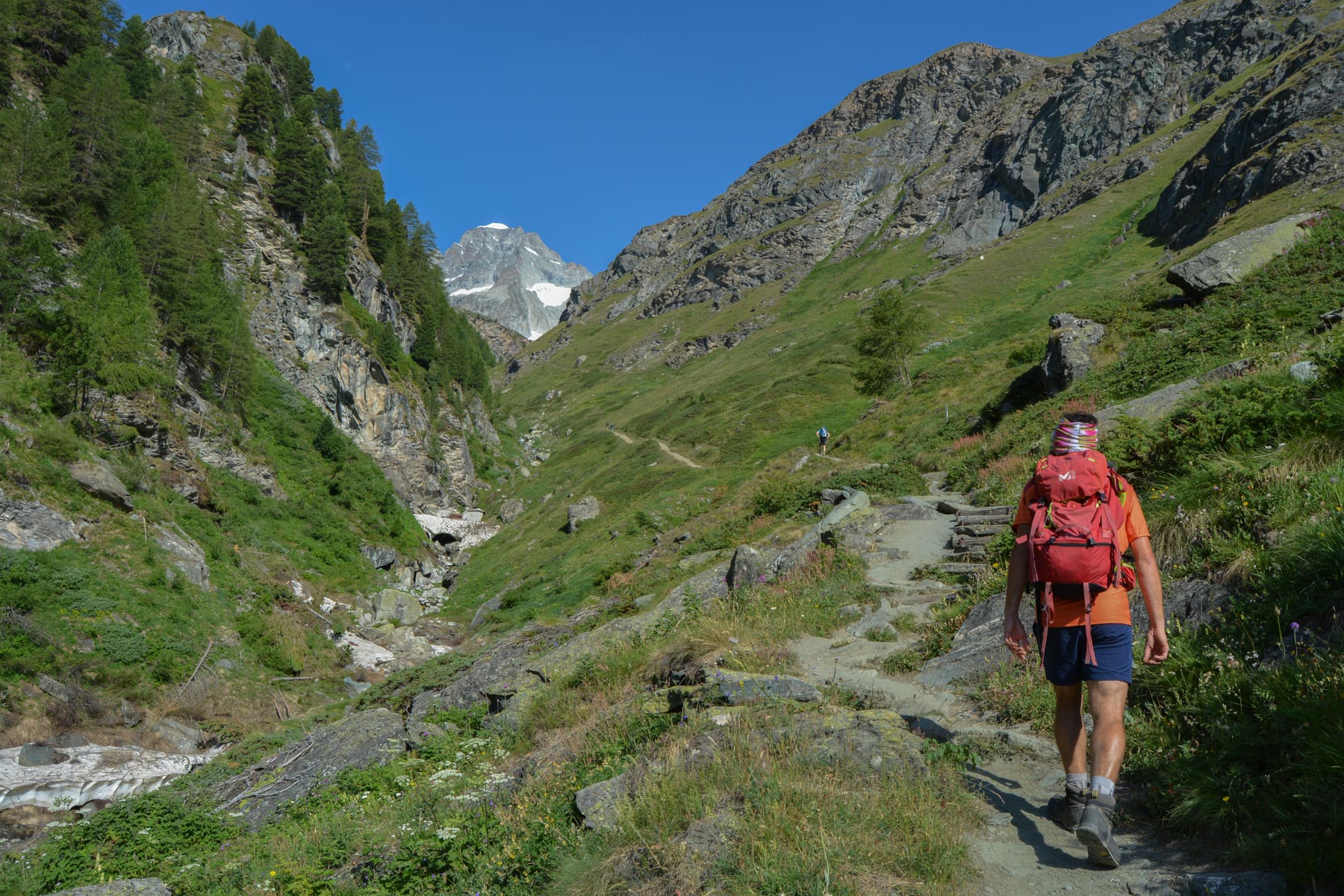
Steep, winding entry path. We're getting close to the Trift Gorge and its noisy torrent. It continues through the forest, with no real rest, to end up at the Alterhaupt refuge. 1st landing.
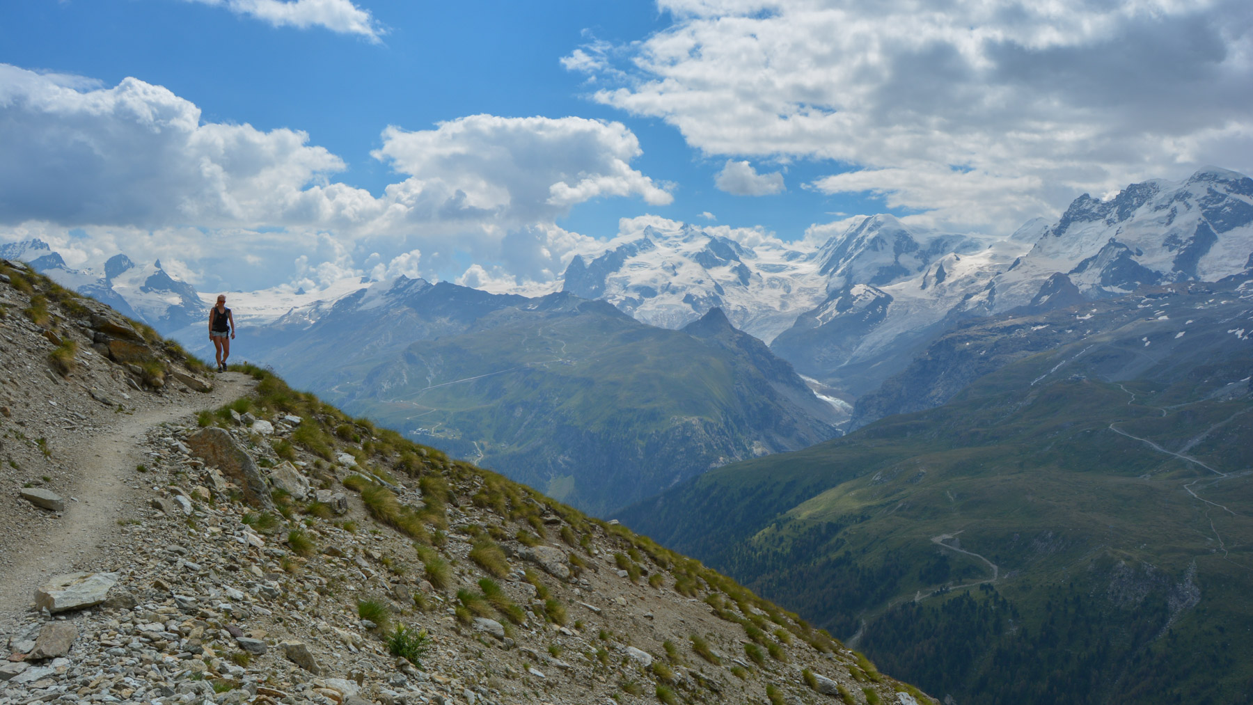
Off we go again, following the Trift gorge. Higher up, we switch to the opposite flank, and the path continues to climb in large laces, more gradually until we reach the Hôtel du Trift. The view of the circus of snow-capped peaks is superb!
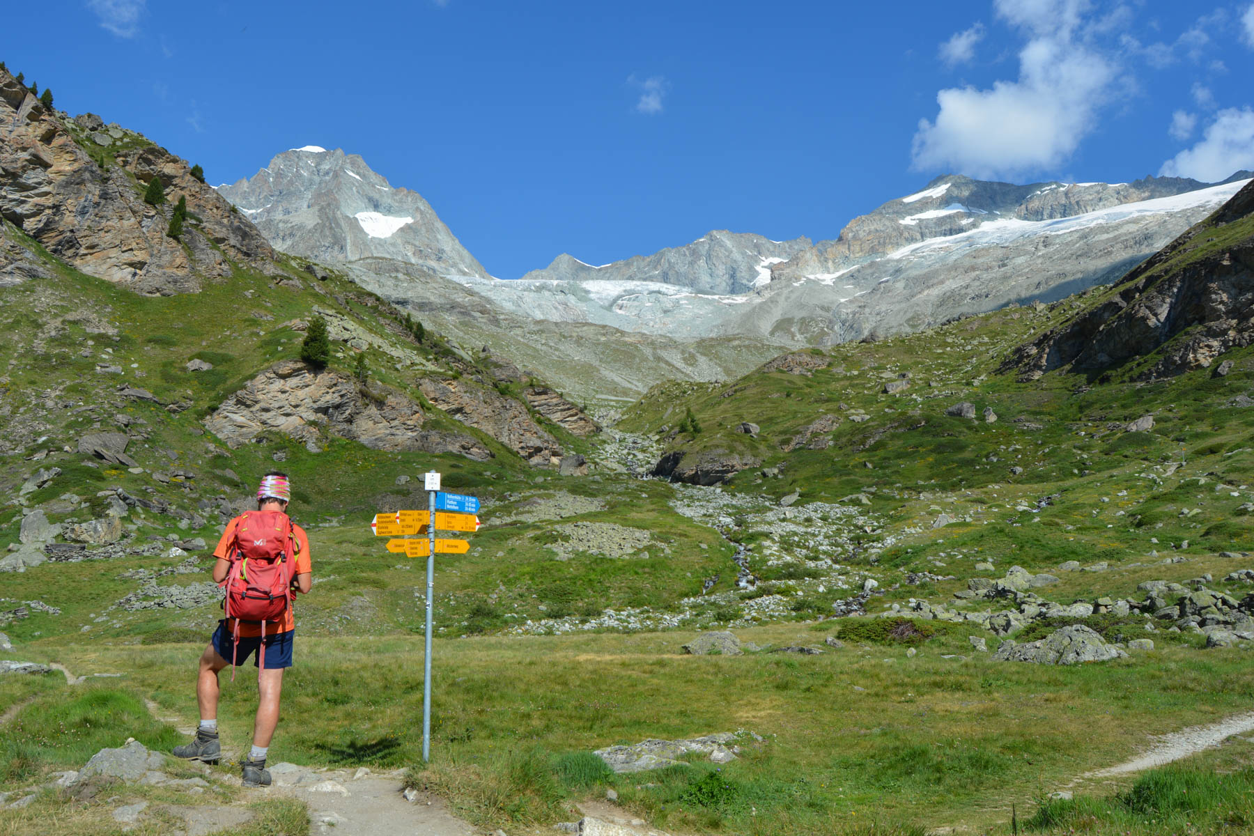
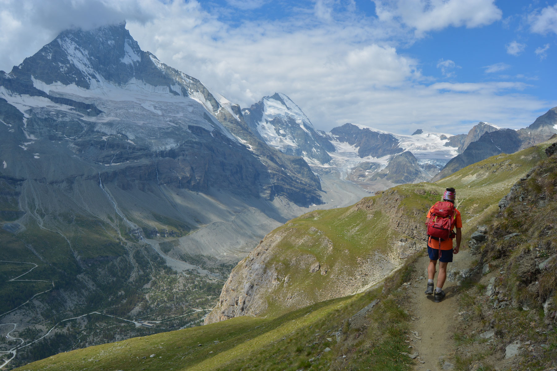
From the hotel, the path leads off at right-angles towards an obvious shoulder, which we climb steeply but not too far, then cross over to a second shoulder that takes us back into the Zermatt valley, with a fantastic 1st view of the Matterhorn.
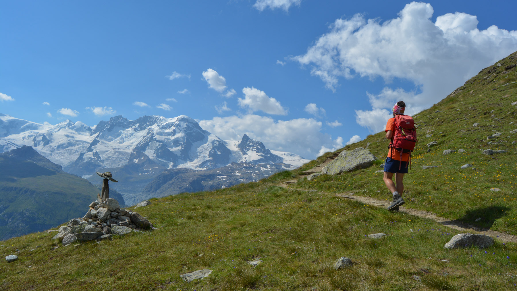
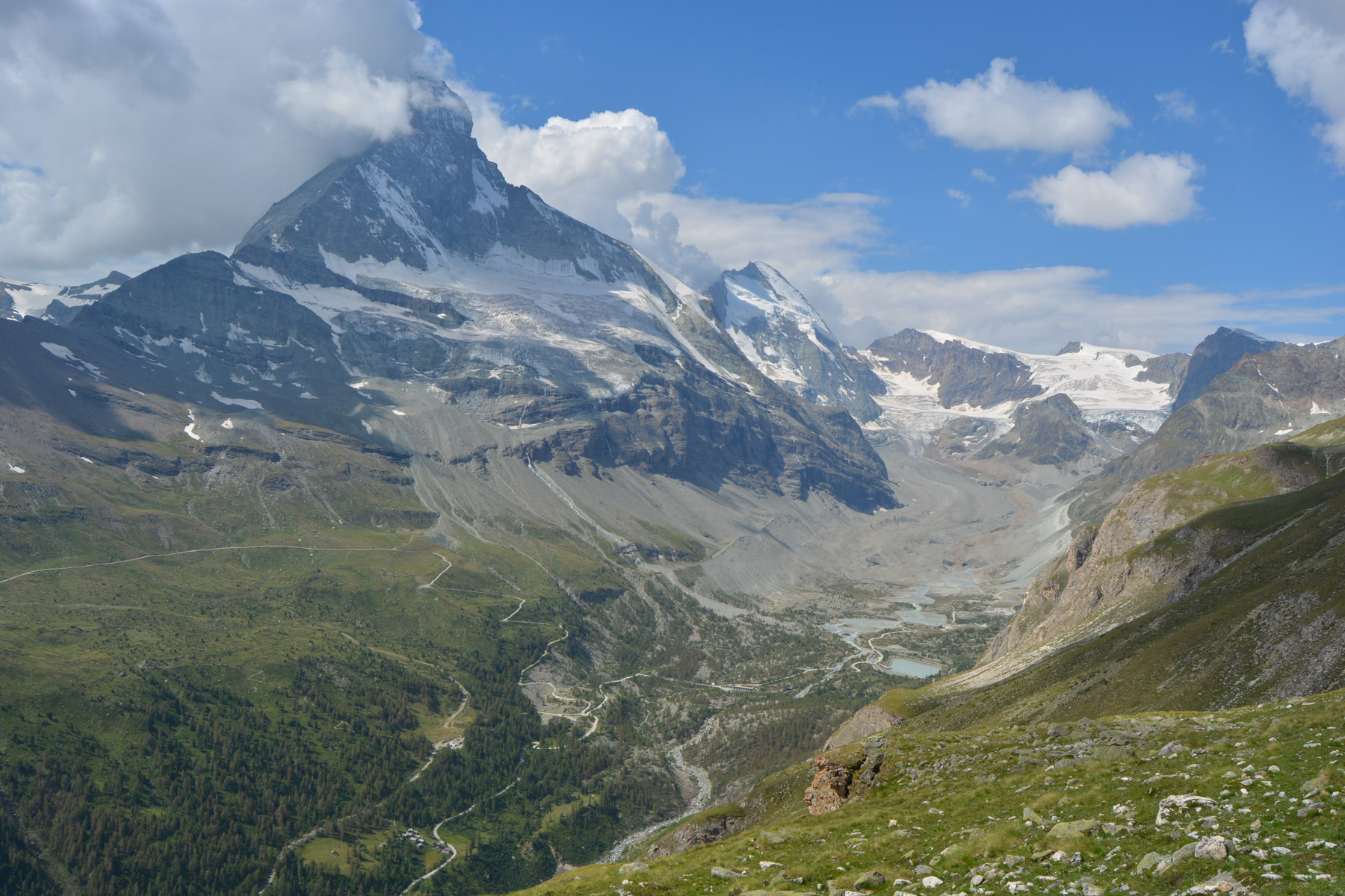
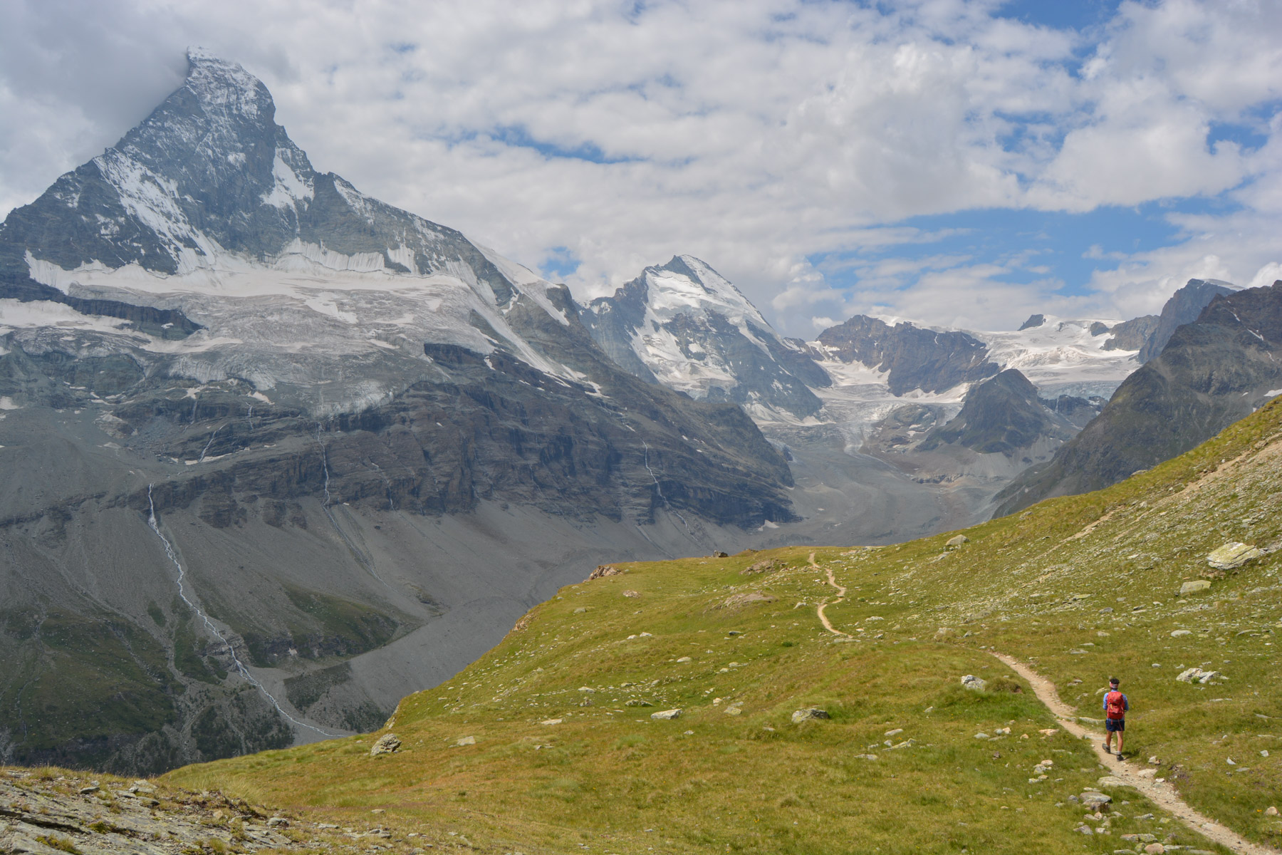
This time, the route is visible on sight: a small path winding its way up through the alpine pastures at over 2500m towards the Matterhorn and the Dent d'Hérens glacier on which it seems to rest. With little difference in altitude, you're almost totally taken up by the view of this incredible rock, a veritable twisted pyramid rising to almost 4500m. The path follows the relief of the mountainside, descending or ascending a little to reach the highest point, a small promontory facing the pyramid. Impressive!
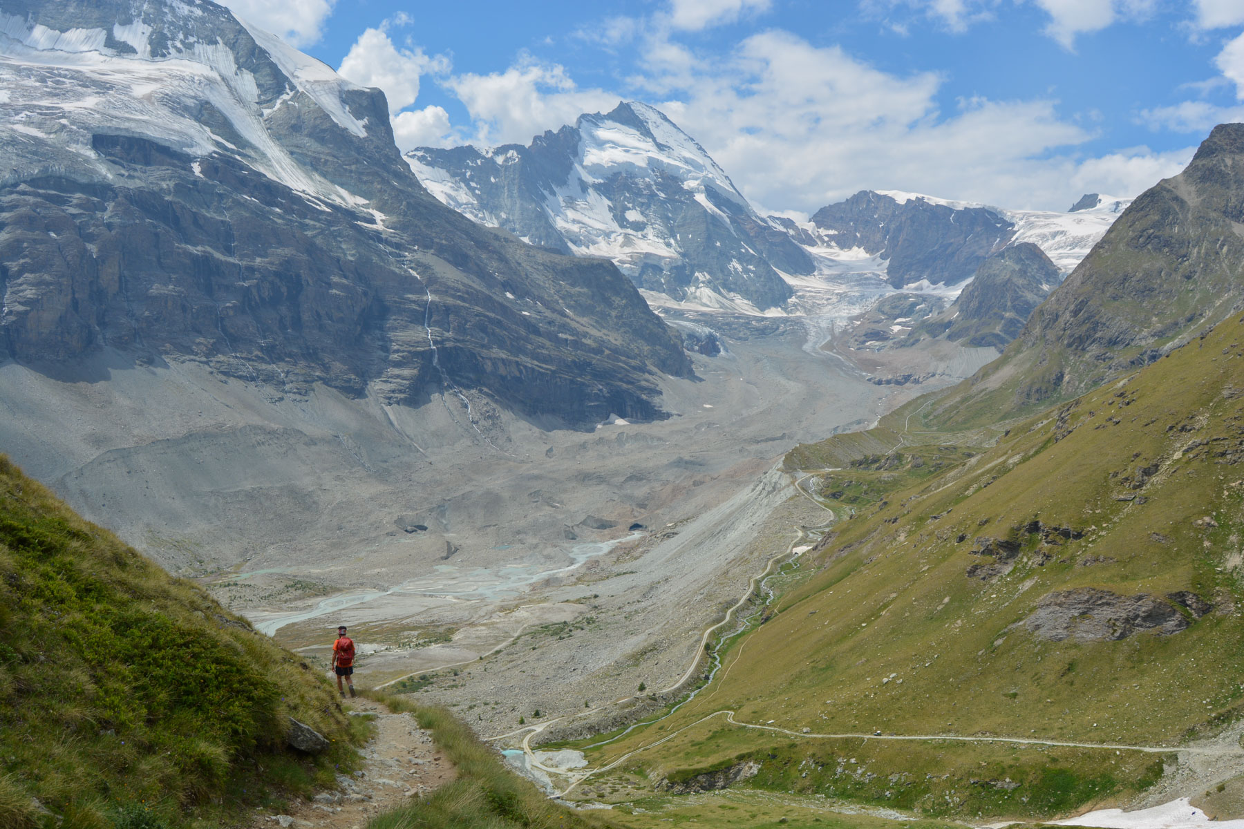
The trail descends gently into the valley, then twists and turns steeply to join the return path at the very bottom. Turn left to pass a small waterfall against a backdrop of the Matterhorn. After this, the path descends but very gradually over the alpine pastures at the base of the Zmuttbach, except for a section that has been closed (scree?) which takes us down to the torrent and then back up to the alpine pastures. Further on - it's quite far, but the views are magnificent - we reach the tiny, touristy village of Zmutt.
From Zmutt, the path descends gradually to Zermatt and the starting point of the trek. Allow an extra 10′ to reach the station.


Leave a Reply