


TOPO Via ferrata | CLIMBING7.COM
Publié le
 Partager sur WhatsApp
 Partager sur Twitter
Partager sur Instagram
Partager sur Twitter
Partager sur Instagram

 Partager sur Facebook
 Imprimer le topo
 Laisser un commentaire

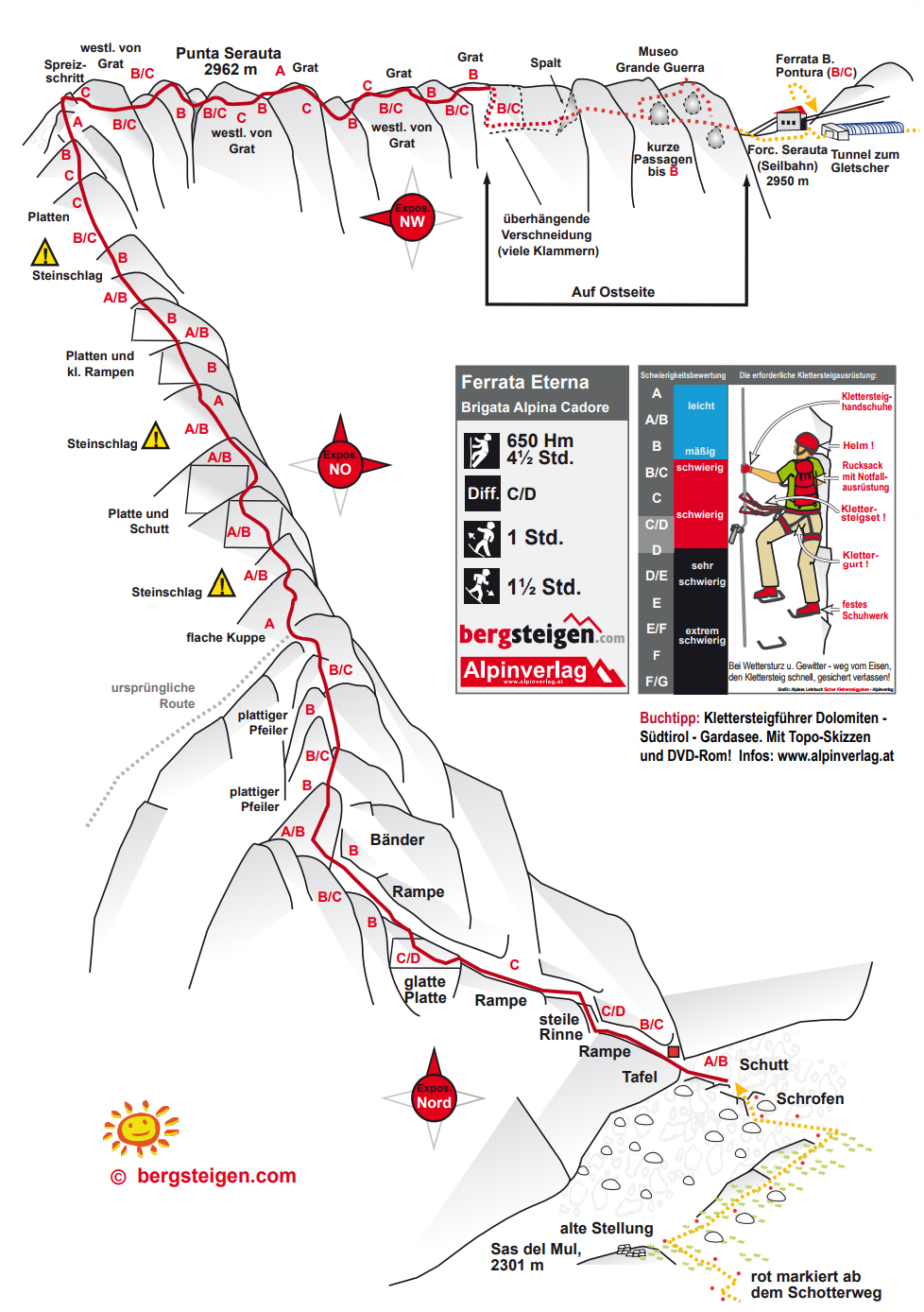
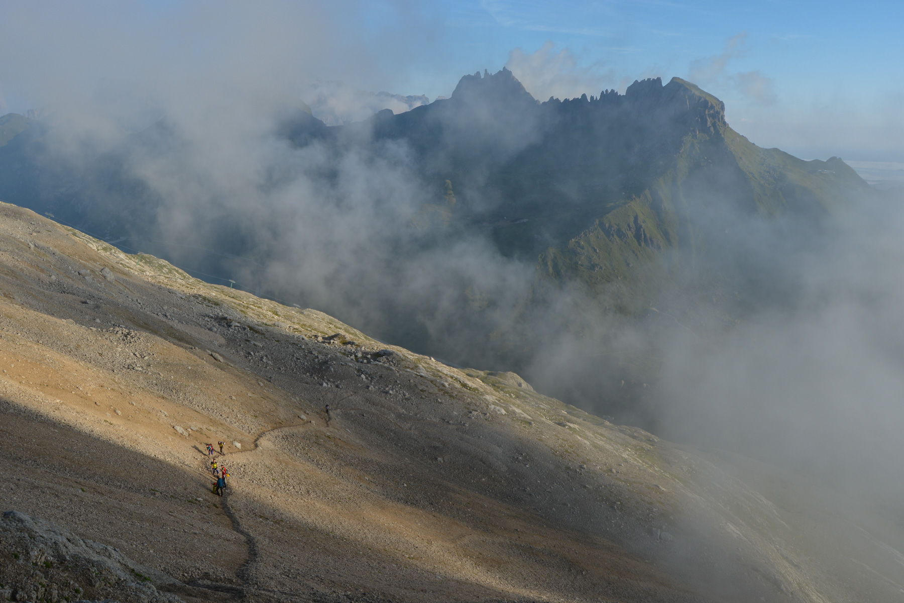
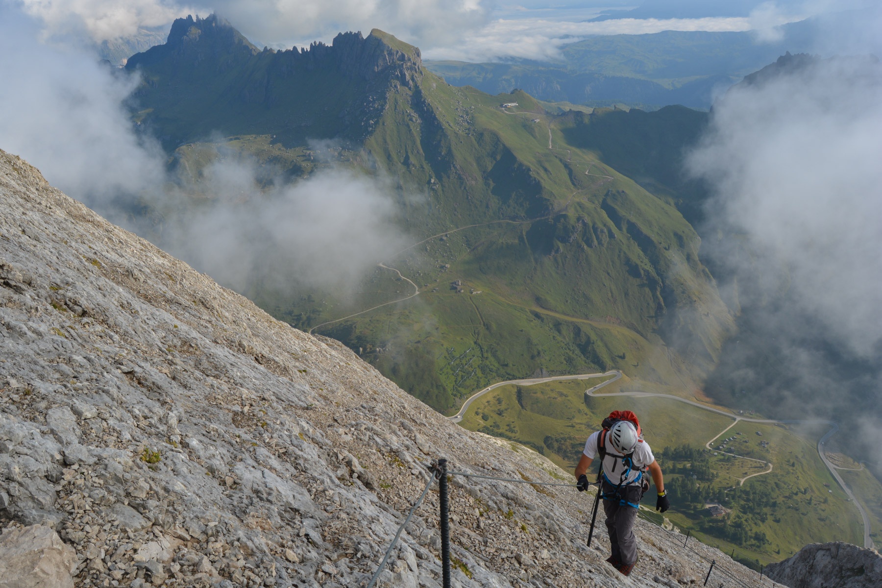
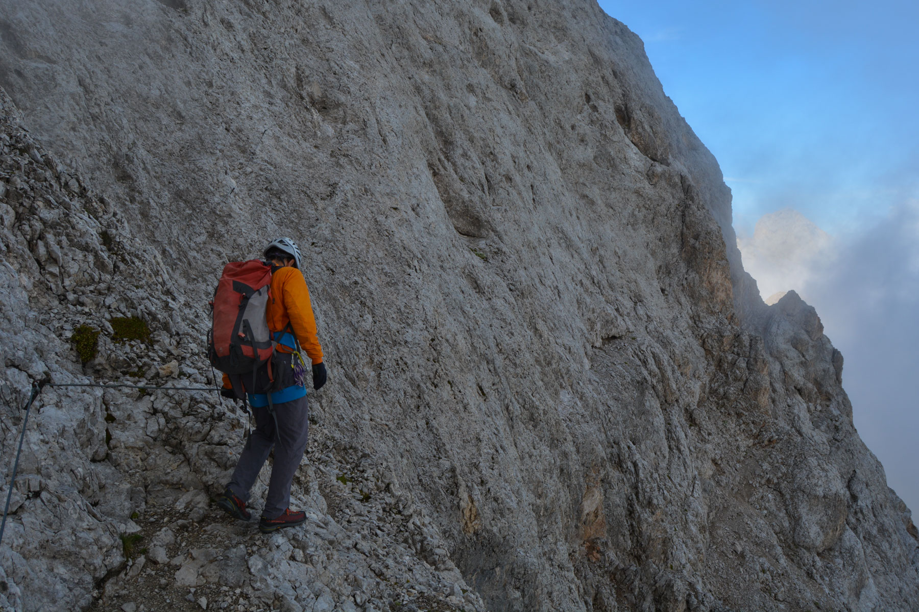
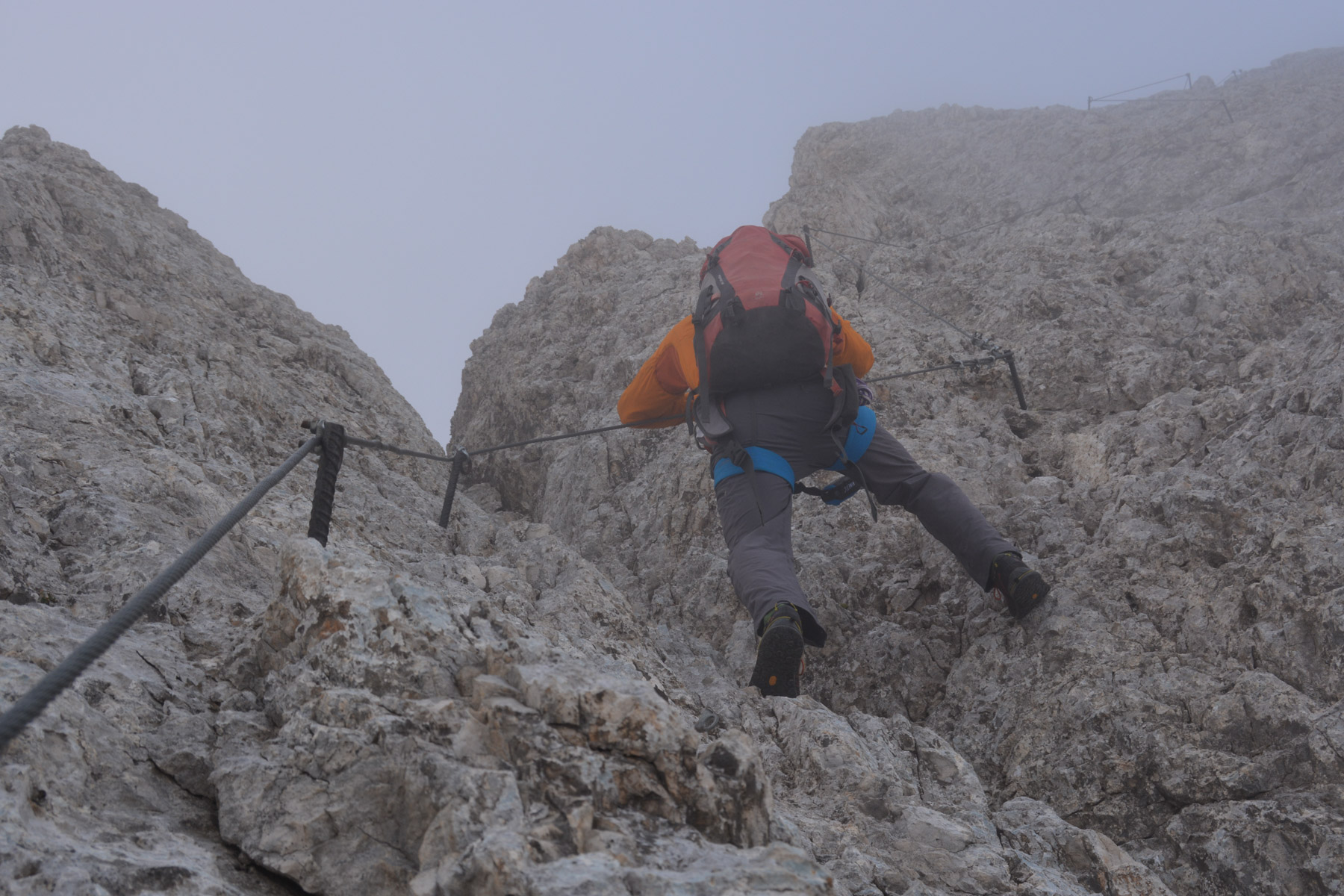
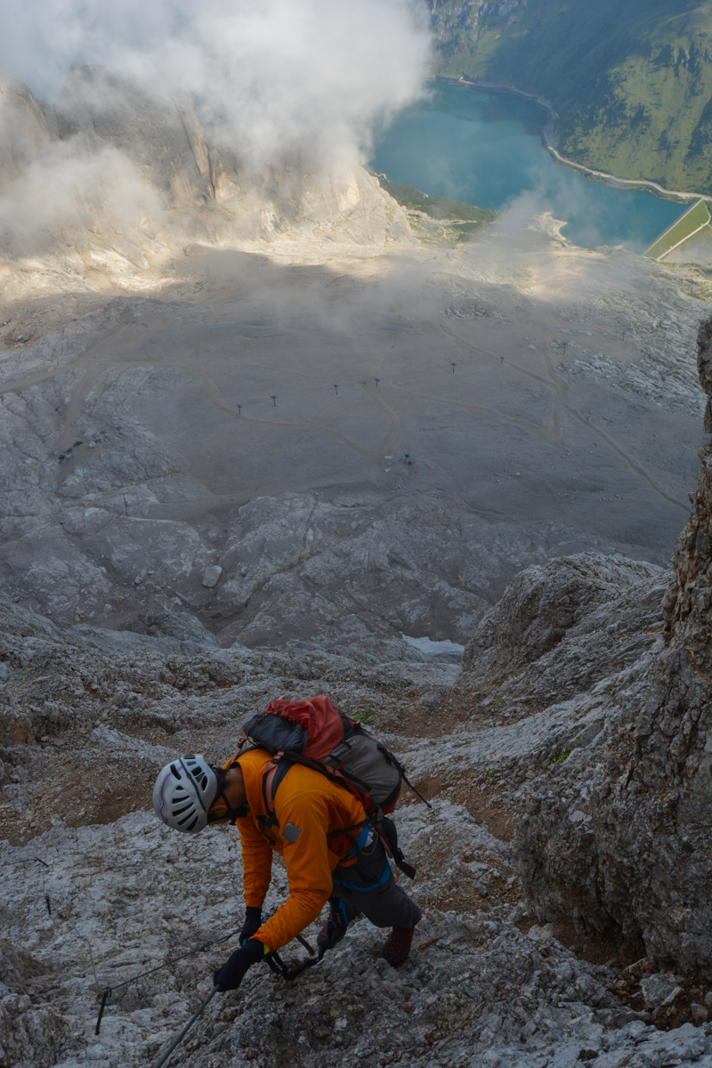
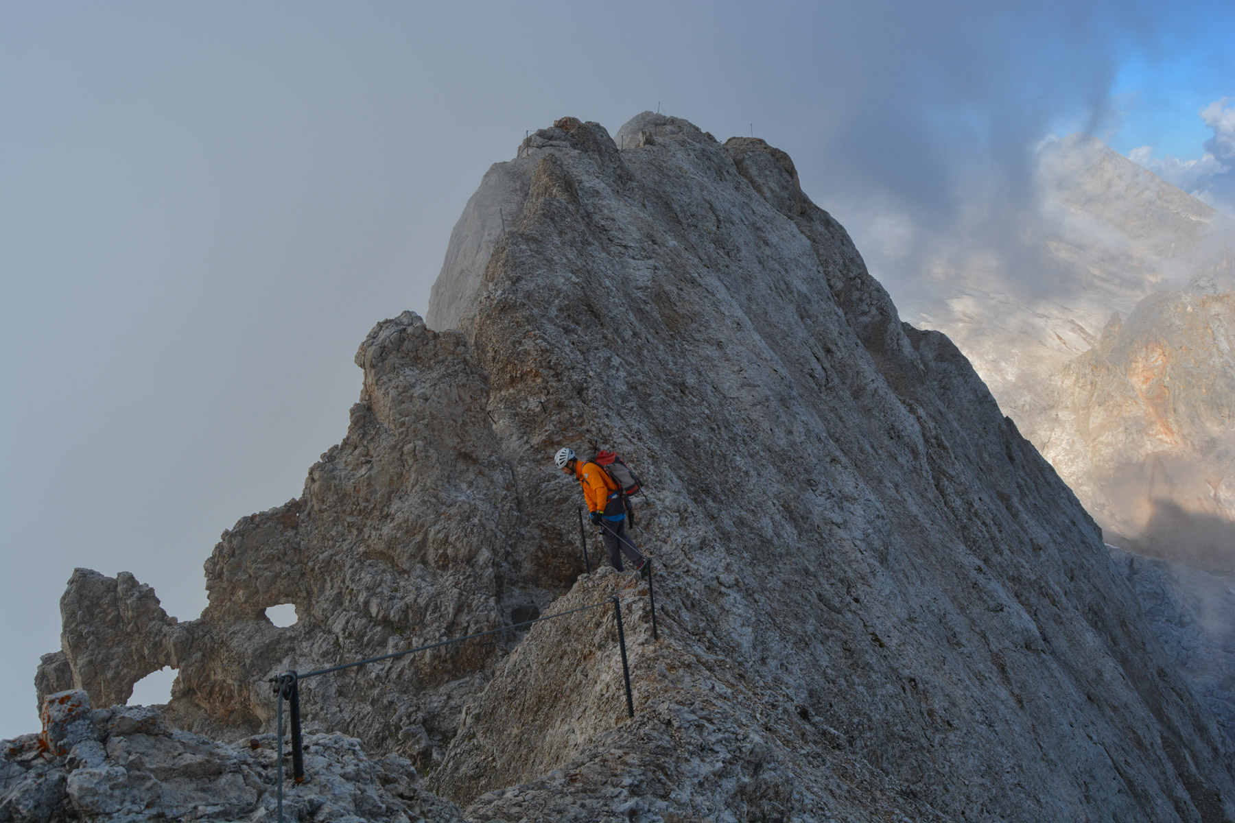
The recently re-equipped via Eterna Brigata Cadore climbs a huge slab and then an airy ridge on the eastern slope of the Marmolada massif in the Dolomites. Equipped with at least a single cable, except in 2 places, the route offers panoramic views of the Marmolada glacier, the Masola ridges and, in the distance, the other groups of Dolomite peaks... at least on a clear day, which is not easy here in summer. The difficulty lies mainly in the 1st section, which is vertical and continuous to reach the sea of rocks and face the slab that leads to the ridges. The rest of the climb is aerial but not very difficult. A great alternative to the normal Marmolada route on the west ridge. A route that can be exceptional on a clear day.
❱❱ Technical summary
Type ✦ Via Ferrata
Location ✦ Canazeï
Region ✦ Trentino-Alto Adige, Dolomites
Country ✦ Italy
Length ✦ 1000m
Vertical rise ✦ 900m
Max. altitude: 2962m
Difficulty ✦ K4
Duration ✦ 5h to 6h
Interest ✦ ★★
❱❱ Access to the place
From Bolzano, reach Canazei and then take the Passo de Fedaïa road. Drive along Lake Fedaïa and park in front of the Passo Fedaia refuge at 2057m.
❱❱ Map & topo
❱❱ Itinéraire
From the refuge, go behind it and take the wide track that climbs steeply in a yaw. Pass the first 3 bends and before passing under the chairlift, a path marked red and white and "F.E" indicates a shortcut to the foot of the route, in the main cliff.
Perfectly equipped with a lifeline and nothing else except at the start and in the final descent with rungs. The difficult part is at the start, with a long, vertical pitch where you have to use the rock to climb. The rock is not always very compact, especially on the lower part. Be careful of the rocks on the ground and what you pick up with your hands to climb. Make sure you wear gloves, as you'll be using the rope all the time.
There are several alternatives for getting back. The easiest is to take the cable car back down to Malga Ciapela on the south-east side (plan a return stop or 2nd vehicle). Alternatively, go down the glacier to join the track below the chairlift, but access to the glacier is not easy as the winter tunnel is closed and you'll need crampons and ice axe as well. That's the option we took.


Leave a Reply