


TOPO Hiking | CLIMBING7.COM
Publié le
 Partager sur WhatsApp
 Partager sur Twitter
Partager sur Instagram
Partager sur Twitter
Partager sur Instagram

 Partager sur Facebook
 Imprimer le topo
 Laisser un commentaire

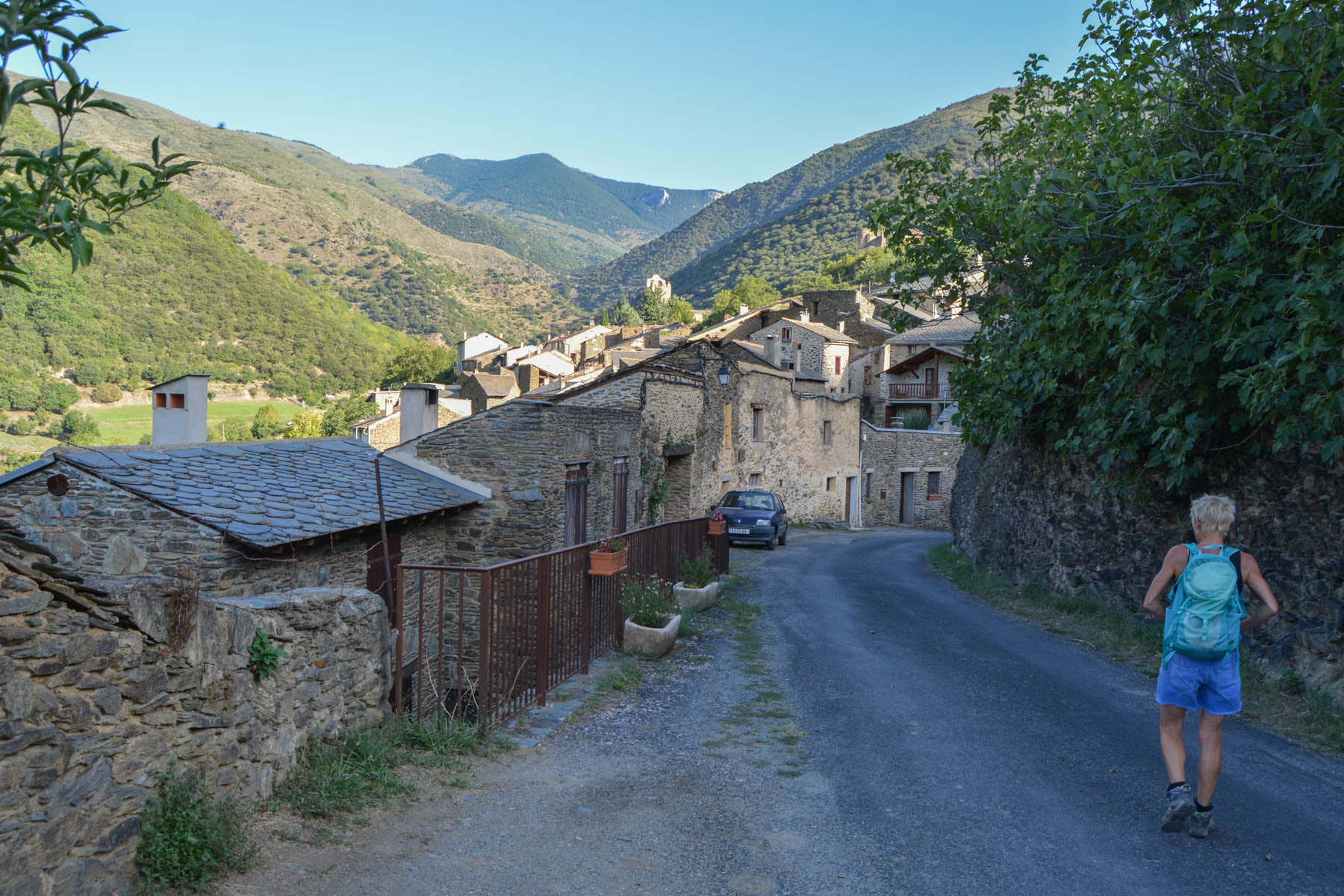
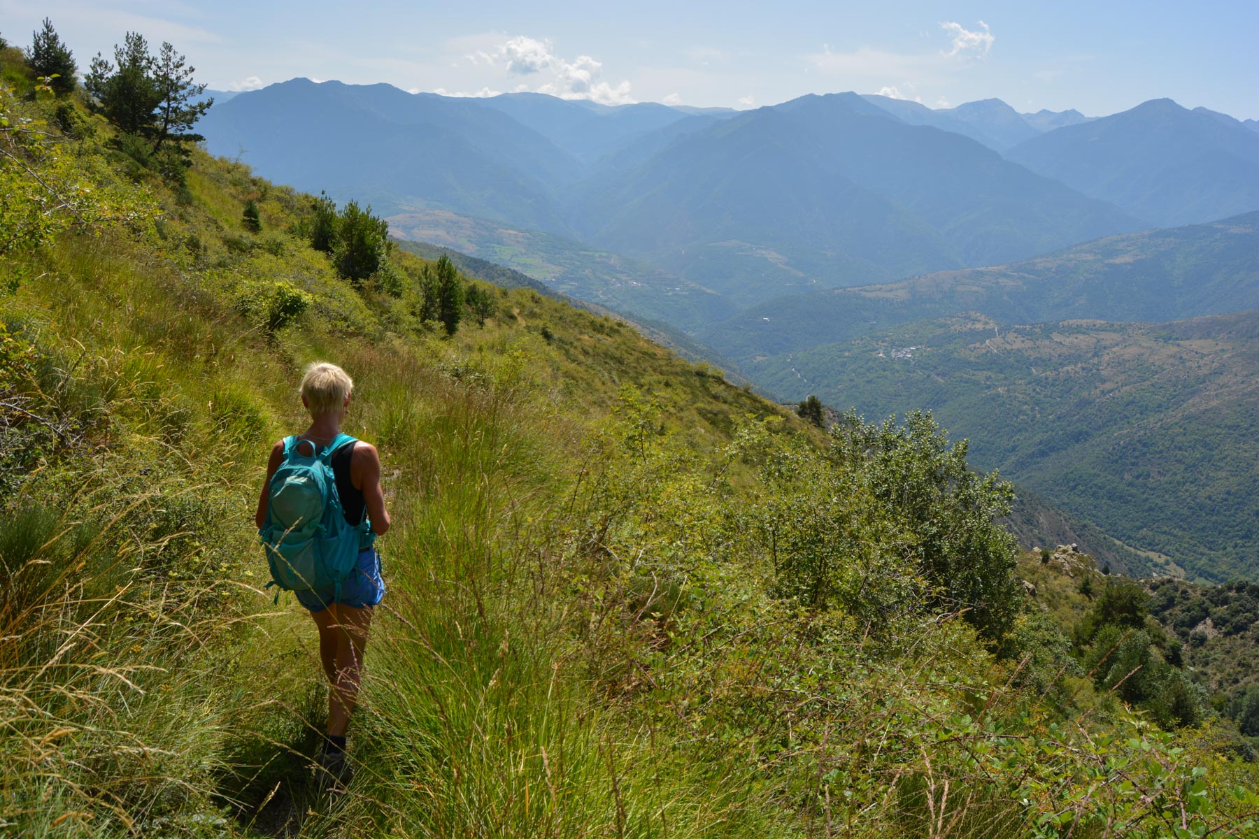
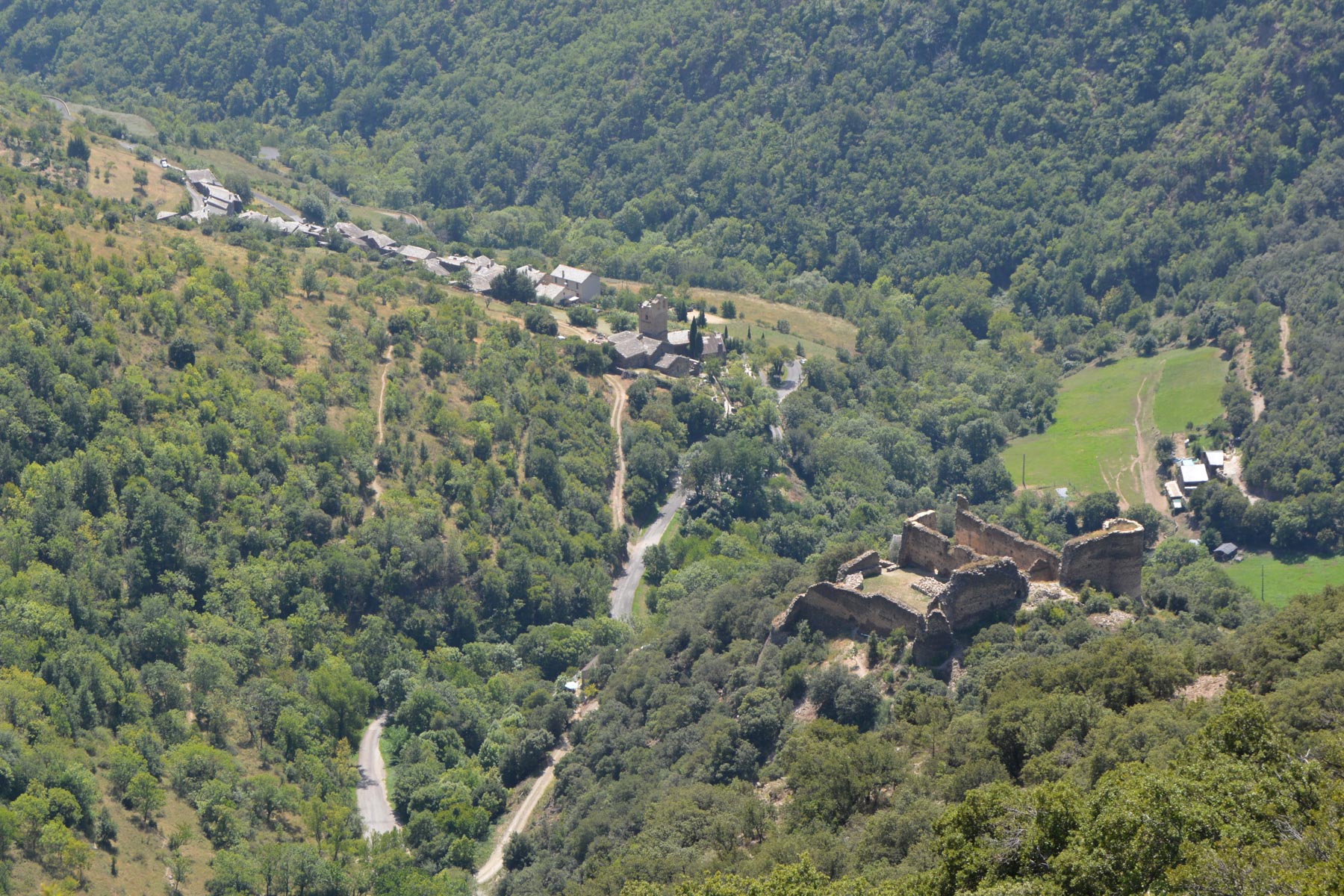
Leaving from Évol, billed as one of France's most beautiful villages, the Cami Ramader circuit offers a loop that climbs along the Evol torrent to the Mouline refuge (1550m), before returning upwards to plunge above the village and its ruined 13th-century feudal castle. The itinerary is not difficult, but the distance and altitude difference are quite considerable. Plus points: a beautiful forest crossing before and after the refuge, panoramic views of the Pyrenees on the return descent. The drawbacks: the long climb along the torrent, cool in the woods but with no view, and the uninteresting section of track to follow at the top before descending. Stroll to be repeated in spring or winter with snow-covered peaks?
❱❱ Technical summary
Type ✦ Hiking
Location ✦ Evols
Region ✦ Pyrénées Orientales
Country ✦ France
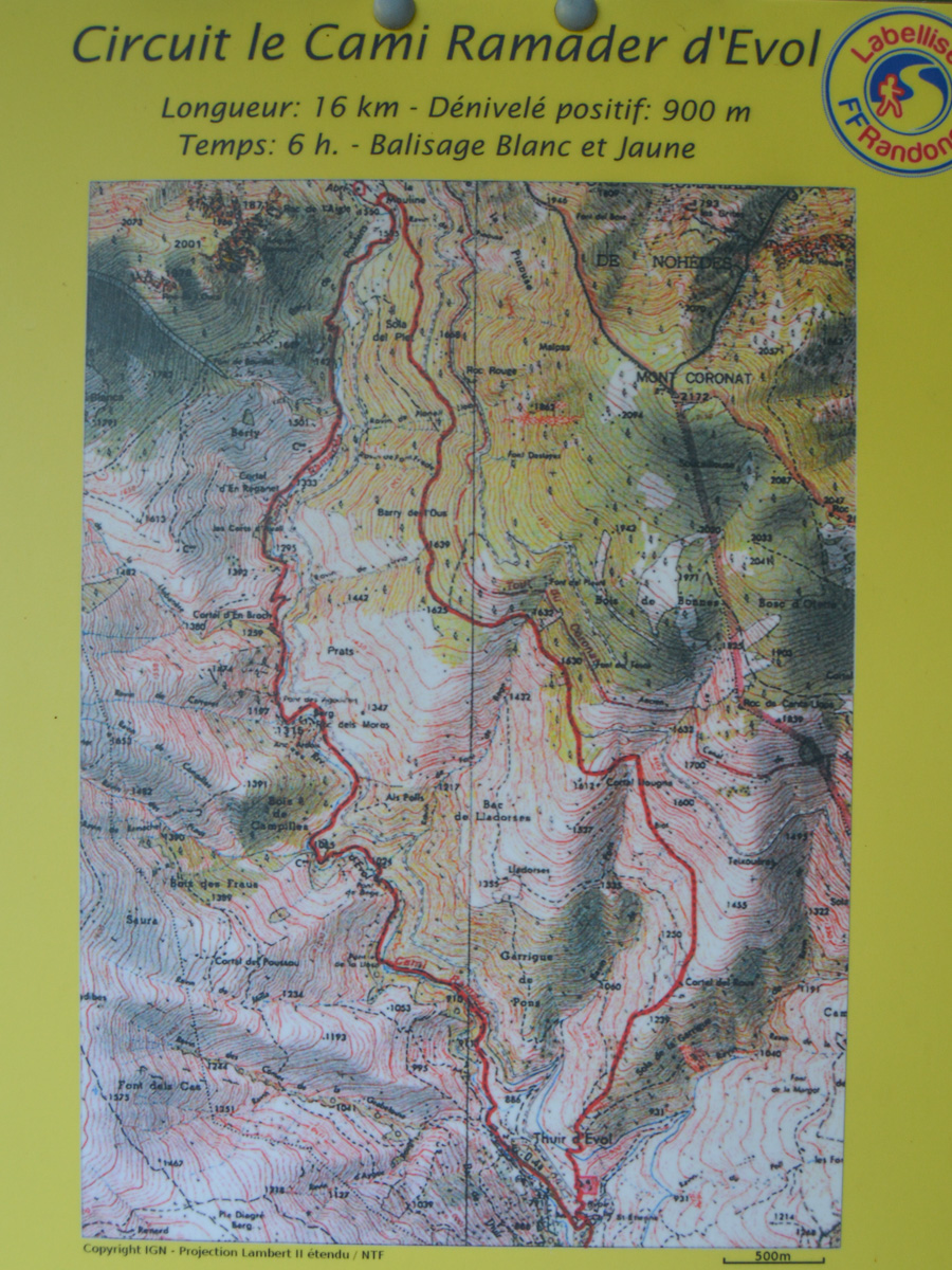
Length ✦ 16kms
Dénivelé ✦ 800m
Difficulty ✦ MD
Max altitude ✦ 1650m
Duration ✦ 5h to 6h
Interest ✦ ★
❱❱ Access to the place
On the N116 from Font-Romeu towards Perpignan, take the road that climbs towards Évol, just as you enter Olette. Drive through the village and park at the left-hand exit, under the church. There's a signposted circuit.
❱❱ Map & topo
❱❱ Itinéraire
Walk along the road for a few minutes, make the bend and just after, at the fork with the Thuir d'Évol sign, turn right and walk along the asphalt to the end where you'll find the start of the path.
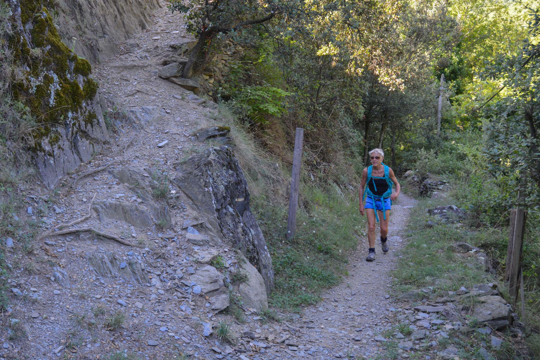
The Cami Ramader is marked in white and yellow throughout, although on the final descent the path is less well maintained and the markings less visible. The loop can be done in 2 directions, but clockwise seems preferable for the gradualness of the ascent and the panorama of the descent.
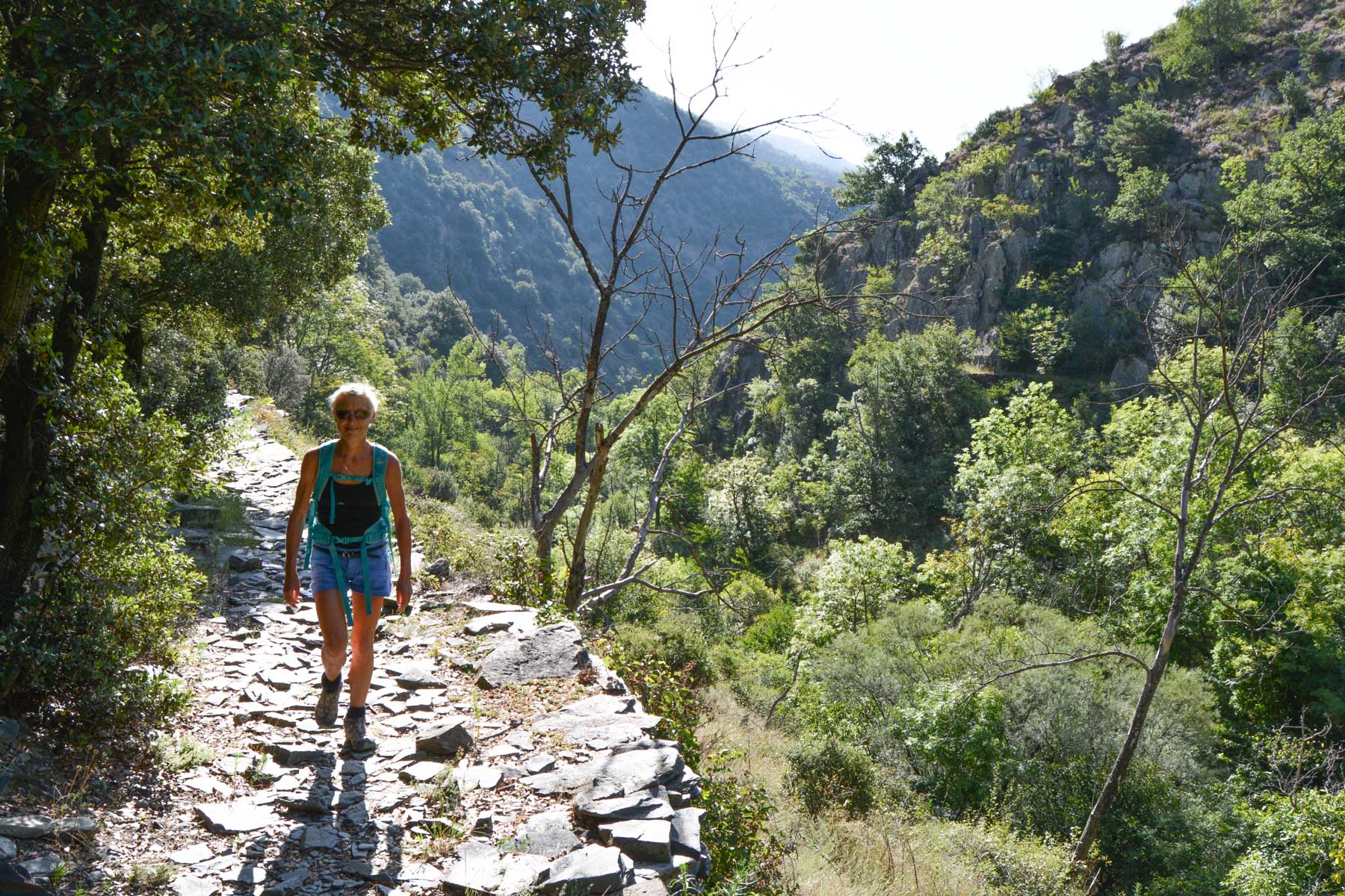
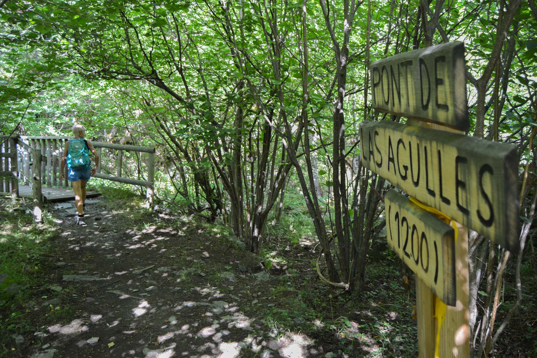
The path that starts climbs through the woods on a prepared path above the village. Higher up, you discover the valley winding along the torrent in a carpet of vegetation. We cross the torrent a 1st time over the small Llosa bridge (960m), then over the Bege bridge (1040m), then over the Las Agulles bridge (1200m).
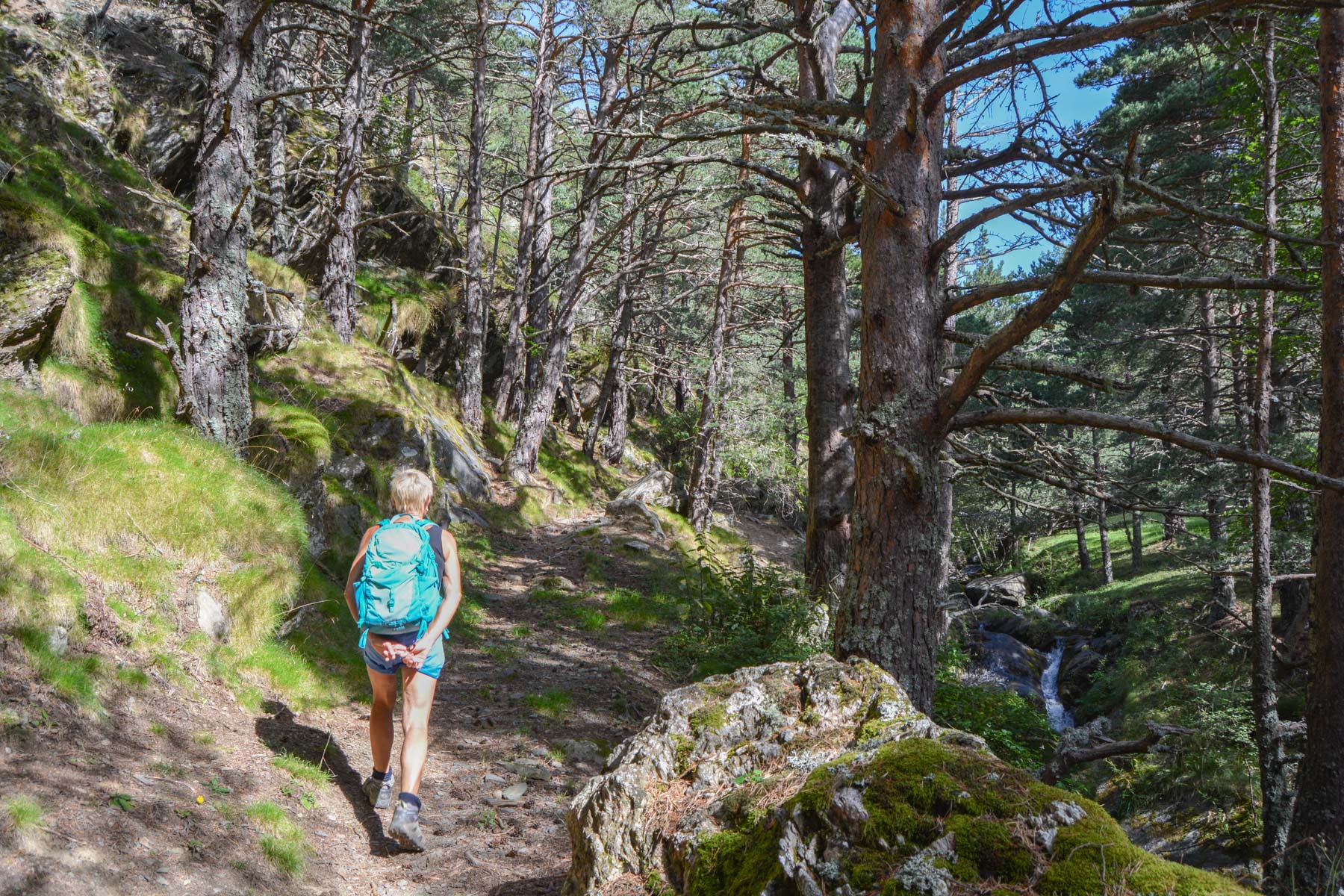
Higher up, we cross the stream again over stones, this time to climb steeper and exit at the top of the valley. At almost 2000m, you can see the rocky bars overlooking the refuge. What follows is more beautiful, with a very fine passage through a forest of tall pines with very green grass on the ground. There are a few twists and turns to climb back up to the level of the torrent, which becomes smaller at this point. One last wooden bridge to cross to end up in the forest and reach the refuge, a free open shelter close to the trail. Nice spot.
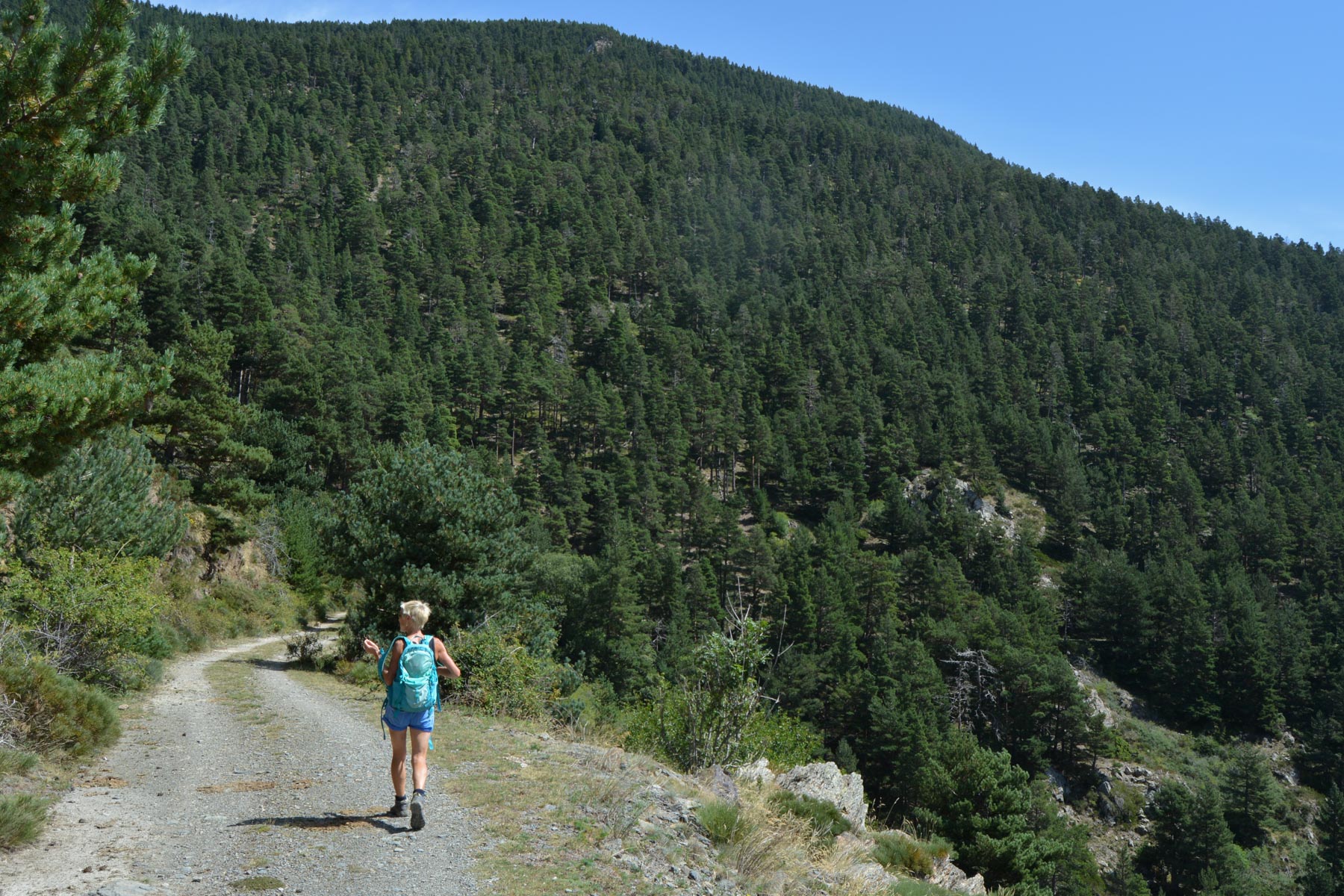
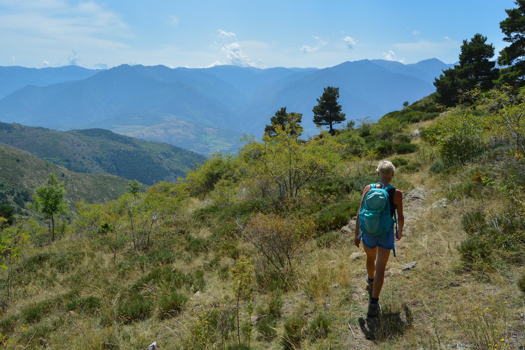
Descend the track and almost immediately find the path leading off to the left into the forest (yellow signpost). A beautiful, slightly uphill traverse through the same forest of tall pines eventually leads to another, higher trail. This is the less interesting section, with at least 2 km of walking. At a sharp bend, you'll come to a well-marked junction. The trail then descends into a more open area. There's a panoramic view over the valley and the mountain range opposite. From this point onwards, the trail is less marked, with little cleared ground in places. It descends following the curves of the valleys, descending rapidly over the flanks and ridges to a final promontory. Here the path veers off to the right and becomes steeper and less comfortable. It's a steep slope that lasts all the way to the château, for a total of almost 400m of negative gradient.
From the château, descend to join the track, which becomes a road again to return to the parking lot.


Leave a Reply