


TOPO Hiking | CLIMBING7.COM
Publié le
 Partager sur WhatsApp
 Partager sur Twitter
Partager sur Instagram
Partager sur Twitter
Partager sur Instagram

 Partager sur Facebook
 Imprimer le topo
 Laisser un commentaire

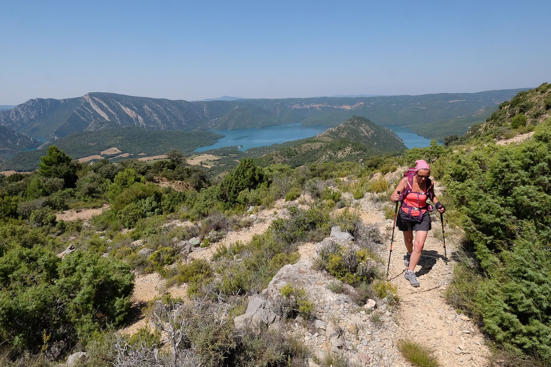
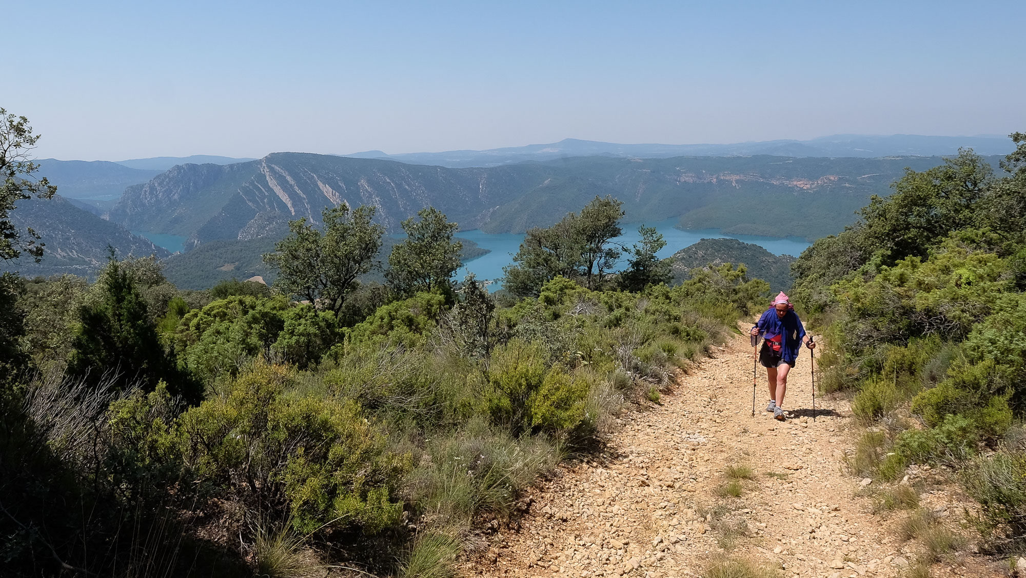
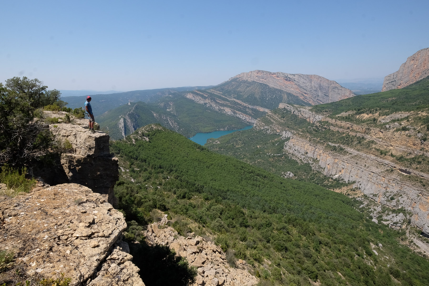
From the natural vantage point of Serrat de Roplans, above the village of Corça on the border between Catalonia and Aragon, you can admire the extraordinary scenery of the Montrebei gorge. Two immense walls tumble down towards each other, letting the crystal-clear waters of the Noguera Ribagorçana flow through the deepest part and opening a small window onto the Pyrenean peaks to the north. An accessible hike, fairly short in terms of altitude and distance, but which can prove more demanding in high summer, as was our case, with nearly 40°C on the clock. It's a good way to get started before approaching the gorge to see it from the inside, crossing over to the Aragonese side to climb the Pasarelas de Montfalco or take in one of the superb via ferratas or canyons in the area. Alternatively, if it's really hot, head down for a dip in the blue-green waters of the Pantano de Canelles.
❱❱ Technical summary
Type ✦ Hiking
Location ✦ Corça, Ager
Region ✦ Catalunya
Country ✦ Spain
Direction ✦ South
Max altitude ✦ 1050m
Distance ✦ 6.5km
Dénivelé ✦ 440m
Difficulty ✦ E2 / T2 / R2
Duration ✦ 2h to 3h
Interest ✦ ★
❱❱ Access to the place
North of Leida and Balaguer, on the C12 before reaching Ager, turn off onto the tiny road leading to Corça. In the village, find a place to park at the entrance to the village, the starting point for the approach.
❱❱ Map & topo
❱❱ Itinéraire
From the bend in the road at the entrance to Corça, take the track that climbs towards Castell de Sant Llorenç. It climbs a little above the houses and you'll soon find the start of the path to Castell de Sant Llorenç on the left. Green signpost. Start of the hike.
This is a round trip. Not very difficult, the trail is well marked up to the upper track, with green paint in places. The route up the ridge is more difficult to follow, but there's no risk of error. Be sure to bring plenty of water in summer, as it's very hot!
The easiest option is to retrace our steps in the opposite direction. But if you retrace your steps on the ridge, you'll find a small couloir cairné in a rocky spur, which descends to the south to join the main track at the bottom (a tricky descent), which you can then climb to the left (east) to find the descent path. This 2nd option avoids repeating the route through the vegetation on the ridge.
Topo of a possible loop on Wikiloc, more difficult from Corça via Castell de Sant Llorenç, Mas carlet refuge and return via the GR1 (13kms, 970m d+)
Discover the Canal de los Olmos via ferrata, in the same place.


Leave a Reply