


TOPO Hiking | CLIMBING7.COM
Publié le
 Partager sur WhatsApp
 Partager sur Twitter
Partager sur Instagram
Partager sur Twitter
Partager sur Instagram

 Partager sur Facebook
 Imprimer le topo
 Laisser un commentaire

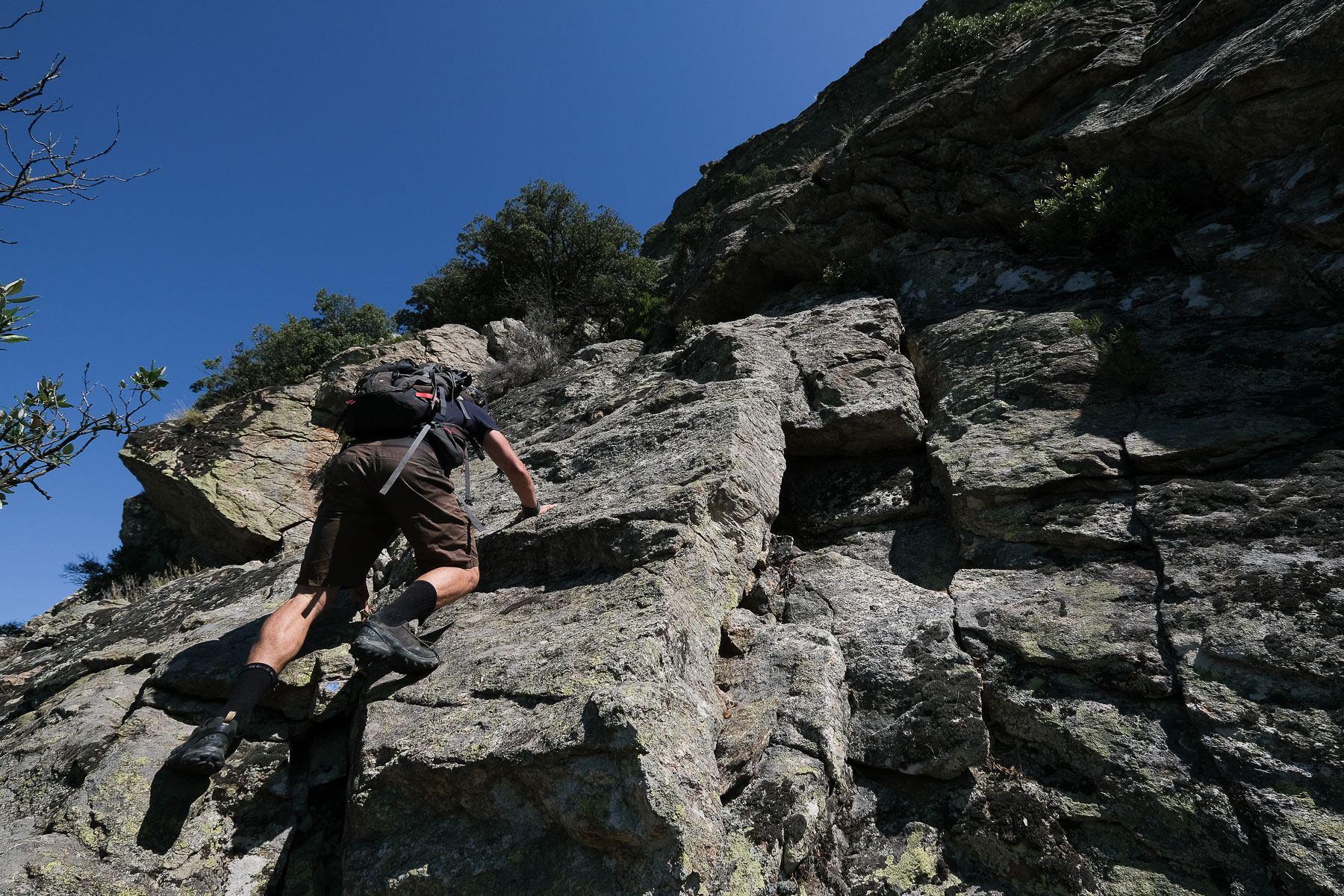
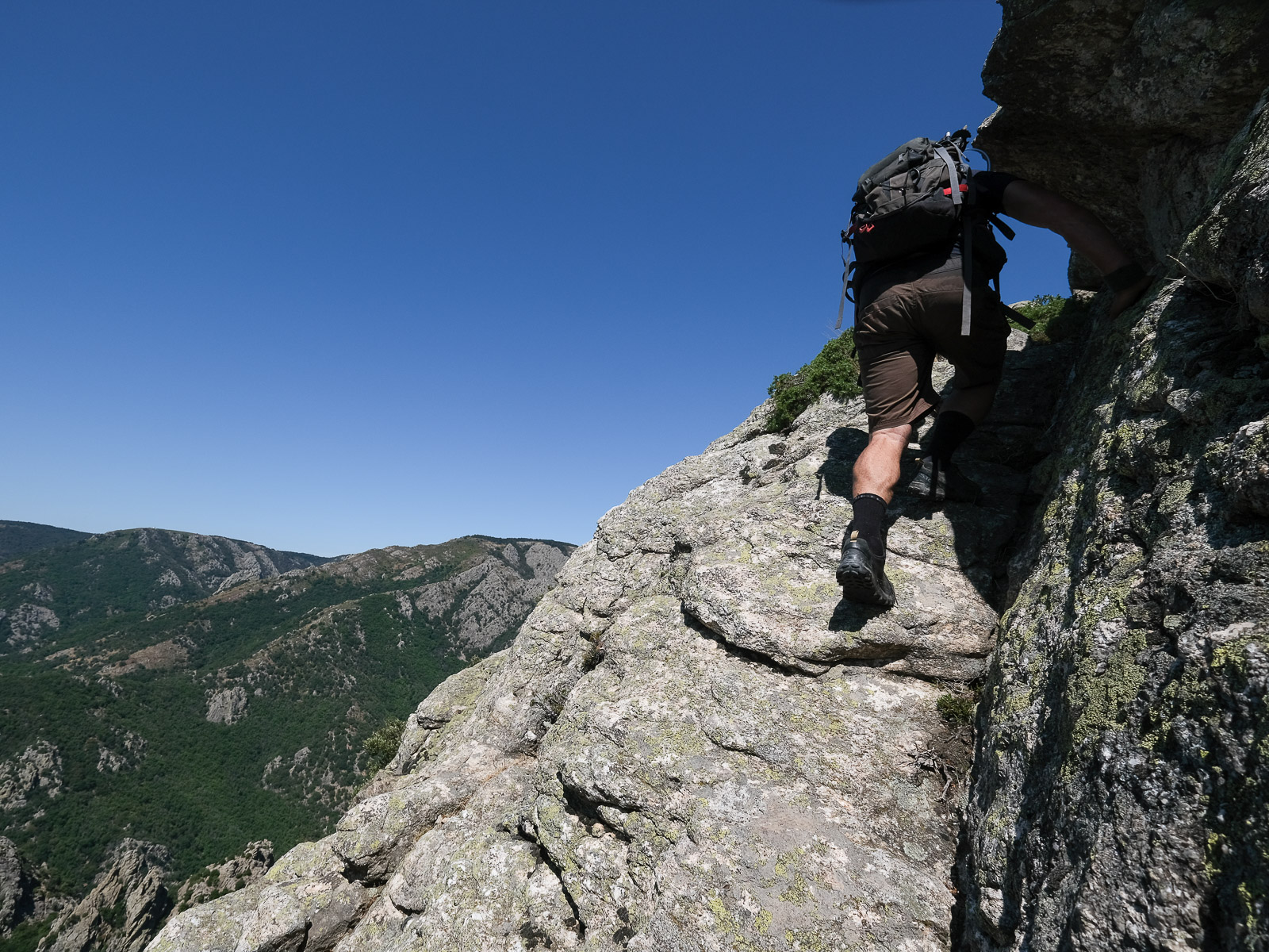
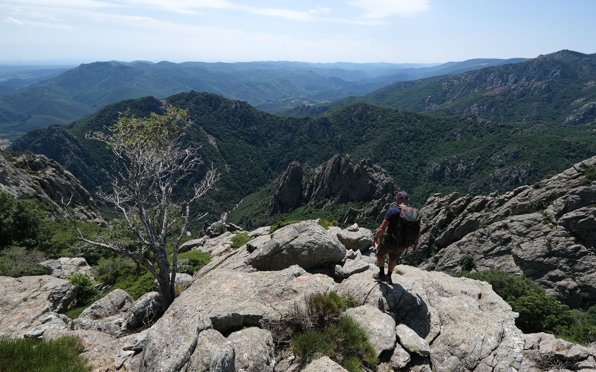
The aim of today's itinerary is to discover Mont Caroux via a challenging and original route, off the beaten track. On the program: very steep trails, equipped sections to climb, easy but aerial climbing passages and beautiful ledges to dominate the massif and the Héric gorges. Although the gorges are very busy in summer, you won't meet anyone on this route, apart from 1 or 2 mouflons if you manage to keep a low profile. The hike is physically demanding, however, and requires commitment to negotiate a few exposed passages with the help of your hands (III, 1 or 2 steps of IV).
❱❱ Technical summary
Type ✦ Hiking
Location ✦ La Coste, Mons-la-Trivalle
Region ✦ Haut-Languedoc, Hérault
Country ✦ France
Orientation ✦ West, North
Max altitude ✦ 1034m
Distance ✦ 11km
Dénivelé ✦ 1155m
Difficulty ✦ E3 / T5 / R4
Duration ✦ 4h30 to 6h
Interest ✦ ★★
❱❱ Access to the place
North-west of Bédarieux, on the D908 between Pons-la Thomières and Bédarieux, park either at the official Mons-la-Trivalle parking lot (paying in season) or at the hamlet of La Coste, on the east side of the Héric gorges (free). The second option we chose, however, adds around 15' of approach (and therefore return) to reach the gorges d'Héric.
❱❱ Map & topo
❱❱ Itinéraire
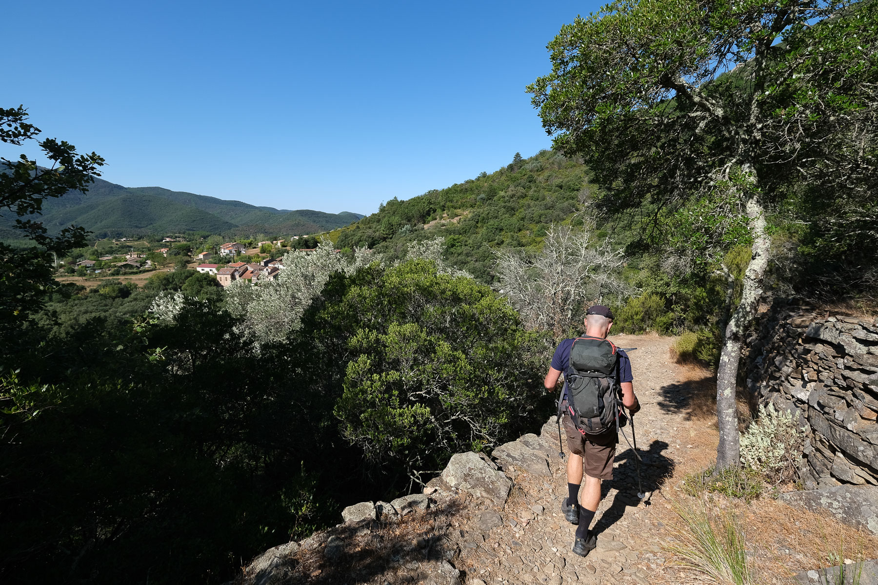
From the village of La Coste, head west following the yellow PR signs. Exit downhill after the last houses, cross the ruisseau de la Combe and go through undergrowth to reach the left bank of the ruisseau d'Héric fairly quickly (10-15'). Cross the Soupirs bridge to find the right-bank gorges road. Climb due north on the cement road. Cross the brook again, then a new bridge to span the Rieu Tort brook, and just before you cross the Héric again, you'll find the start of the Charbonniers trail. Signpost for the Charbonniers ridge. Start of the loop.
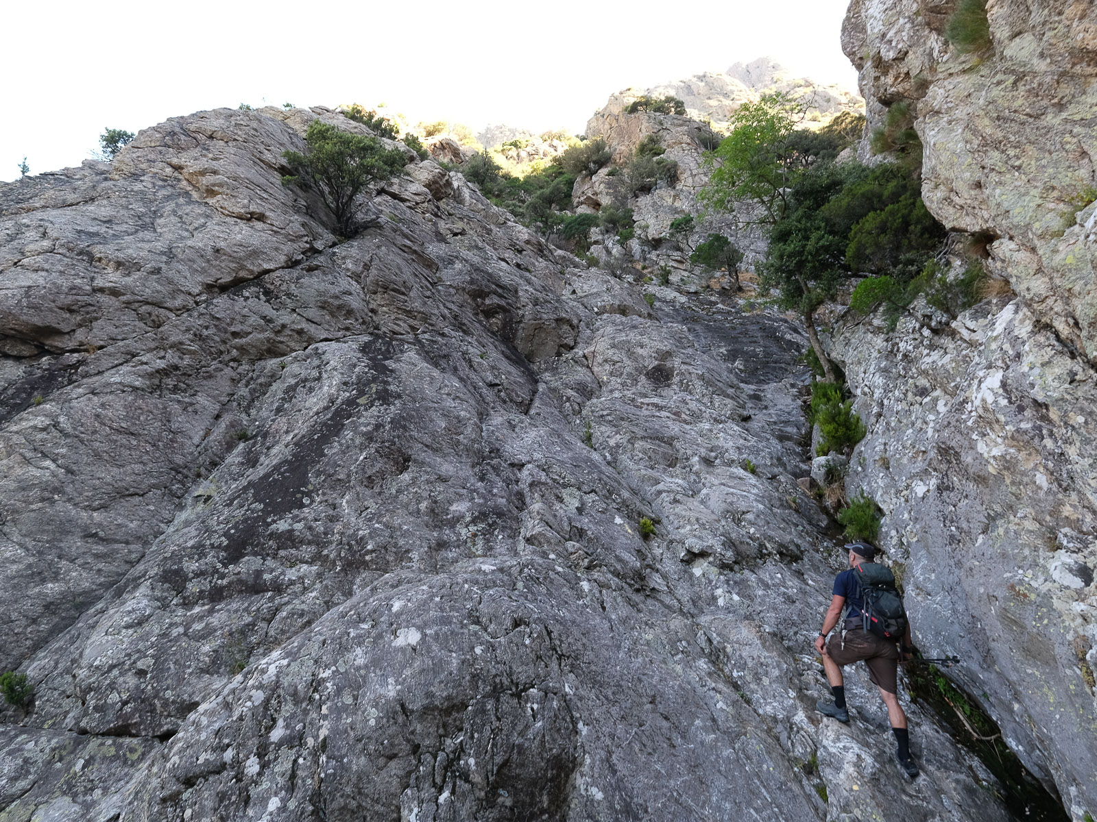
The itinerary follows two switchbacks leading to the summit of Caroux. Both are marked in blue (dots and dashes). The difficulty lies mainly in the steepness of the ascent (quite significant over a short distance) and the exposed passages to be climbed, often with the help of the hands, especially on the Rieutord vire. The sections to be climbed are in III, but there are a few steps in IV. As far as orientation is concerned, the route is obvious once you're on the switchbacks. Wearing a helmet may prove useful, given the proximity of the walls for much of the route.
Go back down the route des Gorges, cross the Pont des Soupirs and take the PR back to the village of La Coste.
Topo du Roc du Caroux par la Grande Vire du Rieu Tort on Visorando
Description of Vire Guy Pistre on Camp to Camp


Leave a Reply