Three 3000m summits. An original alpine ascent of the Pique d'Estat via its South-East ridge from the Pointe Gabarró, more challenging than the normal route from the refuge du Pinet but also much less frequented. A steep ascent from Etang de Soulcem, which can be split into 2 days by approaching Etang de Riufret on the first day at an altitude of almost 2500 m. Mineral landscapes, turquoise-blue ponds, rust-colored rock, aerial views of the French and Spanish sides: in short, a splendid route to discover.
❱❱ Technical summary
Type ✦ Alpine hiking
Location ✦Étang de Soulcem, Auzat
Region ✦ Ariège
Country ✦ France
Orientation ✦ East and South-East
Max altitude ✦ 3143m
Distance ✦ 13.5km (J1 + J2)
Vertical drop ✦ 1820m
Difficulty ✦ E4 / T5 / R4
Duration ✦ 2h30 to 3h (J1) + 6h to 7h (J2)
Interest ✦ ★★★
❱❱ Access to the place
Go to Vicdessos then Auzat and continue due south along the Vicdessos stream up to the Soulcem pond at 1600m. Park at the end of the road, on the south bank of the pond.
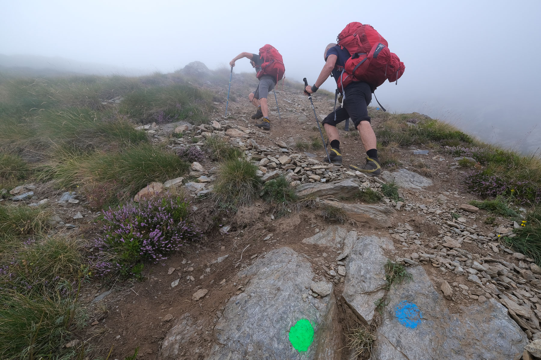
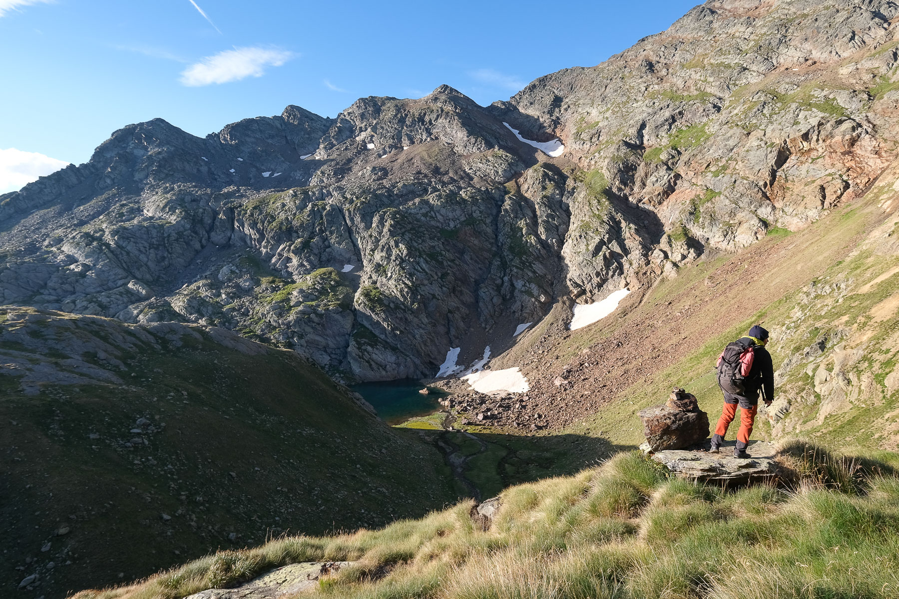
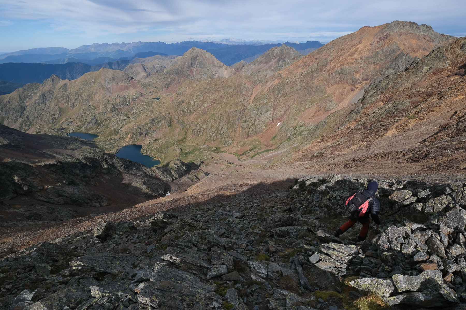
This option, with a bivouac at Etang de Riufret, allows you to spread out your efforts, especially the ascent from Etang de Soulcem. Leave the parking lot to the east and immediately pick up a small path that gradually heads north, following the banks of the pond upwards. You then cross the Riufret stream and begin the ascent to the Riufret pond. In other words, this is a very, very steep, very steady path, which climbs up the left bank of the stream and its gorges to reach the small upper basin.
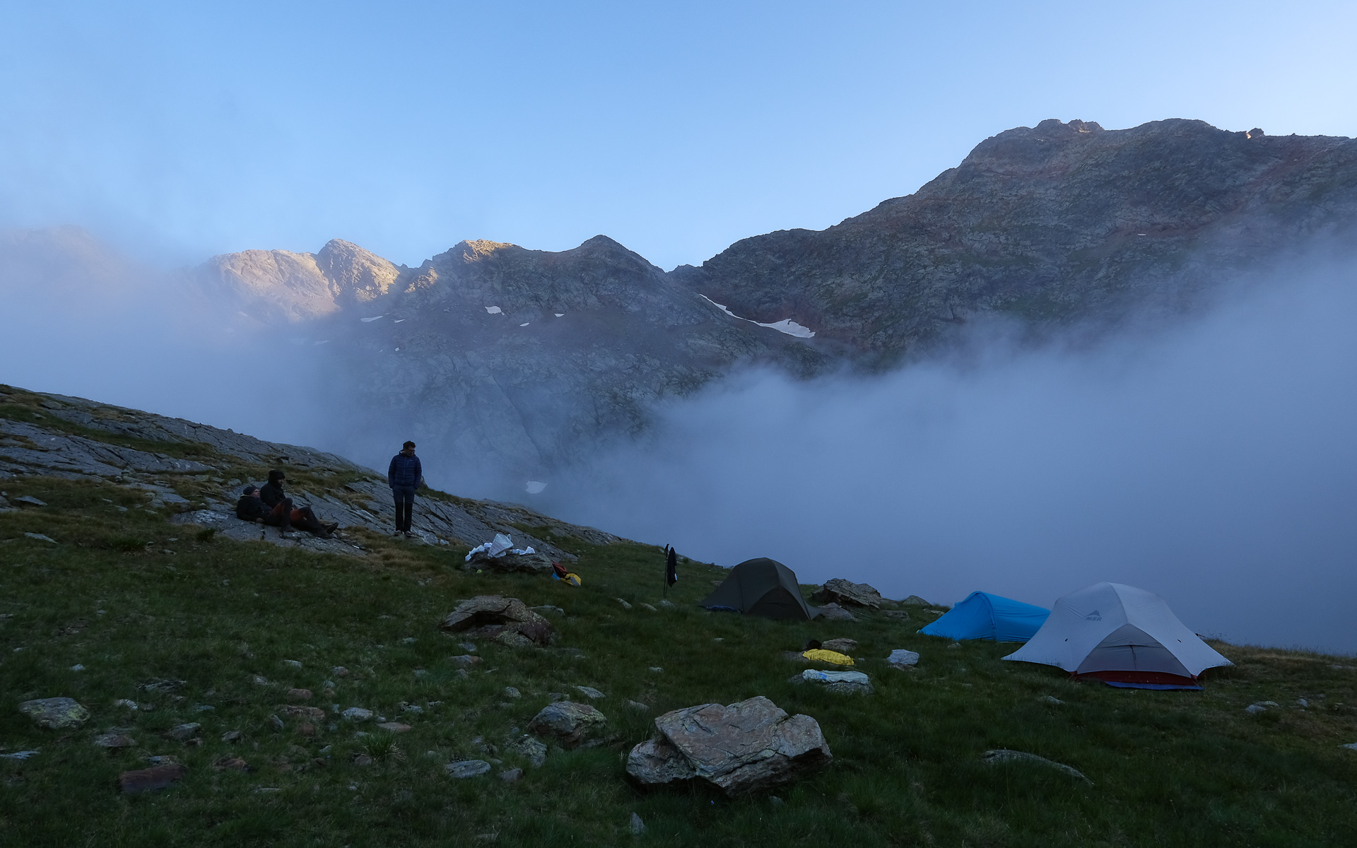
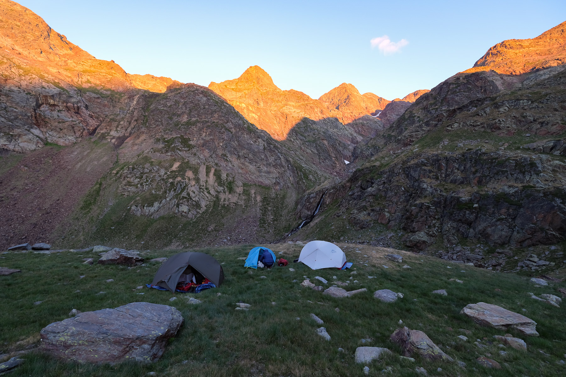
876m of ascent in the gispet, the rockery, on an airy path in places marked out with cairns, then at the end with fluorescent green and blue dots. There's a passage at the beginning where you have to use your hands to get over a wall. You come out at the bottom of the Riufret pond (which is on the left as you arrive). You can easily find grassy areas where you can bivouac high up, facing the waterfalls that rise towards the bottom of the cirque. Pointe Gabarró and Pique d'Estat can be seen in the background, looking smaller from up here.
Course
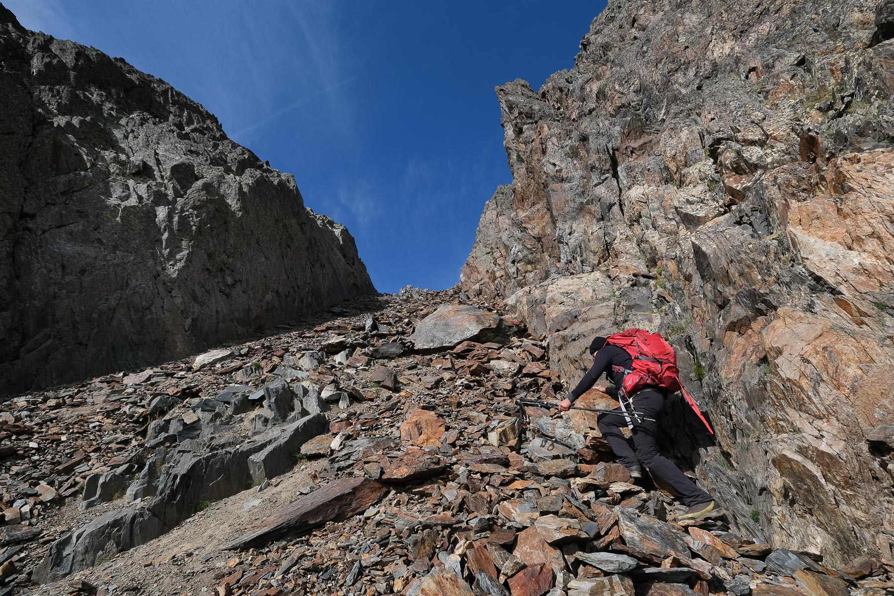
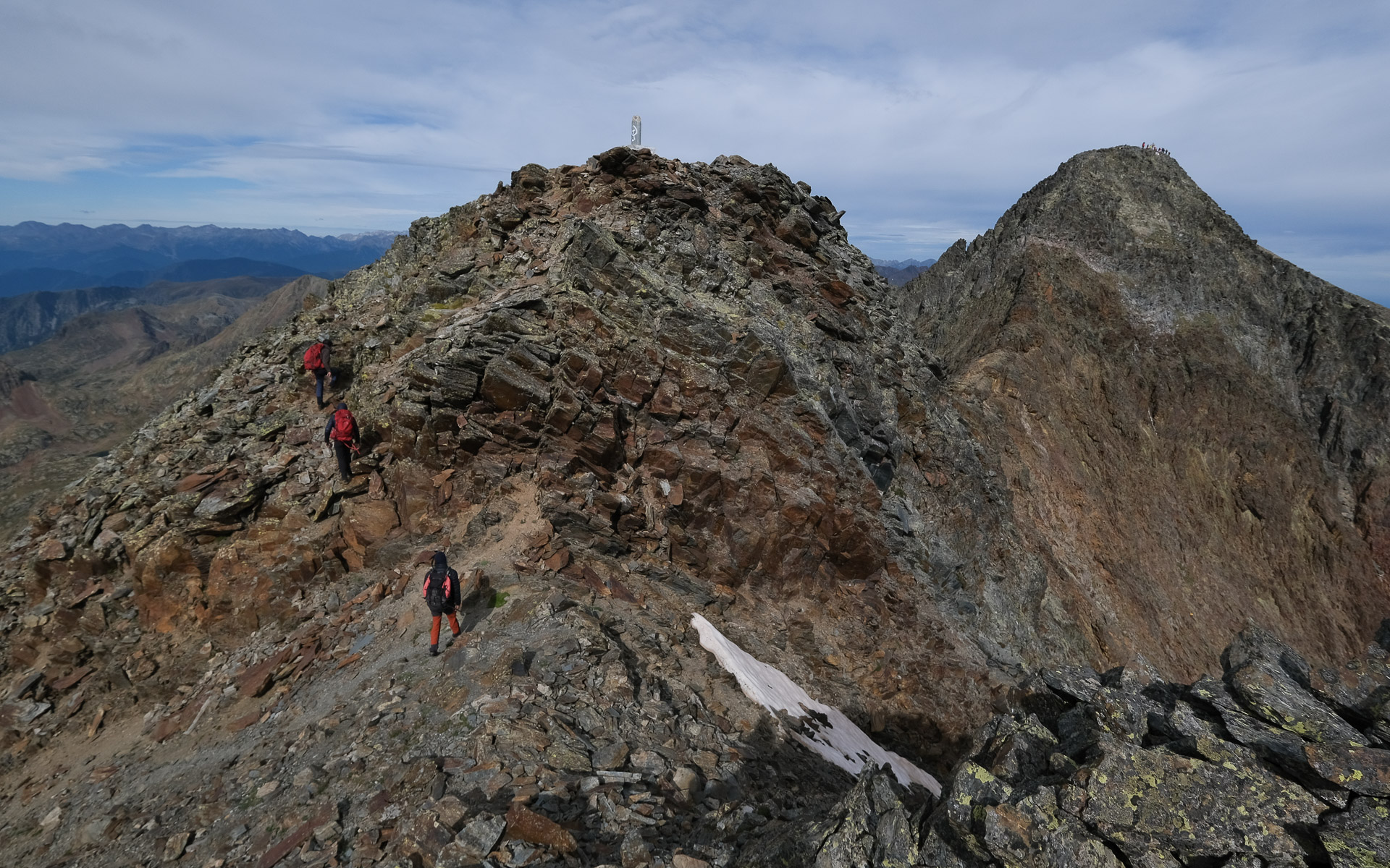
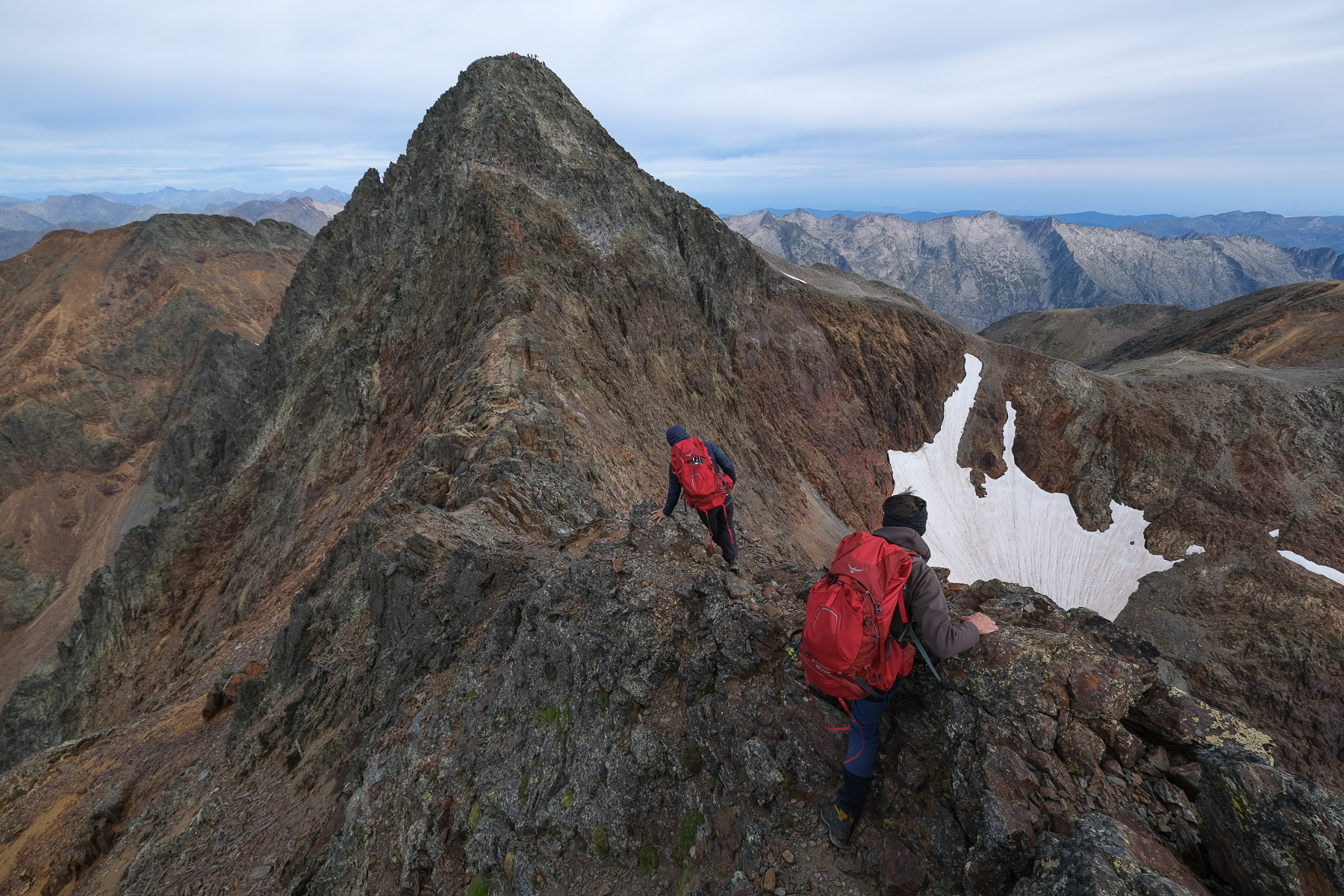
A challenging route due to its altitude, with many difficult sections: scree, climbing, ridge, couloir. The most impressive part is the ridge/arête section between Pointe Gabarró and Pique d'Estat, where you have to use your hands and climb in places (III).
Part 1: Collet Franc (1h45 to 2h)
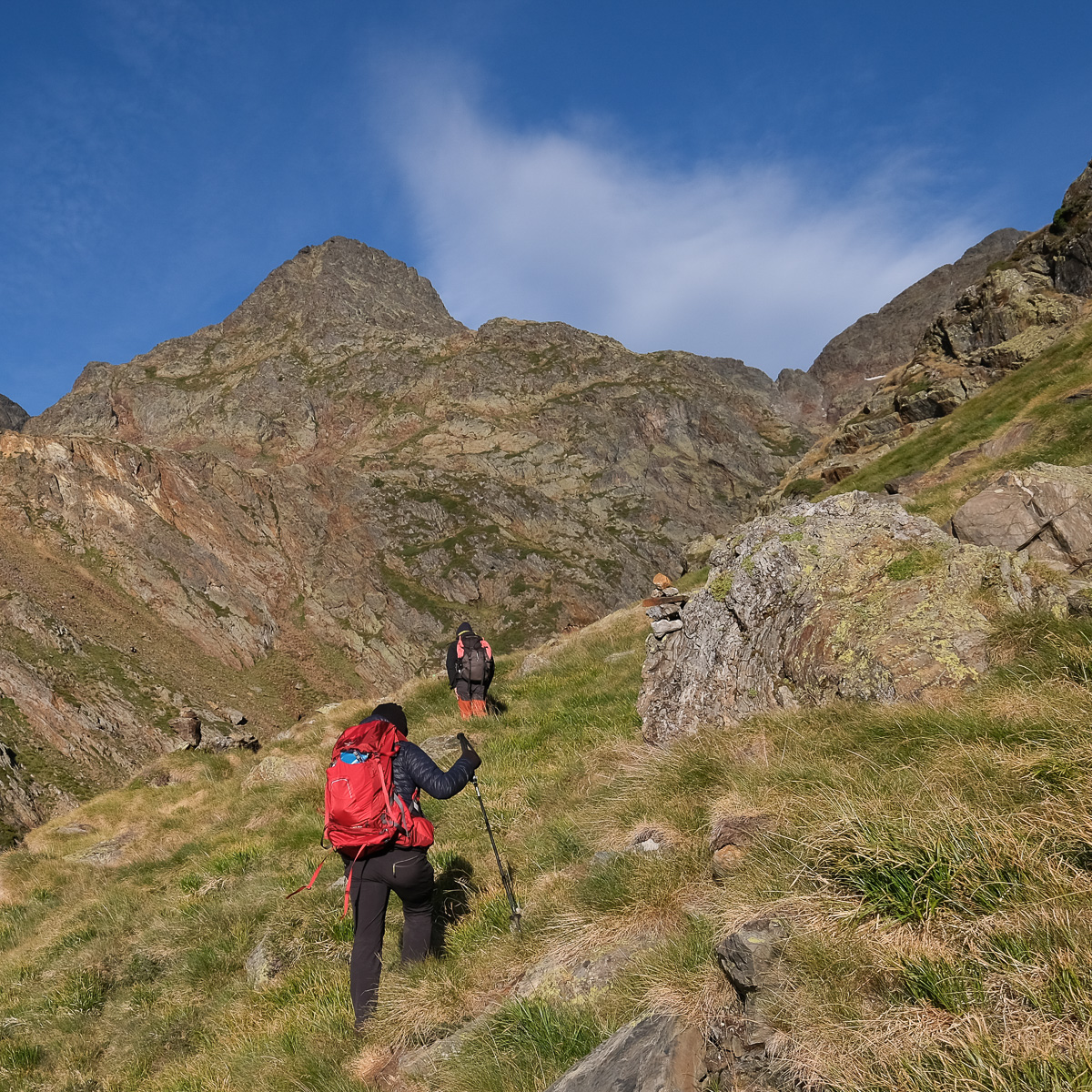
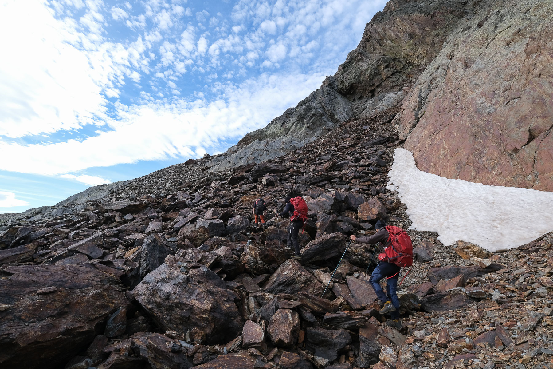
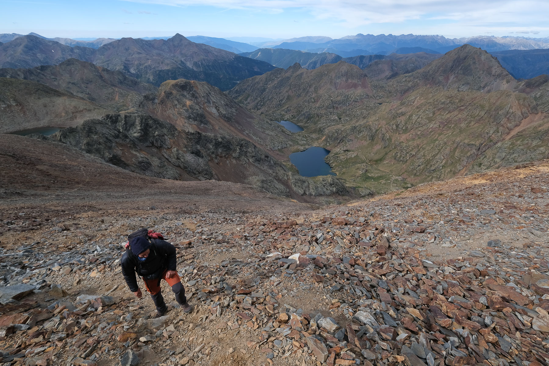
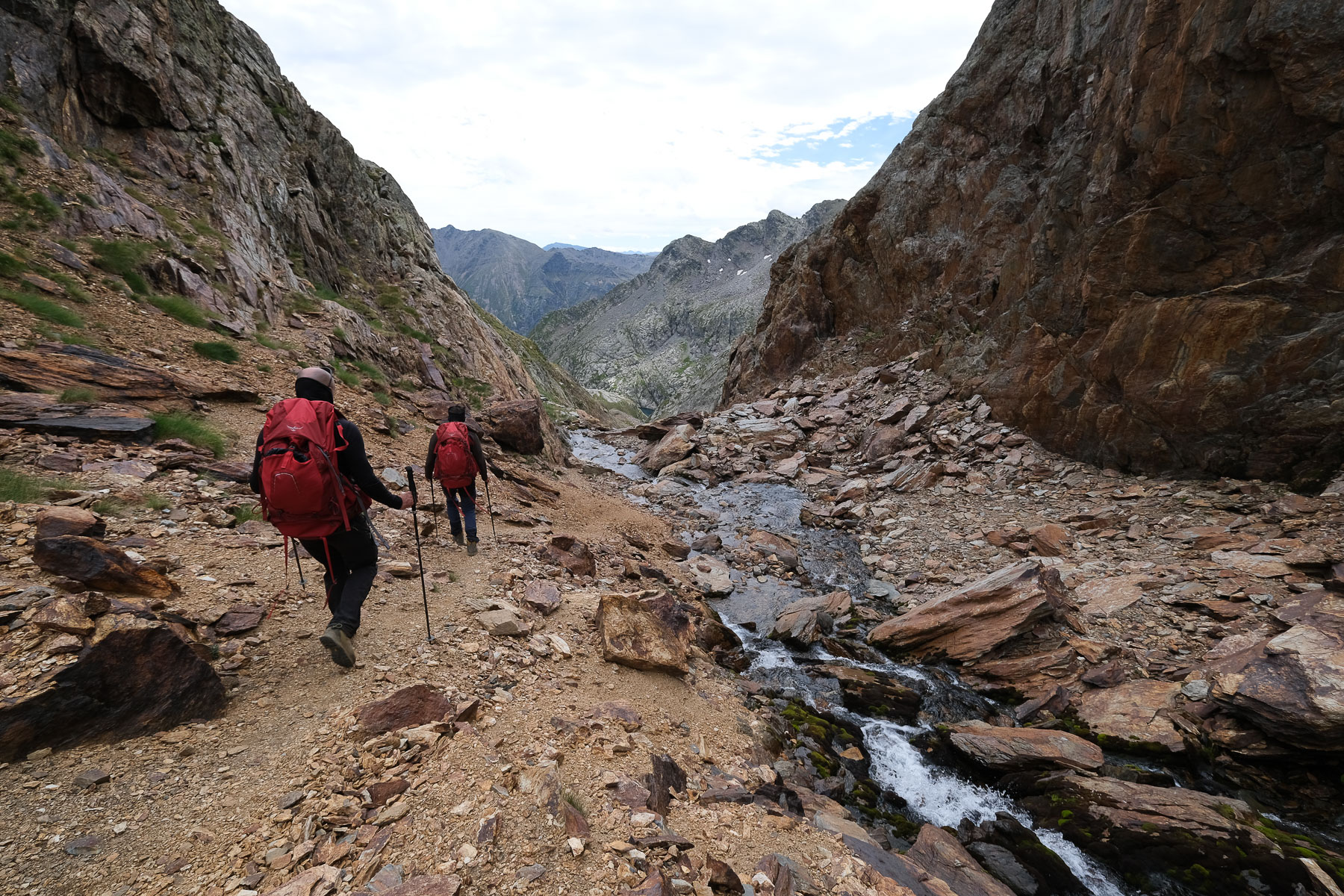
Head west along a small path marked with cairns and fluorescent green dots (descending from Col de Riufret, between Pique d'Estat and Montcalm). Climb a shoulder to cross the 1st waterfall on the left bank. Further on, the second waterfall can also be crossed on the left bank, where you pass over a beautiful rust-coloured undulating slab (see photo). A short transition of almost flat walking takes you to a 3rd small waterfall, which you climb to the water's edge. Exit via a small couloir in the upper basin, at the bottom of a wide stony valley below Pointe Gabarró. You can clearly see the way back from the Col de Riufret high up at the bottom of the valley.
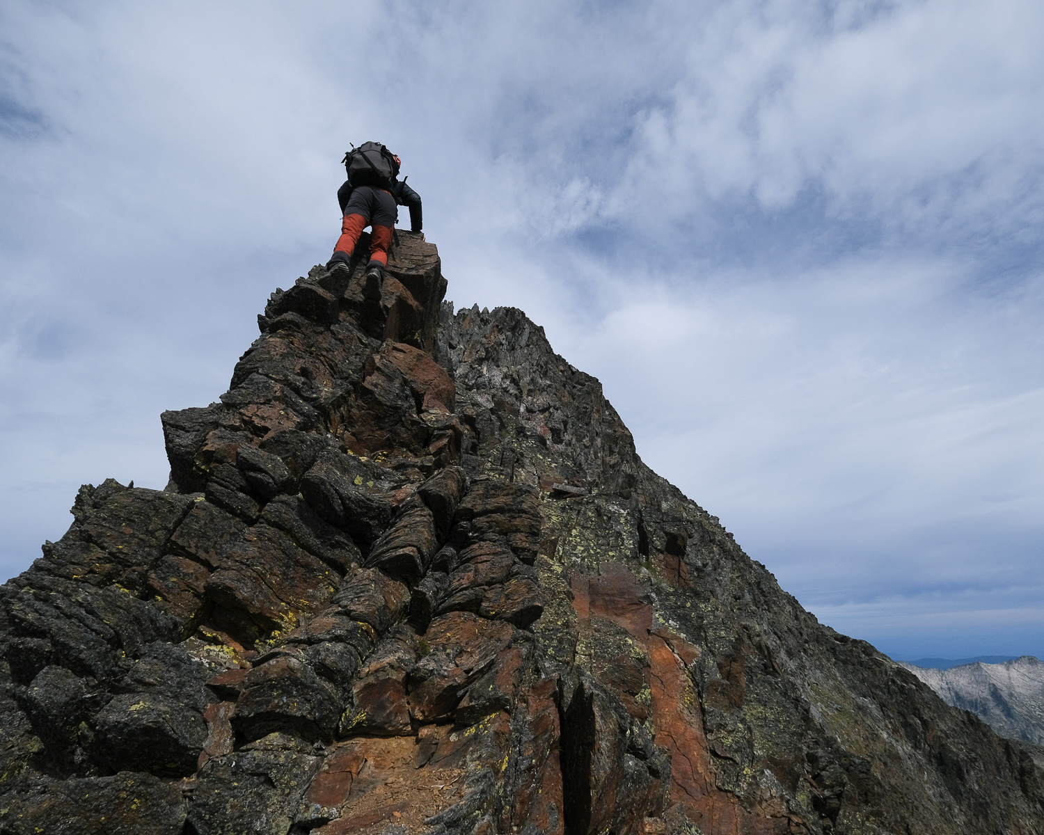
From here, climb a boulder ramp and turn due south, following the cairns up to the spillway of the Canalbonne pond. You'll then see a narrow pass to the south that looks like a spit from here: it's the Collet Franc. To get there, follow the pond to the left (east) and cross the scree at the top, or halfway up, climb a sort of easy rock face (III) to gradually move below the collet. At this point, it's best to cross over and climb the last 50 m on the left bank (i.e. right as you climb), where you have better support and can use the rock. The final section is very steep and leads to a much wider col and a view to the south of another Canalbona pond, on the Catalan side.
Part 2: Pointe Gabarró and SE ridge of Pique d'Estat (1h to 1h30)
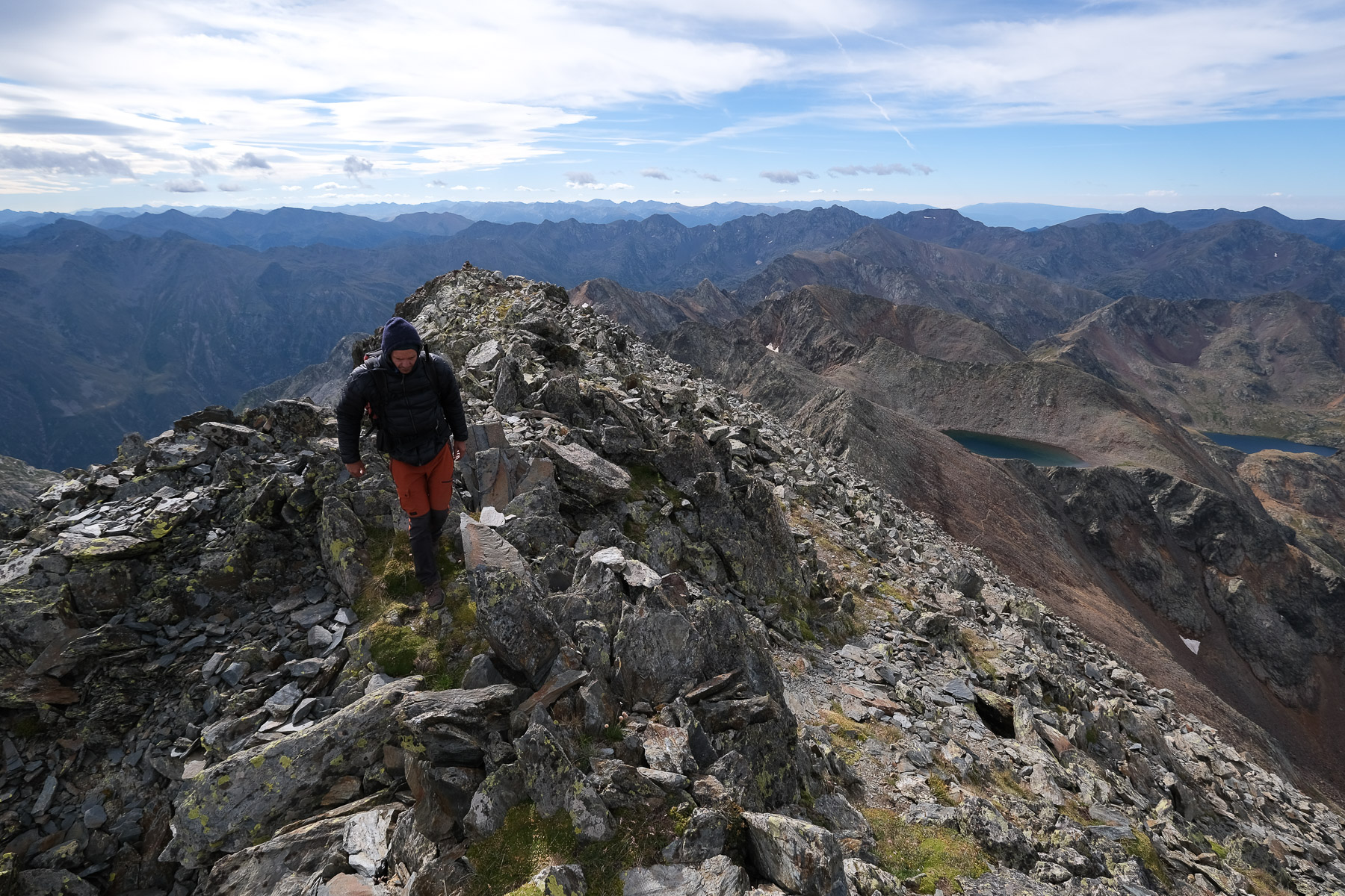
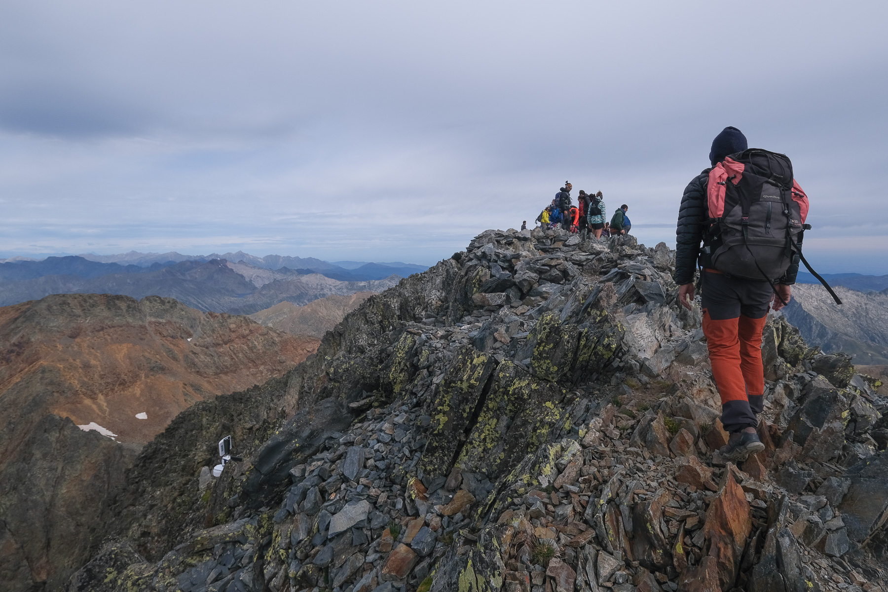
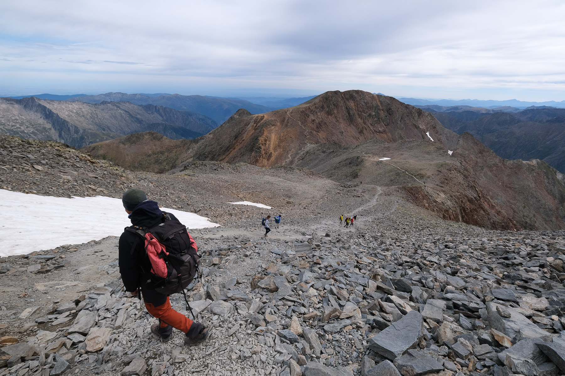
From Collet Franc, head west to tackle the rocky ridge leading to Pic Rodo de Canalbona, the 1st 3000m of the day. No difficulty, just a few hand-balancing steps (II+). We descend to reach a pass before the ridge that climbs straight up to Pointe de Gabarró. We pass this point on the south side, then return to the ridge and finish on a 1st summit, then climb to Pointe Gabarró where there's a small concrete post. 2nd 3000m of the day. This time we have a good view of Estat and the SE ridge to cross.
Descend Pointe Gabarró on an already more aerial section to pass over a sort of horse saddle of rust-colored rock. From this point onwards, the route becomes more exposed and you have to use your hands for a few climbing passages (III+ max). In places, you can dodge to the left and then to the right, or climb along the edge of the ridge (IV more exposed). The route ends on a rocky ridge. The final climb to the summit of Pique d'Estat is a walk. 3rd 3000m of the day.
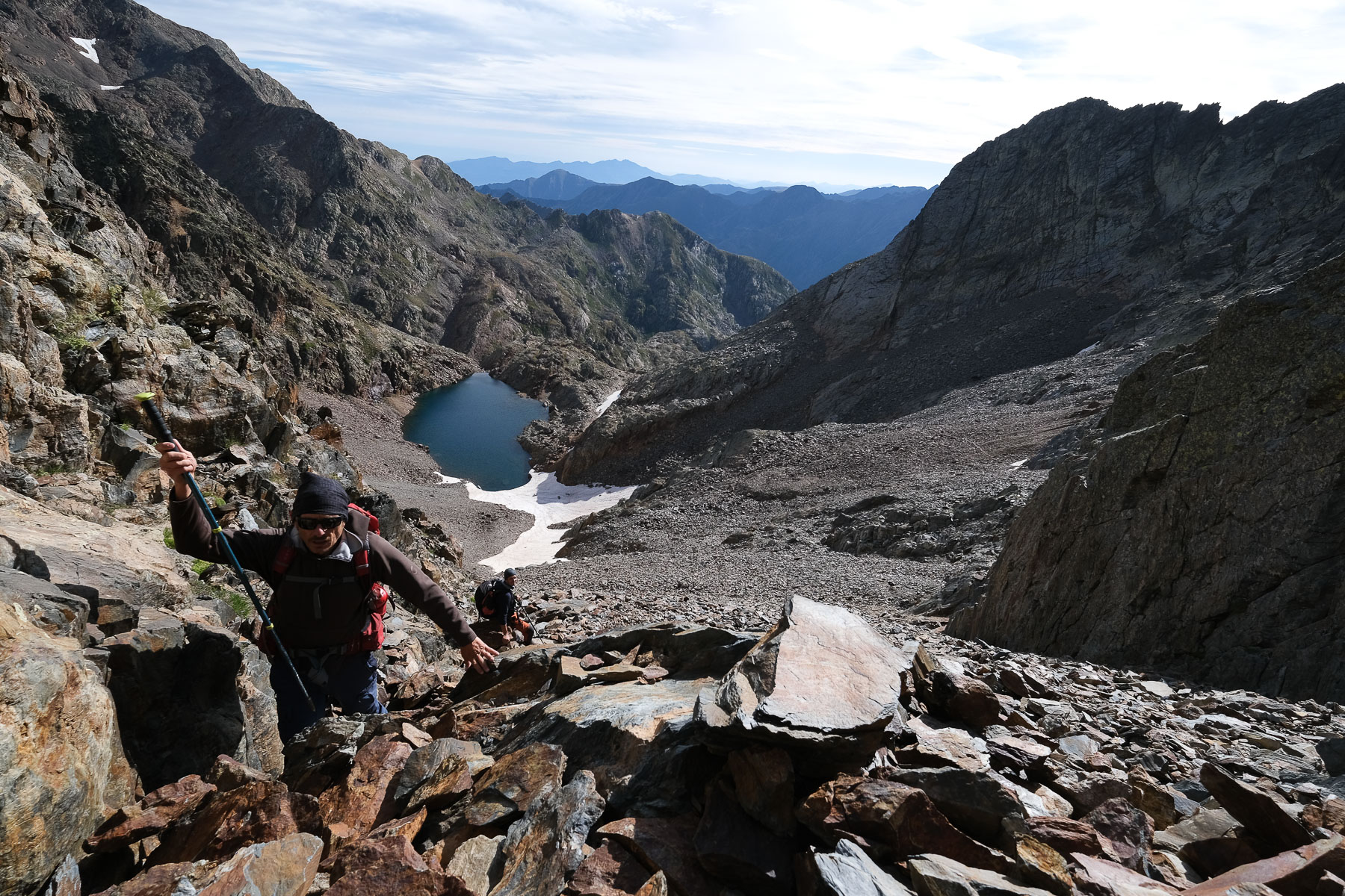
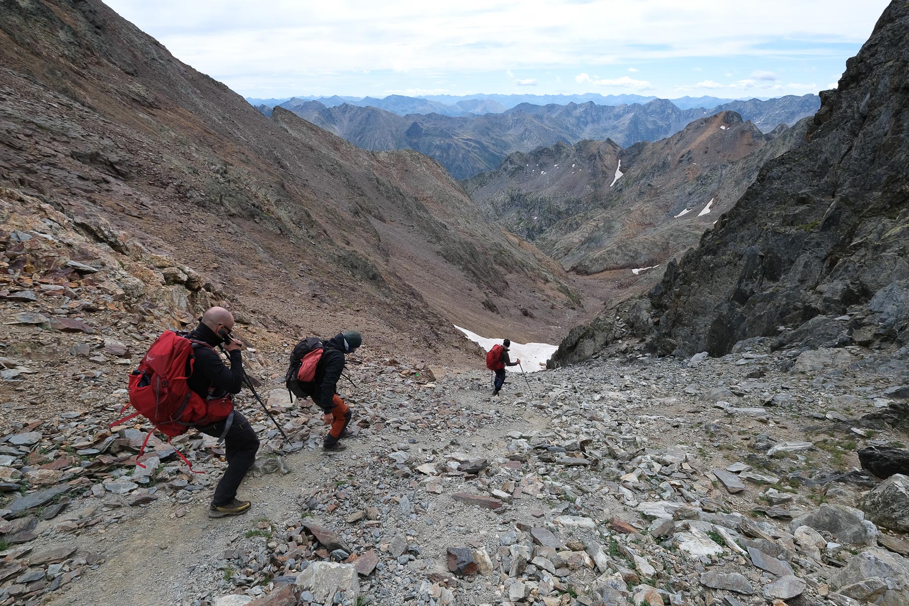
Part 3: Col de Riufret to Etang de Riufret (1h15 to 1h30)
From the summit of Estat, descend to the north-west and then head due north-east on the obvious path towards Montcalm. It's usually very busy here. Just before the final ascent to Montcalm, you come to Col de Riufret, with a stony valley descending to the southeast.
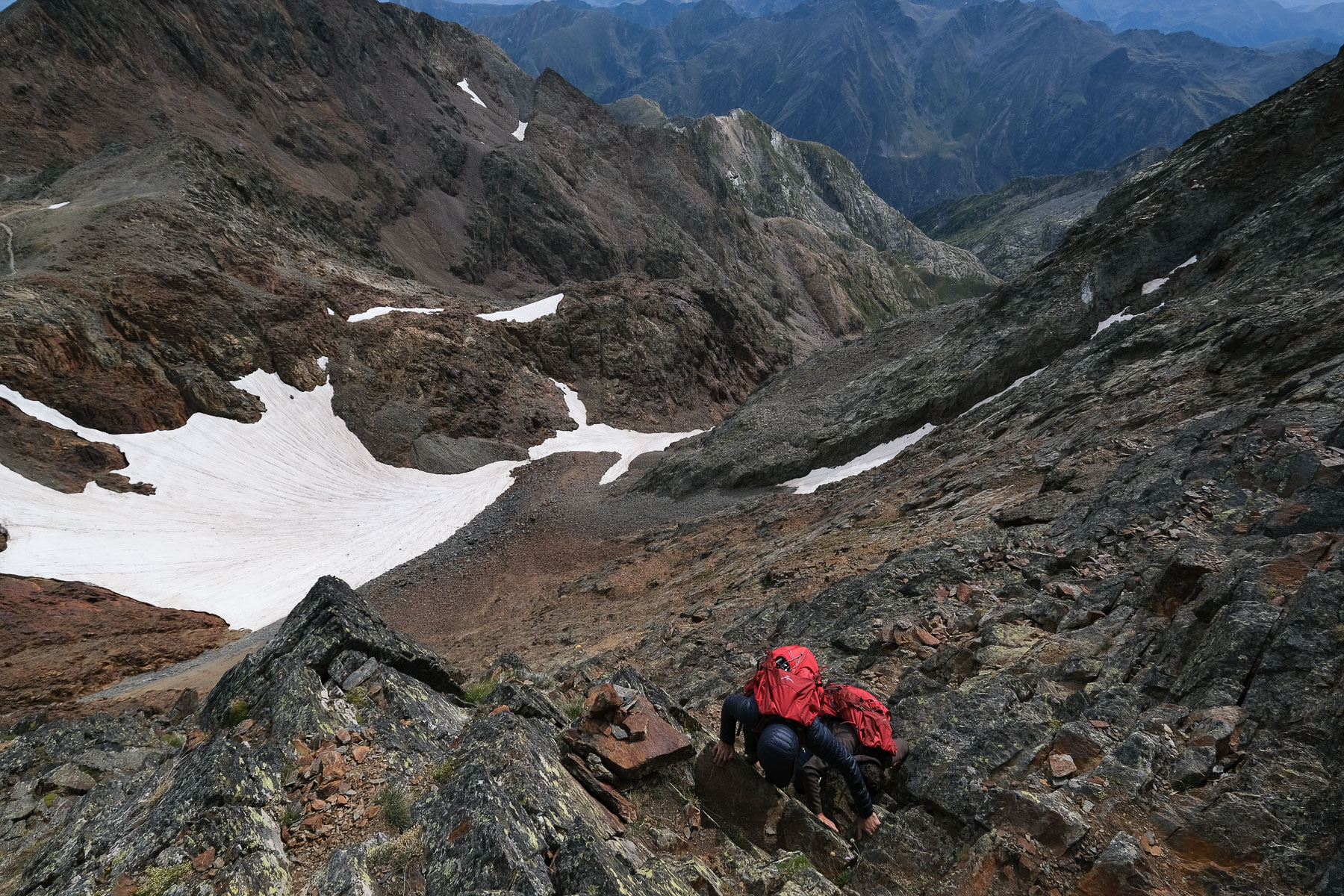
Descend this narrow valley at the start, following the path marked with green dots. Further down, on the left bank, climb up a rust-colored wall (II/III) to reach the scree below. A steep, winding descent takes us back to where we had turned south to climb to Collet Franc. From here, it's back to the left bank of the 3 Riu Fret waterfalls and back to the bivouac site above the Etang de Riufret.
Back
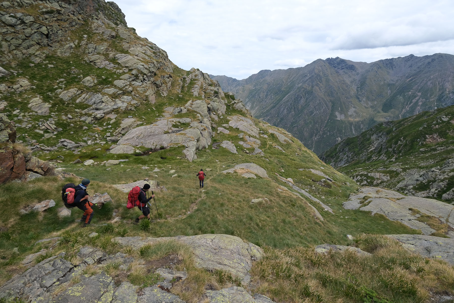
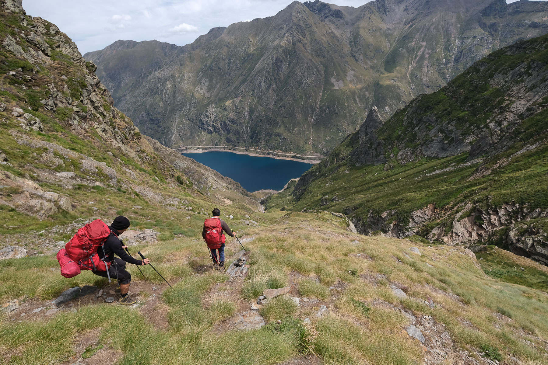
There's still the 876m of ascent to contend with, on the same trail as the ascent, which is just as physical as the ascent, if not more so! Fortunately, the beautiful aerial view of the Etang de Soulcem accompanies us back to the starting parking lot.
L'étang Bleu via the Embans cirque 8 April 2025 At the entrance to the Haute Ariège, in the narrow valley that runs due south from Rabat-Les-Trois-Seigneurs,…


 Partager sur WhatsApp
 Partager sur Twitter
Partager sur Instagram
Partager sur Twitter
Partager sur Instagram

 Partager sur Facebook
 Imprimer le topo
 Laisser un commentaire


Leave a Reply