Departing from the Etang de Soulcem, here's a 2-day hike between France, Spain and Andorra, featuring two near-3000m peaks: Pic de Médécourbe (2913m) and Pic de Comapedrosa (2943m), Andorra's highest peak. Although the difference in altitude and distance are not too great for 2 days, the hike includes some technical sections on very steep slopes in unstable terrain and some exposed alpine sections. The overnight stay at the free Baïau high mountain refuge, the numerous high altitude ponds, the panoramic views of the Pyrenees and the wild atmosphere of this part of the Ariège make this an exceptional route.
❱❱ Technical summary
■ Departure point: parking des Orris du Carla, Soulcem valley, Ariège (09)
■ Type of route: 2-day itinerant high-mountain hike, with alpine sections
■ Distance: 24 km (9.5 + 14.5)
■ Cumulative elevation gain: +2270 m (1240 + 1030)
■ Cumulative negative altitude gain: -1200 m
■ Estimated total duration: 2 days (4h to 5h30 + 6h to 7h) ■ Min and max altitude: 1650 m / 2943 m
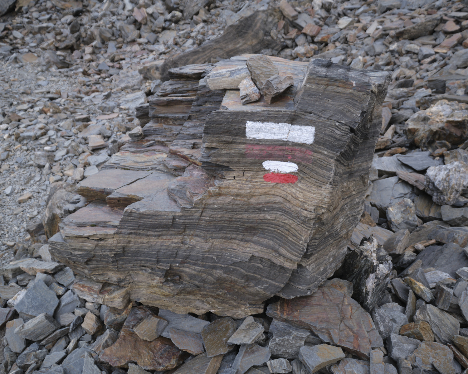
■ Markings: GR, PR and cairns
■ Equipment in place: none
■ Equipment required: helmet if necessary
On the N20, just outside Tarascon in the direction of Ax-les-Thermes, turn south to pass Vicdessos then Auzat and continue along the Vicdessos stream up to the Soulcem pond at 1600m. Park at the end of the road, on the south bank of the pond, at the Orris du Carla parking lot.
❱❱ Map & topo
The route from the Etang de Médécourbe to the Port de Médécourbe and then to the Pic de Médécourbe is indicative as it is off-piste.
DAY 1: PIC DE MEDÉCOURBE AND BAÏAU REFUGE (4H30 to 5H30)
1st part: Port de Médécourbe (2750m, 3h to 3h30)
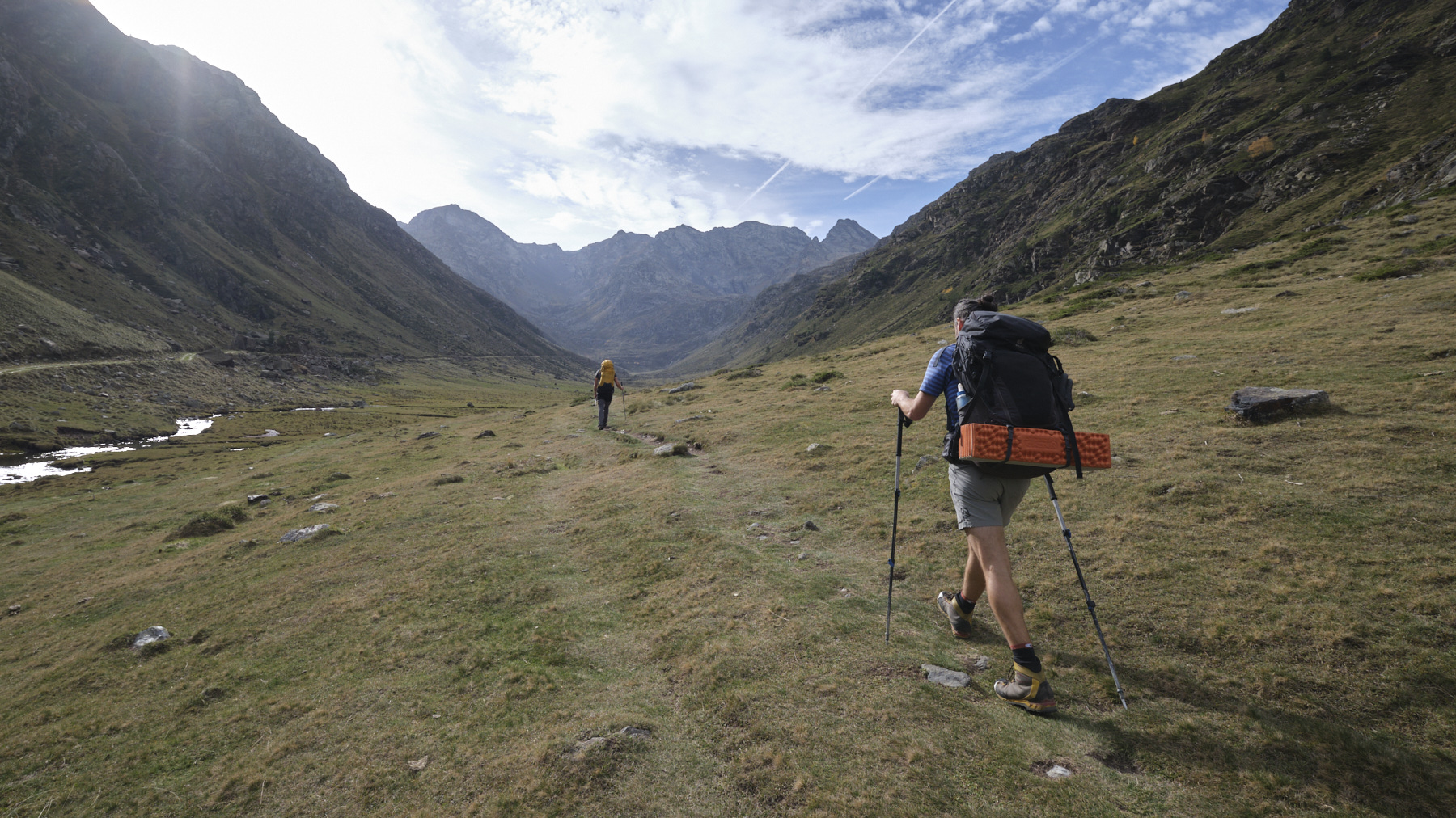
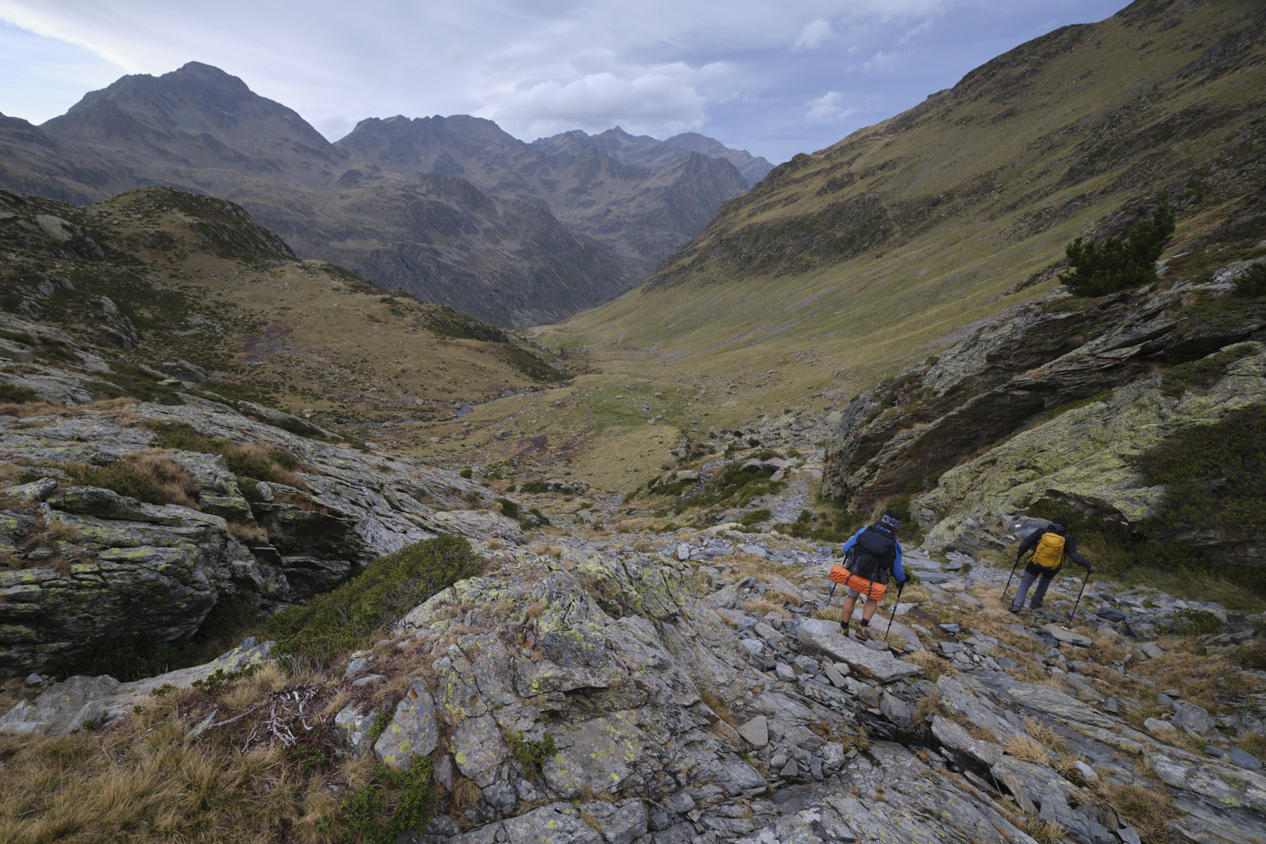
Leave the parking lot to the south and follow the track up to the 1st hairpin bend. Cross the torrent by the footbridge and climb up to the right of the superb Labinas waterfall. You then emerge into the very long Pla de Labinas, which stretches southwards, with the Pic de Bareytes and Pic de Médécourbe cirque in the background.
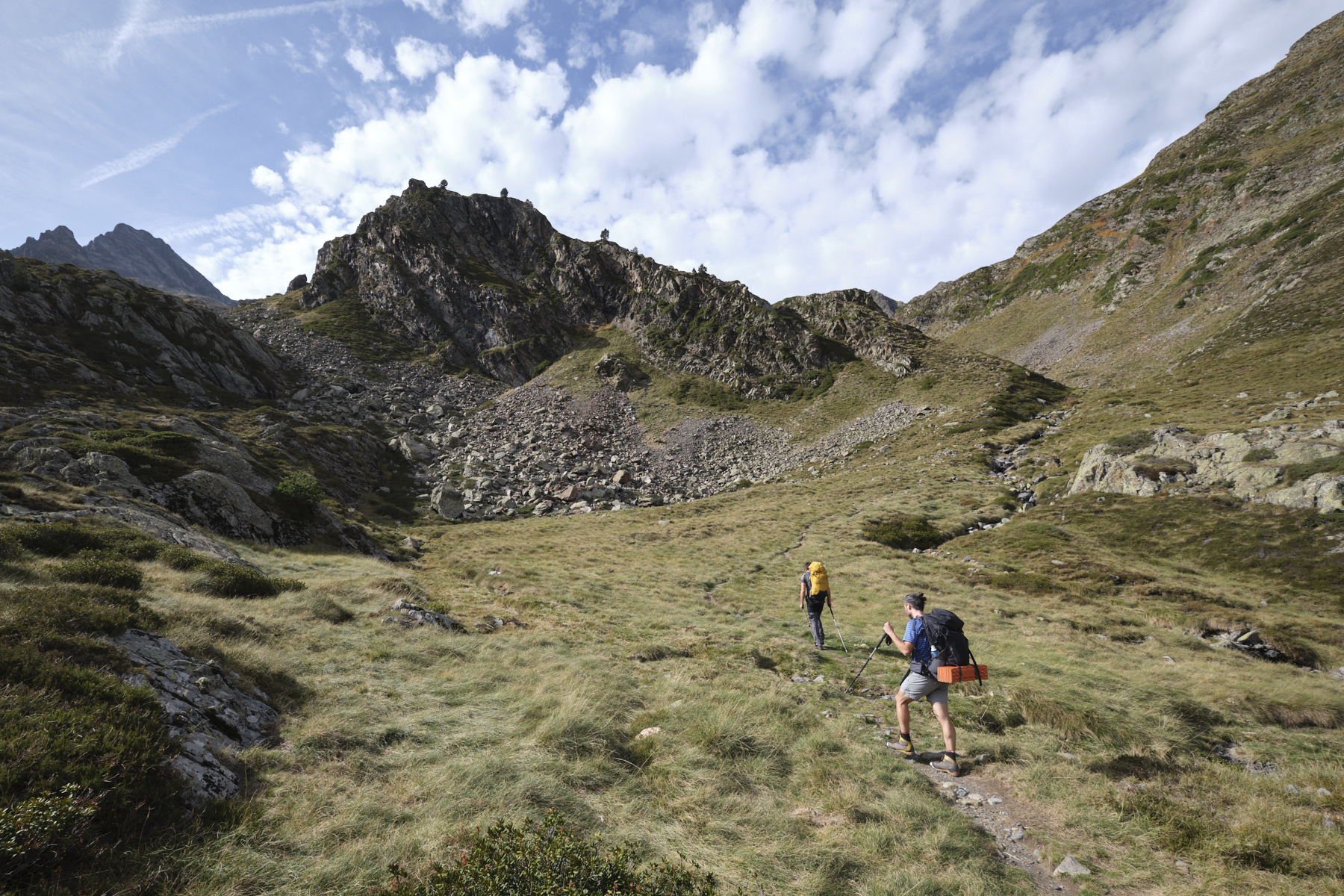
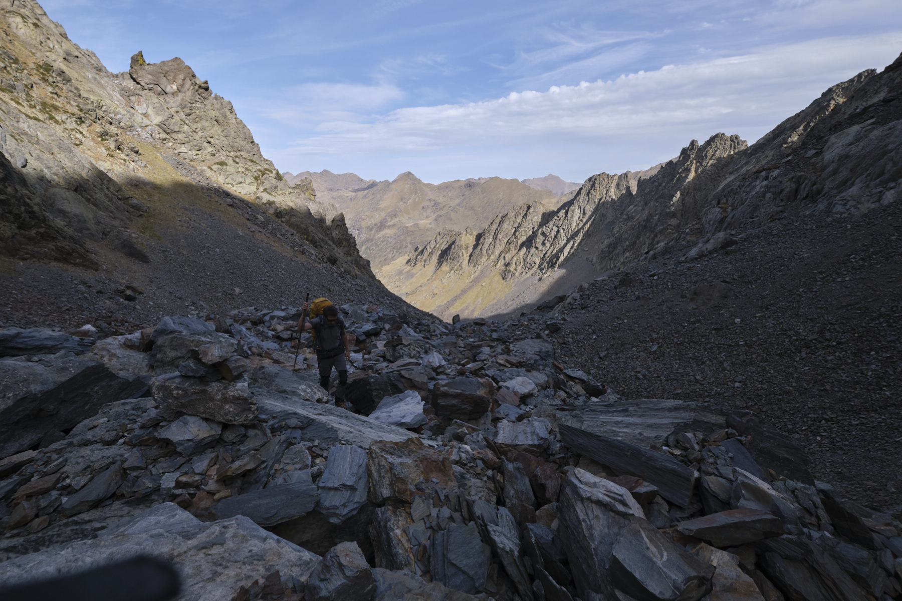
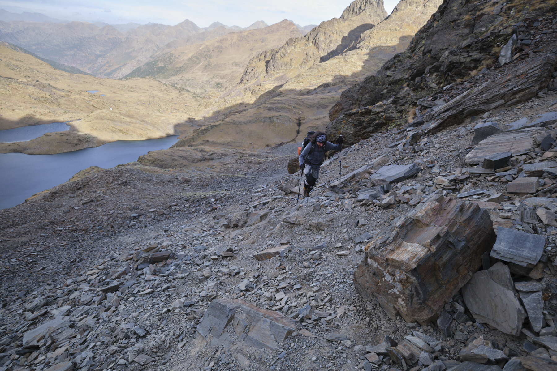
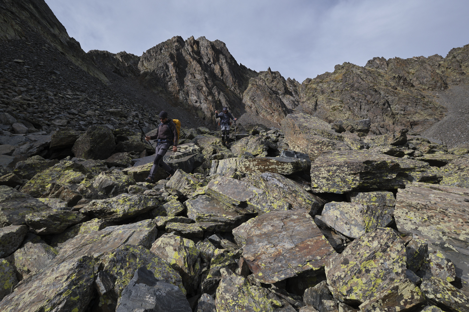
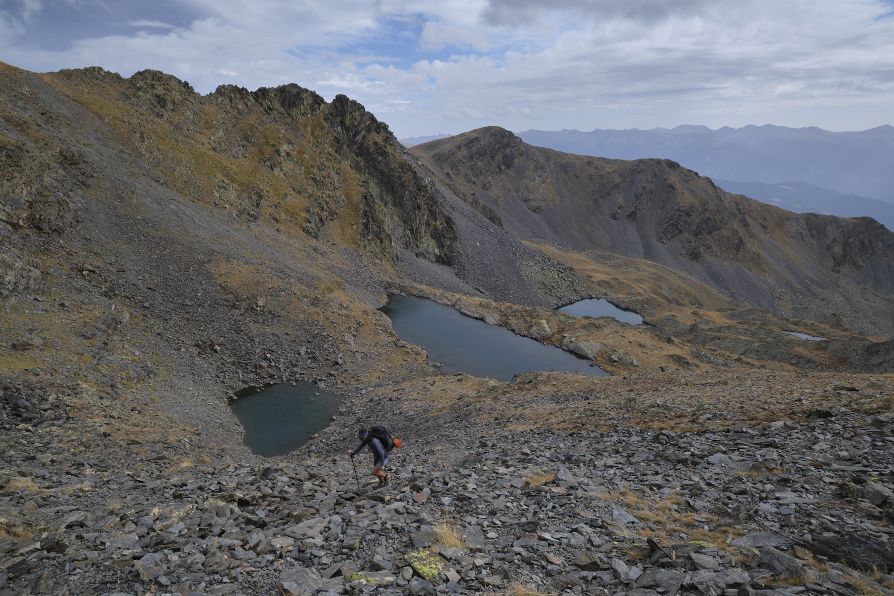
On the Pla de Labinas, stay on the left bank, or follow the GR path to the right of the Soulcem stream as it rises. Leave the fork to the right towards Pic Rouge and Etang de Roumazet and stay below, near the torrent. Almost at the end, there are several orris (de la Crouts). A little further on, the path begins to climb on the right-hand side along a waterfall, over a first and then a second rise, and ends at the wild Médécourbe pond, in a basin in the middle of a large scree slope.
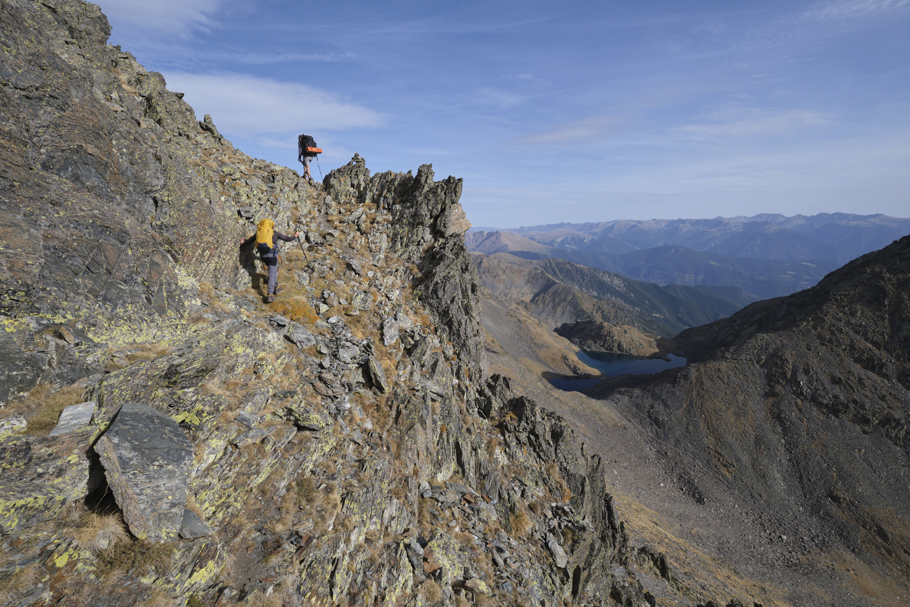
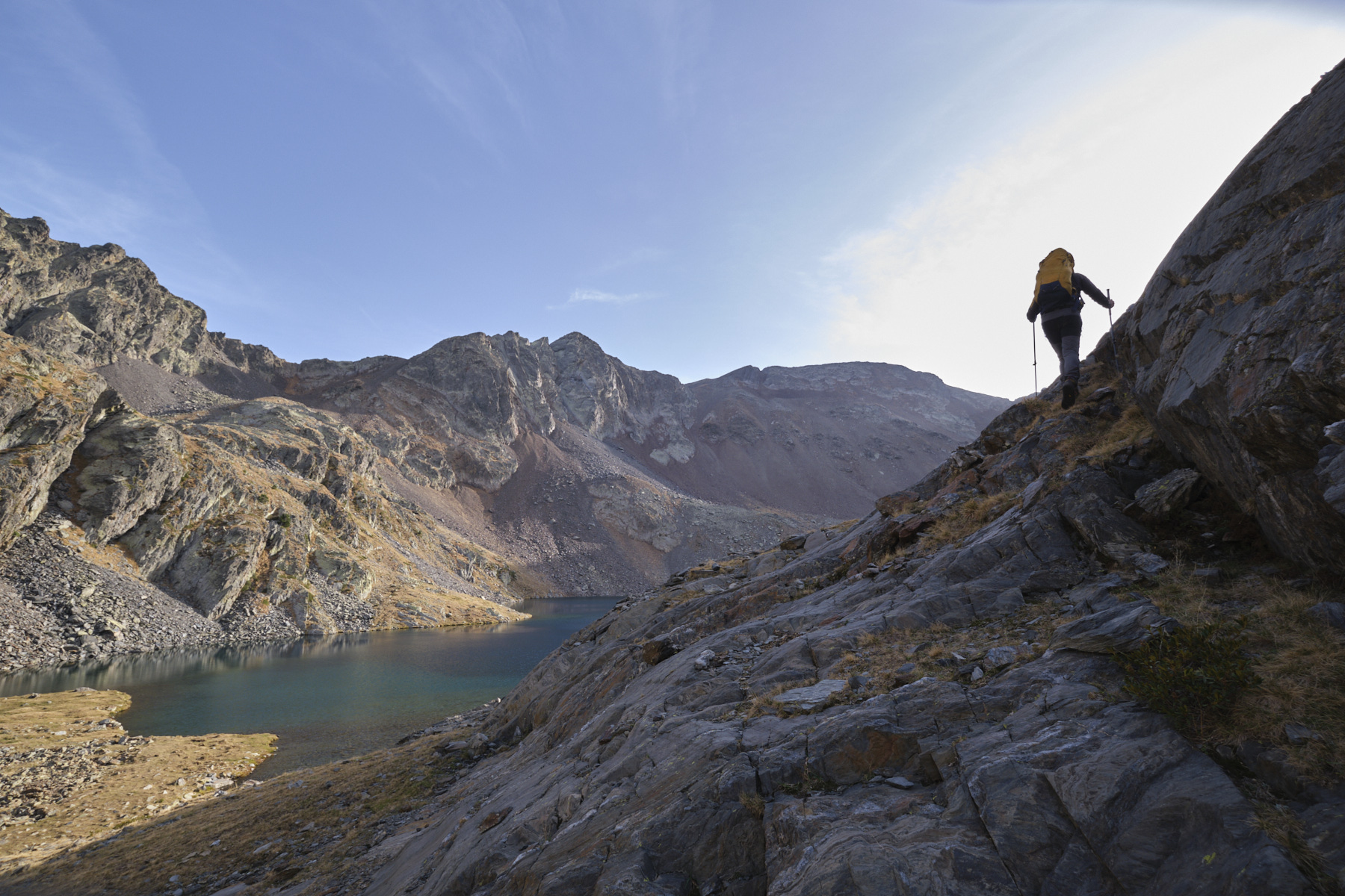
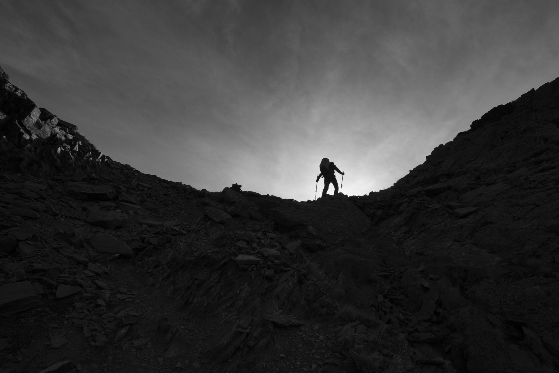
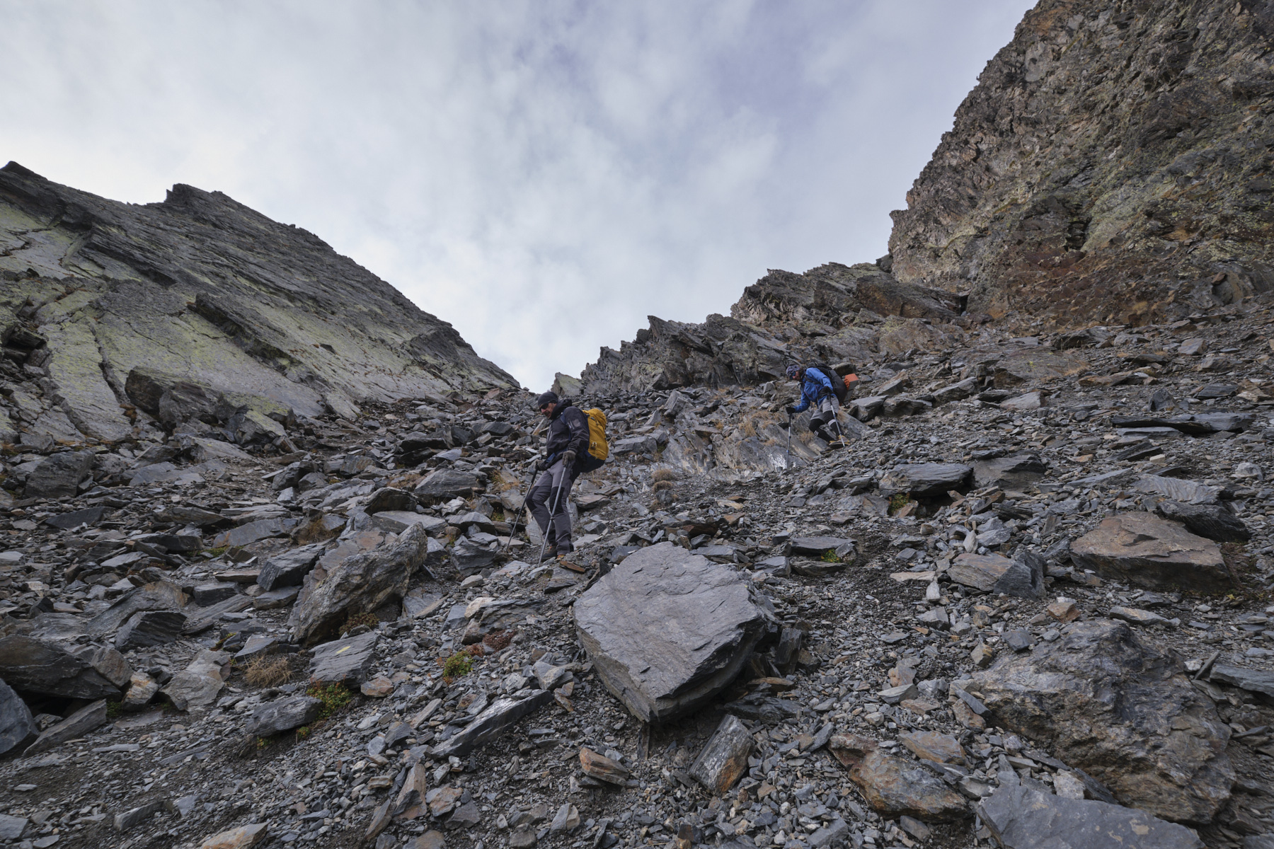
From here, go around the pond to the west, following the marked path, and on the opposite side (south), start to climb into the scree to cross a jump with a small waterfall. You'll find a 2nd stone-filled basin. Head for the couloir, which rises steeply to the right towards the bottom (south-west). A very steep slope, between scree and gispet, leads to the last small valley which leads to the Port de Médécourbe. It's a long way up, in the middle of huge scree, and ends in an increasingly narrow and steep couloir on unstable terrain. You can exit to the right or to the left, with a few steps where you put your hands down to balance yourself. Exit onto the pass in the form of a wide, stony saddle. To the east, the Pic de Médécourbe, to the north-west the Pic de Lavans and to the south, at the bottom, the ponds and the Baïau refuge.
Part 2: Pic de Médécourbe (2914m, 45' to 1h)
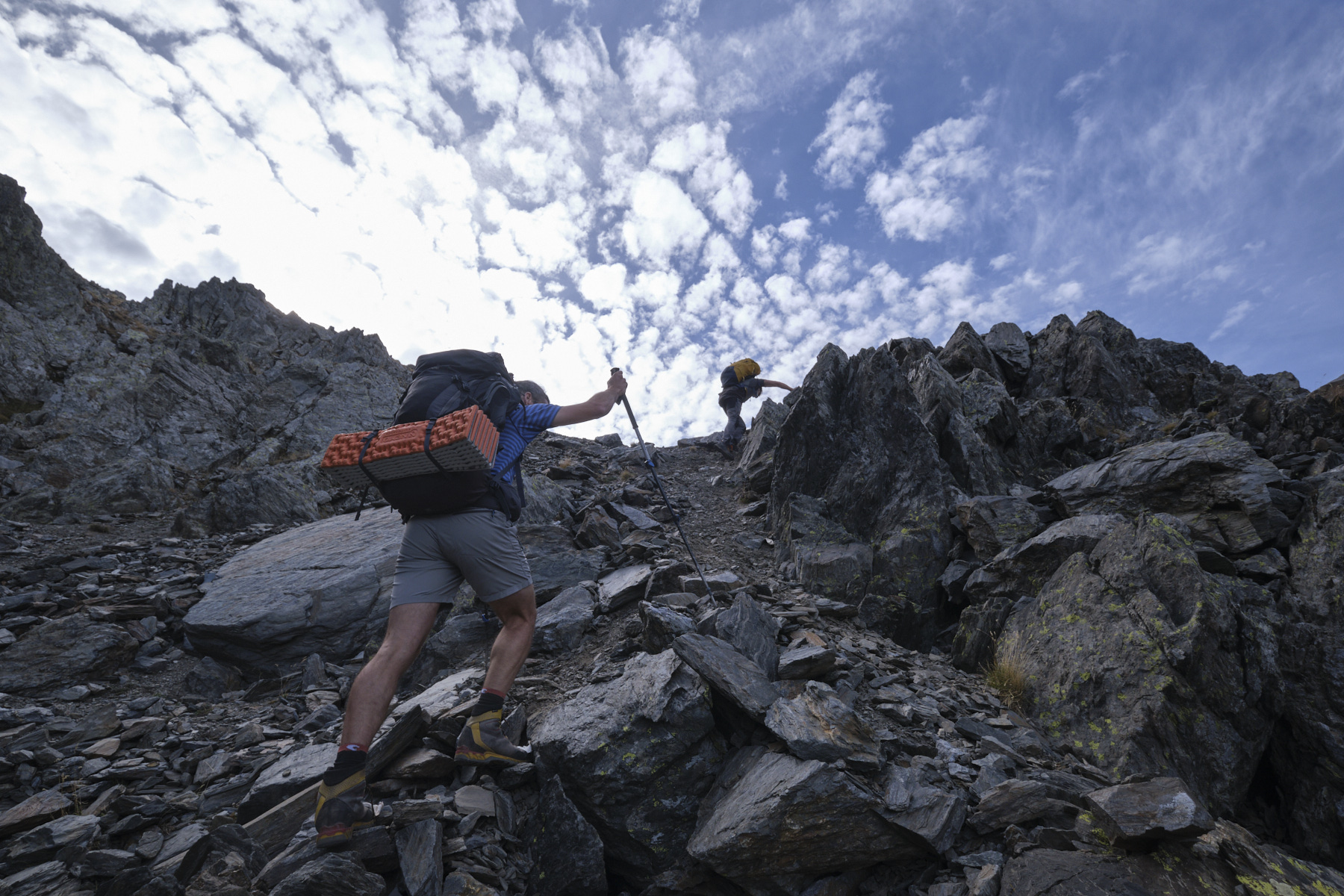
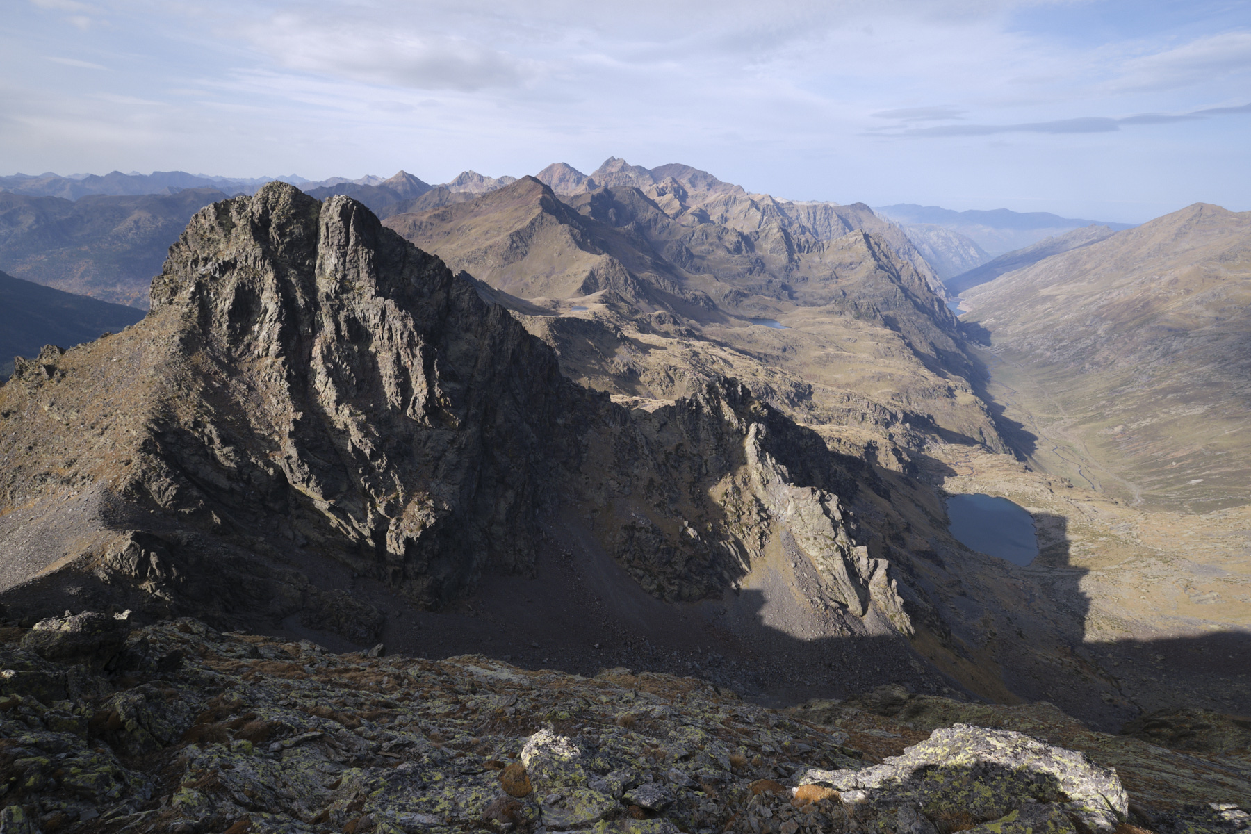
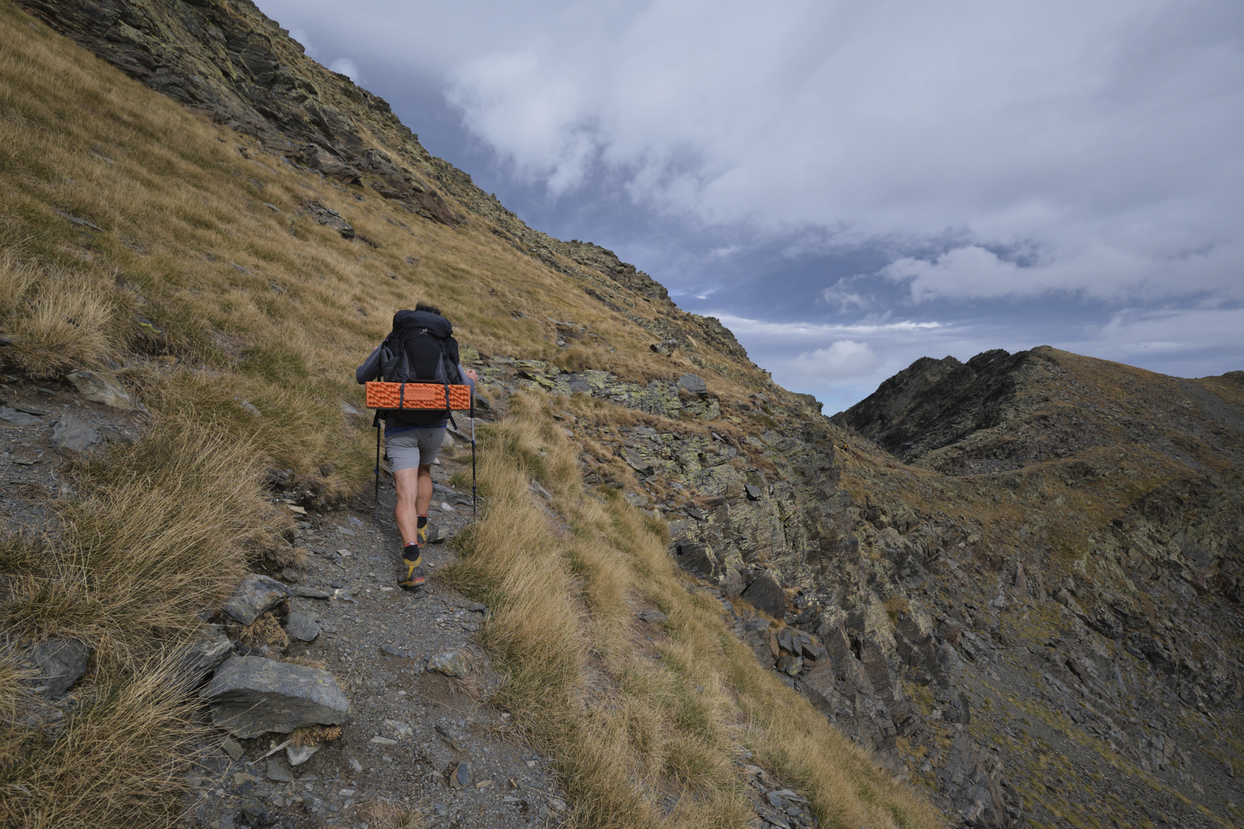
From the Port de Médécourbe, start climbing the ridge to the east and gradually head back north to find the couloir to be climbed without difficulty (cairns, climbing in the II+/III- range). We pass a small gap with a view of Andorra and the Forcats lakes. Cross over to the southern flank and climb up to the ridge as soon as possible. It's quite aerial, with 1 or 2 narrow and impressive passages, but you reach the summit of the Pic de Médécourbe at 2913m without too much difficulty. Plunging view to the north over the Soulcem valley.
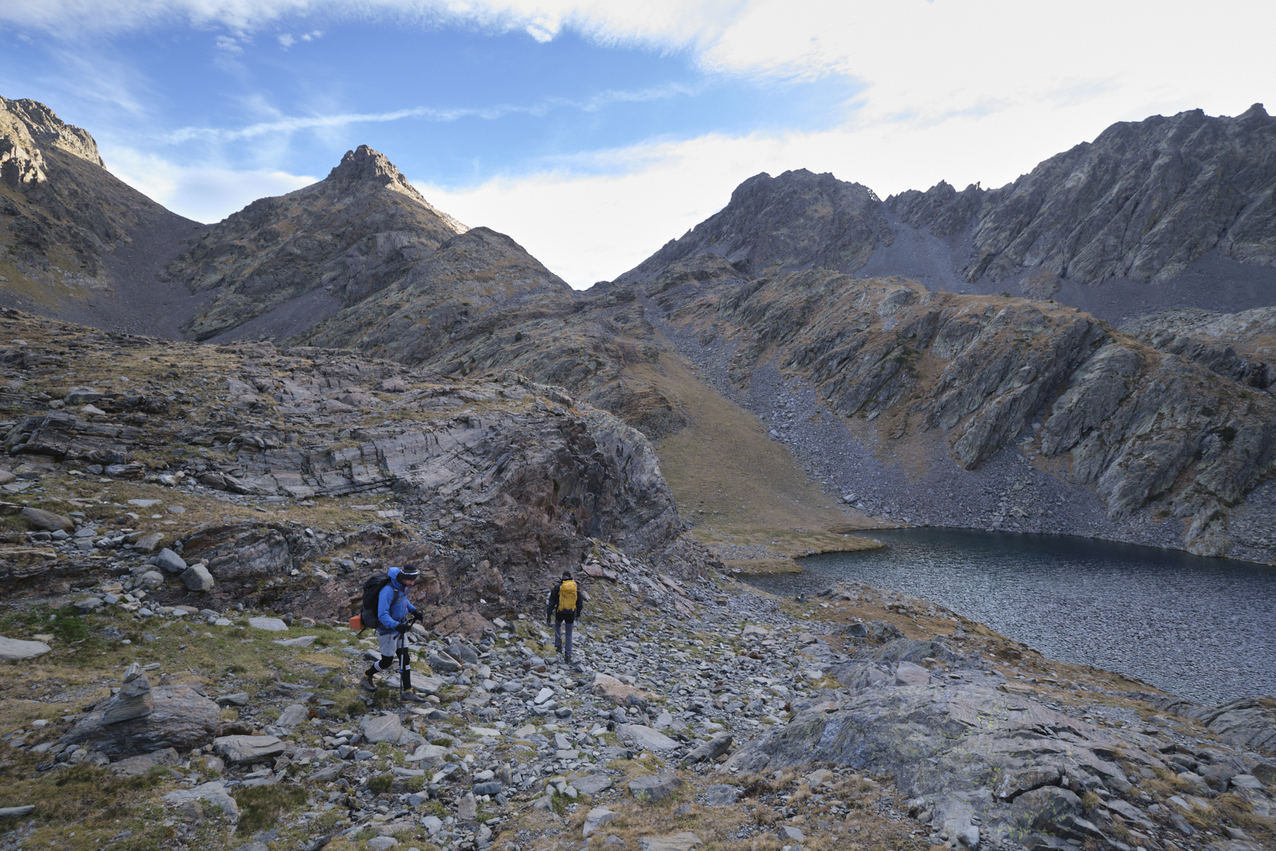
3rd part: Refuge de Baïau (2517m, 1h)
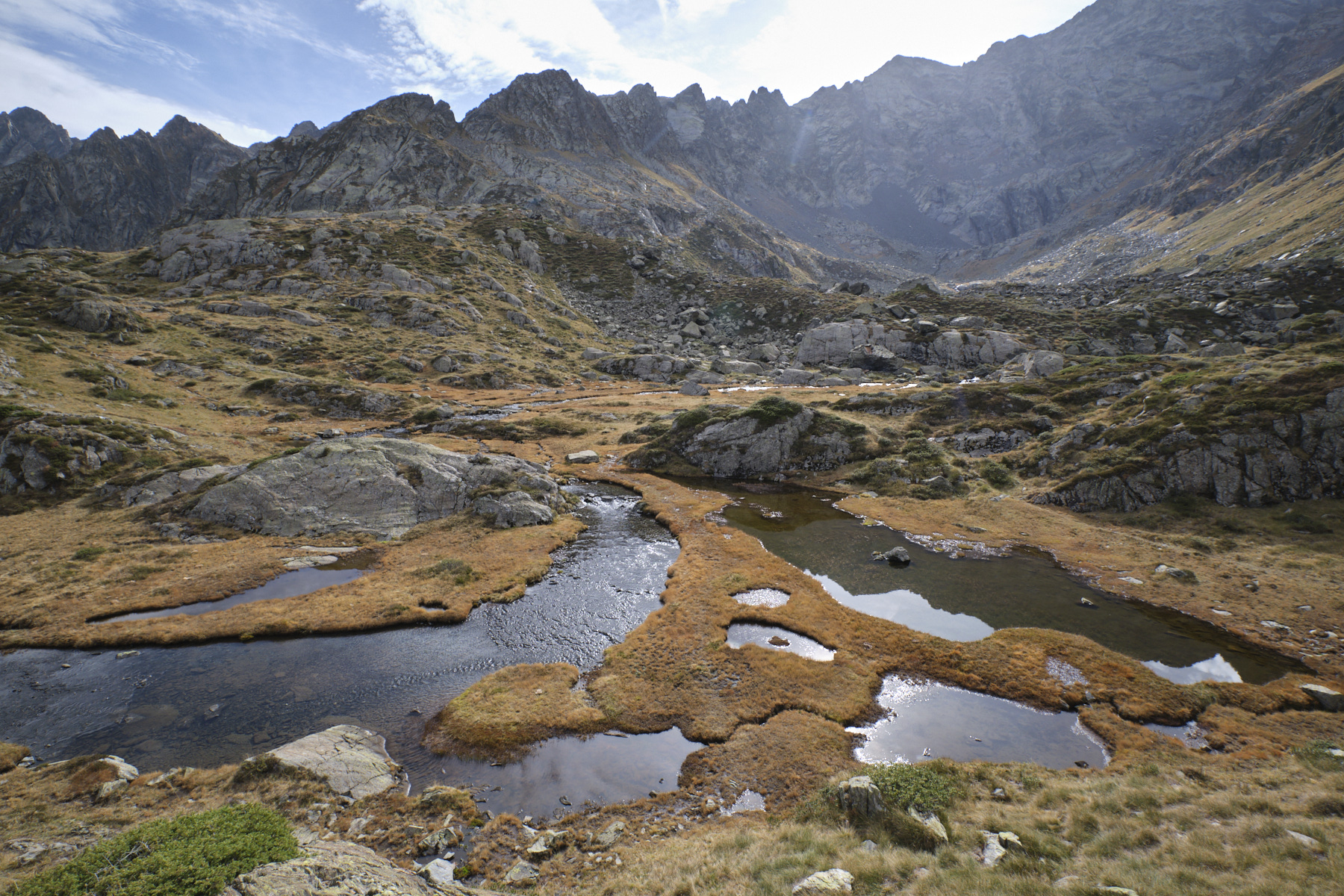
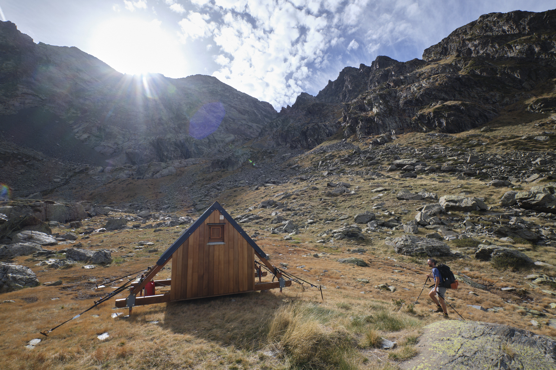
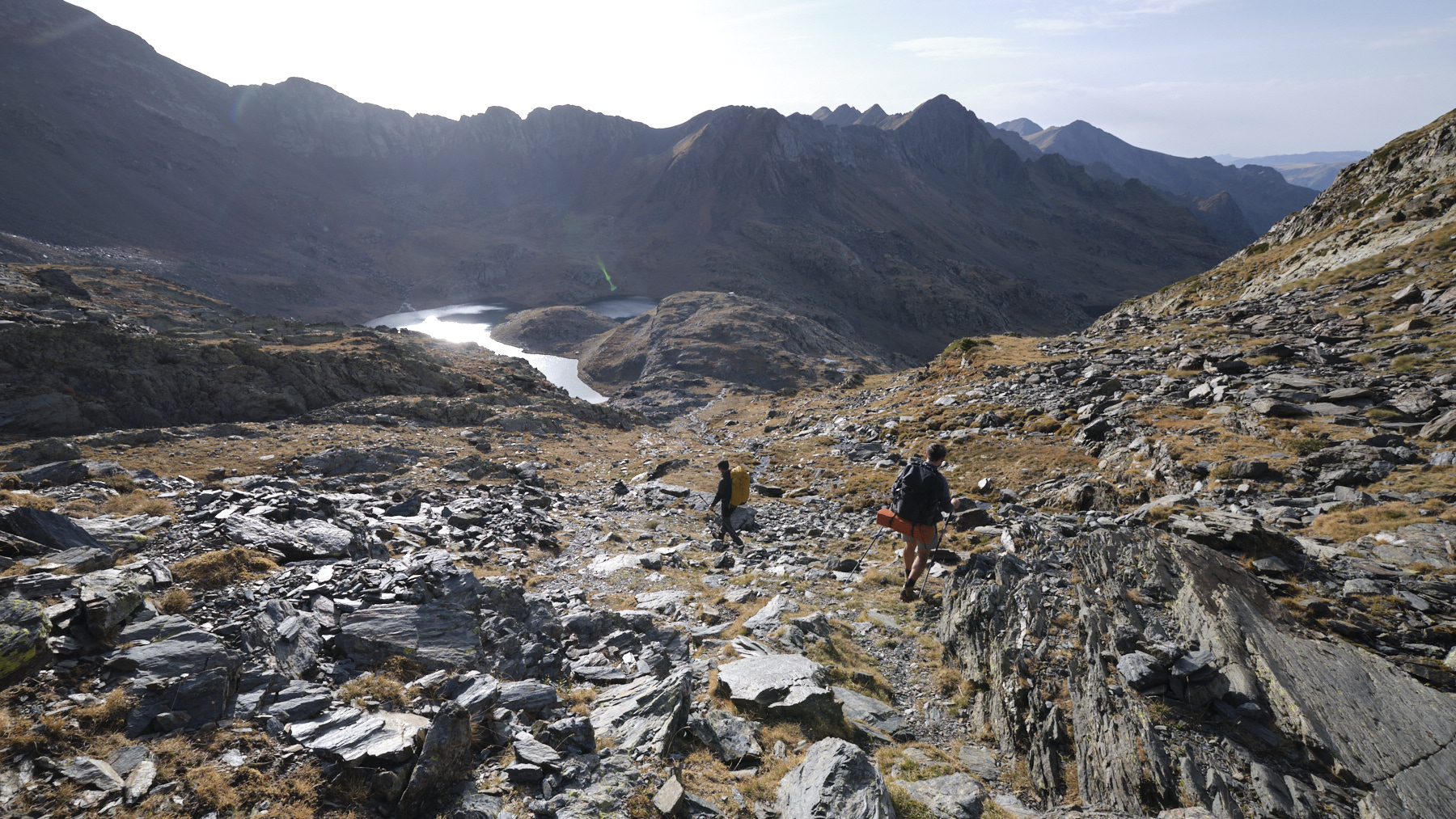
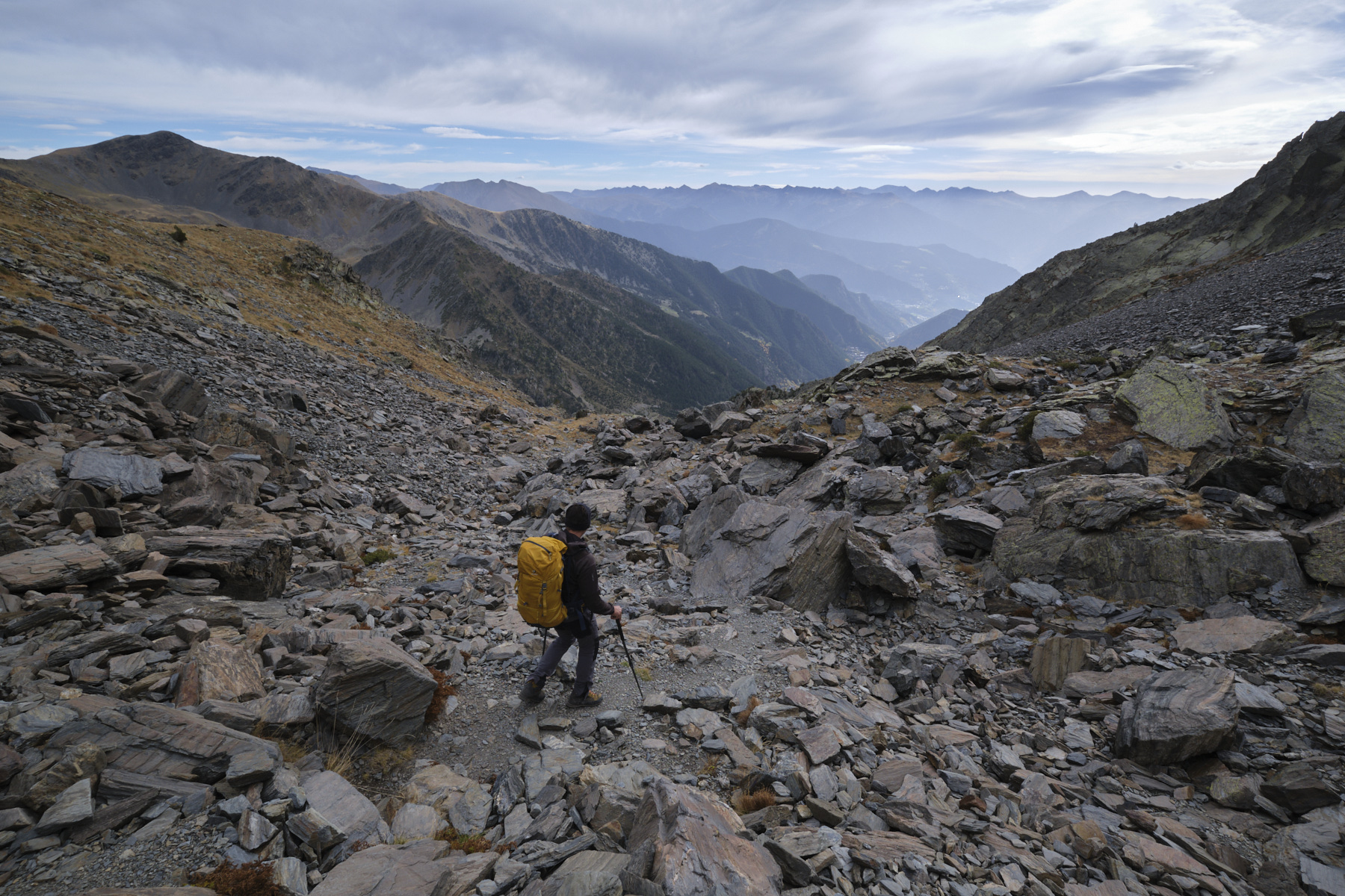
Follow the ridge eastwards for a few metres, then descend steeply to the south, following the Andorran yellow dots. The path winds down the south-facing slope of the Médécourbe wall, ending at the Col des Etags Forcats (2743m). It then crosses the GR 11, which you follow due west, gradually descending to the Baïau ponds. Climb slightly to reach the free Baïau refuge, 2517m, ideally placed in the middle of the Baïau cirque (sleeps 9).
DAY 2: PIC DE COMAPEDROSA AND PORT D'ARINSAL (6H to 7H)
Part 1: Pic de Comapedrosa (2943m, 1h15 to 1h30)
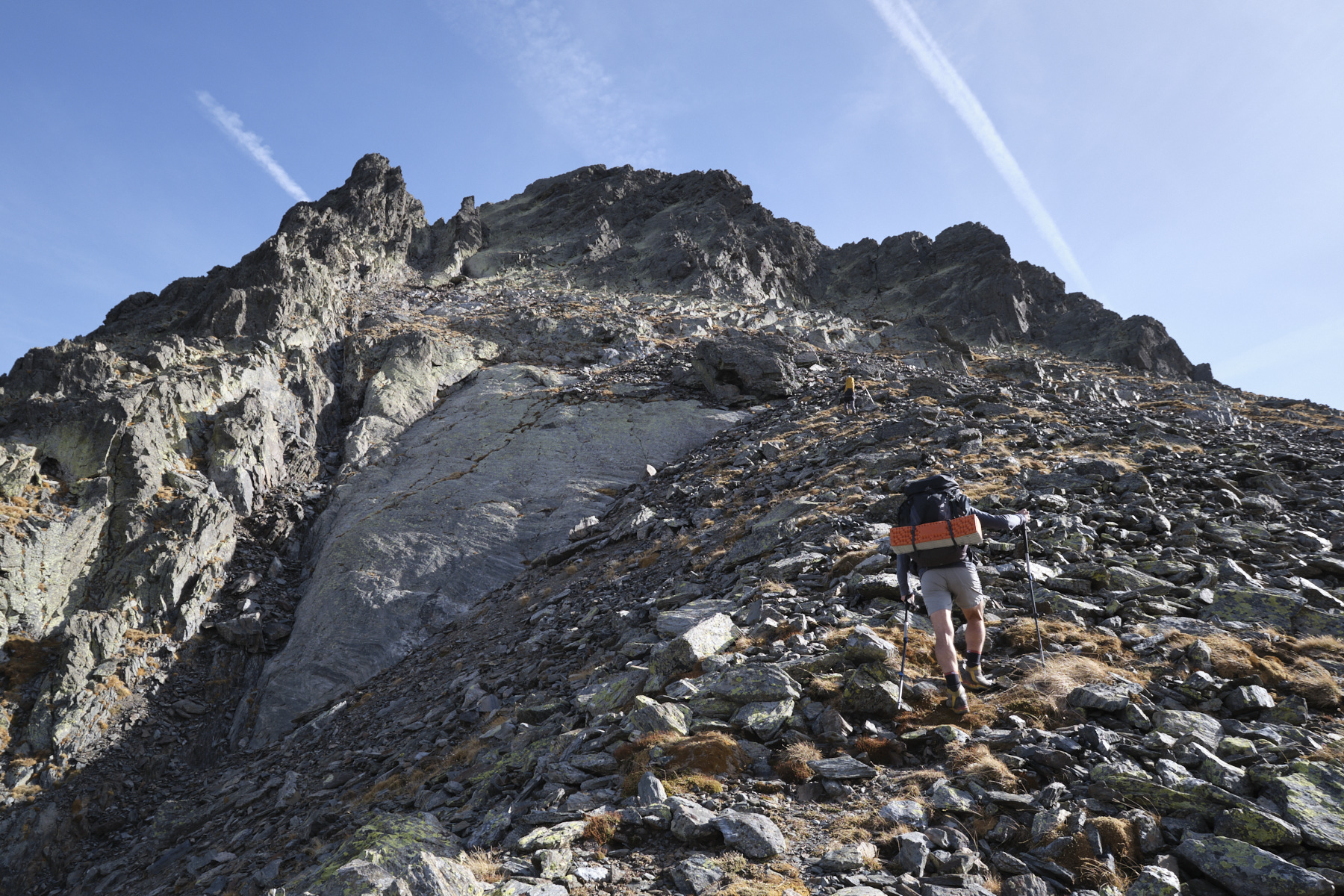
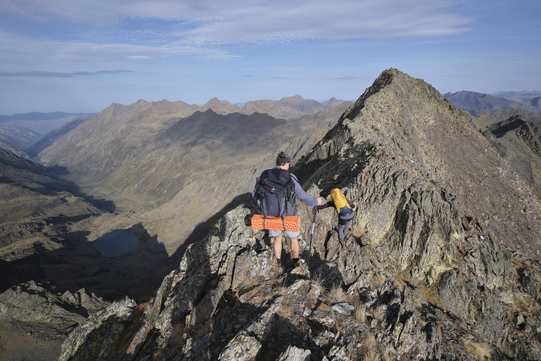
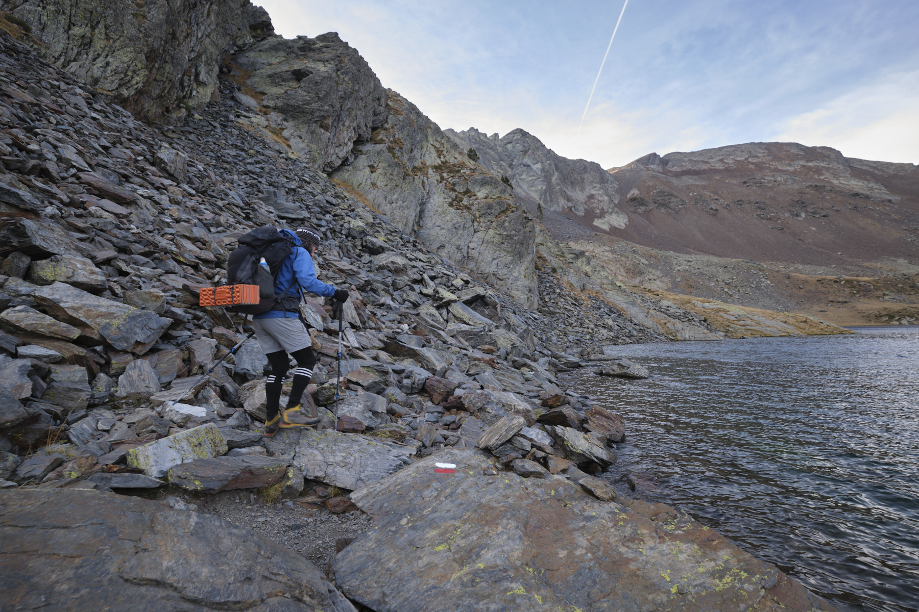
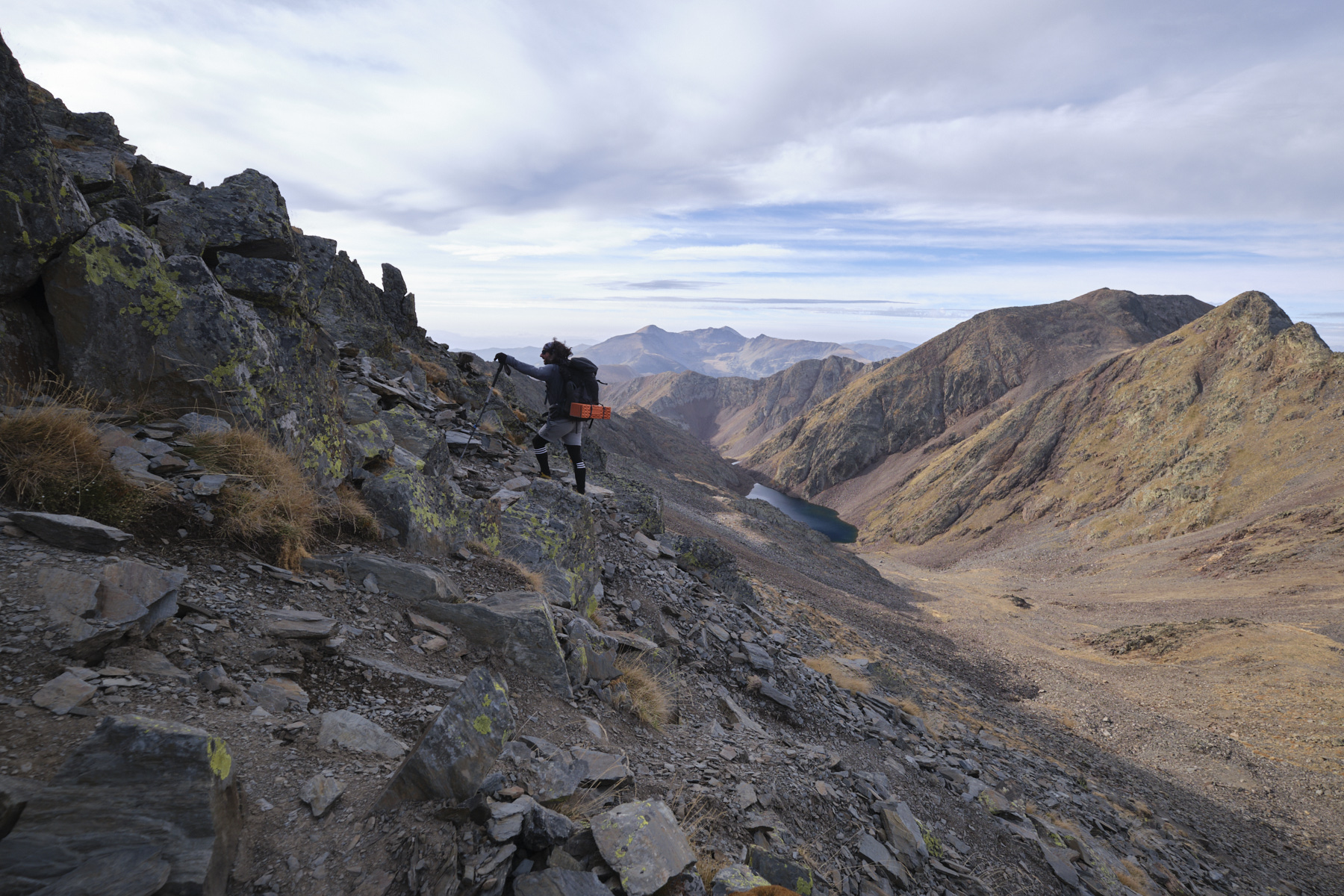
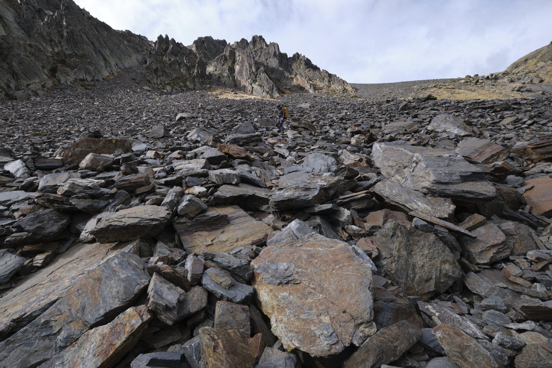
From the hut, descend along the same path as the previous day, following the GR11. Stay level with the pond and follow the bank flush with the water to skirt around it, then start climbing eastwards. We pass a waterfall, then the path crosses and climbs a huge scree slope. The slope becomes steeper and steeper, ending at the Portella de Baïau at 2747m. We switch to the opposite side, with a view to the south of Étang Negre. Follow the path that crosses flat to the left and ascends the southern slope of the Pic de Comapedrosa to reach the summit fairly quickly. Superb views over the Andorran valleys.
Part 2: Port d'Arinsal (2734m, 3h)
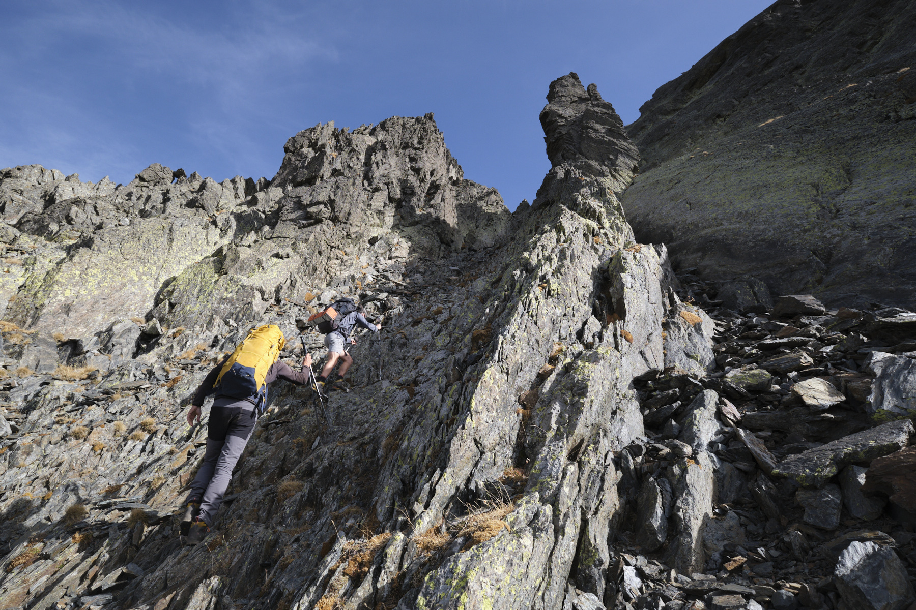
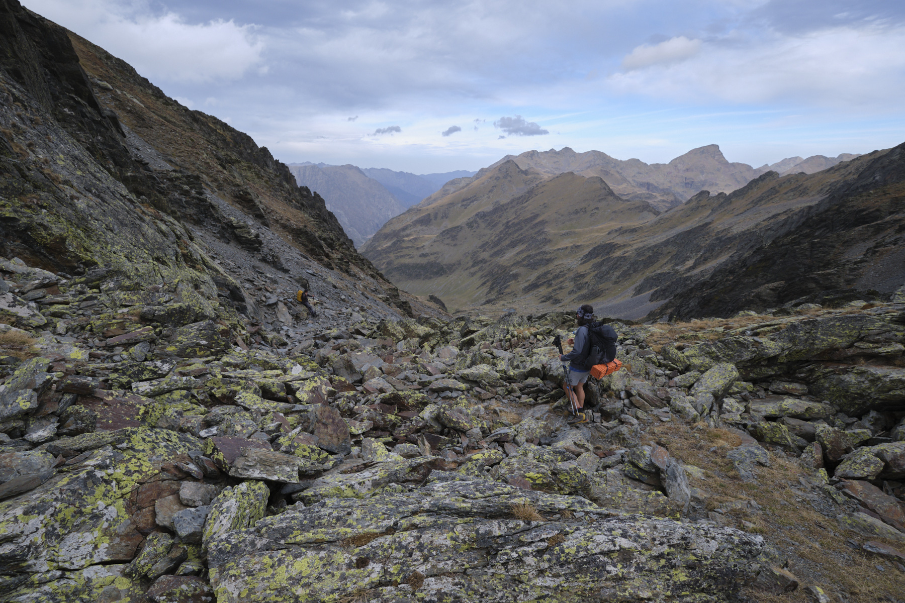
Descend from the summit following the ridge, then skirting the end to the left to reach the Collada del Forat dels Malhiverns. The slope is steep at the start and the couloir narrow enough to widen further down. Then descend the valley in several steps, always following the large yellow dots. Further down and before plunging towards the Pla de l'Estany refuge, cross the grassy cirque off-piste to aim for the small laces that rise on the opposite side (visible in the distance).
From here, climb along a waterfall before crossing it and entering an upper grassy valley below the Pic de les Fonts. Wind your way upwards, step by step, to reach a small hut. Climb a little further to reach the Montmantell ponds below Port d'Arinsal. Go around them to the west and follow the path to the Port d'Arinsal border with France (2734m).
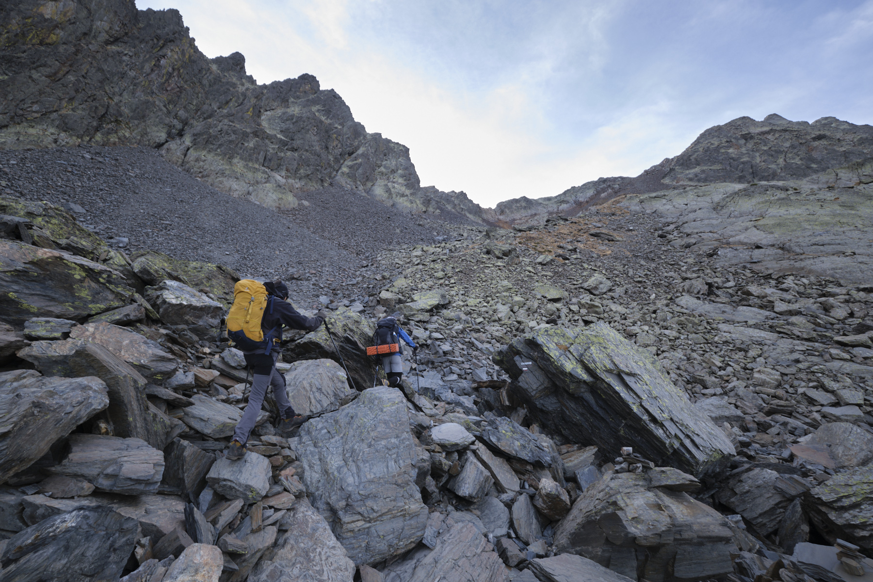
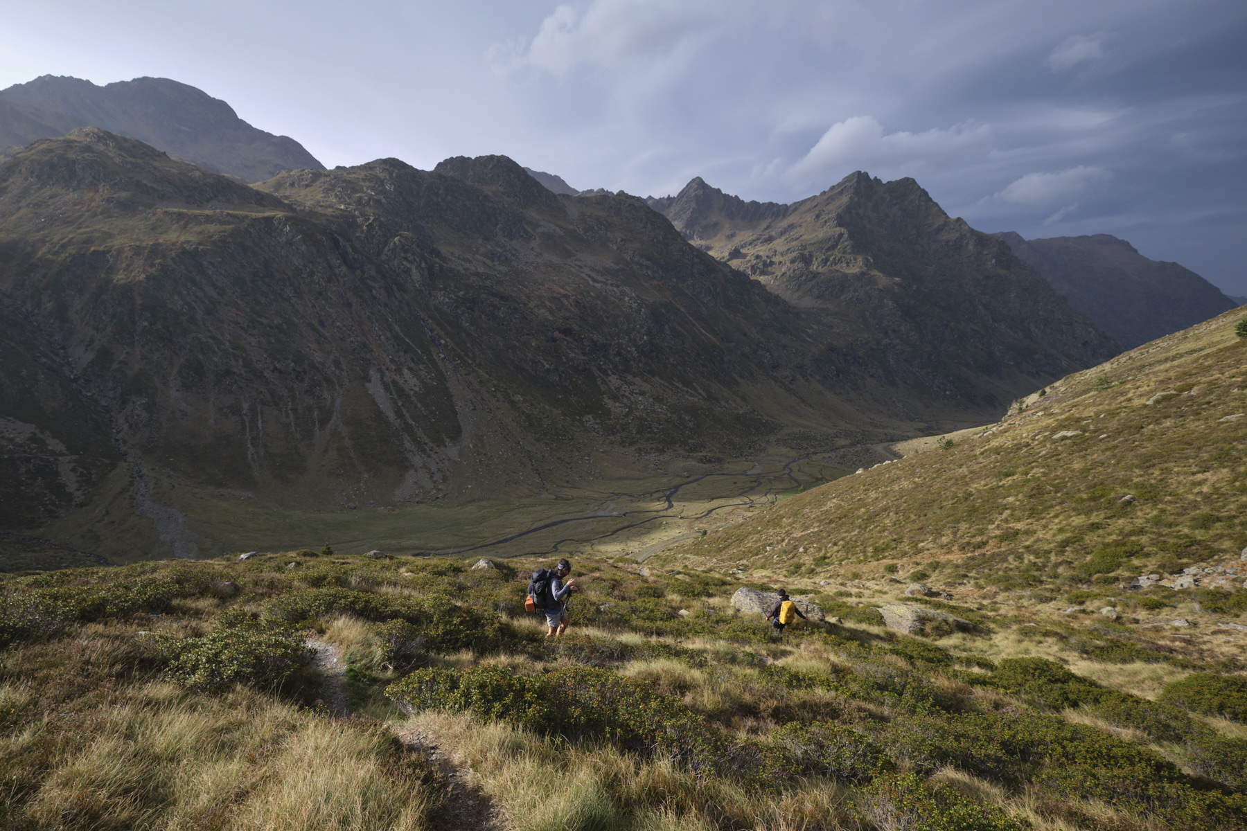
3rd part: Cabane du Rat to Pla de Labinas (2h to 2h30)
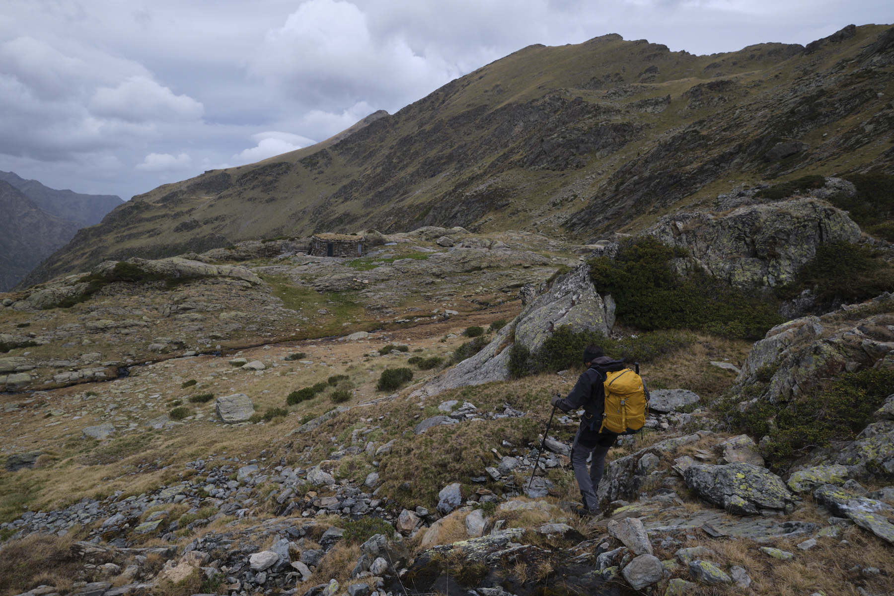
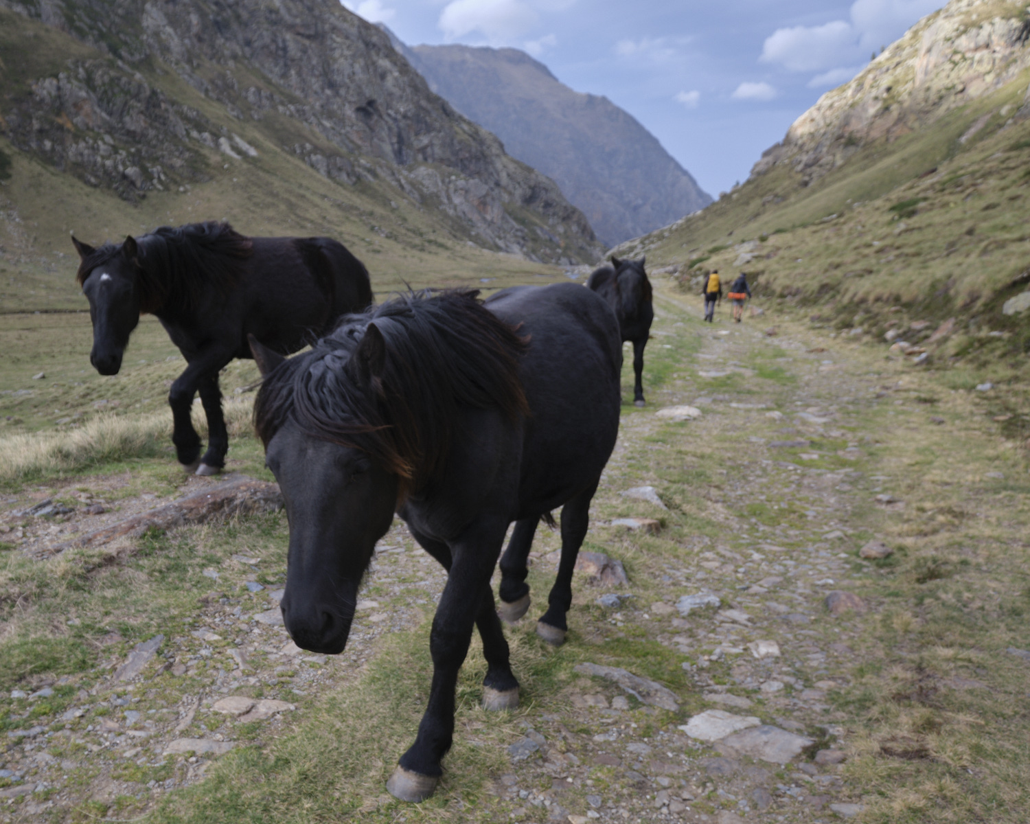
Here we go again for an interminable descent through giant scree! The trail is marked with yellow lines that are a little faded, but very useful for navigating this sea of stones. You end up on a grassy flat where you'll find the superb Rat hut, perfectly integrated into the landscape. Continue downhill to find the GR descending from the Port du Rat and follow it along the ruisseau du Rat. Further down, the GR crosses the track several times to finally overlook the long Pla de Labinas. You land at the far end at the Cabane de Soulcem. Follow the track along the right bank of the Soulcem to return to the end of the Pla at the footbridge. Cross the footbridge and take the approach path in the opposite direction to return quickly to the starting parking lot.


 Partager sur WhatsApp
 Partager sur Twitter
Partager sur Instagram
Partager sur Twitter
Partager sur Instagram

 Partager sur Facebook
 Imprimer le topo
 Laisser un commentaire


Leave a Reply