×
Randonnées Escalade Alpinisme Via ferrata Canyoning Ski de rando Raquettes
×

Search Close search

TOPO

Pic de Céüse loop via Pas du Loup, Sigoyer

Publié le |

0 Comments

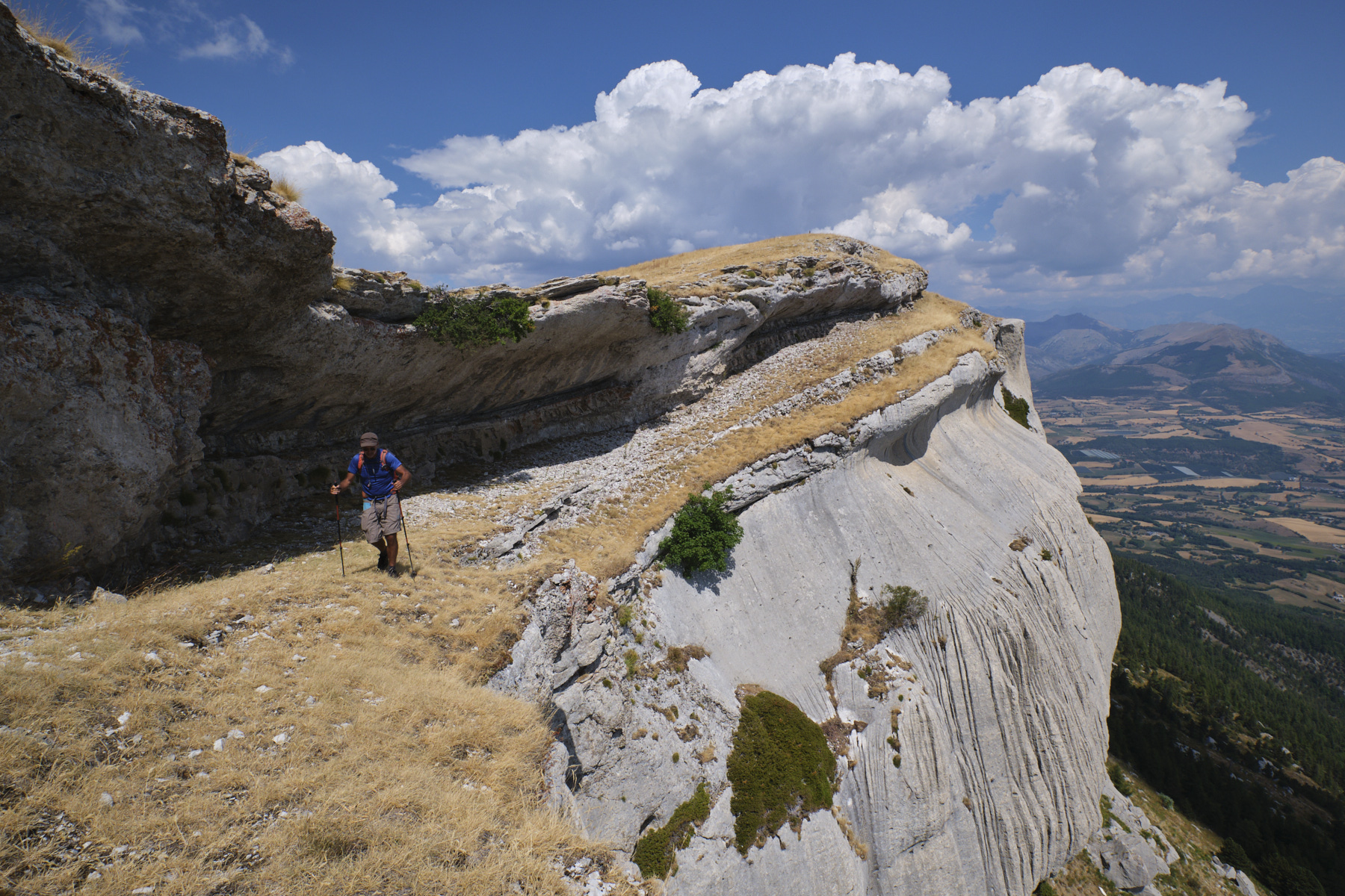
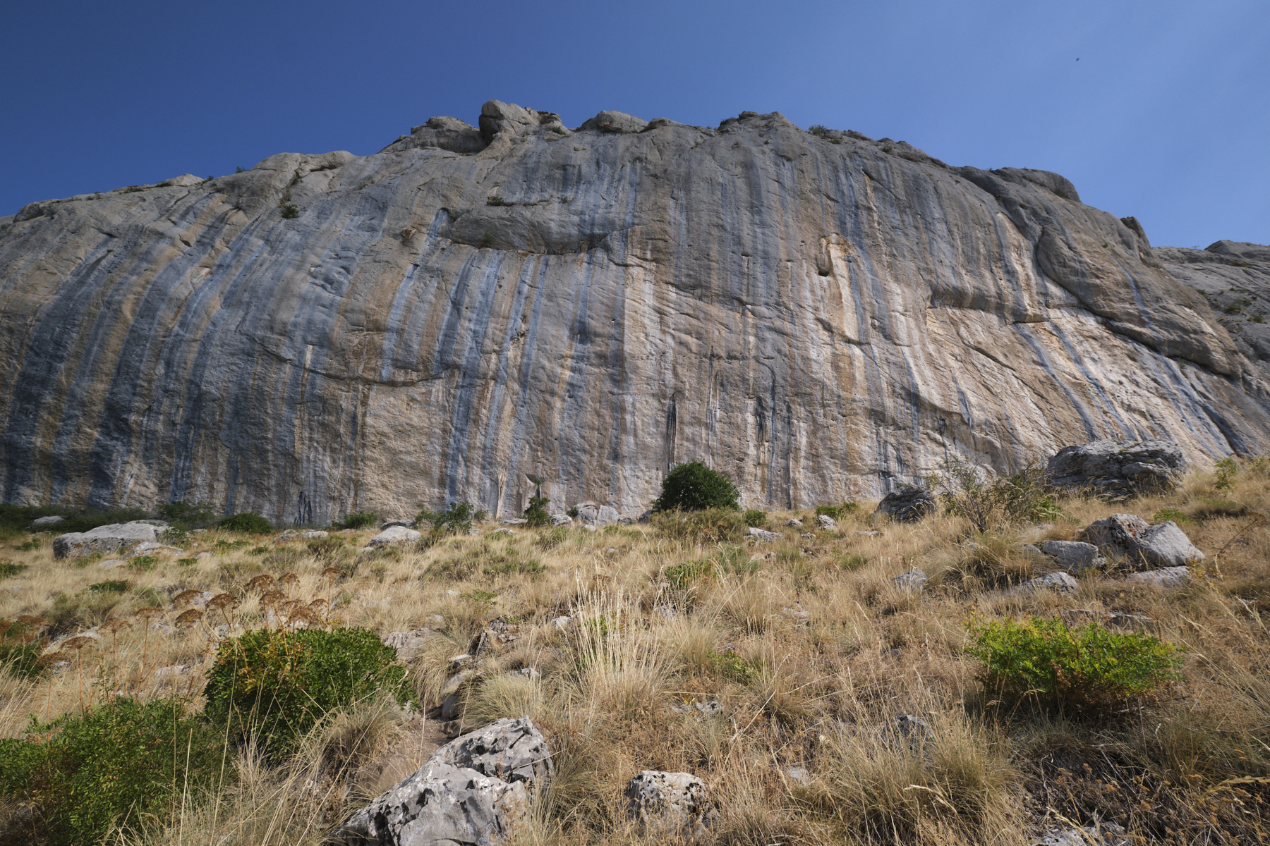
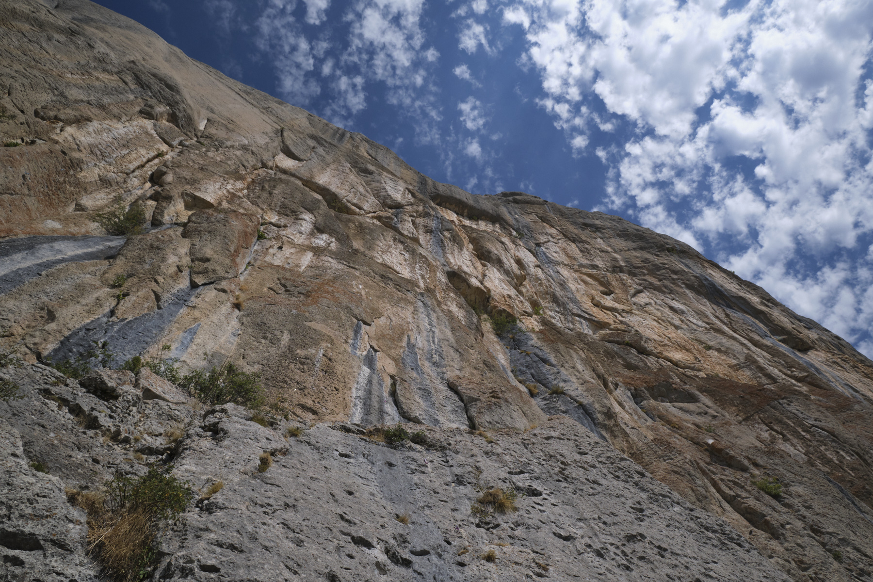
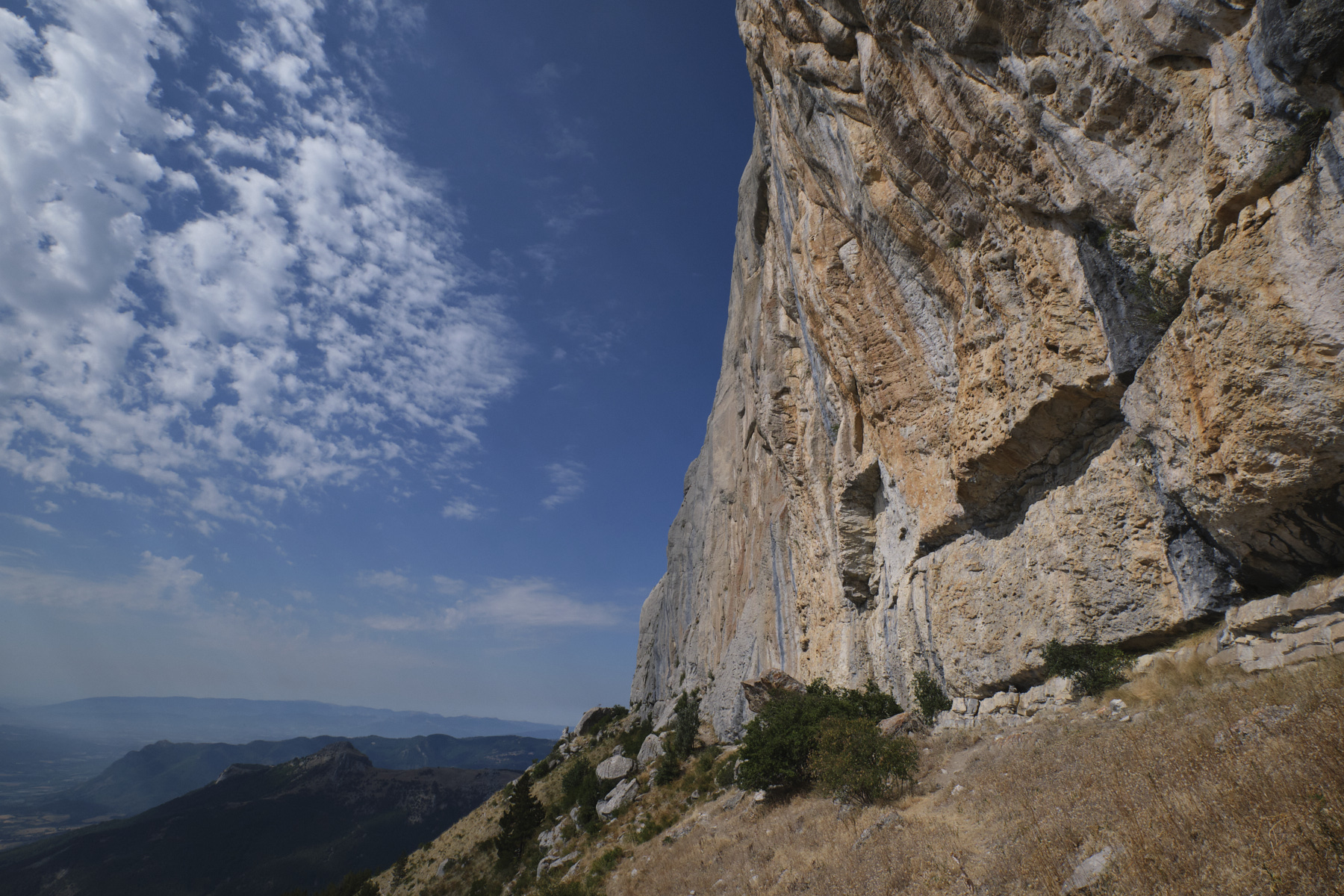
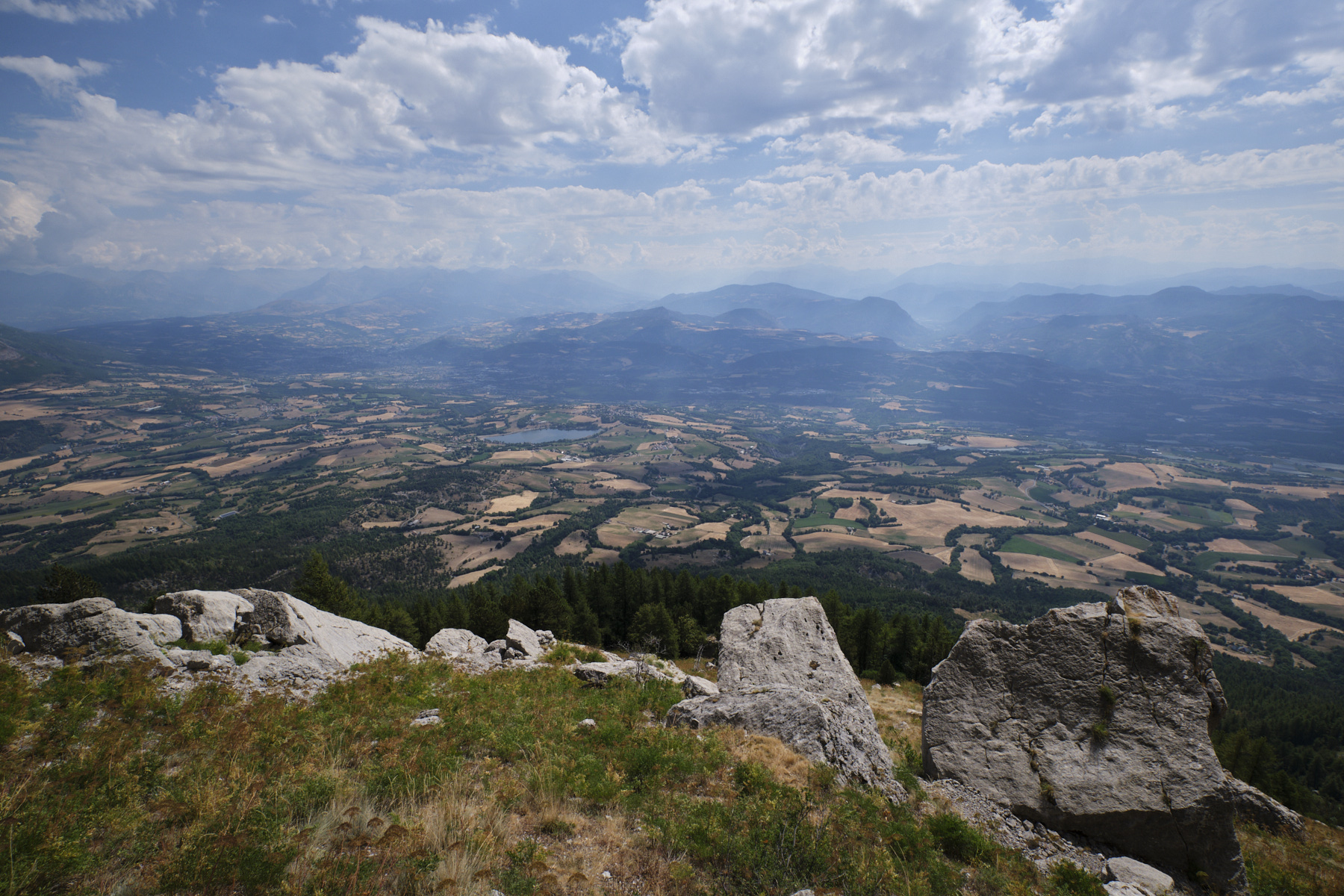
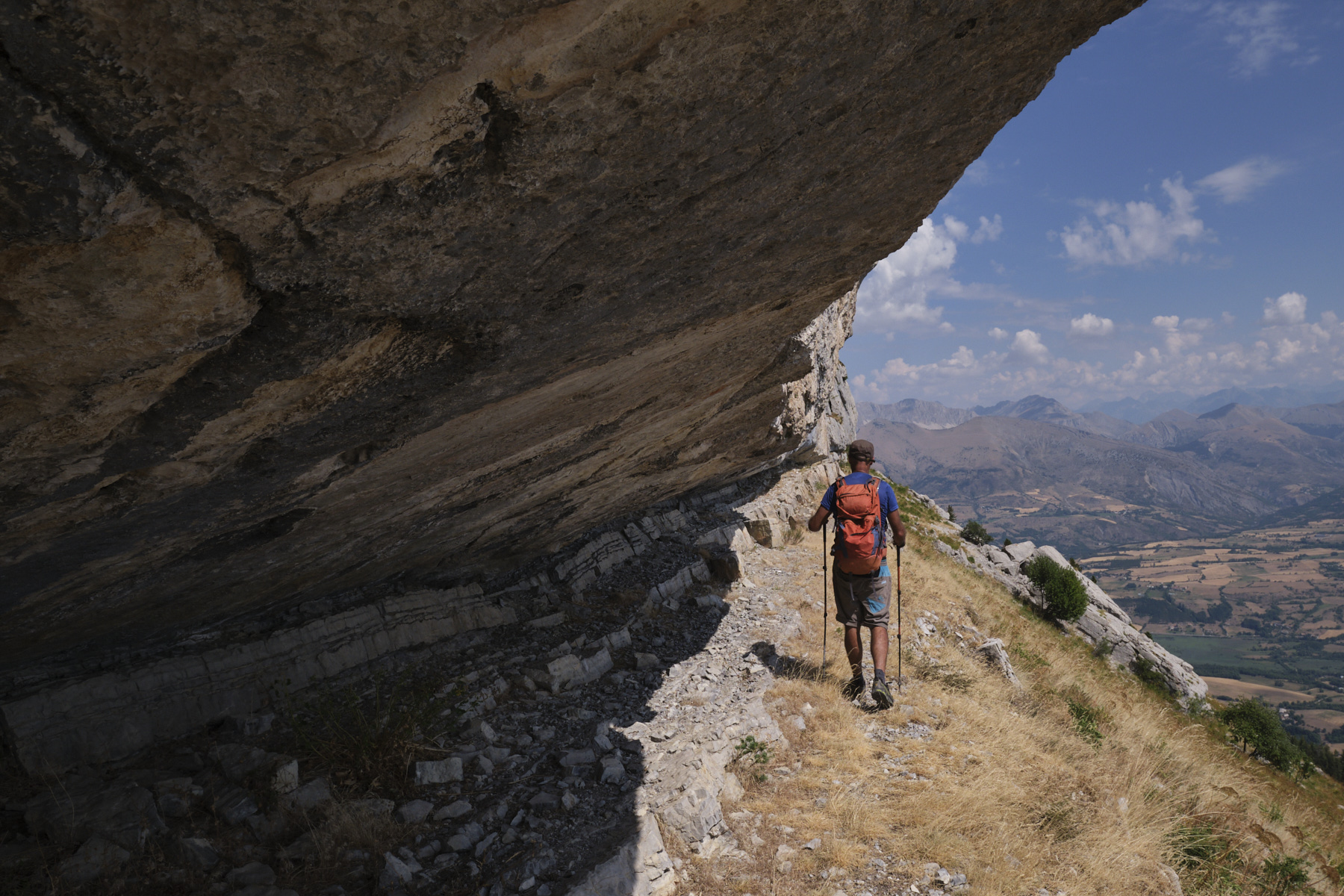
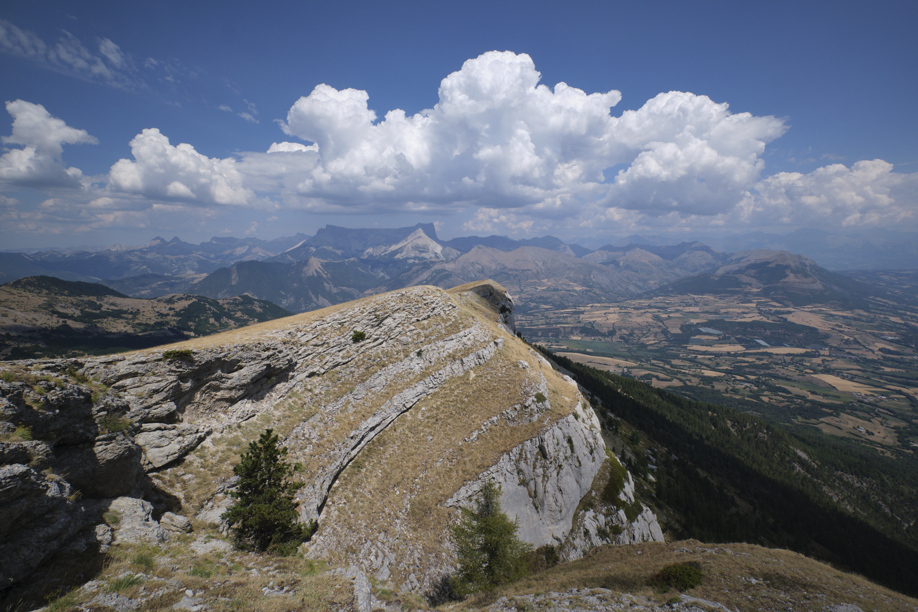
Renowned for its climbing cliffs, the Montagne de Céüse also offers an aerial and panoramic hiking circuit close to the Dévoluy and almost above the town of Gap. On the climbers' trail, the loop begins with a review of a string of orange limestone walls with impressive bulges, giving an idea of the difficulties of the 8 and 9 routes on the local program. At the very end, a small equipped passage allows you to retrace your steps on the ridges above the cliffs to the Pic de Céüse at 2016m. The route continues beyond, on the western arc of the Montagne, finally returning to the base of the cliffs. Even if the altitude difference remains reasonable, the distance and the off-trail progression flush with the cliffs make this a substantial hike. And in summer, the sun beats down hard on most of the route.

Sur une vire sous le Pic de Céüse

Technical summary

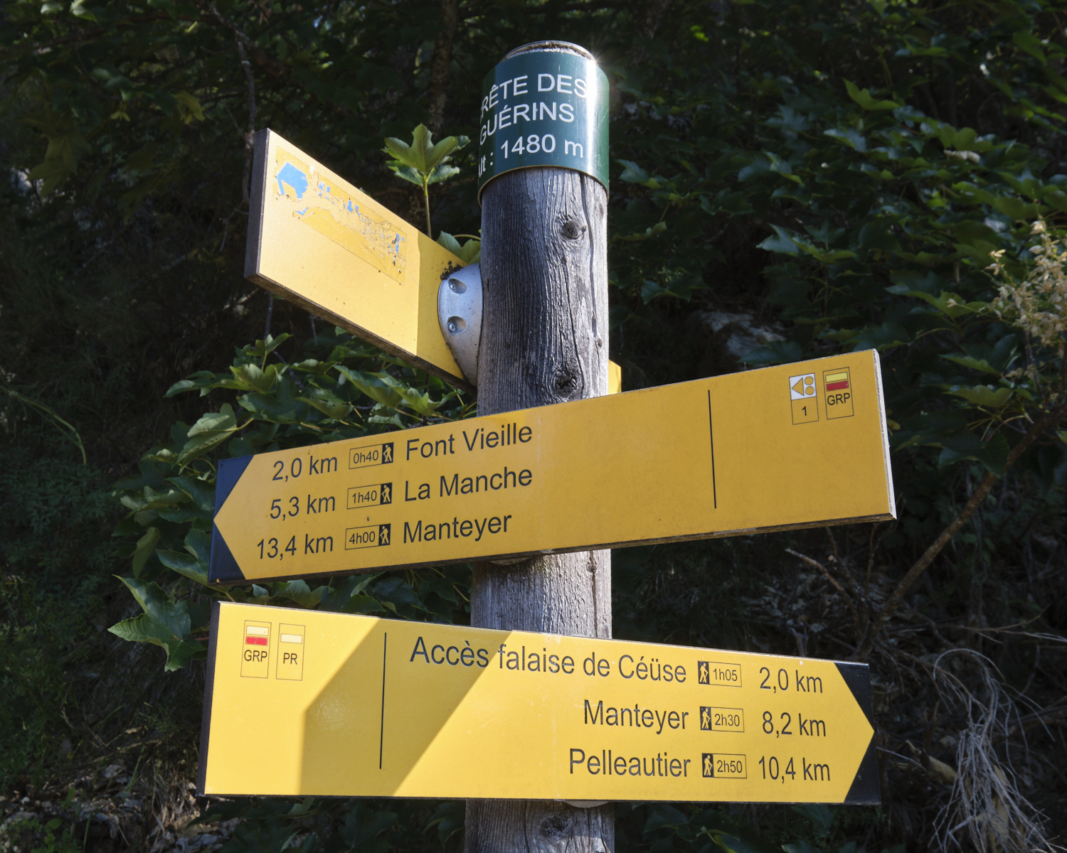
■ S tarting point: near Col des Guérins, Sigoyer, Hautes Alpes (05)
Type of route: mid-mountain loop hike, ridge route
Distance: 14.5 km
Cumulative elevation gain: +875 m
Cumulative negative altitude gain: -875 m
Estimated total time:
■ Min and max altitude: m / 2016 m
Marking: the ascent to the cliffs, the sentier de ronde (GR de Pays) and the crest (PR) are marked. The route to the base of the cliffs is off-piste and requires you to make the best possible progress, avoiding obstacles (boulders, Natura 2000 protected areas). The descent of the crests via the cascade to the junction with the sentier de ronde is the trickiest, because although marked with a double yellow line, the trail is overgrown and the markings are not clearly visible.
Equipment in place: 2 equipped passages: at the Pas du Loup with 2 roped sections and on the descent from the waterfall with 3 sections of knotted ropes.
Equipment required: helmet for passages under cliffs, GPS track recommended.

Difficulties: the Pas du Loup is equipped with a rope on 2 short aerial sections, one of which includes a few steps of III climbing. The descent of the ridges to pass under the waterfall at the end of the route is tricky, steep and unstable in places, equipped with a few knotted ropes.

Access to the place

From Gap, head for Veynes and at La Freissinouse turn towards Pellautier and Sigoyer. From Sisteron, head for Gap and after La Saulce, turn towards Sigoyer. After Sigoyer, continue towards the Col des Guérins. Park near the last bend before the pass.

Itinerary description

Hiking to the start 45 à 1h

From the road or campsite, follow the path straight up to the cliffs. You cross a track and continue for 2 long hairpin bends through the forest, coming out just below the base of the first walls, on the round path. On the left is the return via the waterfall, on the right the start of the loop.

Course 3h30 à 4h30

Part 1: the base of the cliffs to the east (1h to 1h30)

Follow the path gradually upwards towards the base of the cliffs, and fairly soon you'll find a small, steep path leading up to a part of the cliff that's bulging with long streaks of orange and black: this is the Biographie sector. Climb up to reach the flats at the base of the route starts. You can see the incredible overhang. The view over the valley is superb.

From here, the idea is to walk along the base of the walls, heading east and up all the climbing areas and beyond. You'll find a path for a good while, then, as you pass the last equipped areas, continue on, trying to keep as close to the rock as possible. The route gradually turns northwards, following the arc of the Céüse massif. We pass under the Pic de Céuse. There are a few easy climbs over boulders, 1 large finger leaning against the wall, which you can sneak under, and 2 enclosures, also to be avoided, which protect the Benoîte à fruits divers, Céüse's unique plant (Natura 2000).

Finally, after a long progression further and further north, the Dévoluy massif comes into view and, at the level of a last large boulder leaning against the wall, we are obliged to descend a little to return to the path below. Follow it, this time descending along the gradually diminishing wall. This is where the sign for the start of the ascent to the Pas du Loup crosses.
Part 2: Pas du Loup and ridge to Pic de Céüse (30' to 45')

At this point, retrace your steps almost back to the south, following a steeper path that climbs diagonally. Immediately afterwards, there's a first cabled section on a mini rock lip, a very aerial passage, more impressive than difficult. This is followed by a very narrow switchback to take a second small ledge that heads back north to the second equipped passage. This time, you have to climb (III) over a spur and then exit fairly quickly onto the wide ridge.

All that's left is to head due south on the yellow-marked path to the summit of Céüse at 2016m, where one of the ski resort's chairlifts arrives.
3rd part: the ridges to the west and return under the cliffs via the waterfall (1h30 to 2h)

The next part consists of following the edge of the cliffs to enjoy the aerial atmosphere and admire the spectacular rock formations. In some places near the summit, you can walk on suspended intermediate ledges (photo on top). Continue south-west to pass a second summit, then traverse more ridges following the relief formed by the walls. The ridge then descends, this time over slabs, before reaching a grassy flat where the via ferrata ends.

From here, follow the yellow-marked path as it descends slightly through a grassy inner valley, to emerge further on and join the ridge and cliff edge again, this time on the south-west side. Follow the ridge path for a while, veering increasingly to the west and then north-west, crossing the torrent la Lumineuse (dry in summer) until you reach the descent. The path then heads south, past a large boulder, and the waterfalls begin.

Follow the double yellow line markings. The path, which is rather overgrown and not very visible in places, weaves its way between the rocks, with a few easy climbs, and then passes under the Lumineuse torrent, which forms a pretty waterfall at this point, unfortunately dry at this time of year. A little further on, the "sentier des rondes" joins the path, which we take to the left to return slightly uphill to the junction at the start of the climb.

Back

Exactly the same as the outward journey in the opposite direction.

Map & topo

The yellow path is the one you can take from the Camping Des Guérins (private). The purple itinerary is the one described in the topo, staying at the base of the cliffs, on the small route start ledges and in the final off-path section. Voir en plein écran

Photos

Commentaires

Leave a Reply

Basic HTML is allowed. Your email address will not be published.

Subscribe to this comment feed via RSS