This itinerary, starting from Appy, forms a long loop on the south face of the Massif de Tabe. On the program: the Etang d'Appy, the crests to reach the Pic Galinat then the Pic du Han and a spectacular descent to the Roc de Lauzate plateau facing the Pyrenees. The route is physical, technical and challenging, with many exposed sections on the ridges where you have to use your hands to make progress. But there's nothing to throw away, because in addition to the variety, the route offers superb panoramic views of the Monts d'Olmes to the north and the Ax valley facing the Ariège Pyrenees to the south.
❱❱ Technical summary
Type ✦ Alpine hiking
Location ✦ Appy, Massif de Tabe
Region ✦ Haute-Ariège
Country ✦ France
Orientation ✦ South
Max altitude ✦ 2115m
Distance ✦ 17km
Dénivelé ✦ 1275m
Engagement ✦ P3-T3-R3
Duration ✦ 6h to 8h
Interest ✦ ★★★
❱❱ Access to the place
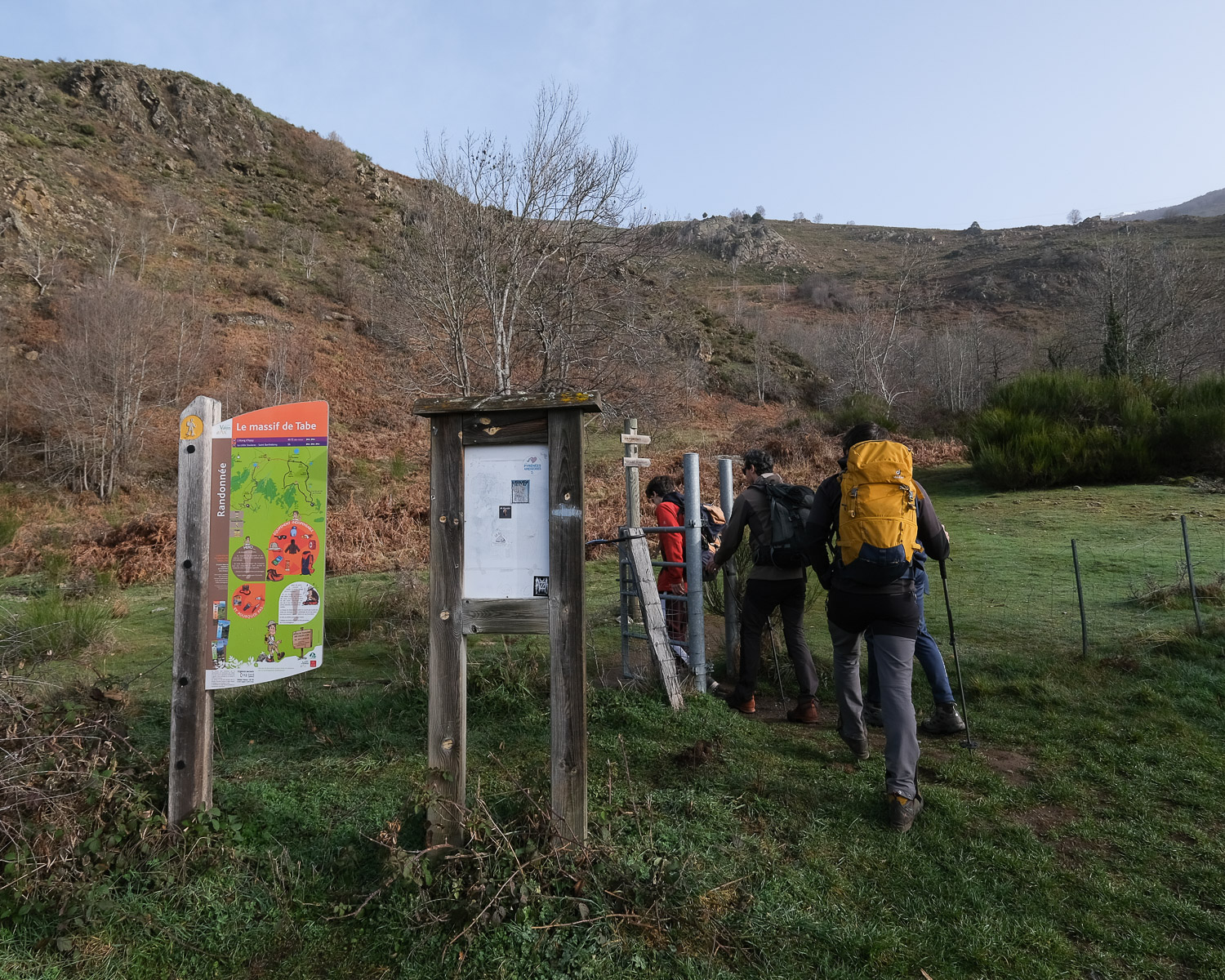
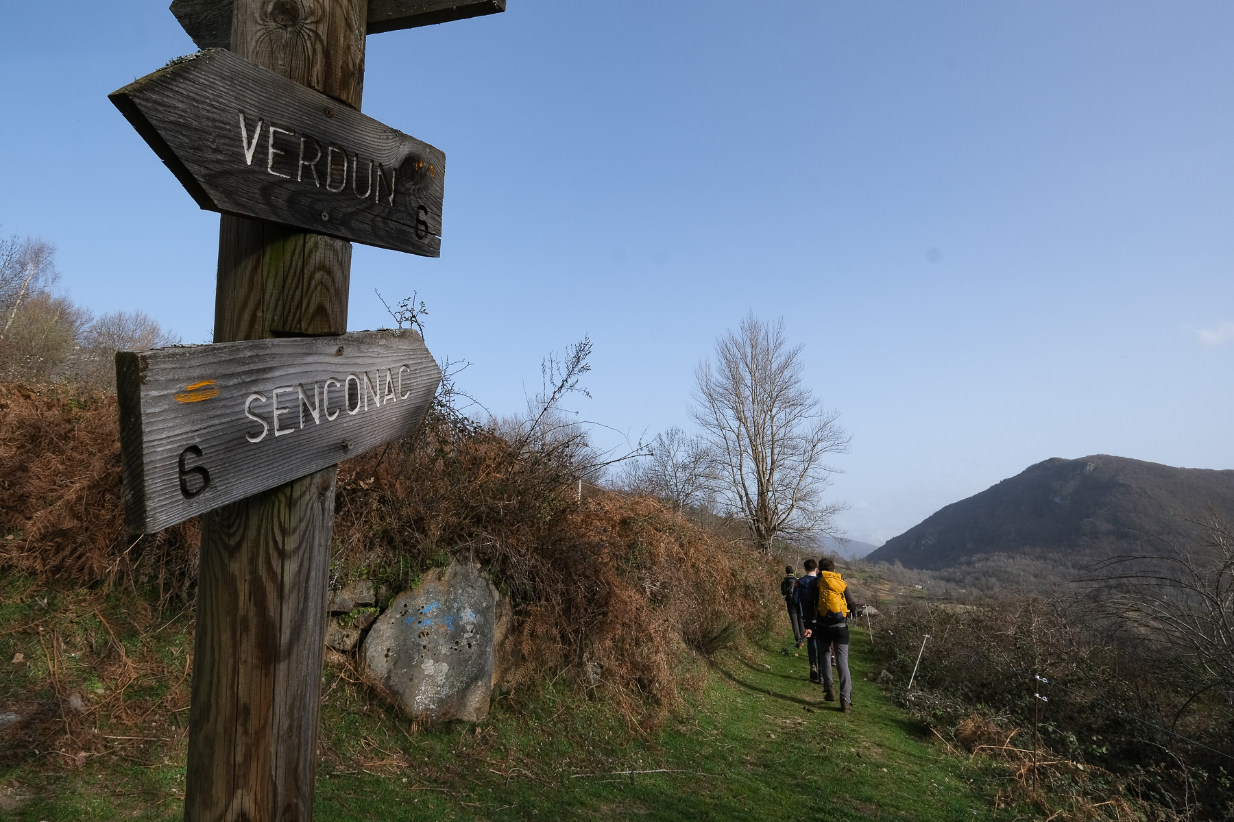
On the N20 between Tarascon-sur-Ariège and Ax-les-Thermes, reach the village of Appy on the Corniche road. If you have 2 vehicles, leave one in Senconac for the return transfer. Otherwise, hitch a ride at the end of the route between Senconac and Appy.
Immediately from the parking lot. The yellow-marked path leads to the Etang d'Appy.
Course
The route combines sections of the PR (yellow), the GRP du Tour du Massif de Tabe (yellow and red) and off-trail sections from the Col de l'Etang d'Appy to the Col de Cadène via the ridges. The physical commitment is high, with both distance and elevation gain. Numerous passages on the crests require the use of the hands and a few steps of climbing/descaling in III/IV- on exposed terrain in places. The presence of snow should not have made this itinerary possible in February, but with the current mild weather, most of the route was dry and the snow passages not too exposed or very short.
Part 1: Col de l'étang d'Appy (2020m, 2h to 2h30)
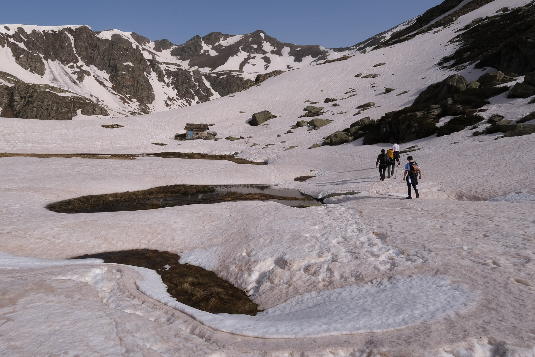
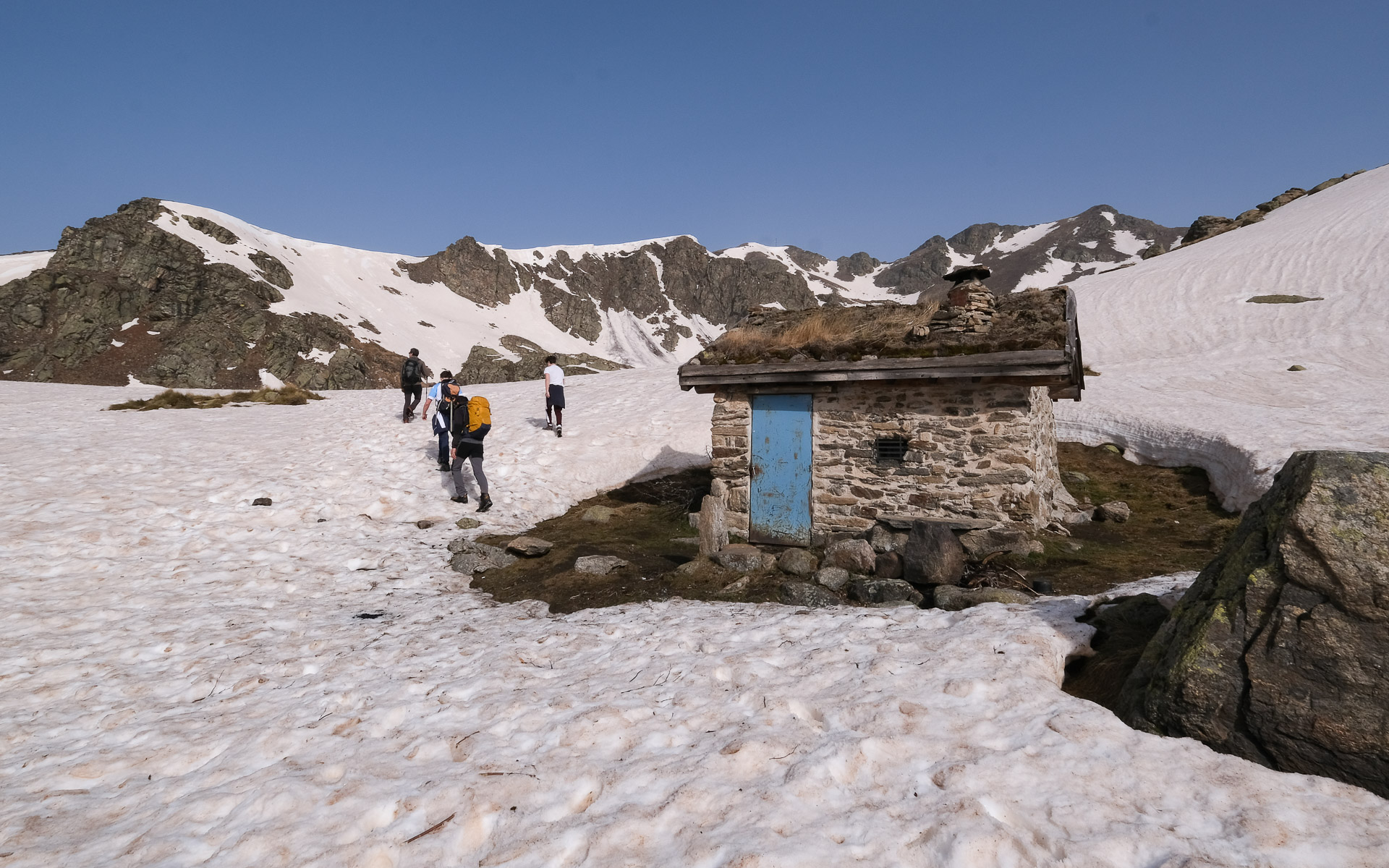
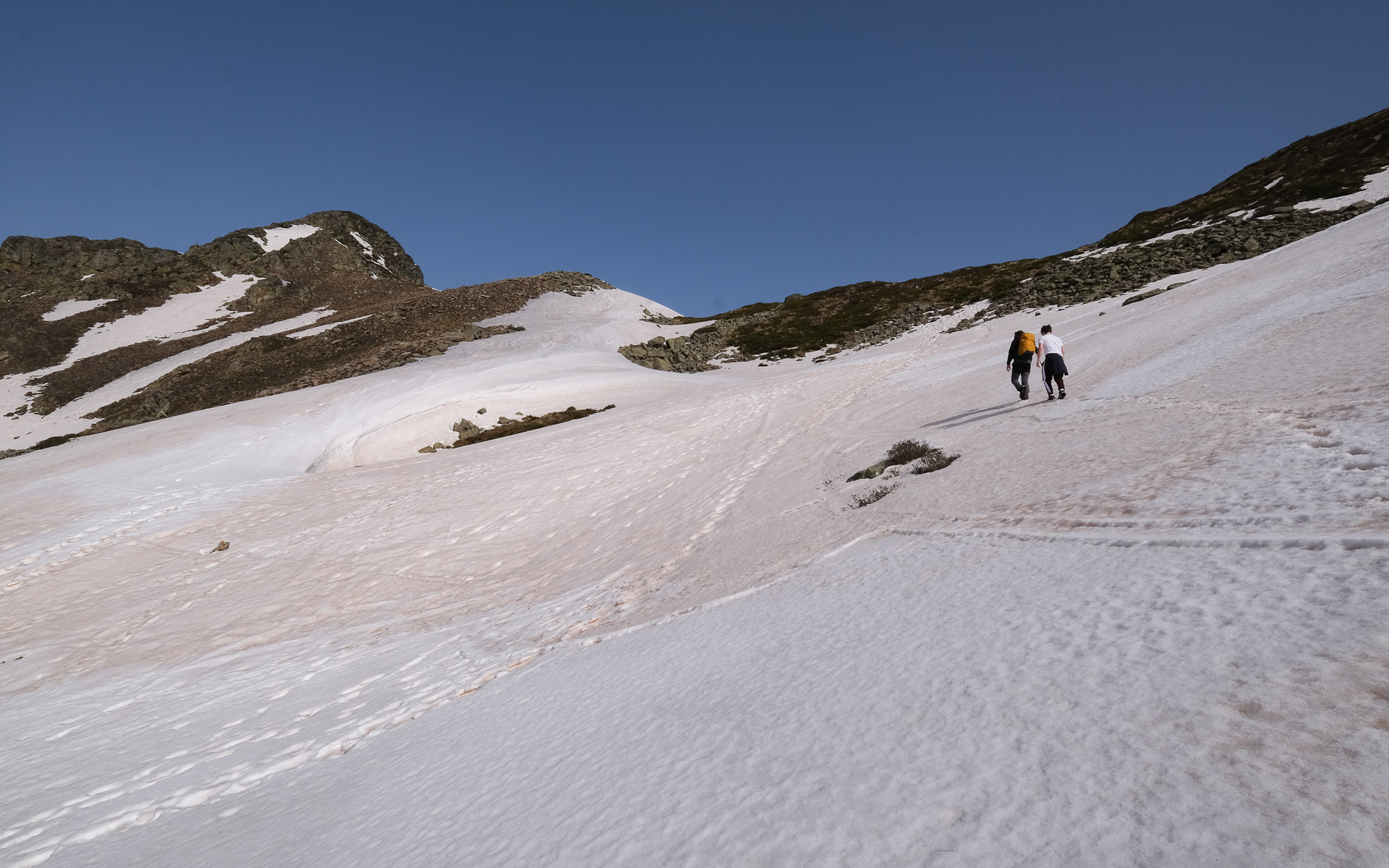
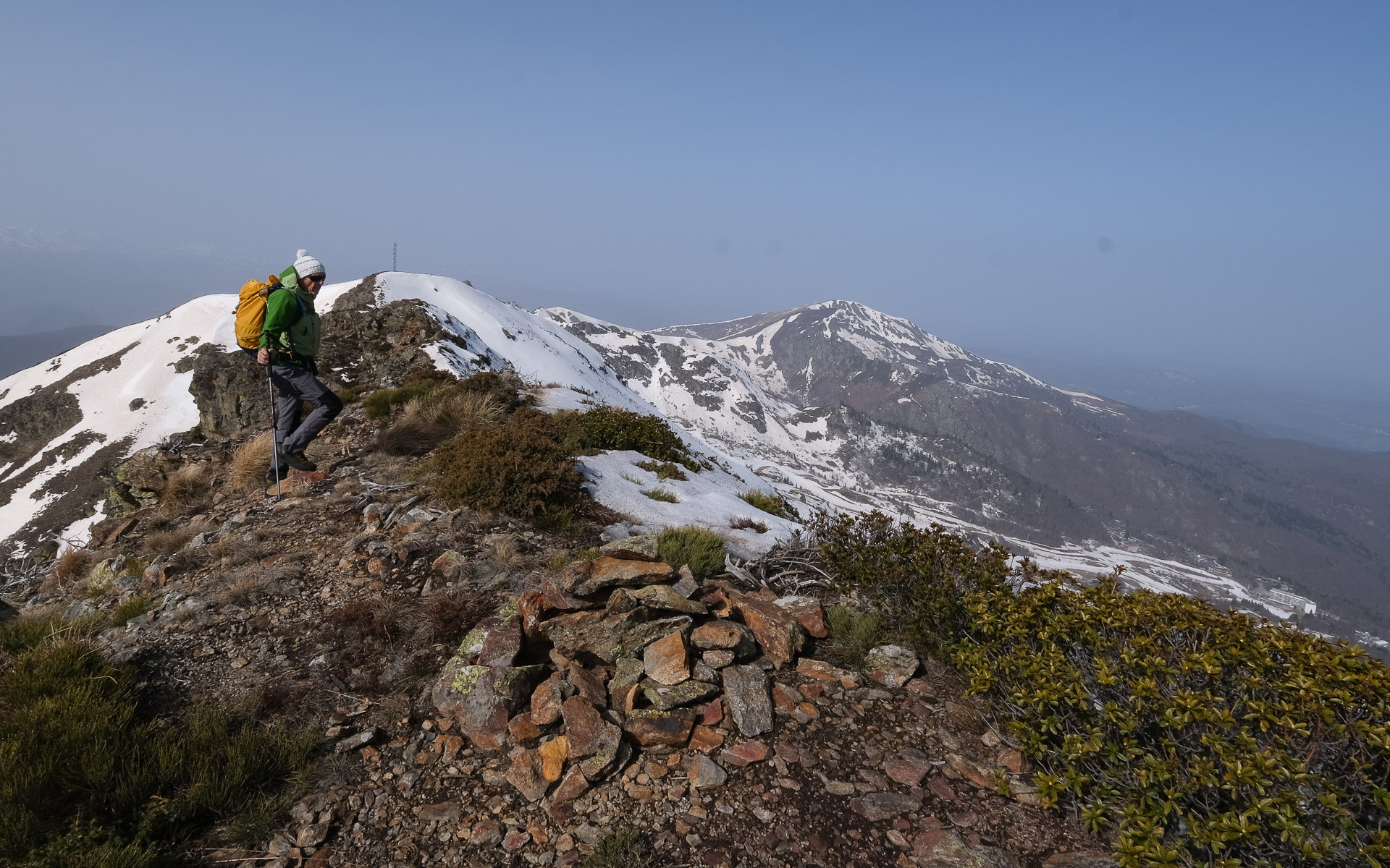
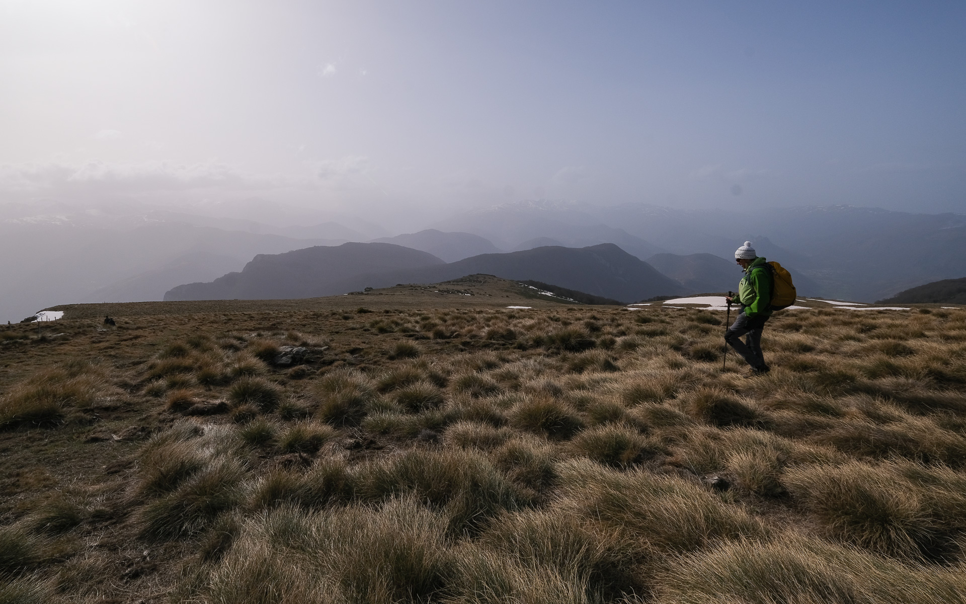
Exit behind the parking lot and begin a long, gradual climb up the eastern flanks of an inland valley. You pass a natural spring gushing out from under the trunk of a large tree. Continue upwards, then the path turns right-angled to the west to join a ridge that drops us into the valley of the Lac d'Appy stream. From here, the trail heads north on a false flat, descending slightly into the Jasse de l'étang d'Appy, where there is a hut. Go past the hut to see the étang d'Appy below on the left, which is largely frozen over today. In front of us is a closed cirque with Pic Galinat at the top left, with its antenna sticking out.
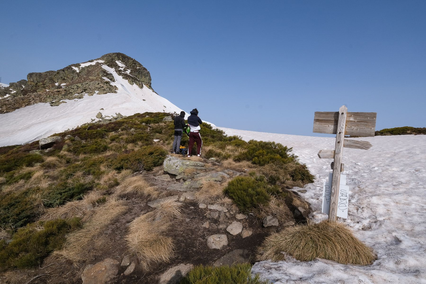
A little further on, we join the GRP (red and yellow) which climbs on the eastern flank, still heading north. It climbs quite steeply towards the pass, which you can soon make out on the right of the ridge. You then come to the Col de l'Etang d'Appy, at 2020m. To the right, the GRP heads towards the Col de Girabal and Pic Saint Barthélémy. To the left, the ridge that leads to Pic Galinat, hidden from the col by a first stony summit.
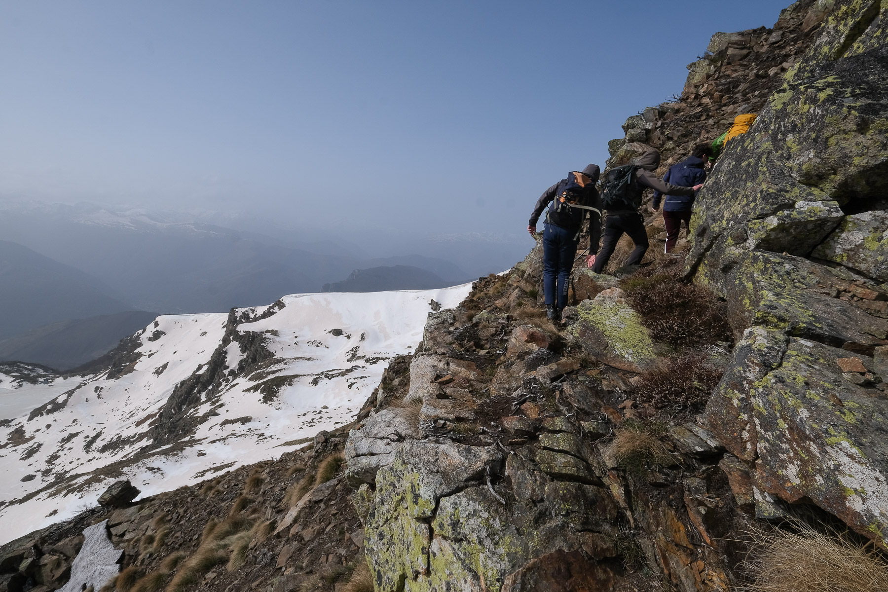
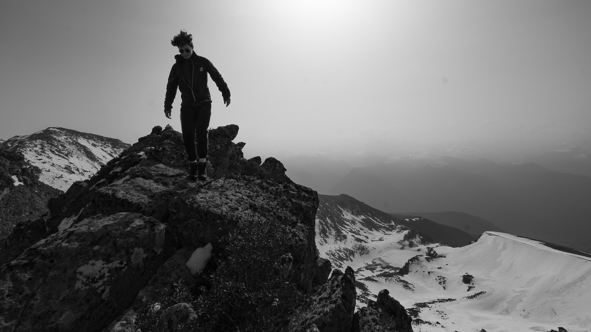
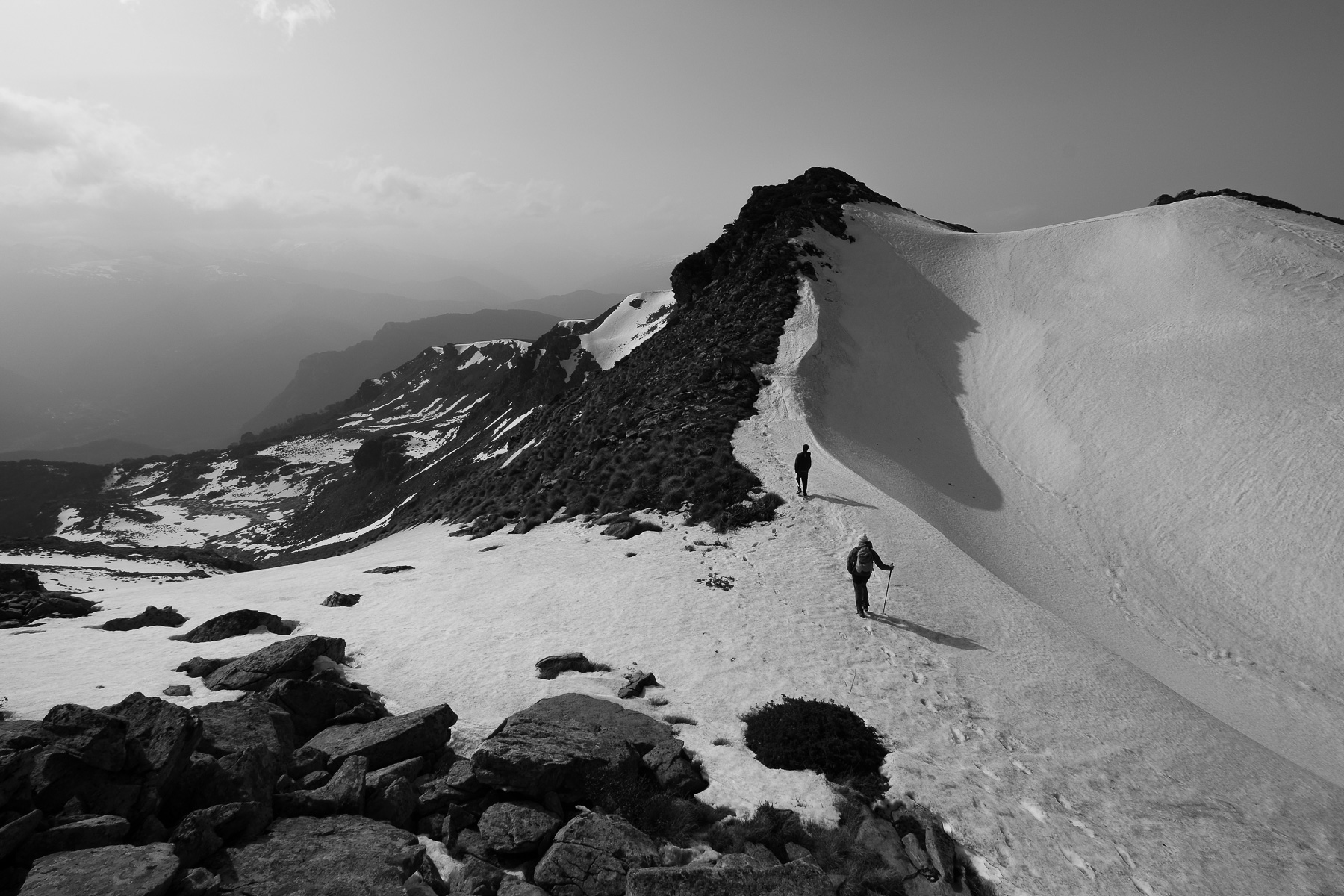
Part 2: Pic Galinat via the South-East ridge (2115m, 1h to 1h30)
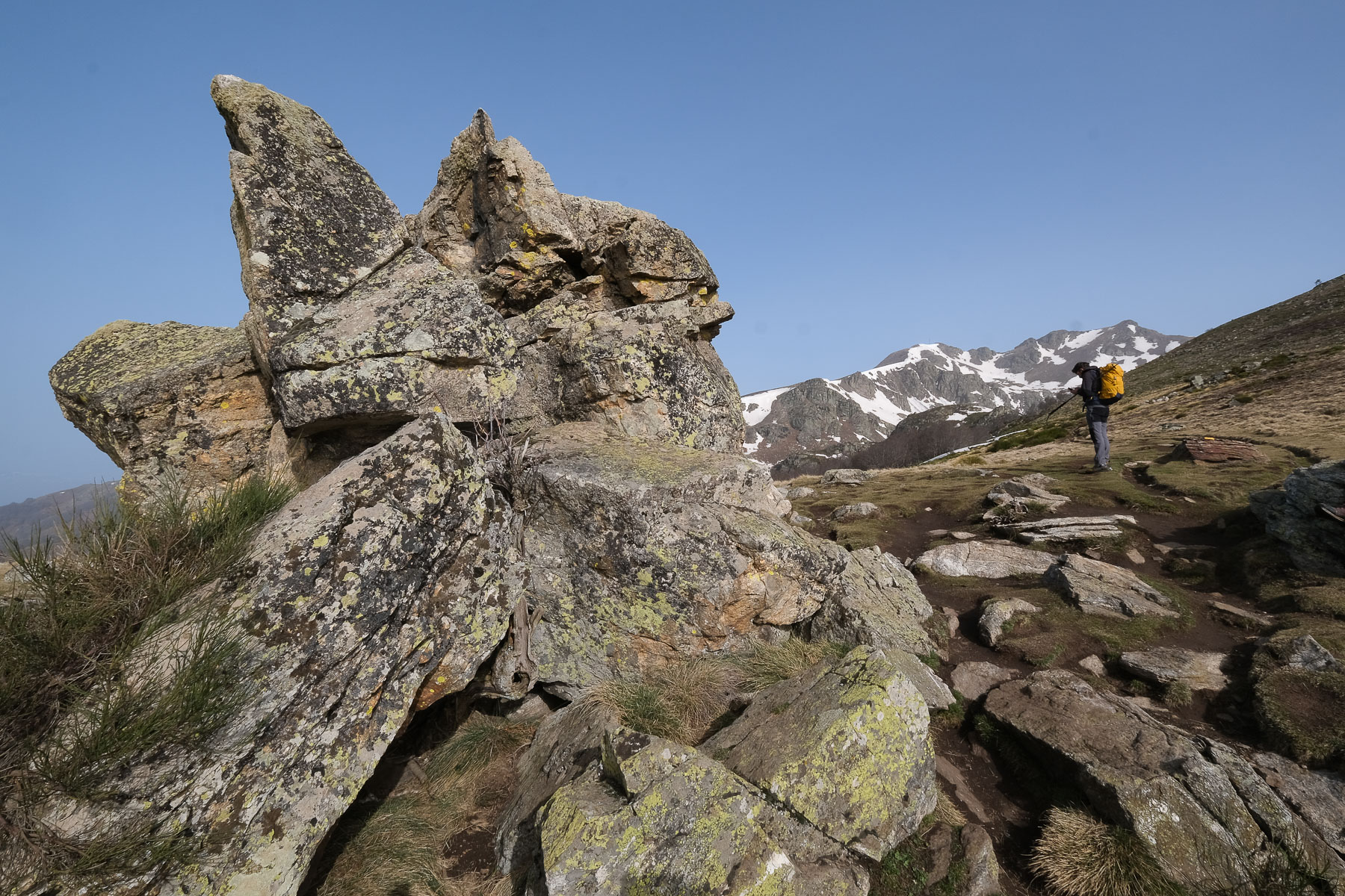
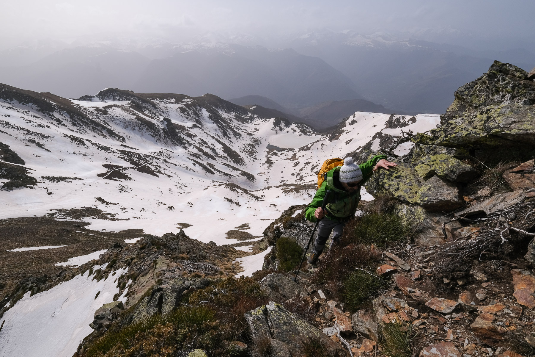
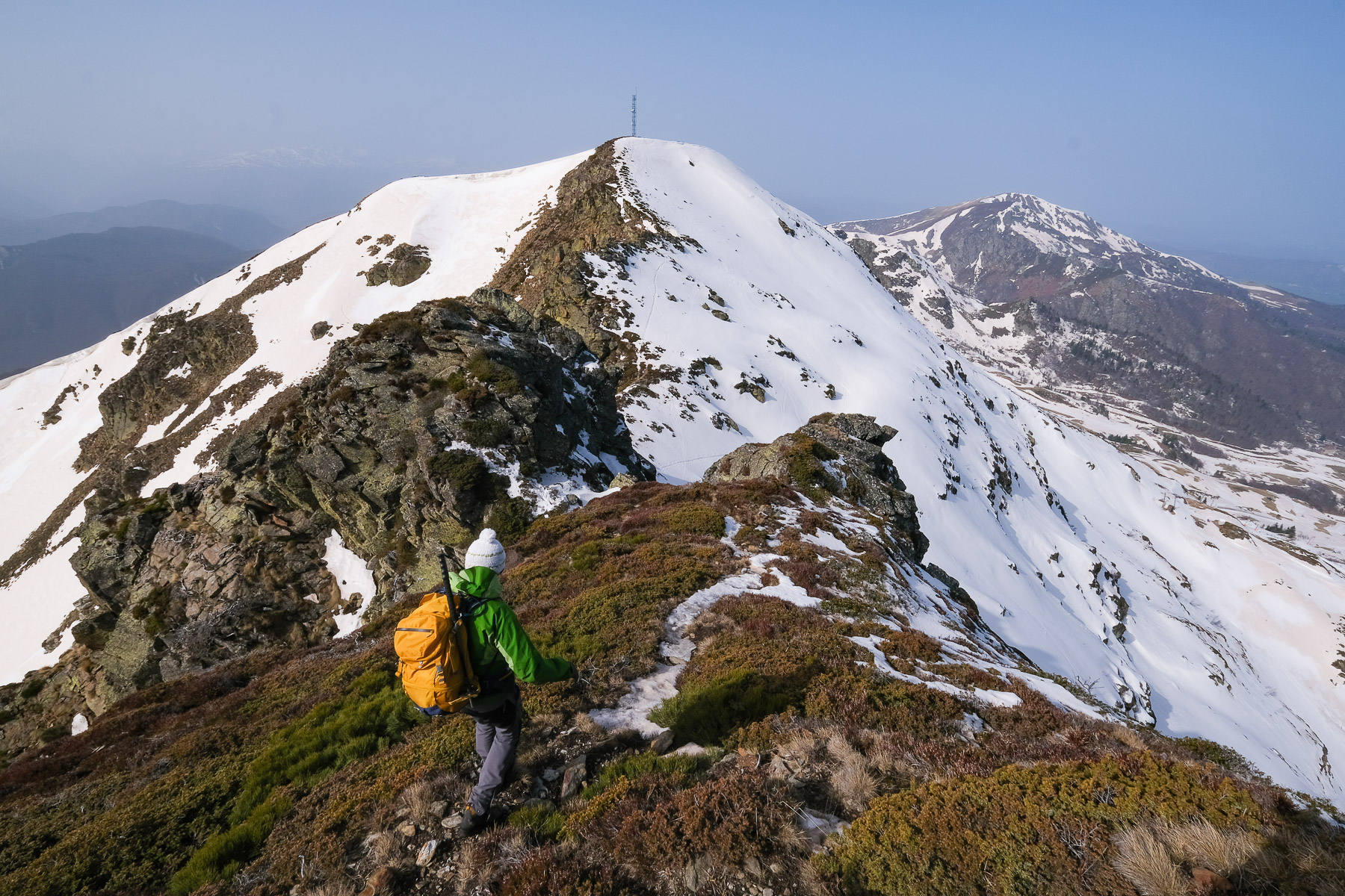
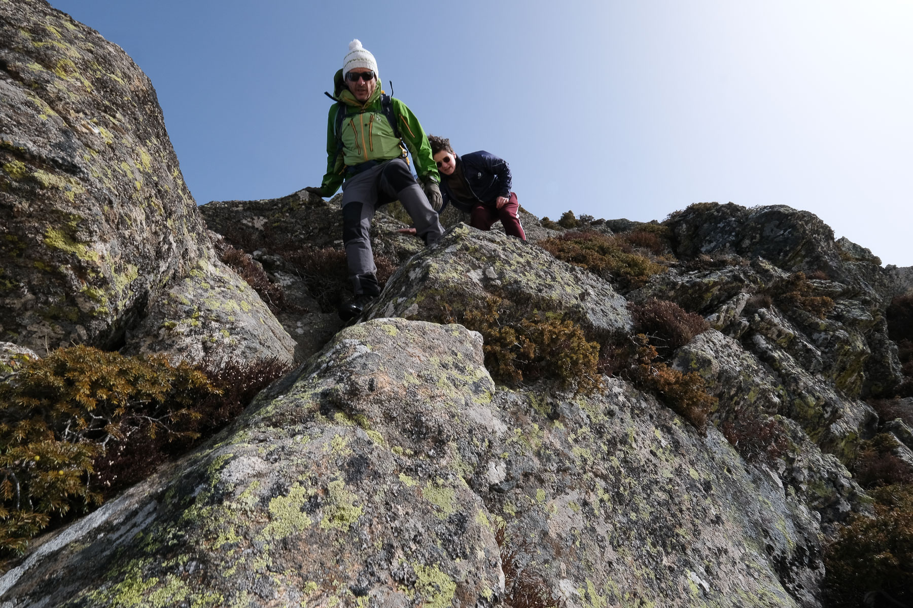
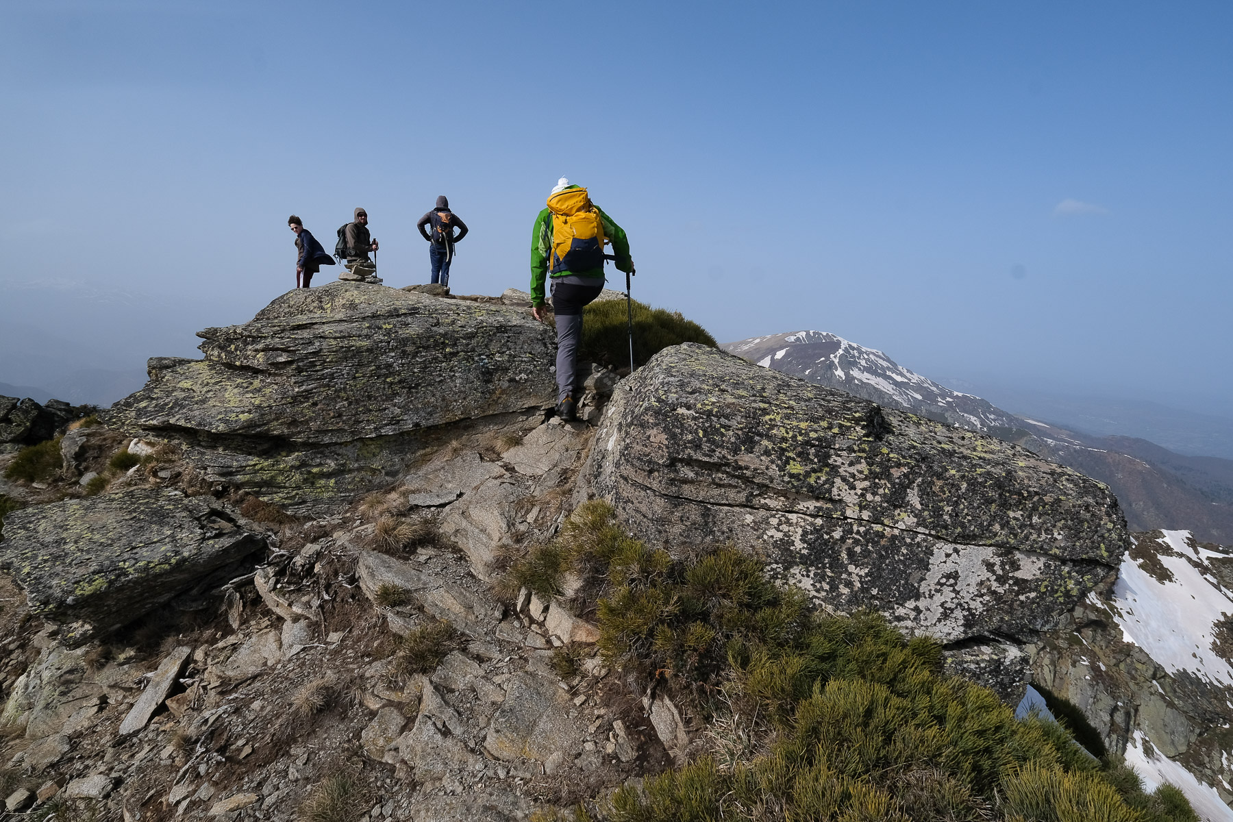
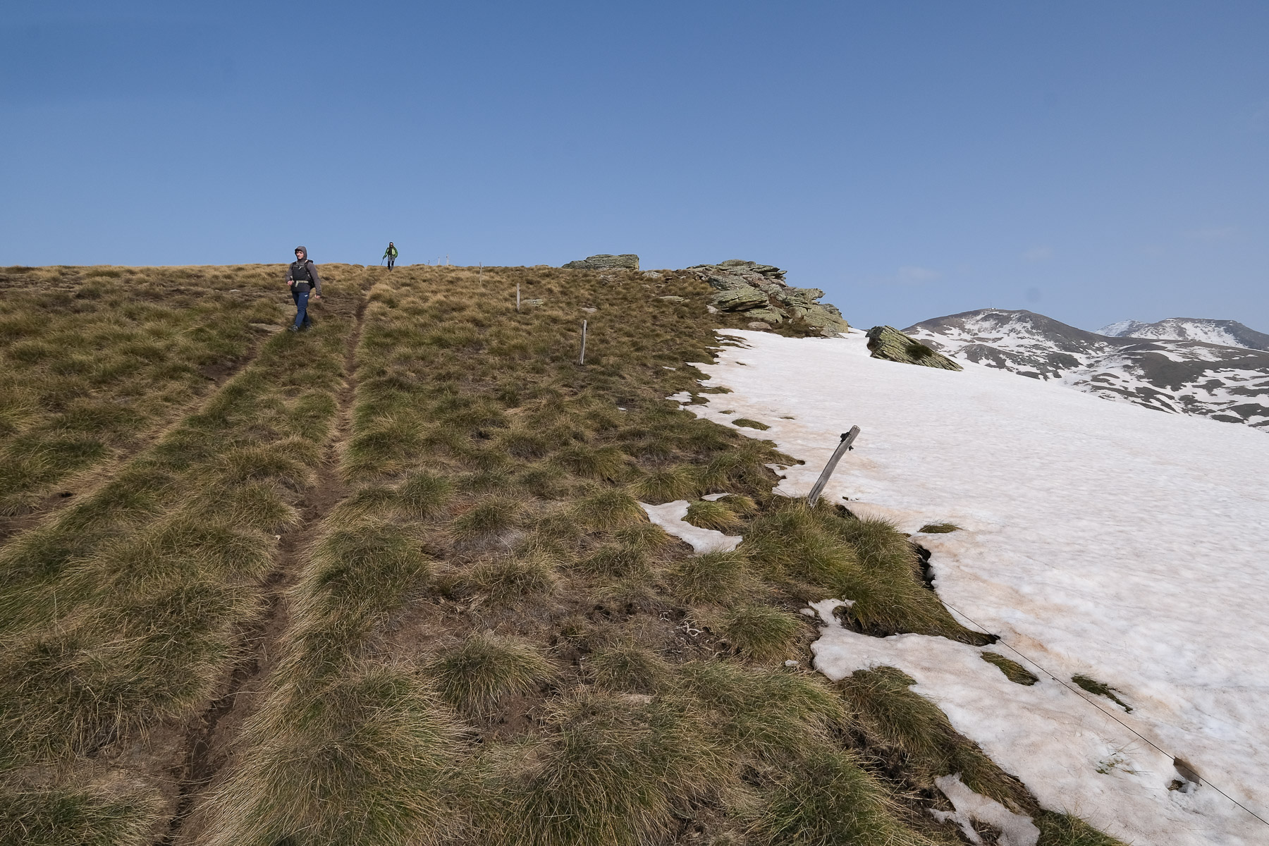
This section is completely off-piste. It's an improvised ridge route, with no major difficulties, but many exposed passages and a few easy climbing steps. Climb the first summit first, or bypass it to the south if the final climb to the rocky head seems too exposed. Descend and continue walking on the gispet-covered ridge. There are narrower passages with gaps on both sides, but you can progress by walking. Climb back up to the end to pass a new promontory and then descend the south face to a mini-collar (small de-escalation). Climb back up, using your hands, to reach a mini-summit again and then de-escalate, improvising on the south side to find more gispet. This time, you can clearly see Pic Galinat ahead and the last section of ridge to cross. Further on, there's another aerial section, but it's not too difficult (see photo). There remains the final ramp to the summit of Pic Galinat below the antenna at 2115m.
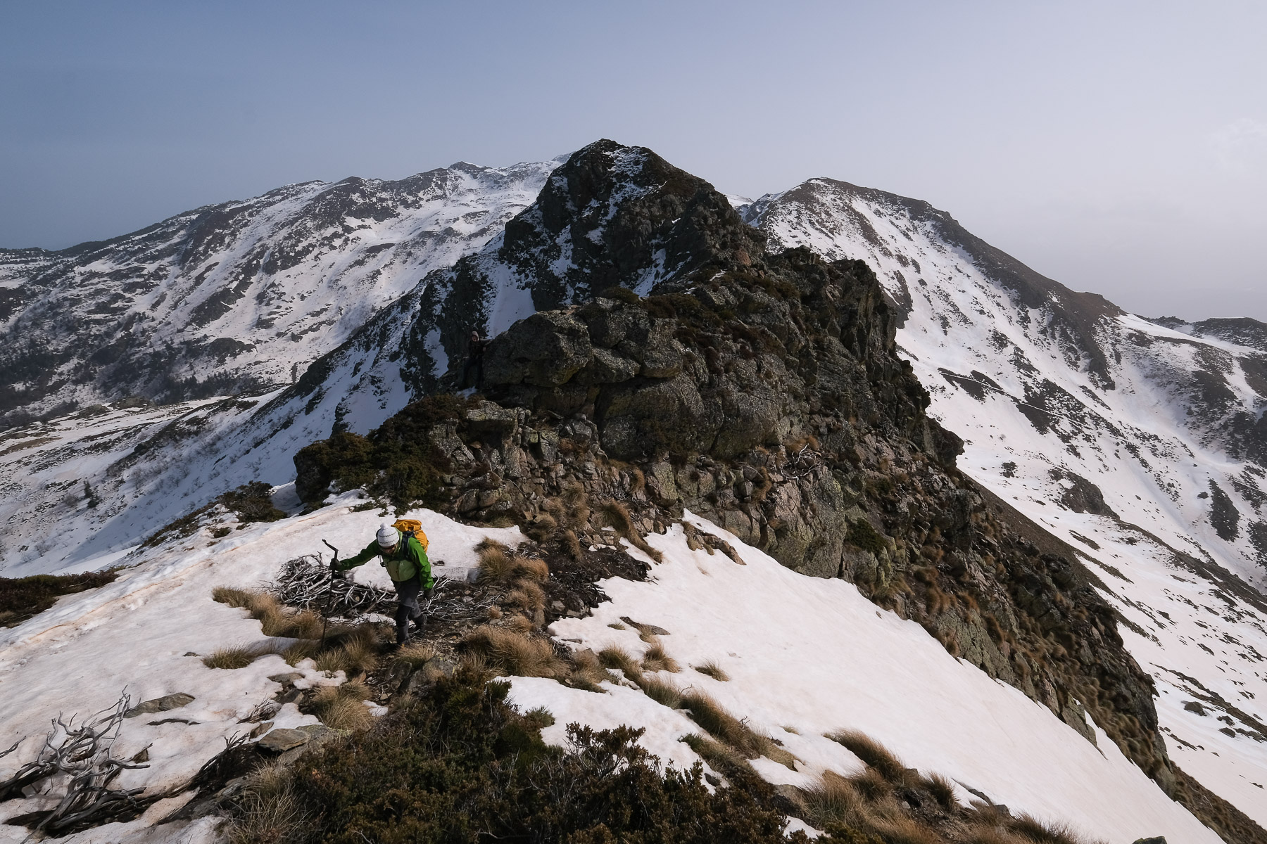
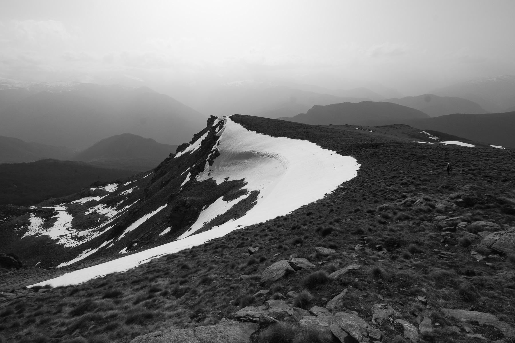
Part 3: Pic du Han via the ridges (2075m, 45' to 1h)
Descending on the other side of Pic Galinat, we can see Pic du Han in the distance, forming a small rocky jag on the next summit. We're still on the GRP, so follow the ridge on foot and descend to the end to reach the Col de Cadène (1955m), where one of the Monts d'Olmes ski lifts ends. Cross the pass and head uphill, following the red and yellow GRP signs. The route climbs steeply and over airy sections to reach the summit of Pic du Han fairly quickly. From here, the panorama widens to the west, with Mont Fourcat appearing at the very end of the Massif de Tabe range.
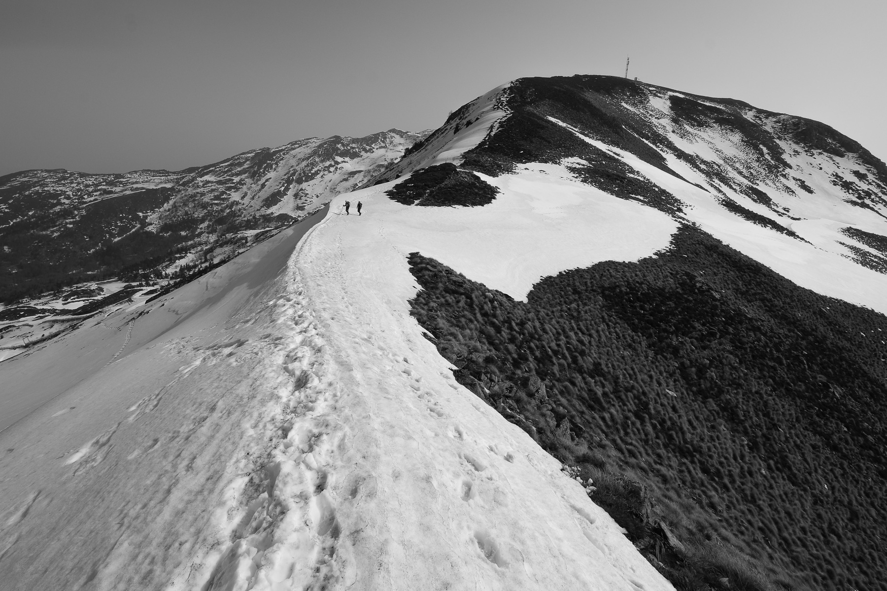
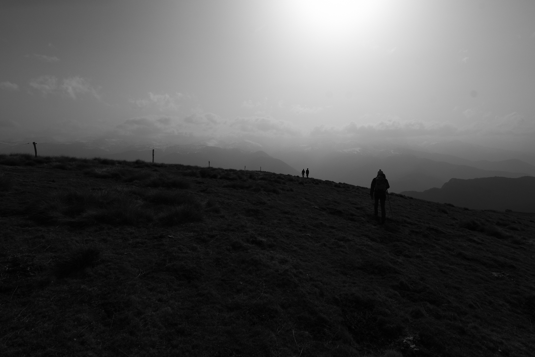
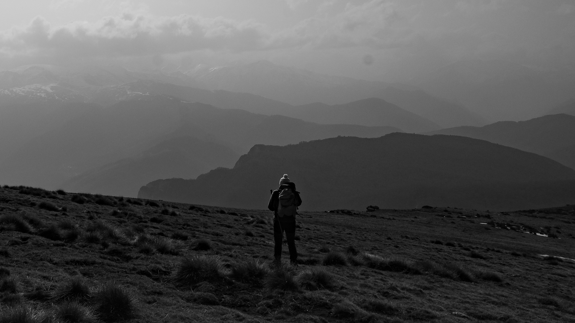
Part 4: Roc de Lauzate plateau (1h15 to 1h30)
Descend to the west, staying on the rocky ridge. The GRP trail passes to the south to cross the gispet slopes, then runs gently to the Col du Han. Cross it again to the west and climb slightly to reach the large gispet plateau to the south. Turn off at this point and leave the GRP. Descend following a small, clearly visible but unmarked path (not seen?). You soon come to the bars on the east side overlooking the Estagnolette valley. Go along the edge and further down find traces of a 4-wheel track in the gispet. You then follow a fence. The path then turns west at Roc de Lauzate. Continue down a gentle slope, with fine views of the Pyrenees and the Ax valley. A few hairpin bends further down, vegetation reappears and the path finally joins a forest track. End of the trail.
Back
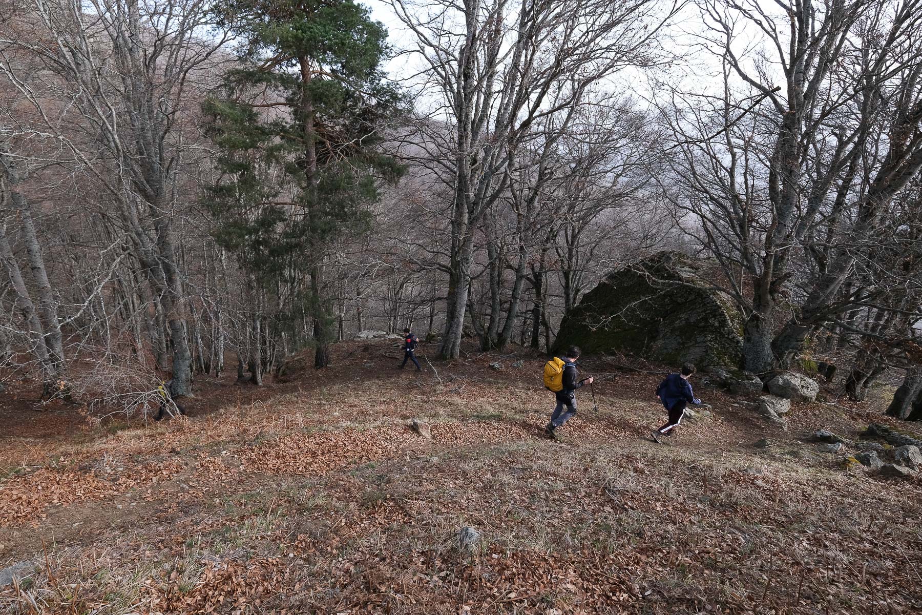
Follow the forest track, which bends sharply to head east again. The track descends gently and crosses with beautiful views of the Verdun valley, the back of the Quié de Sinsat cliffs and the Pyrenees in the background. Pass under a small hut and a little further on, at a right-hand hairpin bend, take a path down into the forest (cairn clearly visible). Then begins a long, winding descent under the trees, not too unpleasant as the gradient is not too steep. Much further down, you pass a forest house set into a boulder, then the path continues downhill close to the Ruisseau des Molines, which you can hear. At the very bottom, cross the stream on a wooden bridge and continue along the path until you come to the Route des Corniches. Walk along the road to the left and at the end of a straight stretch, take the final yellow-marked path which climbs a little and then crosses over the road to end in the hamlet of Senconac. End of trail.
Monte Rotondo, Melo and Capitello, Corte 5 August 2017 From the Restonica Valley, climb Corsica's second highest peak, Monte Rotondo at 2622m, and return via the…


 Partager sur WhatsApp
 Partager sur Twitter
Partager sur Instagram
Partager sur Twitter
Partager sur Instagram

 Partager sur Facebook
 Imprimer le topo
 Laisser un commentaire


![2017-08-05_13-35-40 [Monte Rotondo]](https://climbing7.com/wp-content/uploads/2017/09/2017-08-05_13-35-40-monte-rotondo-1024x683.jpg "Monte Rotondo, Melo and Capitello, Corte")


Leave a Reply