

TOPO Climbing | CLIMBING7.COM
Publié le

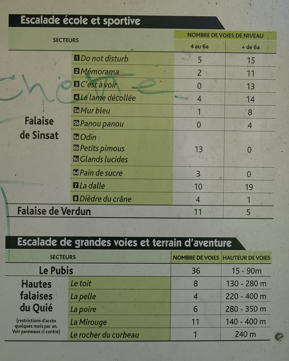
At the entrance to the Ax valley, between Tarascon-sur-Ariège and Les Cabannes, the Quié de Sinsat cliffs rise up in shades of gray and orange, in stark contrast to the verdant surroundings of the Haute-Ariège forests. South-facing, they offer incredible climbing potential in almost all seasons. The Club Alpin Français des Montagnards Ariégeois (CAFMA) lists a large number of equipped rises and long routes on their website. The Quié is divided into 2 main sectors: Quié de Sinsat 1, with the sport climbing zones at the bottom and the upper level on the west side, and Quié de Sinsat 2, which includes the upper zones on the east side. Well-frequented because of its easy access, the Sinsat cliffs offer numerous routes from level 4 to 7c+. There's something for every level, and the often sunny location is ideal for a great day's climbing!
❱❱ Technical summary
Type ✦ Sport climbing (rind)
Location ✦ Quié de Sinsat, Sinsat
Region ✦ Haute-Ariège
Country ✦ France
Direction ✦ South
Routes ✦ 4a to 7c+
Rock ✦ Limestone
Equipment ✦ Mainly sealed pins
Interest ✦ ★★★
❱❱ Access to the place
On the N20 between Tarascon-sur-Ariège and Les Cabannes, in the small village of Sinsat, turn north towards the cliffs along the route de Padalis. Cross the Ariège on a sky-blue metal bridge and park on the right in the climbers' parking lot.
❱❱ Map & topo


❱❱ Itinéraire
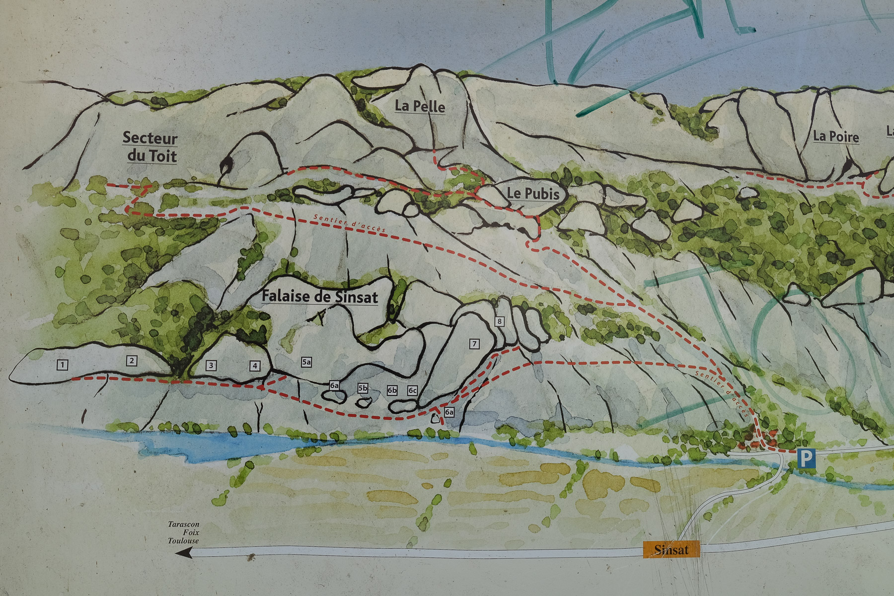
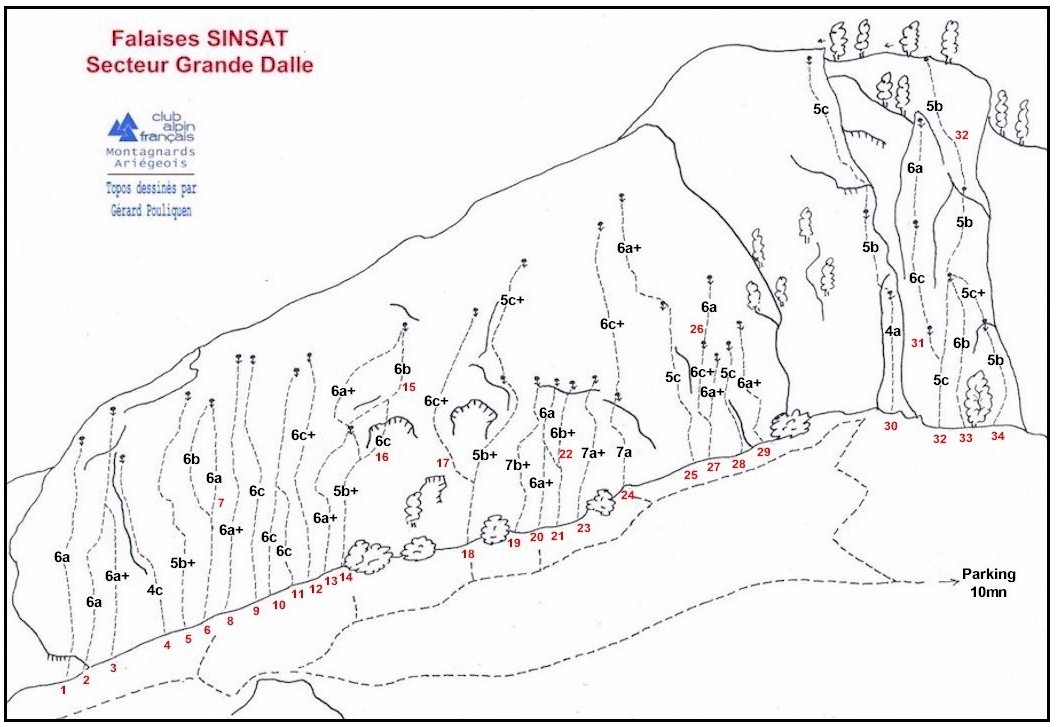
From the parking lot, return to the bridge and continue along the small road on the right bank of the Ariège. After a few dwellings, you'll find the path on the right that leads up to the climbing areas (signposted). Climb steeply for about 10 minutes and you're at the fork: straight ahead to the upper sectors (Pubis in particular) and left to the Sinsat cliffs (Grande Dalle and Lac). Another 10-minute traverse, this time slightly uphill then downhill, leads to the foot of the distinctive Grande Dalle. Continuing eastwards along the wall, we find the other sectors. Further down, a small fork leads back up to Odin (the easternmost sector of Les Couennes) and Le Lac further on.
The routes described below are those we tested during our climbing sessions. New routes will be added as we discover them. So far, the equipment in place is very good: fairly close points (usually sealed pins), belays equipped and chained, and any suspect rock protected. The rock is excellent, with a slight patina in places on the most accessible routes. The foot of the routes are between sun and shade, as they are close to small shrubs. All routes face south or south-west in some sectors.
The routes are described from left to right in each sector. Lengths and ratings are those of the CAFMA topos, except for some routes where we have a slightly different assessment.
Please note that access to certain sectors may be restricted at certain times of the year. See signpost at parking lot.
Simply an approach path in the opposite direction.
All climbing guidebooks from CAFMA, Club Alpin Français des Montagnards Ariègeois.
Leave a Reply