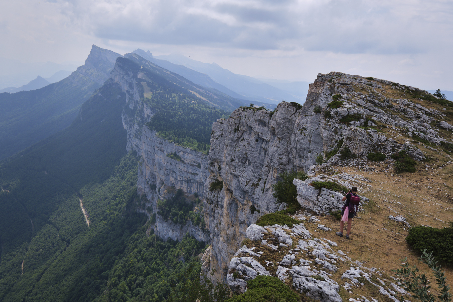
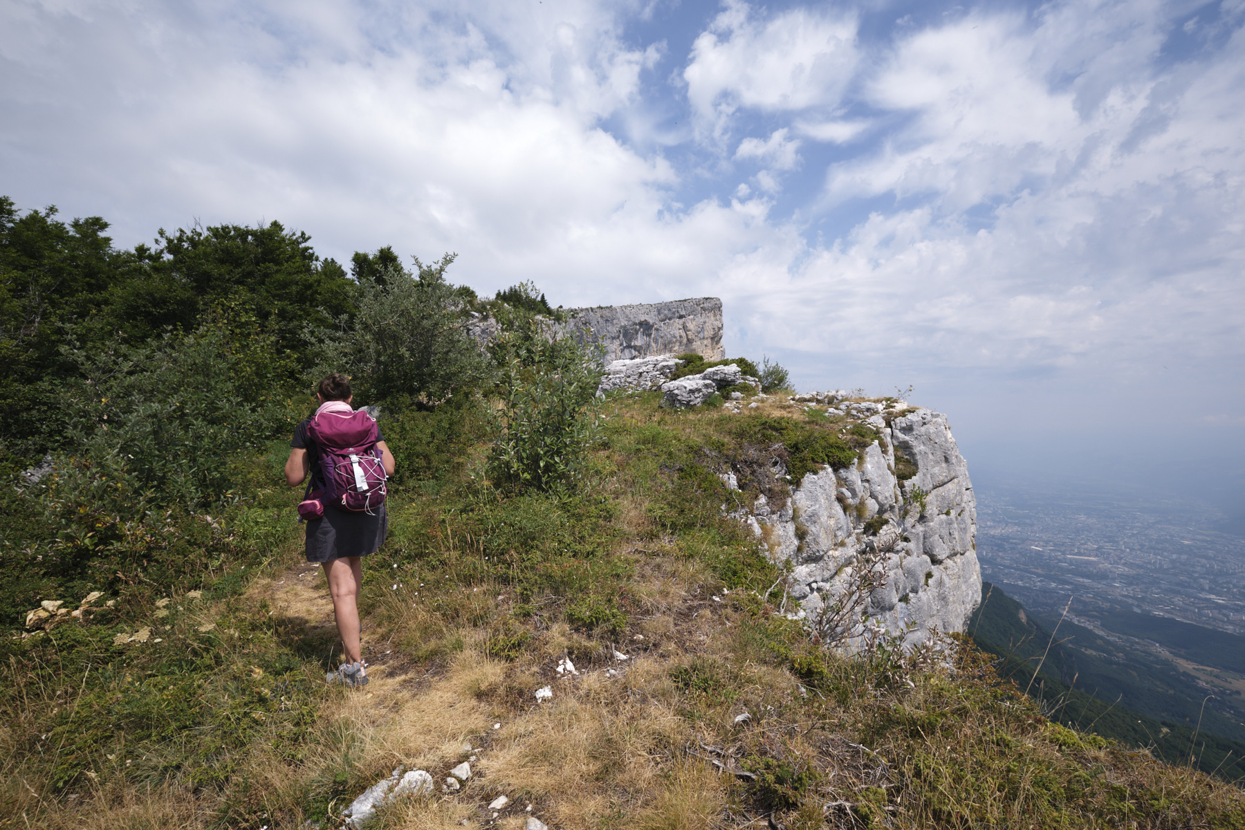
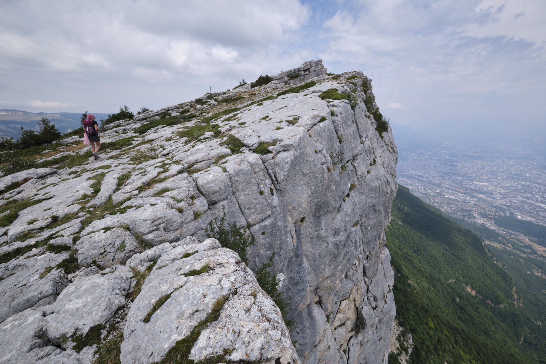
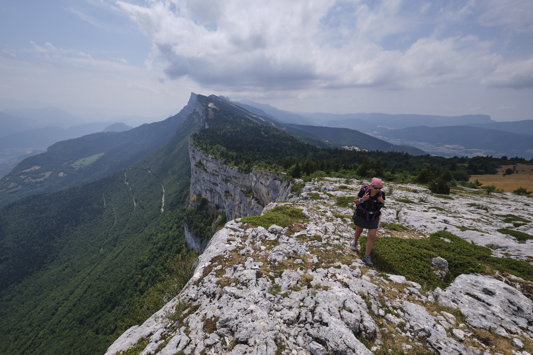
Climb the crests of the Vercors just a few meters above sea level and admire the cliffs overlooking the city of Grenoble, with a view of the Écrins? That's the hike proposed here, in the northern Vercors. While the difference in altitude and the distance may seem reasonable, the loop is substantial, with progress along the rocky ledges of the cliffs not so rapid, and a fairly steep return as you continue along the ridges past Moucherotte. On the other hand, if you avoid the most popular trails, notably the GR de pays, you'll find yourself virtually alone for the whole route. An added bonus is the descent into the trou Saint-Michel, which leads to a cliff-side ledge. The ridge route poses no technical problems, and you can easily adapt the distance to the void to suit your sensitivity. The aerial views over the valley and the string of cliffs that form great vertical undulations thrusting forward are incredible and spectacular all the way. Many thanks to Patrick Sombardier, from whom we obtained the original topo!
❱❱ Technical summary
■ S tarting point: hameau des Volants, south of Saint-Nizier-du-Moucherotte, north of the Vercors massif, Isère (38)
■ Type of route: mid-mountain loop hike
■ Distance: 11.5 km
■ Cumulative elevation gain: +850 m
■ Cumulative negative altitude gain: -850 m
■ Estimated total time: 5h to 6h30 ■ Min and max altitude: 1130 m / 1901 m
■ Marking: combination of marked trails for ascent and descent, route on the ridge on a marked but unmarked trail
■ Equipment in place: none
■ Equipment required: GPS track useful, 20m rope optional if descent into trou Saint-Michel
Difficulties: to reach the Pas de la Bergère, there are 2 or 3 places where you have to put your hands to progress (III-). The trou Saint-Michel is optional, but the descent can be made free (III+) or with a rope (20m). The ridge poses no problem, but the void is very present on the east side. A few short passages close to the edge are compulsory. A section of descent below Moucherotte (return) is fairly steep and broken up.
❱❱ Access to the place
The start is in the hamlet of Les Volants, on the D106 between Lans-en-Vercors and Saint-Nizier-du-Vercors. It's not easy to park as there's no parking or roadside space nearby. In the alleyway leading down to the start, there's a seemingly abandoned space where you can park your car. Otherwise, in the street that runs perpendicular to the road, past the garbage cans.
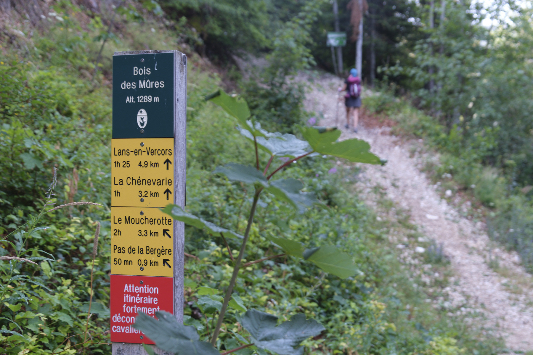
1st part: from the parking lot to Pas de la Bergère and Abri des Ramées (2h to 2h30)
Climb the narrow path that leaves the road and joins the Bois de Mures trail. It climbs up through the forest, quite steep in places, and ends up on the track at Les Clots. Then turn right (you'll come back on the left).
Follow the track until you reach the junction for Pas de la Bergère on the left (signposted). It climbs up through the forest and then reaches rocky ground. A few hand-over-hand sections, a rocky corridor to cross and you're out on the upper plateau. Continue on the path, which climbs much more gently through the undergrowth, sometimes in the open, until it crosses the GR 91 on a wide track. The ridge is then visible on the left.
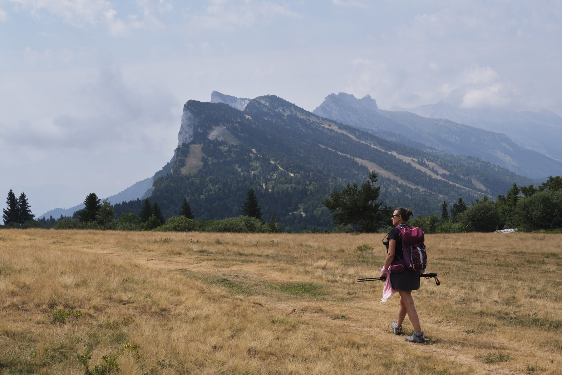
Cross it and continue on the GR, rising slightly to the right. You come out onto a large grassy plateau with a superb view of the Pic Saint-Michel and the walls further south. The path then descends gently to reach the Habert des Ramées. Continue downhill and after a stony area on a flat spot in a clearing, go left at 90° on a barely visible path. You go deeper into the forest and the little blue dots on the rocks on the ground confirm the right direction. The path soon reaches the edge of the cliffs, where you'll find the trou Saint-Michel.
Option: descent into Trou Saint-Michel (15')
Its location on the IGN map is not exact. It's at the end of the path as you come to the edge of the cliff, where you'll find the sign "Scialet Chaise du Ranc du Buis". There's a tree and belay points to place an aid rope. We can de-escalate without too much difficulty, but the rock is patinated (III+). At the bottom of the 2 projections, we exit through a hole in the cliffside to admire the walls. Climbing back up is no more difficult before attacking the ridge, continuing to follow the blue dots.
Part 2: South ridge from Grande Roche Saint Michel to Moucherotte (1h30 to 2h)
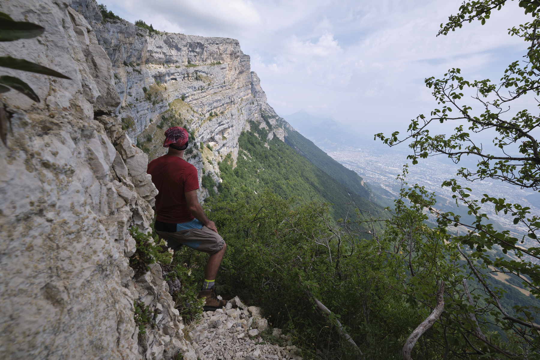
Follow the cliff-edge path, initially marked with blue dots. It climbs back up with the first superb views of the walls and Grenoble below. The path then leaves the wooded areas to climb up a first rock overhang. The blue dots get lost, especially if you stay close to the void. The rest of the route alternates between flat and false-flat sections, following the undulations of the walls and always staying on the ridge. No difficulties to overcome. You gradually return to the level of the junction with the GR from the outward journey. Continue in the direction of Moucherotte in the distance, which you can recognize with its small weather station at the summit. The end of the ridge, which is more wooded, is less easy to climb, so you can join the GR, which runs parallel to the ridge below, before finishing at the summit of Moucherotte.
3rd part: the Crête Nord, the Pas de la Cheminée and return to the parking lot (1h30 to 2h)
Not easy to orientate, but GPS track very useful. Pass behind the Moucherotte weather station and descend to the grassy platform at an angle above Grenoble. Follow the ridges for a while before rejoining the main trail, which runs a little lower on the left and is clearly visible. Further on, a steep, uneven section begins. At the bottom, take the track on the right, fork left downhill and then right into the forest. Follow this for a while to find the Pas de la Cheminée, a small rocky couloir with no difficulties (wooden sign at the top). At the bottom of this couloir, follow left, then left again, to finally descend to the track leading to Les Clots.
Once back on the Bois des Mures track, walk a little to find Les Clots and turn right down to the road where you parked.


 Partager sur WhatsApp
 Partager sur Twitter
Partager sur Instagram
Partager sur Twitter
Partager sur Instagram

 Partager sur Facebook
 Imprimer le topo
 Laisser un commentaire


Leave a Reply