Le Haut Bouffet, between the Tête et Roc de Garnesier and the Tête de Vachères, lies at the end of a long, airy ridge, the Crête du Vallon, which overlooks the splendid Vallon des Aiguilles. Not only does this route offer superb panoramic views of Dévoluy and beyond, it is also a very seldom-visited route, unlike the much-traveled Aiguilles valley. While the distance and elevation gain are reasonable, the off-trail route on the ridge requires attention, particularly when avoiding an impassable rocky section. A beautiful loop starting from Col du Festre, in the southern Devoluy.
❱❱ Technical summary
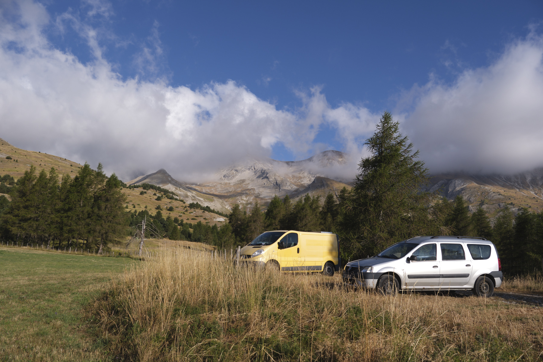
■ Departure point: Serre Noir parking lot, Col du Festre, Dévoluy, Hautes-Alpes (05)
■ Type of route: high-mountain loop hike
■ Distance: 10 km
■ Cumulative elevation gain: +620 m
■ Cumulative negative altitude gain: -620 m
■ Estimated total time: 4h to 5h ■ Min and max altitude: 1500 m / 2161 m
■ Markings: GR 94 except on the crest with a cairned trail
■ Equipment in place: none
■ Equipment required: none
Difficulties: avoiding the walls on the south-west side of the ridge is tricky and a little exposed, as is the start of the final ascent of Haut Bouffet.
❱❱ Access to the place
Go to Col du Festre on the D 937, north of Veynes, south of Corps. At the pass, take the track heading west and park at the small Serre Noir parking lot a little further up. We're at around 1500m.
❱❱ Map & topo
The route of the avoidance section on the ridge is indicative. It is located at around 2000m and is clearly visible when it becomes very rocky. The exit follows the small cairns and the fairly visible trail.
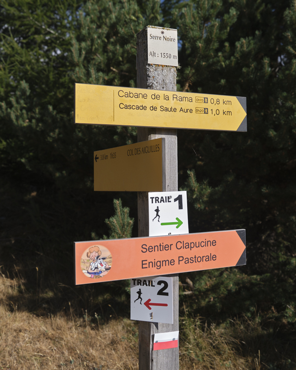
Leave the parking lot and follow the track past the barrier. Go through a second barrier to find the signpost. Go straight ahead on the GR 94 de pays Tour du Dévoluy towards the Col des Aiguilles. Climb up and the GR bends to the south to quickly reach the Bachassous basin, where there's a pretty little hut. Here, the GR continues to the right towards the top of the Saute Aure waterfall, the return route. To rejoin the ridge, pass above the hut and climb off-trail to the south-west in a small grassy valley.
Part 2: The ridges and Haut Bouffet (2161m, 1h30 to 2h)
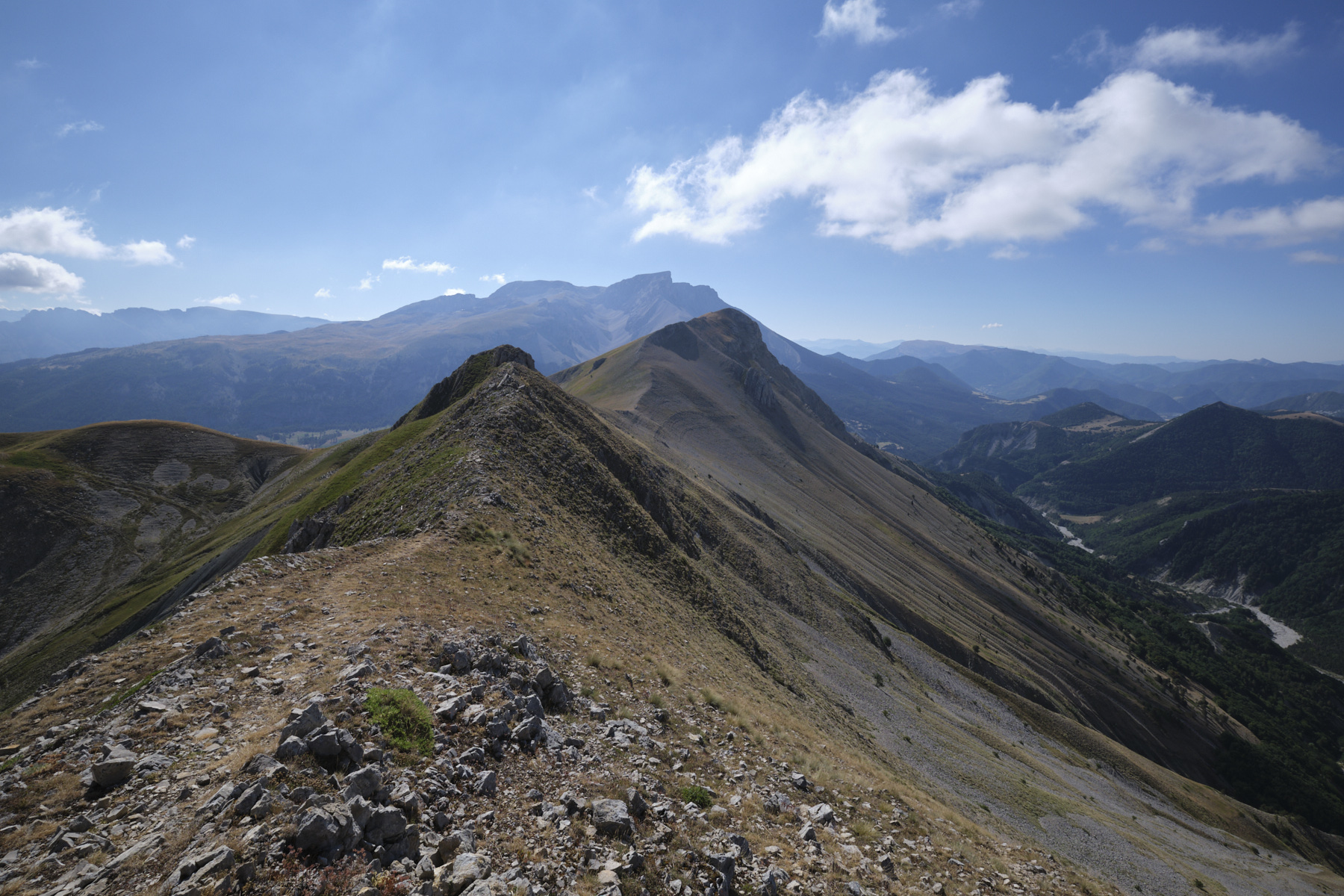
Climb the grassy valley without difficulty. Higher up, the carcass of an old shelter catches the sun. Continue along the valley and climb until you reach the wide Col de Darne at 1933m. We're on the crest. The view to the south-west is already spectacular, with the Tête and Roc de Garnesier opposite.
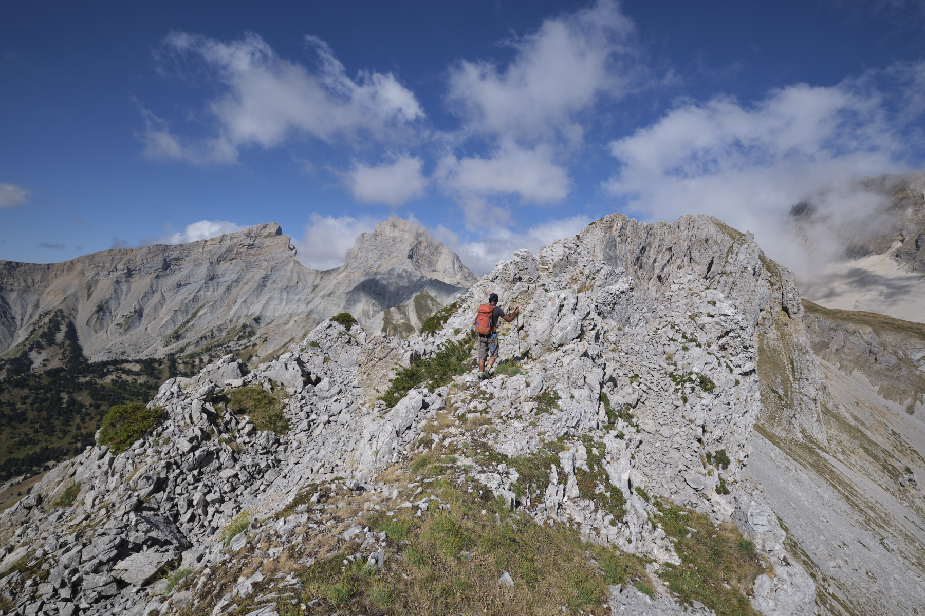
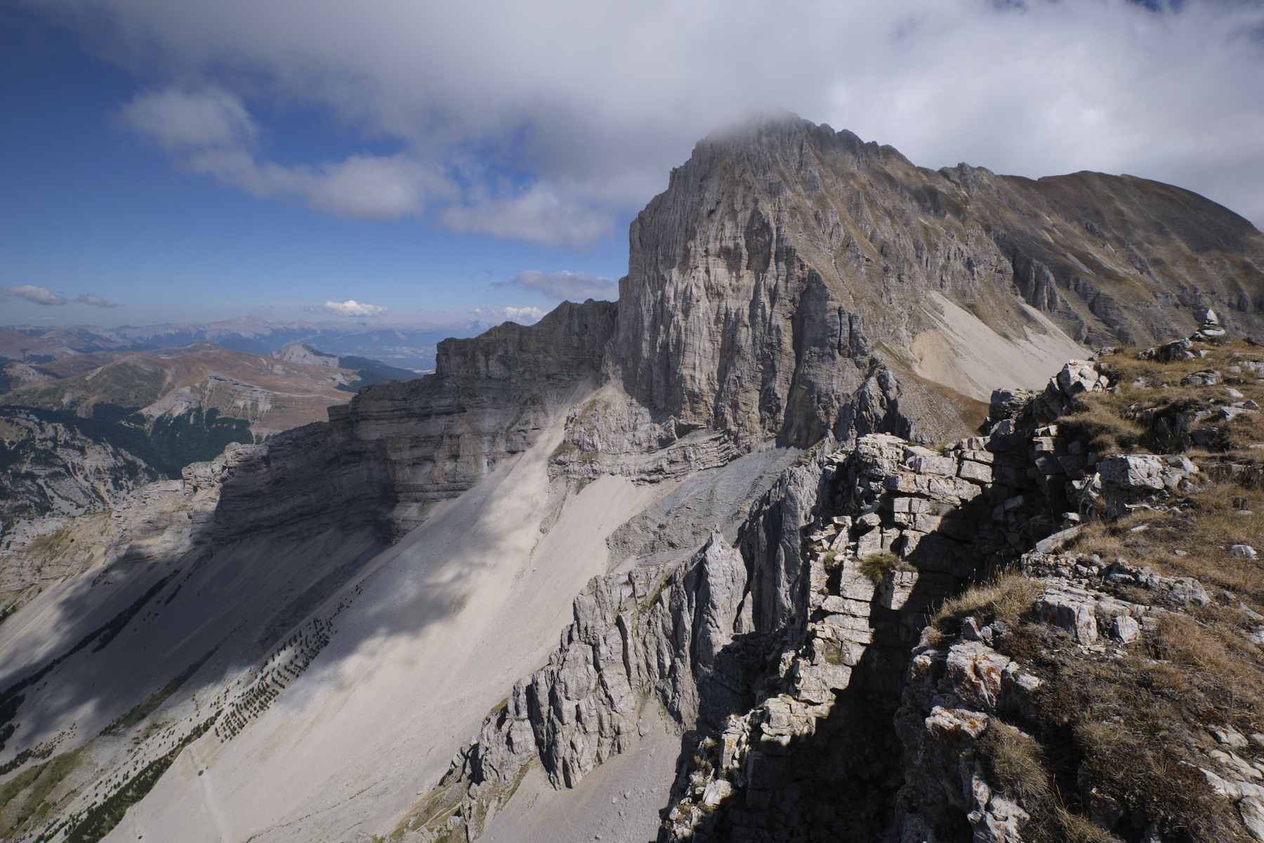
Follow the ridge on an unmarked but clearly visible path. Pass a first summit, the Tête de Merlant (2001m), then a second at the same level before descending a little on a flat section. As the ridge becomes rockier, there are large cairns pointing the way to avoid the rocky bar on the south-west side. Descend to stony ground and then cross, still following small cairns and staying fairly high up near the base of the walls. Soon enough, we find the passage back to the ridge, just after a narrow corridor between the walls that we leave behind. The ascent is not hard, but delicate and a little exposed.
Once back on the ridge, the terrain is grassy and very rolling, on a wide ridge that leads straight up to Haut Bouffet and its narrow ramp up to the very end. Further on, descend a small couloir to the small col at the foot of the final section of Haut Bouffet.
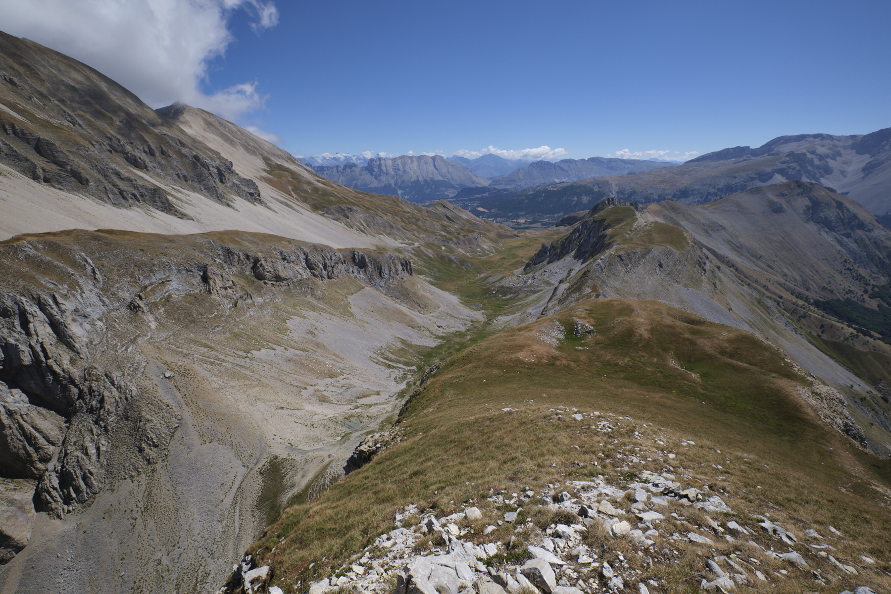
From the col, make the round trip, starting on the left-hand side of the step and quickly climbing up to the ridge that leads gently to the summit at 2161m. The view plunges down to the Jarjatte valley, the sculpted south face of the Tête de Vachères, the tête and Roc de Garnesier and the Vercors to the north-west. As we turn east, we can clearly see below us the wide Aiguilles valley, which we'll follow in the second part.
Part 3: The Aiguilles valley, the Saute Aure waterfall and return to the parking lot (2h to 2h30)
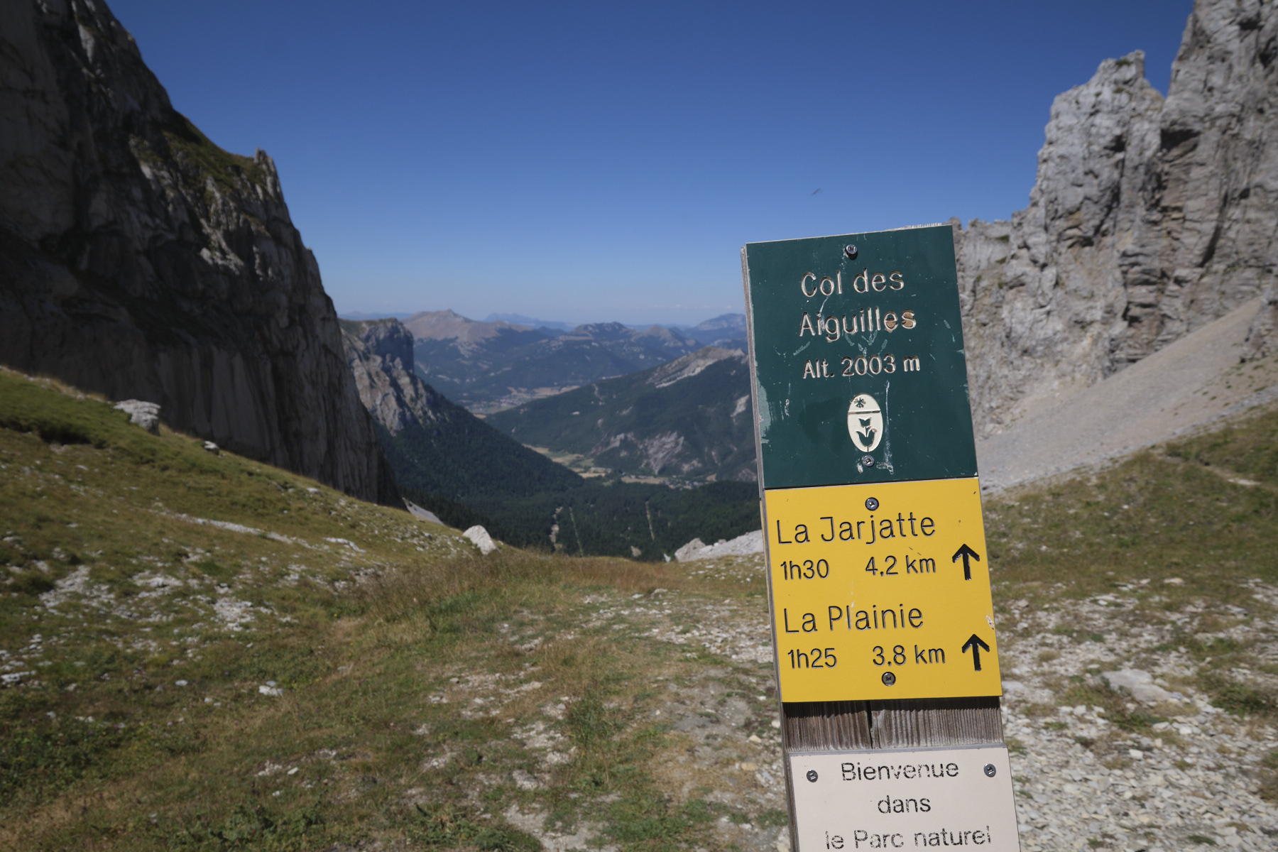
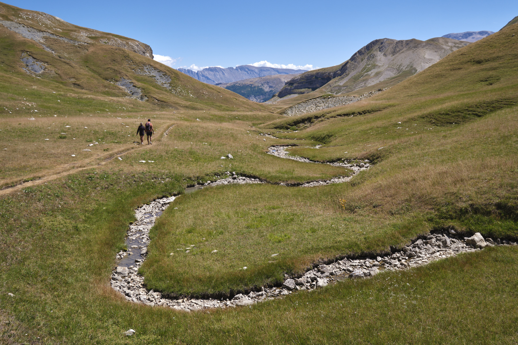
Descend from the summit to the col and follow a steep path down to cross and reach the col des Aiguilles at 2003m. This takes you back to the GR 94 Tour du Dévoluy. This time, head due east down a gently sloping valley, which gradually widens and leads to a large jasse with a meandering stream.
Continue until you are above the Saute Aure waterfall. The GR then bends right and climbs around the Tête du Jas des Arres. The view from the top of the waterfall is splendid. Follow the GR down to the Bachassous basin, where you'll find the starting hut. From the hut, follow the GR 94 back down to the Serre Noir parking lot.


 Partager sur WhatsApp
 Partager sur Twitter
Partager sur Instagram
Partager sur Twitter
Partager sur Instagram

 Partager sur Facebook
 Imprimer le topo
 Laisser un commentaire


Leave a Reply