


TOPO Via ferrata | CLIMBING7.COM
Publié le
 Partager sur WhatsApp
 Partager sur Twitter
Partager sur Instagram
Partager sur Twitter
Partager sur Instagram

 Partager sur Facebook
 Imprimer le topo
 Laisser un commentaire

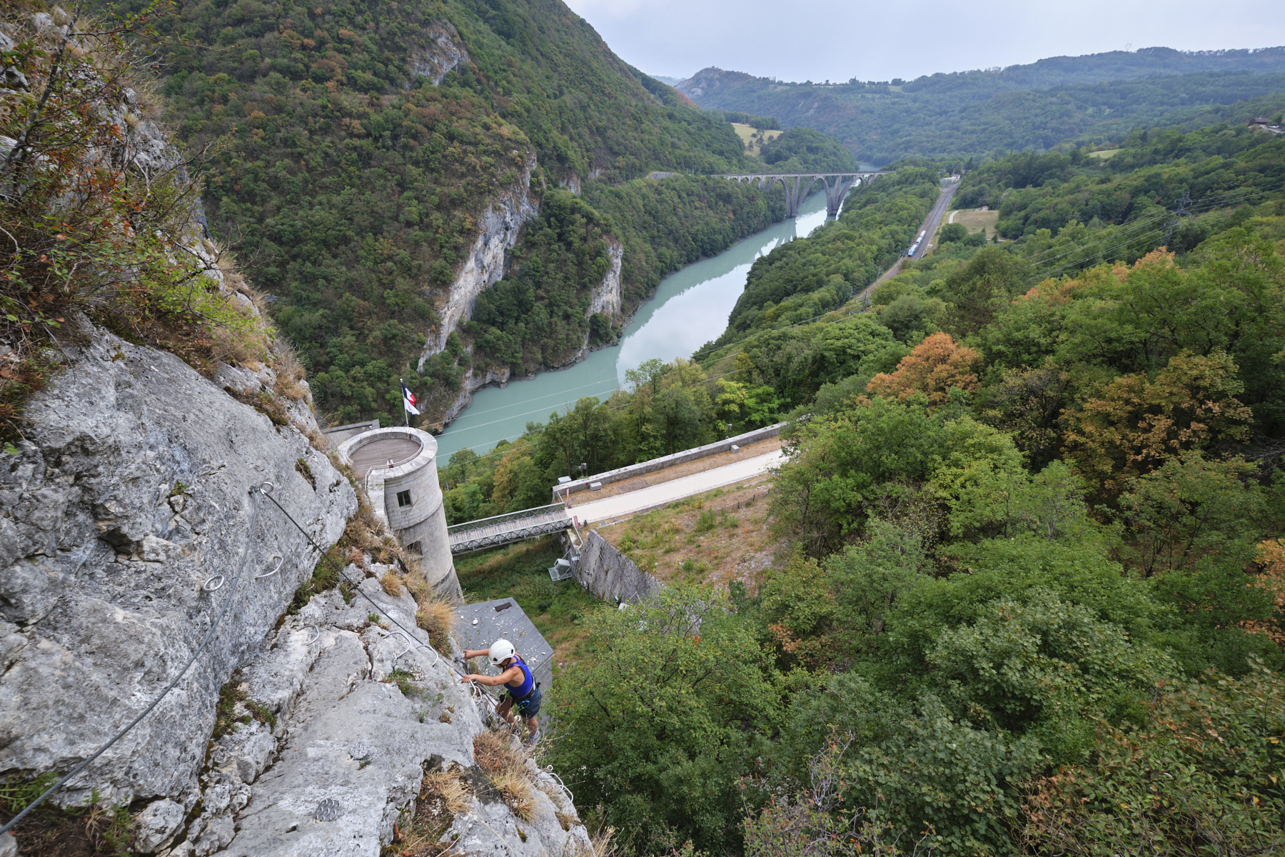
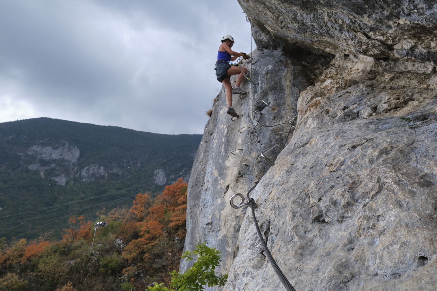
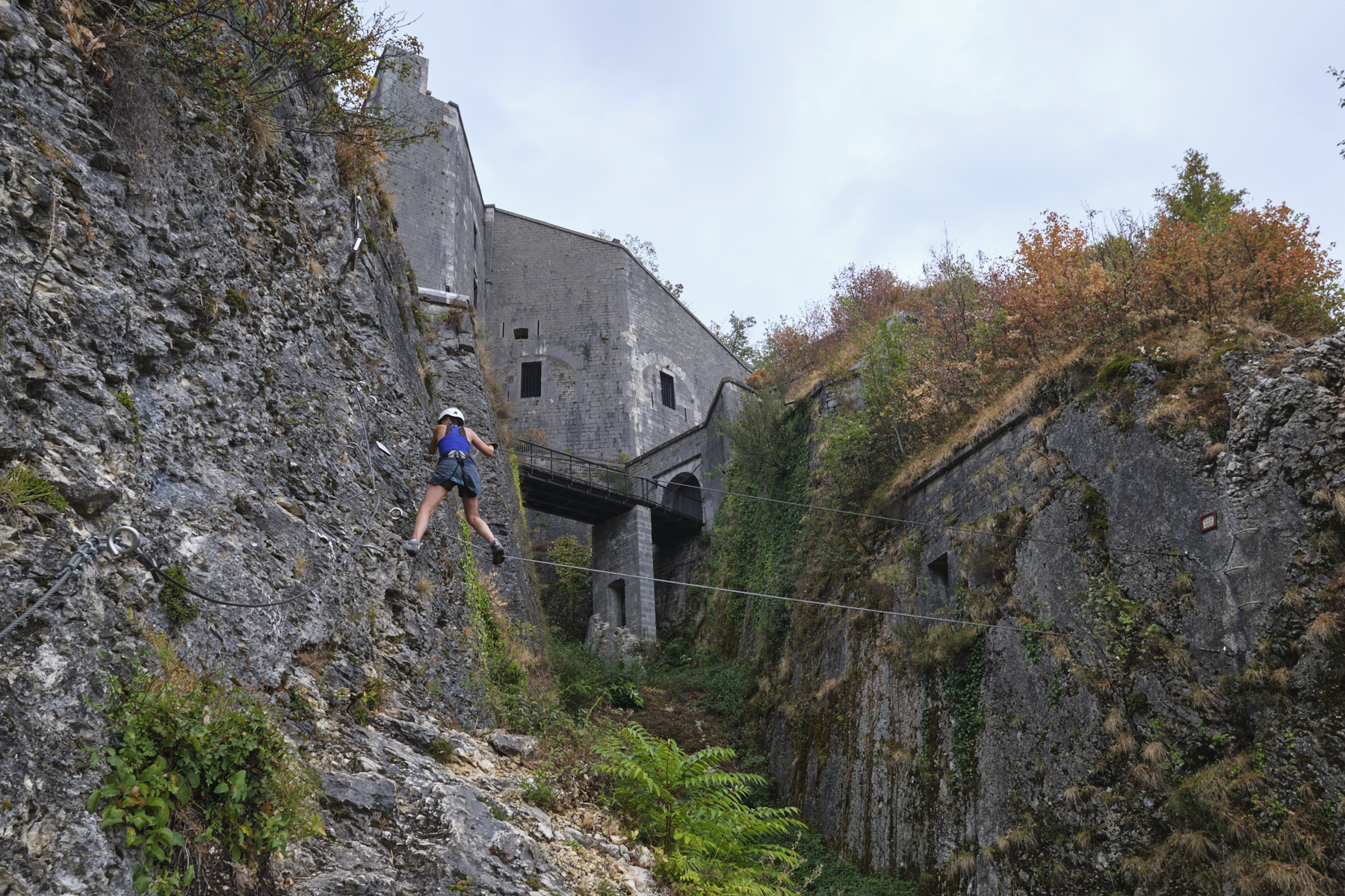
Strategically located at a natural passageway between the Jura and the Alps, above the Rhône which flows from the Geneva basin, the via ferrata climbs a limestone wall between the lower and upper forts, 2 military constructions dating from the 17th century. Advertised as an AD level climb, in our opinion the route includes several sections that are more than vertical, although they are short and tend towards the D level, so an AD+ rating would seem more appropriate. In addition to the historical and architectural aspects of the fortifications, the view over the natural corridor and the course of the Rhône is spectacular. An interesting and original ferrata that can be complemented by a visit to the lower fort.
❱❱ Technical summary
■ Departure point: Fort l'Écluse parking lot, Léaz, Ain (01)
■ Type of route: via ferrata
■ Direction: south-east
■ Length: 400m
■ Vertical rise: + 150m
■ Estimated total time: 1h30 to 2h
■ Min and max altitude: 430 m / 580 m
■ Equipment in place: rungs, pedals, 1 beam and a small monkey bridge.
■ Equipment required: standard equipment
Difficulties: 2 or 3 short, slightly sloping sections. Unstable and tricky return trail in wet weather.
❱❱ Access to the place
From Valserhône, take the road to Geneva on the D1206, and after Léaz watch for the 1st tunnel. Just before the tunnel, turn right into the Fort parking lot. Starting point for the via ferrata.
❱❱ Map & topo

❱❱ Itinéraire
From the parking lot, head towards the fort, and a few metres further on you'll find the small path leading up to the start of the ferrata (signposted). You'll soon reach the first equipped section, just above the fortifications.
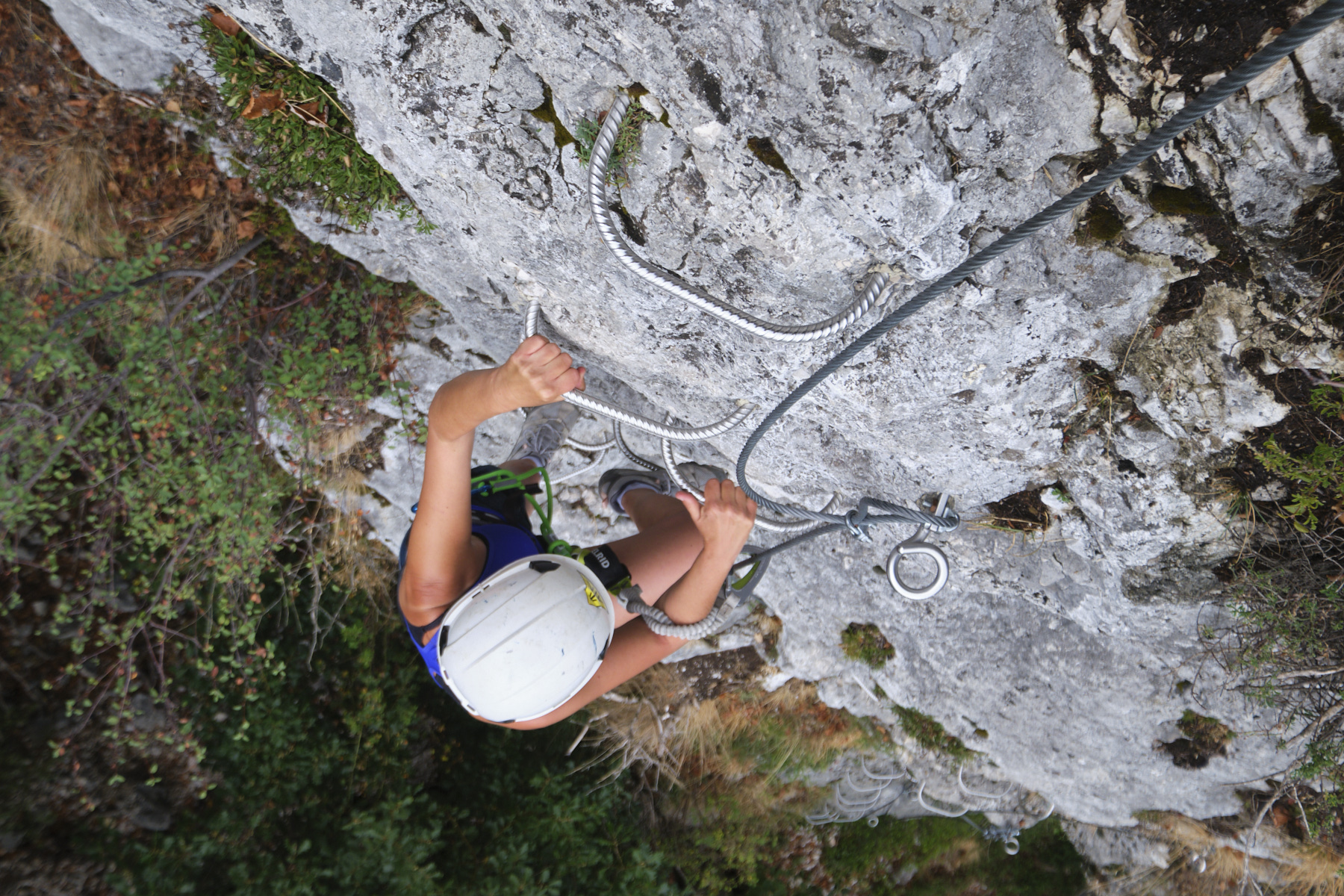
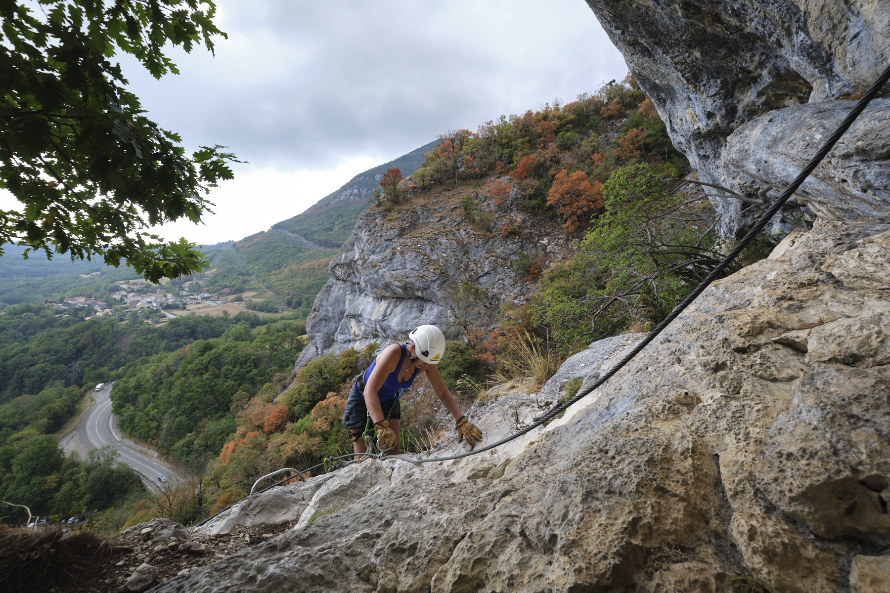
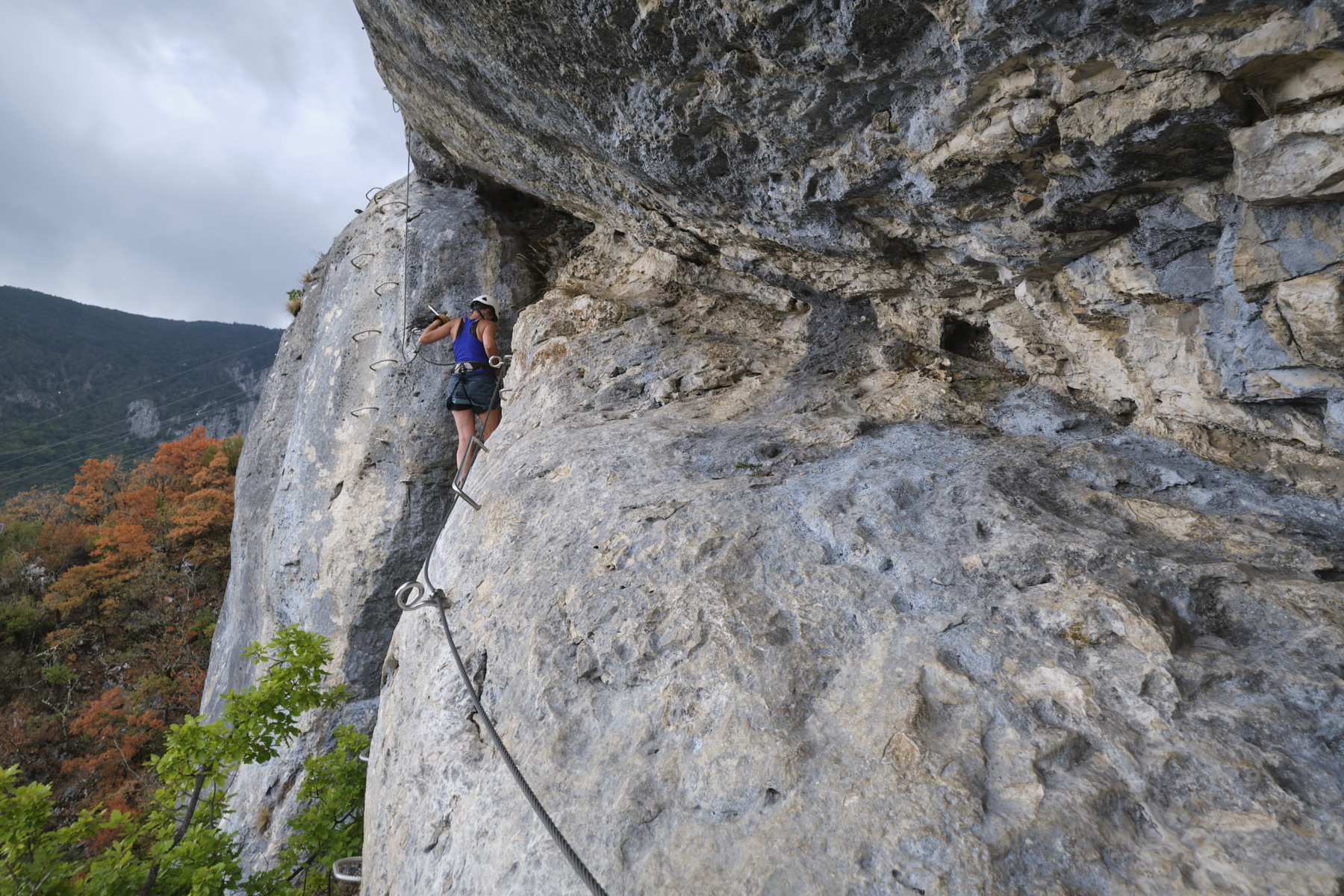
The ferrata is divided into 4 sections: A, B, C and D. Overall, it's a succession of small, more or less vertical walls, and steps or traverses on ledges, some of them quite aerial.
Zones A and B alternate easy sections with steeper or slightly overhanging passages. Zone C begins with an ascent by walking up a simple cable, ending with what is perhaps the most impressive passage: a traverse over a bulge, a change of wall and a slightly overhanging wall to exit. Zone D goes up more easily by walking under the fort, passing a small beam and further on, after skirting the base of the fortifications, a final monkey bridge to finish just beyond the entrance to the fort. End of the route.
From the upper fort, descend to the small road and quickly take the forest path down to the lower fort (yellow markings). The path is fairly steep and, above all, unsurfaced. Return to the road just before the tunnel, and cross it back to the starting parking lot.


Leave a Reply