A new excursion into the Aston valley to cover the Cabane Sourde ridge, between France and Andorra, and link up the Pic de Fontargente and the Pic de la Coume d'Enfer. The views of the Etangs de Fontargente, Etang de Mirabail and the doughnut-shaped Etang de l'Isla on the Andorran side are spectacular. No major technical difficulties, but very steep slopes to negotiate, a few aerial passages and a tricky off-trail descent to the Coume de Varilhes pond from the summit, to be avoided in wet weather. A great race for experienced hikers.
❱❱ Technical summary
■ Departure point: Pla des Peyres parking lot, Aston valley, Ariège (09)
■ Type of route: high-mountain loop hike
■ Distance: 13 km
■ Cumulative elevation gain: +1050 m
■ Cumulative negative altitude gain: -1050 m
■ Estimated total time: 4h30 to 6h ■ Min and max altitude: 1700 m / 2730 m
■ Markings: PR and GR, visible unmarked cairned trails and a section completely off-trail
■ Equipment in place: none
■ Equipment required: GPS track
Difficulties: steep slopes on the way up (II), aerial ridge crossings, tricky descent from the summit on steep slopes and gispet.
❱❱ Access to the place
On the N20 between Tarascon-sur-Ariège and Ax-les-Thermes, enter the village of Les Cabannes and turn south onto the D520A towards Chateau Verdun and Aston, cross the 2 villages and continue towards the Rulhe refuge. The little road is very long, over 20 kms, skirting the étang de Riète and further up the étang du Laparan (dam). Continue a little further to reach almost the end of the valley and park at the final Pla des Peyres parking lot (1700m).
❱❱ Map & topo
The descent section from the summit of the Pic de la Coume d'Enfer to the Etang de Varilhes is shown as a guide.
Part 1: The Fontargente ponds and port (2262m, 1h30 to 2h)
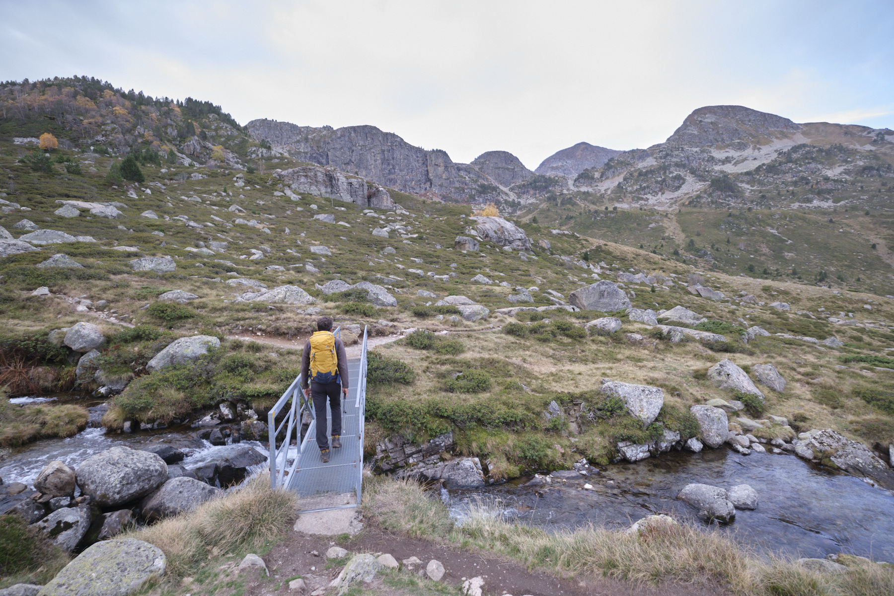
Take the yellow-marked path towards the Rulhe refuge. We walk flat before climbing a first steep slope and finding the fork: left towards the refuge, straight on towards Fontargente. Continue straight on alongside the Aston river, then cross the torrent on the metal footbridge. Then climb to the right, still following the yellow markings. There's a fairly steep section to climb up to reach a flat area, then after another 2 or 3 hairpin bends, the path crosses over towards the high altitude basin where the Fontargente ponds are located (approx. 1 hr from the parking lot).
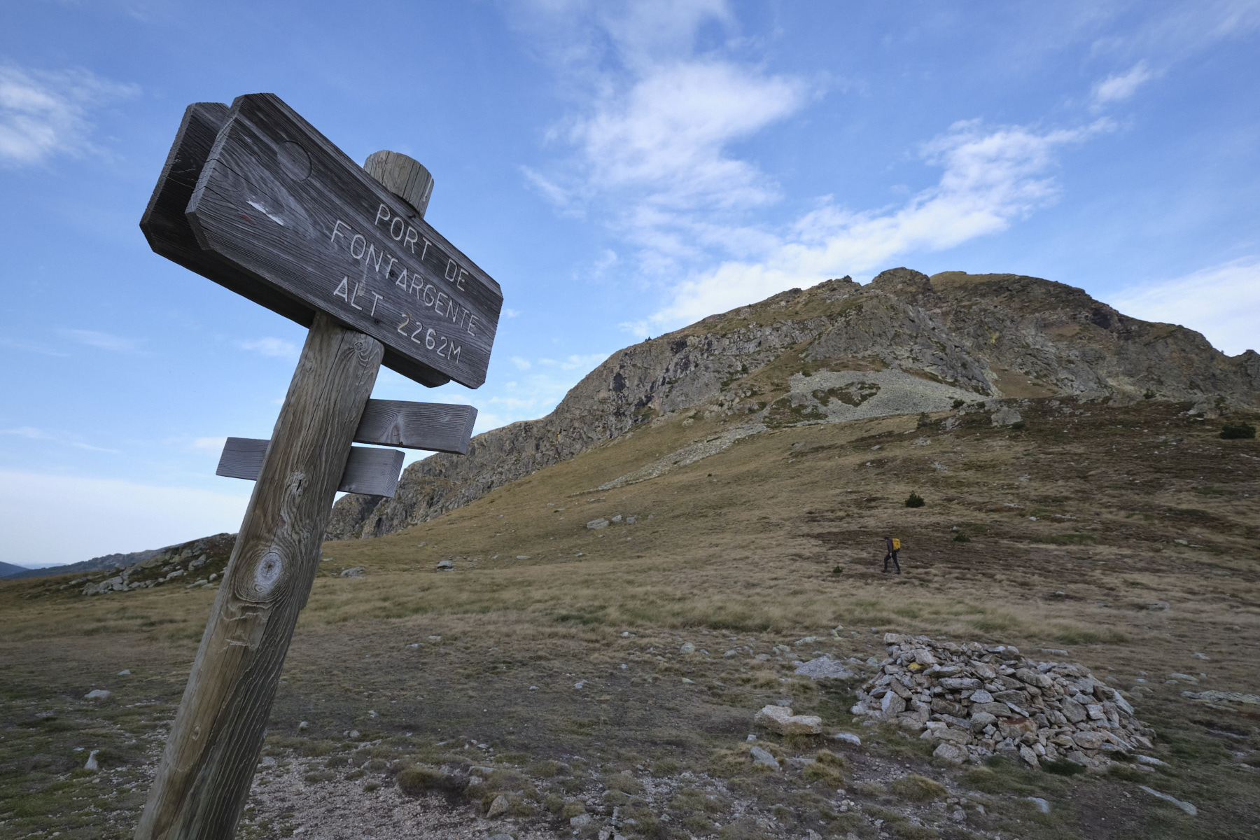
Follow the pond to the right, and at the bottom follow the path (GR at this point) through a small chaos to the port of Fontargente, the border with Vall d'Inclès in Andorra, at 2262m.
Part 2: Pic de Fontargente and Pic de la Coume d'Enfer (2730m, 1h30 to 2h)
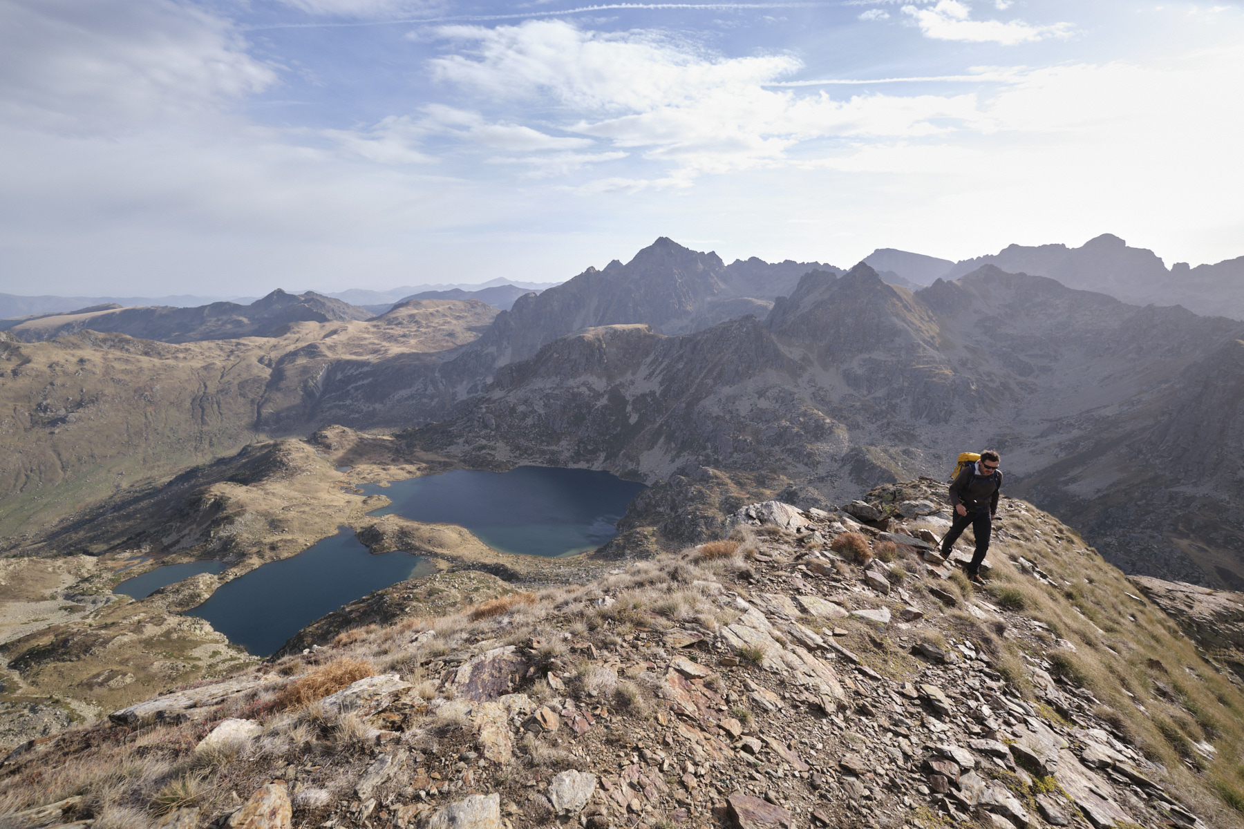
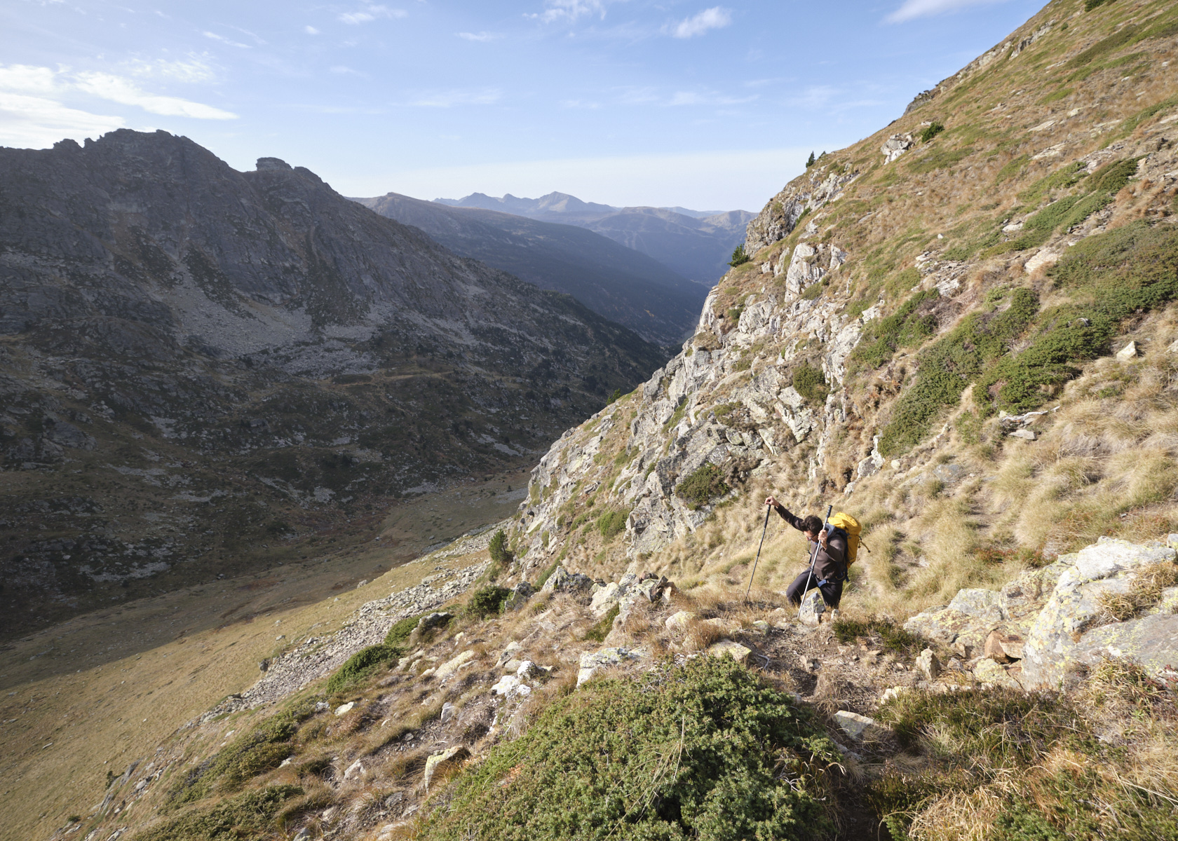
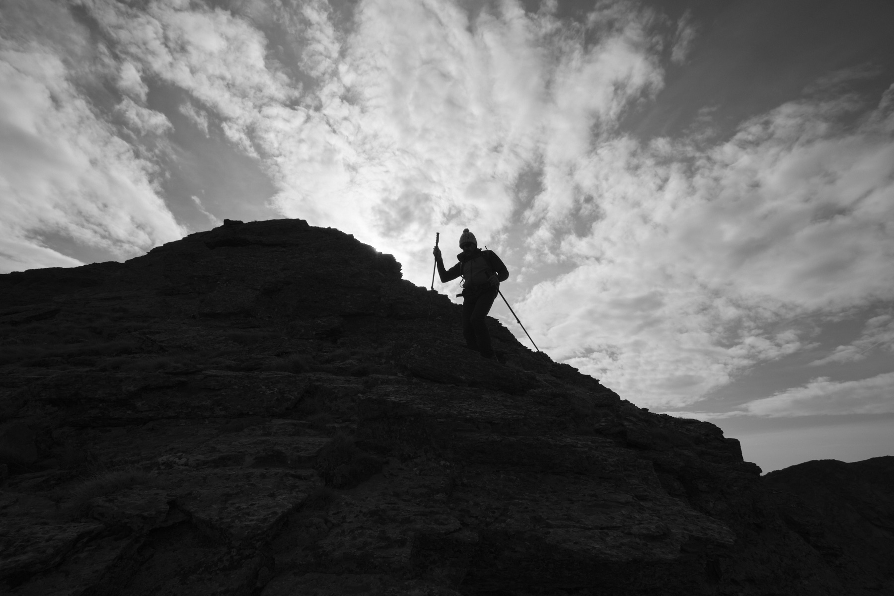
From the pass, climb to the right, westwards, on a grassy slope that becomes progressively steeper. You soon come to a cairned path that leads to an obvious gispet corridor that weaves its way between the walls. It's very steep, and after crossing another small couloir above, a little to the left, you reach a ridge with a view of both sides: Fontargente and Vall d'Inclès.
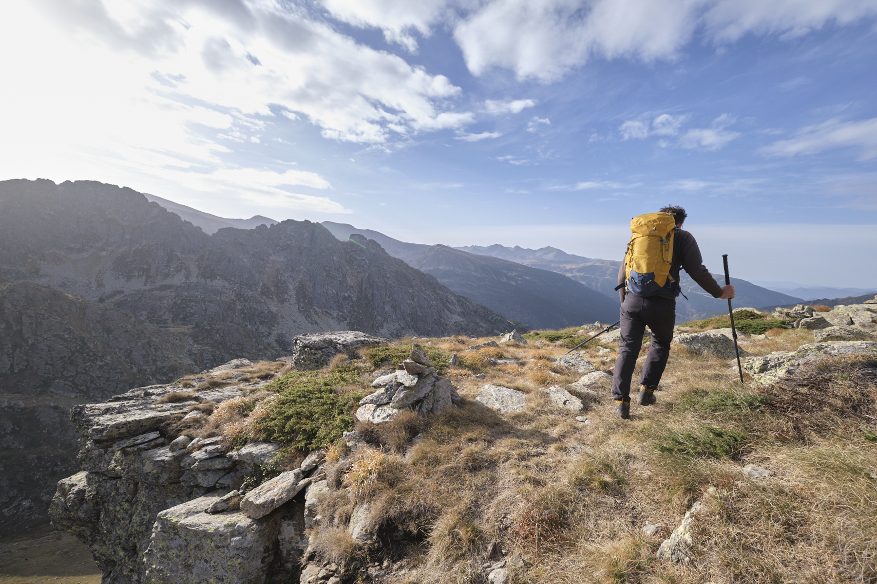
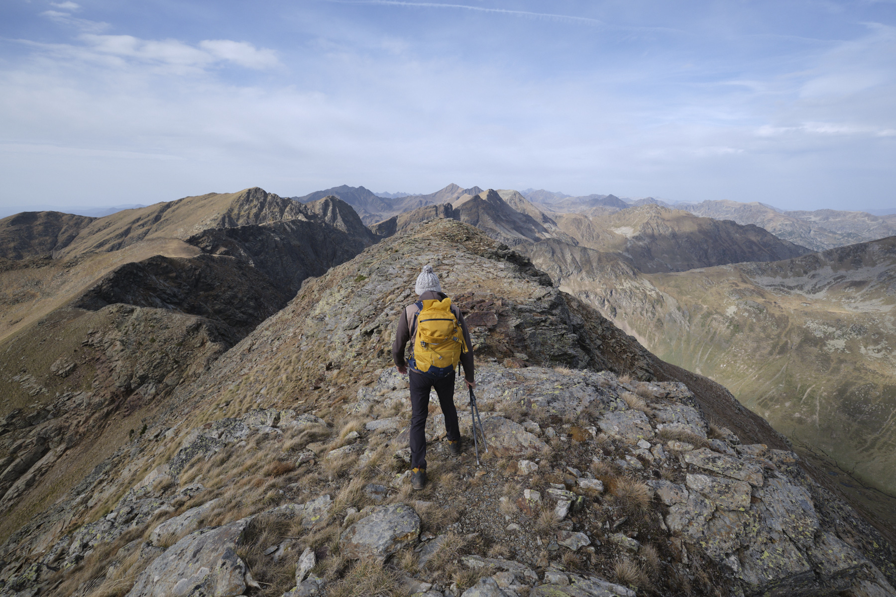
Follow the cairns up the ridge, first on a series of small rocky slabs, then on more stony terrain. The aerial views are spectacular. Pass a first small summit marking the start of the Cabane Sourde ridge, where you can see the route ahead to the Coume d'Enfer peak to the west. Progress along the ridge is easy and more or less level until you climb slightly to pass the summit of Pic de Fontargente (2618m).
From here, the next stage is right in front of us: a descent on the ridge to pass the Col d'Anrodat and the ascent across to the Pic de la Coume d'Enfer. The final ramp is quite steep, leading to the rounded, panoramic summit of Coume d'Enfer (2730m).
Part 3: Varilhes pond and coume (1h30 to 2h)
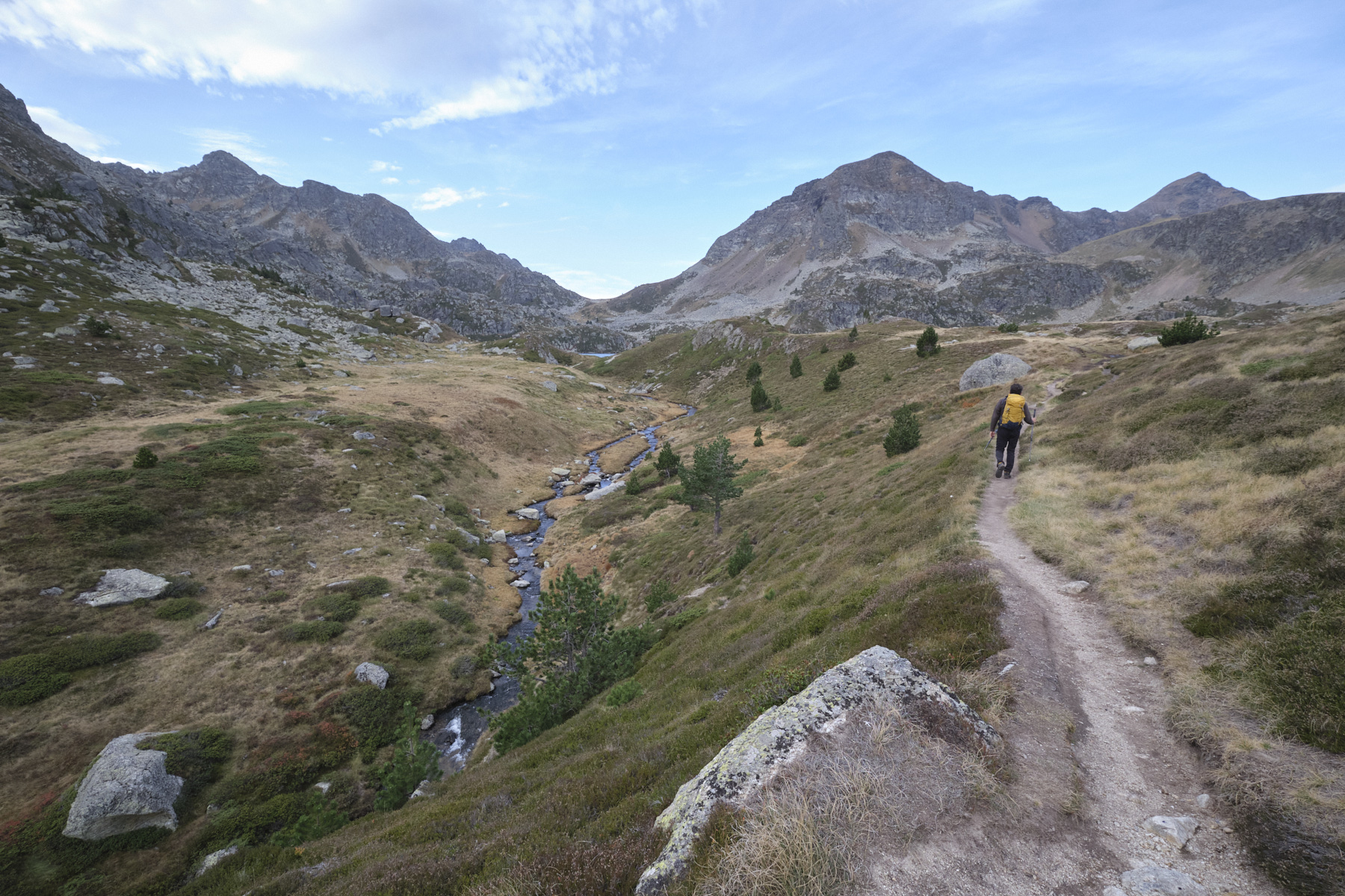
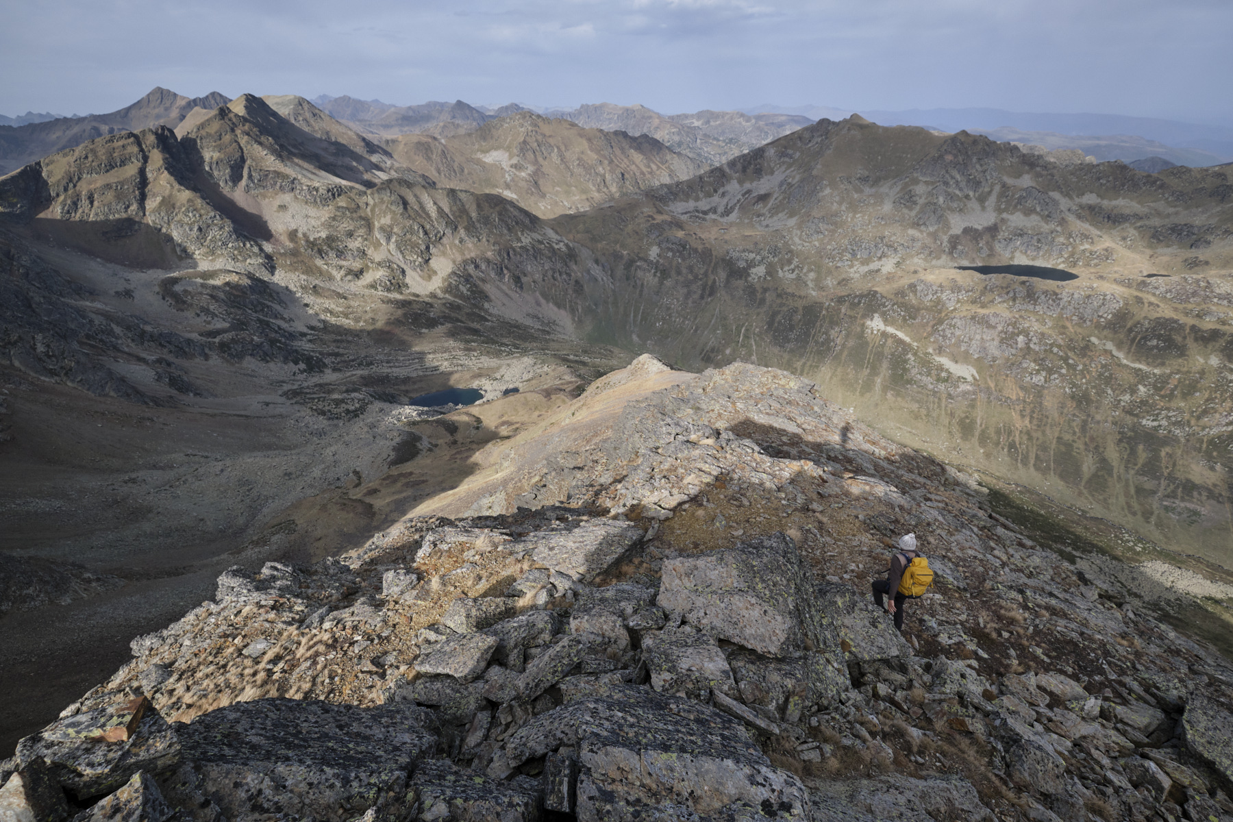
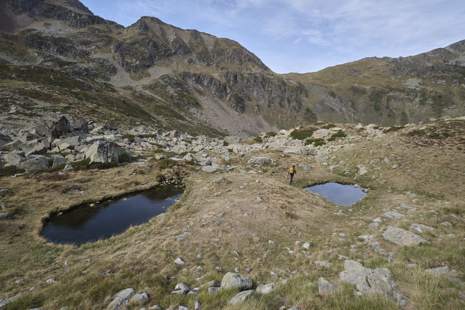
From the summit, walk along the ridge a little further to the west before seeing the north-west ridge that descends to the valley of the Coume de Varilhes. This section is off-trail, but fairly easy to follow. Descend the ridge without too much difficulty on rock, then on more stony terrain. At the bottom, just before a small plateau and a rocky promontory, turn left down the grassy slope towards the Coume de Varilhes pond, which can be seen at the far end.
This is the trickiest part. The slope is steep and the gispet can make for unstable footing. We've descended into the main couloir before crossing slightly to the left to finish the steep section along a dry stream bed. A passage further to the right is probably also possible (avoid the axis as there are small bars). Once at the bottom of the basin, continue broadly westwards towards a large scree that you can see to find cairns and the marked path coming from the valley.
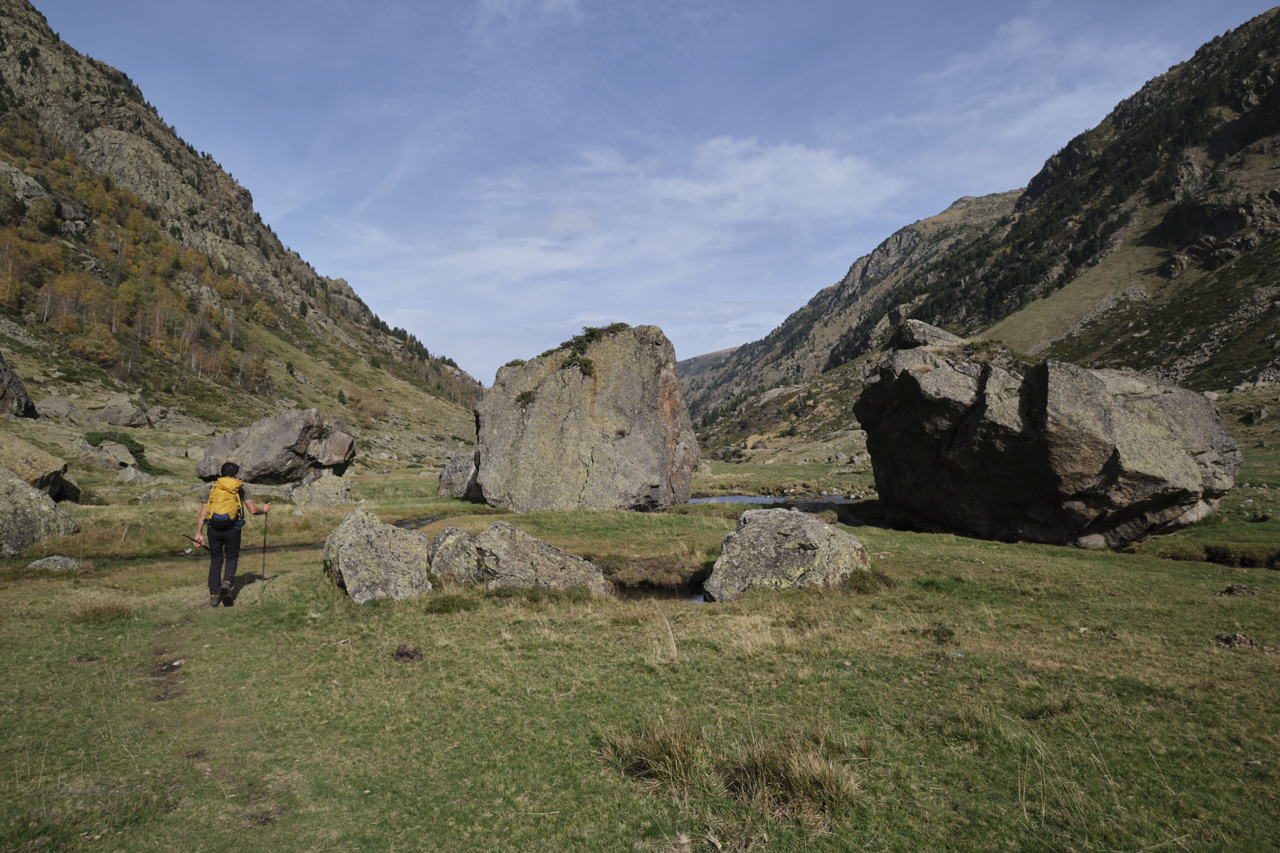
Descend following the path, skirting the scree, or rather the chaos given the size of the boulders (!), skirting the 2 small ponds of the Coume de Varilhes and finally descending in a northerly direction to find the valley floor of the Coume de Varilhes. All that remains is to traverse the long, gently sloping valley back to the Pla des Peyres parking lot.


 Partager sur WhatsApp
 Partager sur Twitter
Partager sur Instagram
Partager sur Twitter
Partager sur Instagram

 Partager sur Facebook
 Imprimer le topo
 Laisser un commentaire


Leave a Reply