TOPO
The Isards ridge from Pla des Peyres, Aston valley
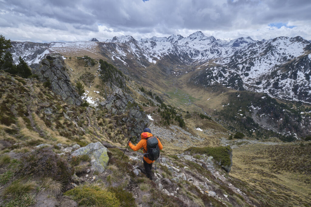
Return to the Aston valley for a magnificent loop at the foot of the Rulhe massif. Starting from the Rulhe refuge, the crête des Isards is an aerial route overlooking the Rieutort valley to the west and the Najar valley to the east. Although not very difficult, the hike is quite long and some of the passages on the ridge can be quite impressive. Today's autumn conditions, with a little snow, were perfect, but the route can't be done with more snow without equipment.

À la sortie de la crête des Isards, passage enneigé
Technical summary
Type ✦ Hiking
Location ✦ Aston Valley
Region ✦ Ariège
Country ✦ France
Max altitude ✦ 2358m
Distance ✦ 12,5km
Vertical drop ✦ 705m + / 850m -
Difficulty ✦ E2 / T2 / R3
Duration ✦ 4h30 to 5h30
Interest ✦ ★★★
Access to the place
From Les Cabanes, on the N20 between Foix and Ax-les-Thermes, take the small road heading south into the Aston valley. It's over 20 kms to the final parking lot at Pla de las Peyres (1700m), passing the Etang de Riete and then the Etang de Laparan. You can either park at Laparan and walk up to Pla des Peyres, or park at Pla des Peyres and find a car to return to the parking lot at the end of the hike, or walk back up (2.8 kms).
Itinerary description
Hiking to the start 1h15 à 1h30
Head for the Rhule refuge, at around 2200m, facing the Pic du Rulhe and the Fontargentes lakes, which can be seen on the other side of the valley. Follow the path south from the Pal des Peyres parking lot. You enter flat terrain before climbing the slopes to the left. The path then reaches a slightly higher level and the Rulhe refuge can be seen to the east. Turn off a little further on (signposted) and climb steadily up the south-facing slope to reach the refuge.
Course 2h à 2h30
The route is signposted all along the crest, as it follows the GR10. When you leave the ridges to reach the Col de la Didorte and then descend to the Cabane du Rieutort, there are some unmarked paths, but these are obvious as you have the whole route in front of you.
Part 1: Col de Belh (2243m)
From the hut, head north-east on the GR and as it rises, fork right at the crossroads (continue on the GR). Climb gently to the Col de Terre Negre (2304m). Here you switch to the hidden Rieutort valley. Descend slightly to the north before crossing to the east to reach the Col de Belh, which marks the start of the Isards ridge, clearly visible from the Col de Terre Negre (you can also see the Col de la Didorte at the far end).
Part 2: Crête des Isards and Pic de Belh
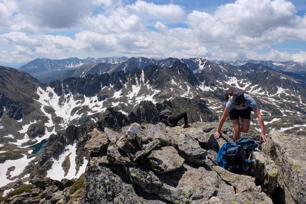
From the Col de Belh, continue on the path that attacks the Crête des Isards. The route gradually becomes more aerial, particularly on the south-east side, but you are always walking on the other side. We soon pass the first small summit (2358m), then the path cuts below the Pic de Bleh on the north face. This is where we'll find the most snow, with a few exposed passages. Finally, we reach a wide pass between Pic de Belh and Pic de Lauzate.
Section 3: Col de la Didorte (2104m)
From the pass, the path bends to the north. It climbs a little and then begins a traverse under the Lauzate over a large scree. At the end of this traverse, a small stone arch has been built into the wall, forming a natural gateway. Continuing on, you soon reach a new grassy pass with a view of Embizon pond to the east. Climb back up and continue along the ridge, eventually reaching a very flat area. At the fork in the road (sign), change direction and head straight for the Col de la Didorte, crossing this grassy plain off-trail. The trail descends very gently and ends at the col, the end of the ridge.
Back
From the Col de la Didorte, descend to the south-west on a small path not always very visible, but with a few cairns. You can see the Cabane de Rieutort at the bottom, which you need to reach. At the bottom, take the GR T66, which runs alongside the torrent for a while on the right bank, before plunging downhill through the forest to the parking lot at Etang du Laparan.


Leave a Reply