


TOPO Climbing | CLIMBING7.COM
Publié le
 Partager sur WhatsApp
 Partager sur Twitter
Partager sur Instagram
Partager sur Twitter
Partager sur Instagram

 Partager sur Facebook
 Imprimer le topo
 Laisser un commentaire
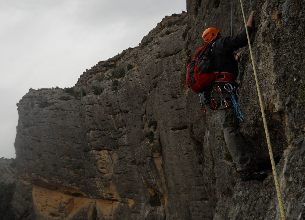
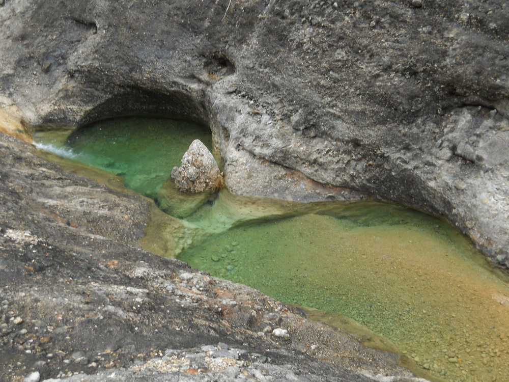
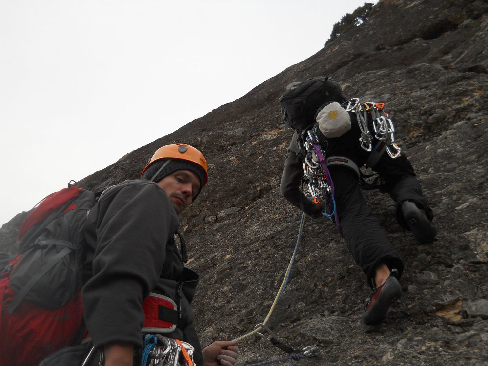
First outing in southern Catalonia to discover the massif dels Ports de Beceit and one of its climbing areas: l'Estret d'Arnes, home to the rock known as "Les Moles del Don". Despite the gloomy weather and greyish light, the site is superb. A parade of cliffs sculpted by erosion, with grey-orange hues and the emerald, literally translucent waters of a peaceful mountain river. A beautiful setting, don't you think? The cliffs of Les Moles del Don are just around the bend, and the Via Itaca, a local classic, winds its way 140m vertically through this impressive scenery. Advertised as a V+ route, it turned out to be a little harder than expected. A 6a pitch in L1 and a few more V+ pitches later. In any case, the site is well worth the detour and is full of climbing sectors to discover.
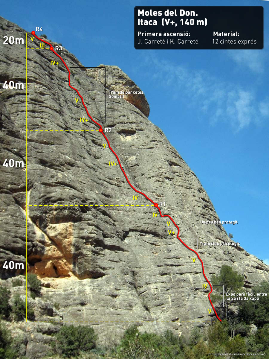
❱❱ Technical summary
❱❱ Access to the place
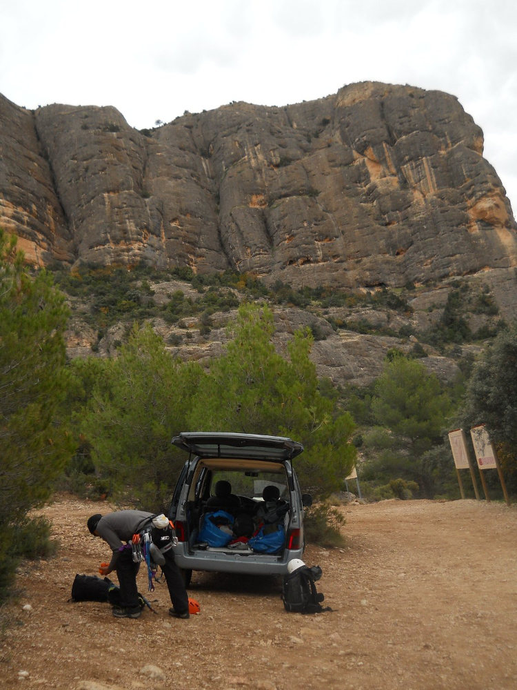
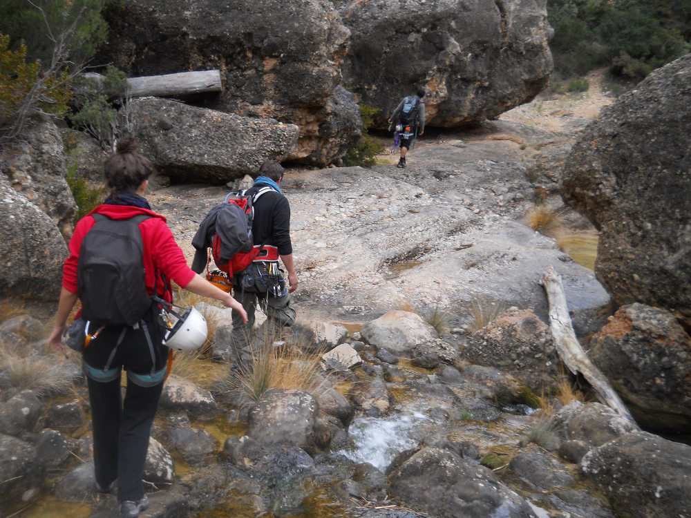
Via Arnes, a small village northwest of Tortosa, on the T330 after La Horta de Sant Joan. Enter the hamlet, cross it to find a track on the other side that leads to l'Estret d'Arnes. Here you pass through magnificent olive groves, and the road winds along, rapidly approaching the first cliffs. Drive for about 5km and at the end of the track, leave your car in the parking lot (dead-end road). From here, the path leads to the foot of the tracks.
❱❱ Map & topo
❱❱ Itinéraire
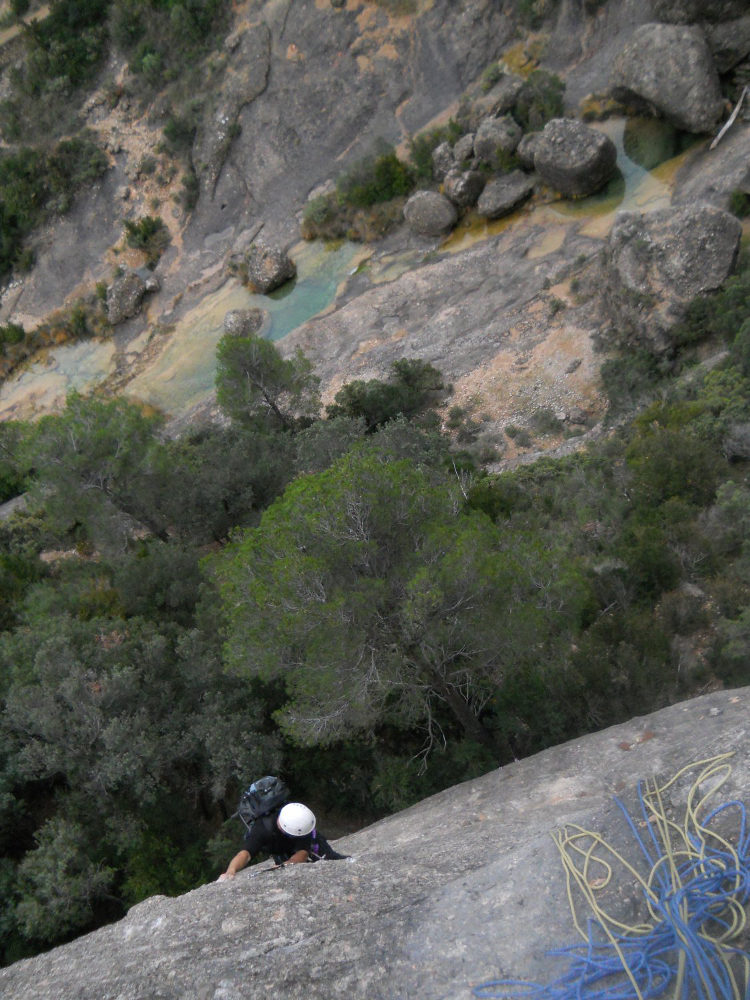
Take the path into the gorge. The path runs alongside the jade-green stream, forming small pools where we dream of taking a dip (well, not right now, given the temperature!). After 20/25′, a sharp right-hand bend brings us to huge new walls, and we discover on the other side of the river the great wall of Les Moles del Don, easily spotted with a block cut out at the top and a large oblique crack. At this point, descend to the stream, cross it (there is a passage with stones) and climb back up to the cliff. A narrow path leads to the foot of the routes. The start of the via Itaca is on the left, at the foot of a large, easily recognized pine tree.
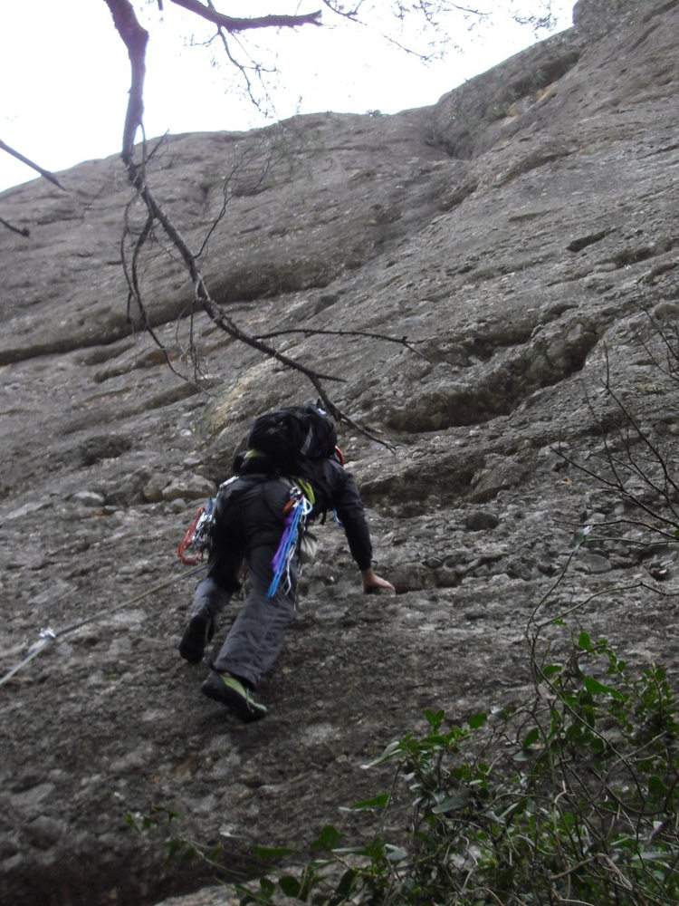
The route is southeast-facing and 140m long in 4 pitches (40m, 25m, 40m, 25m). The equipment is good, except on L1 where nails 2 and 3 are too far apart, and on L5 too, where it's exposed. You'll need 15 quickdraws, lanyards for merlet and belays, and 1 small pin (L1).
L1 (40m, 6a or V+/A0)
This is the most difficult pitch right from the start! The first steps set the tone, and something is missing between the 2nd and 3rd belay points, with a risk of falling back to the ground. If you're looking hard enough, you can place a small anchor to protect the passage. The route then climbs vertically, rather diagonally to the left. It's a very steady V, bordering on V+. Towards the end of the pitch, you come to a bulge that you'll have to overcome in 6a free or A0. The last 10 meters are in V then IV but very little protected... Comfortable R1 belay on a small flat.
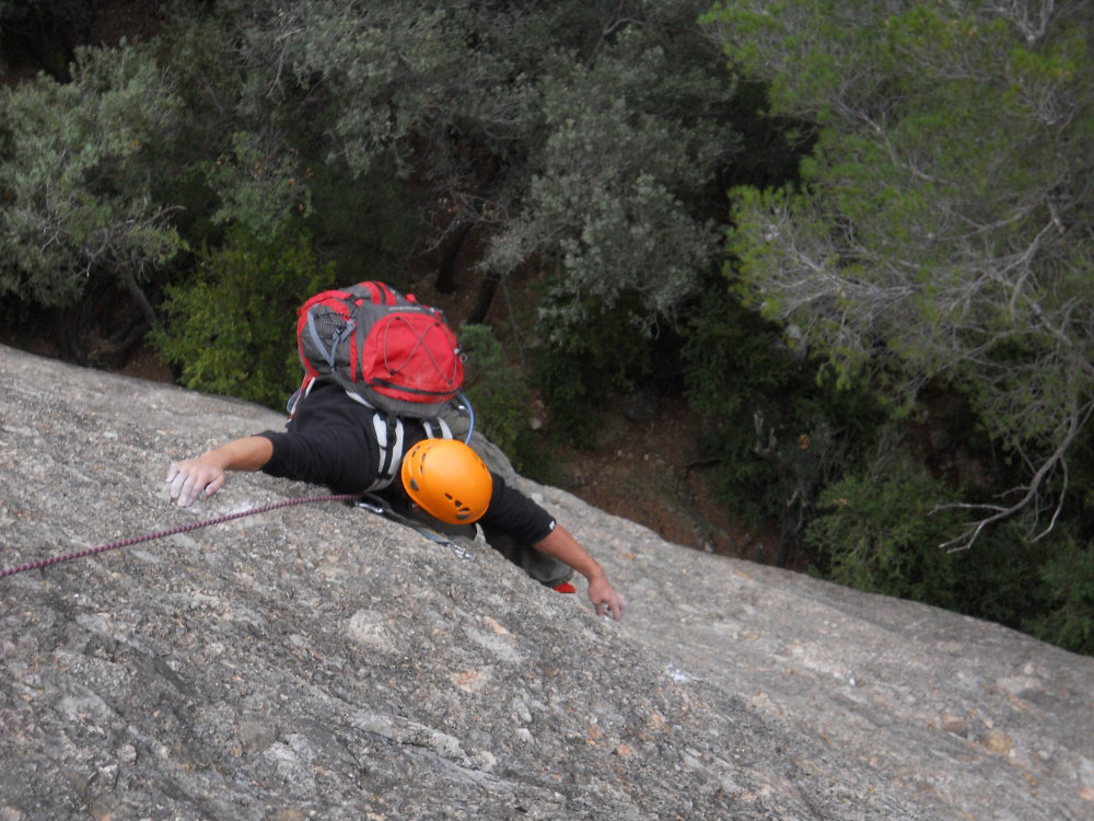
L2 (25m, V)
Diagonal left, then straight ahead. The first point is quite far away and the rest is well equipped. A merlet with a cable higher up and an easy-to-follow line of nails. We soon reach the R2 belay, which is also fairly comfortable.
L3 (40m, V+)
2nd long pitch, quite demanding but very pleasant to climb. The exit from the belay is tricky, with an athletic step in V+ using good holds. We arrive on a small ledge which we follow to the left to find the next part of the very straight route. This involves overcoming a series of rock lips. The level is sustained here too, with a few steps very close to V+. The second part of the pitch approaches the large crack on the right, ending at the level of a shrub. Watch out for the last plate just before the belay, which is just begging to go...
L4 (25m, V)
An easy first bulge, then higher up a small wall with a really unprotected V-step. The route ends on a III slope to the R4 belay on the summit of Les Moles.
From the summit, follow the path to the right with kairns. It descends eastwards through the vegetation and soon overhangs the approach path. Continue further down to the right, flush with the rock, in a narrow channel that leads to a mini abseil of around 10m (rope on site). Finally, still following the kairns, climb up to the right to find the foot of the routes (30′). All that remains is to cross the stream in the opposite direction and rewind to the parking lot (another 30′).


Leave a Reply