


TOPO Climbing | CLIMBING7.COM
Publié le
 Partager sur WhatsApp
 Partager sur Twitter
Partager sur Instagram
Partager sur Twitter
Partager sur Instagram

 Partager sur Facebook
 Imprimer le topo
 Laisser un commentaire

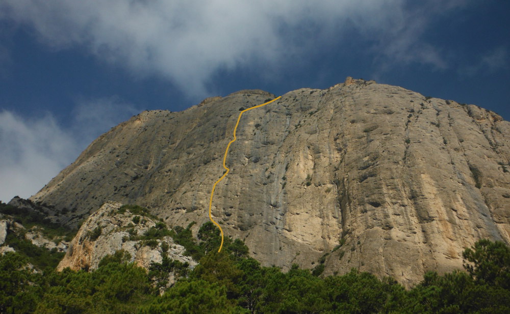
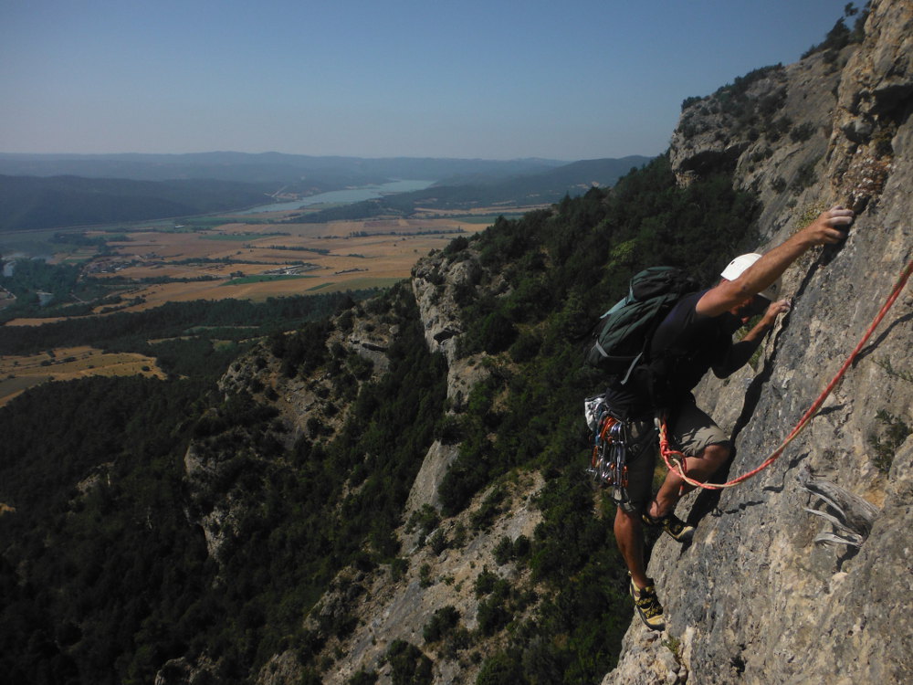
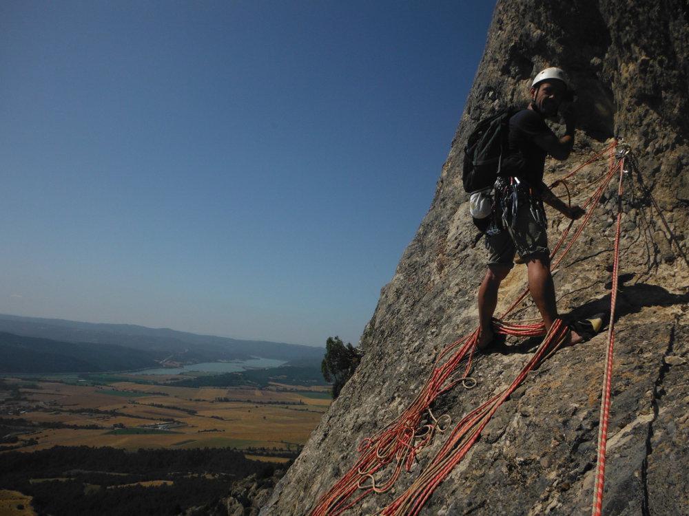
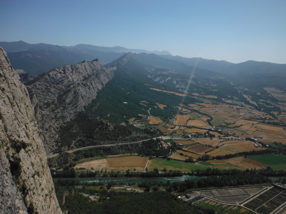
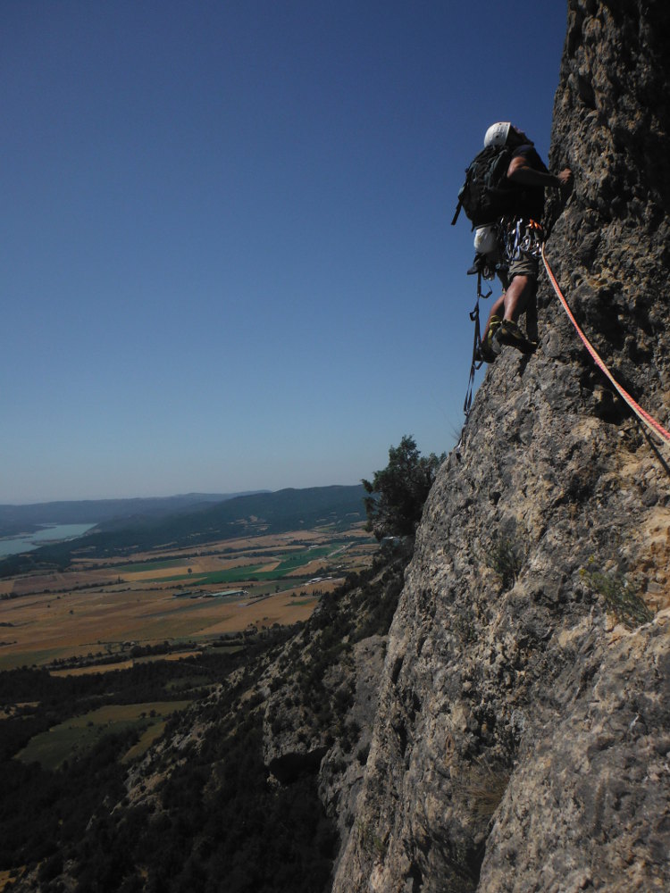
After Putes Mosques, we needed a road name to match! And we made no mistake: this is the highlight of our stay in Alt Urgell. A huge route on a monumental wall at the entrance to the Segre valley, above Oliana. Superb weather, a little breeze for the occasion and 265m of fantastic climbing, on a very well-equipped route, freely accessible in 6b. 3 brilliant pitches (L2, L4 and L5), hyper aerial but on impeccable rock (conglomerate. The last 2 pitches are of no interest apart from access to the ridge and an exceptional panorama of the Riyalb and Oliana pantanos. A great 5-star route, a must-do area!
❱❱ Technical summary
❱❱ Access to the place
From Oliana, head for Andorra. On leaving the village, just after the bridge over the Segre, turn left towards Peramola. The narrow road runs alongside the river, passing under the Paret del Rumbau. Further on, fork right towards Hotel Cal Boix. The road crosses the fields in front of the wall, an impressive, spectacular view. Just before the entrance to the hotel, take the track on the right which climbs up through the woods along the wall, passing under the famous Contrafort del Rumbau sector (9a routes, Cris Sharma's stronghold). After 2 or 3 km, you can spot the route on the right-hand side of the wall, as shown in the photo on the topo. There's a small parking area on a slightly uphill bend.
❱❱ Map & topo

❱❱ Itinéraire
It starts on a tiny path a little above the parking lot, on the left with a cairn. Follow it up to the mud wall (not well marked). Take your bearings from the photo of the wall, but it's the only equipped route in the area anyway, so it's hard to go wrong. The start is under the trees.
The southeast-facing route is 265m long in 7 pitches (45m, 35m, 25m, 35m, 35m, 55m, 35m). The equipment is generous and allows you to use artif' on the most difficult pitches.
L1 (45m, V)
A small wall to start with (V), warm up, no difficulty. Follow diagonally left onto easier terrain (III) to reach belay 1, very comfortable in a characteristic hollow.
L2 (35m, 6a+)
Exit to the left to make a delicate right turn and climb back up vertically. Good holds, fine but straightforward, the rest sustained in 6a then V+ at the end. Very nice length.
L3 (25m, V)
Transitional length, easy with a left turn to get to R3, in a new, large, characteristic hollow.
L4 (35m, 6a)
Another left-hand start, followed by vertical climbing. Uniform length in 6a, then halfway up in V+. Beware of a few wobbly scales.
L5 (35m, 6b)
A very fine, sustained and well-equipped pitch. A 6b of continuity, technical and fine, very vertical, with a slight overhang in the middle. The end is less sustained (6a/V+).
L6 and L7 (55 + 35m, IV then III)
Easy, far-flung nails but no difficulty, just to finish the route and reach the summit... and it's worth the detour. The panorama is exceptional
You can always call back up the route, but it seems endless (in which case avoid L6 and L7). Alternatively, climb back up the ridge to reach the 1st valley. This is where we improvise our way down into the undergrowth (probably climb further up the ridge to find a trail?). In any case, at the bottom we rejoin the main trail, which runs along the foot of the hermitage (on a piton) and around the wall to our starting point.


Leave a Reply