


TOPO Hiking | CLIMBING7.COM
Publié le
 Partager sur WhatsApp
 Partager sur Twitter
Partager sur Instagram
Partager sur Twitter
Partager sur Instagram

 Partager sur Facebook
 Imprimer le topo
 Laisser un commentaire
We're off for 3 days of trekking in the Ariège Pyrenees. Our goal: to get from Hérens-Les-Vals to Orlu via Porteille de Bésine, Couma d'Anyell and Couillade d'En Beys. The weather is fine. Quite a lot of ascent and descent, but splendid scenery in store. The trek combines part of the GR10 and a small section of the GR7 before returning to Orlu via the Tour des Monts d'Ax. No major difficulties apart from a few large scree slopes, and the presence of snow and water in places, which makes the itinerary difficult at times. 3 days to (re)discover the Pyrenees.
❱❱ Technical summary
❱❱ Access to the place
Go to the village of Hérens-Les-Vals, on the N20 between Foix and Latour de Carol. In the village, fork left to cross the torrent and climb to the very top, past the Mérens refuge "Le Soula". Further up, at Vives, there are several places to park.
❱❱ Map & topo

❱❱ Itinéraire
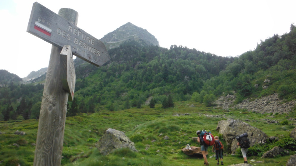
without difficulty, except for a difference in altitude of around 1100m (Vives 1100m - Porteille des Bésines 2333m). The path is clear and very well signposted (GR10). The half-way fork is signposted. Passing the Porteille is no problem either, unless it is snow-covered. There are 2 superb bivouac spots: a little before the pond before the Porteille (but short from Mérens) or a little before the Gite des Bésines (on the right, obvious).
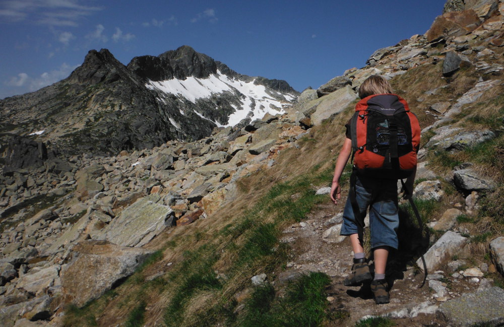
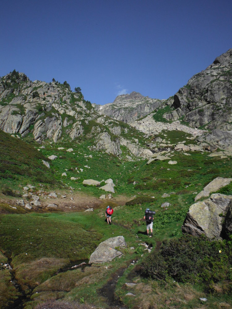
Stage 1: Mérens to refuge des Bésines
Up the Nabre valley through the forest. A quarter of an hour after Vives, small pools of sulphurous water at 35°, under the woods. Much higher up, out of the woods, crossing the Saut du Nabreil, a small cirque marks the bottom of my valley, also the domain of a few Meringais horses that can be seen, black coats on a green background. From here, turn right towards Porteille. The 1st steep, winding ascent leads to a small, magnificent high-altitude pond. Porteille des Bésines can be seen. The path is steep but not difficult, and ends by crossing a large scree. From here, a new horizon opens up. We can already see the Bésines gite on the left below. There's a big névé on the way down, but you can get around it, and you soon reach a sort of small plateau above Lac des Bésines (not visible), a little before the refuge. A perfect place to bivouac, with soft, flat grass, plenty of water and a south-facing view.
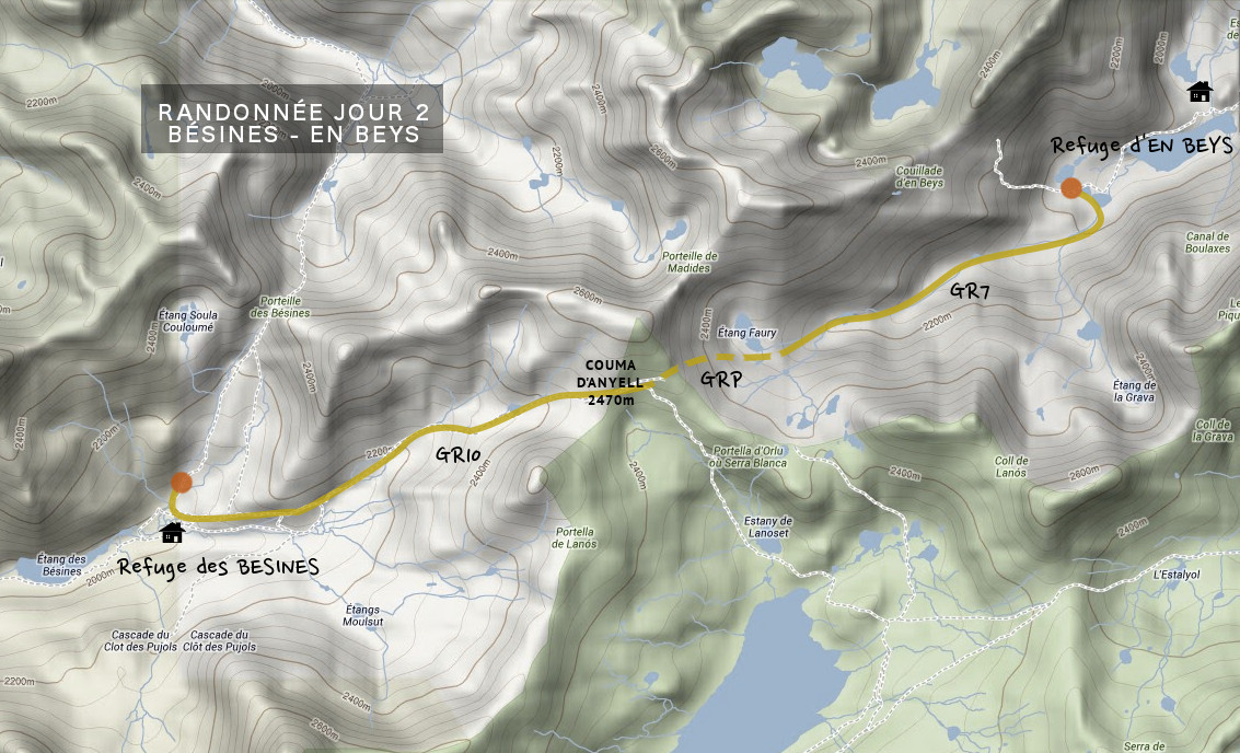
Stage 2: Bésines to En Beys refuge
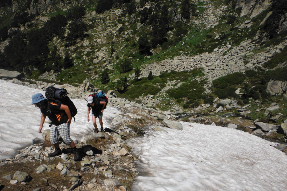
This is a little more difficult than the previous day, with a not-so-high positive altitude difference (370m from the Bésines refuge 2100m to the Couma d'Anyell 2470m) but a significant negative altitude difference (500m from the Couma 2470m to the En Beys refuge 1970m). The difficulty also comes from the very rocky path, crossing and traversing chaos and scree (but without danger) and, exceptionally this year, from the presence of numerous and often unavoidable névés, which sometimes obscure the legibility of the itinerary.
Part 1
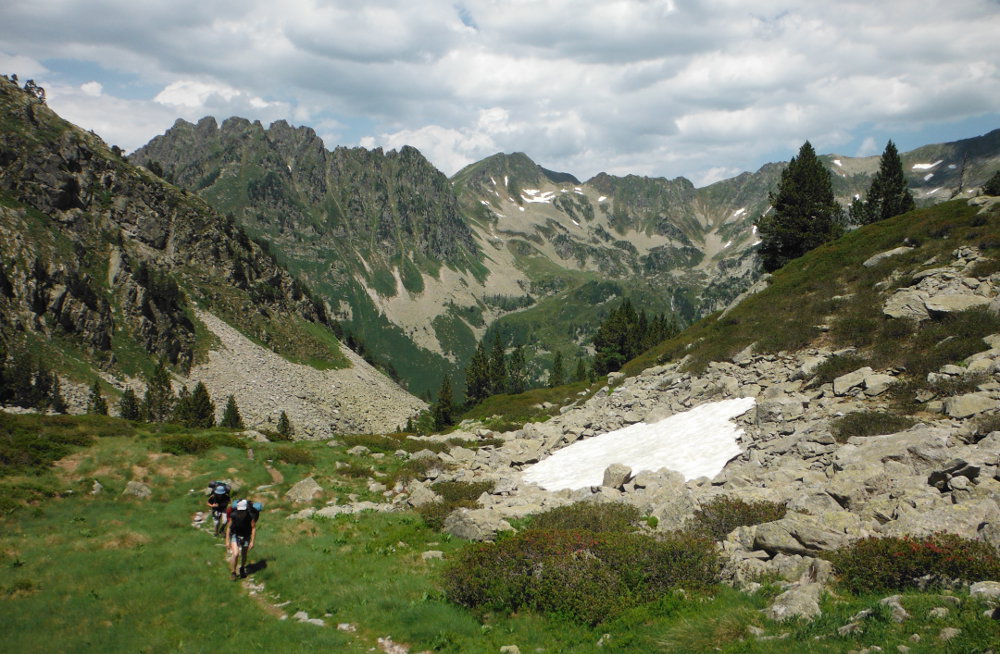
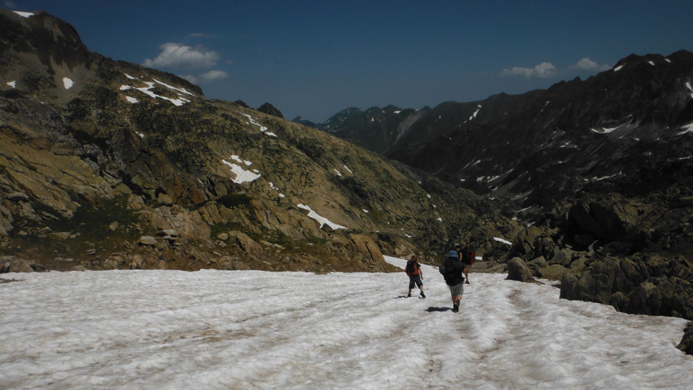
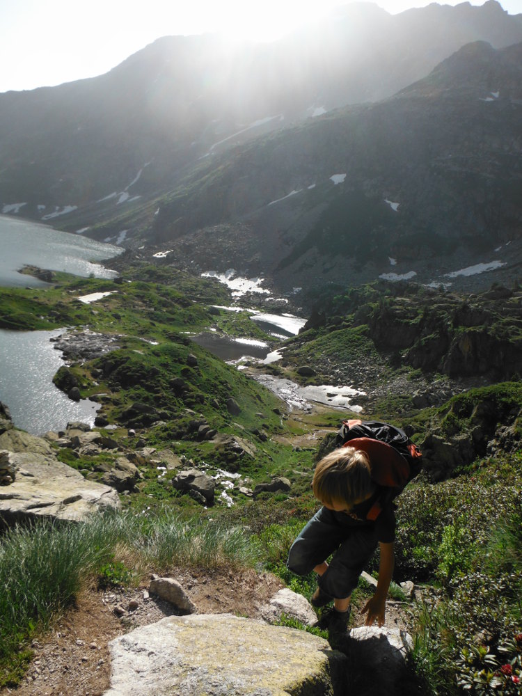
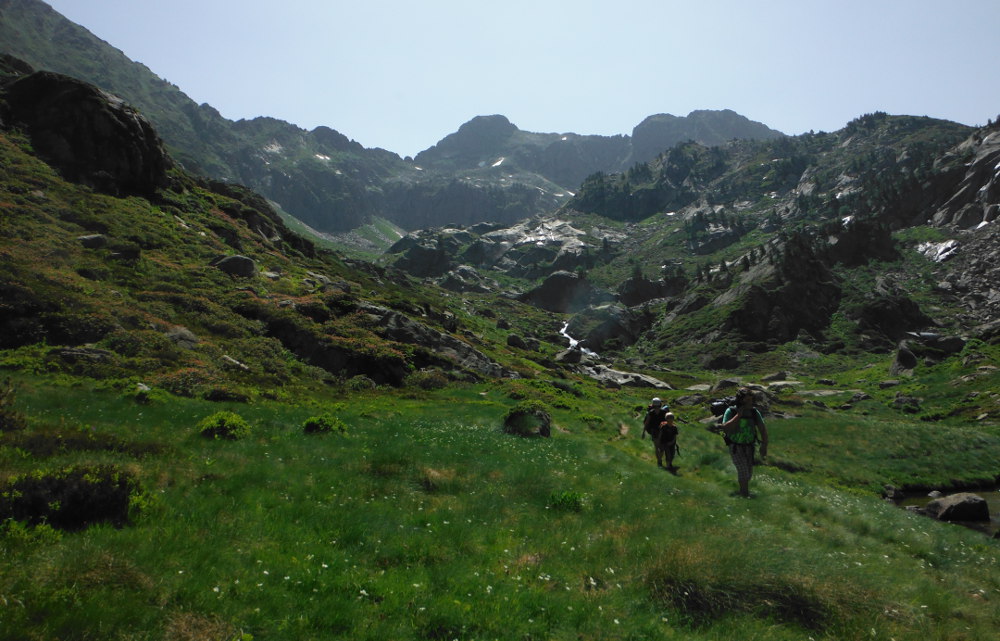
Past the Bésines refuge, the path (still GR10) heads due east up the valley, gradually flanking another torrent. Higher up, a first plateau, irrigated by streams, shines in the sun. One level above, a second high plateau leads to the valley floor. The path then climbs steeper, with snow covering the GR in several places. If the 1st névé can be bypassed, it takes us through the next ones, without any real difficulty, with soft snow and a reasonable gradient. We arrive at the splendid Couma d'Anyell (2470m), a wide balcony overlooking Lac de Lanos and Puig Carlit.
The junction
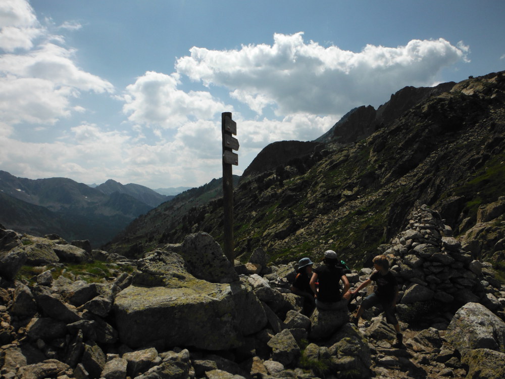
After lunch, a snowy descent from the Couma to cut the GR10 to the GR7 via the GRP (red and yellow markings). The path then follows the ridge down to the northeast. There are a few difficulties here, mainly due to the snow and the slope. The junction with the GR7 is indicated by a wooden signpost.
Part 2
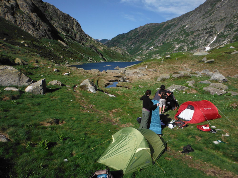
Head left to emerge above a splendid little lake with its "water mint" colors, tongues of ice on the surface, transparent effects. What follows is a long descent along the torrent, on a very rocky path. Given the unbelievably high water flow for the area, you have to cross with your feet in the water several times. Further down, a 1st pond, and even further down, after crossing a large scree, we finally catch sight of the étang d'en Beys, now much wider due to the abundant water flowing in from all directions (so much so that the GR is completely submerged for 150m as we skirt the pond!) L, without going as far as the refuge, fork left to take the GRP Tour de la montagne d'AX, marked in red and yellow and heading towards La Couillade d'en Beys. Before the climb, a small camping spot.
Stage 3: En Beys to Orlu
Leaving the bivouac to the west of the Etang d'en Beys, we leave the GR7 to take part of the Tour de la Montagne d'Ax, pass the Couillade d'en Beys (the name alone is a must), reach the Etang de Naguille and end up in the village of Orlu, on the other side of all these mountains. Short climb ahead, morning flat and a long, long (some would say interminable) descent to finish our journey and touch down in the Orlu valley. The weather was still splendid, with the windy Couillade pass, splendid views all the way and our packs lighter at last, unburdened by all those tins of tuna and mackerel we'd ended up swallowing and all those blocks of Bjorg organic bread weighing an ingot - fortunately, it's nourishing and tasty!
No particular difficulty, only the considerable negative altitude difference (1435m from La Couillade 2345m to Les Forges d'Orly 910m). The wind at La Couillade can also hinder progress and cause you to lose balance, especially as the final ascent and the first hairpin bends on the other side of La Couillade are quite steep. The presence of abundant water makes the path at best spongy, at worst slippery. The yellow and red GRP markings are fairly obvious and easy to spot. Numerous cairns also point the way.
Part 1
From the bivouac, you're soon on the slope. Short switchbacks with a few squiggles along a chaos (right hand). We reach a 1st small plateau in the middle of a cirque, where the path turns right to cross a second plateau. The final stretch is on a steep, yawing grassy slope to the pass (which is actually a little on the downside. Beware of strong winds!
Part 2
Impressive descent over the Peyrisses ponds, partly frozen today. The path then runs along the side of the mountain before coming to a landing with a view far ahead, below, of the Etang de Naguille, our goal. From here, follow the GRP downhill to the right, crossing scree to finally reach a wide combe leading to Etang de Naguille. After crossing the pond's southern footbridge, the path skirts the pond to the west, until it reaches the dam to the north. Time to rest your legs before the long descent to Orlu.
Part 3
From the dam, we enter the wooded gorge and follow an interminable descent, not as difficult as it sounds, but very long indeed. After about an hour, you enter an impressive forest, with gigantic trees and picture-postcard undergrowth. The path widens out a little and winds its way down the steep slopes of the valley to the Forges d'Orlu, the finish point of the hike.
As the loop is only partially complete, we need to stop off at the N20 before Ax, and then do the same to return to Mérens to pick up the car.


Leave a Reply