


TOPO Climbing | CLIMBING7.COM
Publié le
 Partager sur WhatsApp
 Partager sur Twitter
Partager sur Instagram
Partager sur Twitter
Partager sur Instagram

 Partager sur Facebook
 Imprimer le topo
 Laisser un commentaire

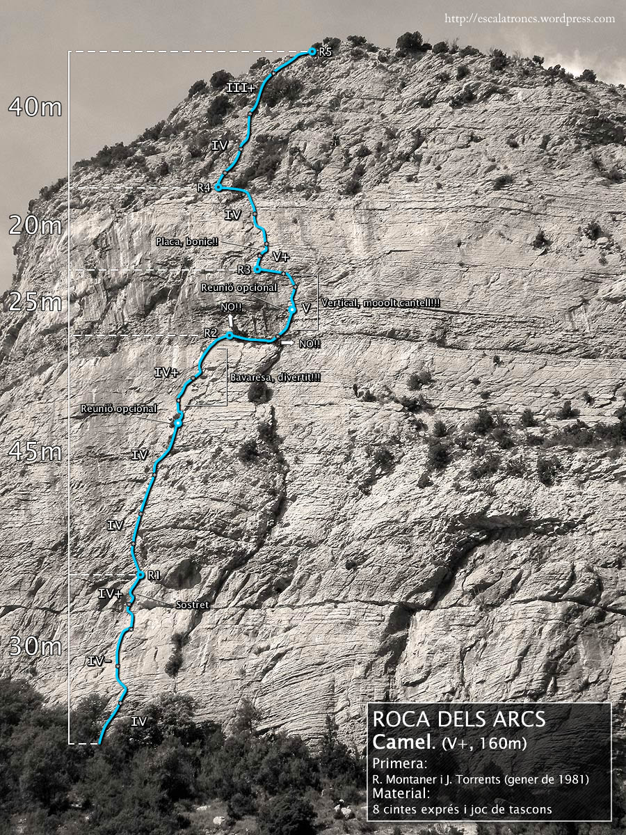
Vilanova de Meïa, a small Catalan village at the foot of Montsec de Rubiès, and above it, the impressive cliffs of Rica Alta and Roca dels Arcs. Just to the left of the Necronomicon route, the Camel is also a local classic, almost as beautiful, with a brilliant 3rd pitch that's well worth the detour. Excellent rock, an airy atmosphere in a fabulous setting and an accessible but committed route, in a very steady V (a few steps in V+ in our opinion), to enjoy the fantastic Roca dels Arcs. Semi-equipped, you'll need a set of friends to avoid spooking yourself.
❱❱ Technical summary
❱❱ Access to the place
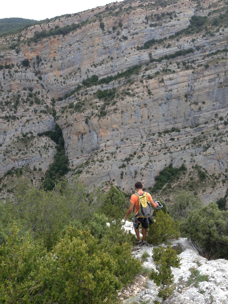
Go to the small village of Vilanova de Meïa, about ten kilometers north of Artesa de Segre. Pass under the village and continue on the small road towards Tremp. After a few hairpin bends, you pass under the Roca dels Arcs, then a large sharp bend (Font Blanca, drinking water, possible bivouac spot). The road then heads towards a gorge that can be seen to the right of the Roca. Cross a small bridge and park on the side. You can see the route perfectly on the east face of Roca dels Arcs, with a large piece of rock next to the wall.
❱❱ Map & topo
❱❱ Itinéraire
Find a path on the other side of the road which descends to climb up the opposite side. Follow it steeply uphill, then fork right to reach the foot of the track. Obvious start under the plaque, 1st nail visible at 5m.
The route is east-facing and 160m long in 5 pitches (30m, 45m, 25m, 20m, 40m). The equipment in place (bolts) is minimal, the belays equipped but not linked, except for R4. The compulsory level is V+, as we believe the old-fashioned ratings given in the topos are slightly underestimated. Bring 10 quickdraws and a set of friends from 0.3 to 2 for protection between very distant points (except on the V+ pitch of L4). Easy-to-install protection.
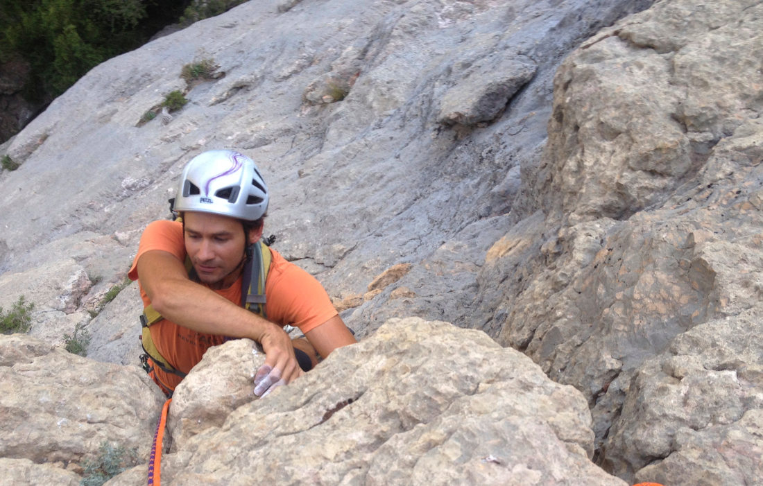
L1 (30m, V)
Climb up the undulating slab to a small overhang where the large plate begins. Not impressive, athletic but with very good holds. Above, climb R1 belay, next to a tree and under the dihedral.
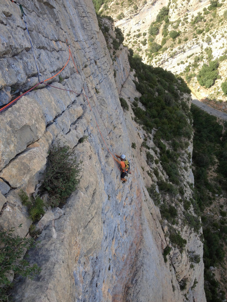
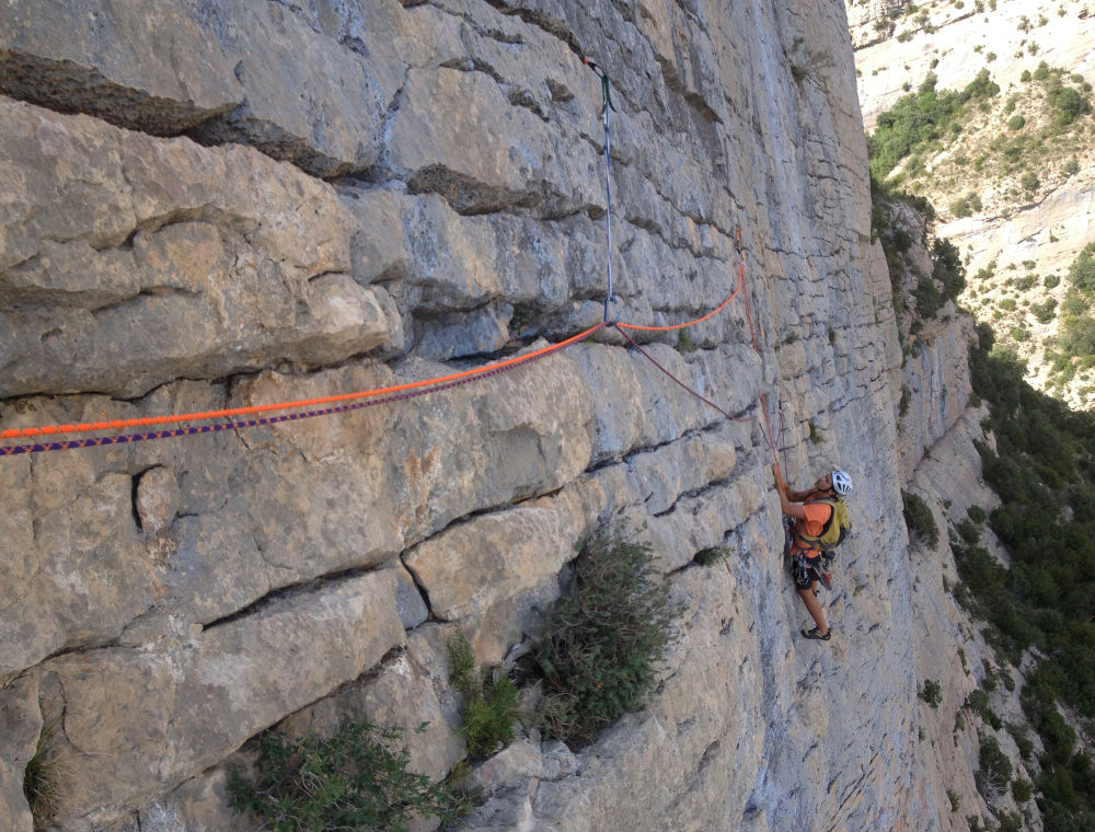
L2 (45m, V)
Follow the dihedral, protecting yourself especially at the start. After a fairly vertical section, the next part is a little inclined with a very nice crack on a plate to climb. We pass an old rusty belay and end up on the top of the plate at R2. A beautiful aerial pitch.
L3 (25m, V/V+)
The most beautiful pitch of the route! Descend to the right on a small, increasingly narrow, unprotected ledge to clip the 1st nail. Then attack straight ahead on a very vertical wall with lots of nice horizontal cracks for the hands. Pass a belay point and continue obliquely left to finish by traversing to belay point R3. We looped back to just above R2.
L4 (20m, V+)
A good pitch at the relay exit, well protected and with good lateral holds and exit onto a ledge. Finish in IV+ diagonally left to relay R4.
L5 (40m, IV)
Length to finish the route. Easy climb that ends by passing between shrubs. R5 belay on the ridge.
Once again, we had trouble following a trail all the way down. Head north and descend following what looks like a path. Further down, we lost it, so should we stay not too far from the ridge? Anyway, in the end, one way or another, we reach the road just above the parking lot.


Leave a Reply