


TOPO Canyoning | CLIMBING7.COM
Publié le
 Partager sur WhatsApp
 Partager sur Twitter
Partager sur Instagram
Partager sur Twitter
Partager sur Instagram

 Partager sur Facebook
 Imprimer le topo
 Laisser un commentaire
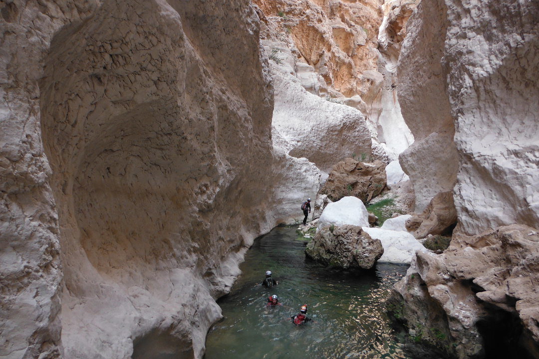
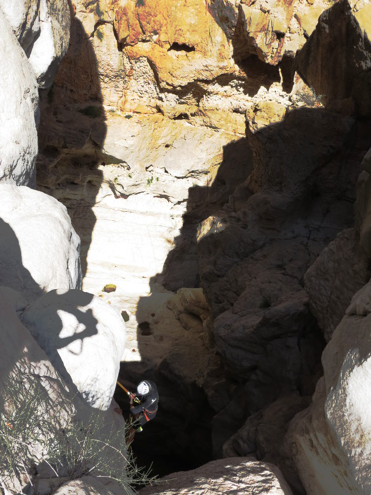
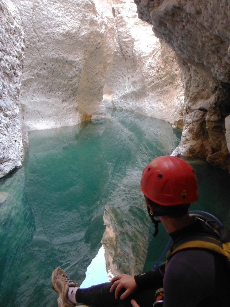
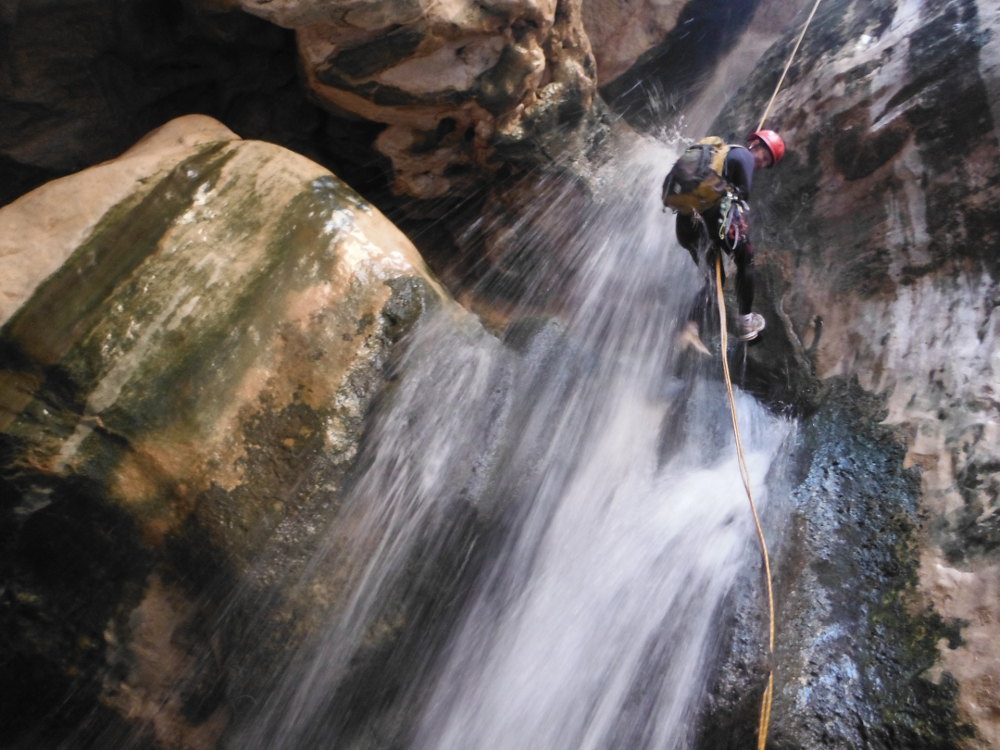
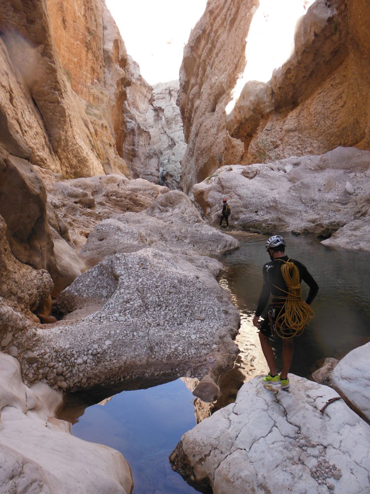
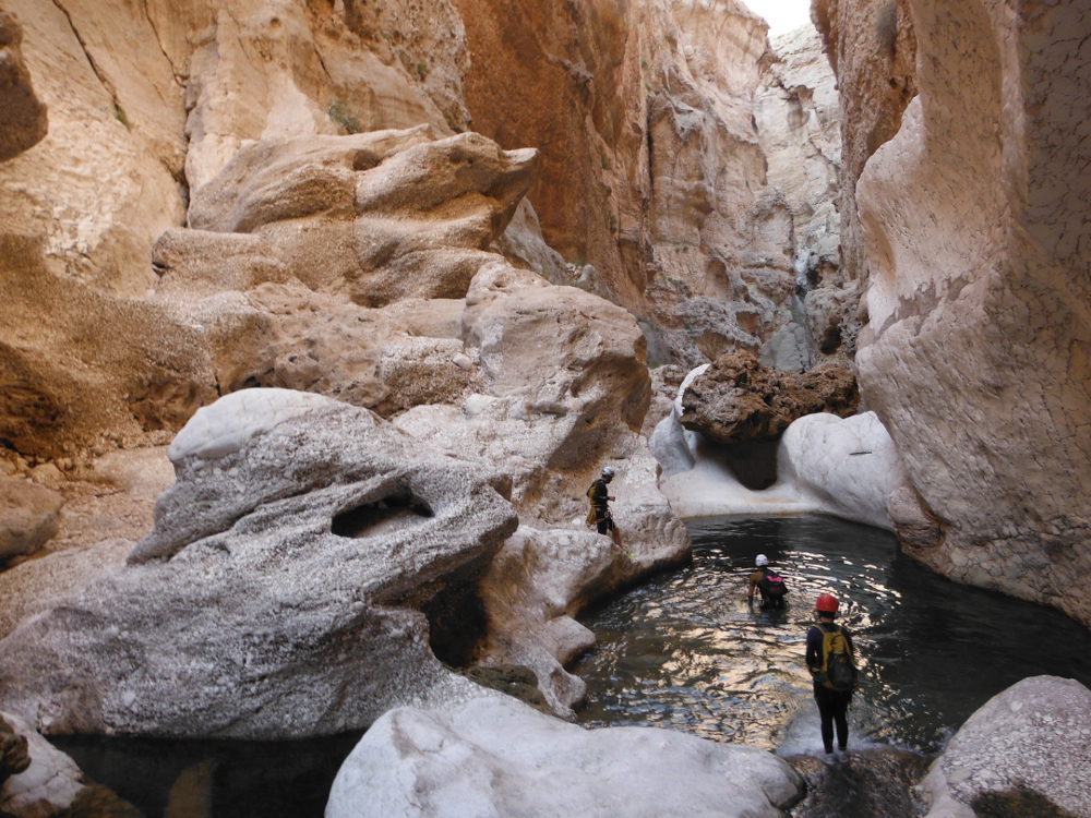
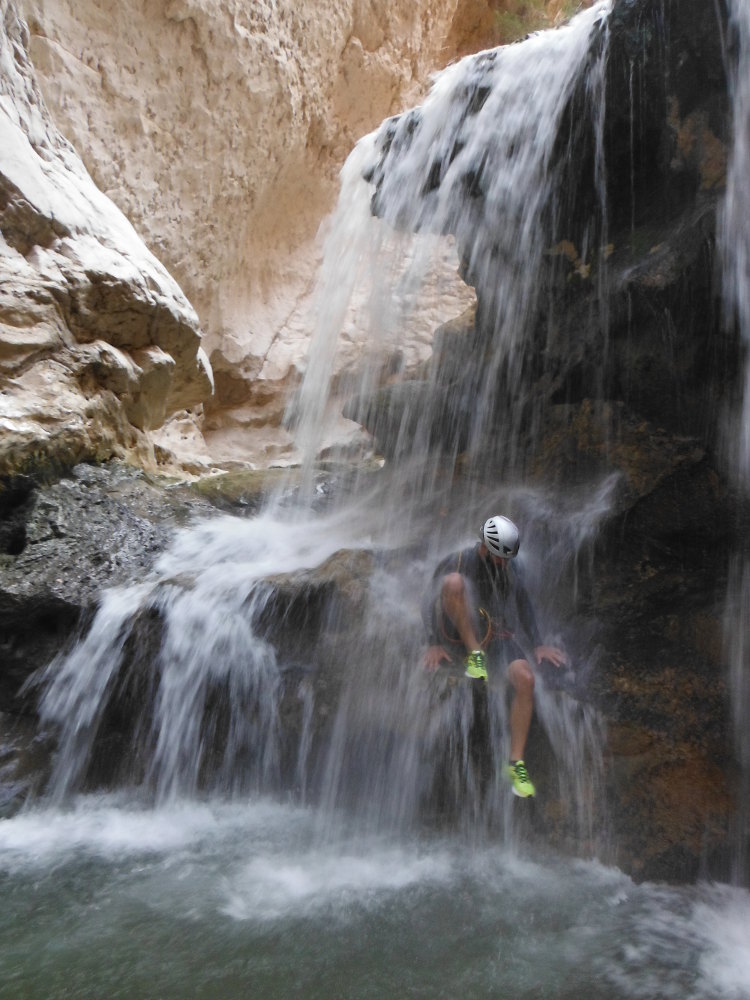
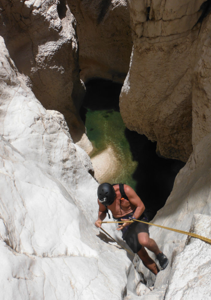
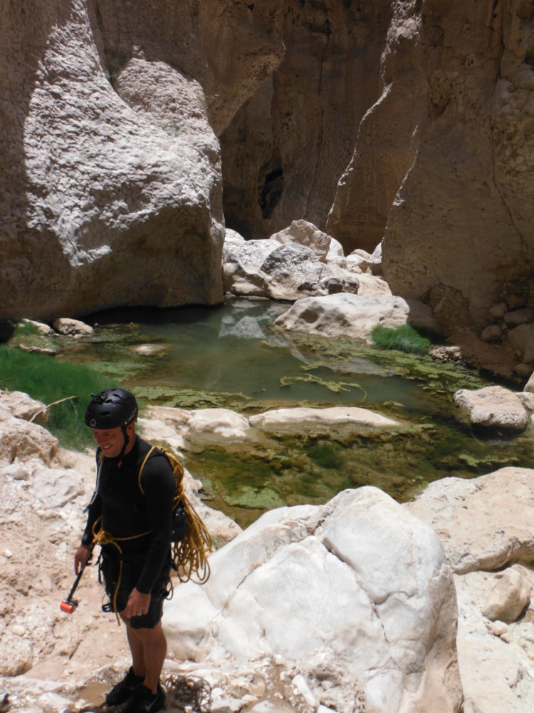
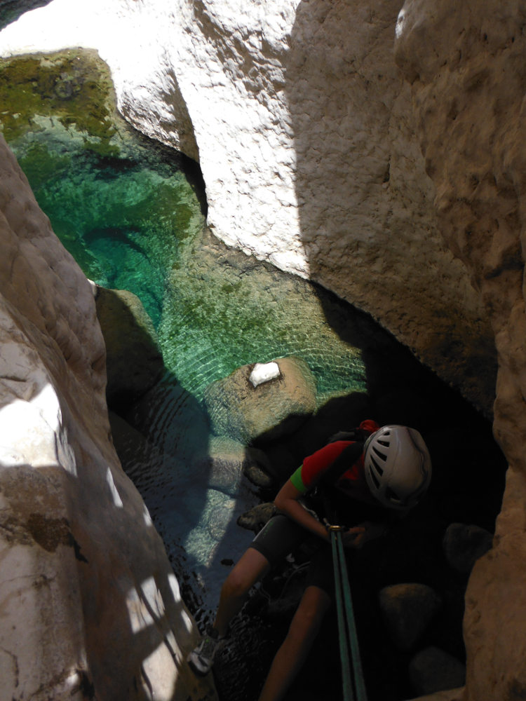
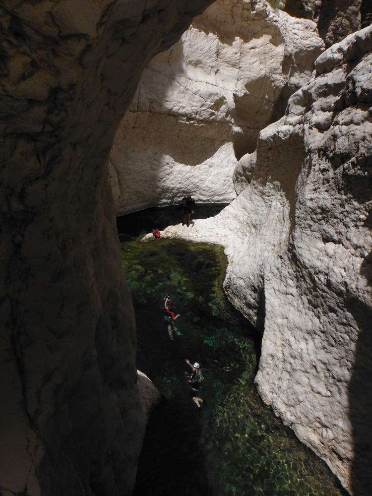
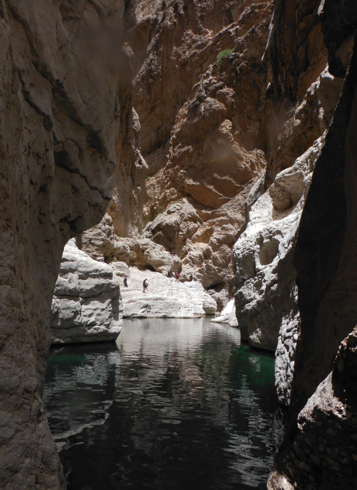
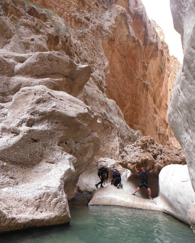
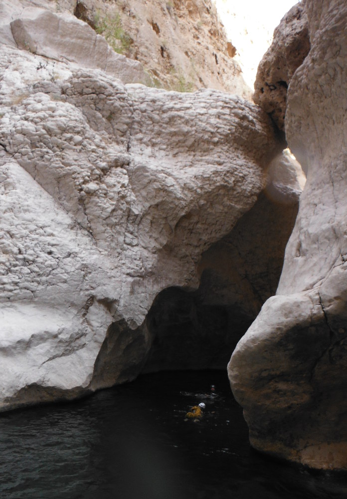
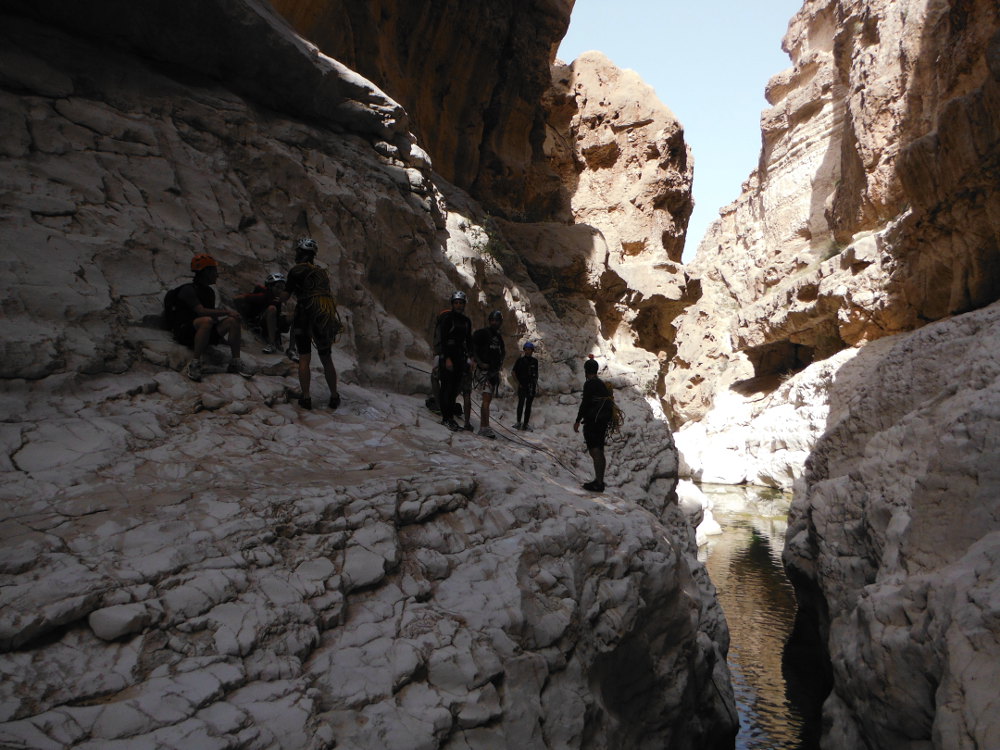
On the road from Sur to Quryat, south of Muscat, two large canyons end in the Gulf of Oman: Wadi Tiwi and Wadi Fins. Ta'ab Canyon is the lower part of Wadi Fins, from the small village of Ta'ab. It's also the most aquatic section, and probably the most incised. Although not technically very difficult, apart from a few tricky climbing steps, the route is long and above all very challenging, with no way out before the steep exit after 4 hours of descent. Several abseils, including 2 large ones (50m and 35m), 1 under a waterfall, a few small jumps and splendid pools to swim in, all in a splendid setting. An impressive approach to the incredible village of Ta'ab, followed by a festival of colors: green or sometimes midnight-blue, translucent water, white, orange, brown and gray walls. An absolutely exceptional trip.
❱❱ Technical summary
Location ✦ Fins
Region ✦ Charquiya
Country ✦ Oman
Type ✦ water canyon
Vertical drop ✦ 110m
Difficulty ✦ v4-a2-IV
Duration ✦ 4h to 5h
Max abseiling ✦ 50m
❱❱ Access to the place
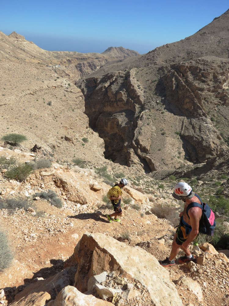
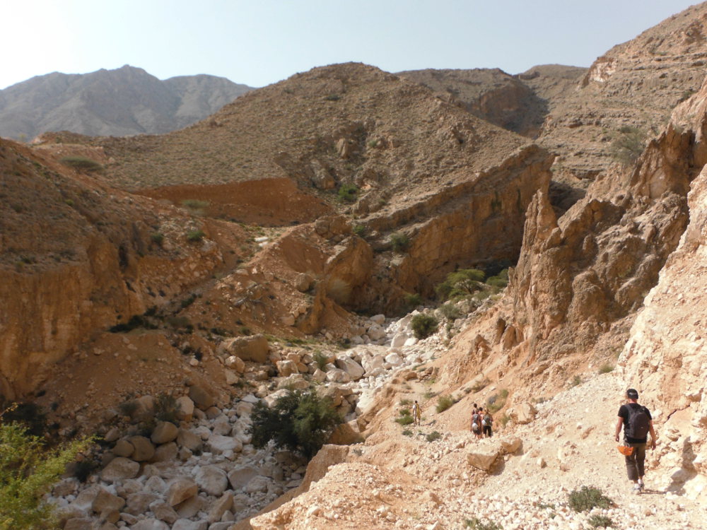
From the coastal highway leading down from Muscat and Quryat towards Sur. Exit at the village of Fins, and take the road that heads towards the mountains in the direction of Wusal (signposted at 58 kms). In fact, only a few hundred meters of asphalt, and it's a fairly good track that first leads to a plateau opposite the canyon's entrance. Follow the track to the right, downhill a little, then uphill again to pass over the mountain, through a few hamlets and finally along the canyon (on the left as you go up). After 8 or 9 kms from the freeway exit, there are a few houses on the left, on a small promontory above the canyon. Leave the 1st vehicle here, as this is the exit (see photo). To get back to the starting point, continue along the track for just a few more minutes, then turn off at the first track on the left, which leads downhill to the bed of a secondary wadi. Park here.
❱❱ Map & topo

❱❱ Itinéraire
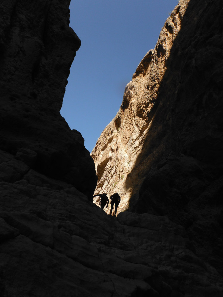
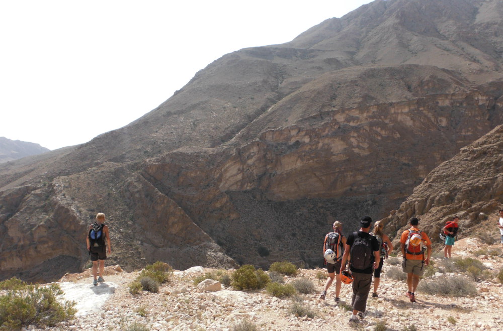
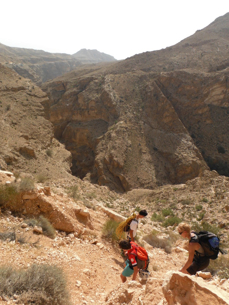
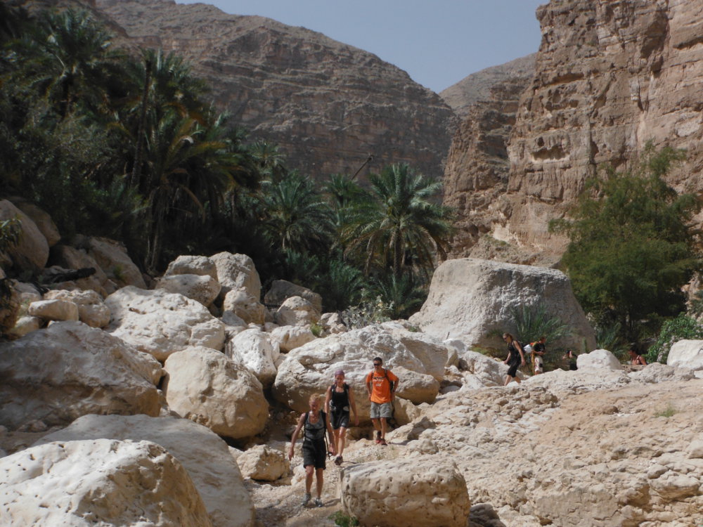
It's very beautiful. From the parking lot, cross the bed of the wadi and head uphill on a stony, winding track leading to a small pass with a 1st view of the canyon. From here, descend along a small, more or less marked path, which twists and turns before veering off to the right to reach the palm grove and the village of Ta'ab, hidden at the bottom of the wadi. Before the village, reach the stream bed where the canyon begins.
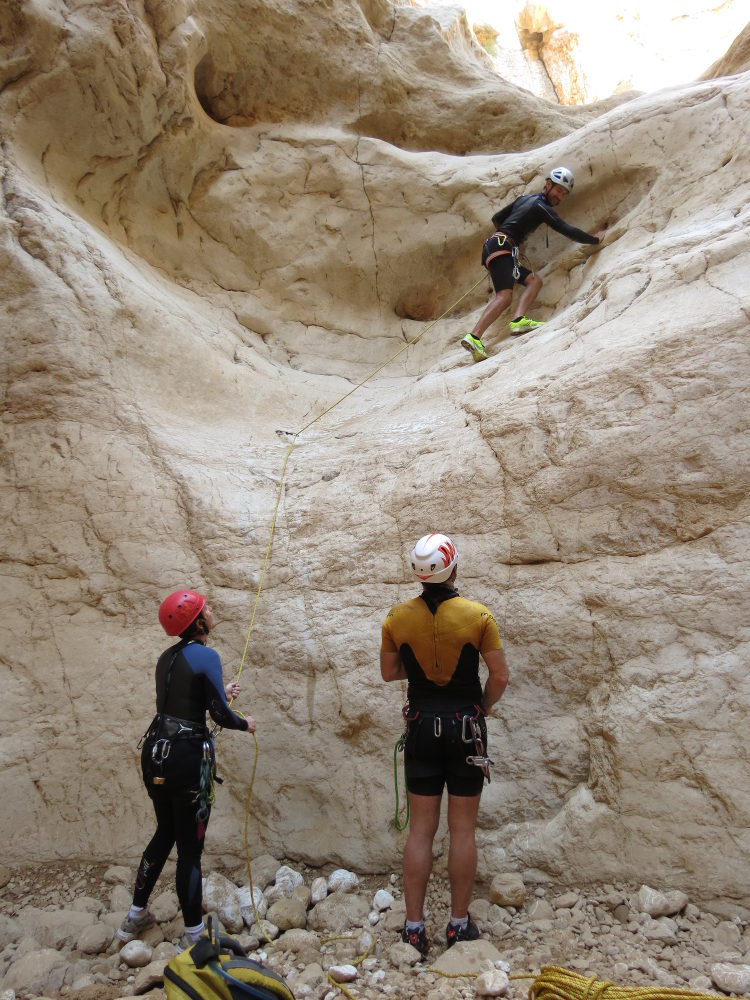
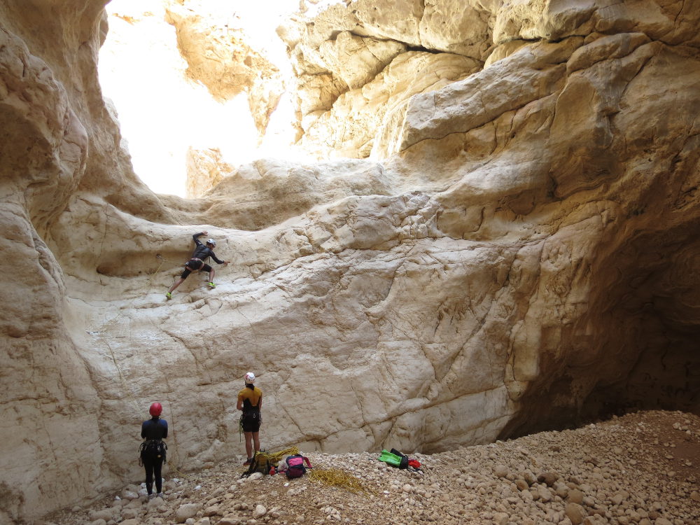
The canyon is fairly short in distance but concentrated and therefore ultimately long to descend. The equipment is good, with bolted or lunula belays and rope aids. Plan on a 2x60m, and possibly a dynamic 50m, and 6 or 7 quickdraws for the climbing sections that are equipped. A full wetsuit is welcome in winter, otherwise a shorty may be sufficient.
Climb back inside the tunnel to exit higher up. At this point, climb the ramp to the right, possibly with the help of the bolts along the way (easy climbing in III/IV, but exposed). Continue higher up, turning left again, then wind up on a slope that joins the houses of the finish point hamlet. If there's only one vehicle, it's a 20-30′ walk back to the starting point.


Leave a Reply