


TOPO Climbing | CLIMBING7.COM
Publié le
 Partager sur WhatsApp
 Partager sur Twitter
Partager sur Instagram
Partager sur Twitter
Partager sur Instagram

 Partager sur Facebook
 Imprimer le topo
 Laisser un commentaire
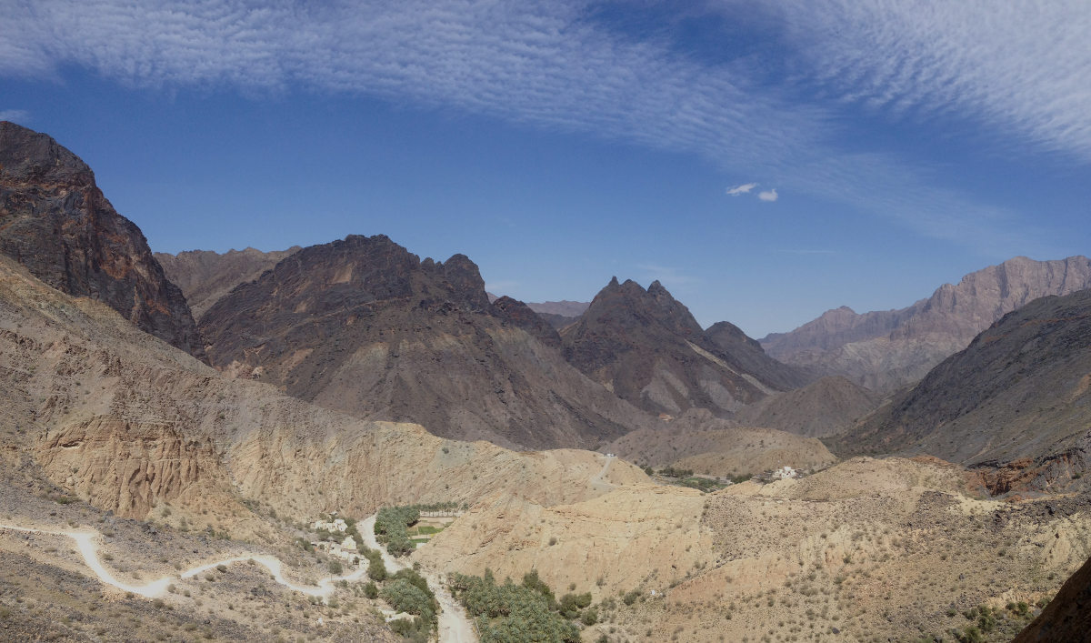
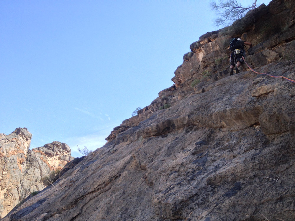
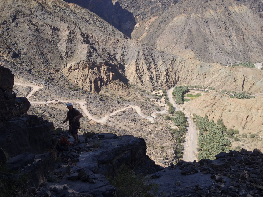
At the top of Wadi Bani Awf, before tackling the final climb to La Gorgette and Bala Seet, just outside the village of Zammah, 2 large pillars mark the end of Snake Gorge Canyon. After "Le vent l'emportera" on the east pillar (left), we set off on one of the routes on the west pillar (right). Several topos indicate the route, not always with the same layout. No Slicks is the route described in the 2014 Oman topo, but we probably didn't follow the same route, especially on the 1st pitch. No equipment in place and a favourable northerly orientation, a great atmosphere in this fabulous mountain setting, overlooking the Zammah palm grove. Nothing extraordinary for climbing, but an accessible route on fairly good rock, with pitches L5 and L6 being the most interesting.
❱❱ Technical summary
❱❱ Access to the place
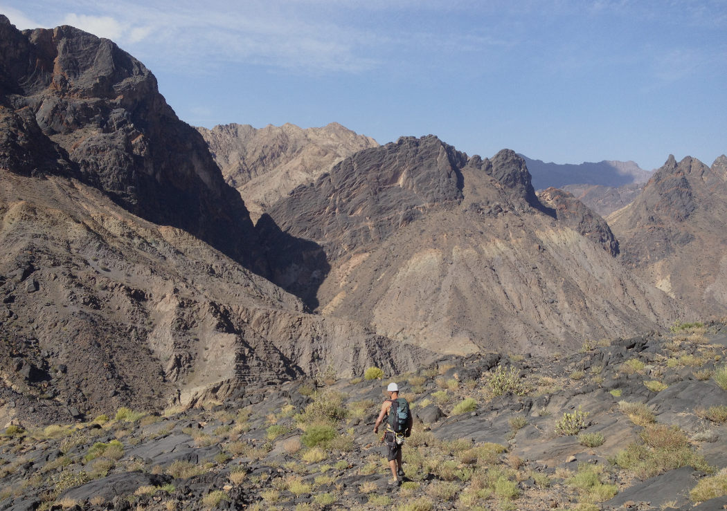
Between Rustaq and Al Awabi (R13), take the entrance to Wadi Banu Awf and climb up on the road and then the track, following the signs for Balad Seet, Hat or Zammah. A 4×4 is required, but there are no particular difficulties. Finally pass through Zammah and before starting the climb, at the exit, continue along the bed of the wadi to almost reach the base of the 2 pillars (obvious on sight).
❱❱ Map & topo

❱❱ Itinéraire
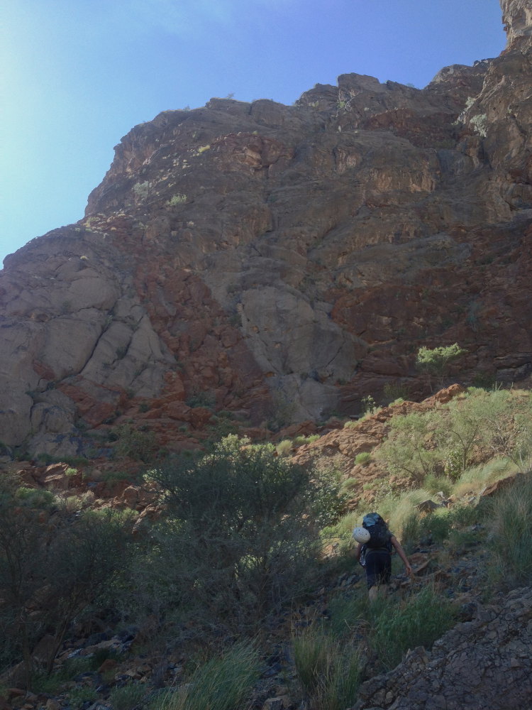
Approach the wall and climb in a zigzag pattern to reach the start of the route at the characteristic tongue of orange rock.
The route is north-facing and about 250m long in 6 pitches (60m, 60m, 30m, 25m, 25m, 50m). No equipment in place. Provide a set of friends and jammers, doubling the resources from 0.75 to 2. Compulsory level is V+.
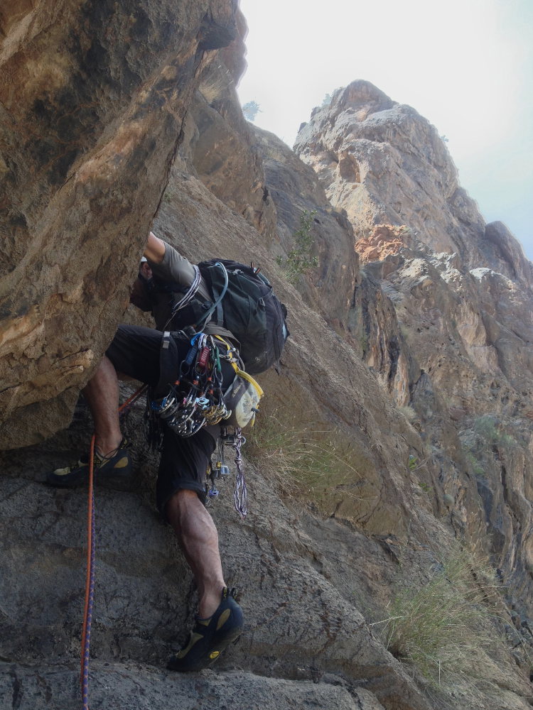
L1 (60m, V+)
Climb the orange rock then cross it, cutting upwards to attack the grey rock. Go straight on (or go round to the right to find the original path?) with a small overhang in V+ and finish by bending to the left. The R1 belay can be climbed at shrub level, in a recess. (there's a small ledge next to it).
L2 (60m, V)
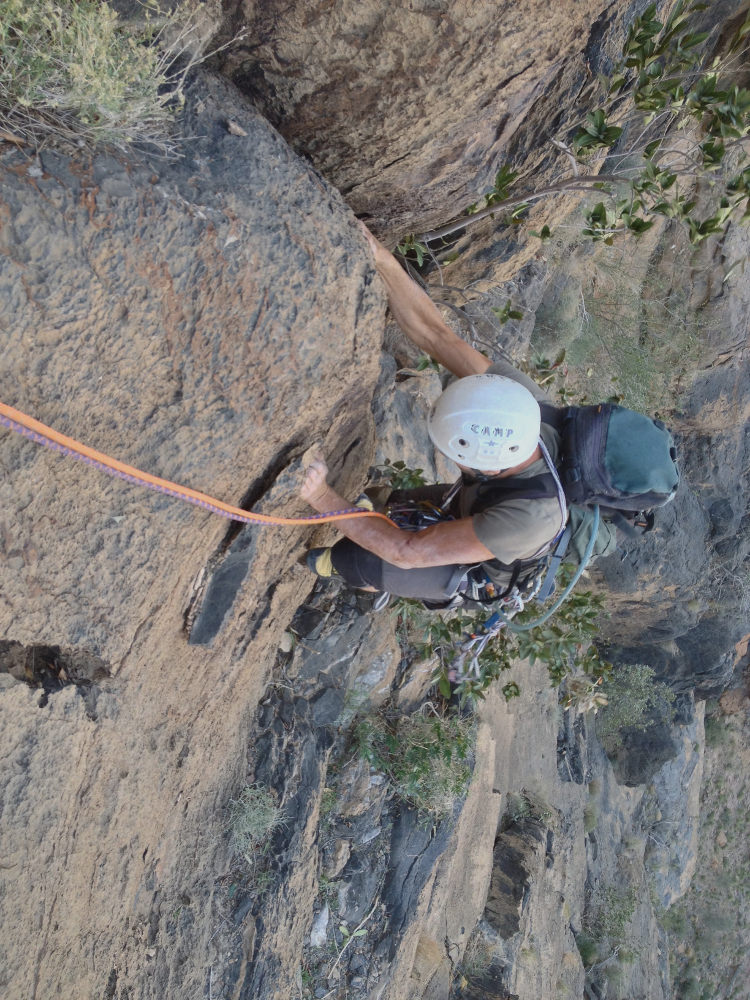
Aim for the clearly visible white break. Climb along the boulders and cross to reach the dihedral, which is a little tricky (some boulders are moving). R2 belay in the dihedral.
L3 (30m, IV)
Finish the dihedral and climb up a steep, easy ramp to come to rest under a pretty right-angled cedar.
L4 (25m, V+)
Pass the dihedral with some nice holds on the right-hand side. Exit along the gully on steeper ground.
L5 (25m, V+)
A good climb. Climb the clean crack in the middle of the spiked slab. Not easy to protect (big stuff!). Finish at the upper angle, where the rock becomes steeper again.
L6 (50m, IV)
Follow the ramp upwards and reach the summit to the right.
Climb to the summit and follow the dome westwards to reach a rocky, grassy plateau. From here, either try to cut through the last gully on the right (de-escalation) or head straight for the track and walk back down (no longer than that).


Leave a Reply