


TOPO Hiking | CLIMBING7.COM
Publié le
 Partager sur WhatsApp
 Partager sur Twitter
Partager sur Instagram
Partager sur Twitter
Partager sur Instagram

 Partager sur Facebook
 Imprimer le topo
 Laisser un commentaire

The idea is to summit Jebel Kawr, Oman's 2nd highest peak at 2740m, from the village of Sant on the east side. The trek takes a minimum of 10h, with 6 to 7h of ascent and a minimum of 4h of descent. A little tired from the previous day's big send, we didn't make it to the summit this time, starting too late and lacking a little energy. After all, it takes quite a bit of energy to climb some 2,000m of positive ascent, not counting the negative, on a very rocky and steep trail with few markings. The route, which looked difficult on the "Adventure Trekking in Oman" guidebook, is in fact quite obvious and logical to reach the summit. We make a U-turn below the pass at 2075m before the summit plateau, with the intention this time of rescheduling a 2-day traverse of Jebel Kawr from Sant (East) to Mawal (West).
❱❱ Technical summary
❱❱ Access to the place
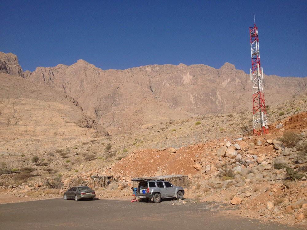
From the Nizwa to Ibri road, turn towards Amlah, Al Ayn and Sint at the village of Kubarah. Pass these villages and after Al Ayn, at the small roundabout, climb the hairpin bends to reach the plateau. Go straight on, past Sint and at the last stalls at a fork, take the track on the right which leads to Sant, a small hamlet hidden in the hollow of the mountain at the foot of Kawr, with magnificent cultivated terraces at the entrance (GPS or google map 23°06'20.9″N 57°04'07.8″E). Park just before entering the village, in a parking lot on the right.
❱❱ Map & topo
❱❱ Itinéraire
It's hard to describe it all the way to the end, because it's not finished, but at least as far as the pass that leads to the final plateau. Allow 4-5 hours to reach the pass. In the end, orientation is quite straightforward and some photos show the route perfectly.
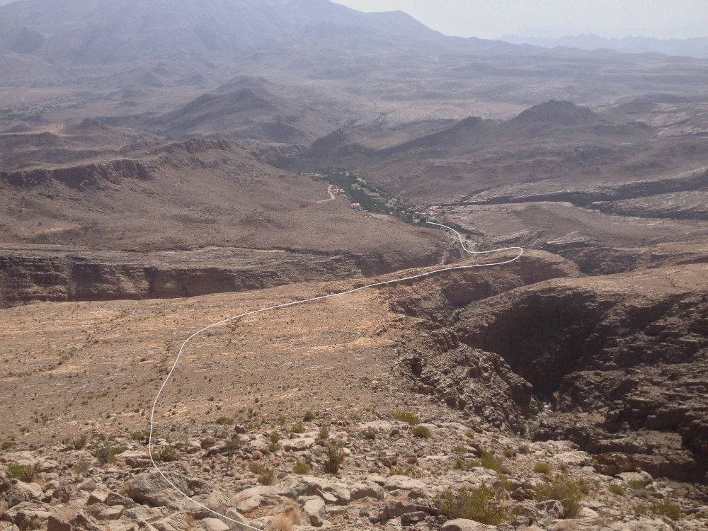
Part 1: Sant to Shidayt (1h30)
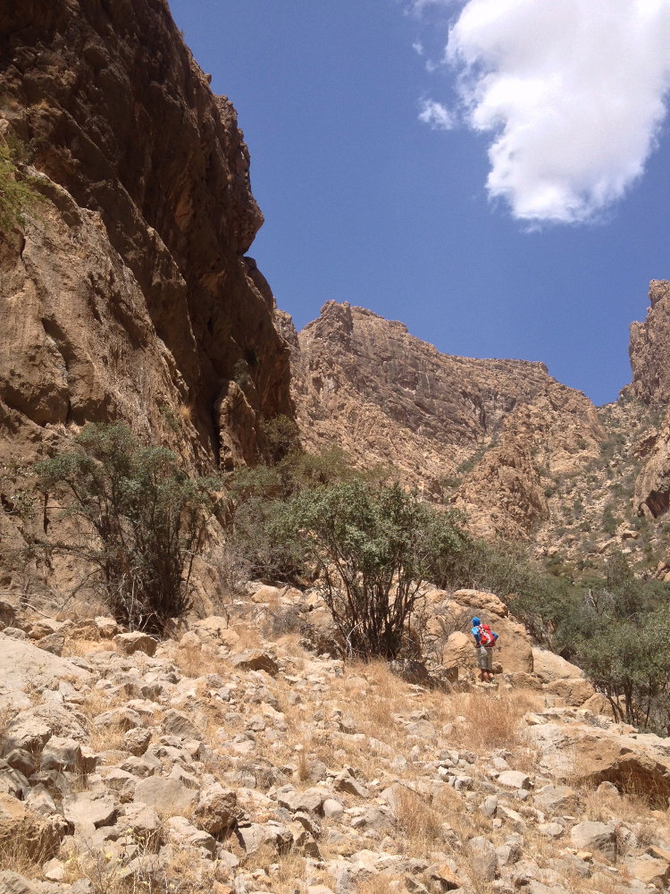
Take the falaj at the entrance to Sant and head for the mountains. Then cross the bed of the wadi and climb over the large ledge to reach the plateau. Walk on this platform, which is actually between 2 wadis, up it first to the right and then upwards, aiming for the small rock-covered summit at the end. Shidayt can soon be seen on the left below. A little before the summit, turn left and take a path that leads down and around the small summit to reach the village (characteristic round stone houses).
Part 2: from Shidayt to the pass (2h30 to 3h)
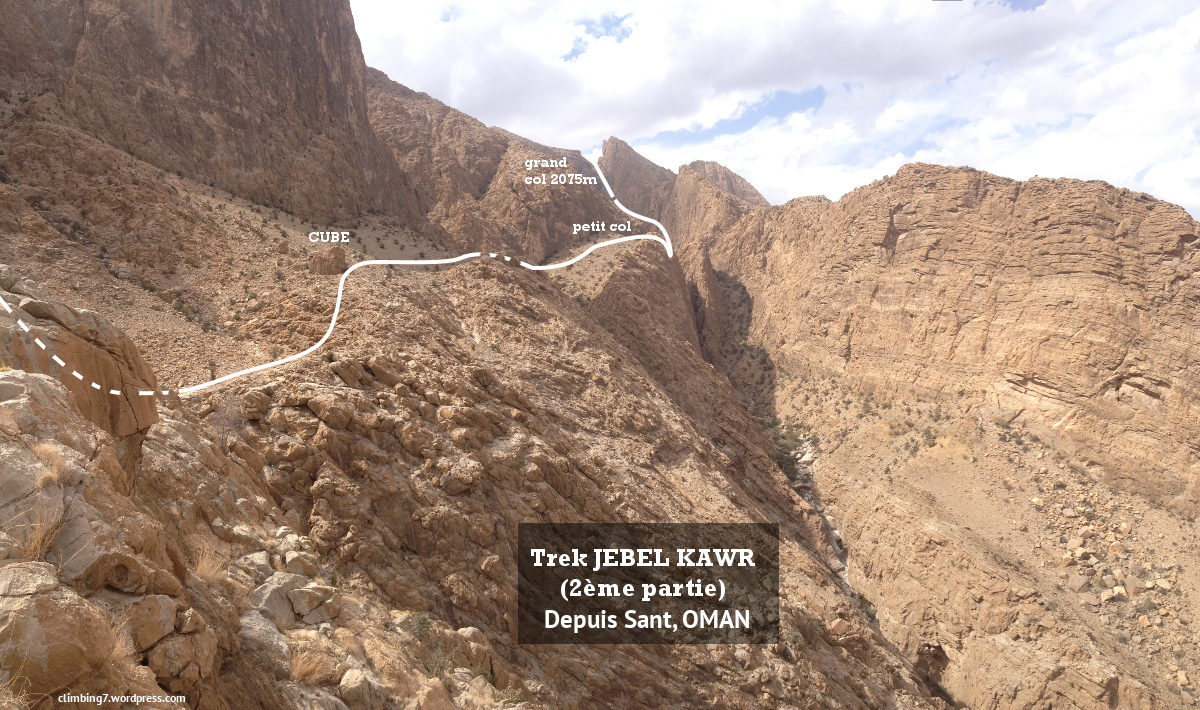
Climb to the right above the village to reach the small pass and continue up the ridge to an area of grey slab that gives access to the opposite slope. Here you can see the entire route to the pass. Descend along a rocky ledge, cross the dry torrent and take the opposite ramp up to the large rock cube (see route photo).
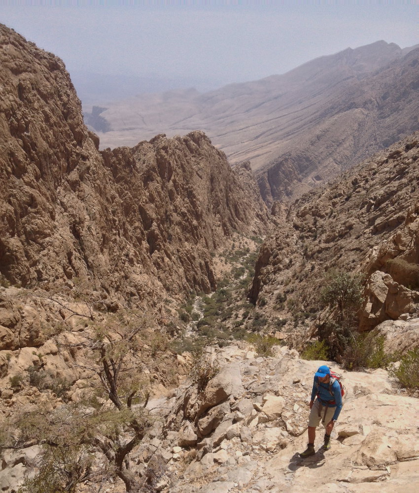
Continue on level ground, pass another depression and climb uphill to a sort of pass between the wall and a rocky ridge on the right. Here you can see the bed of the main wadi (on the right, at least 100m above the wadi). Descend to the bottom, then zigzag up the bed among the boulders.
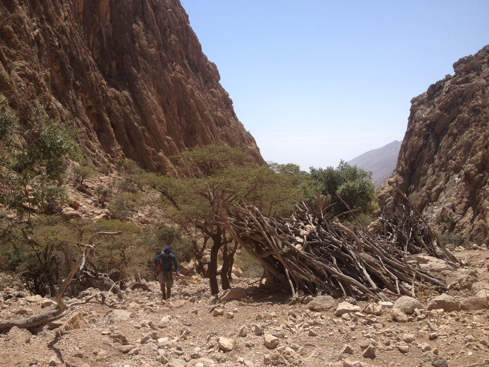
Higher up, you come to a flat area with abandoned wooden huts. Keep to the left (avoiding the bed and boulders), skirting the cliff on the left, and at the end entering the long, steep gully that leads to the clearly visible pass at the top.
Having made a U-turn there, allow around 2h30 to 3h in the opposite direction, without any real difficulty.


Leave a Reply