


TOPO Hiking | CLIMBING7.COM
Publié le
 Partager sur WhatsApp
 Partager sur Twitter
Partager sur Instagram
Partager sur Twitter
Partager sur Instagram

 Partager sur Facebook
 Imprimer le topo
 Laisser un commentaire
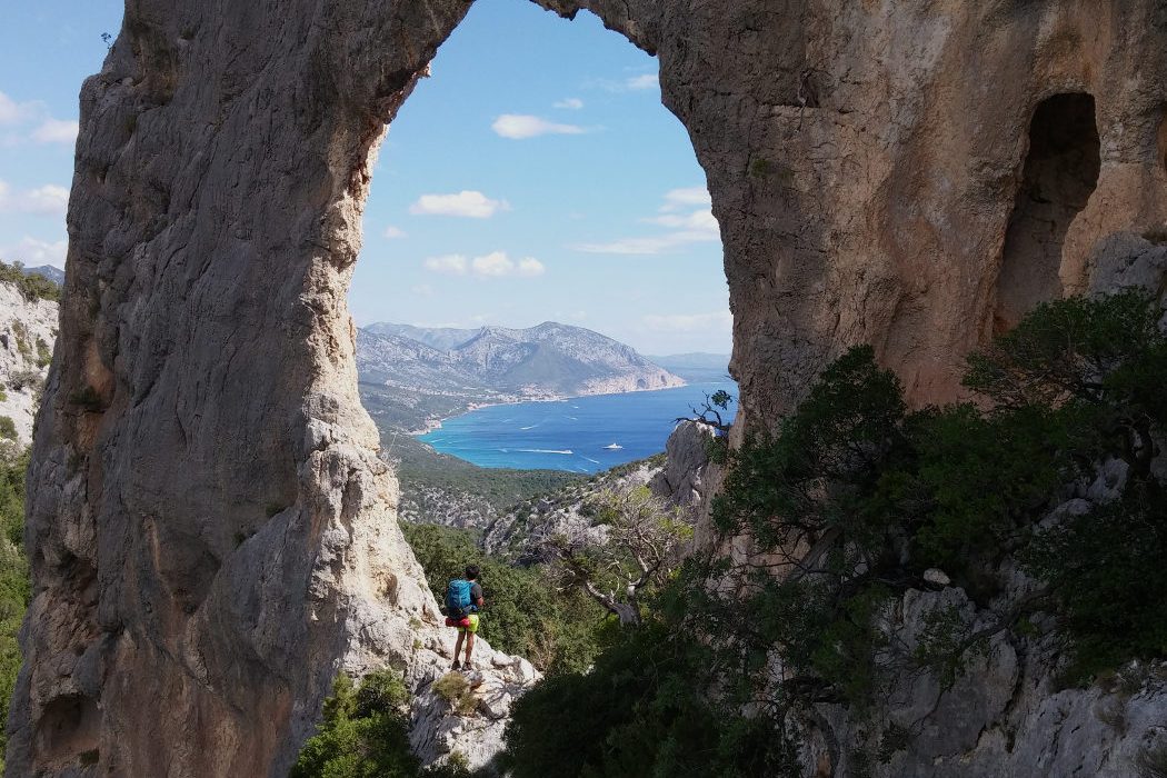
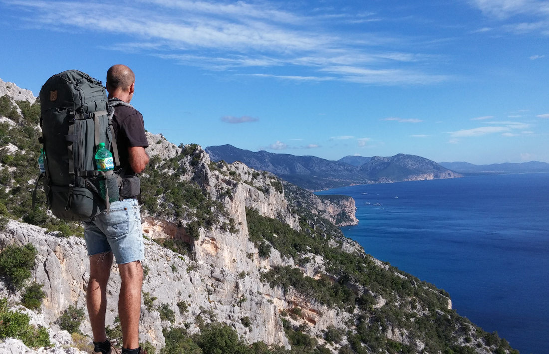
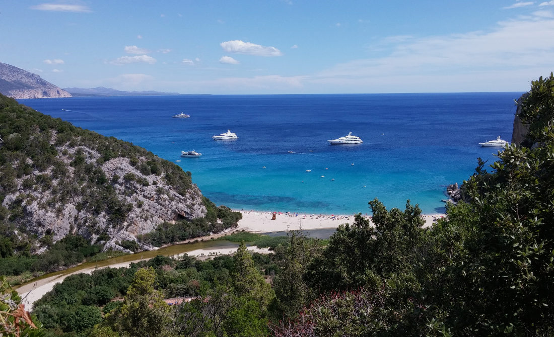
A very pleasant, easy hike along the coast of the Golfo di Orosei, the last stage of the Selvaggio Blu, the 7-day trek that crosses the entire gulf from south to north. With the exception of the first part, which is quite steep, the second part descends slowly until it reaches the small cove of Cala di Luna, which is beautiful but crowded in summer and of much less interest. The route does, however, offer an almost permanent panorama of the sea and a bird's-eye view of the rocky coastline from Capo Monte Santo in the south to Cala Gonone and beyond in the north. Not to mention the photo of the trek in the Arco di Roccia s'Arcada de s'architieddu Lupiru. The only difficulty lies in the logistics of the return or arrival, depending on the option chosen.
❱❱ Technical summary
❱❱ Access to the place
This is where you have to choose an option, as the hike doesn't make a loop, and the only possible way back, if you leave your car at Cala Sisine, is by boat. So there are 3 possible options:
1. Drive up to Cala Sisine from Baunei, climbing up to the Golgo plateau and following, past the San Pietro church, the track leading down to it (10kms, fairly good track in dry weather, 4×4 not really compulsory). In this case, plan to return by boat from Cala Gonone (rather expensive).
2. Drive to Cala Gonone and take a boat (still quite expensive!) in the morning to Cala Sisine, then return to the starting point along the trail. This is a much better option than 1.
3. We took this option because we didn't have a car, and we were self-sufficient with our bags. Walk to Cala Sisine, first up the asphalt road from Baunei, then along the track to Cala Sisine (15 kms). You can camp there if you ask at the bar (10 euros per person). So you can start the hike on day 2 and finish at cala Gonone without needing to return.
❱❱ Map & topo

❱❱ Itinéraire
Once on Cala Sisine beach, the start is on the left-hand side, just in front of a small stone house. There's a cairn where the path begins.
The reference guide used is Rother's Sardinia hiking guide. Make sure you bring plenty of water in summer, as there are no refreshment points before Cala di Luna (approx. 3.5 hrs. hike), leaving 2 hrs. to reach Cala Gonone. The itinerary is fairly easy to follow, with a narrow path in the first part and a wider path with signposts in the second.
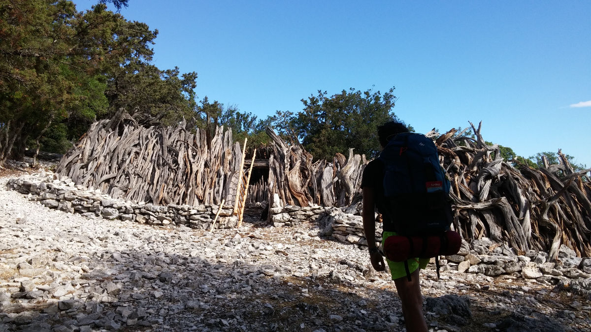
This is a steep climb in 2 stages. A first section in the woods, then over the sea to reach a 1st viewpoint. Then an ascent through undergrowth, with many small switchbacks, until you come to a site of characteristic wooden huts. Here you can drop off a few hundred metres to reach another magnificent viewpoint over the Golfo di Orosei. Return to the huts and pass to the left to rejoin the path and finally reach the highest point of the walk.
Once over the pass, you come across a wider, well-marked stony path, which you then take down to the right. Follow the mini-boulevard downhill, with views over the Mediterranean, before descending gradually and then more steeply on a dirt path in the undergrowth.
You start to see Cala Gonone in the distance, and further down, a little to the right of the path, is a superb rocky spur with a huge hole in the middle that forms a veritable giant eye for gazing at the horizon: the Arco di Roccia s'Arcada de s'Architieddu Lupiru (no less). If you're in the right position, you'll have a fantastic view of Cala Gonone through the natural hole. All that's left is to finish the descent and, after a final short climb, pass by Cala Di Luna and reach the beach.
It's more than just a return trip, as you'll have to walk back to Cala Gonone along the coastal path (lazy types will catch the return boat at the end of the afternoon). From the restaurant set back from the beach, cross the sandy spit of the torrent bed (dry) and walk backwards for around 100m to find the marked return path on the opposite side.
The 1st hour is not so easy: it's uphill, the path is very rocky, there are a few passages equipped with bars and it's better to have planned for the amount of water. The final stretch to Cala Fuili is easier. After a dip in the translucent water, there's just half an hour of asphalt left to reach Cala Gonone.


Leave a Reply