


TOPO Hiking | CLIMBING7.COM
Publié le
 Partager sur WhatsApp
 Partager sur Twitter
Partager sur Instagram
Partager sur Twitter
Partager sur Instagram

 Partager sur Facebook
 Imprimer le topo
 Laisser un commentaire
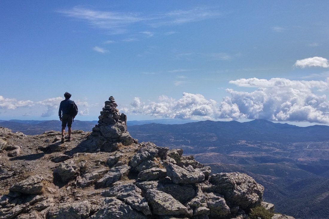
In the center of the island, Punta La Marmora is the highest peak, at 1834m above sea level. A hike that offers a superb 360° view of the big rock. The route can be taken from the east or south, but in either case is not particularly difficult. If you choose to start from the Santa Arena hut at 1500m, the difference in altitude is small and the area is quiet enough for a high-altitude bivouac. The round trip takes a maximum of 3 hours, without hurrying, via Bruncu Spina and simply following the ridge to the summit. The looped route is signposted GR 721, with variant 721a taking you over the ridge and returning via the normal path a little lower down. A great option after the heat of the coast in summer, especially as for once there are drinking water springs along the way. Note the shiny, silvery rock that bears the name of the Gennargentu massif.
❱❱ Technical summary
❱❱ Access to the place
From Nuoro, take the road heading south towards Desulo. Stop 5 kms before the village, passing the Col St Arcu de Tascussi, and follow the road up to the refuge de St Arena on the left. Continue for another 5 or 6 kms to reach the abandoned refuge at 1500m. Bivouacs are possible (and authorized) on the terraces in front of the refuge.
❱❱ Map & topo

❱❱ Itinéraire
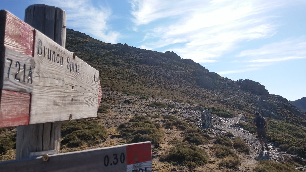
It's immediate, as the path starting behind the refuge is marked GR 721 (red and white markings).
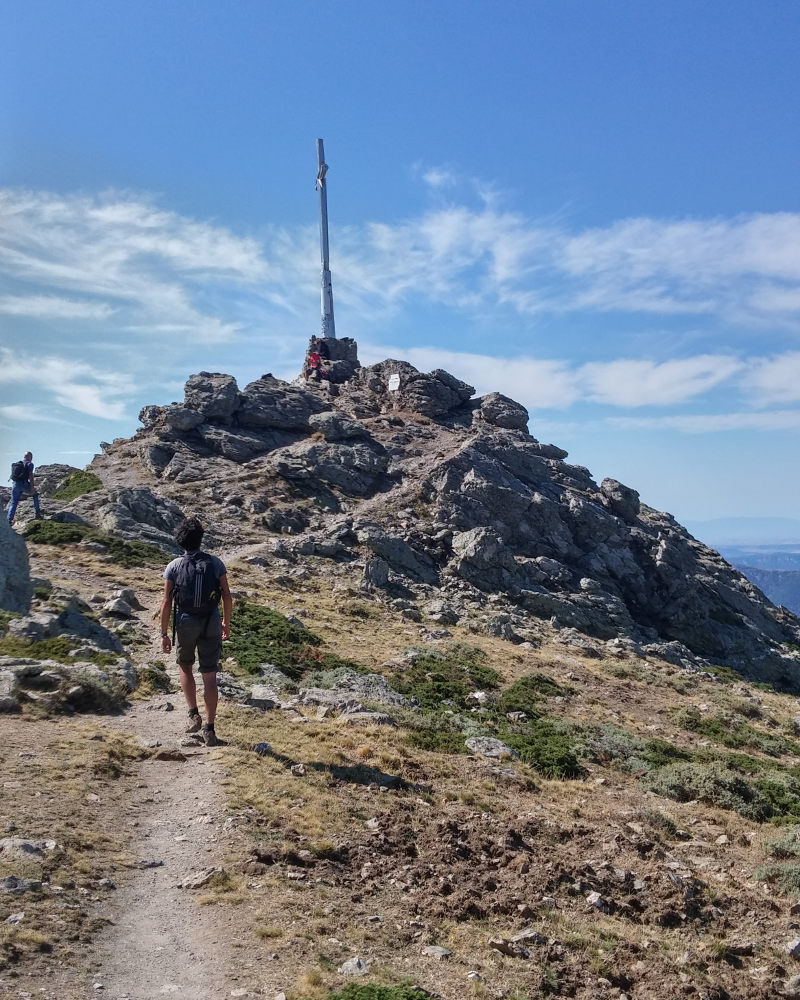
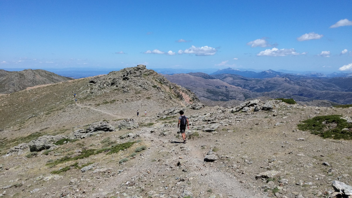
Simple and obvious. Yaw uphill, then head east to reach the 1st small pass with the junction to Bruncu Spina (take the path that climbs 721a, leaving the path on the return slope). In about 45' you reach the summit of Bruncu Spina. From here, you follow the ridge more or less on a marked path, passing to the right or left, following the cairns. We pass a number of small intermediate summits before descending to the pass below the Marmora: l'Arcu Gennargentu. The final ascent is a little steeper but not too difficult.
Descend from the summit in the opposite direction to the pass, then continue straight ahead along the main path on the flank to return to the refuge without difficulty.


Leave a Reply