


TOPO Via ferrata | CLIMBING7.COM
Publié le
 Partager sur WhatsApp
 Partager sur Twitter
Partager sur Instagram
Partager sur Twitter
Partager sur Instagram

 Partager sur Facebook
 Imprimer le topo
 Laisser un commentaire

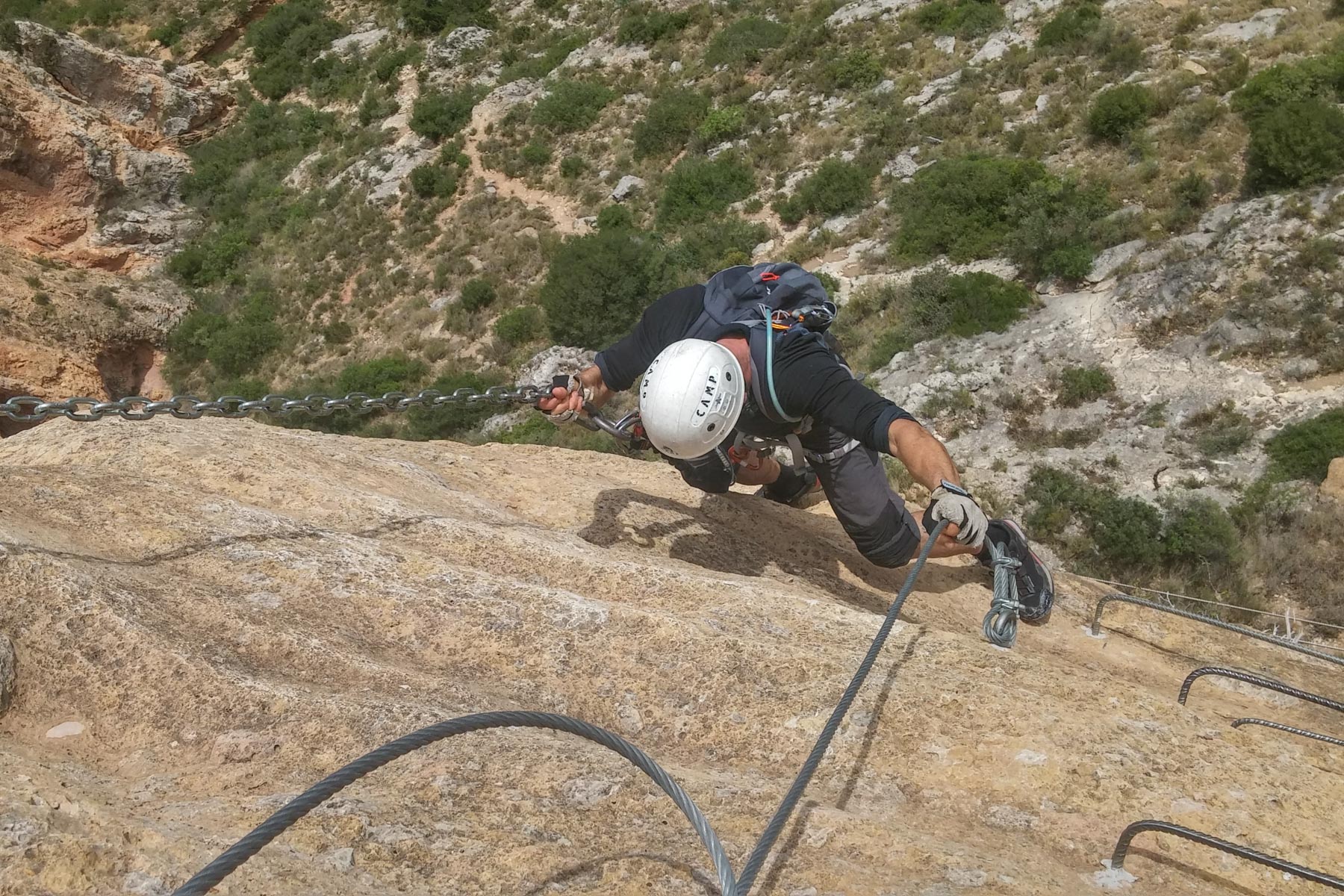
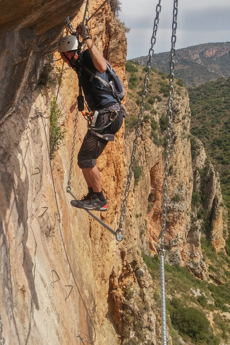
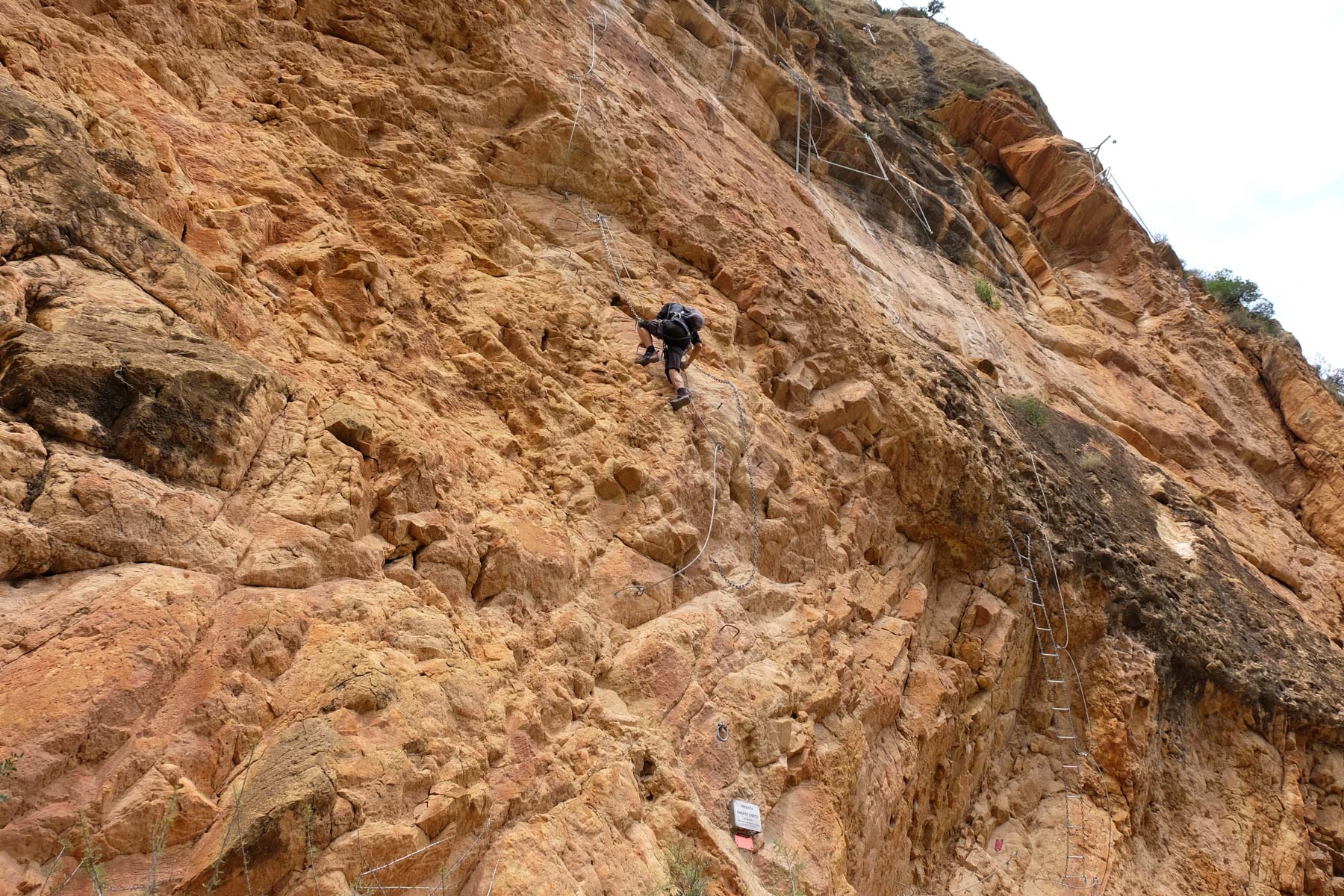
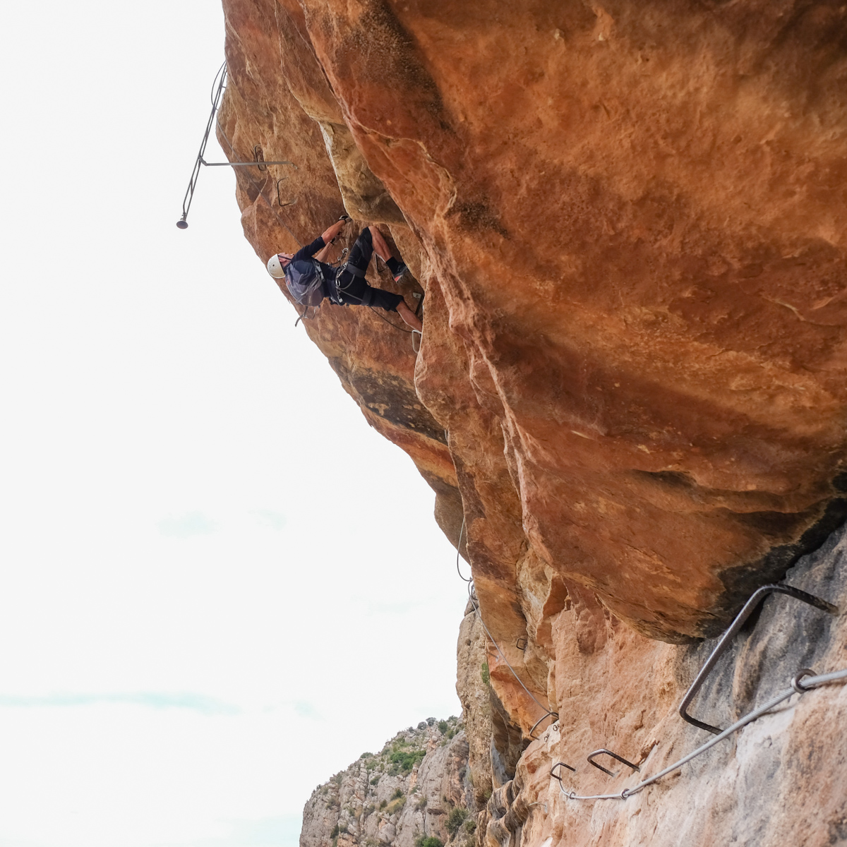
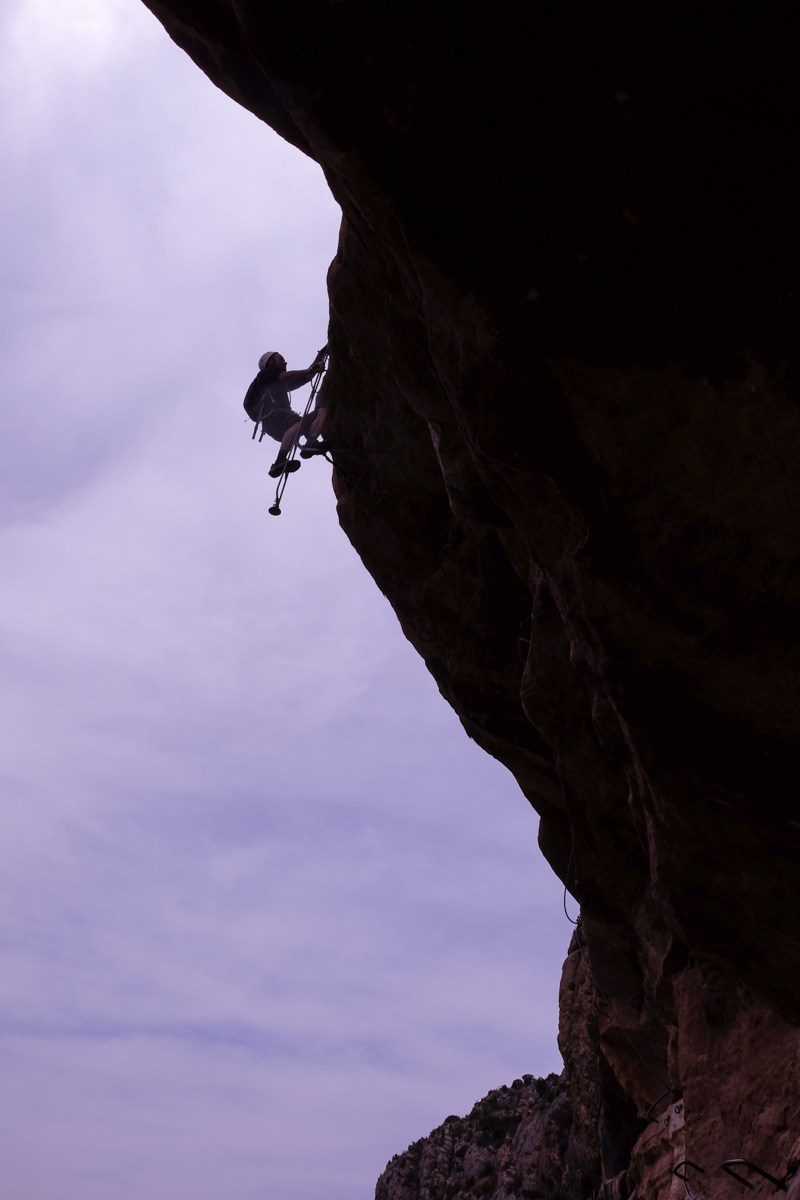
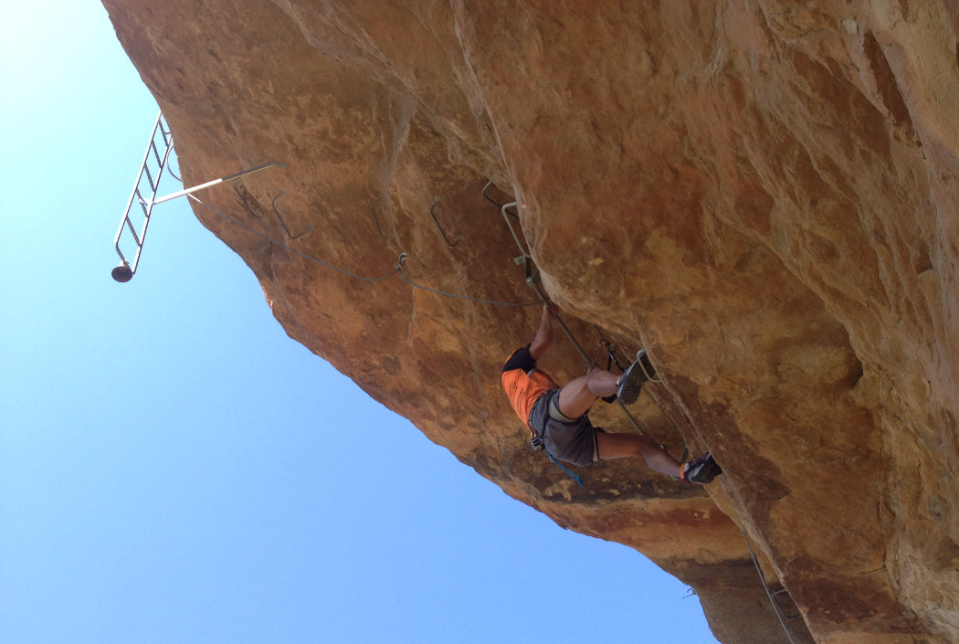
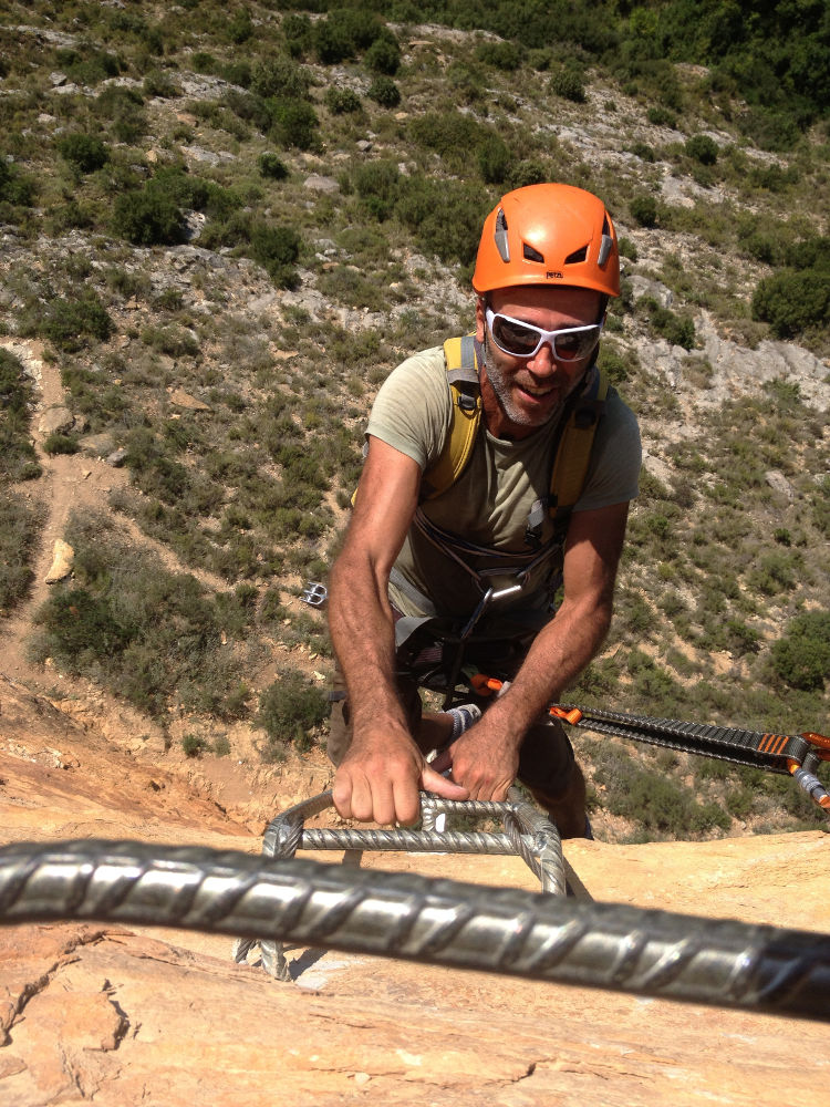
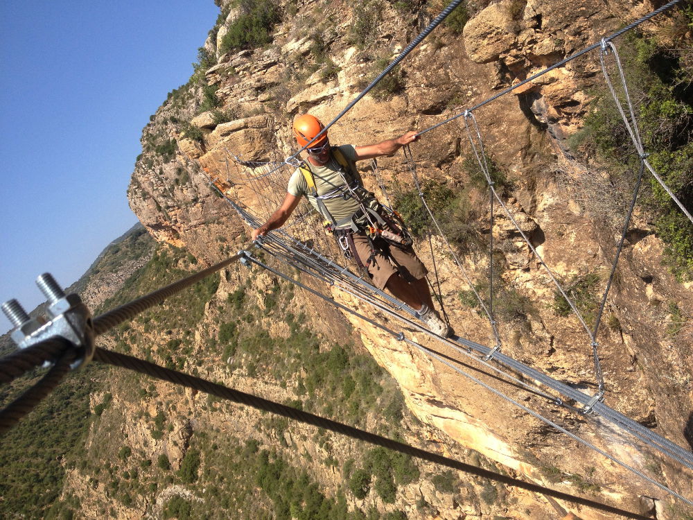
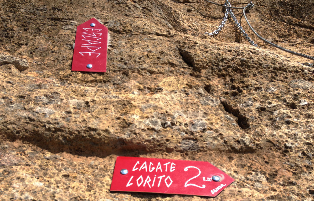
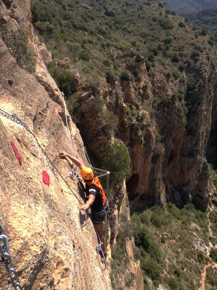
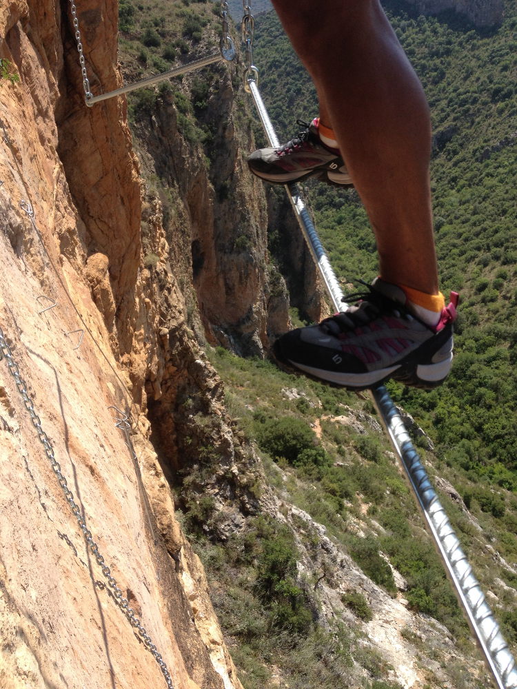
Cagate Lorito, the brand-new via ferrata between Lleida and Ballaguer, near the pantano of Sant Llorenç de Montgaï, is more like a high-level acro-falaise course. It's all there: overhangs, roofs, a suspension bridge, pendulums, a fireman's column, aerial crossings, a zip line, and many other surprises, all above the void at all times. There's little or no rest, as you climb the overhanging wall and then race back down again, ending up with your shoulders, arms, hands and fingers all in knots. The route is of course ED, especially if you have fun doing it without using the lifeline, with movements very similar to climbing. It's a pretty exhausting experience, but fortunately you can then fall back on the village's only terraced bar and whistle a few cañas before slouching again on the lawns beside the Segre.
❱❱ Technical summary
Type ✦ Via Ferrata
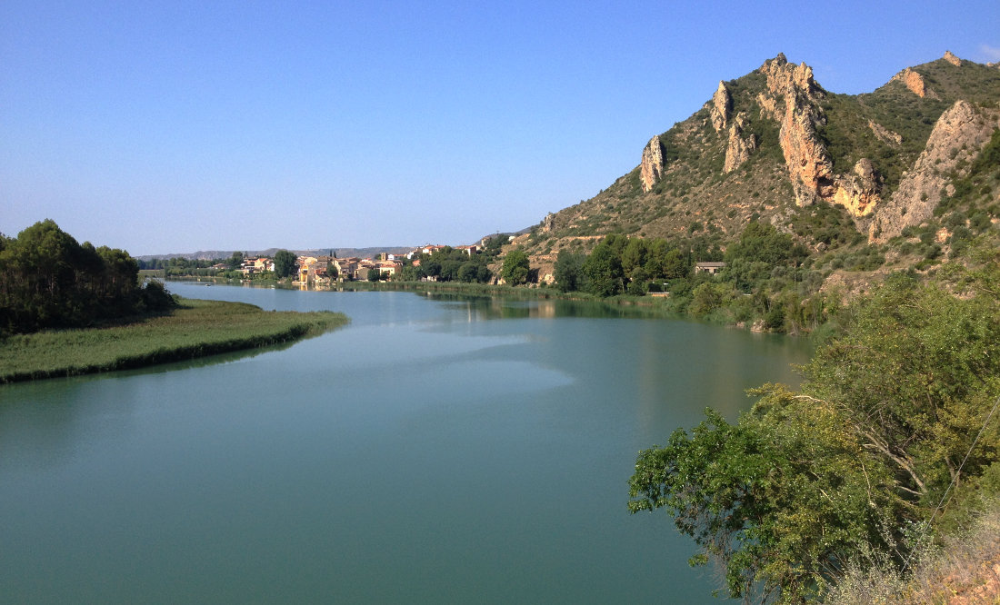
Location ✦ Sant Llorens de Montgaï
Region ✦ Catalunya
Country ✦ Spain
Length ✦ 150m
Vertical rise ✦ 65m
Difficulty ✦ K6
Duration ✦ 1h30 to 2h
Interest ✦ ★★
❱❱ Access to the place
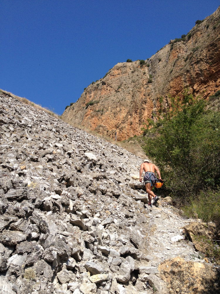
From Ballaguer, take the C13 towards Tremp and turn left towards Sant Llorens de Montgaï just before Camarasa. Before reaching the village, park in the parking lot on the left, just before a small curved bridge. There's an information panel on the local prehistoric site, indicating the past presence of some Neanderthal climbers.
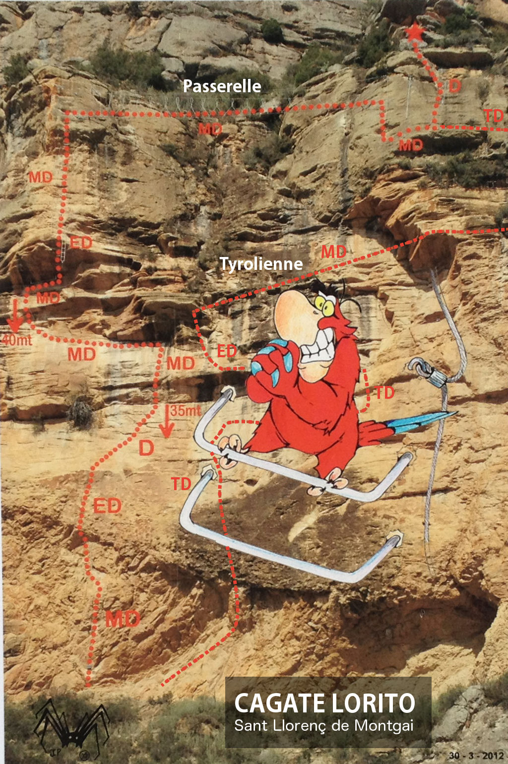
❱❱ Map & topo
❱❱ Itinéraire
The path is very well signposted (arrows and red ceramic dots). Cross the road and descend to the right of the bridge. Follow the bed before forking left and climbing up a large stone embankment over which a railroad track runs. Cross over and continue along the slope, then descend and skirt around the cliff before climbing back up towards the ferrata, which you can soon see.
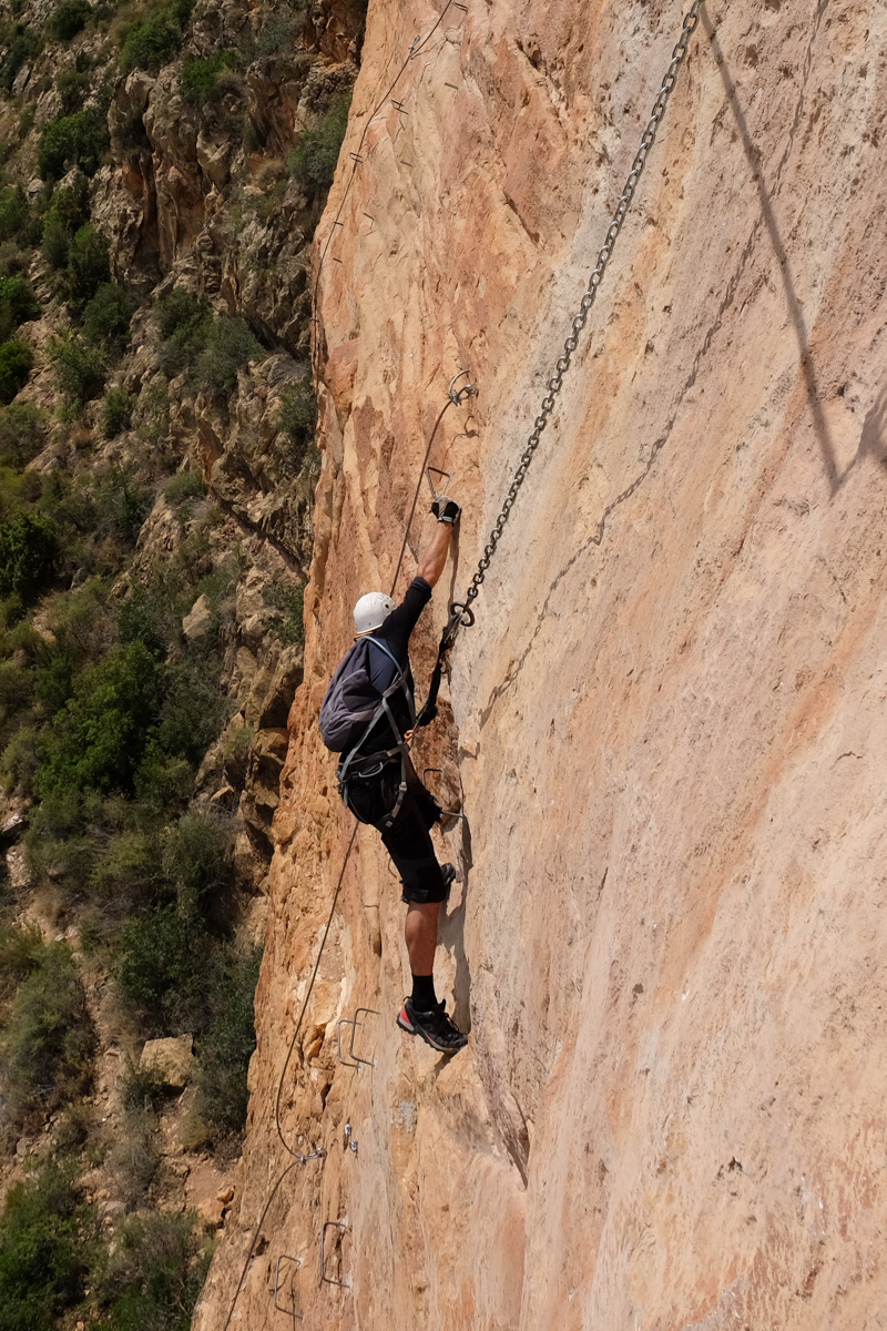
The Cagate Lorito, equipped in 2012 and facing south-east, is perfectly and generously equipped with chains, rungs, cables, nails and lots of other inventions that are completely safe. The gradient is not very steep, so the route is short but rather explosive. In addition to the usual equipment, you'll need at least 2 lanyards and a pair of gloves (no need for pulleys, equipment already in place), and possibly a 2x70m safety line.
Only the zipline can pose a problem, with a fairly rapid arrival followed by a backward movement where it's tricky to grab the exit cable. The rest is simply tiring and very athletic, but you can rest on longe at any time. The builders' topo only mentions the ascent, the descent has been traced approximately to complete it.
Return to the approach path in the opposite direction.


Leave a Reply