


TOPO Canyoning | CLIMBING7.COM
Publié le
 Partager sur WhatsApp
 Partager sur Twitter
Partager sur Instagram
Partager sur Twitter
Partager sur Instagram

 Partager sur Facebook
 Imprimer le topo
 Laisser un commentaire

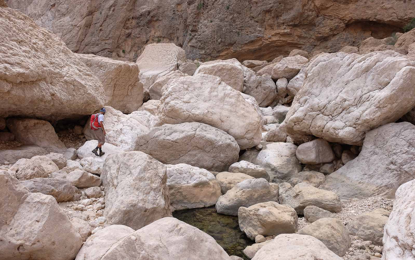
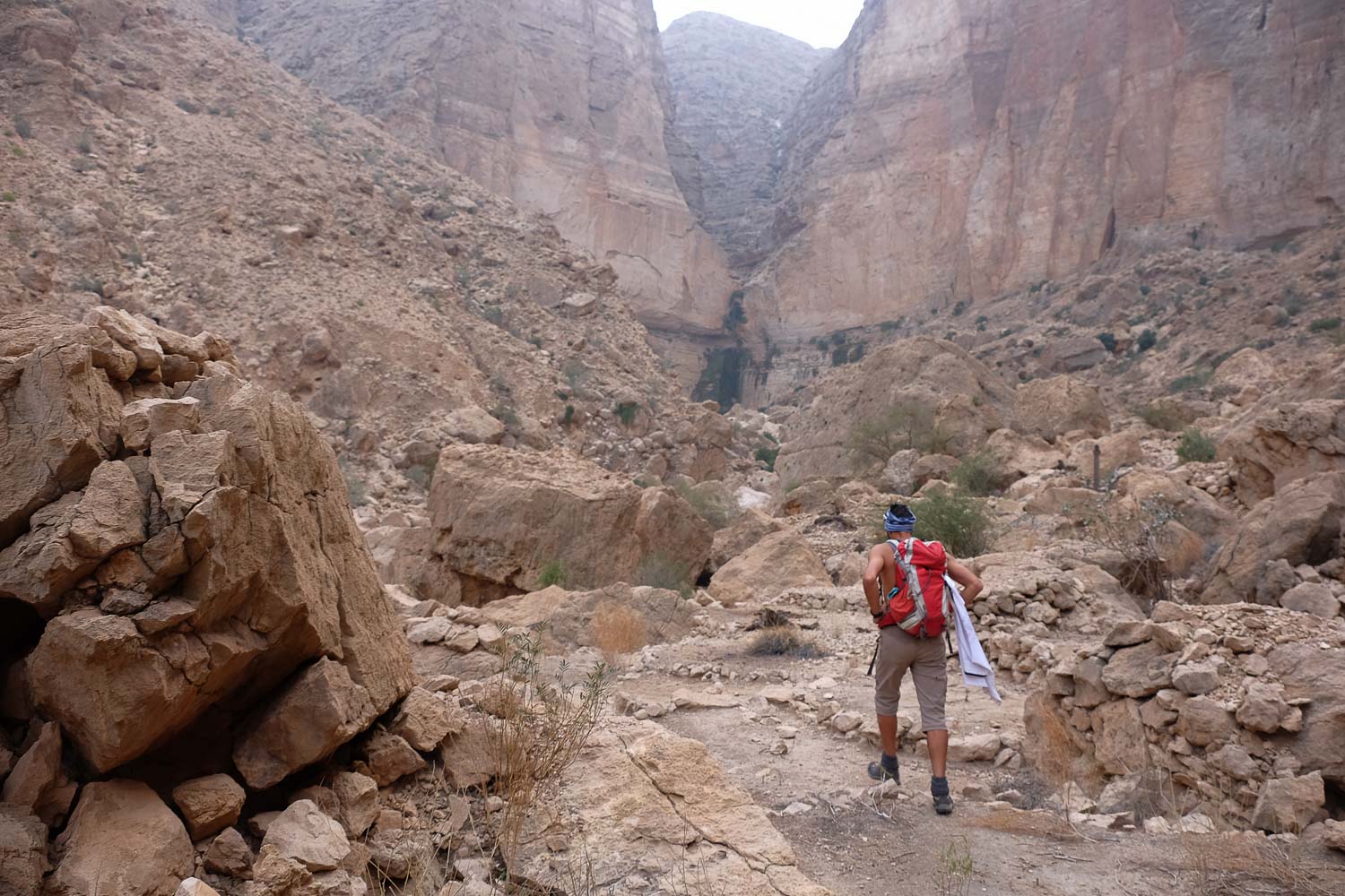
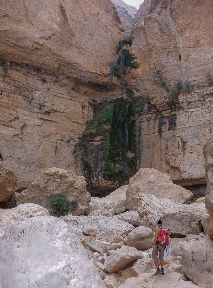
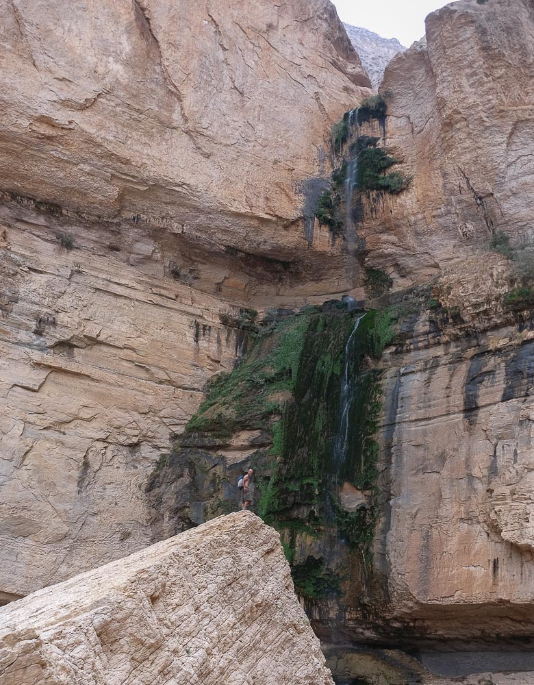
Starting from the pretty little village of Suwayh, at the bottom of the great wadi Al Arbiyeen, on the north-eastern coast of Oman, 2 secondary branches develop: wadi Naqma on the left and wadi Al Hail on the right. It was the Naqma option that we explored, walking up the bed of the wadi to the large 110m waterfall that closes the canyon after around 4 hours' walking. It's a wild, little-visited out-and-back that reveals an impressive abandoned village and 2 beautiful waterfalls above. This is more of a hike than a canyon, with the presence of water at the start and under the waterfalls, but otherwise a dry and physically demanding route. Much of Wadi Naqma is cluttered with large boulders and chaos, and progress is difficult and slow. Nevertheless, it's a good day trip, before exploring the other branch on the right, the more aquatic Wadi Al Hail.
❱❱ Technical summary
Type ✦ Torrential canyon
Location ✦ Al Suwayh, Wadi Al Arbiyeen
Region ✦ Muscat, Hajar Oriental
Country ✦ Oman
Difficulty ✦ v1-a1-III
Vertical drop ✦ 70m
Max rappel ✦ None
Duration ✦ 7h to 8h (round trip)
Interest ✦ ★
❱❱ Access to the place
On the E17 road from Quriyat to Sur, exit at Dhabab and pass under the freeway bridge to find the track in very good condition which enters and plunges into wadi Al Arbiyeen. The canyon is quite steep but wide at the start, and climbs upwards with great twists and turns. Pass the first hamlet on the right, then turn left at the second hamlet to stay in the main wadi. You then pass a small pass and, on the other side, the village of Al Suwayh. Cross over and enter the village, parking at the entrance or in a small central square.
❱❱ Map & topo
❱❱ Itinéraire
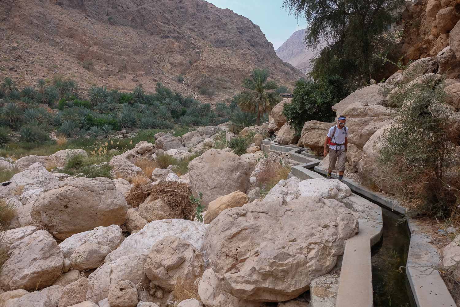
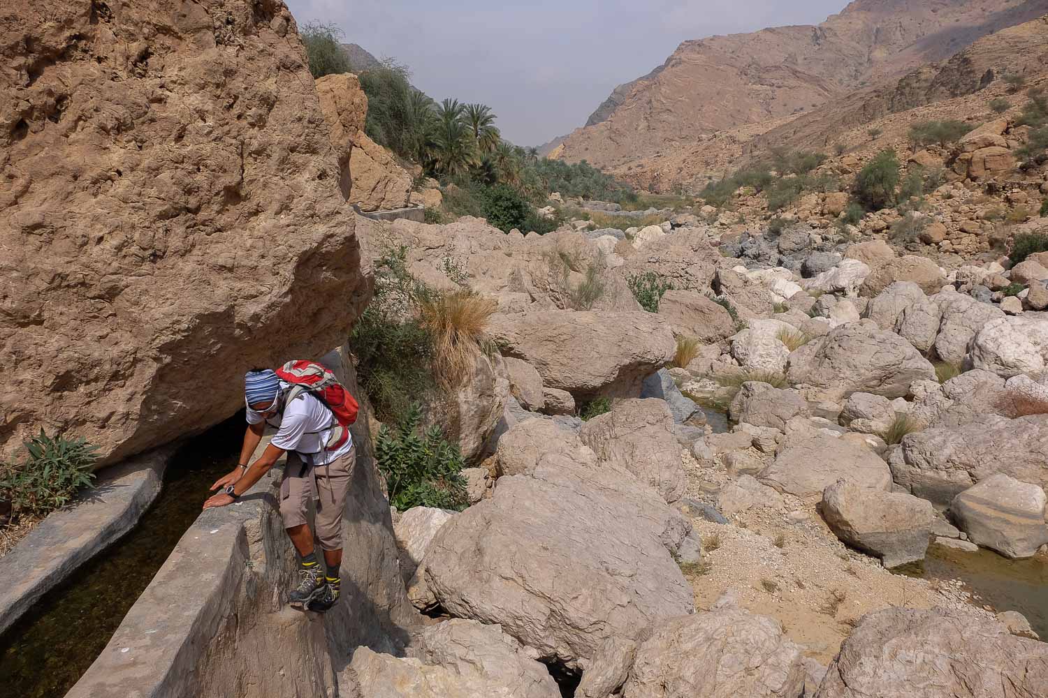
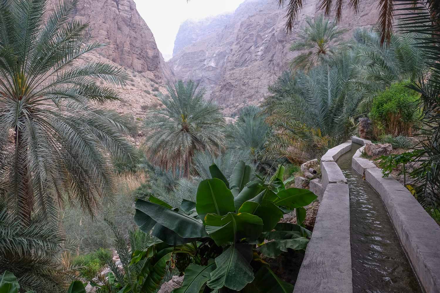
Cross the village (small) and on the wadi side, behind it, 2 options for the approach. Either take the falaj on the left and follow it. Further on, you'll pass along a path before naturally joining the bed of the Naqma wadi. Cross to the opposite side to climb up and walk along another falaj, which you follow to the end. Either cross directly behind the village to enter the terraces. Cross under palm trees and between crops until you reach a double reservoir. Continue to find the falaj, which then leaves the terraces and continues for a while.
This involves climbing up the Wadi Naqma to its end, which is closed off by a cirque and a large, impassable cliff, at the foot of a large waterfall over 100m high. No equipment or gear is required. You mainly have to walk between and through the boulders before climbing up a huge scree slope in the upper part, above the abandoned village. This canyon was opened by Khaled Abdul Malak and is also described in his topo book. There are no marked or signposted paths, but the itinerary is obvious even if some passages are not easy to find.
Reverse route but quicker, avoiding the intermediate cascade. It's a tough way back, but easier knowing how to best negotiate the boulders and chaos.


Leave a Reply