


TOPO Hiking | CLIMBING7.COM
Publié le
 Partager sur WhatsApp
 Partager sur Twitter
Partager sur Instagram
Partager sur Twitter
Partager sur Instagram

 Partager sur Facebook
 Imprimer le topo
 Laisser un commentaire

Another hike in the Emirates. Today's route links Wadi Shah to the entrance to Wadi Bih, passing through the small village of Hasiq before overhanging and then descending into Wadi Qasab. Some 1100m of ascent in a setting of sculpted and folded rocks ranging in color from black to orange to red, and beautiful green-covered highland terraces, the trek is well worth the detour and can be completed in around 5 or 6 hours, in one go. The itinerary is not obvious, though logical, as the old paths have more or less disappeared, even if in places sturdy Bedouin steps are still in place to cross the steepest parts. A must-see near Dubai.
❱❱ Technical summary
Type ✦ Hiking
Location ✦ Wadi Shah
Region ✦ Ras Al Khamiah
Country ✦ United Arab Emirates
Length ✦ 9kms
Elevation gain ✦ 1720m
Difficulty ✦ MD
Duration ✦ 5h to 6h
Interest ✦ ★
❱❱ Access to the place
From Ras Al Khaimah, take the Jebel Jais road into Wadi Shah. After the long straight stretch, pass the first hairpin bends and park alongside the Junction climbing area. Start in the small gorge where the climbing routes are located. The finish is in the village of Qasab, 18km from the starting bridge, so bring a second vehicle or hitchhike.
❱❱ Map & topo
❱❱ Itinéraire
Cross the road and descend on the opposite side. Climb up into the gorge, past the tracks on the right and up to the 1st waterfall, where the rock steps (cemented) mark the start of the trek.
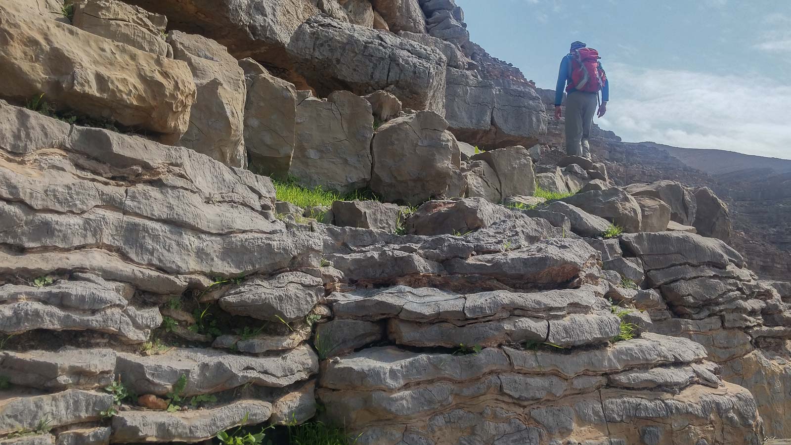
1720m cumulative ascent (380m - 1110m - 220m) for around 9km on the ground, the trek is generally south-facing. There is no signposting on the way, and the trail is vaguely marked or totally absent in places. No difficulty except for some tricky scree crossings and descents, and a few steps of de-escalation on the descent to wadi Qasab (IV).
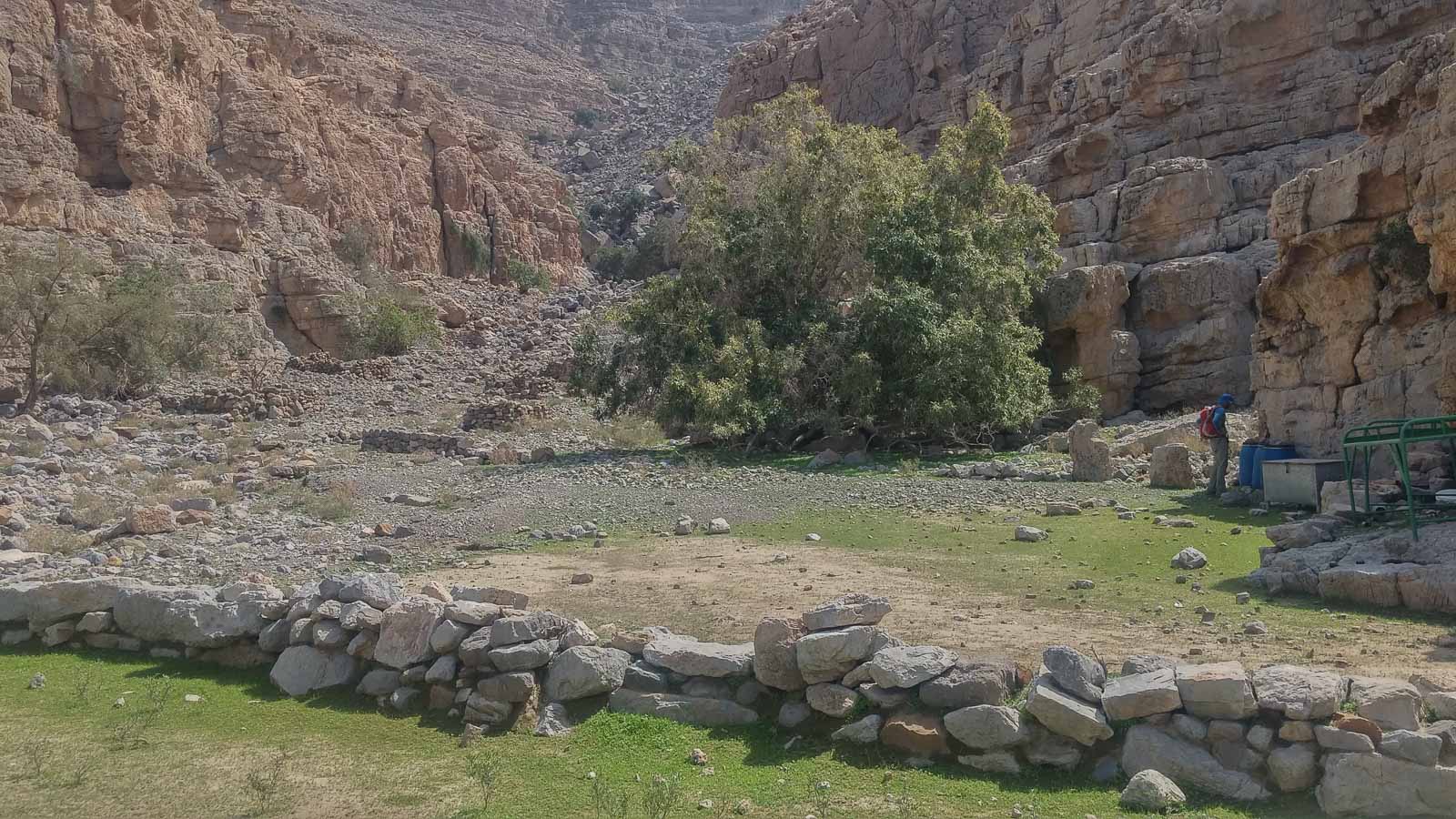
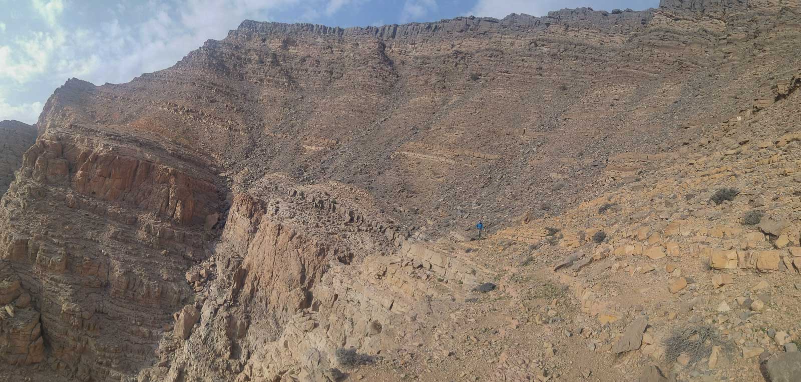
Above the 1st waterfall and the starting steps, continue along the main bed of the wadi. The path is a little marked in places, with a few steps. You soon reach wide terraces. Go straight across them, and at the end the path narrows to a spring under a tree. Climb up the rocks and further up you reach a platform with a large house on the right. From here, continue down towards the great wall that closes off the wadi. Cross a huge scree slope and climb again to pass under a high dry waterfall on the left. There's no sign of a passageway to the ridge, yet a route has been built to cross the wall.
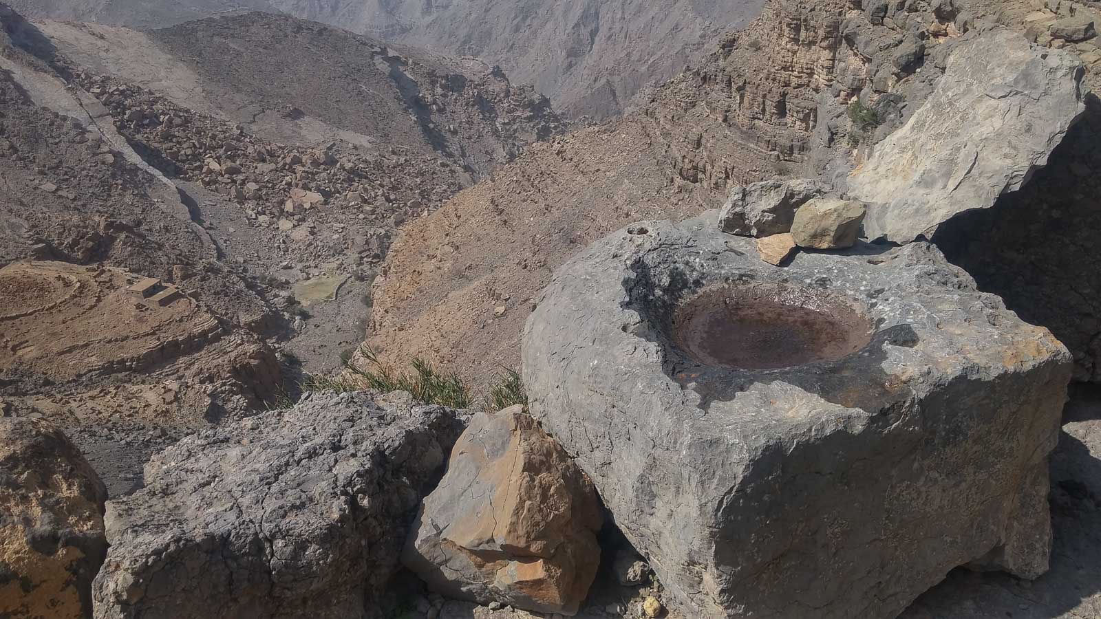
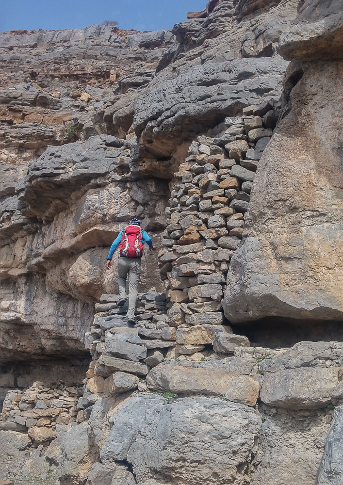
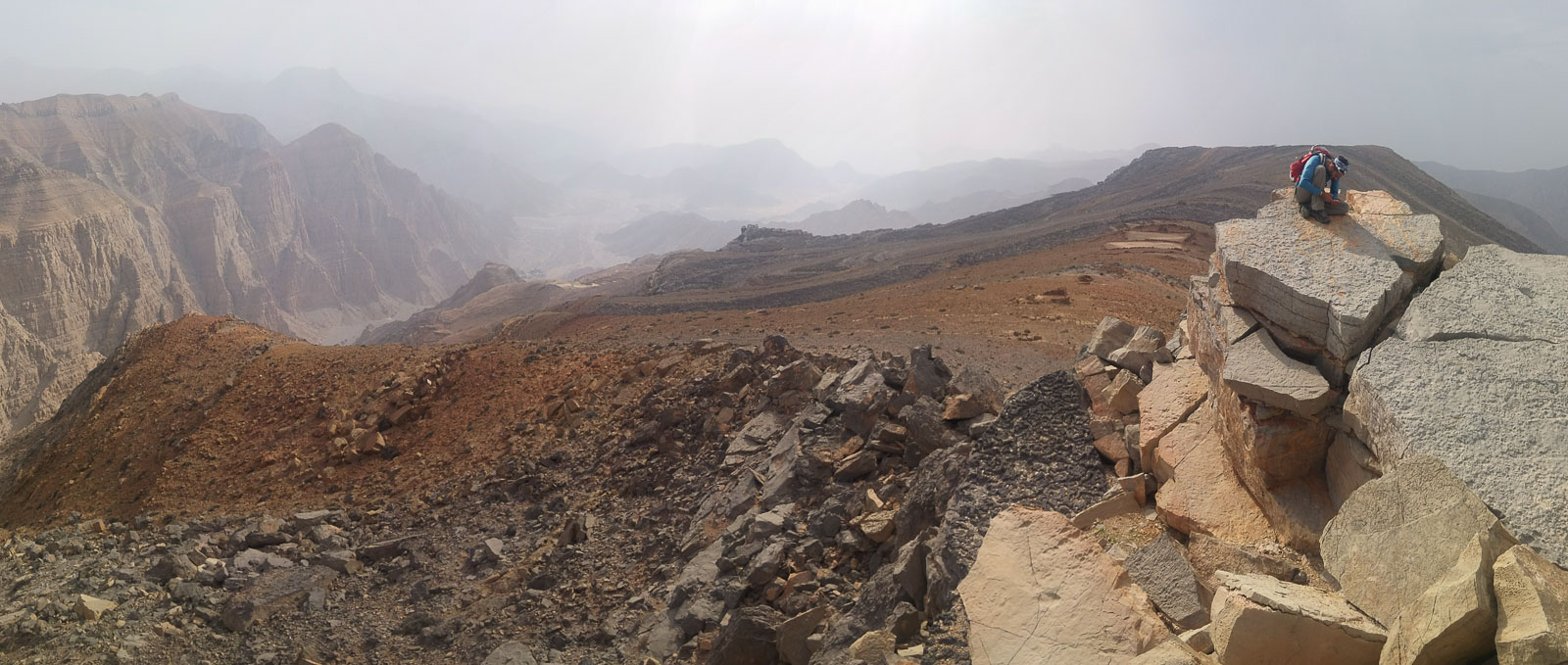
Pass under the main axis of the waterfall and return below via an intermediate ledge. You can then continue by crossing under the top of the waterfall via this route, which continues quite a long way. There are abandoned buildings all along the way. You then find the Bedouin staircase, which is still very solid and allows you to cross a wall. At the top, climb further, aiming left, to find several more small Bedouin steps. Finally, you reach the ridge and open out onto magnificent terraces on an elevated platform. This is the abandoned village of Hasiq.
From the terraces, climb towards a small rectangular building overlooking the village. From here, turn right and climb westwards to reach the ridge. Once there, you'll have a 1st view of the deeply incised Wadi Qasab and the valley that opens up further on at the entrance to Waqi Bih. Continue along the ridge until you reach the local summit, a sort of mesa with 2 or 3 large stacked docs. Beautiful view over the valley to the west. Continue along the ridge, aiming for the next terraces. Cross them to reach the abandoned house just beyond.
From here, descend to the left and reach the edge of the cliffs. As you walk along them, there's a cairn indicating the way down. After a few steps of de-escalation (IV), you reach a new ledge overlooking new cliffs with a small wadi descending quite steeply. Continue along the edge to the left, eventually reaching new terraces and another small abandoned village. From here, a slightly visible path leads down to a sort of shoulder on a characteristic rocky outcrop. Once you've descended, you'll find a large cairn on the left indicating the gully through which you can finish the descent and reach the bottom of the wadi Qasab without too much difficulty.
Walk along the bed of the wadi and you come to a large flattened area to cross (dry lake?). At the end, large boulders lie there to cross over to the other side and fairly quickly reach the entrance to Qasab. From here, a track turns into the Wadi Bih road, just before the border post and military checkpoint.


Leave a Reply