


TOPO Hiking | CLIMBING7.COM
Publié le
 Partager sur WhatsApp
 Partager sur Twitter
Partager sur Instagram
Partager sur Twitter
Partager sur Instagram

 Partager sur Facebook
 Imprimer le topo
 Laisser un commentaire

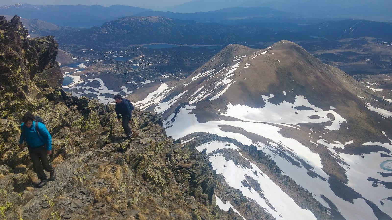
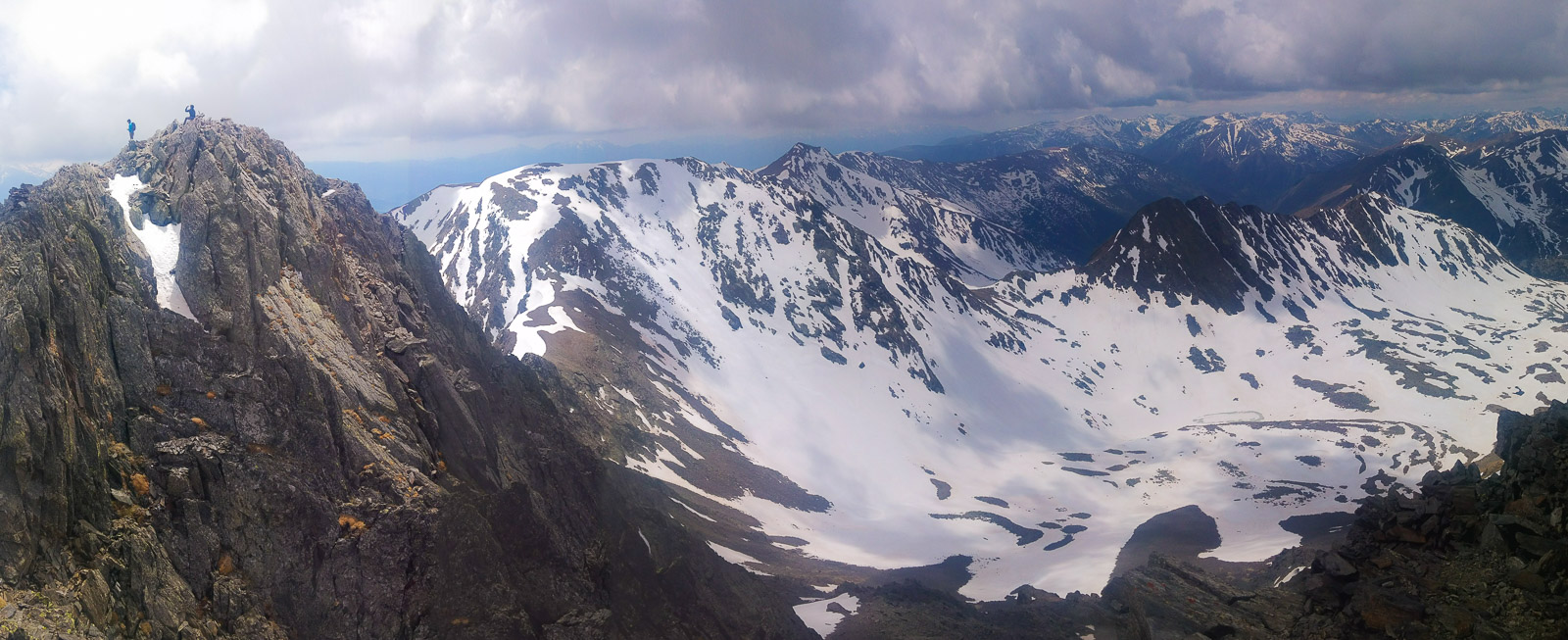
A day trip to the Cerdagne to do the Pic du Carlit, this almost 3000-meter peak, with the snow at the end of winter and before the summer hikers. Departing from the Lac des Bouillouses, the hike climbs gently upwards, first passing the high altitude lakes before tackling the final ridge leading to the peak, via a fairly airy path with a few exposed steps. The route is fairly straightforward and above all logical, even if the still heavy snow makes following the paths more difficult in places. We tried to return around the Tossal Colomer to the right, on a trail that was almost non-existent, before finally managing to join the main path back to the Bouillouses dam. A fine hike, with quite exceptional views of the Pyrenees and nearby Estanyos lake from the peak.
❱❱ Technical summary
Type ✦ Alpine hiking
Location ✦ Lac des Bouillouses
Region ✦ Pyrénées Orientales
Country ✦ France
Length ✦ 15kms
Vertical drop ✦ 900m
Difficulty ✦ MD
Max altitude ✦ 2921m
Duration ✦ 5h to 6h
Interest ✦ ★★
❱❱ Access to the place
From Bourg-Madame, head towards Perpignan. Pass Saillagouse, then at Mont-Louis, turn left towards Lac des Bouillouses. At the top, turn left onto the D60, which leads to the dam, where you'll find the parking lot. In summer, this road is closed, so take a shuttle bus.
❱❱ Map & topo
❱❱ Itinéraire
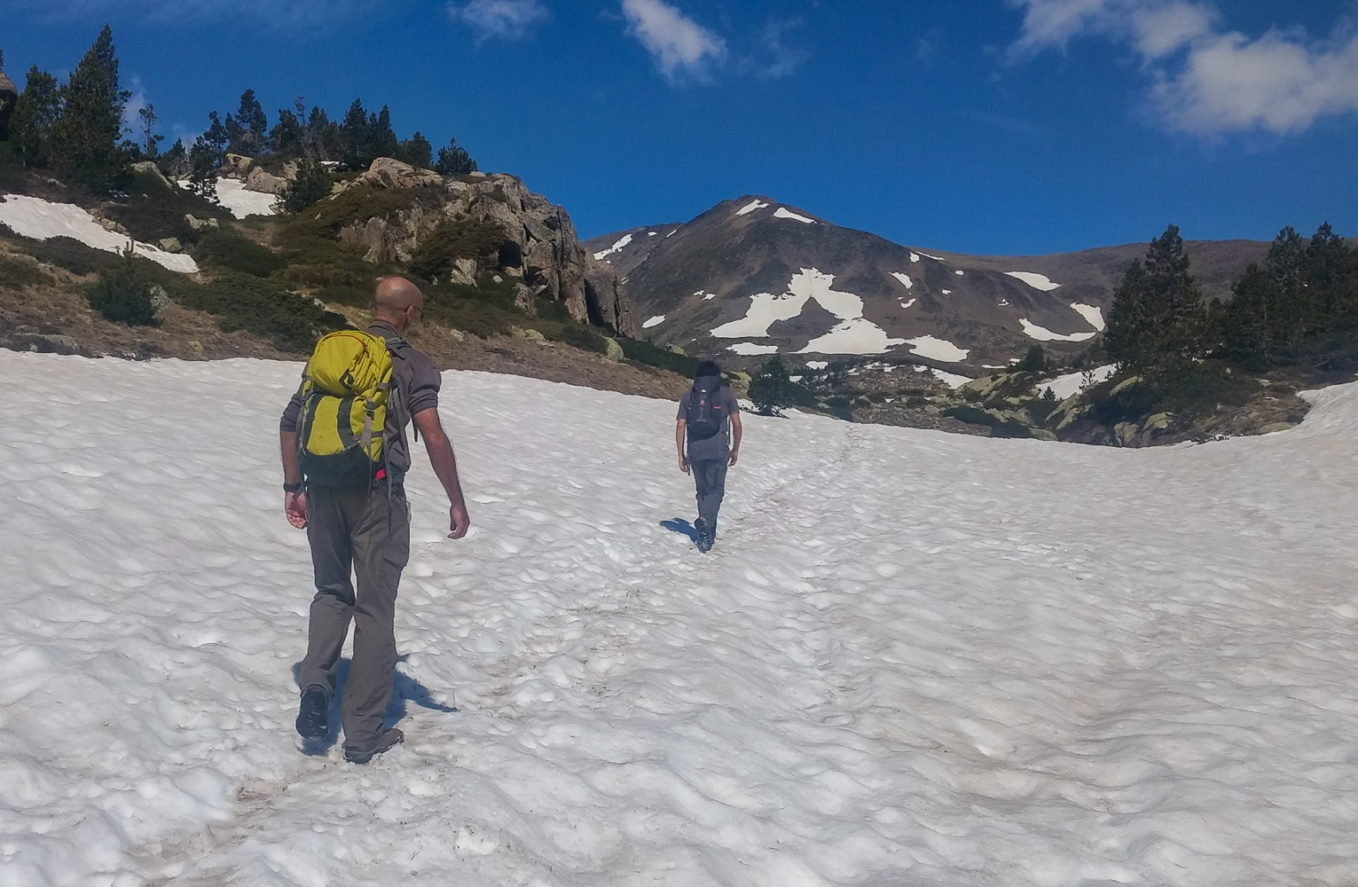
From the parking lot below the dam, climb up and pass to the left of the lake to find, to the left of the "Les Bonas Hores" hotel, the start of the trek. Yellow markings and label "3".
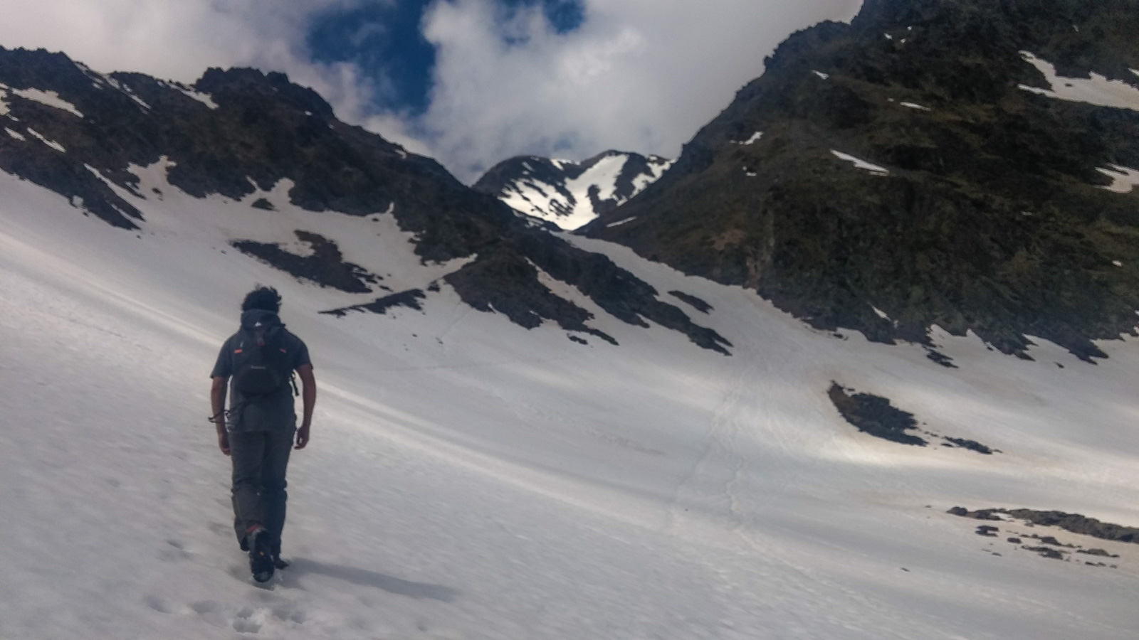
Generally east-facing, the ascent of Carlit doesn't pose any real difficulty, apart from the final section, when you climb the ridge leading to the summit, with a few slightly exposed steps in III/IV. In the pre-summer period, snow can complicate the route a little, but it remains very logical. Numerous passages on névés which, if the snow is soft, pose no major problems, otherwise crampons and ice axe are advisable.
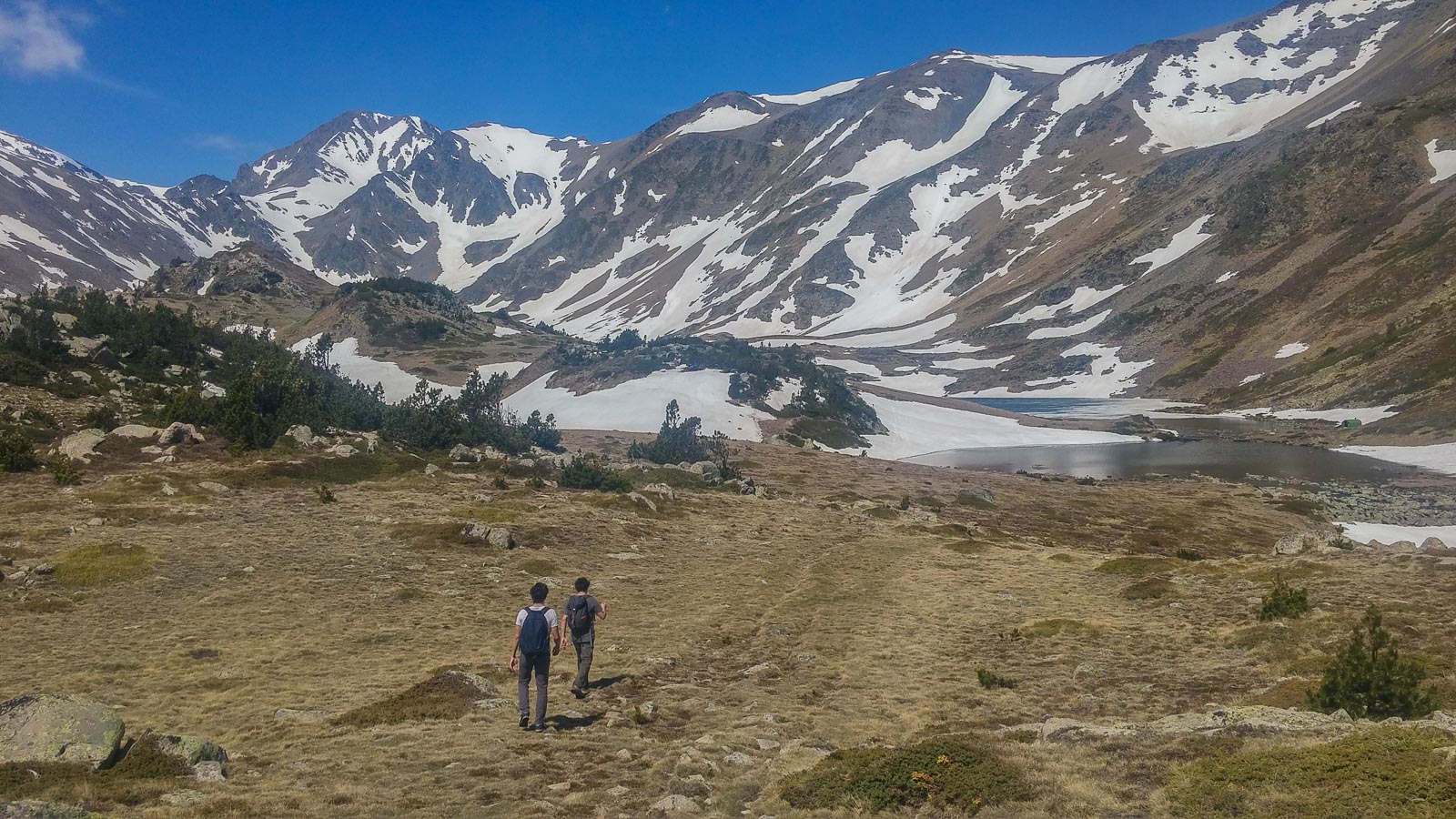
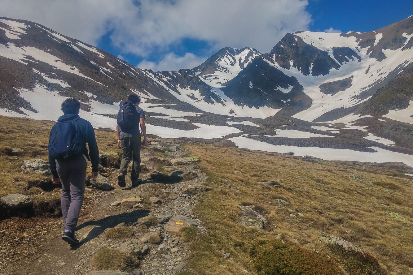
The well-marked path climbs through the forest until it forks just before the 1st lake. Keep to the right, pass Lac Viver and climb again to reach the plateau with the lakes. Cross the valley, skirting the lakes, and head for the base of the Carlit, clearly visible at the far end.
At the far end, climb diagonally to the left, following the path to Colomer pass (2595m). From here, climb straight up, following more or less the ridge to the summit. The path is marked with a few red dots, but in all cases the route is obvious. There are a few passages where you have to put your hands down to climb. After 1 intermediate flat, there's the final slope to the summit, with a spectacular view over the other valley and Lake Lanos.
Descend the ridge in the opposite direction to the pass, then turn right towards the small round lake. This combe (Coma dels Forats) is fairly easy to spot, but there's no particular trail, even if in places there are small blue marks and a few cairns. In the valley, continue around the Tossal Colomer to return to the left and reach a new lake (the Llat). Walk alongside it and go straight on for quite a long time before crossing the main path that leads back to the Bouillouses dam (we navigated a bit à la vista, not sure we'd taken the shortest route).


Leave a Reply