


TOPO Hiking | CLIMBING7.COM
Publié le
 Partager sur WhatsApp
 Partager sur Twitter
Partager sur Instagram
Partager sur Twitter
Partager sur Instagram

 Partager sur Facebook
 Imprimer le topo
 Laisser un commentaire

Departing from Tsarasoa, the grand tour of Tsaranoro passes at the foot of the fabulous 800m walls before skirting the massif from the south, passing behind its back, then reaching the top of Karambony and descending due north on an aerial ridge on the edge of the void. An extraordinary hike, to which we can add an ascent of Tsaranoro (1950m) via the normal route along the way. While the 1st part is fairly straightforward, the second part is more difficult to follow and poses a few difficulties in negotiating the large granite slabs with grip and the technical, aerial descent of the Karambony ridges. A local guide is therefore preferable to fully appreciate the day.
❱❱ Technical summary
Type ✦ Scrambling hike
Location ✦ Tsaranoro Valley
Region ✦ Ambalavao
Country ✦ Madagascar
Length ✦ 13,5kms
Elevation gain ✦ 1200m
Difficulty ✦ D
Duration ✦ 5h to 6h
Interest ✦ ★★★
❱❱ Access to the place
From Fianarantsoa on the RN7, continue to Ambalavao, then a little further on take the track south to Vohitsoaka. Continue down the valley to the small villages at the foot of the great walls. Tasarasoa Lodge makes a good base camp.
❱❱ Map & topo
❱❱ Itinéraire
From Tsarasoa, exit to the west, aiming for the Tsaranoro walls. Cross the flanks of the Chameleon to cross the river where the pools are located. From here, take the path (signposted) back up to the Tsaranoro.
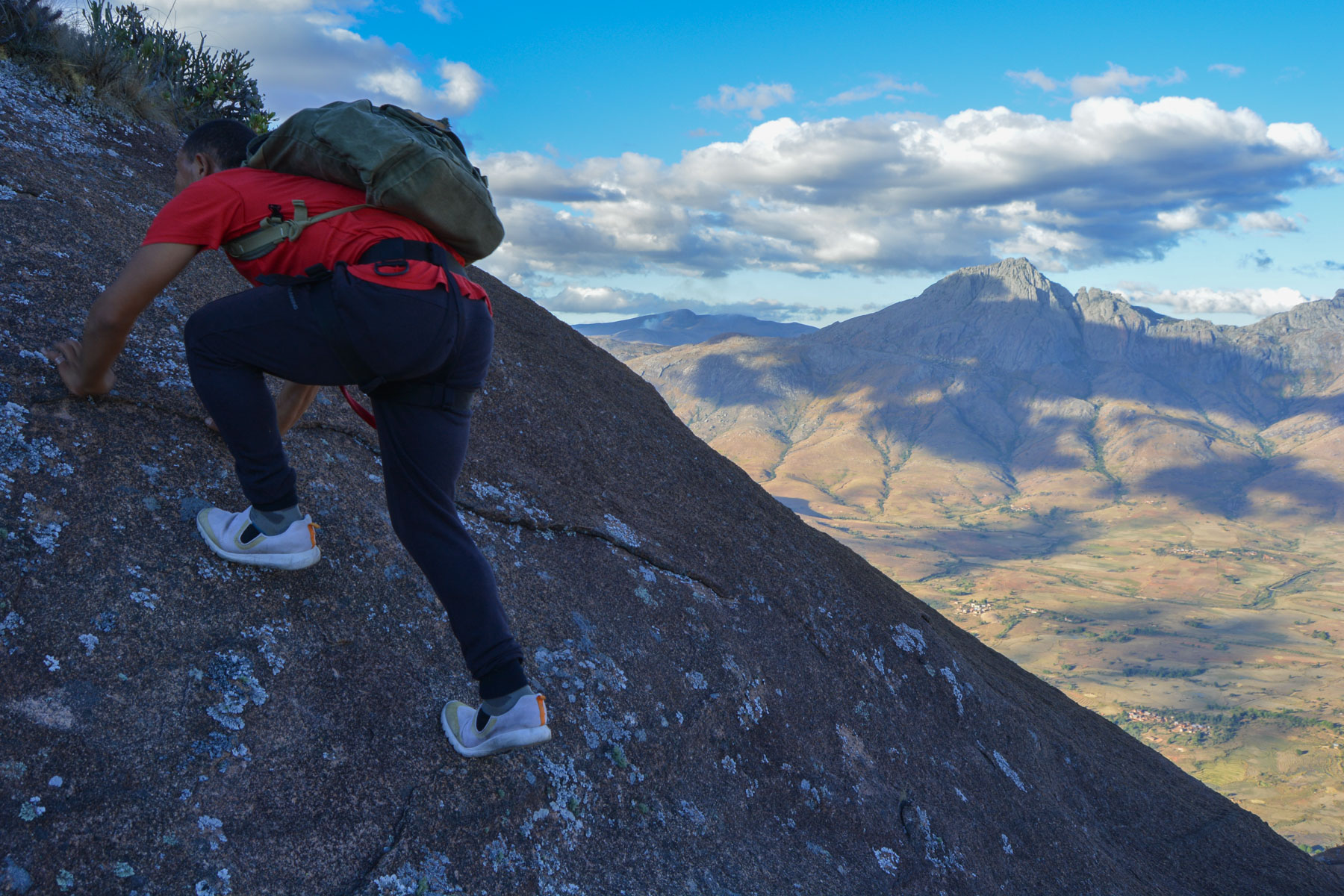
The trek follows a generally well-marked but unmarked path, with the exception of a few cairns on the rockier sections. A local guide is therefore highly recommended, especially for the second part, which is not easy to find in the large granite slabs. Quite a lot of ascent and descent, but above all long scrambling passages on steep granite slabs where you have to climb or descend with grip, sometimes with a lot of empty space next to you! All these passages are challenging, and there are belays equipped for rope access. The whole thing isn't quite so simple, and it's best to be sure-footed before committing yourself.
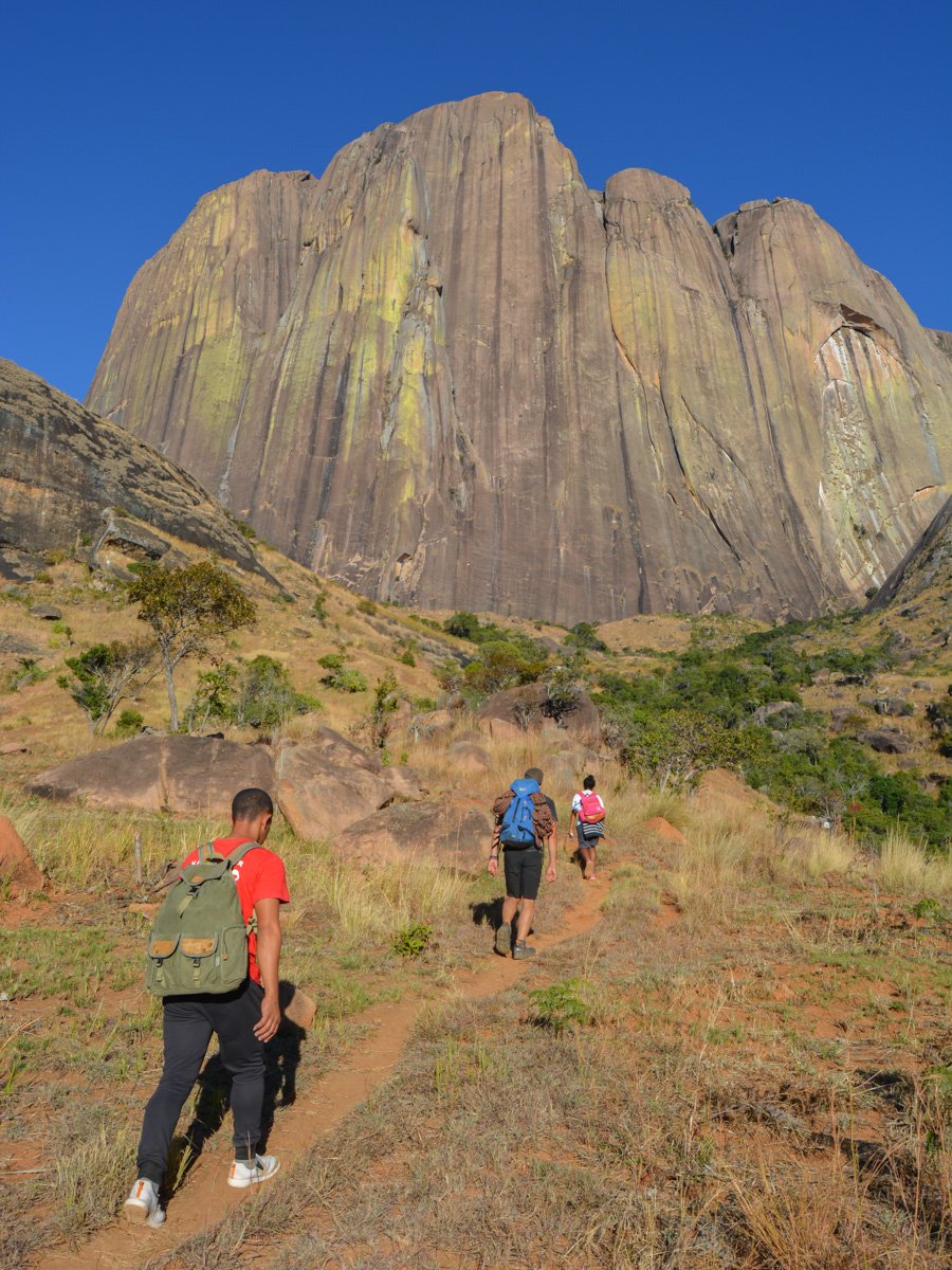
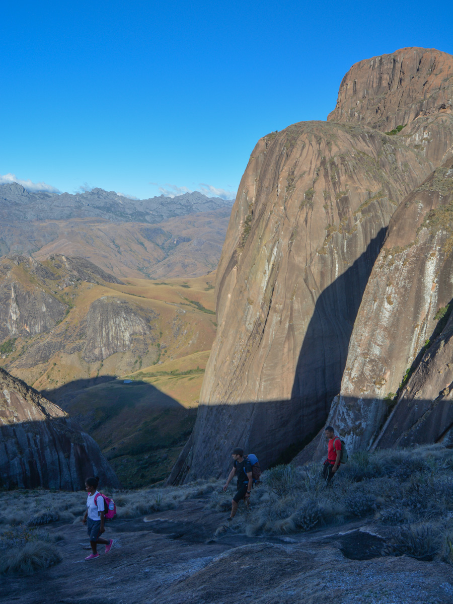
The trail climbs steeply upwards, soon reaching the base of the immense, magnificent walls, sculpted and coloured with orange and yellow lichen. We skirt the base, at the foot of the great routes, to finally climb the natural corridor that runs between the Tsaranoro and the next massif, just as beautiful and impressive, which shelters at its feet the tombs of Tsara and Noro, daughters of the Betsileo king.
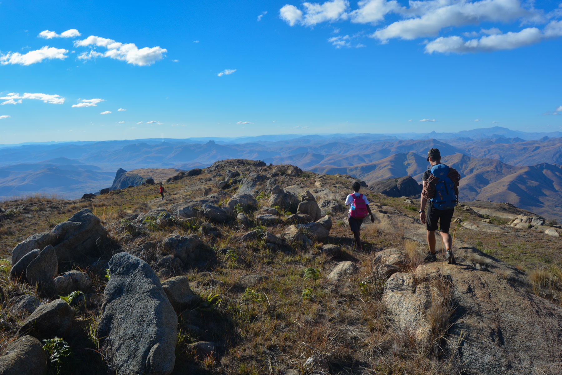
As you climb, palm trees appear. It's a steep climb, with long passages over granite slabs before finally reaching a sort of pass behind the head of Tsaranoro. There's a superb view of the other side of the mountain, to the north-west, with the RN7 in the distance and the rocks of the Portes du Sud, the unofficial border between the Betsileo and Bara countries. This 1st section is not particularly difficult, but the gradient is quite steep. This is where you can aim for the normal route by descending into the vegetation corridor that separates it from the Tsaranoro (cf. topo of the normal route at Tsaranoro).
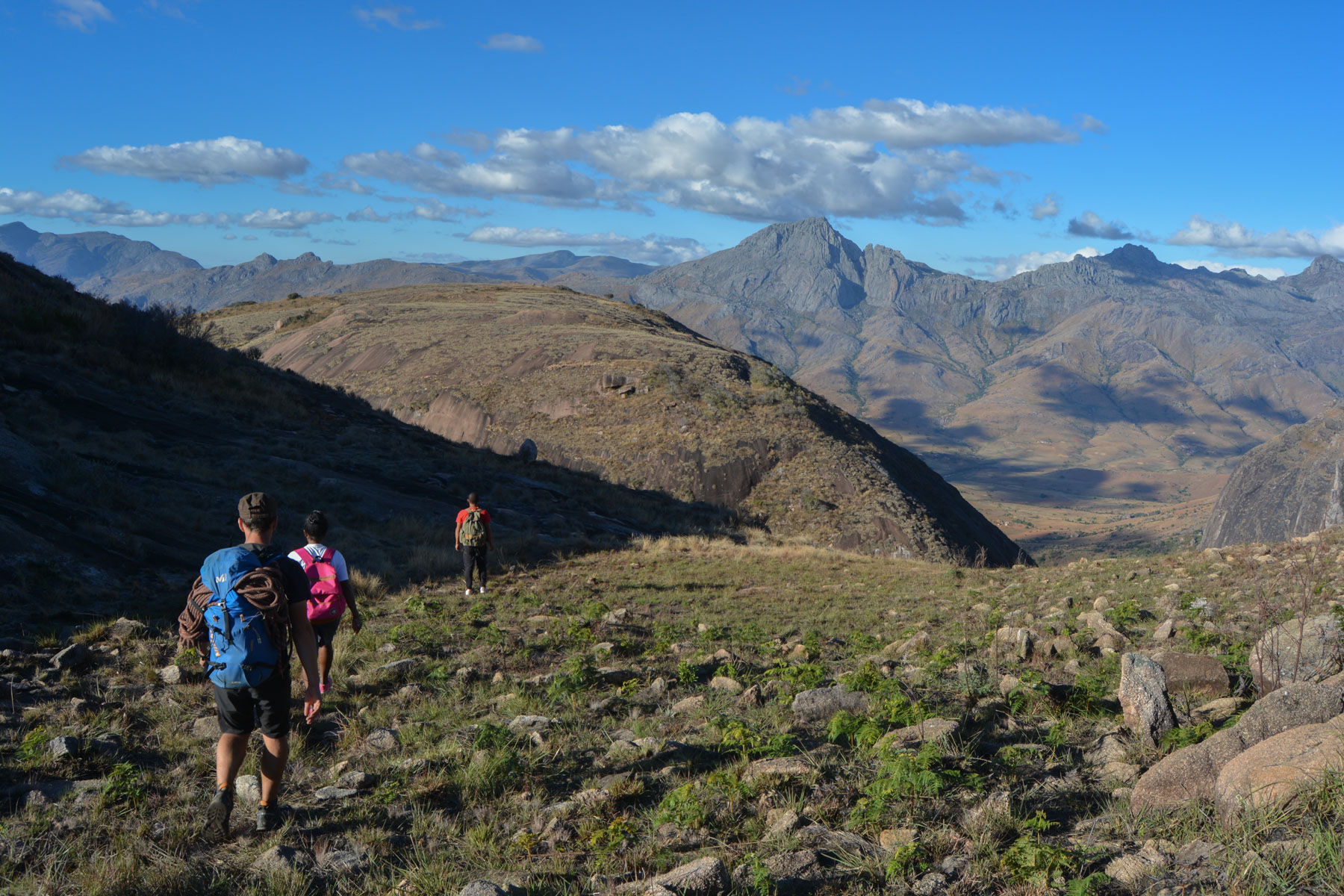
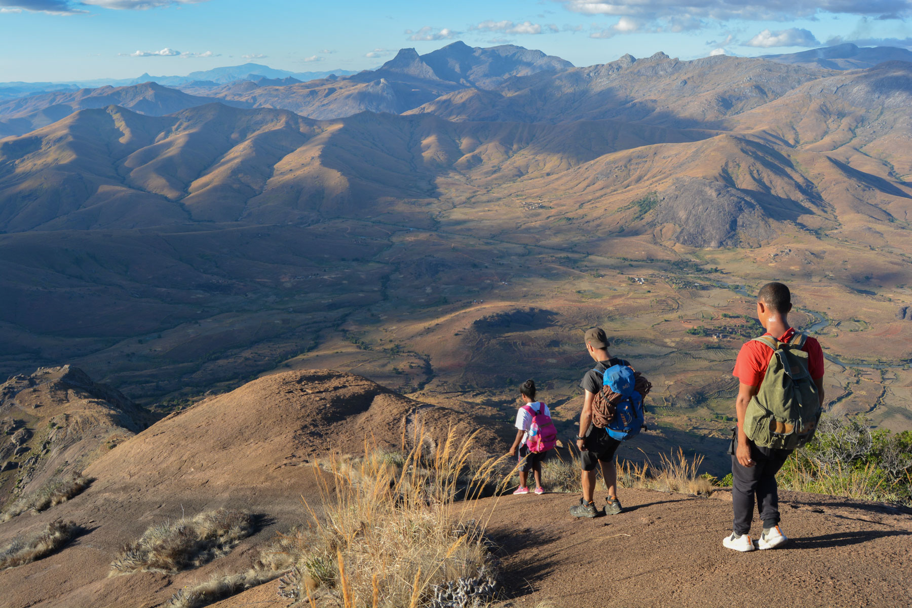
Continue along the ridge above Tsaranoro, due north, and descend to the end, following the path and cairns. We then plunge to the right (east) down the large granite slabs to join a small corridor of vegetation that bores into a small canyon behind the Kamabony. We pass through the bush for a while before heading out to tackle the steep slabs at the back of Karambony. It's a dry climb, grip is a must, but it's quite exposed all the same. At the top, we reach a small summit overlooking the entire valley on the east side and Pic Dondy at the far end of the Andringitra range.
From here, it's downhill on a moderately wide, rounded granite ridge that skirts the 200-300m valley-side gap. It's impressive, all the more so as we're at the limit of our grip! A few passages will be done seated for safety reasons. Here too, belays are set up to equip the descent. A first ridge, then a passage through the vegetation and a second ridge. At the end, much lower down, we join another path which turns east this time to plunge into the valley. This is the final part of the itinerary. It's still steep and the switchbacks gradually lead down to the valley floor and Camp Catta.
From Camp Catta, cross over and continue towards the forest, which you must cross completely (lemurs can be seen if you look up) to reach the pools. You then have to cross the slope again to reach Tsarasoa Lodge.


![2017-08-01_10-56-03 [Crête de Pinu]](https://climbing7.com/wp-content/uploads/2017/09/2017-08-01_10-56-03-crc3aate-de-pinu-e1580117578105-1024x683.jpg "The Pinu ridges, Cap Corse")


Leave a Reply