


TOPO Hiking | CLIMBING7.COM
Publié le
 Partager sur WhatsApp
 Partager sur Twitter
Partager sur Instagram
Partager sur Twitter
Partager sur Instagram

 Partager sur Facebook
 Imprimer le topo
 Laisser un commentaire
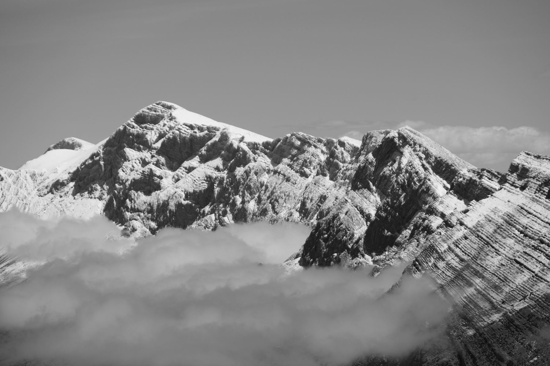
Starting out from Taghia, opposite Oujdad, the immense orange-tinted limestone pyramid that dominates the village, a path crosses a huge wall on the west side, thanks to ingenious Berber paths built above the void. From the high plateau we reach a spring and then a summit at almost 3000m, close to Tagoujimt n'Tsouyane, for an incredible view of the High Atlas and its many snow-capped peaks. The 2nd part takes us northwards to reach the immense, wild and arid Akka n'Tazaghte canyon on the way back to Taghia. A long and quite demanding trek, but absolutely fantastic, with exceptional panoramas. Not to be missed!
❱❱ Technical summary
Type ✦ Hiking
Location ✦ Taghia
Region ✦ Haut-Atlas
Country ✦ Morocco
Length ✦ 22kms
Difference in altitude ✦ 1350m
Difficulty ✦ TD
Max altitude ✦ 2950m
Duration ✦ 9h to 11h
Interest ✦ ★★★
❱❱ Access to the place
From Azilal, reach the village of Zaouia Ahansal. From there, cross Agoudim and follow the track for 2 or 3 kms to leave the car at the last small village near a pink mosque (car storage available for 50 dh per day).
❱❱ Map & topo
❱❱ Itinéraire
Continue on foot along the track, soon crossing a torrent to join the path leading to Taghia in the gorge on the left-hand side (currently being converted into a road). After 45′ or so, continue to the left and end up on the original path, winding its way between the walls. You gradually discover the site and, at the end, the magnificent little village of Taghia, in the heart of a large limestone cirque. Youssef Reski's gite at the top of the village is highly recommended for enjoying the stay and the view (150 dh half-board to date).
A long loop of more than 22 kms, on a route that is generally obvious but little or not at all marked, with numerous avoidances to anticipate in the canyons on the way back. It's best to set off with a local guide to avoid searching too long...
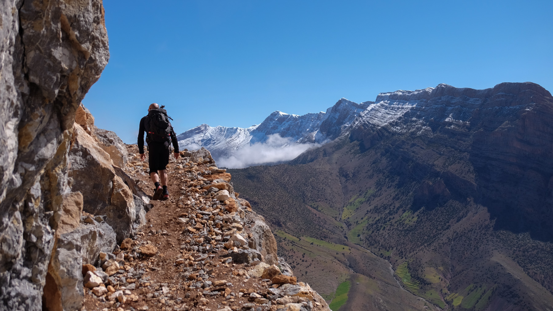
The path over the wall is not obvious from the bottom, but in fact access is via a small valley hidden by the walls, on the inside and therefore not visible from the bottom. The final passages of the 1st section are aerial, but wide and without difficulty. The "Corkscrew" passage is very short and fairly straightforward (a short climb up a spiral gully).
If you want to shorten or avoid the long loop, you can turn around from the plateau, with splendid views over the Taghia cirque and the valley (4h to 4h30 round trip).
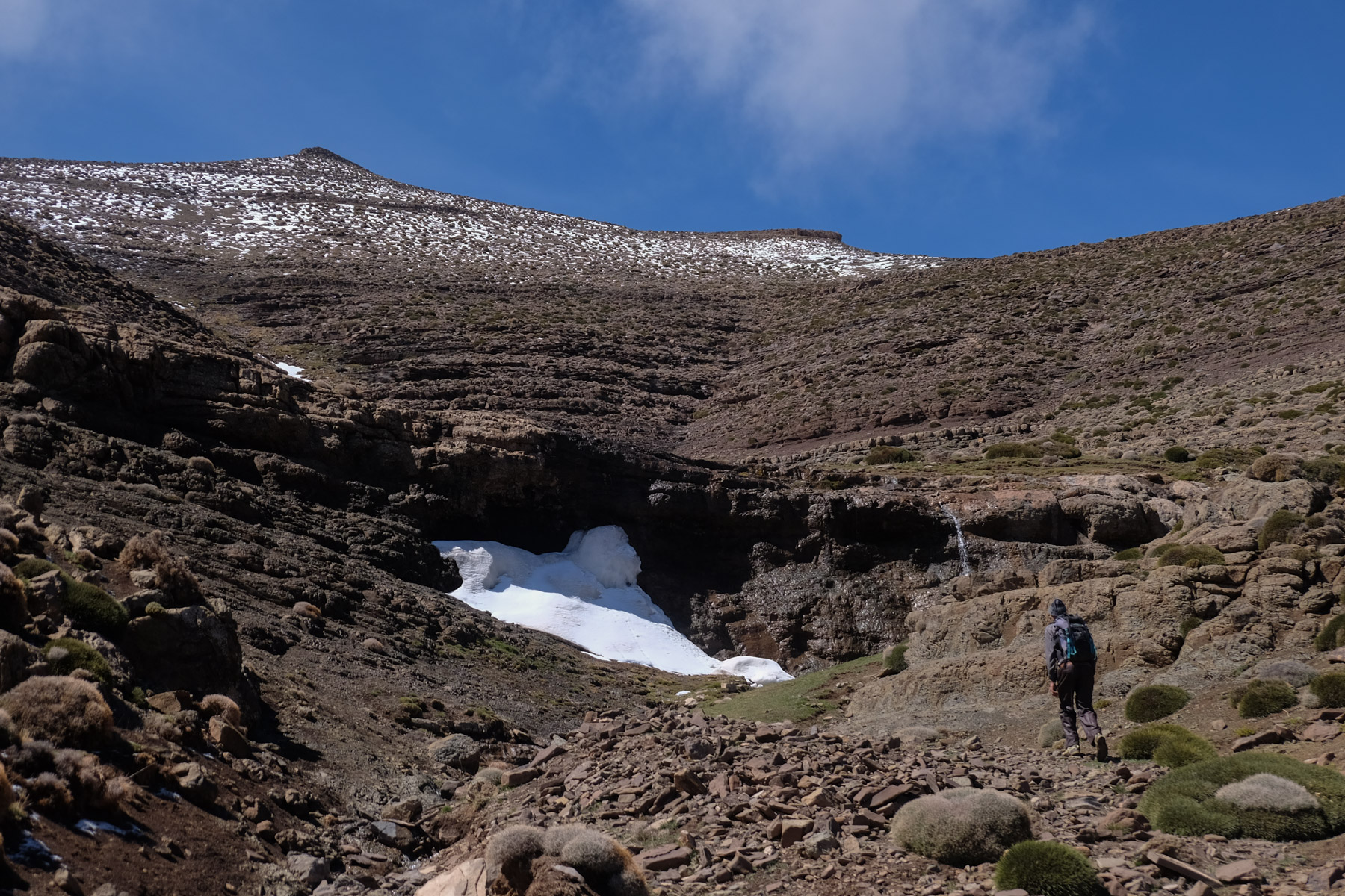
From the bottom and at the entrance to the village, cross the concrete bridge over the torrent and climb straight up towards the large walls. We climb up the grassy slopes that stand out against the purple rock that is so characteristic of the area. Higher up, as you approach the base of the walls, the route veers off to the left into a wide, steep, stony valley. As you ascend, you actually sink between the walls, and at the very top, it gets narrower, where you'll find the start of the Berber steps. The path is cleverly reinforced with stones and wood. Before exiting, you can either pass through the Tire-Bouchon (30m) or follow the new mule trail.
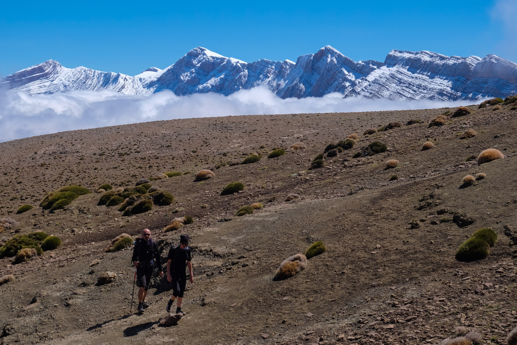
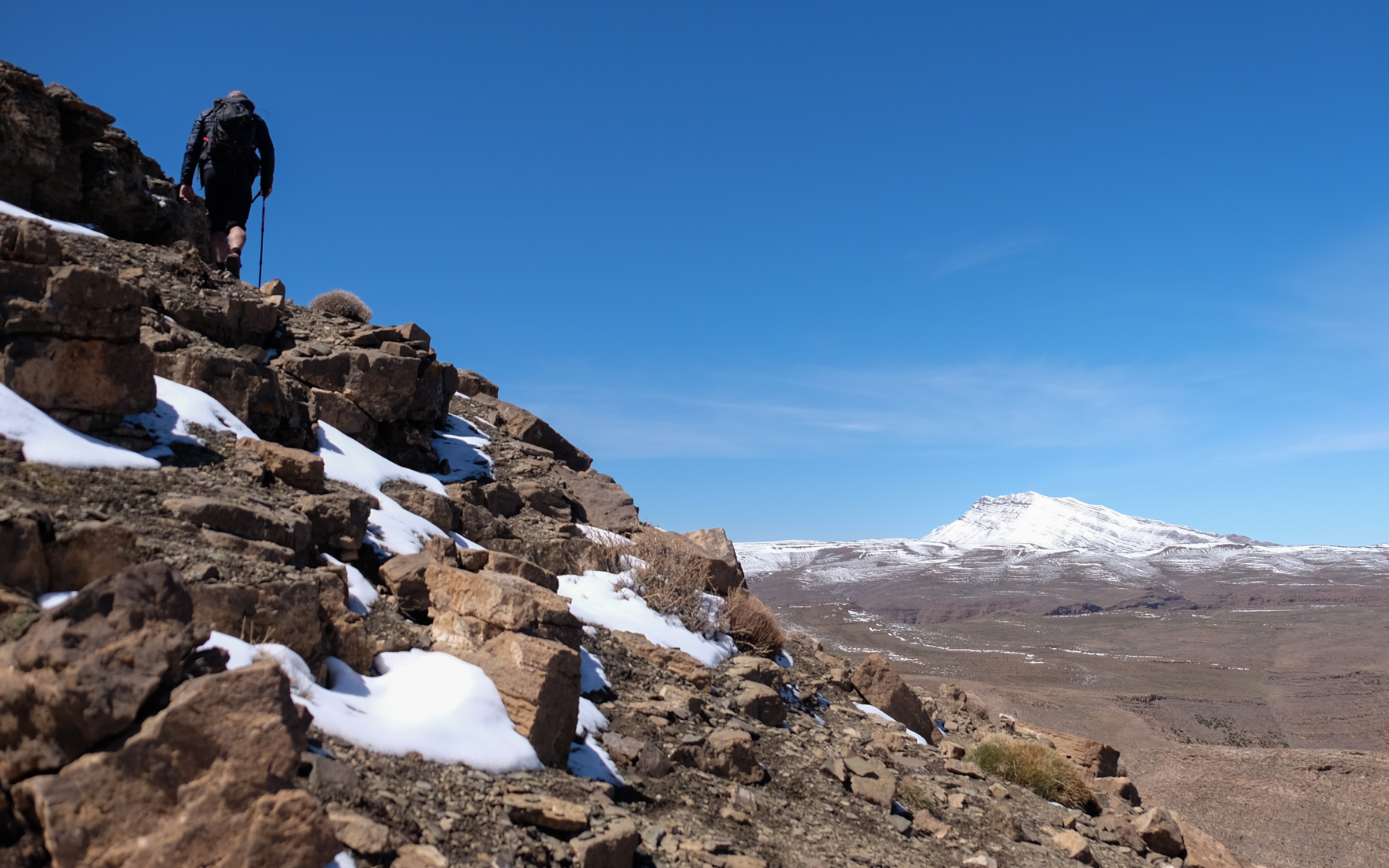
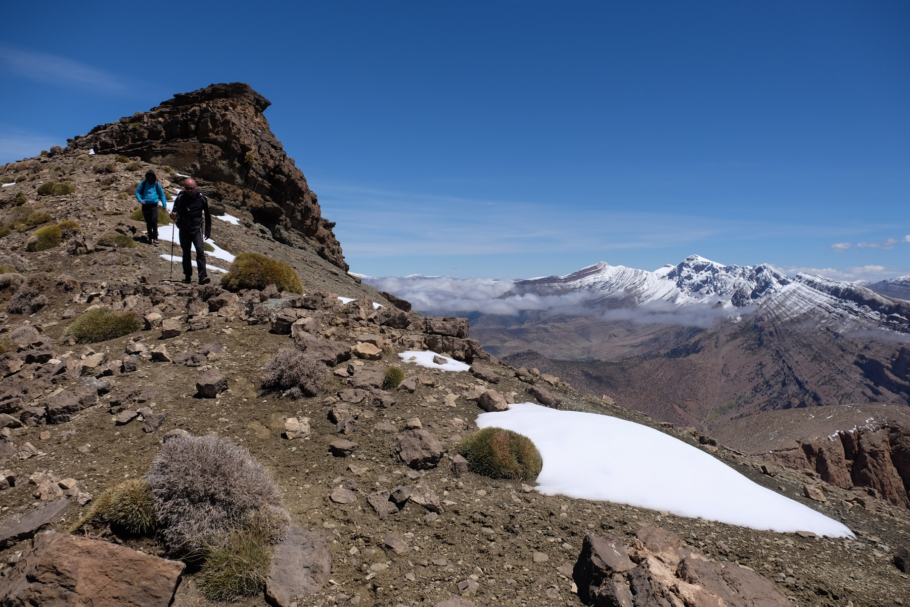
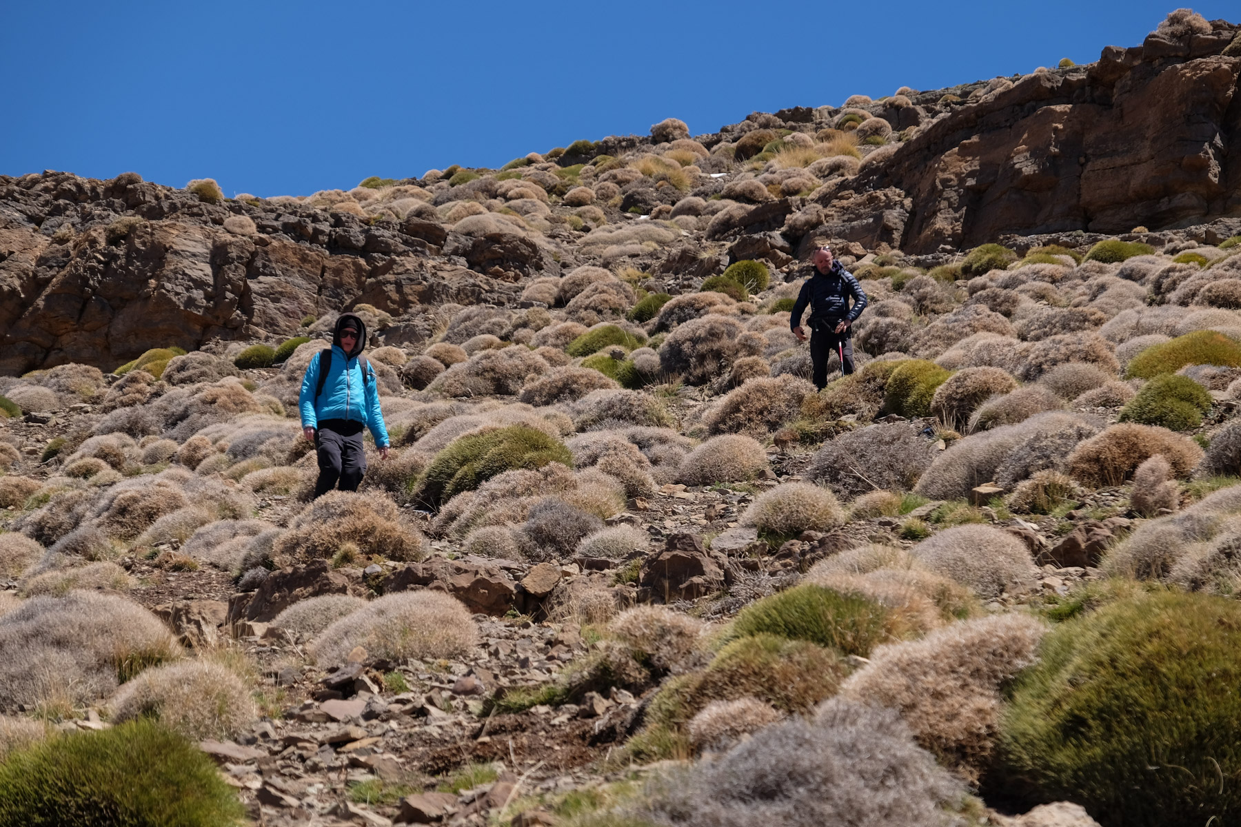
You then come out on a wide, airy ledge overlooking the entire valley: an exceptional panoramic view! Follow this ledge, continuing to climb until you reach a ridge and the upper plateau (2600m), climbing up the bed of a small dry torrent (which leads to the huge waterfall seen from Taghia). We soon find ourselves in a high altitude basin, with small balls of vegetation on the ground and a direct view of the summit ahead.
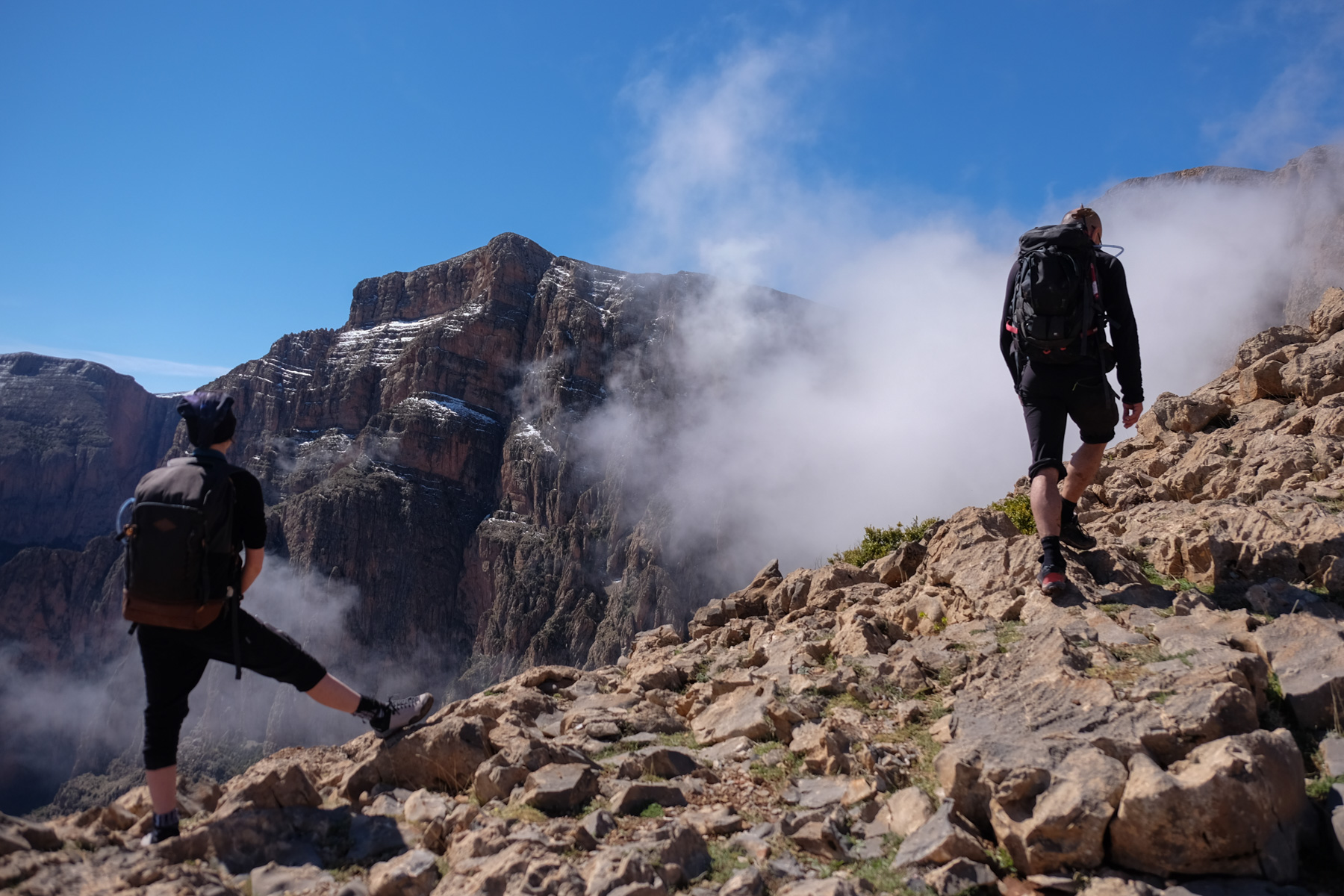
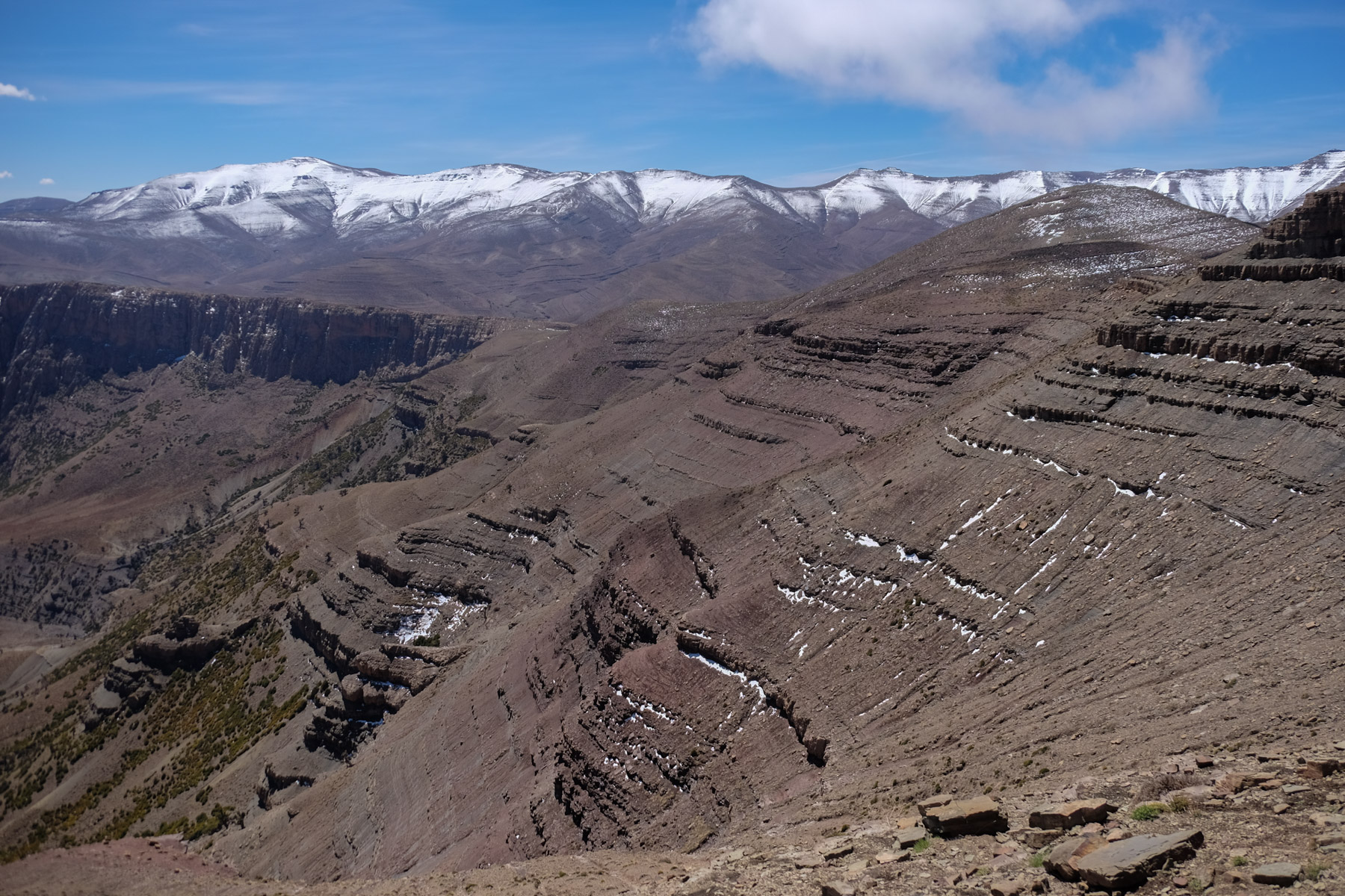
Climb more or less up the center of the basin, aiming for the summit. The spring is there, at the foot of the ascent, with a small drinking trough above a waterfall. Continue above it, then higher up, join the ridge on the left and climb to the summit, with its ever-widening panorama. We finish at almost 3000m on a large flat rock table, ideal for admiring the 360° view of the Atlas and the scuptured (and snow-covered!) walls of Jebel Azourki at 3690m to the north.
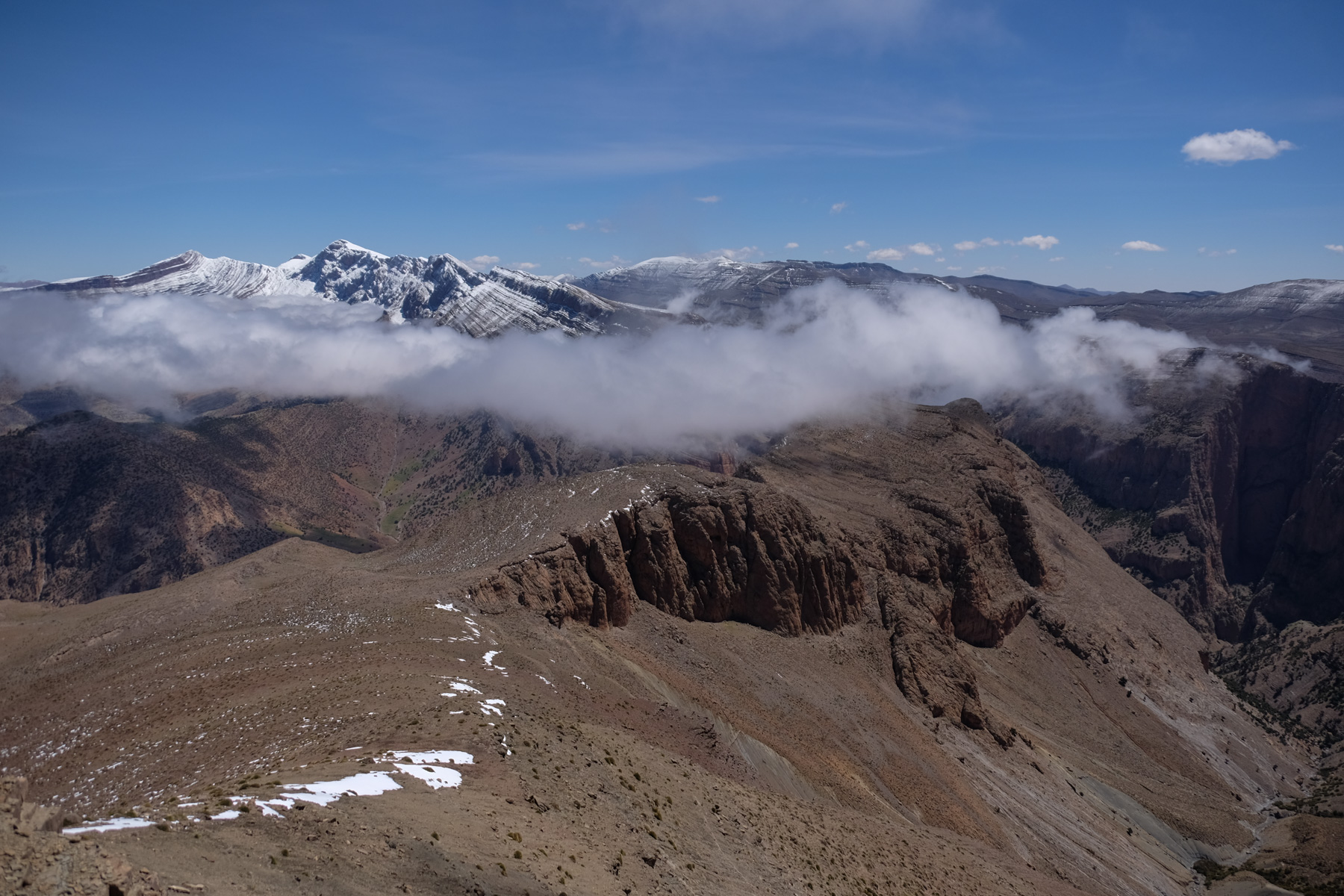
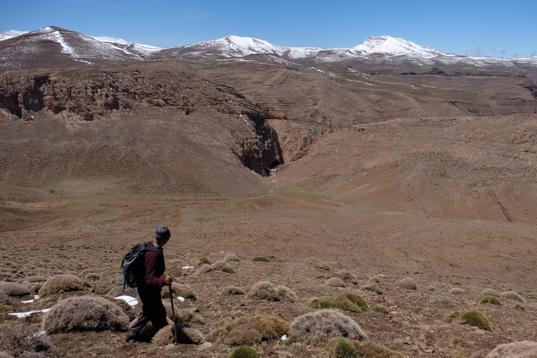
From the summit, plunge north, aiming for the only gully offering an exit on this side. A long descent over steppe leads down into the canyons. A cave on the left serves as a shelter for shepherds, then the path winds its way down into the canyon. Further on, you walk through the vegetation and, before the torrent bed becomes too complicated, extract yourself on the right-hand side to continue along the flank, gaining height in relation to the canyon. We follow the relief for quite a while before finally crossing a large shoulder and switching to the Akka n'Tazaghte side. The trail then descends steeply down the stony slopes, ending at the very bottom of the canyon bed.
Once in the Akka n'Tazaghte canyon, there's still a good while to walk down to the Taghia trail. The route is mostly cairned, but oscillates between the bed, the right and left flanks, to avoid the chaos and boulders that obstruct the dry torrent (not easy!). Finally, we come to a small hamlet where Akka n'Tazaghte joins the main path to Taghia.
There's still the approach road to follow back to Taghia via the gorge path and then along the torrent to the village.


Leave a Reply