


TOPO Hiking | CLIMBING7.COM
Publié le
 Partager sur WhatsApp
 Partager sur Twitter
Partager sur Instagram
Partager sur Twitter
Partager sur Instagram

 Partager sur Facebook
 Imprimer le topo
 Laisser un commentaire
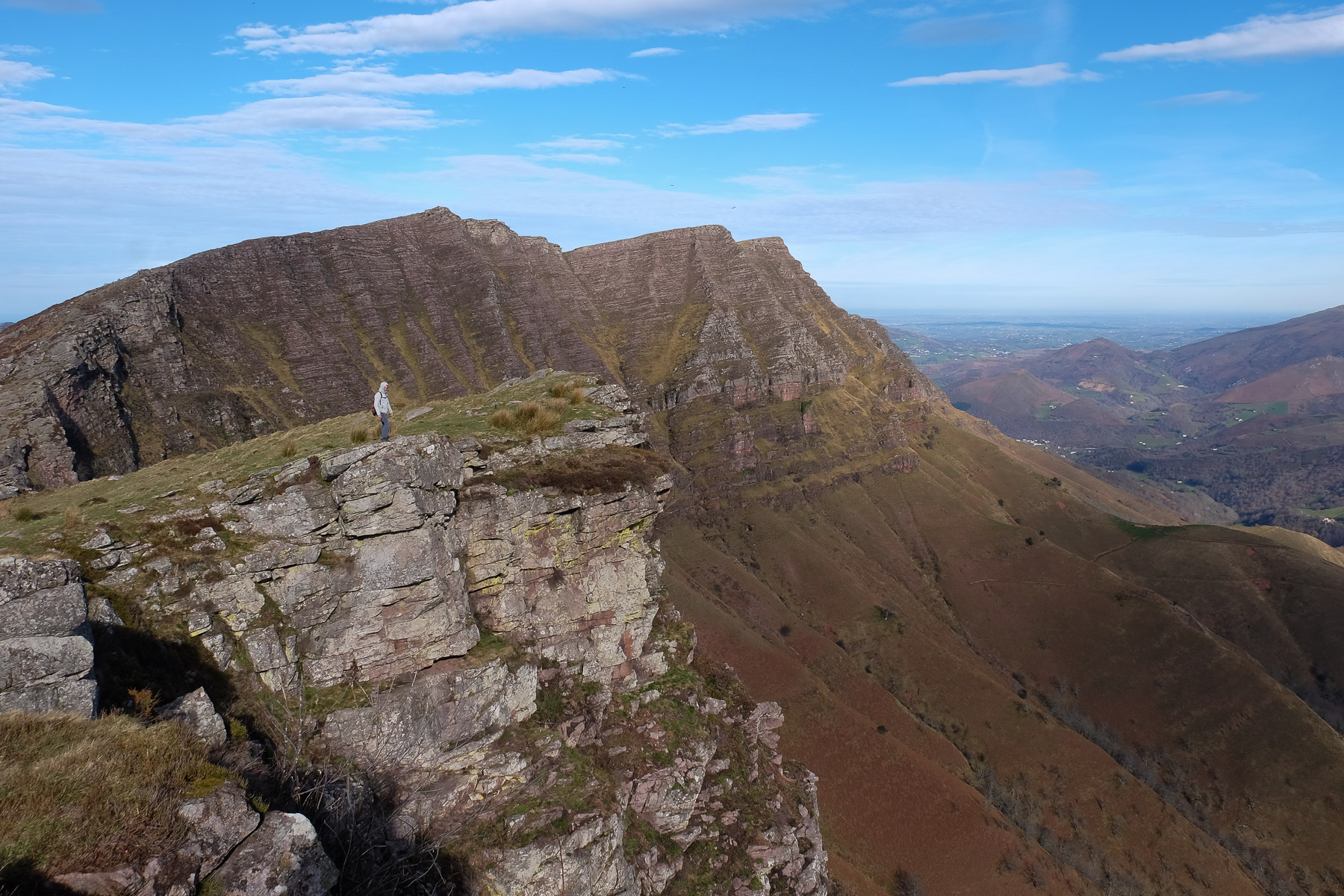
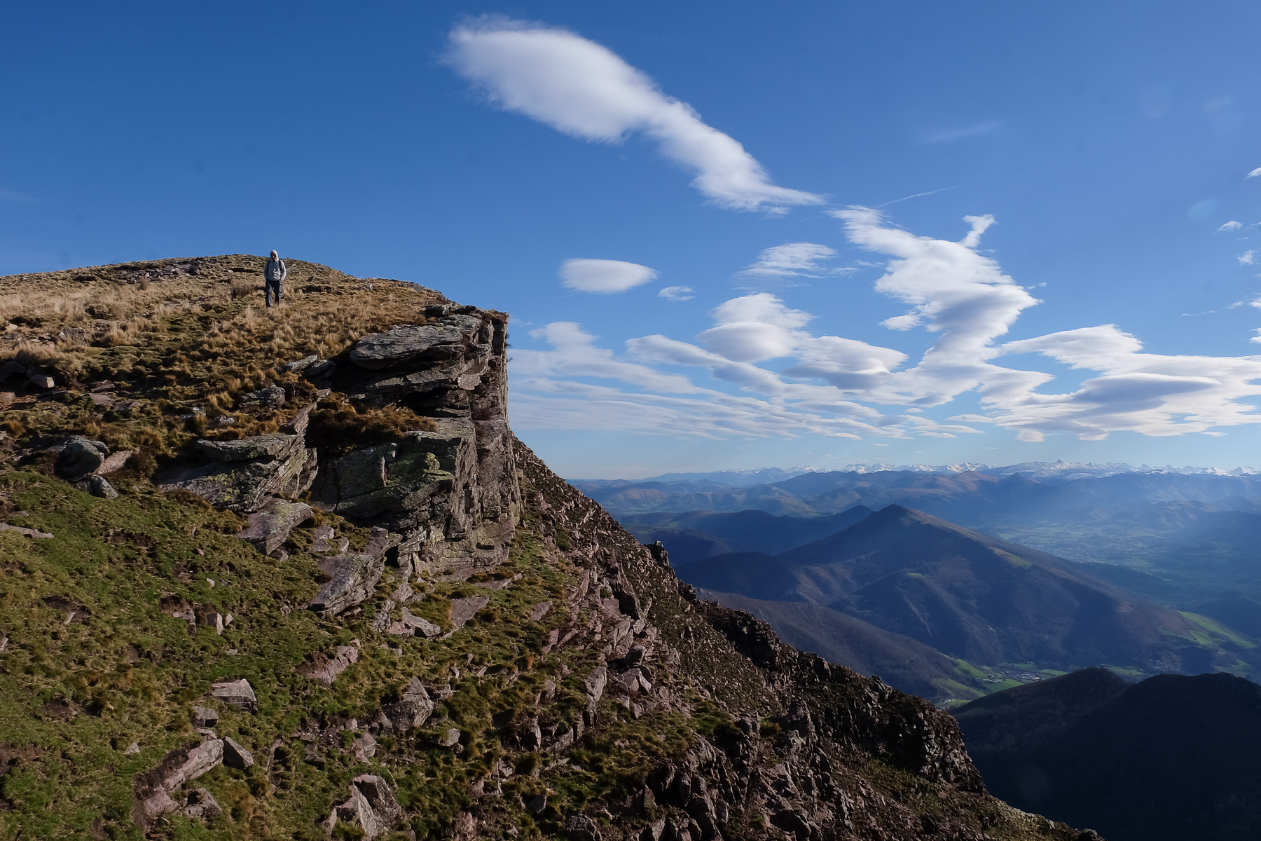
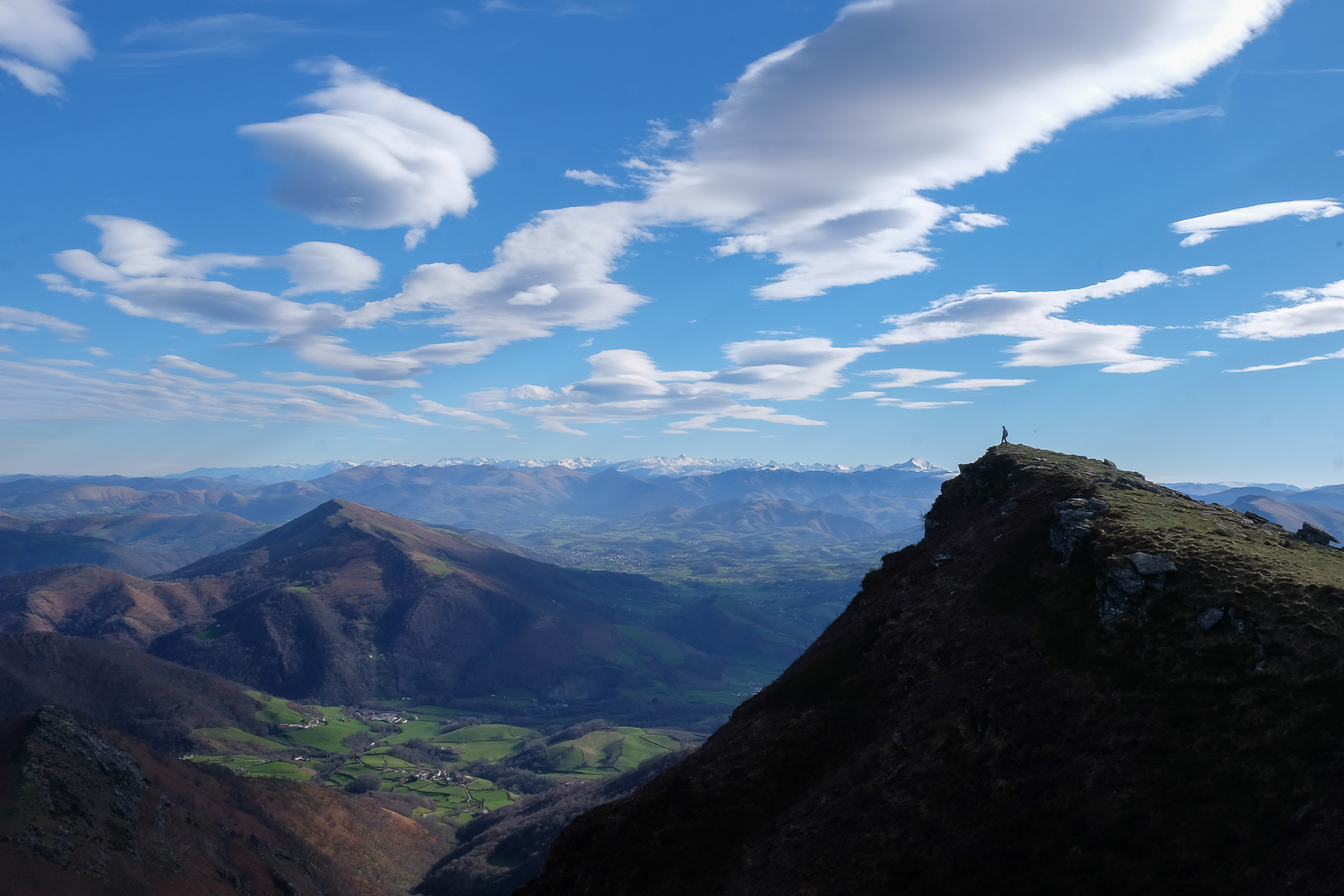
From the pretty Basque village of Urdoz, a path leads directly to the Iparla ridges on the east face. Once up there, another aerial hike begins, along the edge of the void, with an exceptional panorama all the way back to Urdoz. In the background, the snow-capped peaks of Orhy and Anie. Below us, fantastic crenellated rock bars and the Gapelu cirque. In the sky, a ballet of vultures, and in front of us, the colorful valleys of the Basque country. A photo festival! A loop not to be missed!
❱❱ Technical summary
Type ✦ Hiking
Location ✦ Urdoz, Basque Country
Region ✦ Pyrénées Atlantiques
Country ✦ France
Length ✦ 15,4kms
Vertical rise ✦ 1020m
Difficulty ✦ D
Max altitude ✦ 1044m
Duration ✦ 5h to 6h
Interest ✦ ★★★
❱❱ Access to the place
From Saint-Martin d'Arrossa towards Saint-Étienne-de-Baïgorry, turn right towards Bastida Urdoz. Follow the narrow road up to the village to park.
❱❱ Map & topo
❱❱ Itinéraire
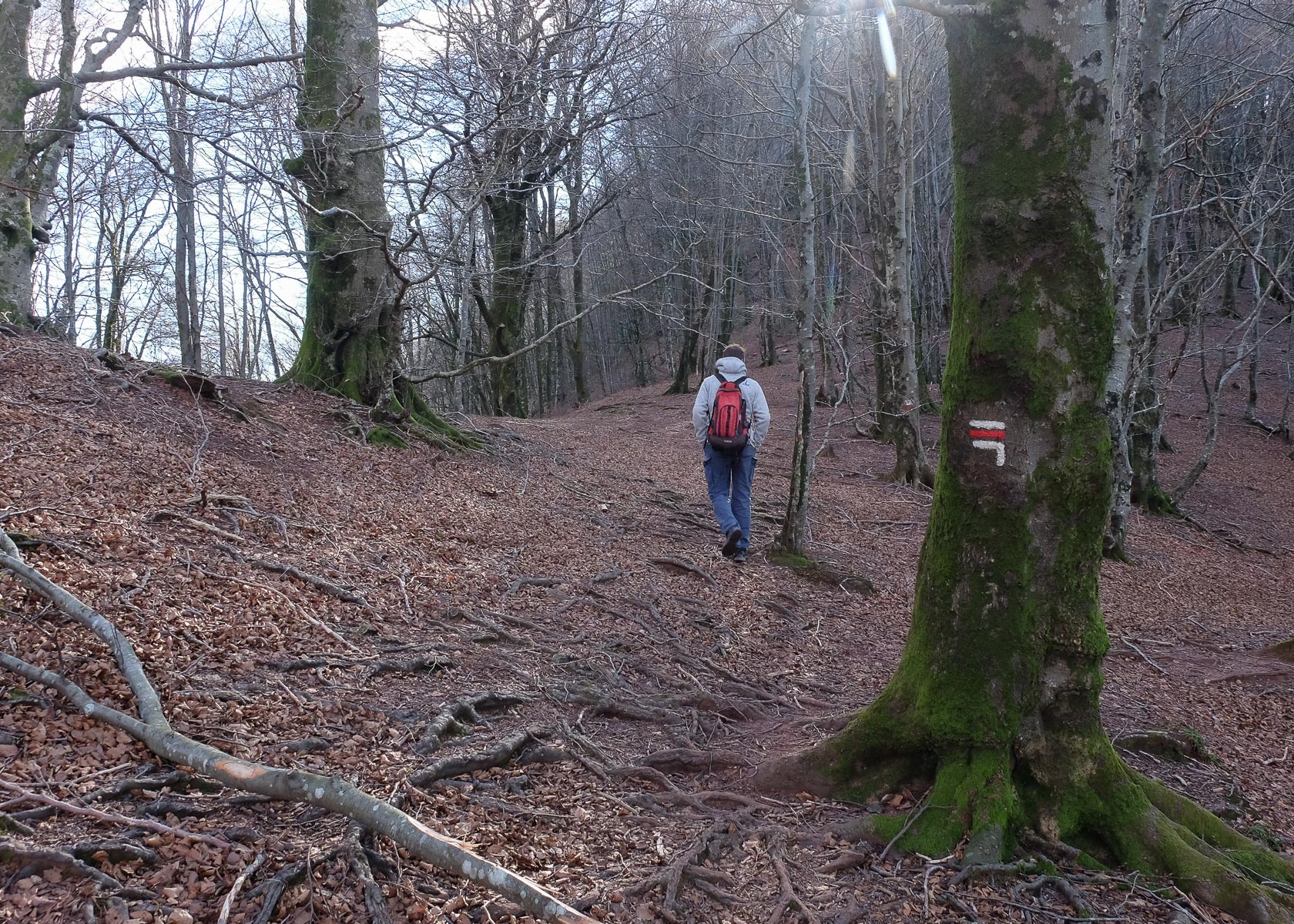
From the village, head northwest on the wide path that descends to the left of a large house. It passes between fields and climbs up to reach a road (15′). Continue on the road until you cross Elichagaray. Immediately afterwards, turn left onto the track following the "Iparla" sign.
The route forms a perfect loop, allowing you to enjoy the panoramas from the bottom and the top. No major difficulties except for the steep final gully to the Col d'Iparla, and today's strong wind on the ridge.
It's easy to get your bearings, as you can quickly see the whole route in front of you, but a GPS track or map can be useful for the ascent and especially on the way back.
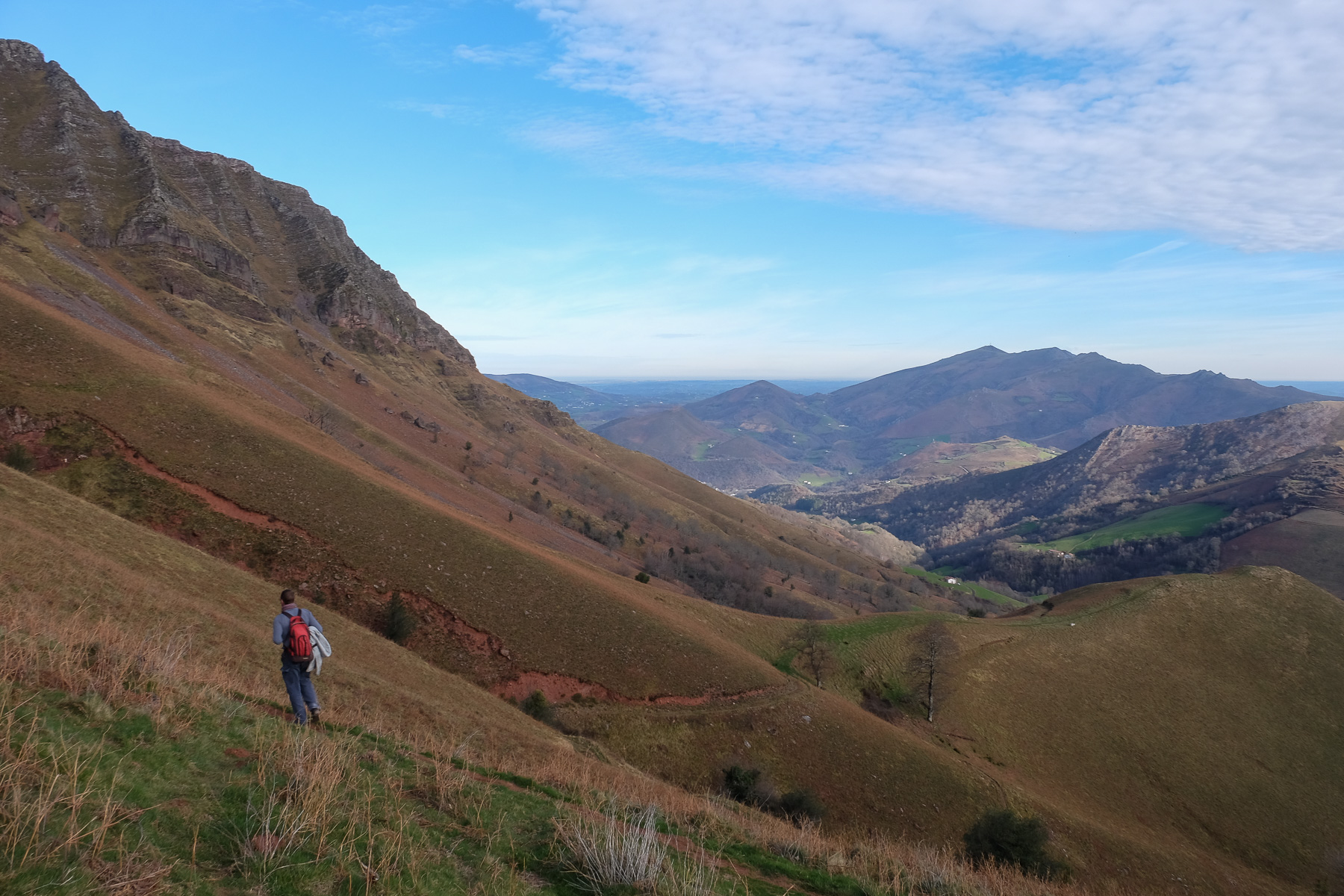
Follow the forest track into a small wooded valley, gradually joining a stream bed. Cross the stream and climb steeply towards the Col de Galartze. Just before the pass, fork left towards the cliffs (cairn). The path climbs steeply up the grassy slope. At the foot of the cliffs, the path reaches a small house on the Idoko pass.
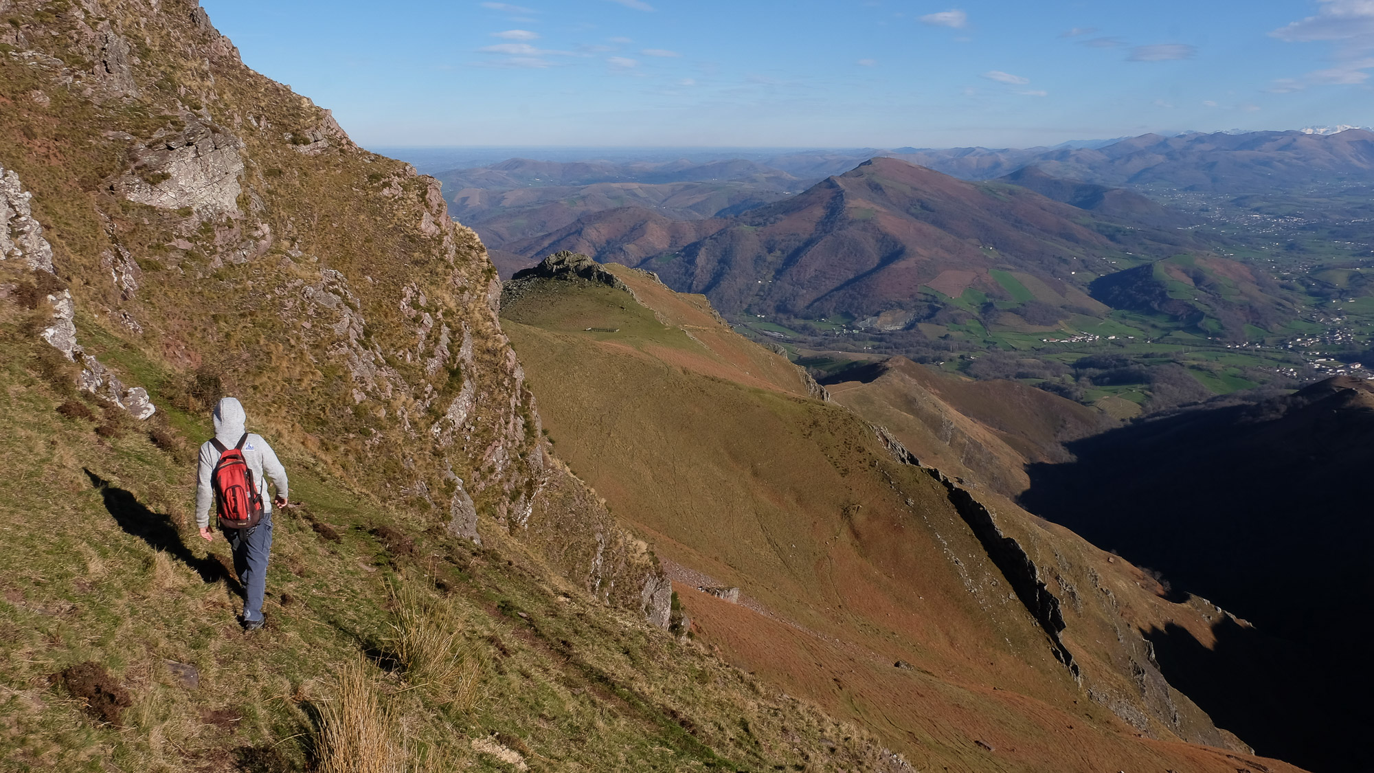
From here, the Iparla ridges begin. Follow the mini-trail that crosses to the north beneath the walls, gradually climbing up to reach the foot of the couloir leading up to the Iparla pass. The slope is very steep and you come out on the ridge at 948m to find the GR10. We've covered about 6km from the parking lot.
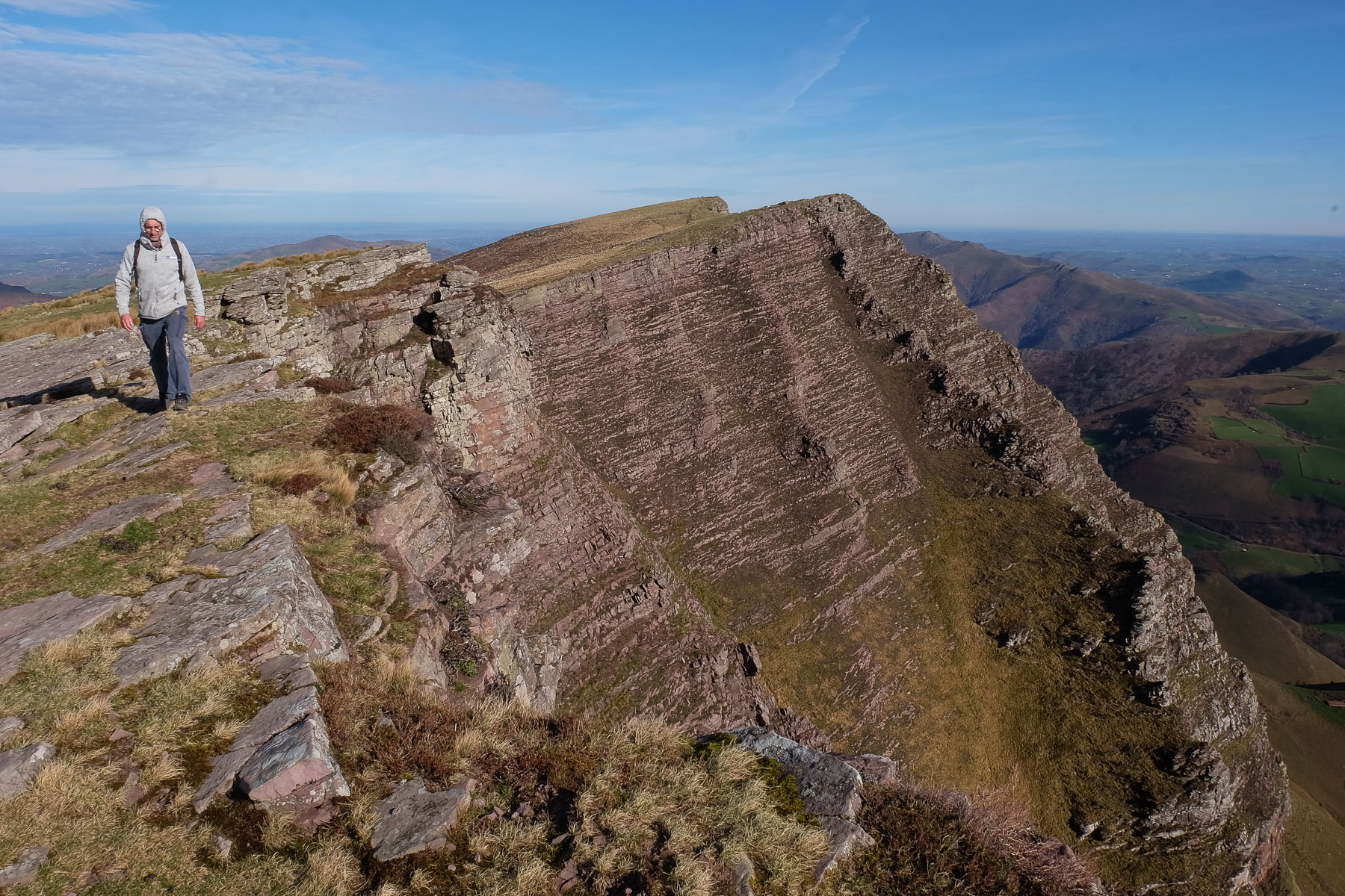
The itinerary covers all the Iparla ridges from the Col d'Iparla to the Col d'Astate, where you descend.
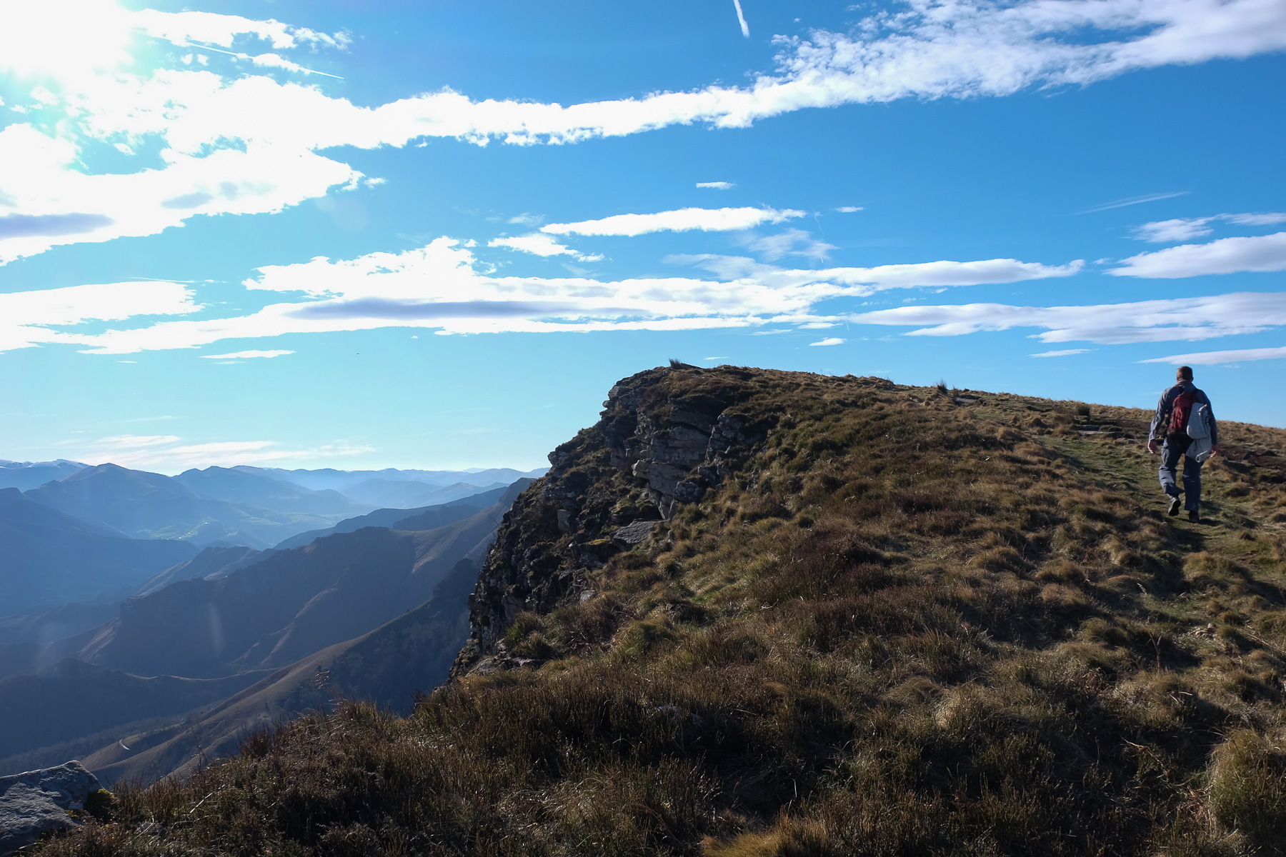
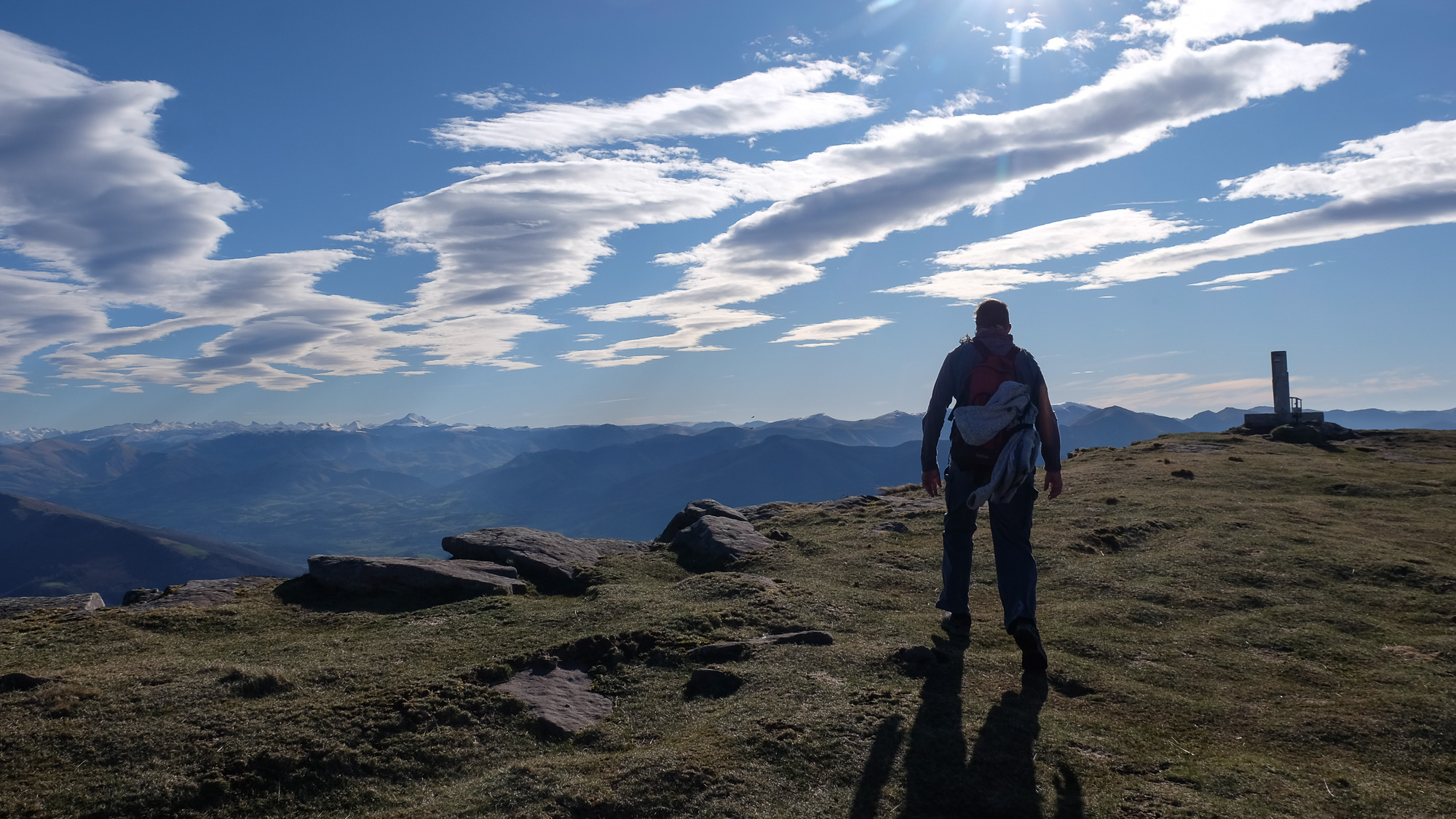
Head due south on the GR10 and climb fairly quickly to the Pic d'Iparla (1044m). The rest of the route takes you down a little, over passes and up new peaks, until you reach the Pic de Toutoulia (987m). The views over the bars are very impressive.
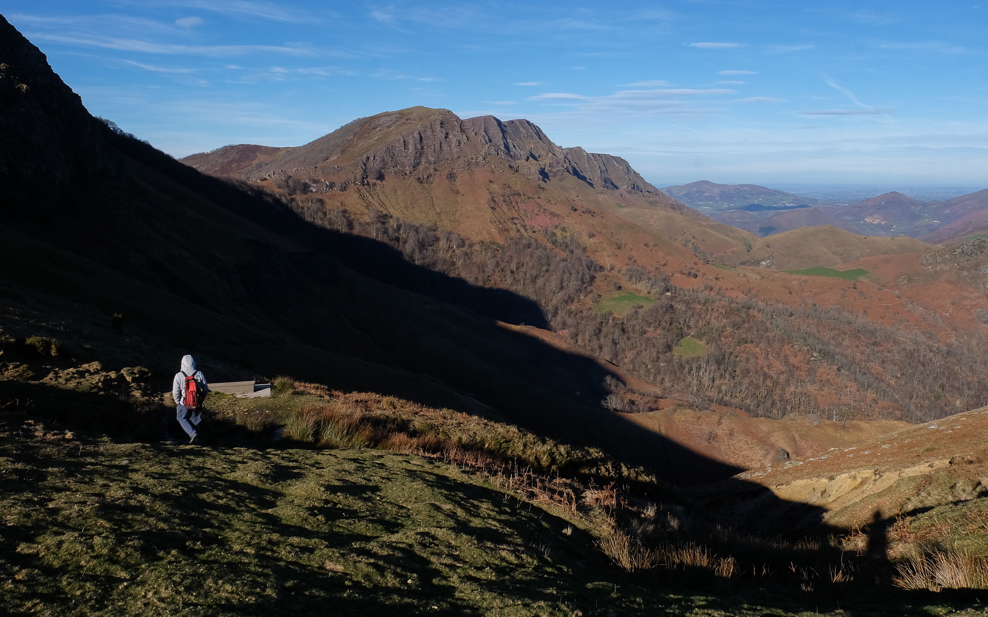
From here, we descend a little further to the Col d'Harietta (808m) before heading back up into the forest. Then it's back up again, with another ridge to follow to the south as far as Astate (1022m). Descend to the Col d'Astate (957m), the end of the Iparla ridge and the start of the return descent.
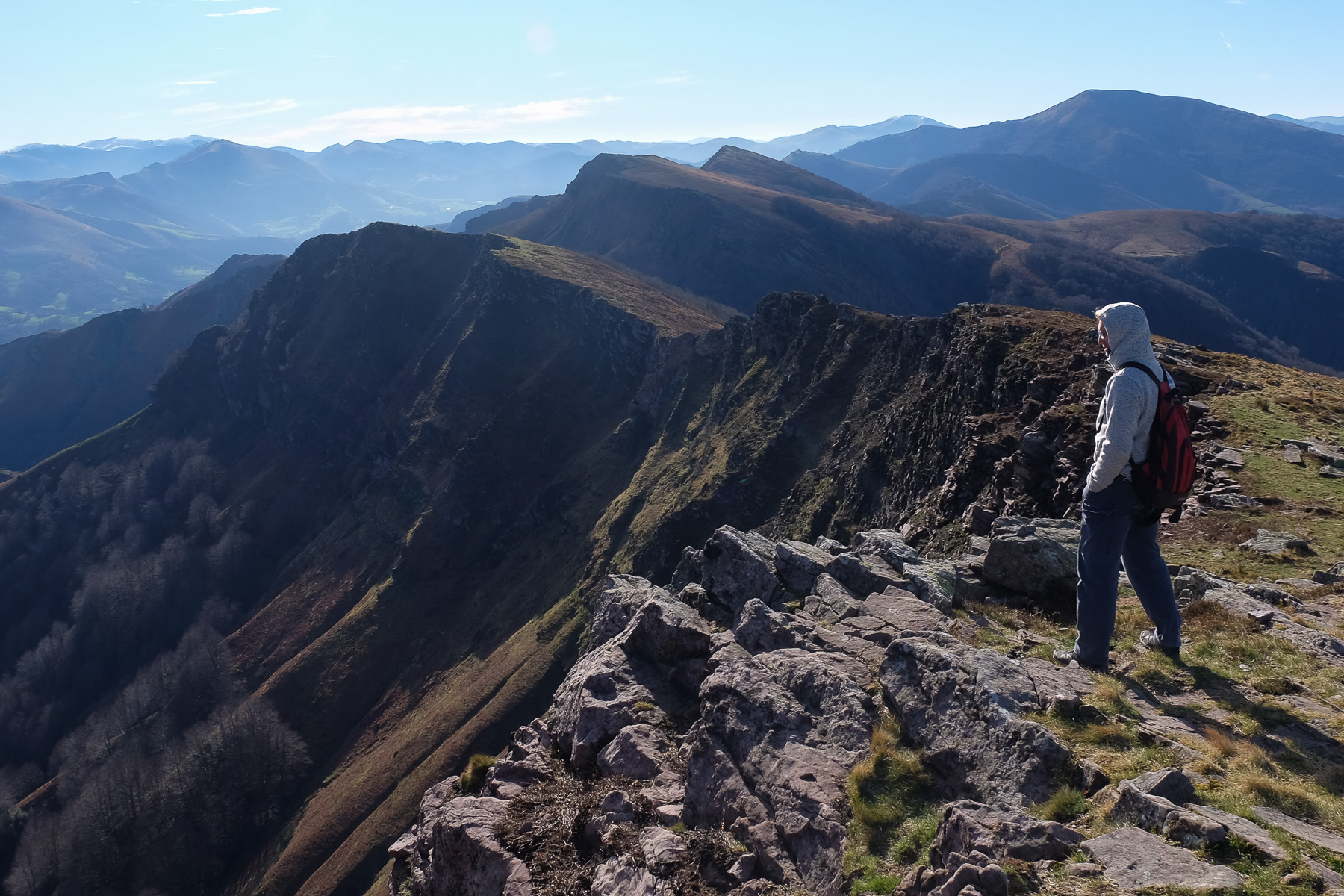
From the Col d'Astate, descend eastwards on a steep, airy path. Below, turn left to the northeast to cross under the walls and soon reach the Col de Sarastegui, where there are large enclosures.
Here, turn north to return under the cliffs. The little path crosses steep grassy slopes, crossing 4 or 5 small torrents that tumble down the slope to end up at the top of a long, descending ridge in the shape of a spine, from which emerges a rocky tooth: l'Armatarre.
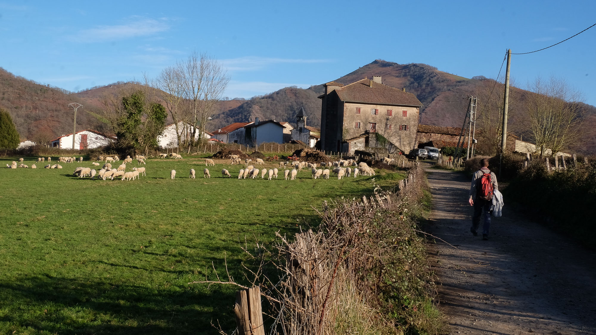
Descend the ridge, passing under the tooth and to its right, then continue into the forest. Staying on the ridge, the path becomes less and less visible and finally disappears. The end is reached by improvising in the ferns to descend the final slope and find a forest track at the bottom. Overlooking the village of Urdoz, orientation is done by sight. Superb panorama all the way!
Follow the track to the right and you'll come straight to Urdoz.


![2017-08-01_10-56-03 [Crête de Pinu]](https://climbing7.com/wp-content/uploads/2017/09/2017-08-01_10-56-03-crc3aate-de-pinu-e1580117578105-1024x683.jpg "The Pinu ridges, Cap Corse")


Leave a Reply