A sporty, almost alpine discovery of the Montagne Sainte-Victoire. This itinerary, which combines several trails and equipped passages, offers a demanding, aerial circuit, with many free climbing passages (III/IV- max). Although all sections can be climbed without equipment, it is advisable to bring a helmet and equipment for the most exposed sections. The route is highly varied, alternating steep climbs, slabs and corridors to be climbed or unclimbed, cave passages, traverses and aerial ledges. It's not easy to find your way around, either, as there are no markings on some sections of the route. So be sure to bring a map or GPS track and plenty of water. A montserratine hike par excellence!
❱❱ Technical summary
Type ✦ Equipped hike
Location ✦ Saint-Antonin-sur-Bayon, Montagne Sainte-Victoire
Region ✦ Bouches-du-Rhône
Country ✦ France
Orientation ✦ South
Max altitude ✦ 954m
Distance ✦ 6.5km
Dénivelé ✦ 663m
Difficulty ✦ E4 / T4 / R5
Duration ✦ 4h to 5h
Interest ✦ ★★
❱❱ Access to the place
The site is just east of Aix-en-Provence. Drive to Saint-Antonin-sur-Bayon, through the village (coming from Aix) and park just beyond at the Deux Aiguilles parking lot.
❱❱ Map & topo
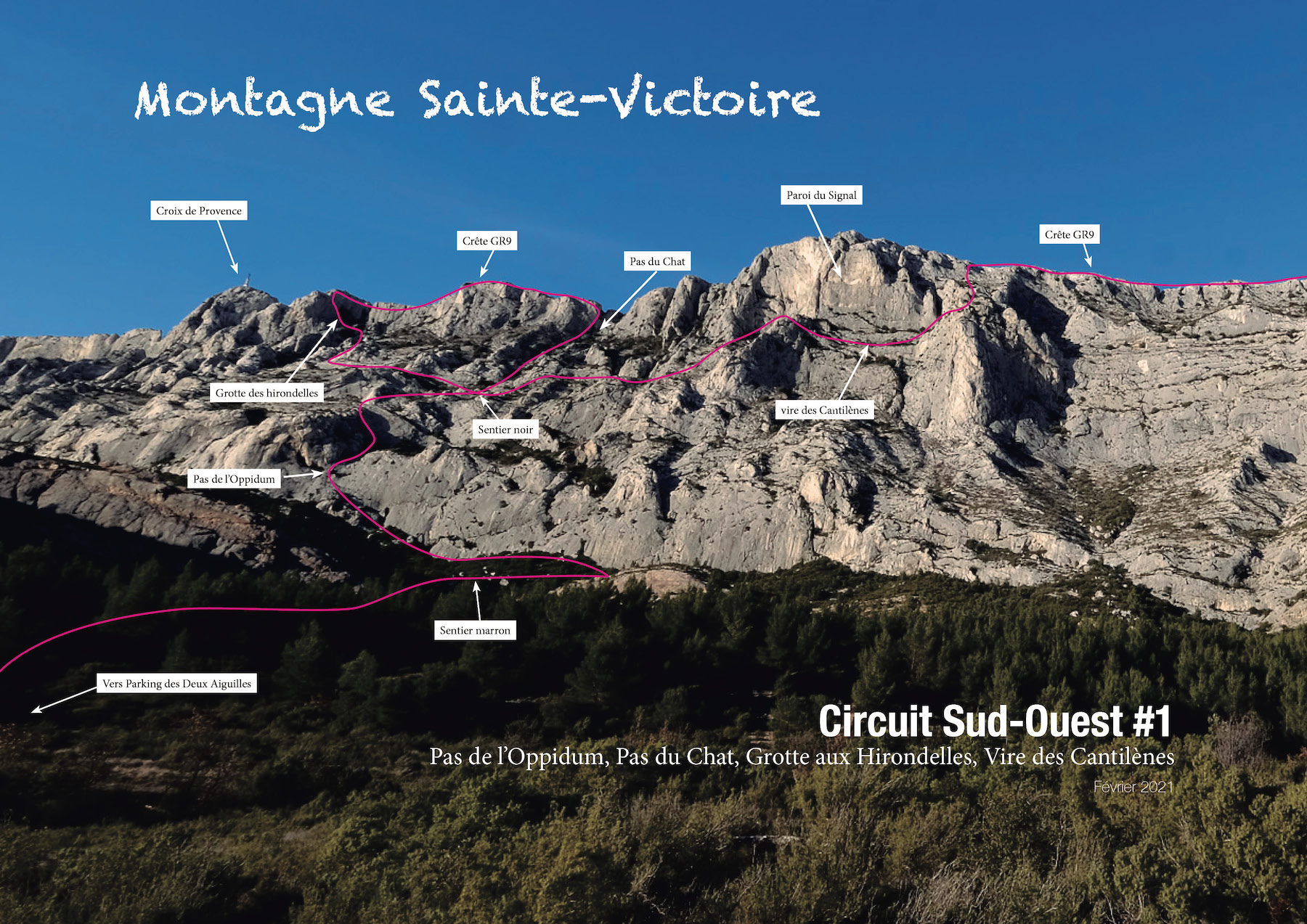
Map routes, especially off-trail sections, are for guidance only. Routes on topos photos may contain errors due to the distance from the photo.
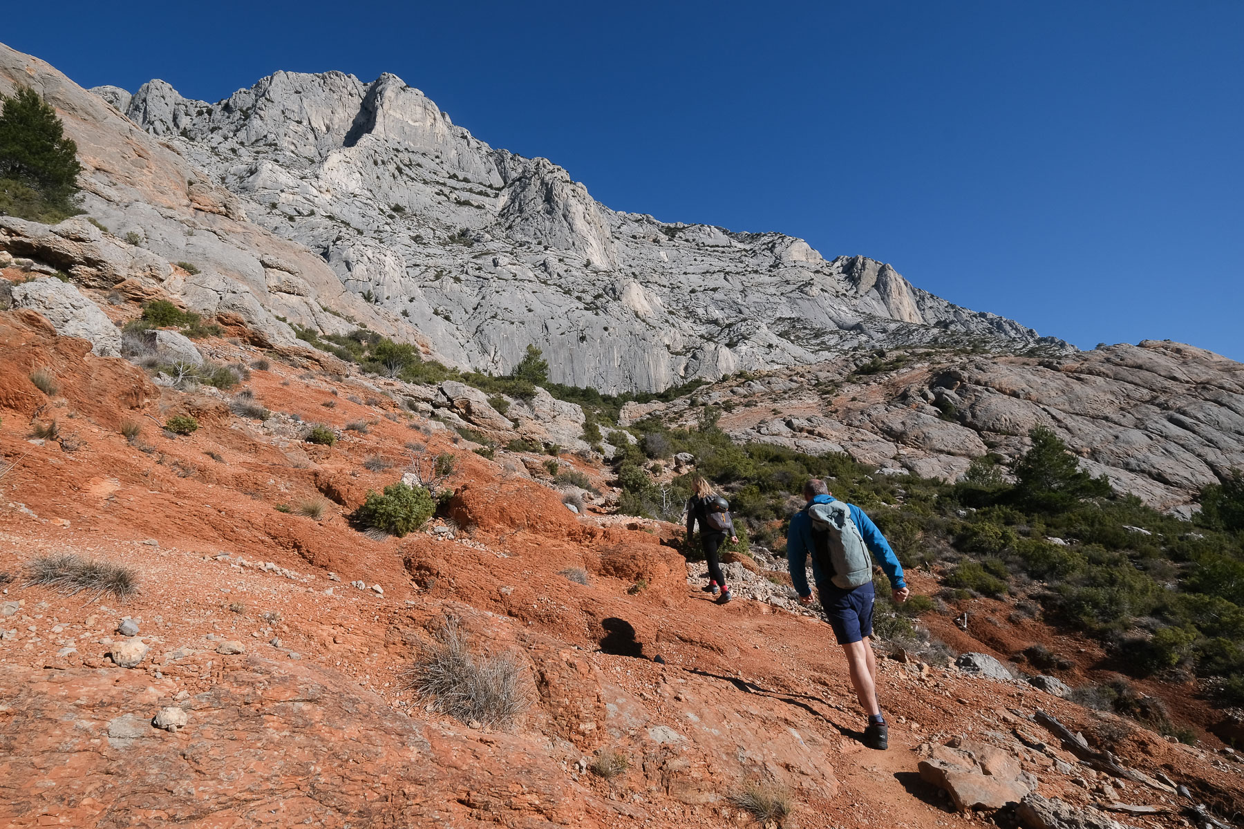
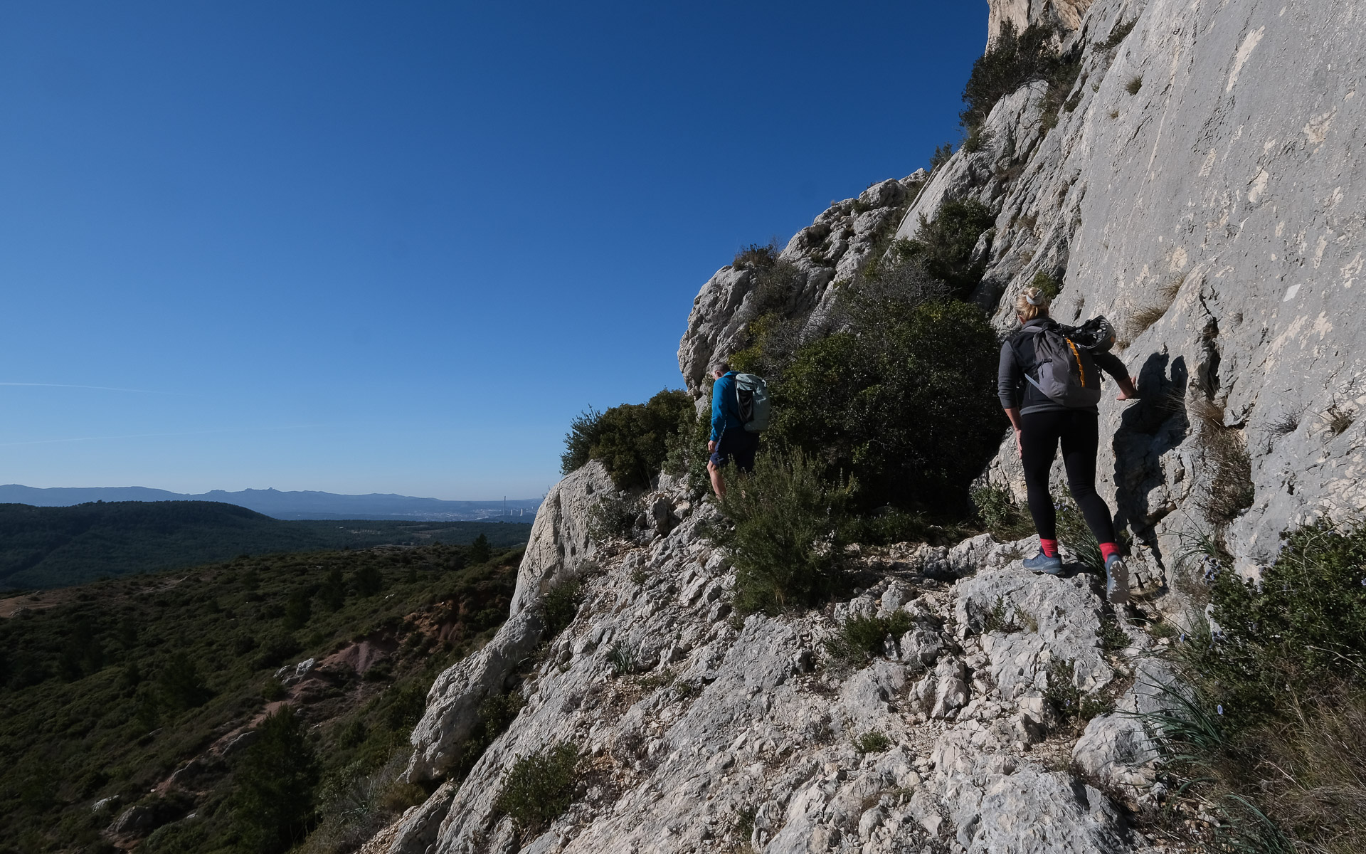
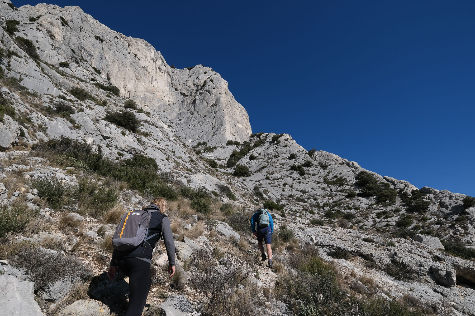
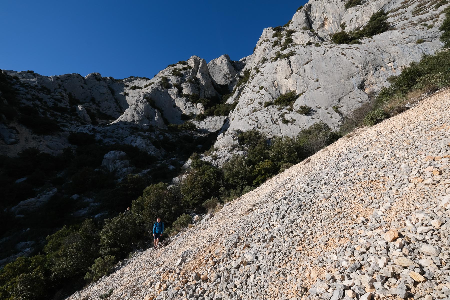
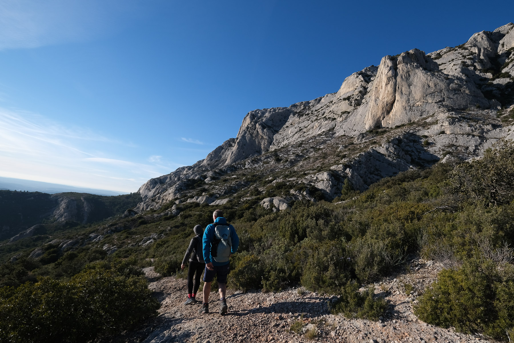
From the parking lot, cross the road and follow the path due north, following the blue triangle markings to the climbing areas. Further on, after crossing an area of red earth, climb a first ledge to cross the brown path. Turn right to the east and after about 200 m, turn left again on a wide path that heads back west towards the cliffs. Walk along the base of the rocks and follow the blue markings to the Rognures sector. At the end, the ascent begins in a steep couloir.
Course
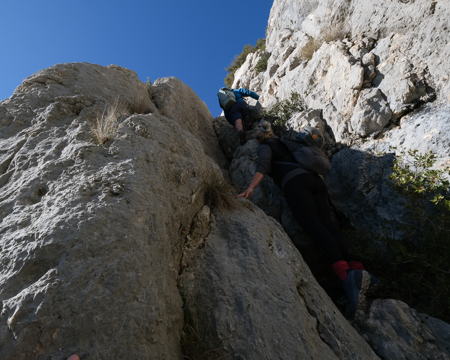
The route follows a combination of official trails (brown, black, green), visible but unmarked paths and off-trail sections. A map or GPS track will come in handy for finding your way at key points. In addition to the physical commitment involved, there are many exposed and aerial passages to negotiate, some equipped (Pas de l'Oppidum, Pas du Chat) and others free climbing (III/IV max). It seems advisable to wear at least a climbing helmet, and to bring a rope and harness for climbing under the Pas de l'Oppidum or equipped sections. There are no water points along the way, so bring your own water supplies, especially as the whole loop faces south and is therefore very sunny.
From June 1 to September 30, access to the massif is restricted: limited hours of access, partial or total ban. To find out more, click here.
Part 1: Pas de l'Oppidum, Pas du Chat, Croix de Provence (1h to 1h30)
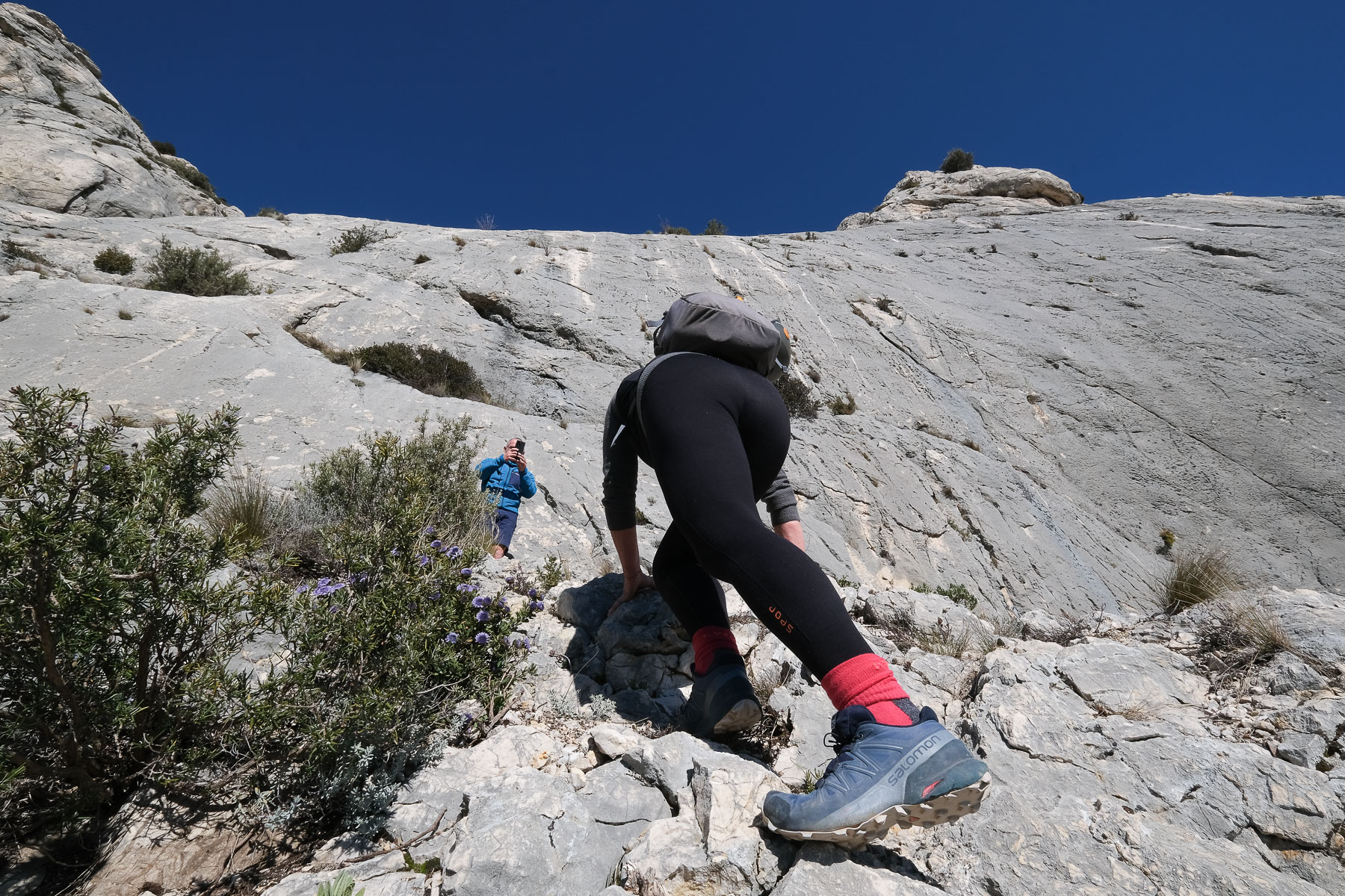
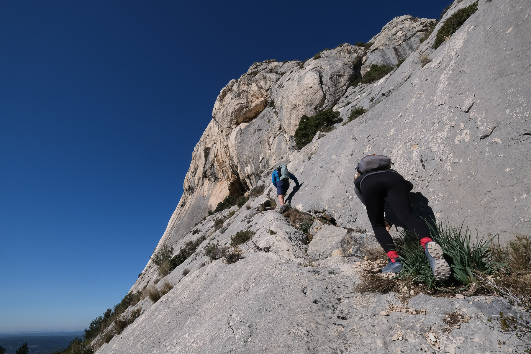
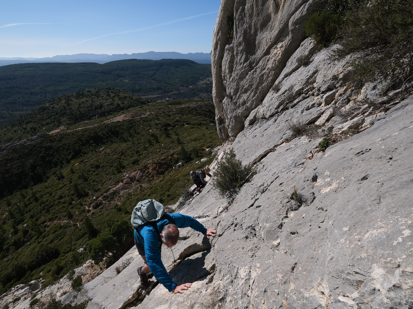
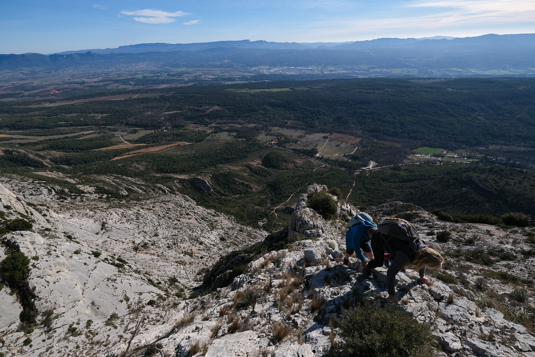
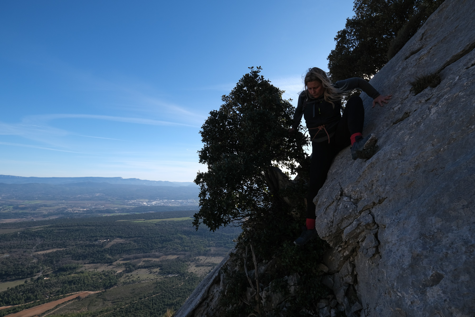
Climb the left-most couloir (IV-) and above it, walking a little to the west, a new projection to be climbed (III) without difficulty. You arrive under a large sloping limestone slab. Climb it, then take a diagonal fissure to the west. To exit, climb 5 metres under a tree, an exposed aerial passage with no difficulty (II/III). This leads to a small flat area behind the tree, below the Pas de l'Oppidum.
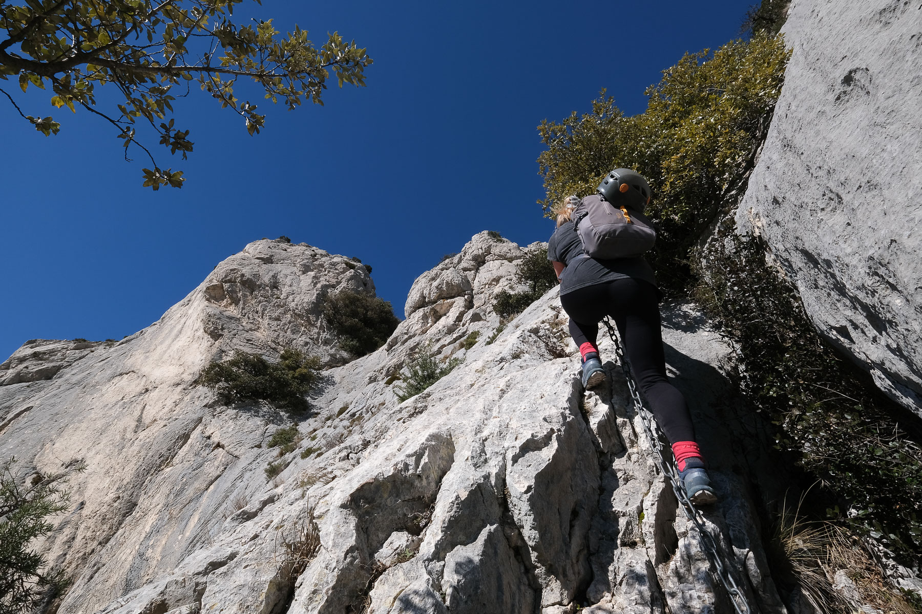
The Pas de l'O ppidum is a small section equipped with large chains to cross a fairly steep, weathered slab. Climb vertically then horizontally to exit to the right and climb higher into the scrub. Continue to climb steeply between rock and vegetation, over a large sloping slab to cross the black path (large cairn).
From here, climb due north in a scree slope that heads straight for the wall and the Pas du Chat passage, which can be seen below the ridge. Steep, sustained ascent over the scree. Higher up, you can see the big chain and its white trail on the limestone. We then reach the Pas du Chat.
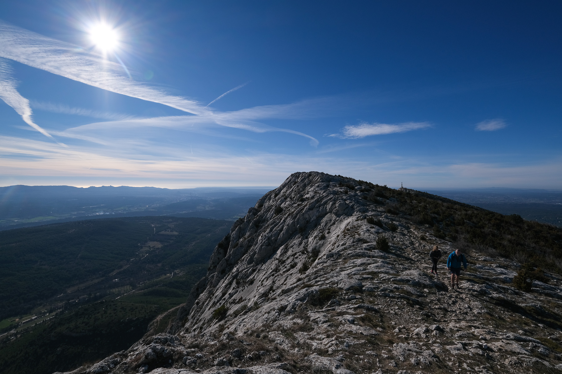
The Pas du Chat is another small section equipped with large chains that allow you to cross the final wall giving access to the ridge. 2 chain passages, less sustained than those on the Pas de l'Oppidum. Then it's a matter of crossing the final slope without difficulty to reach the crest, where the GR9 crosses and the Croix de Provence is visible to the west.
Walk west on the GR9 to quickly climb to the summit of Croix de Provence, which dominates the region 360° from its 950m altitude.
Part 2: Grotte aux Hirondelles, Vire des Cantilènes (1h to 1h30)
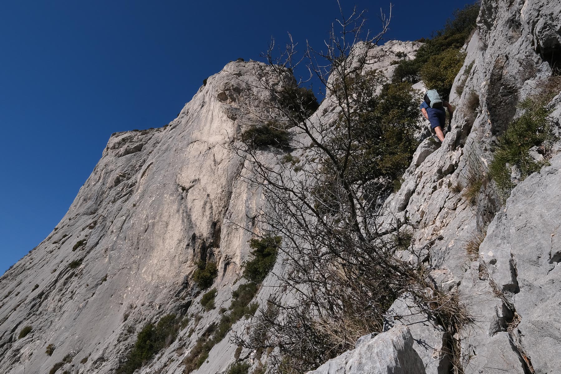
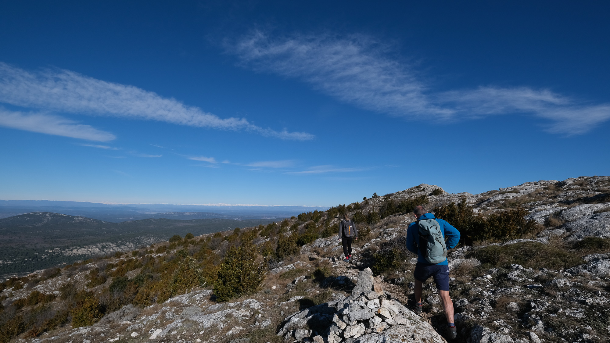
Retracing your steps from the Cross on the GR9, look for the entrance to Grotte aux Hirondelles on the south-facing ridge, a huge hole in the wall that leads back down to the black path. Climb into the cave by means of a series of small, not very complicated, but well-patinated descents. Exit to the sun on the south side of the cave. Descend following the black and green path. You pass right next to the Gouffre de Garagaï and then descend steeply over rock, with a small descent and then into a narrow scree. Be careful, you'll soon find the junction between the black and green paths. Stay on the black path and cross the scree to the east. Further down, find foot holds cut into the slab and cross over to climb up and over a small rocky ridge. From here, descend to find the black path below. Follow it eastwards, passing the scree that leads to the Pas du Chat.
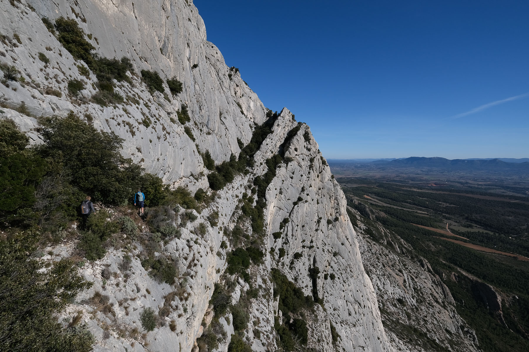
Continue on the black path and, at a large cairn, leave it to climb up a steep valley that leads to a small col below the large Signal wall, where the Vire des Cantilènes begins. To reach the small col, climb on the left side, with one or two climbing passages (III+). Then cross over to pass the small pass. This opens up the Vire des Cantilènes.
The Vire des Cantilènes is a mini-path suspended beneath the large Signal wall. You walk between the shrubbery that marks the line of a wide, upward-curving rock fold. Great atmosphere! At the end, the path climbs back up into the undergrowth to finish on a promontory overlooking the valley. From here, head due north and walk or climb without difficulty (III) up to the ridge and the GR9.
Part 3: From the crest to la Marbrière (45' to 1h)
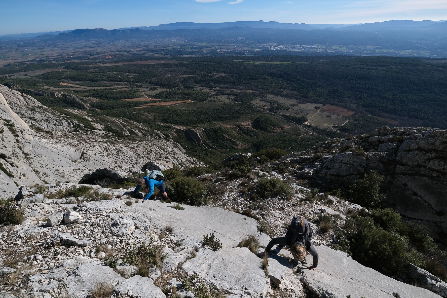
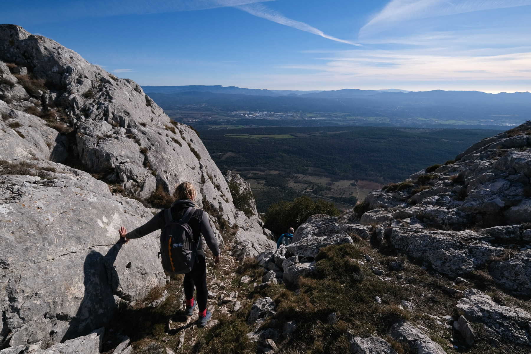
Take the GR9 eastwards and walk about 500m. Look for a small couloir to the right, on the south side, offering the possibility of a descent. This section follows a barely visible, unmarked mini trail. Descend into the narrow gully, keeping to the left of a rocky ridge. It's steep and fairly unstable. Leave the breaches on your left and continue down close to the ridge, which ends in a slab. Reach the edge of the ridge and continue to descend as far as you can. At the southern end, there's a small lunula on the ground. This is the place to de-escalate on the east side in a ramp-like fissure with no real difficulty (III). A rope can be used to help.
Cross the slabs following the crack and reach a small pass behind a huge rocky tooth. Here, plunge eastwards into the shaded valley. A stony path leads to a long, winding descent into the valley. You can admire the magnificent, undulating walls. Before reaching the bottom of the valley, cross over to skirt the base of the large walls. Climb slightly to pass a pass. Follow to the base of the Garagaï des Raspinas, where you can see a large hole in the wall. At the end, there's a small inclined corridor in the rock, leading to a new scree slope, which you descend until you reach the Marbrière and the brown path.
Back
Take the brown path at the old marble quarry, heading west. Take 2 large switchbacks to avoid the first rocky bar, and the path returns to the Deux-Aiguilles parking lot in the undergrowth. From below, you can see the entire route from west to east.


 Partager sur WhatsApp
 Partager sur Twitter
Partager sur Instagram
Partager sur Twitter
Partager sur Instagram

 Partager sur Facebook
 Imprimer le topo
 Laisser un commentaire


Leave a Reply