


TOPO Barranquismo | CLIMBING7.COM
Publié le
 Partager sur WhatsApp
 Partager sur Twitter
Partager sur Instagram
Partager sur Twitter
Partager sur Instagram

 Partager sur Facebook
 Imprimer le topo
 Laisser un commentaire

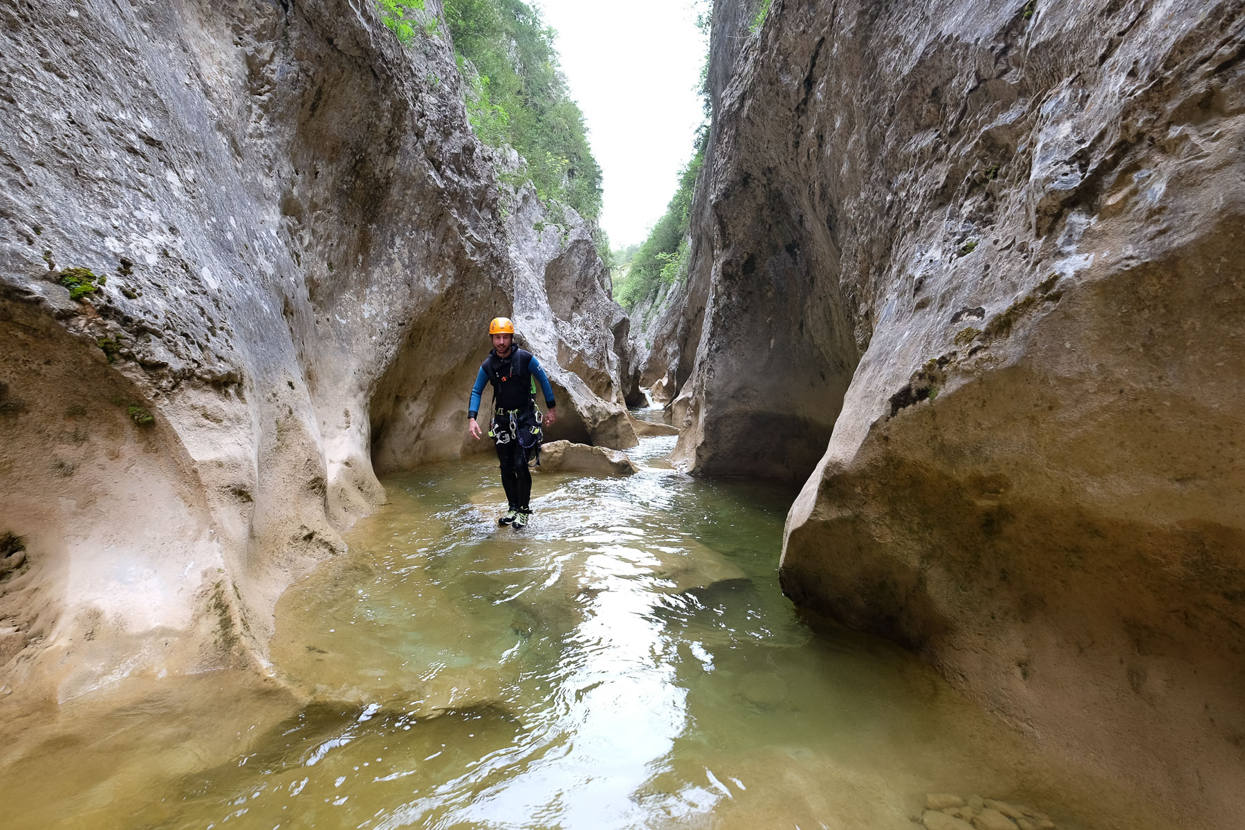
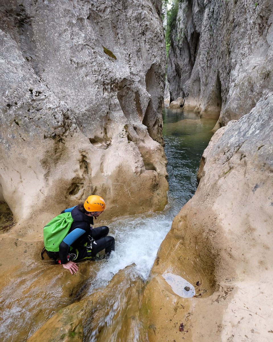
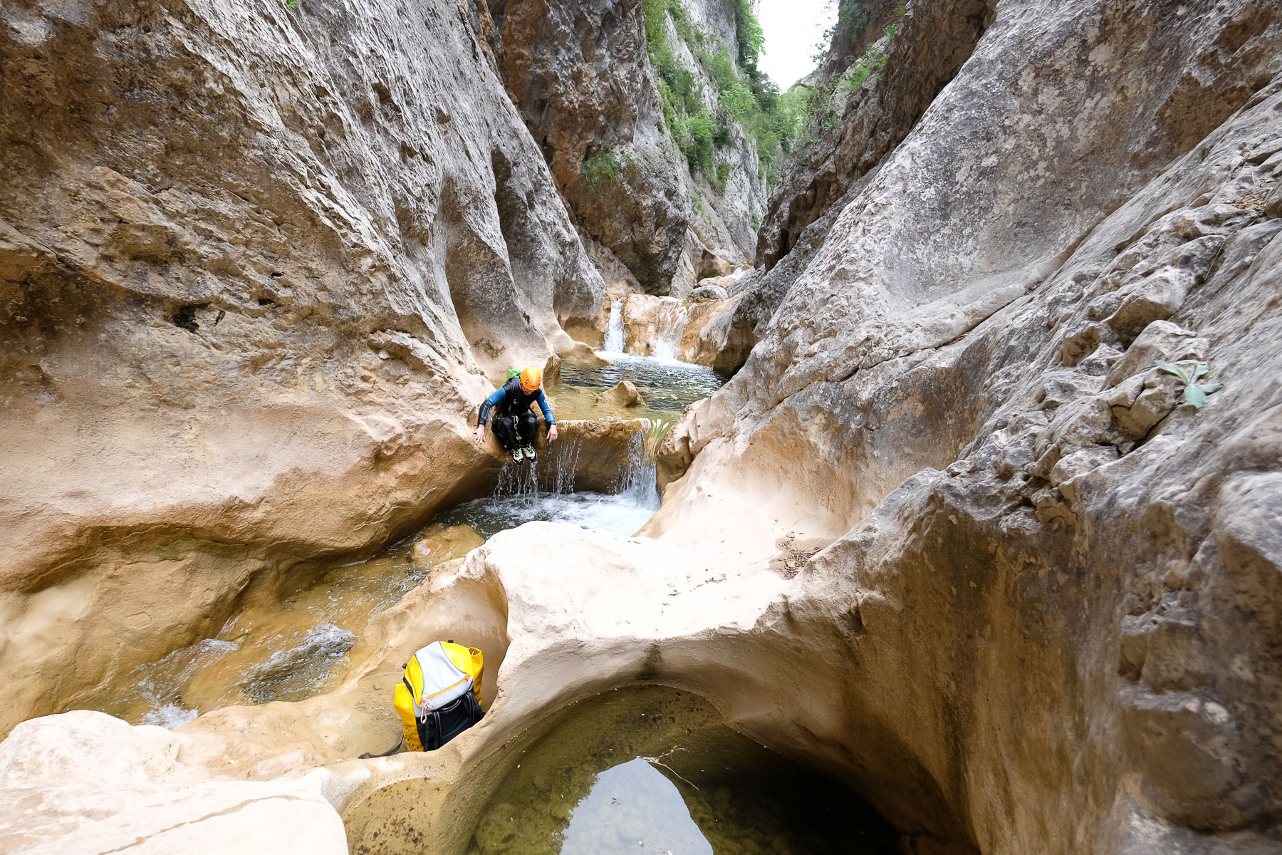
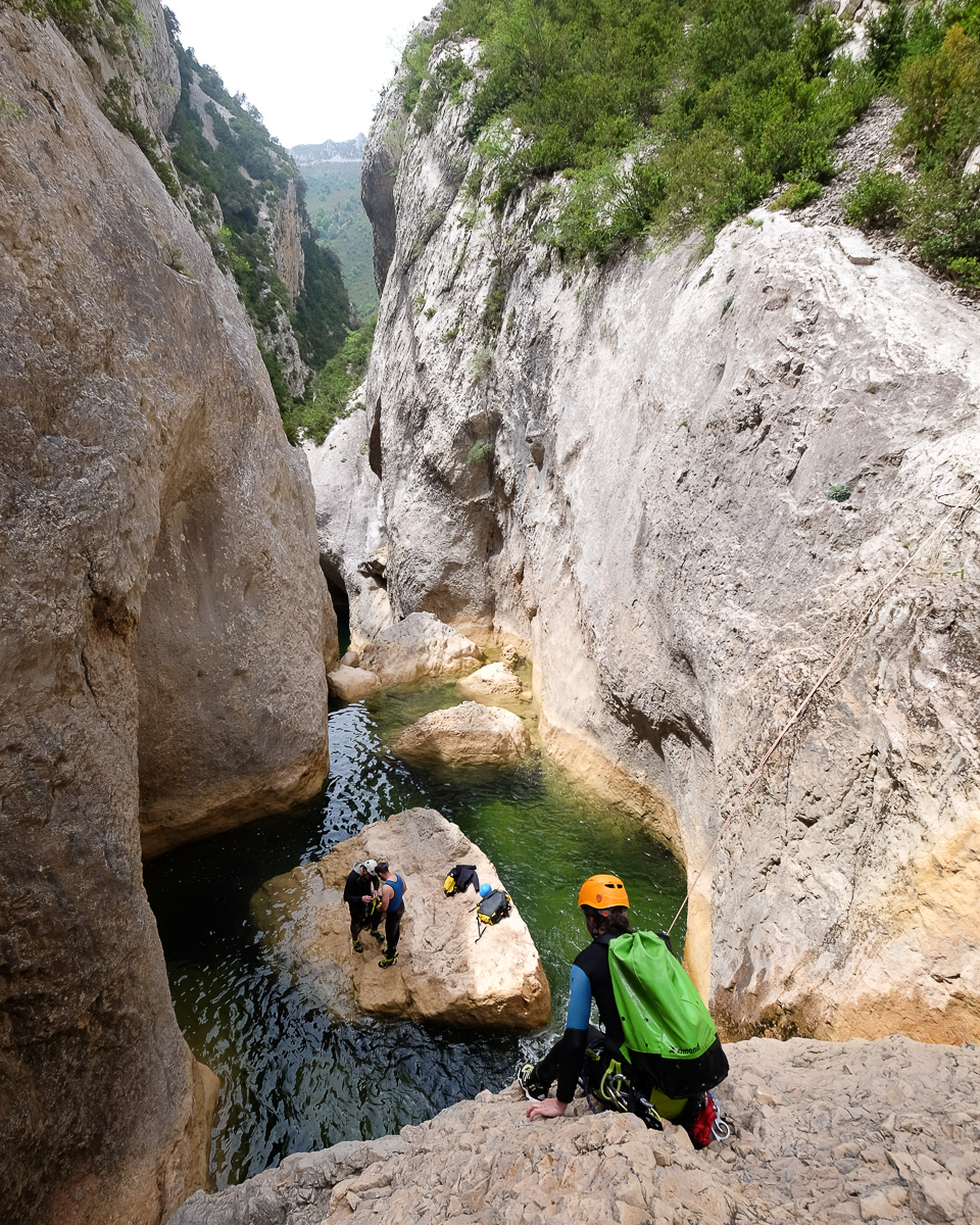
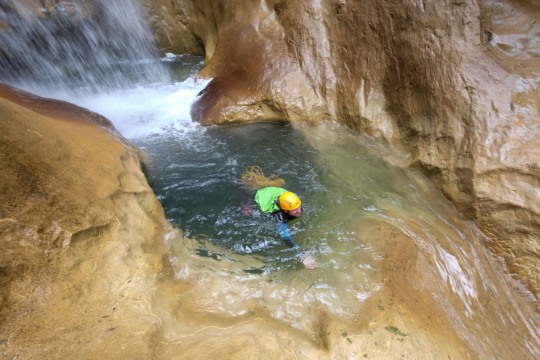
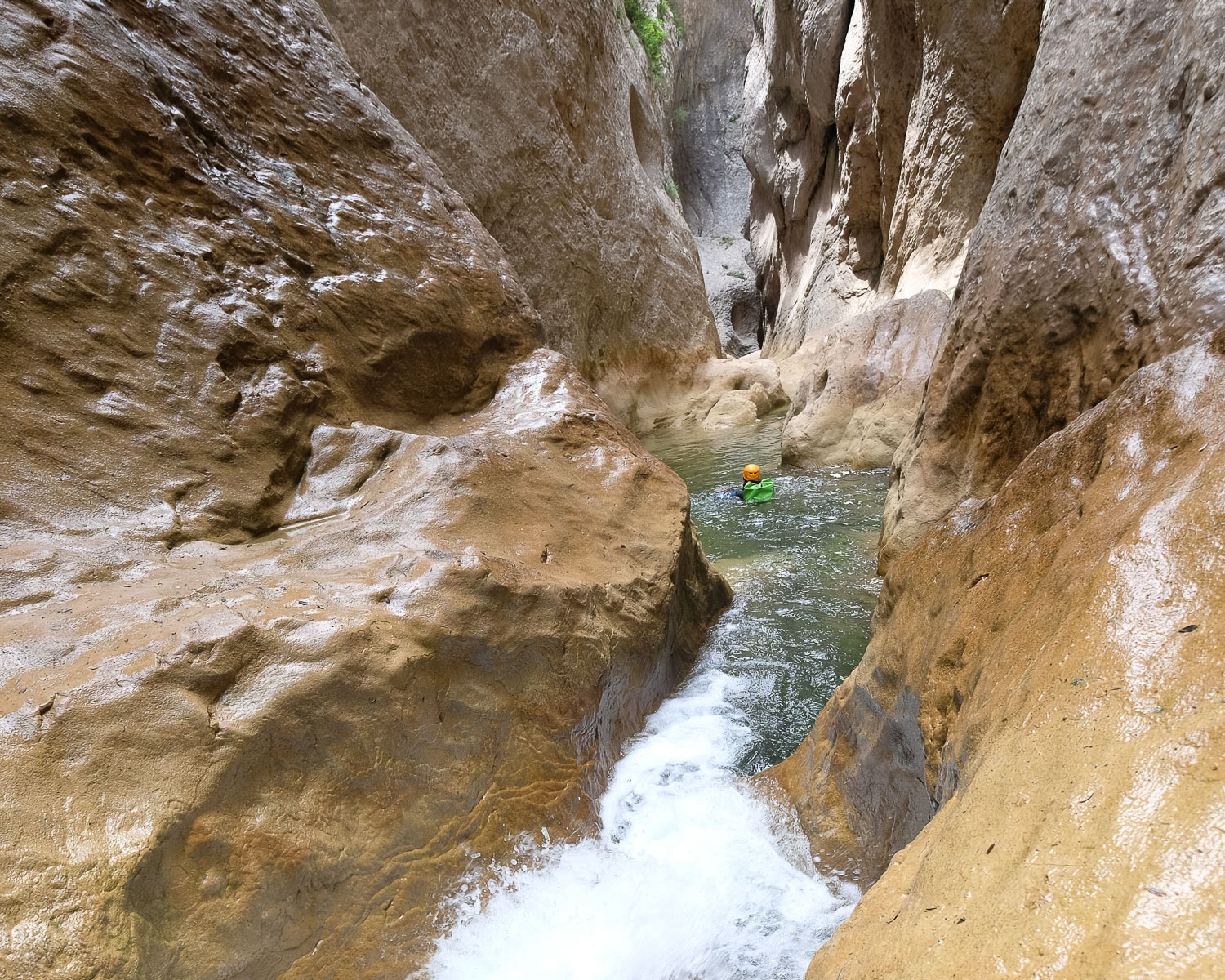
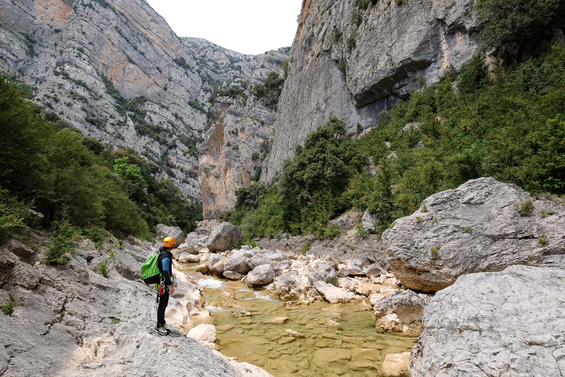
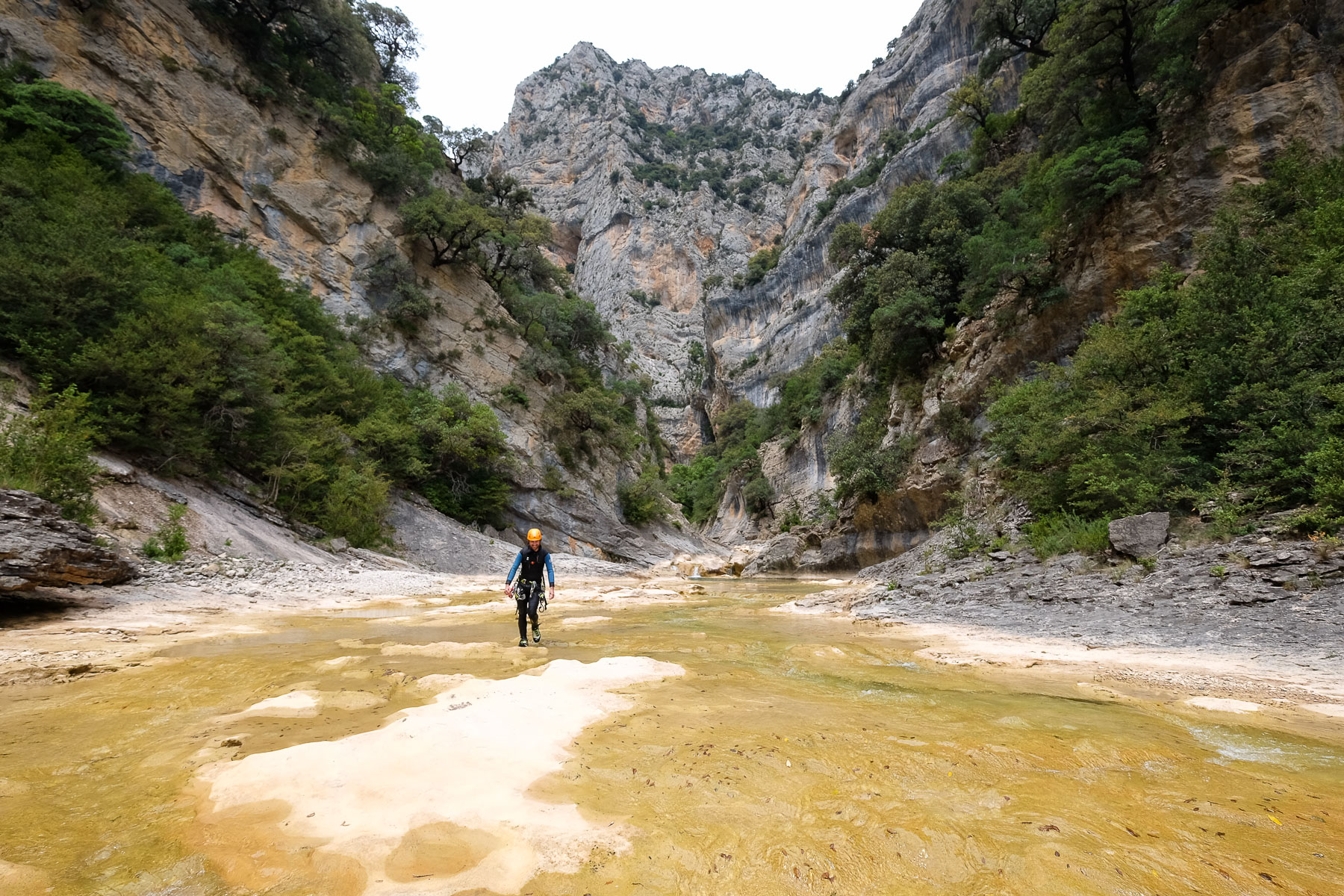
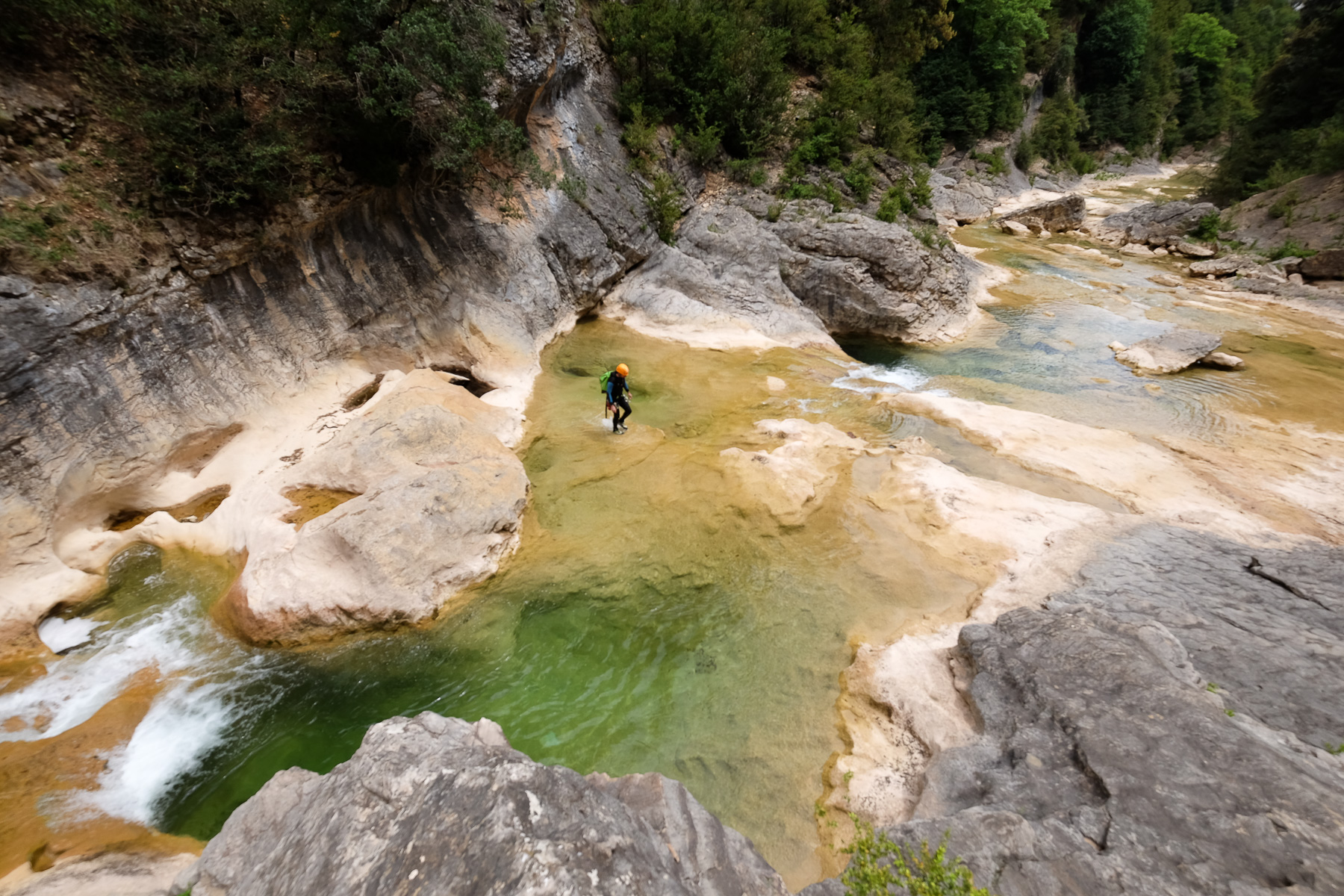
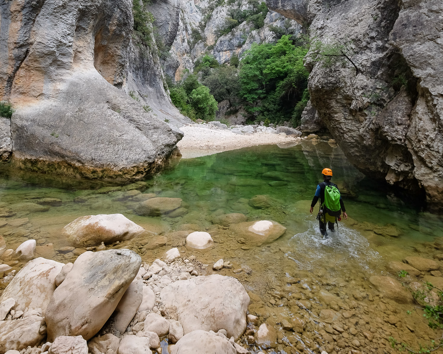
Quizás el cañón más emblemático de la Sierra de Guara, y con razón. Un recorrido acuático desafiante, salvaje y exigente, ambientado en un espléndido mundo mineral donde la caliza esculpida y las aguas verde translúcidas del Río Alcanadre inician su curso por la Sierra. Te adentras en una gigantesca falla a través de un larguísimo corredor de calizas teñidas de negro, con una sucesión de pozas, pozas y pequeñas formaciones caóticas que exigen una progresión muy acuática. Al final, el cañón vira 90° para un segundo tramo más abierto y algo menos acuático: el paisaje sigue siendo espléndido y se alterna el paseo y la natación en pasos estrechos y aguas mucho más frías debido a un resurgimiento a mitad de camino. Una magnífica opción que no debe perderse, y sólo tendrá que aprovechar una buena ventana meteorológica y unas buenas condiciones del agua para zambullirse.
❱❱ Reseñas técnicas
Tipo ✦ Cañón de agua
Ubicación ✦ Rodellar, Sierra de Guara
Región ✦ Aragón
País ✦ España
Dirección ✦ Sur y este
Longitud del descenso ✦ 5km
Desnivel ✦ 205m
Dificultad ✦ v3 - a5 - IV
Duración ✦ 8h a 9h
Interés ✦ ★★★★
❱❱ Acceso al sitio
El cañón comienza en el pueblo de Rodellar. En la A2 entre Lleida y Huesca, gire hacia Abiego, Bierge y luego Rodellar al final de la carretera. Salida desde el pueblo.
❱❱ Mapa & topo

❱❱ Itinéraire
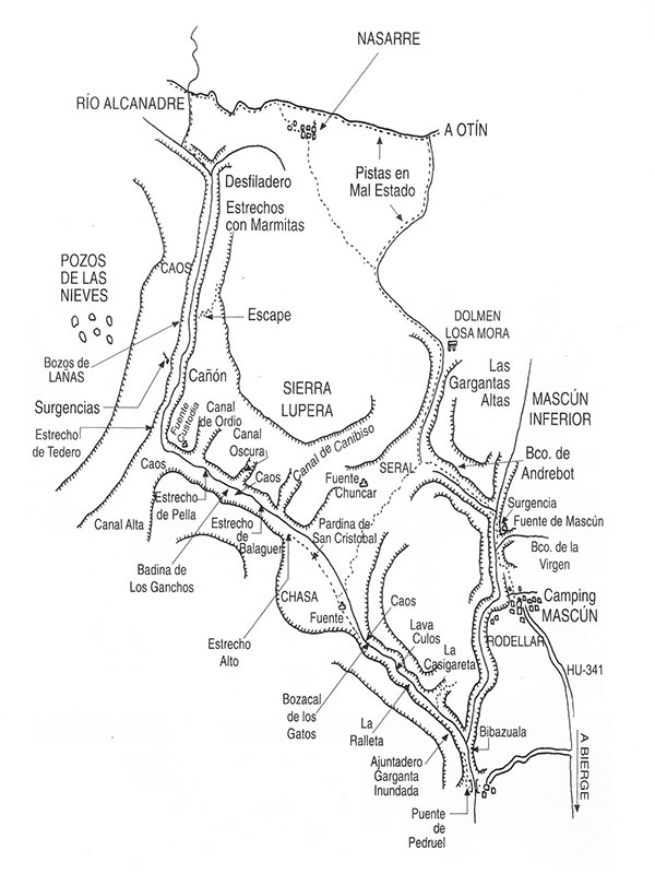
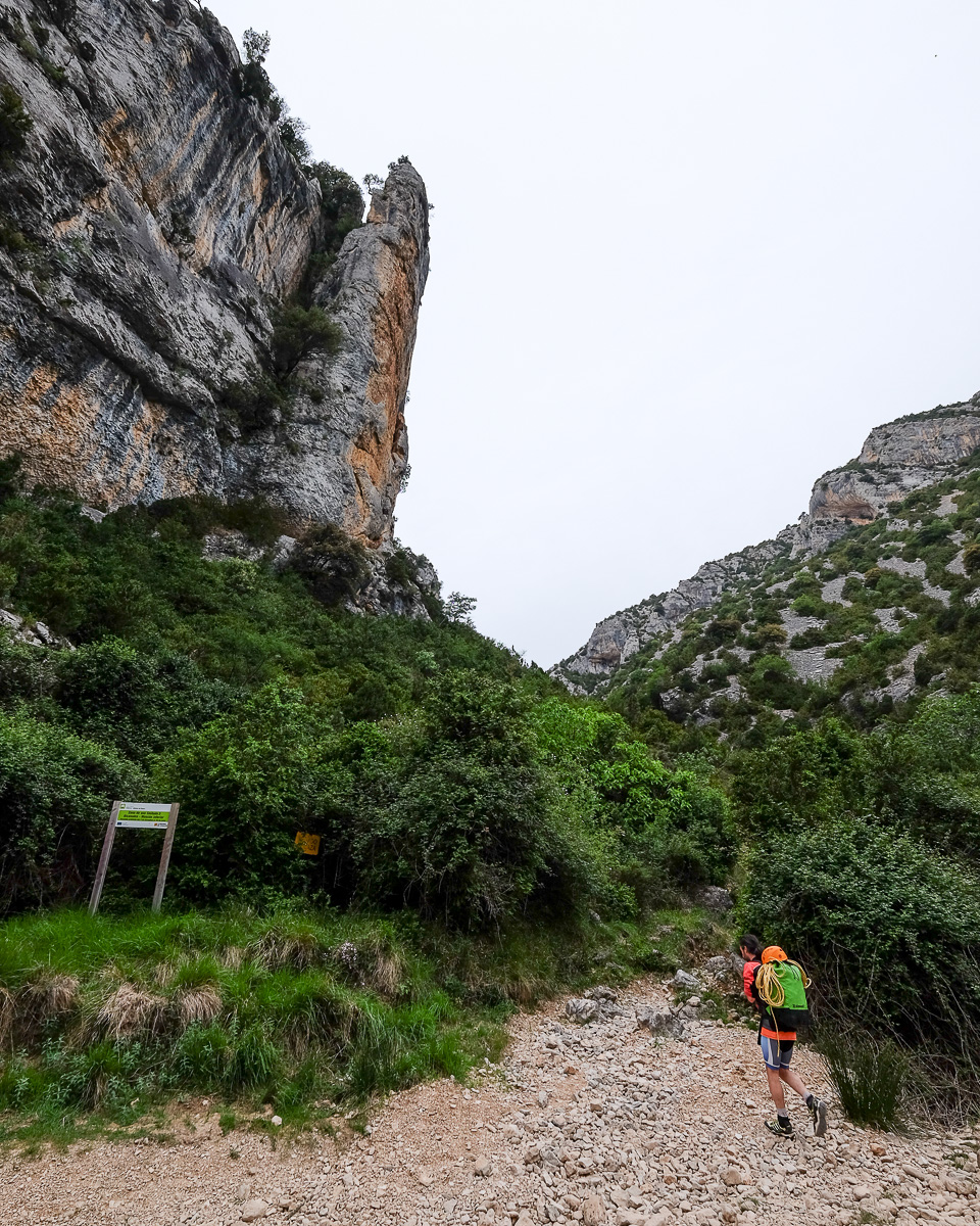
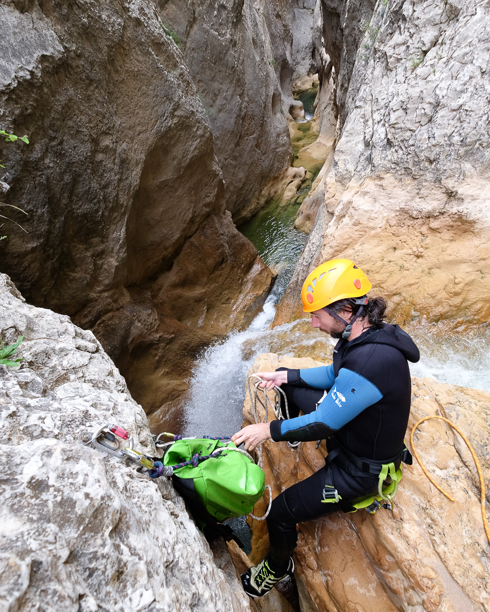
Es una aproximación larga, pero no consume demasiada energía si se sale temprano para evitar el sol y el calor de la Sierra. Desde Rodellar, descender por detrás del pueblo en dirección a las Surgencias del Mascun. Volver a subir por el norte junto a las zonas de escalada, rodear el delfín para llegar al cruce al pie de la vía ferrata. Girar a la izquierda (oeste) en dirección a Gorgas Negras (señal). El camino sube por el barranco de las Gargantas y en la cima hay una bifurcación: a la izquierda está el camino de vuelta desde el inicio del Barrasil, a la derecha está el camino hacia Nasarre. Gire a la derecha en una garganta sinuosa antes de desviarse hacia el oeste. Siga por Nasarre, el terreno es más llano, atraviese el pueblo abandonado, retome el GR1 y continúe pasando el pueblo por el GR1. Desciende un poco y podrá ver la entrada de Gorgas Negras a lo lejos. Más abajo, deje el GR1 y gire a la izquierda hacia Gorgas Negras, que está de nuevo señalizado. Hay un largo descenso entre maleza y empinadas curvas, hasta que en la parte inferior se cruza y se vuelve a cruzar el Río Alcanadre hasta encontrar la entrada al cañón, donde el Río Used emerge por la derecha. Puedes equiparte allí o posiblemente más adelante, en la entrada del desfiladero.
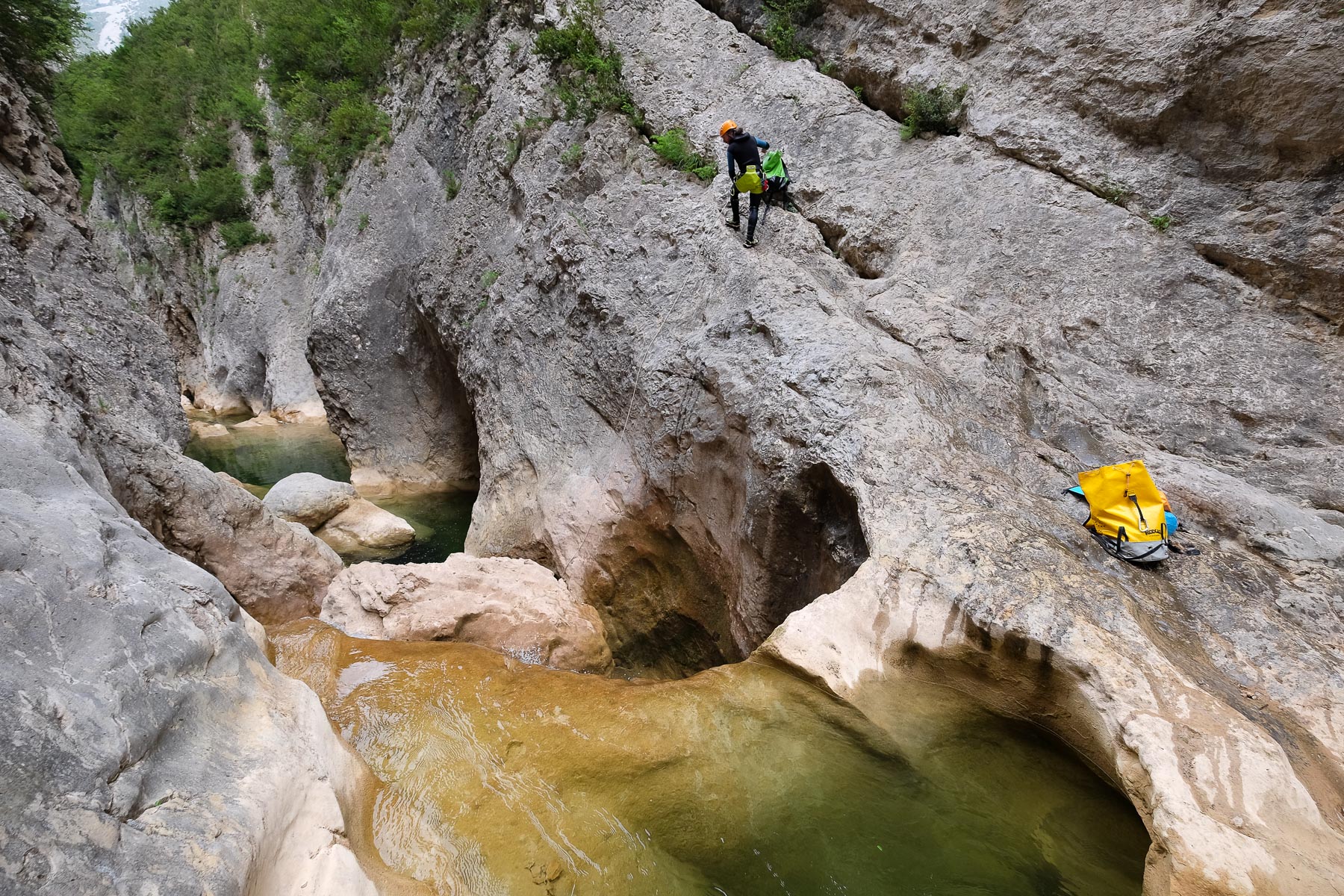
El descenso es muy acuático, sobre todo en la 1ª parte, así que comprueba el caudal de agua antes de empezar. El agua está más fría al final de la 1ª parte y en la 2ª parte, por lo que la calidad de su traje de neopreno es esencial. Hay 3 rápeles, todos en la 1ª parte. Algunos de ellos parecen "saltables", así que comprueba el nivel del agua. En cuanto al compromiso, en la parte 1, no hay ruta de escape y sólo hay 1 ó 2 oportunidades de salir de la inundación. En la segunda parte, es mucho más abierto y puedes salir del cauce del torrente sin problemas, aunque no encuentres una vía de escape antes de Chasa;
Tomar la estrecha senda que sale del barranco por la margen izquierda y ascender en fuerte pendiente para alcanzar el Collado de San Cristóbal en unos 30'. Continuar por esta senda, volviendo esta vez a la bifurcación de aproximación en la cima del Barranco de la Gargantas. A continuación, desandar el camino en sentido contrario: barranco de la Gargantas, delfín y zigzag para volver a Rodellar.
Topo del cañón en descente-canyon.com


Deja una respuesta