TOPO
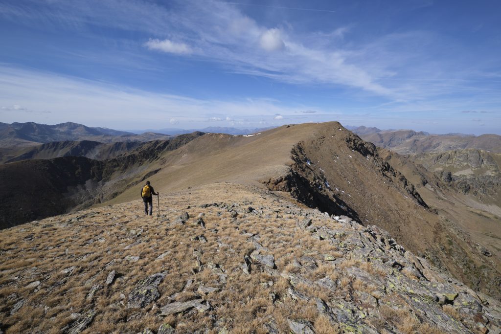
Pic de Nérassol from the east face and Siscar valley, Hospitalet-près-l’Andorre

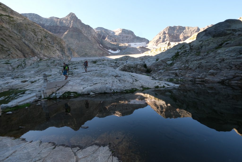
Descente du Pic de Nérassol, vue brumeuse sur l’étang du Siscar
A beautiful loop on the edge of Ariège, along the Andorran border, to climb the Pic de Nérassol, which rises in the middle of 3 small valleys through which flow the ruisseau de Siscar, the ruisseau de Val d'Arques and the ruisseau de la Vaillette. The proposed itinerary leaves the classic Tour du Nérassol loop to climb off-trail on the east side, before rejoining it at Porteilla du Sisca to finish the route. The difficulty lies mainly in the route finding and the steep ascent of grassy corridors and scree. The presence of water, ponds and streams, and the panoramic views from the summit make this hike a great option, despite the fairly heavy traffic in high season.
Technical summary
■ Departure point: Hospitalet-près-l'Andorre, Ariège (09)
■ Type of route: high mountain loop hike
■ Distance: 14 km
■ Cumulative elevation gain: +1200 m
■ Cumulative negative altitude gain: -1200 m
■ Estimated total time: 5h to 6h
■ Min and max altitude: 1440 m / 2633 m
■ Marking: the Tour de Nérassol is marked in yellow and partly follows the GR T68. The ascent of the peak here is off-piste, with no cairns or visible paths, but is fairly logical.
■ Equipment: none
■ Equipment required: useful GPS track, especially if visibility is poor (off-trail section).
Difficulties: the grassy slopes are very steep in places and are likely to be slippery and dangerous in wet weather, so should be avoided in this case.
Access to the place
Get to l'Hospitalet-près-l'Andorre on the N20 south of Ax-les-Thermes and Mérens-les-Vals, just before the Puymorens tunnel. Drive through the village and, after the traffic circle, turn left to park in the station parking lot or opposite.
Map & topo
The route of the off-trail section is indicative and probably lacks precision.
Itinerary description
Part 1: Jasse Panel du Roux (1950m, 50' to 1h)
Walk south on the N20 for a hundred meters or so, past the EDF power station, cross the bridge and just after, on the right, the waterfall trail begins.
Climb a gradual path through undergrowth, gradually entering the valley of the Val d'Arques stream. Higher up, the path bends due west, on flatter, more open ground, and finally crosses the stream on a small stone bridge. This is the start of the loop: to the right, it climbs into the Val d'Arques, and to the left, the path returns via the valley of the Ruisseau de Siscar.
Cross the stream and climb steeper to reach the Jasse Panel du Roux at around 1950m. Here, we leave the GR and cross the stream again before the dam.
Part 2: Pic de Nérassol (2633m, 1h30 to 2h)
This is the off-trail section. Go left due east, cross the stream and go around a hump to head north again fairly quickly. Climbing a little, you come to an old track. Follow it to pass above the dam and reservoir. You also pass some equipped tunnel entrances (linked to the dam?). Go past the pond on the path that continues the track and, after a wide left-hand bend, you can see the grassy corridor to the west that leads upwards.
The slope is steep and you follow a stream to emerge higher up into a basin closed off by a cirque. Keep to the right and aim for a long boulder scree that ends in a couloir to cross the ridge. Climb up the scree, ascend the couloir (a few steps of III-) and emerge at the very top into a new basin, again closed by ridges, with a large scree of boulders occupying the center, with the Pic de Nérassol on the right at the top.
Climb steep grassy slopes, keeping to the right of the scree, before turning north and aiming for the ridge to the right of the Nérassol summit, which can be seen in front of you. Once you've reached the ridge, you'll need to climb back up to the summit, either on the wire or on the right-hand side to avoid obstacles. The slope becomes less steep as you approach the summit. Summit and 360° view.
Part 3: Porteilla du Sisca and Siscar valley (2h15 to 2h45)
From the summit, descend on the west side following a visible path. It descends gently and you can see the Siscar pond (see photo). Follow the steeper descent at the end to reach Porteilla du Sisca. At this point, you come across the yellow-marked Tour du Nérassol trail. The path bends increasingly to the south, eventually reaching the étang de Siscar, which you skirt until you reach the shelter, built in an original way on the water.
The rest of the way is easy, heading south-east and following the signs along the stream, which meanders down into a flat valley floor. Further on, you'll come to a dam, and below it, you'll descend into a pretty, narrow gorge, before turning northeast and returning to the start of the loop at the small stone bridge. Then descend along the same path as before to return to the starting point.
Ressources
Topo of the same loop on rando-marche.fr with a slightly different itinerary for the off-trail ascent of Pic de Nérassol (via the southern ridges).


Leave a Reply