On the border between Ariege and Andorra, near Pas de la Casa, the ridge linking Roc Mélé to Pic de la Cabaneta can be climbed without too much difficulty above the Siscar valley. A high-mountain atmosphere in a setting of autumnal colors, with spectacular views of the Pic d'Escobes, the Nérassol and the eastern part of the Ariege Pyrenees. The loop starting from l'Hospitalet-Près-l'Andorre is long, and the total altitude difference is considerable. The descent of the ridge between Pic de la Cabaneta and Pic du Siscar is off-piste before descending the Siscar valley back to the starting point.
❱❱ Technical summary
■ Departure point: Hospitalet-près-l'Andorre, Ariège (09)
■ Type of route: high-mountain loop hike
■ Distance: 18.5 km
■ Cumulative elevation gain: +1350 m
■ Cumulative negative altitude gain: -1350 m
■ Estimated total time: 6h to 7h30 ■ Min and max altitude: 1445m / 2660 m
■ Marking: GR to the crest, unmarked but visible trail on the crest. Return off-trail to the étang du Siscar, then GR back to the start.
■ Equipment in place: none
■ Equipment required: none
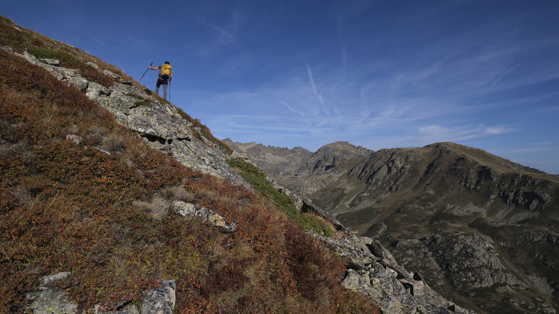
Difficulties: 1 or 2 short passages on the ridge where you have to put your hands down to balance yourself, a few aerial sections.
❱❱ Access to the place
On the N20 between Ax-les-Thermes and Portet-Puymorens, drive through the village of l'Hospitalet-Près-l'Andorre and park in the parking lot on your left, level with the SNCF train station and before leaving the village.
❱❱ Map & topo
The route over the ridge and down to the étang du Siscar is indicative.
1st part: from the parking lot to the Col des Clots (2169m, 1h30)
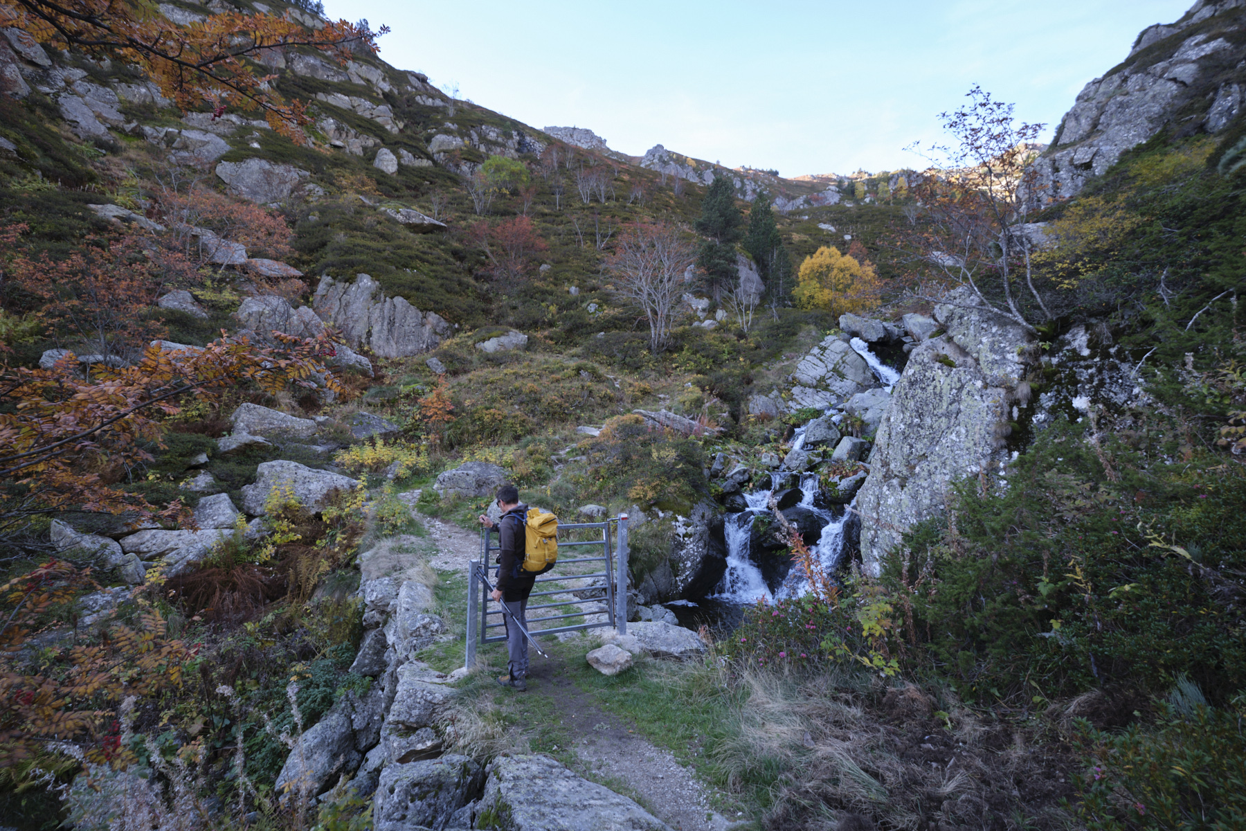
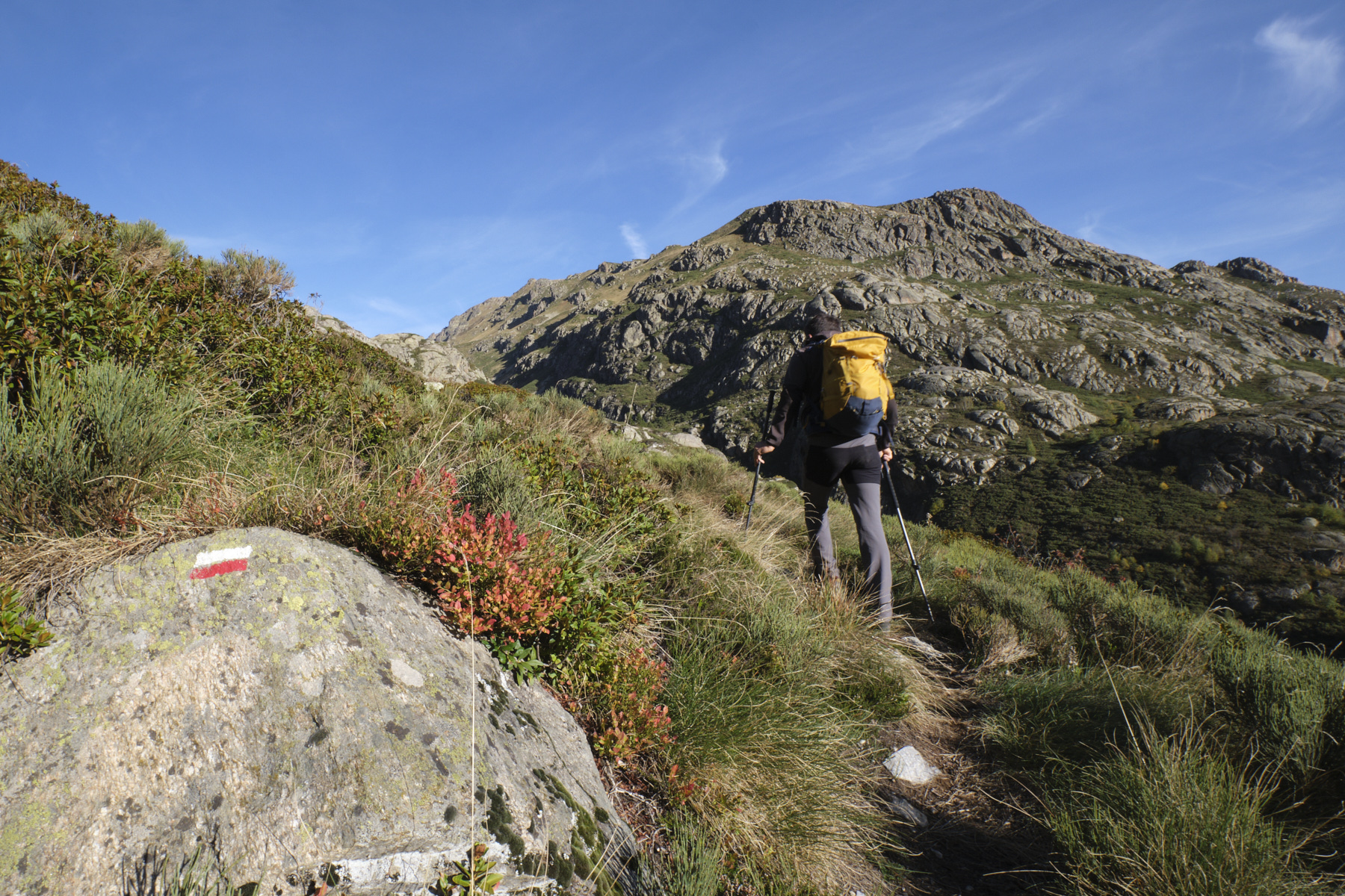
Leave the parking lot and walk along the road alongside the EDF power station. Cross the Ariège and take the path that rises to the right just after (behind a small building). Go through the gate and climb quite steeply, take 2 large switchbacks and climb back up, passing under a large penstock to skirt the Siscar stream further up. Higher up, the Siscar valley gradually opens up. Cross the stone bridge to reach the 1st fork in the road: on the right, the road to the Pédourès pond; on the left, the path to the Siscar pond. Turn left to cross the Siscar stream at a higher level (small gate) and climb up along small waterfalls. Above, after a new landing, it's more open. Before crossing the stream again to enter the Saut du Taureau gorge, turn left, due south, onto the moderately visible GR path. Climb up and make a wide west-to-east bend, before making a long traverse to reach the Col dels Clots at 2169m.
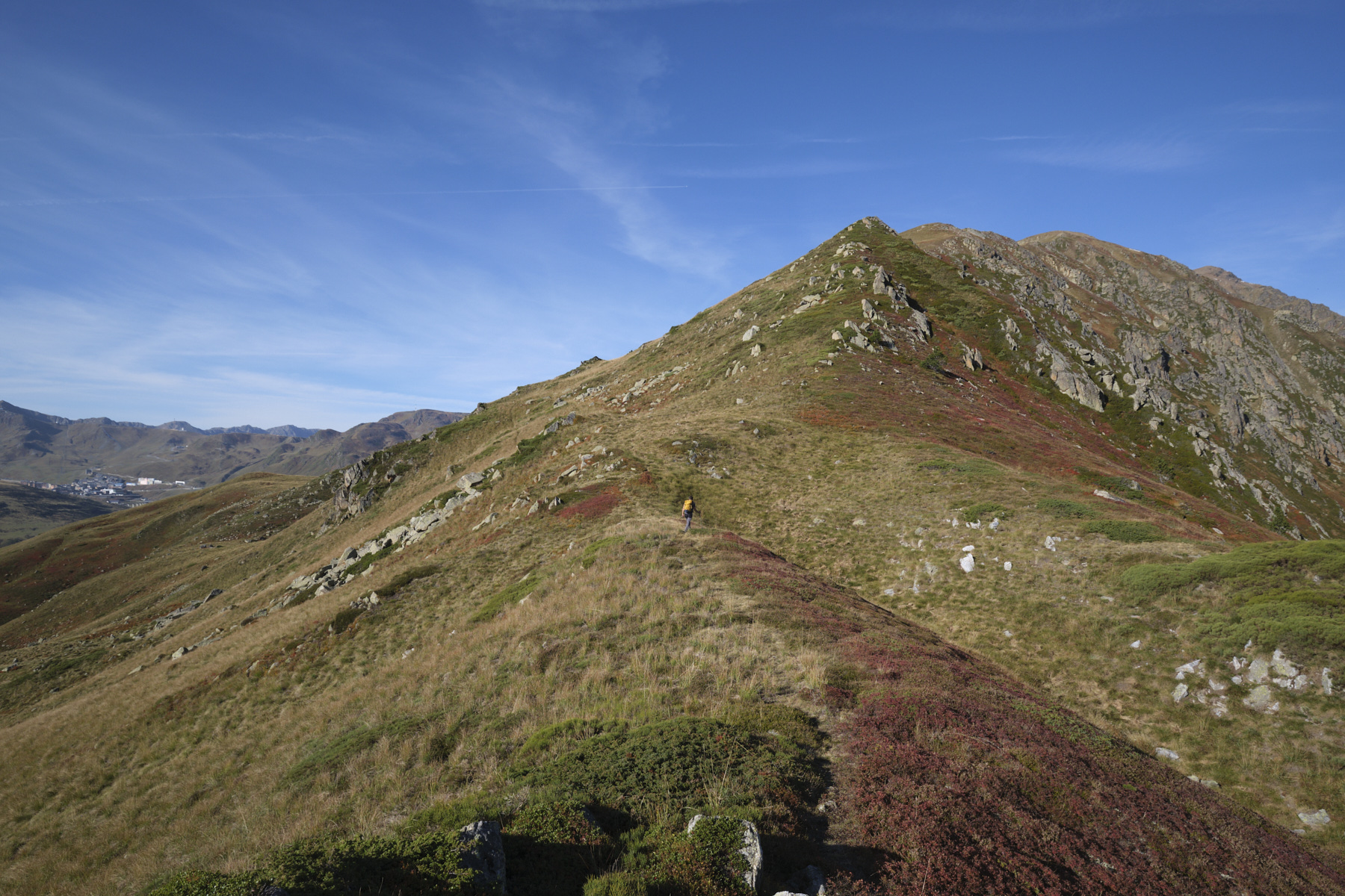
Part 2: Roc Mele and Pic de la Cabaneta (2847m, 1h30 to 2h)
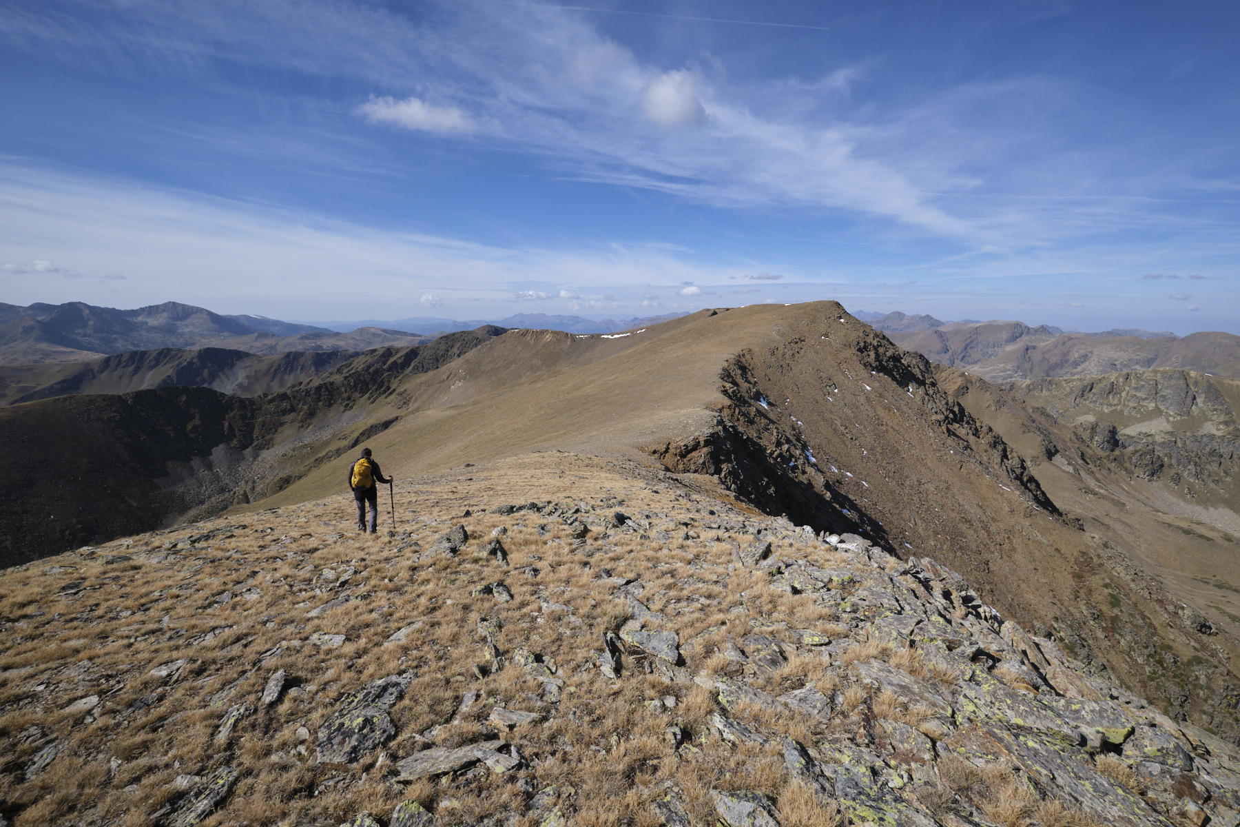
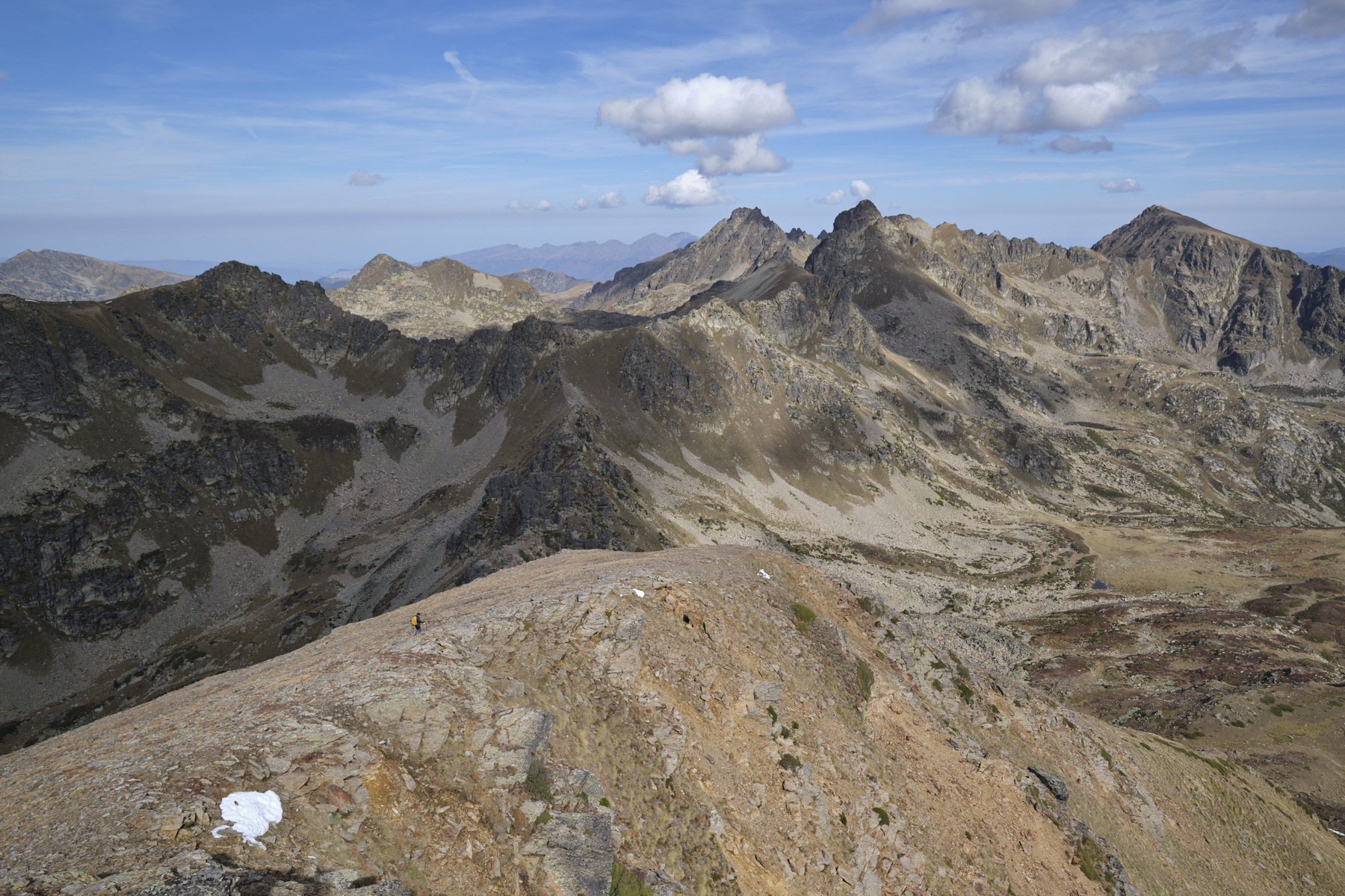
The route is straightforward, simply following the long, generally rounded ridge to the east. It climbs gradually, with steeper sections to pass the intermediate summits. The 1st summit, after a steeper section where you need to balance with your hands, is Cap de la Cometa del Forn (2691m). From here, follow the path slightly downhill before climbing the steeper, more sustained slope that this time leads to Roc Mele (2811m), where a cairn with a blade of standing rock stands. From here, you can see the rest of the ridge to the east, and at the end you can make out the Pic de la Cabaneta.
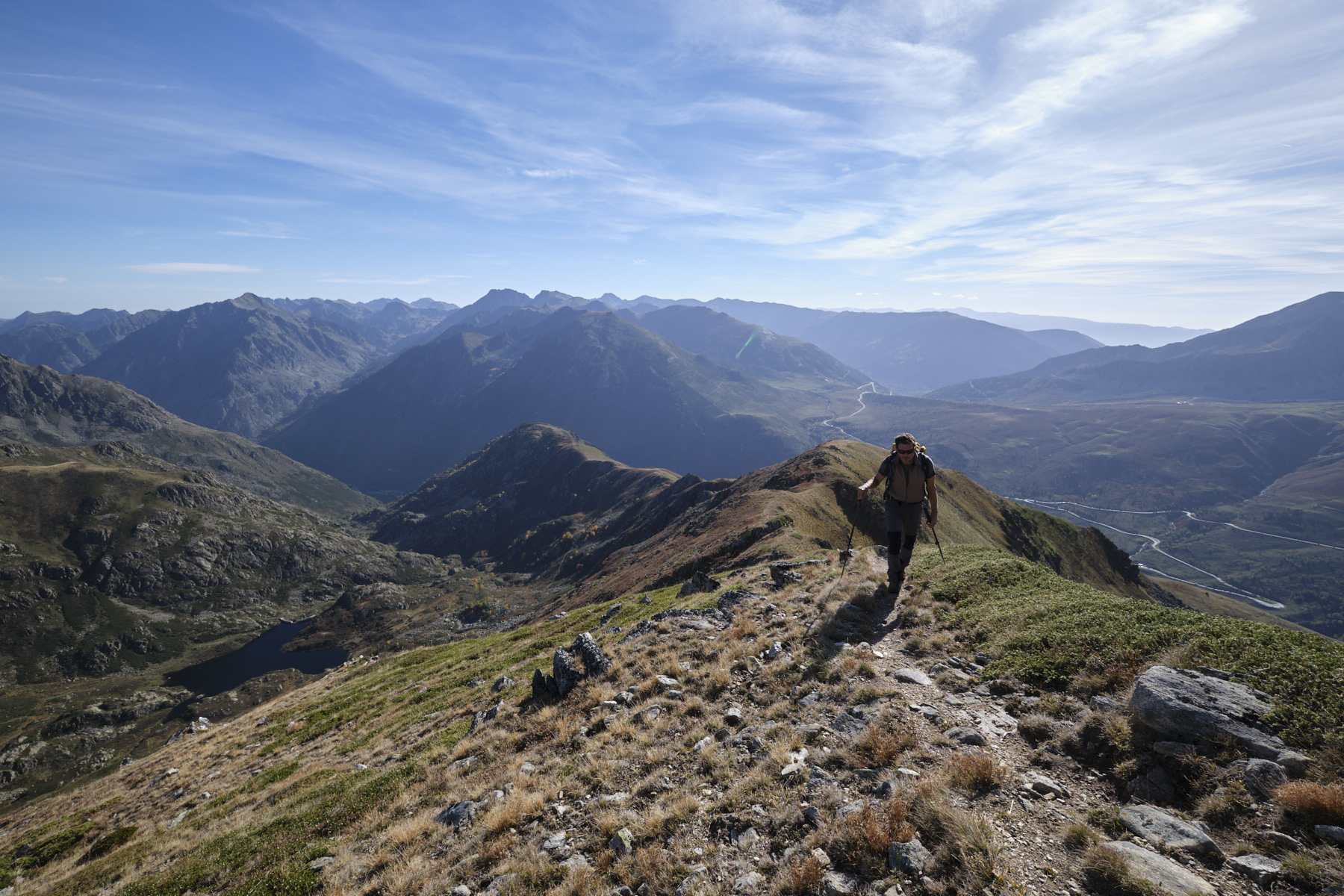
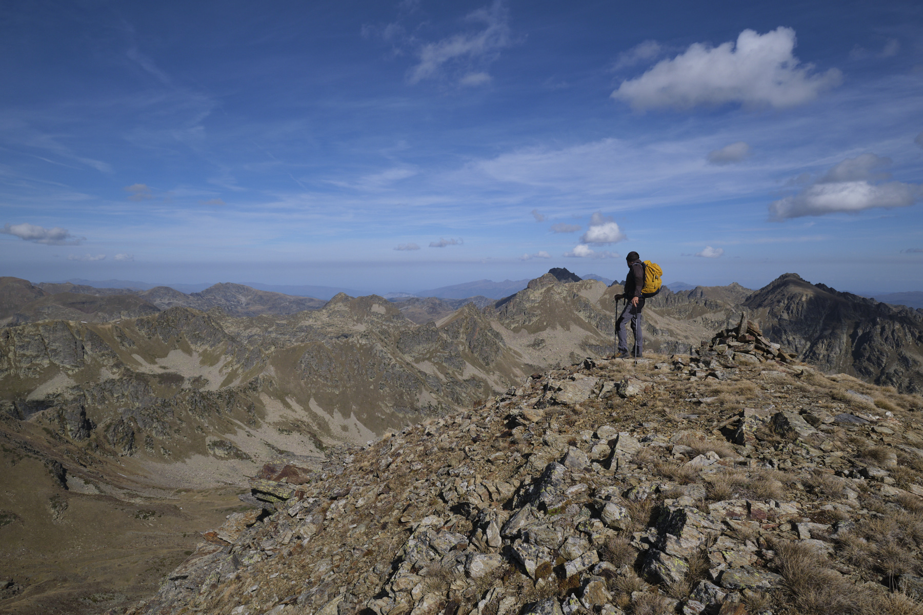
Continuing on flatter ground, you lose a little elevation gain before tackling the final ramp up to the rounded, rocky summit of Pic de la Cabaneta (2847m). We're on the opposite side of the Etang du Siscar and facing the Pic d'Escobes.
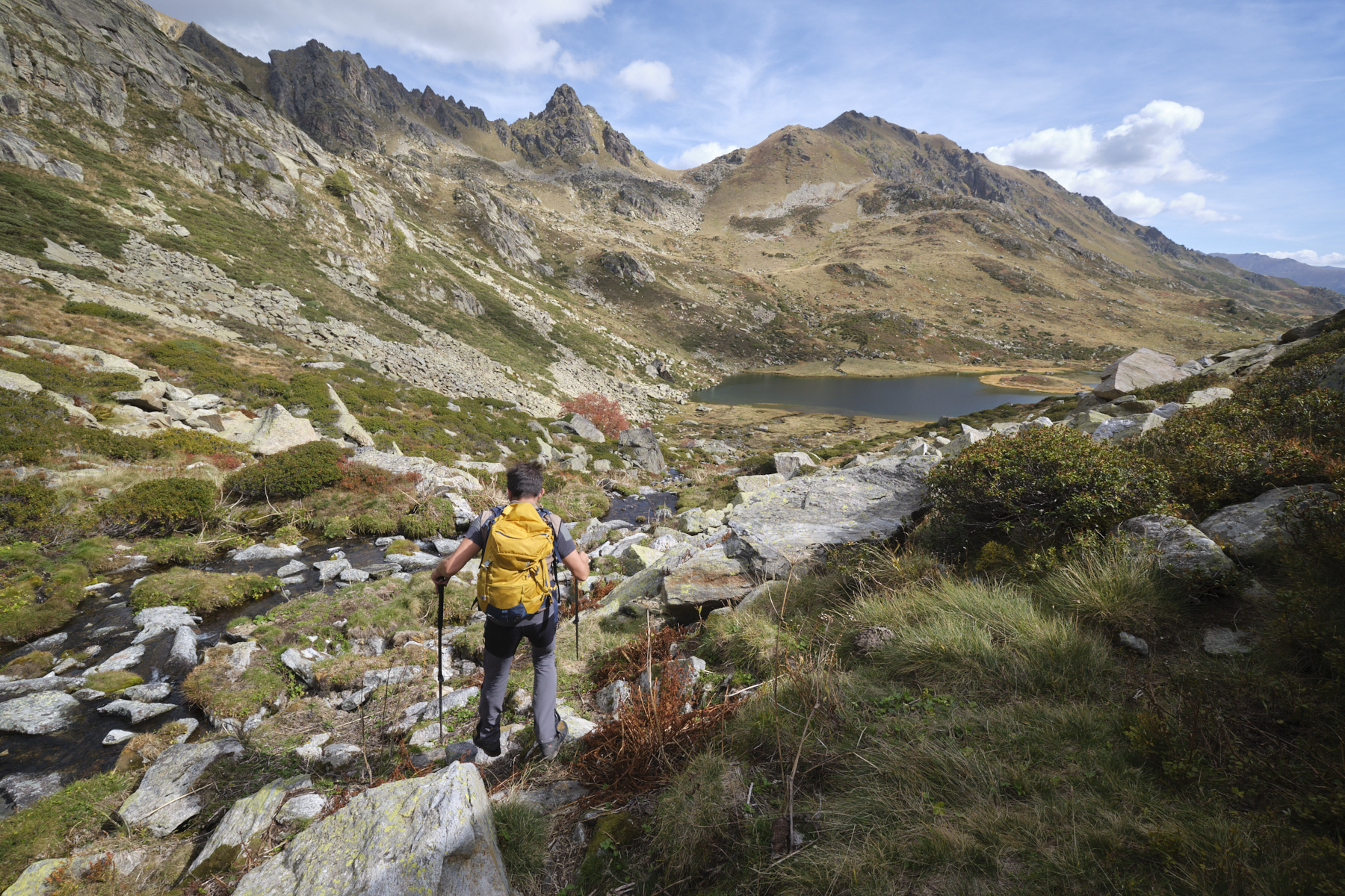
3rd part: Tosa de Siscaro, Étang du Siscar and return to parking lot (3h)
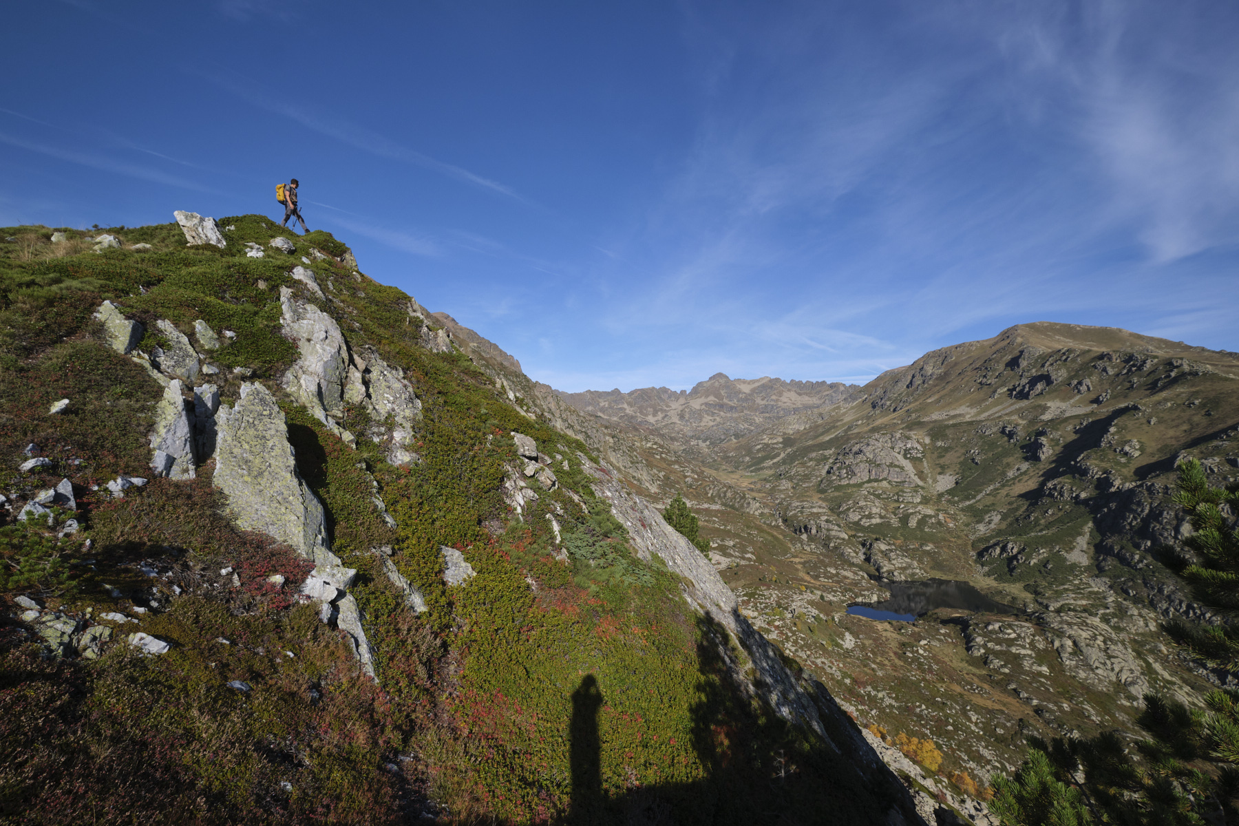
From the summit of the Cabaneta, continue along the ridge, descending slightly and then cutting across the undulating cliffs on the south-facing slope. At the end, climb the Tosa de Siscaro and turn north towards the Pic de Siscar. The trail, still quite visible, descends gradually, then more steeply in stages. Halfway up Porteilla de Siscaro, where the slopes are less steep, turn right into the Siscar valley. Improvise an off-trail path, but without too much difficulty, initially heading east, then bending north until you reach the main path linking Porteilla de Siscaro and Étang du Siscar. Follow it gently downhill, skirting the pond on its south bank until you reach the small building with its stone wall at the far end.
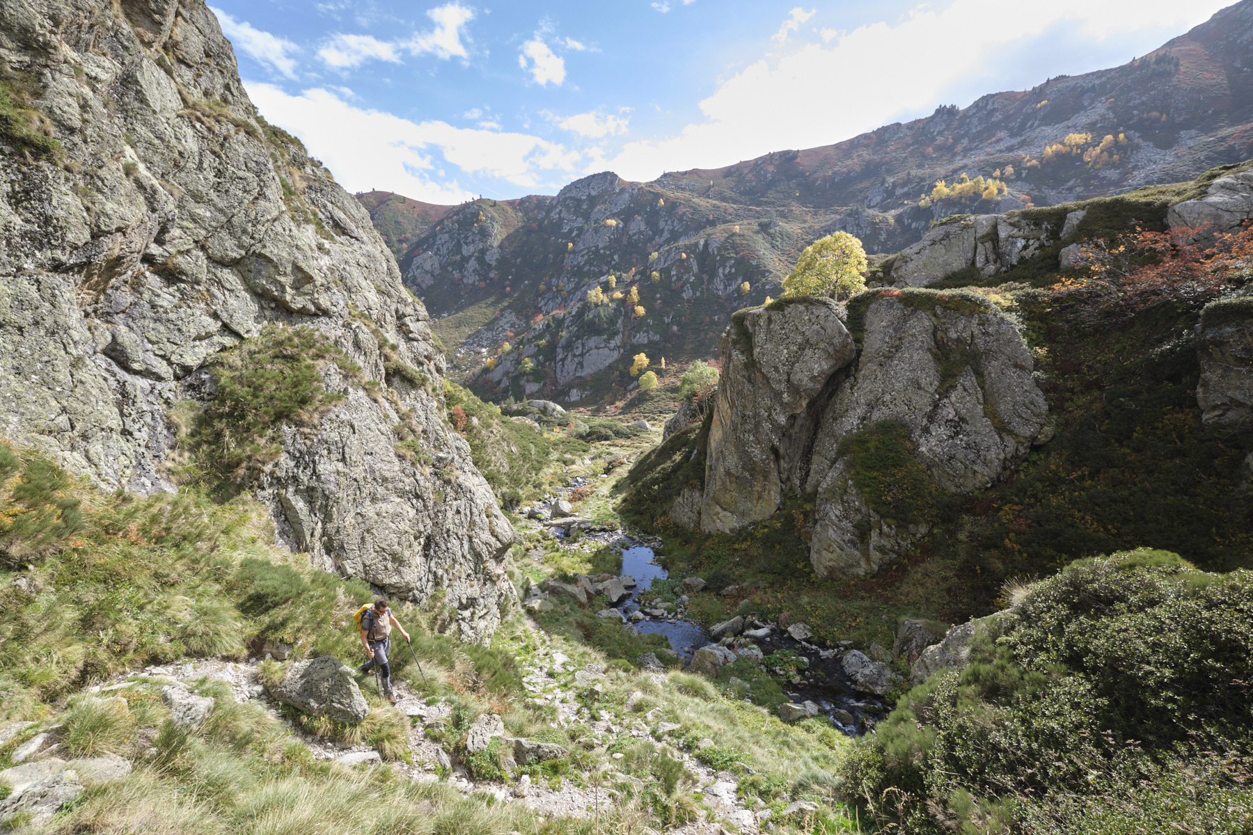
Just after the building, cross the stream to the rich left, cross a small undulation and descend to the Cabane de la Vésine. Follow the meandering brook and a little further down, you'll come to the top of the second Siscar pond, where you'll find the small Sisca dam. Follow the path below, cross the Saut du Taureau gorge and cross the stream to the right bank. Immediately afterwards, you come to the fork in the road leading to Col dels Clots.
Follow the approach path in the opposite direction to the departure parking lot at l'Hospitalet.


 Partager sur WhatsApp
 Partager sur Twitter
Partager sur Instagram
Partager sur Twitter
Partager sur Instagram

 Partager sur Facebook
 Imprimer le topo
 Laisser un commentaire


Leave a Reply