Elegant, little-frequented ascent of Pic Lezat from the Vallée du Lys. An initial landing at the Cabane Libre de Sarnès, facing the spectacular Cirque des Crabioules, allows us to contemplate the second part more serenely. The final section on the north-east ridge of Pic Lezat is not so easy, with exposed aerial sections to climb or cross before setting foot on the summit plateau leading to the summit. A 360° panoramic view of the surrounding 3000m peaks: Maupas, Crabioules, Perdiguère, Gourg-Blanc, Portillon, Gourdon and Spijéoles. Last but not least, don't underestimate the descent via the South-East ridge and the airy, delicate couloir that joins the Portillon lake.
❱❱ Technical summary
■ Departure point: Vallée du Lys parking lot, Bagnères-de-Luchon, Haute-Garonne (31)
■ Type of route: high-mountain alpine touring hike
■ Distance: 10 km
■ Cumulative elevation gain: +1915 m (1100 m + 815 m)
■ Cumulative negative altitude gain: -500 m
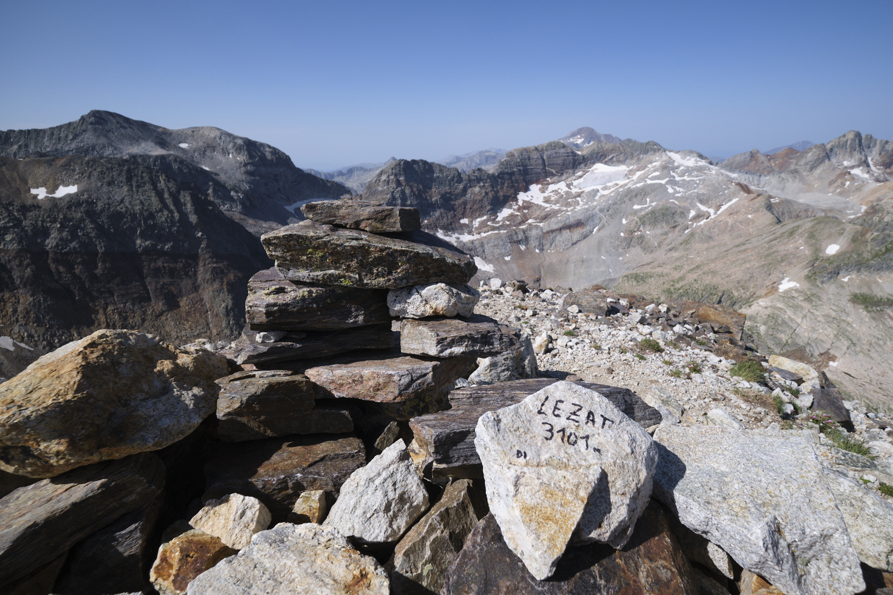
■ Estimated total duration: 2 days (3h + 5h) ■ Min and max altitude: 1130 m / 3101 m
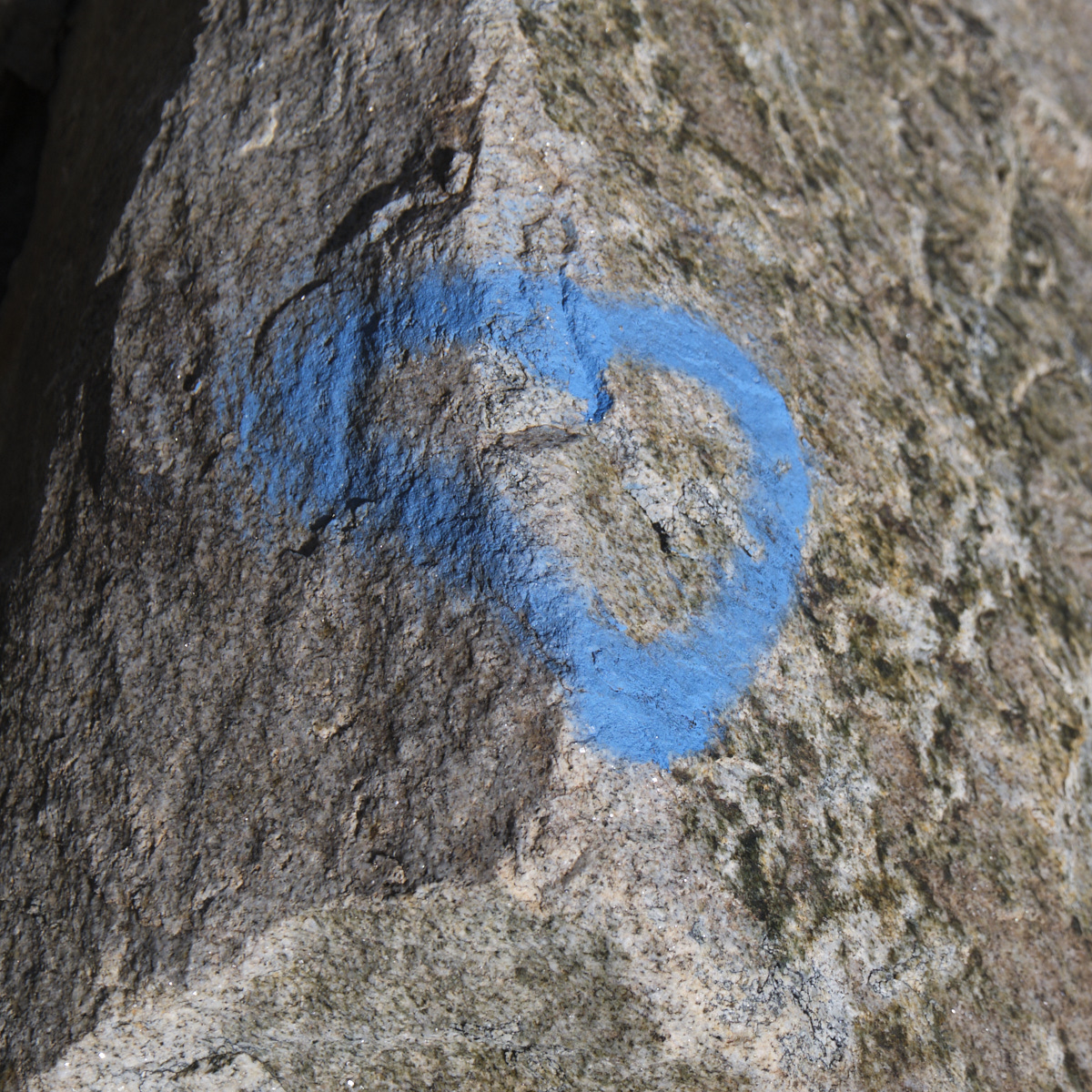
■ S ignposts: signposts and red markers to the Sarnès hut, off-trail or unmarked to the Lezat ridge marked with blue hearts (!). Descent marked with cairns.
■ Equipment in place: none
■ Equipment required: useful GPS track, safety rope if necessary.
Difficulties: PD mountaineering rating, aerial and exposed sections to be climbed, passages to be climbed (III+ max), scree and scree, very steep slopes.
❱❱ Access to the place
From Bagnères-de-Luchon, drive up to Col de Peyresourde and turn off at Cazeaux-de-Larboust to park the 1st vehicle at the Granges d'Astau parking lot for the return journey via the Vallée d'Oô. For the second vehicle, take the direction of Hospice de France and turn into the Vallée du Lys. Park at the parking lot at the far end, at the start of all the hikes.
❱❱ Map & topo
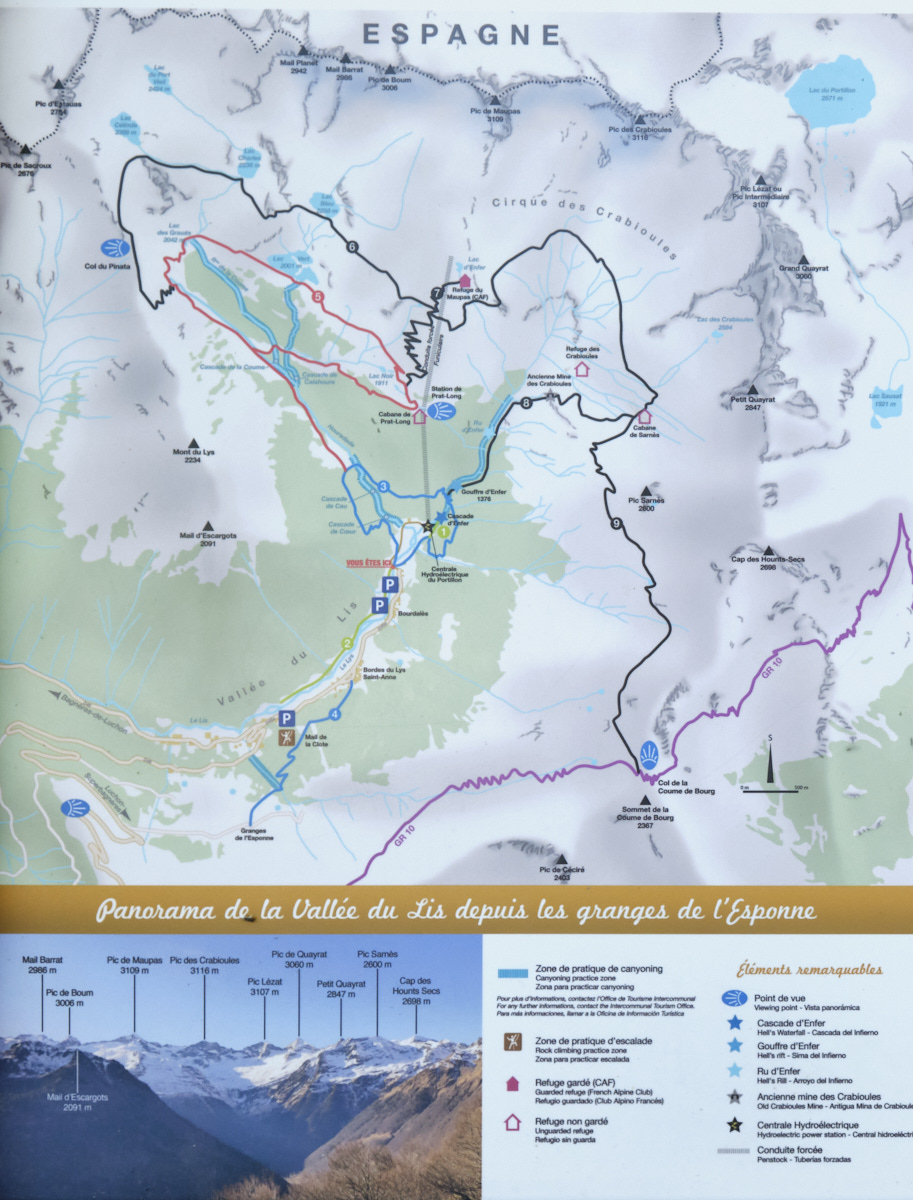
The route from the Sarnès hut to Pic Lezat is indicative.
Part 1: from the Vallée du Lys parking lot to the Sarnès hut (2230m, 3h)
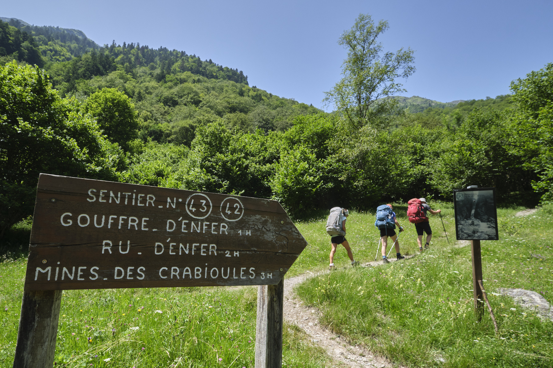
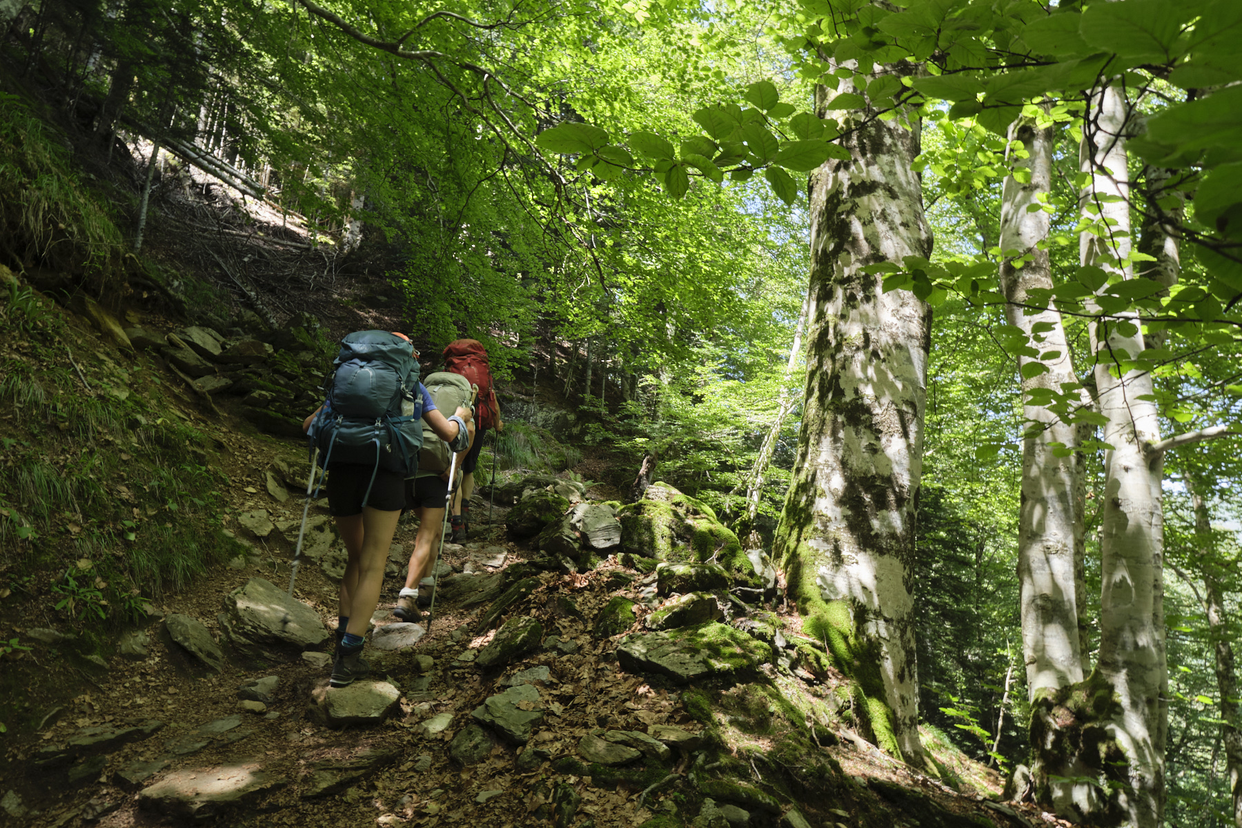
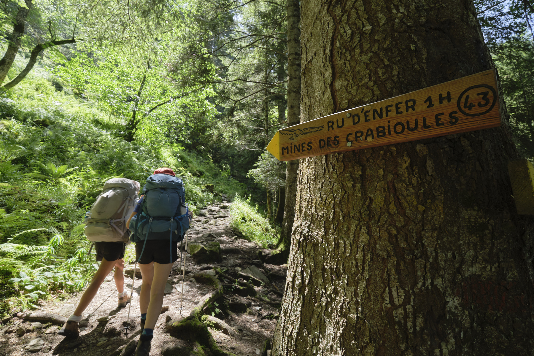
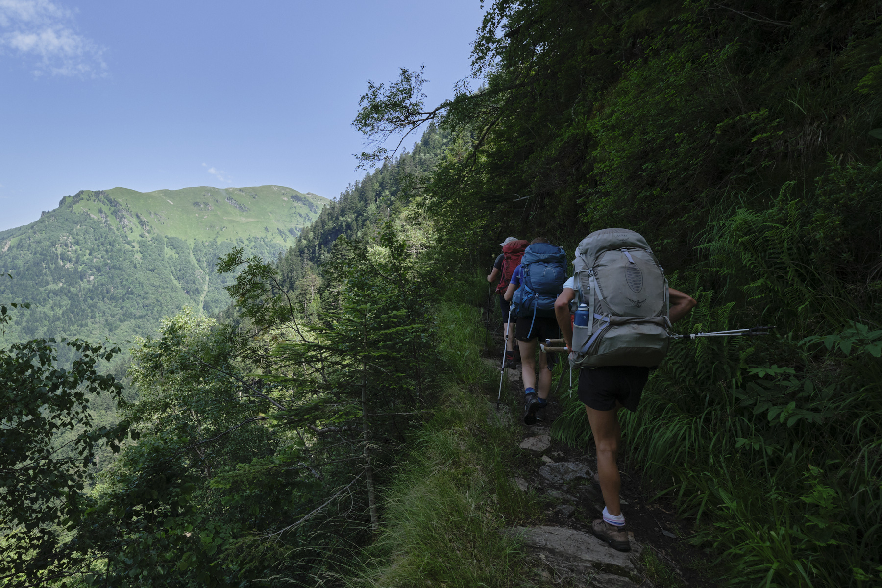
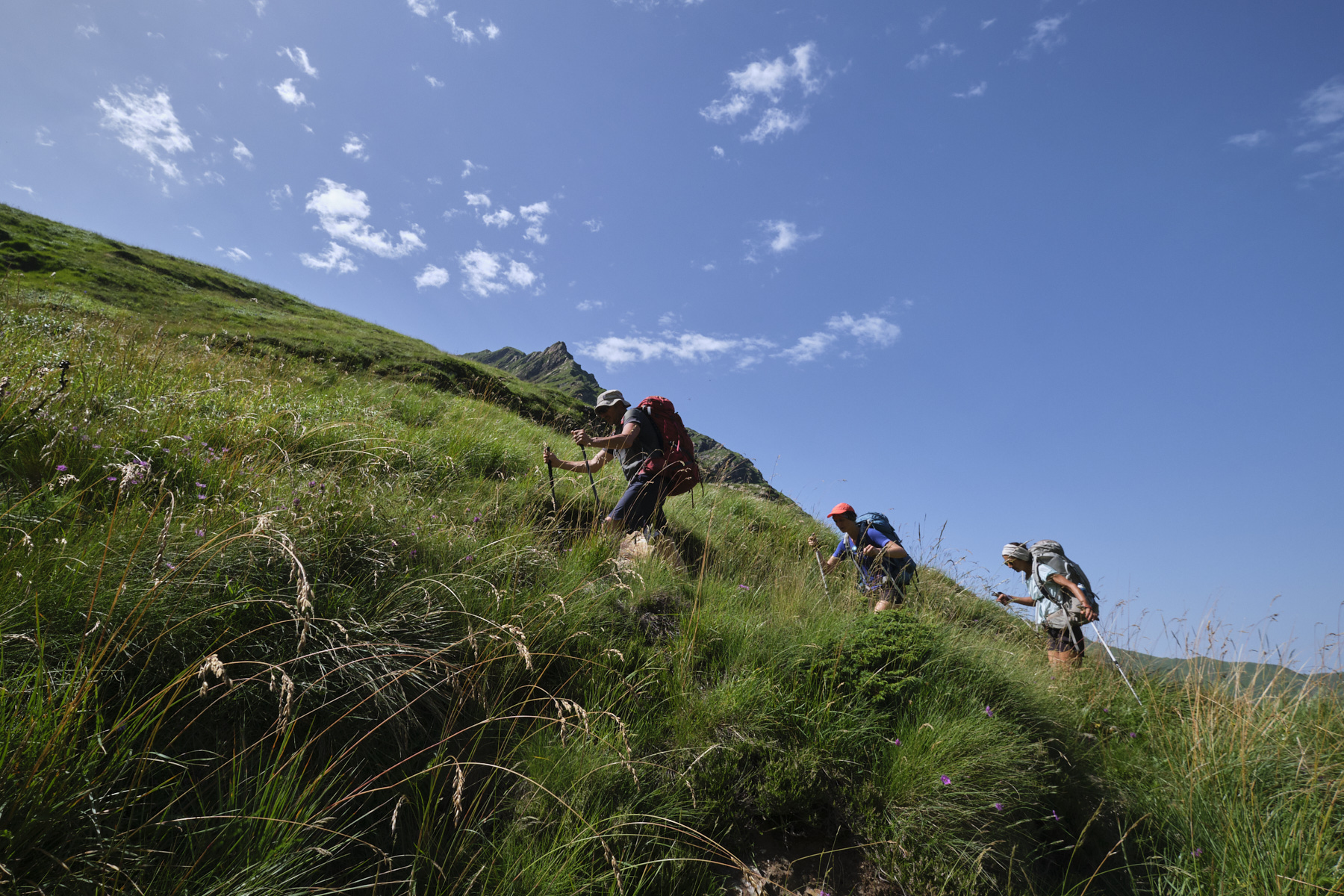
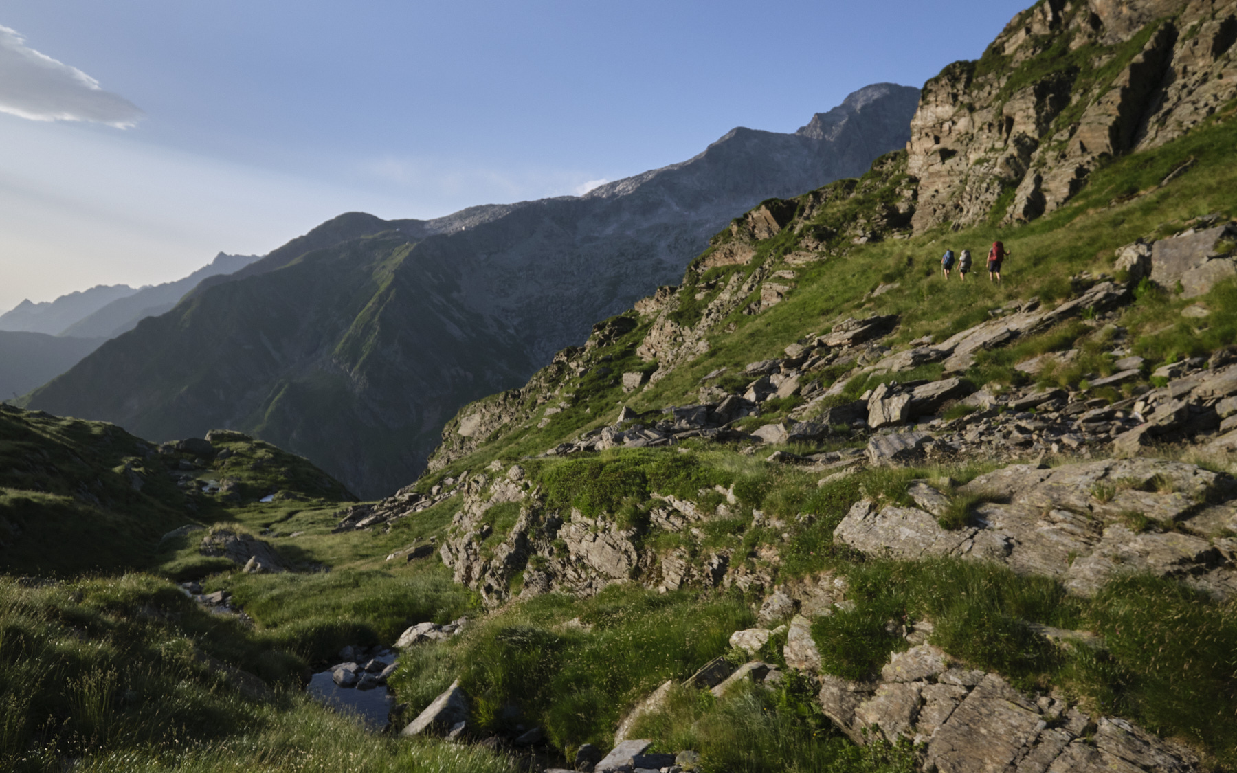
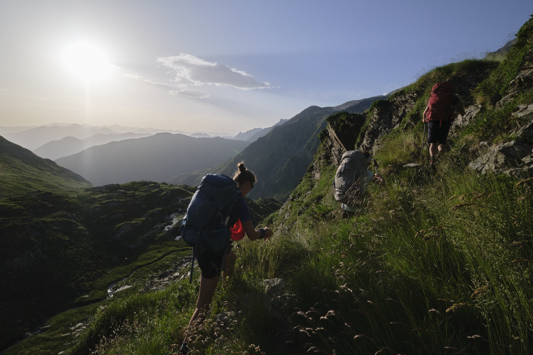
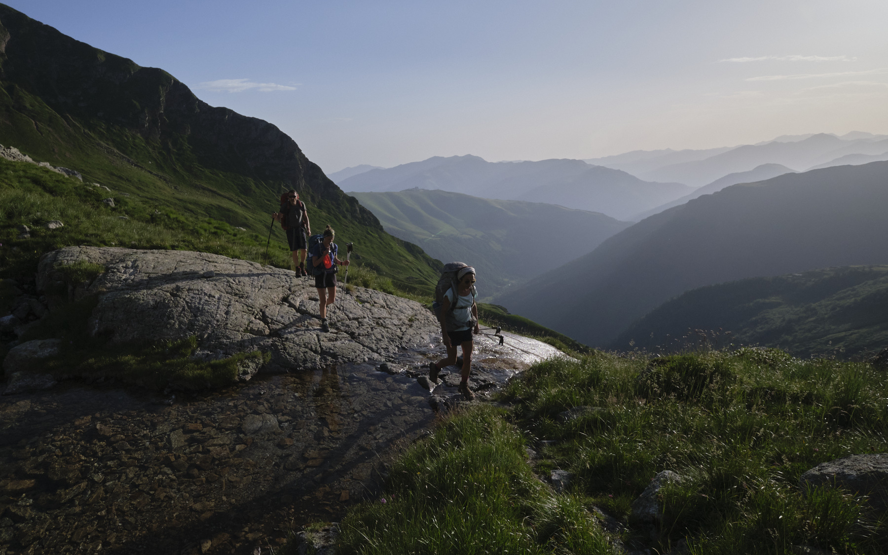
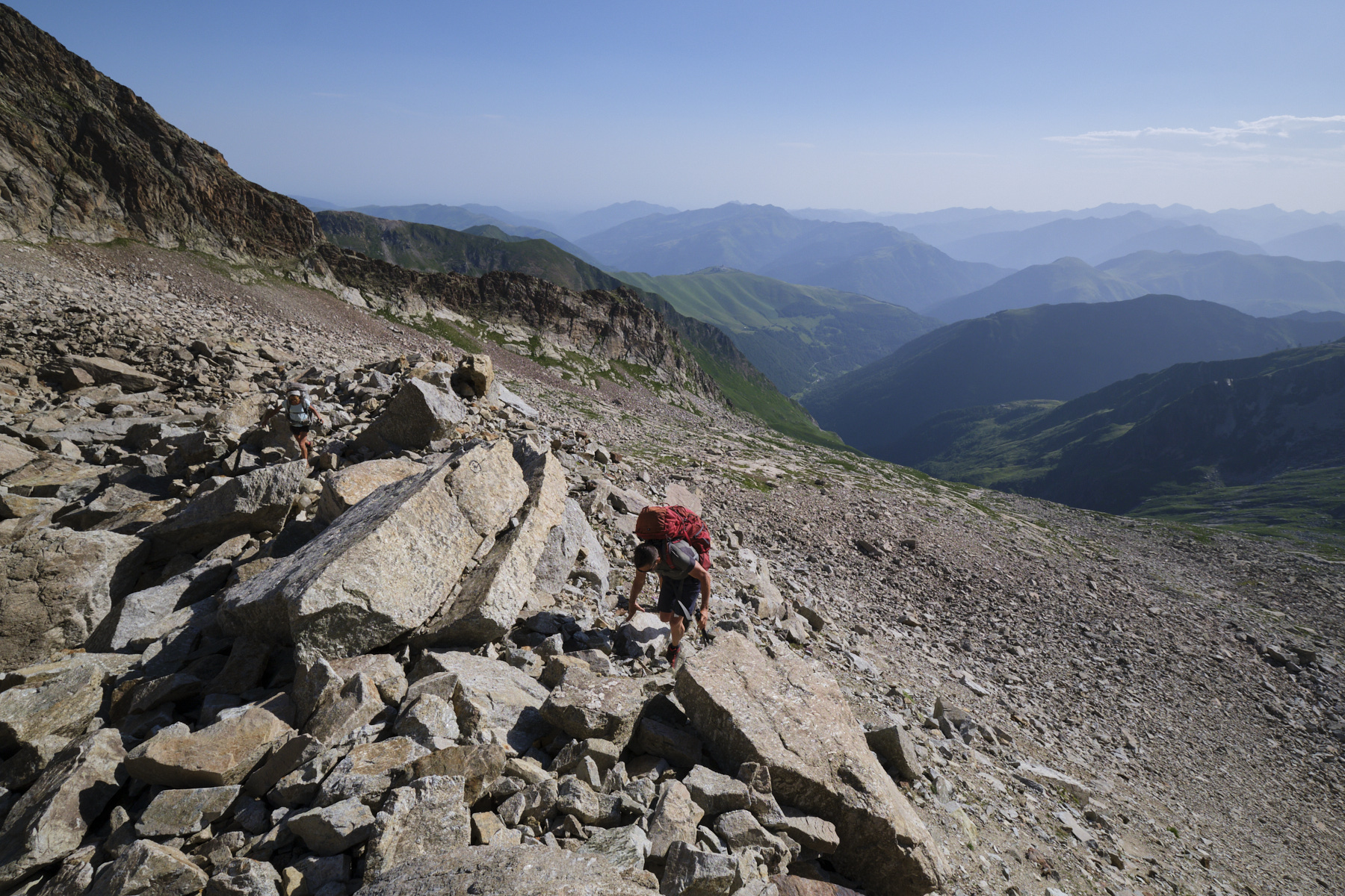
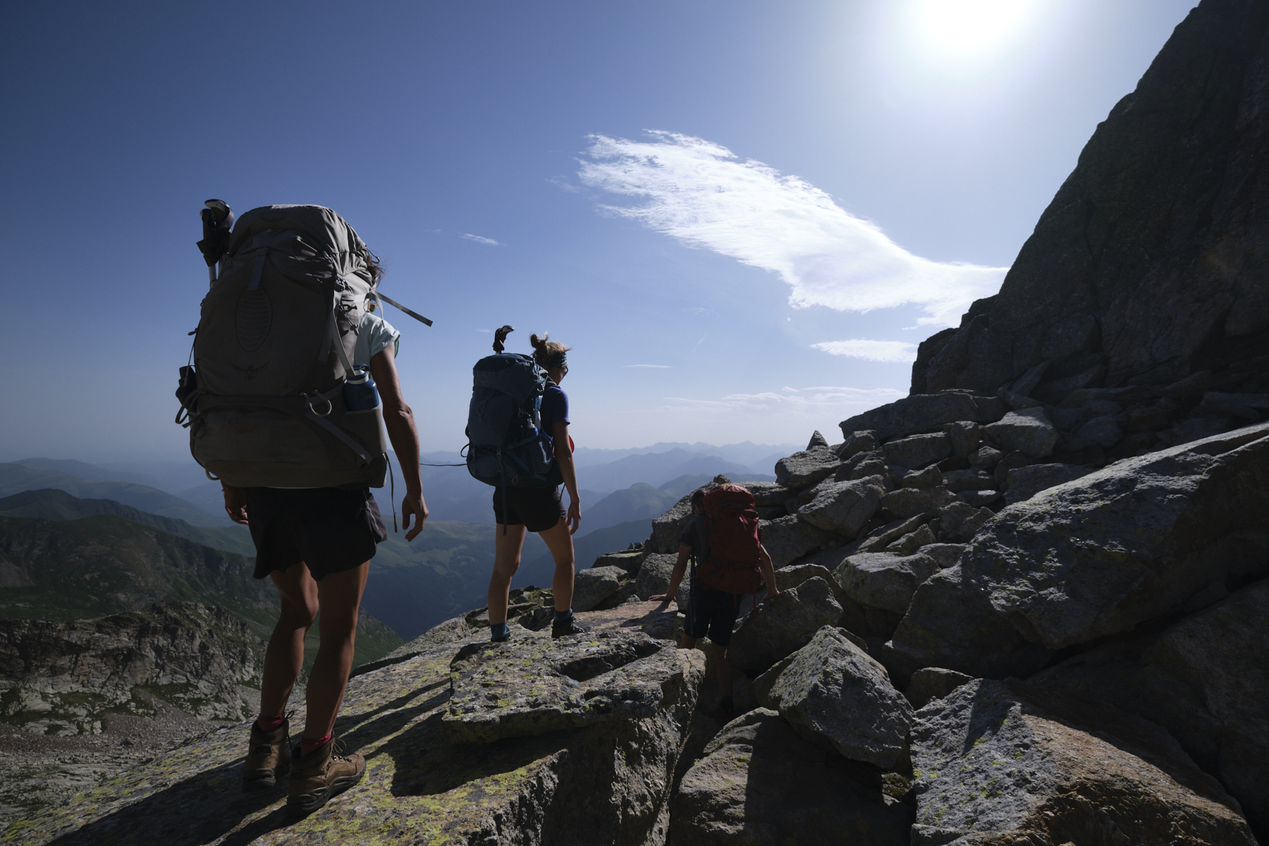
Follow the track leading to the waterfalls, leaving it very quickly on the right towards the Crabioules mines and the Enfer chasm (path no. 43). Climb up through the forest on an almost cleared path to pass over the Riu d'Enfer, admire the large waterfall from the promontory and cross back over the torrent. Further up, fork right on a narrower path towards the Mines de Crabioules. Keep your eyes peeled as the path becomes lost in the grass at certain points. We leave the forest to discover the valley floor and the Cirque des Crabioules. The path climbs back up to the top of the torrent on grassy slopes and continues to sink almost to the end.
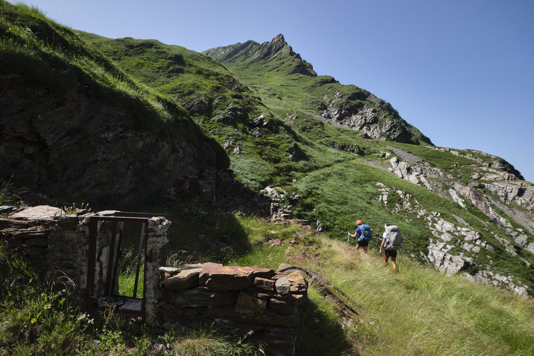
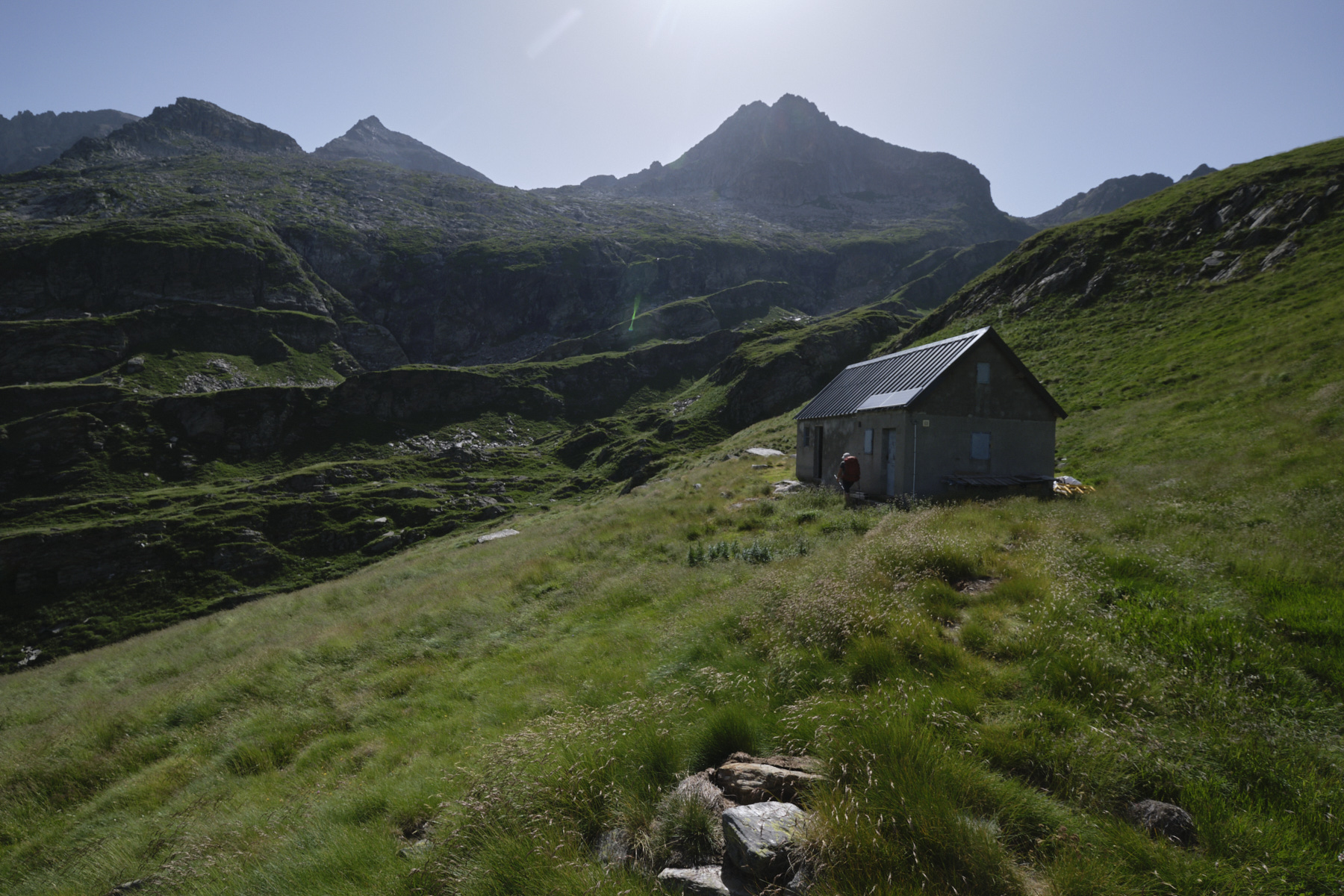
Then begins the steep ascent to the old Crabioules mines, which we pass again on a steep slope, sometimes in search of the path, which is marked in red but not very visible. It's at the last moment, in the last 50 meters, that we discover the Sarnès hut at 2230m, facing the Cirque des Crabioules. Sleeps 4 to 6 downstairs, 8 to 10 upstairs on the parquet floor. Exceptional panorama!
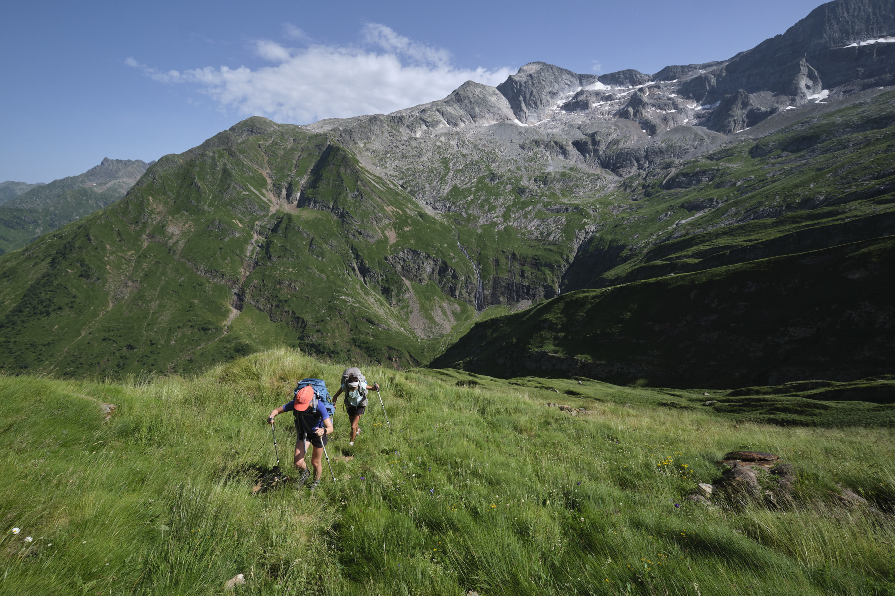
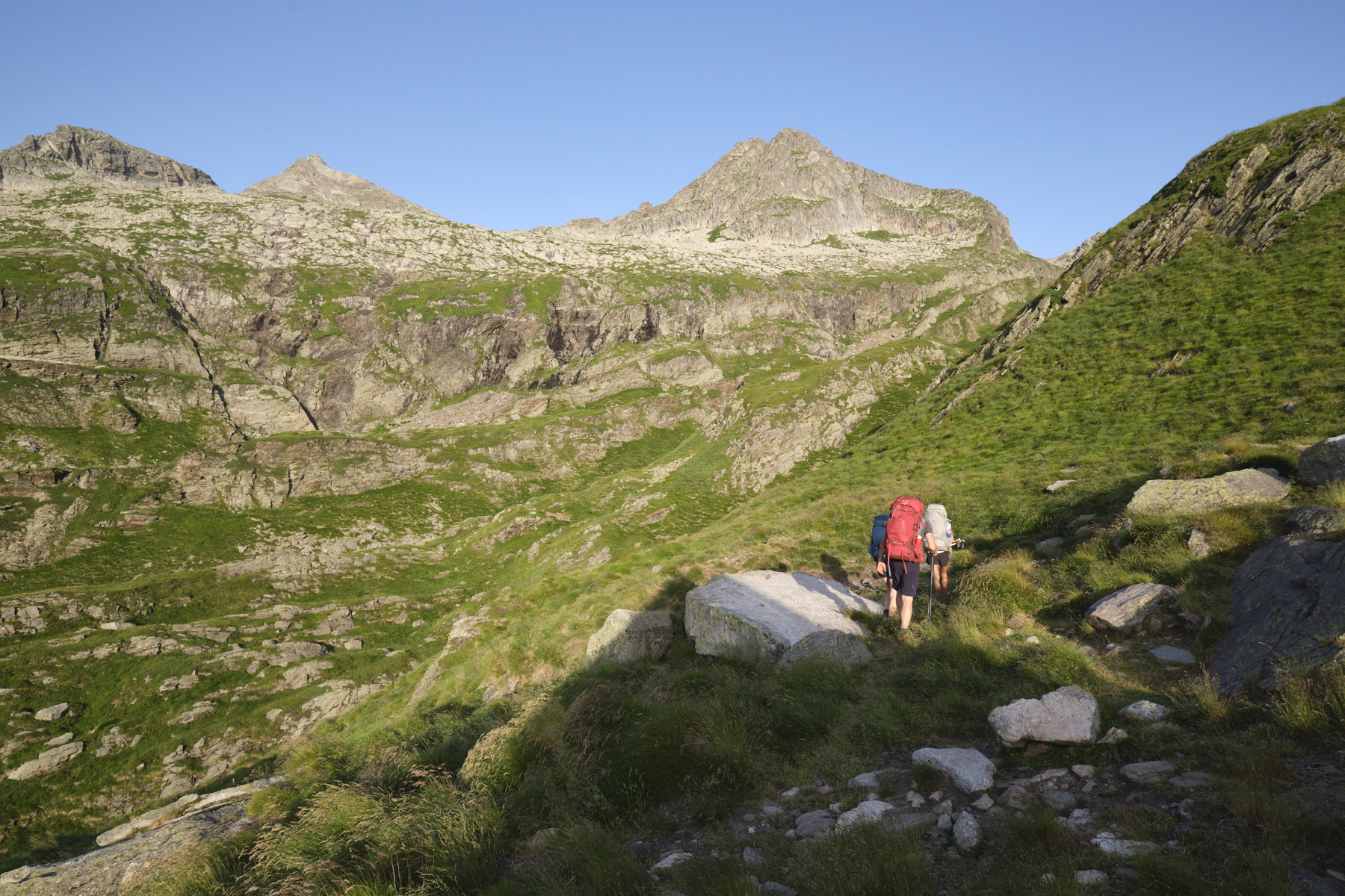
Part 2: from Cabane de Sarnès to Pic Lezat (3101m, 3h)
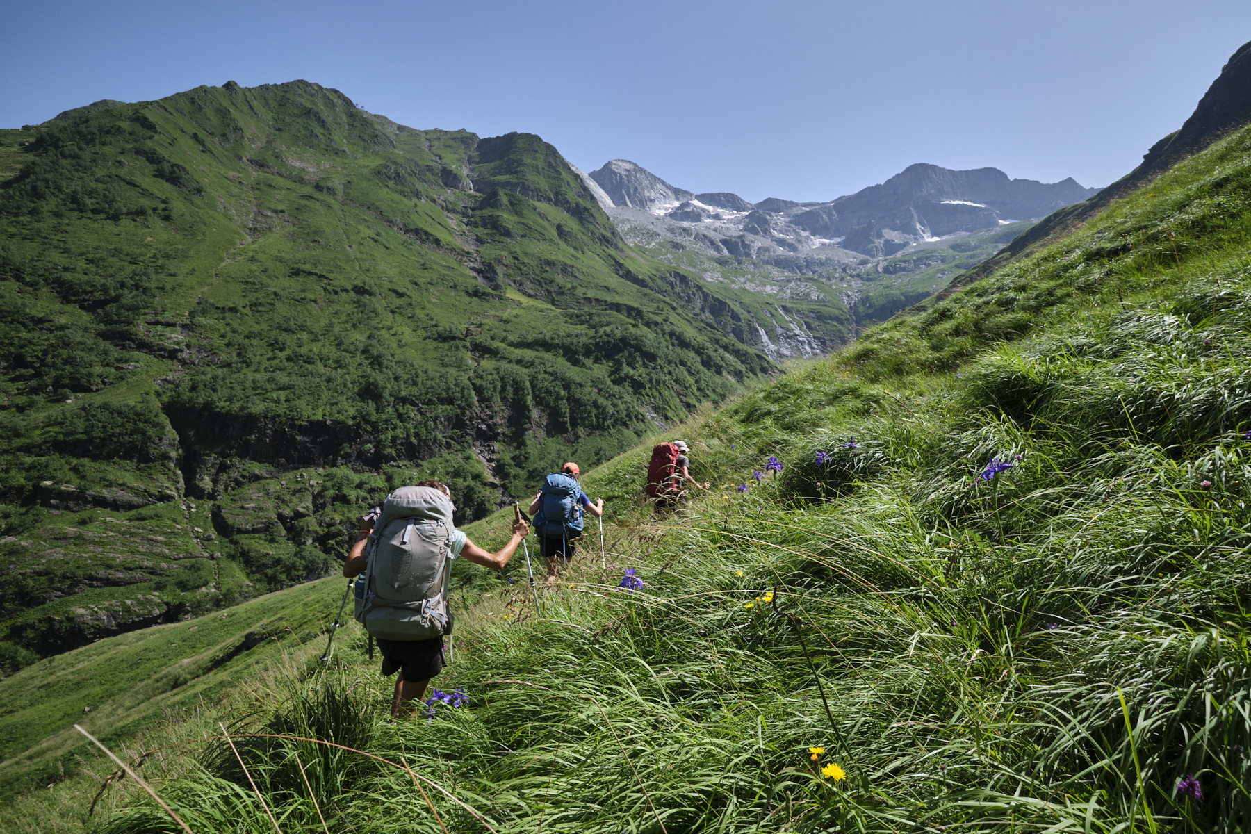
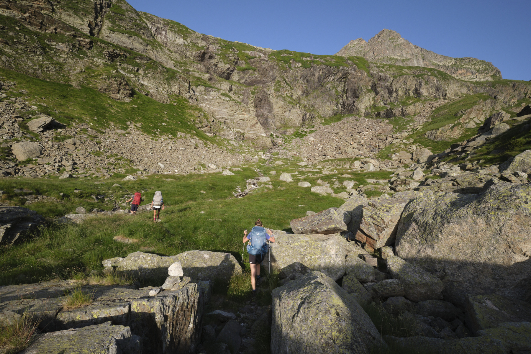
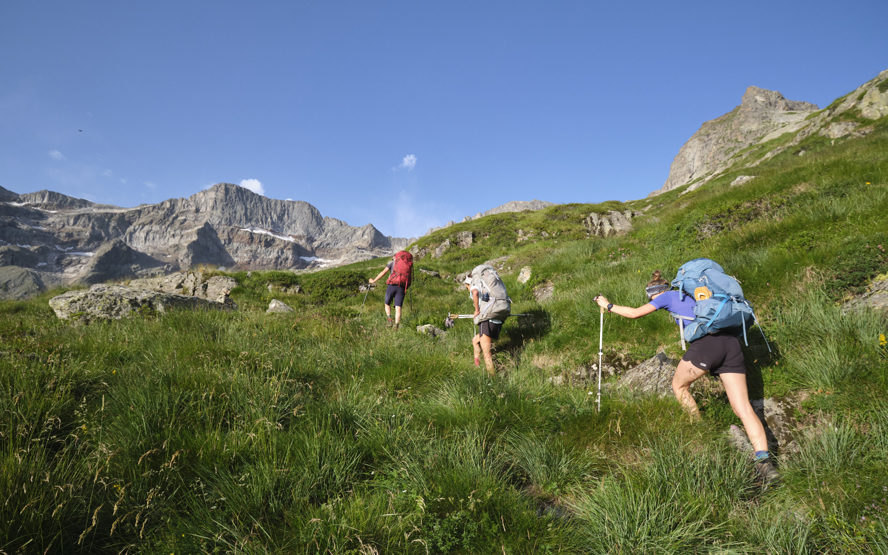
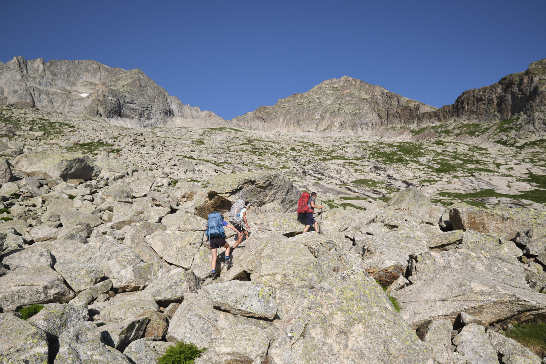
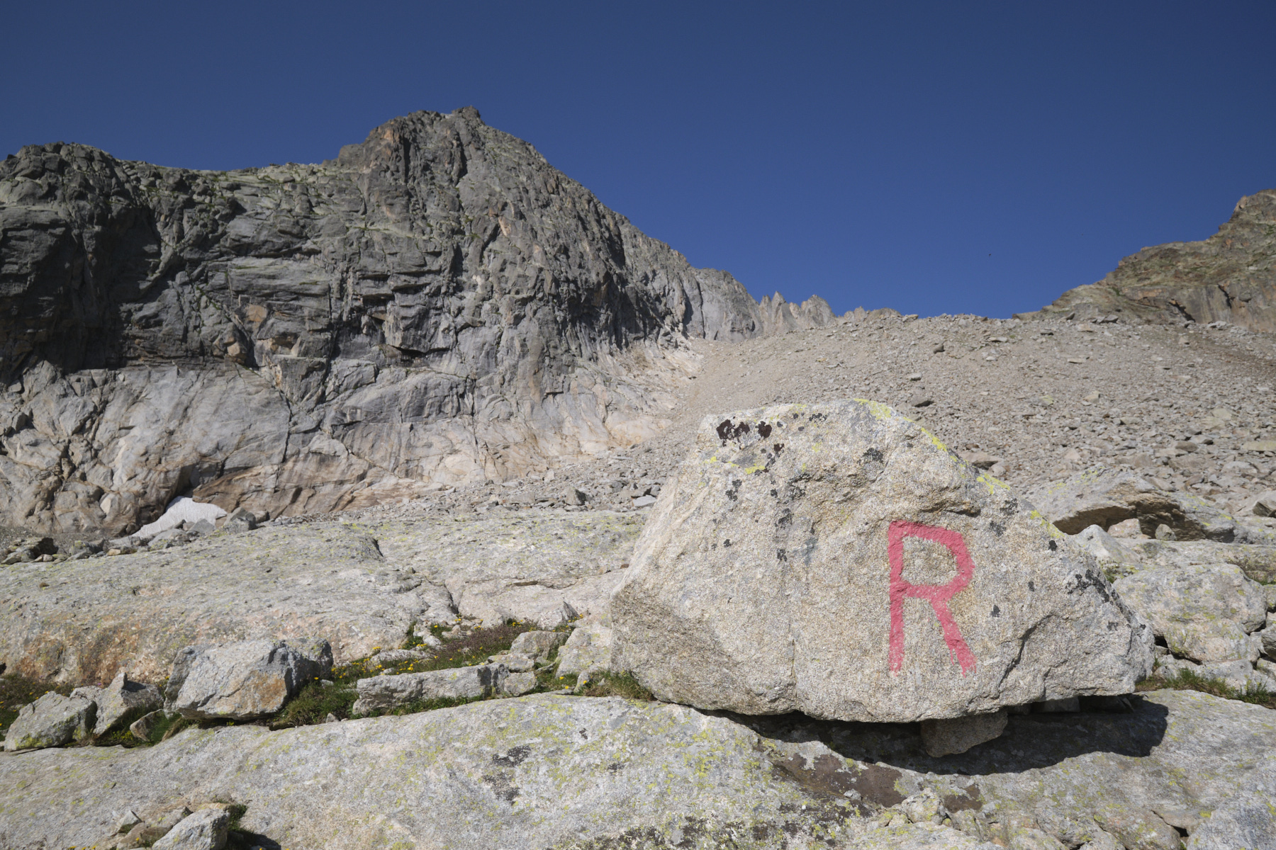
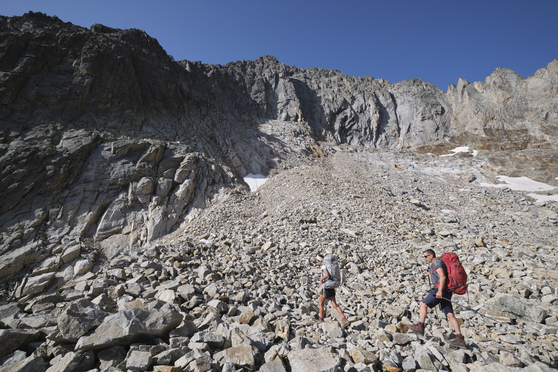
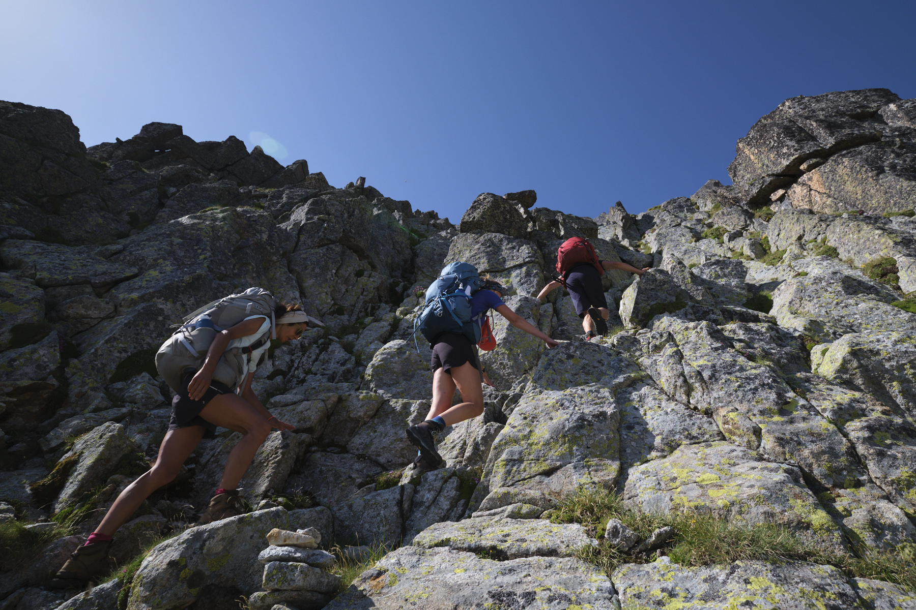
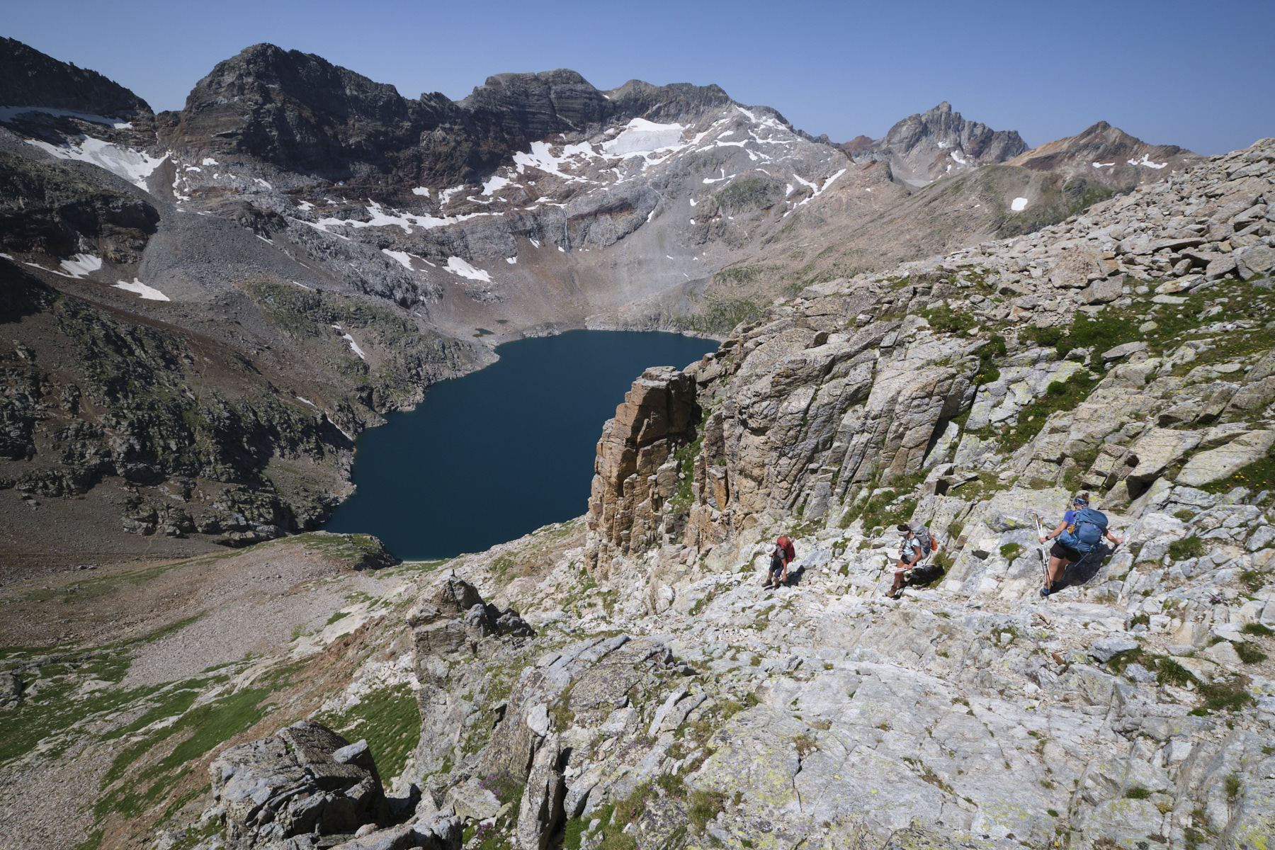
Leave the hut to the west and follow the well-marked red path (and cairns). Weave your way between small rocky bars that seem to pile up one on top of the other (lègnes de Crabioules). Keep going until you pass the last buttresses of Grand Quayrat, and before a series of undulating slabs, leave the path and climb straight up the slope, heading south-west.
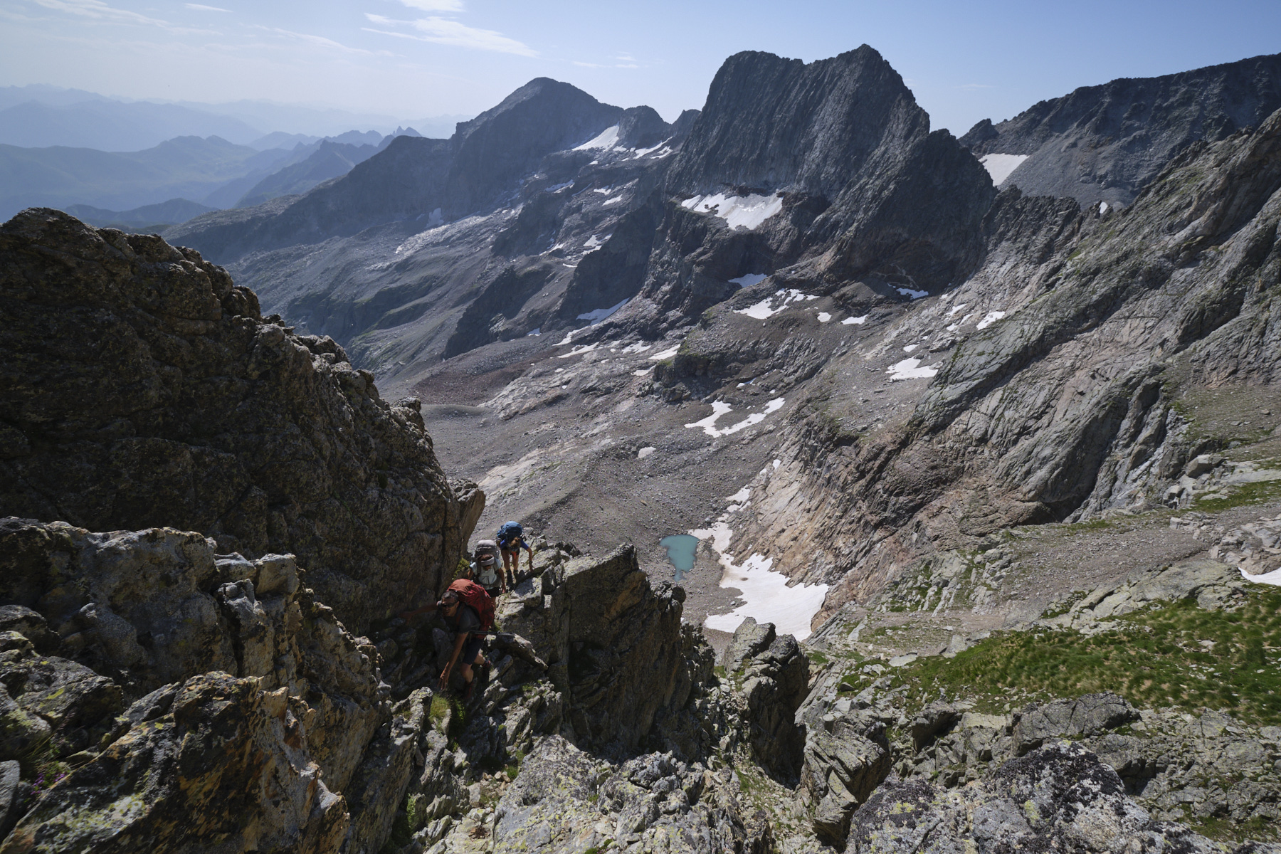
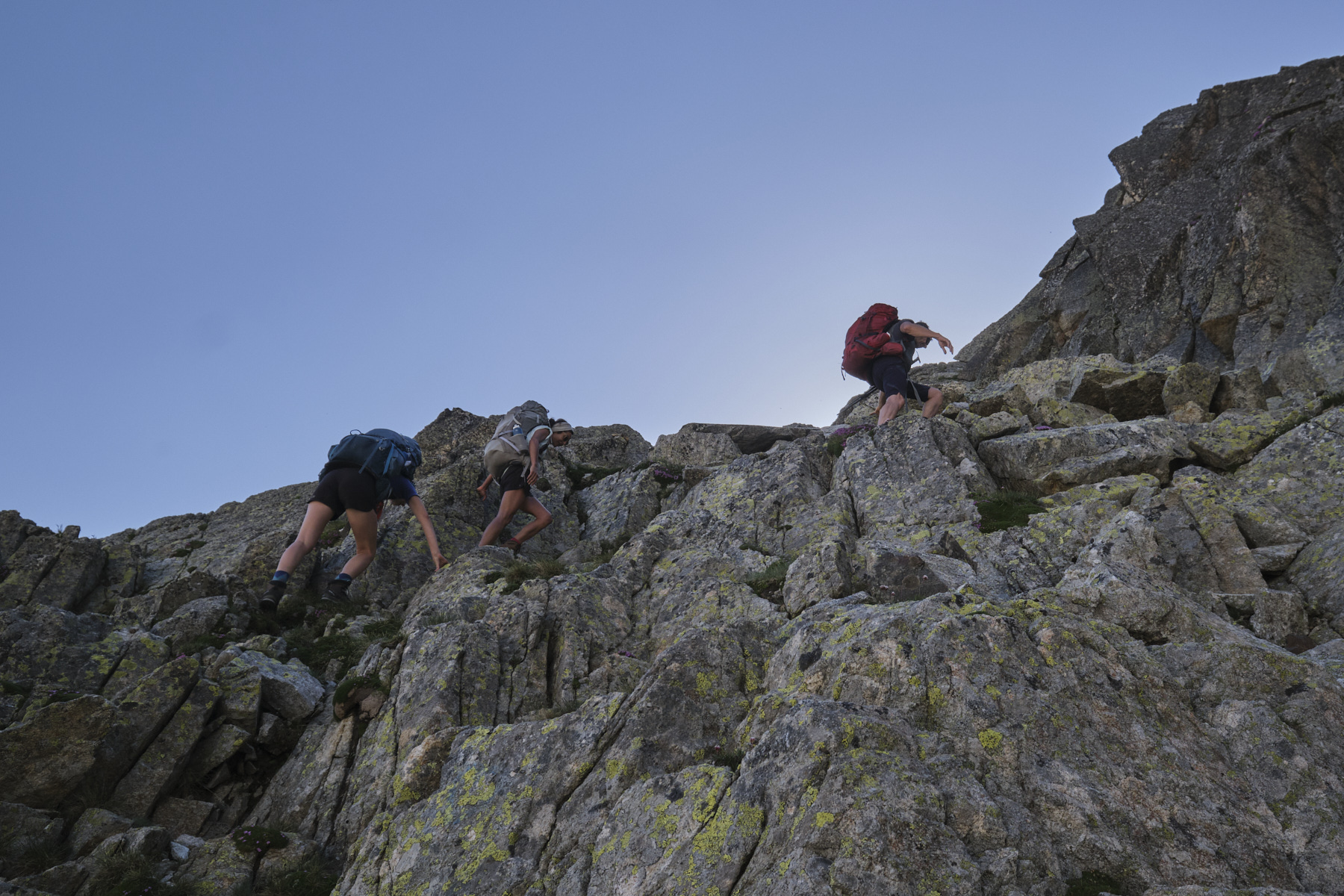
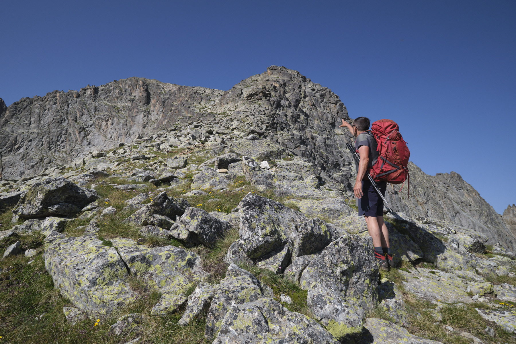
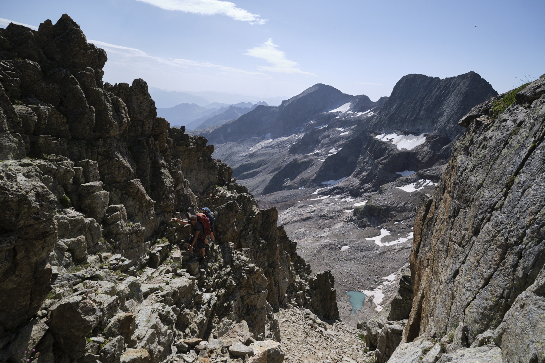
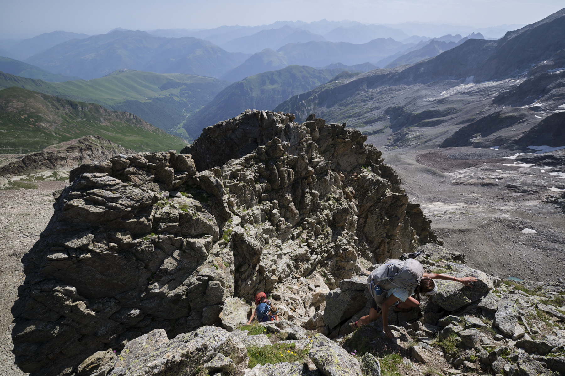
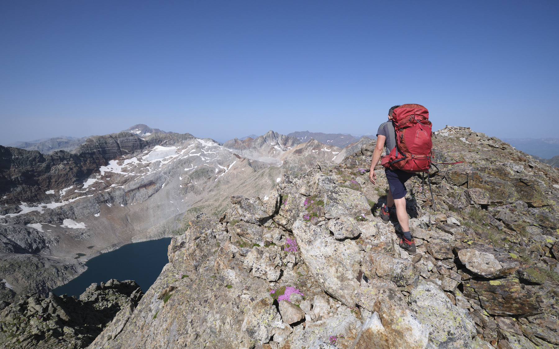
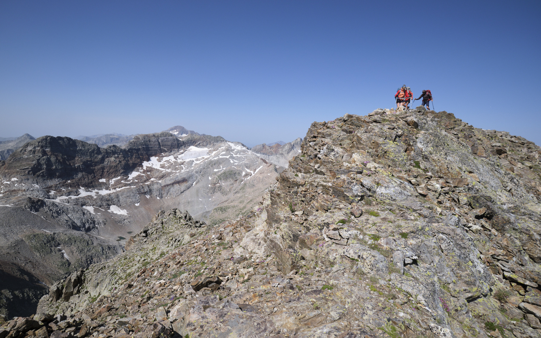
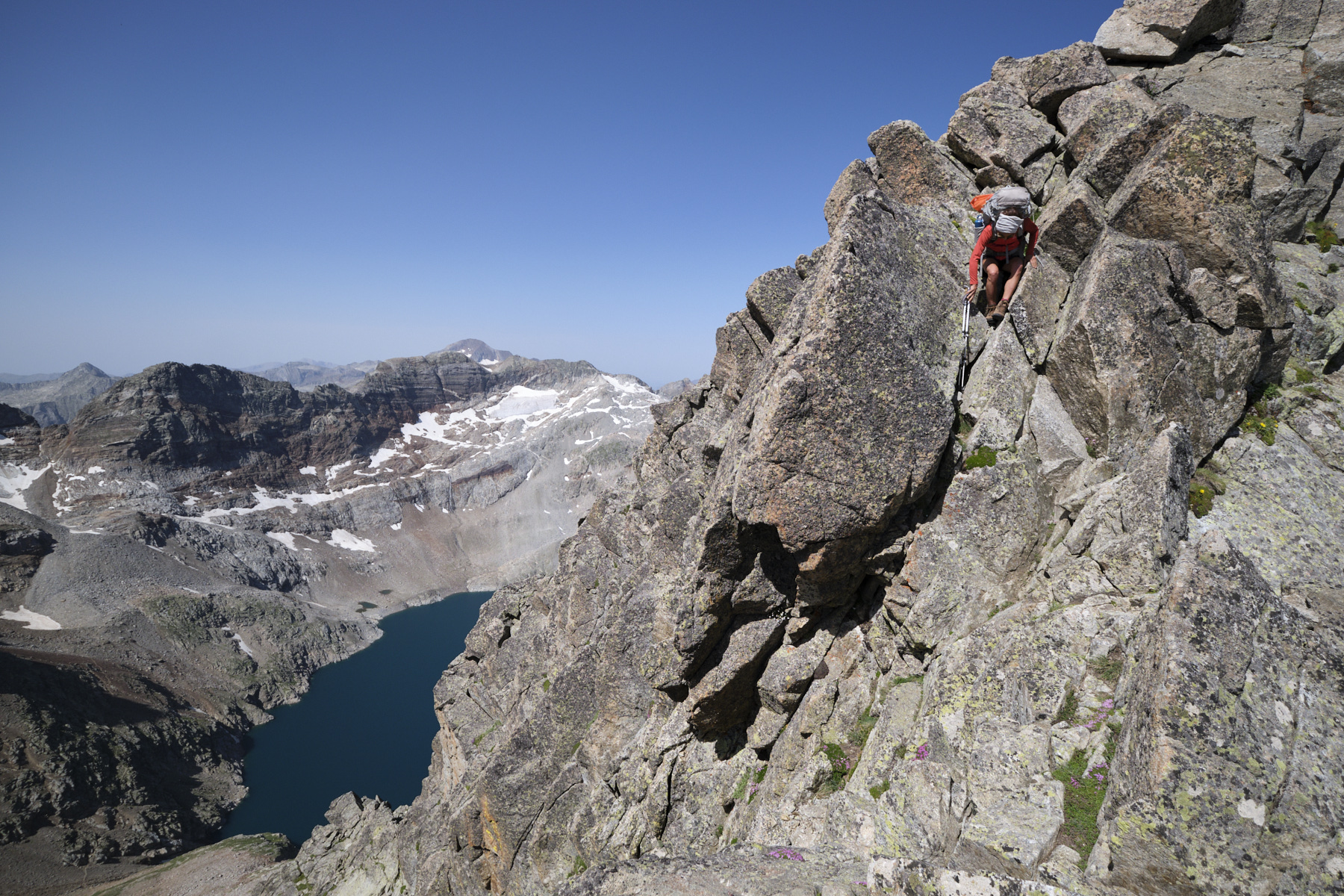
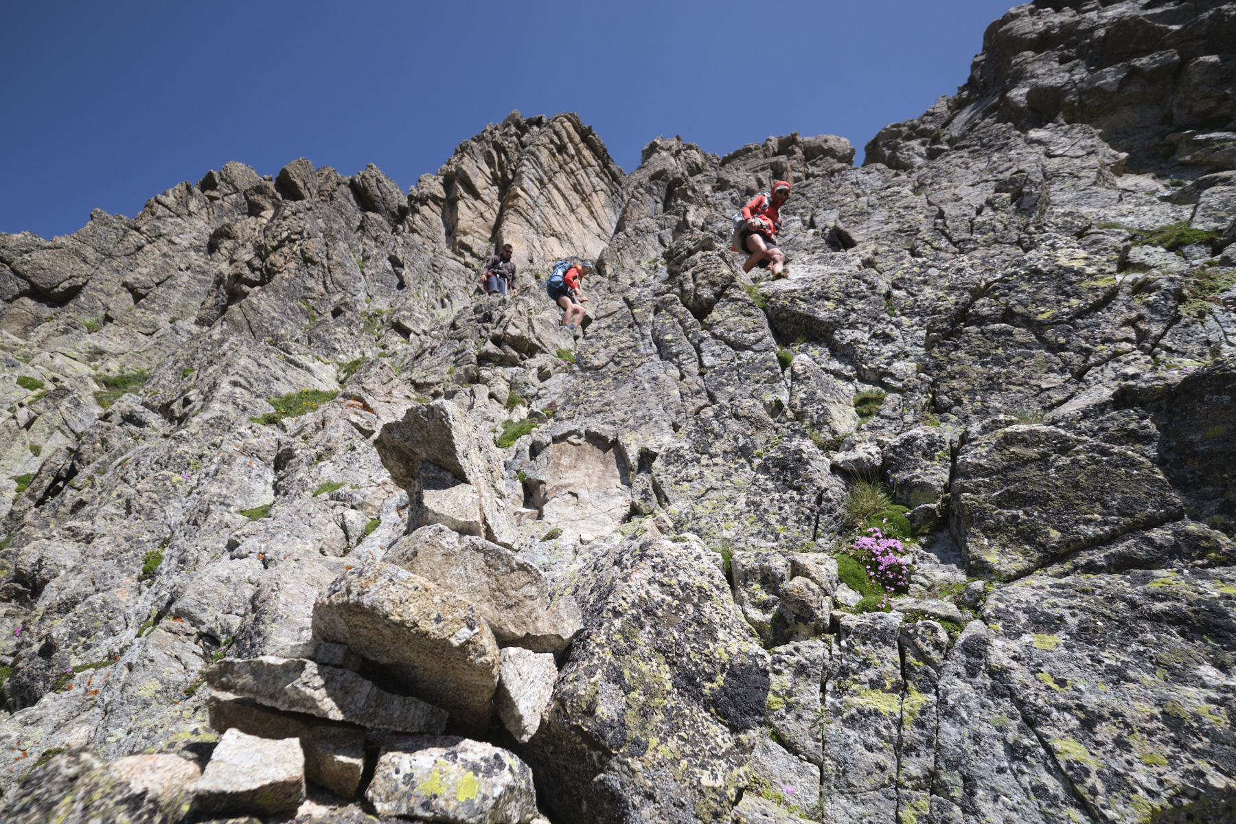
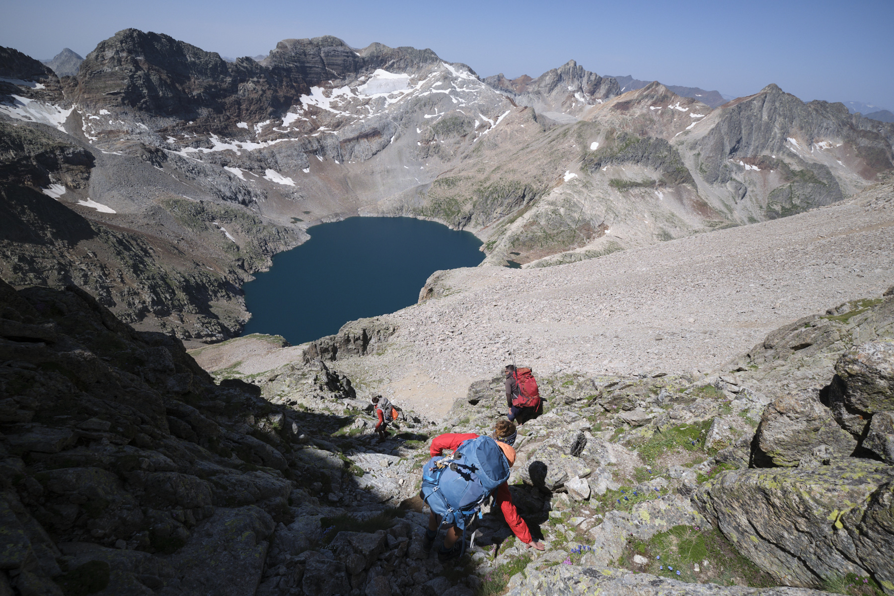
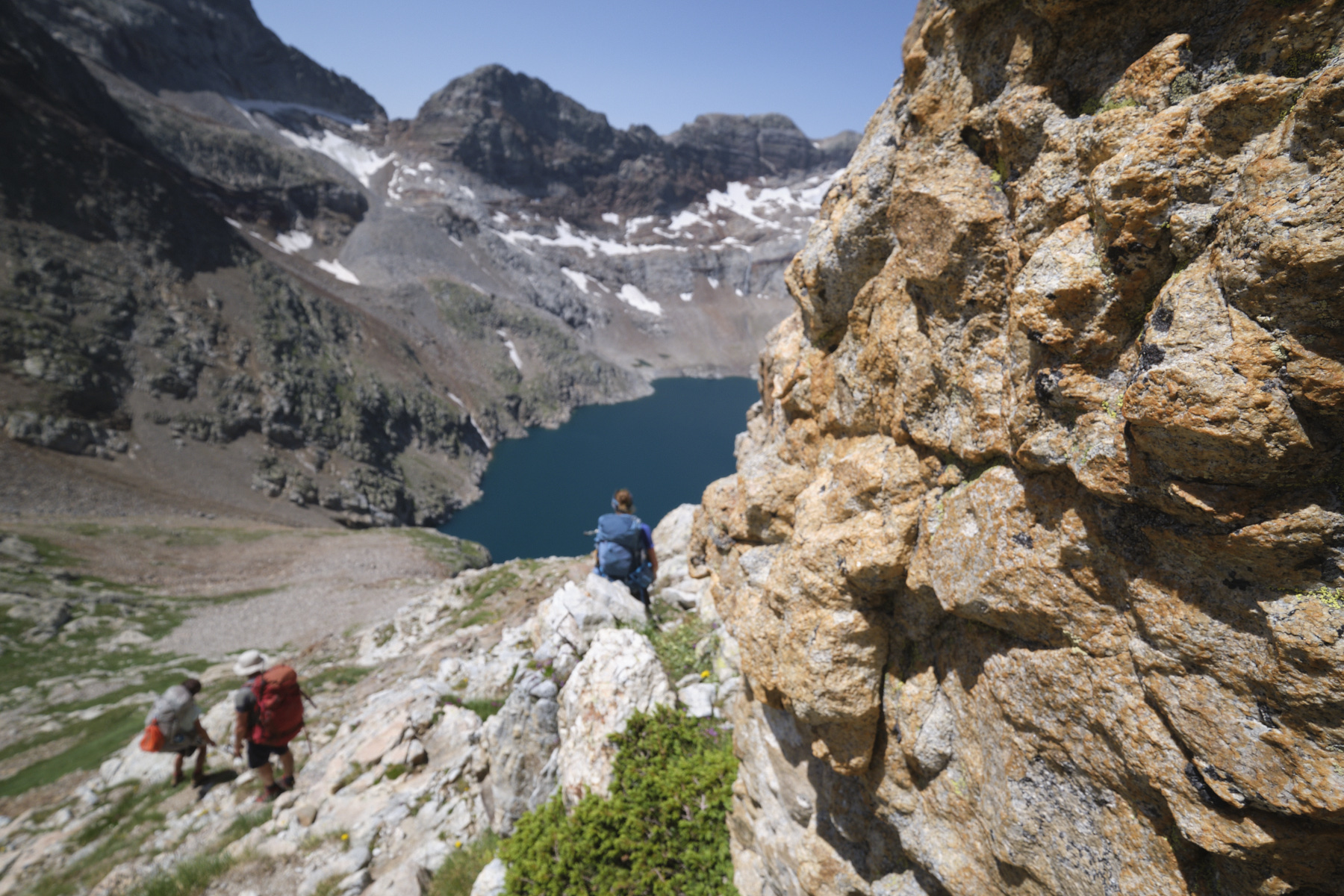
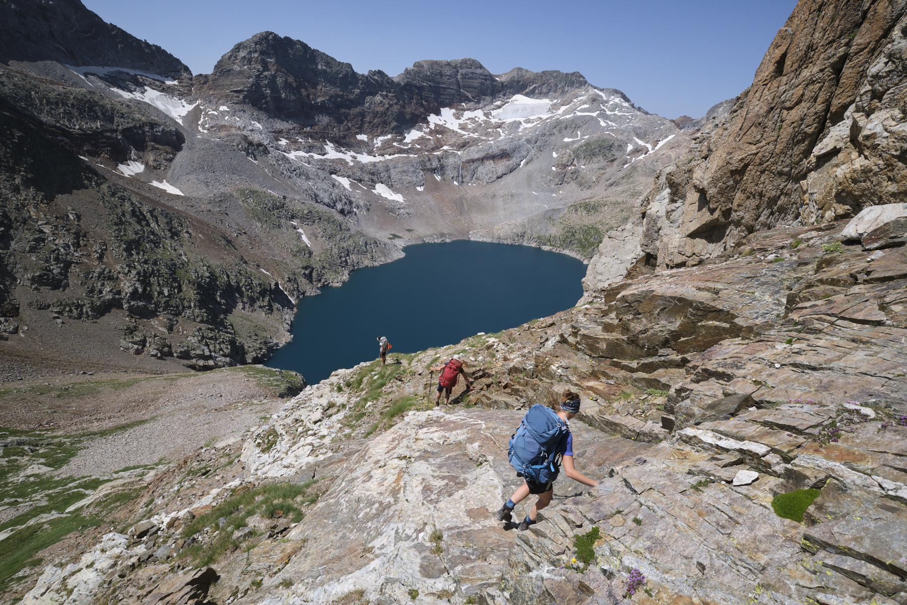
At the top, you come to a large scree slope beneath the north-east pillar of Lezat. Climb the steep, unstable slope to the right of the pillar to emerge on a ridge formed by a mass of boulders. You're now facing the small cirque between Lezat and Grand Quayrat, with the Lezat-Quayrat breach in the center. Keep going up along the northeast pillar, following the little blue hearts that point the way. The route climbs south-eastwards until it reaches the edge of the Pilier ridge. Climb the ridge (II+/III max) and continue above it, heading for a first summit before the main one. The path avoids this 1st summit by passing to the east over an airy, exposed section (II+), which becomes increasingly tapered until it reaches a small gap below the summit plateau (see photo on the front page).
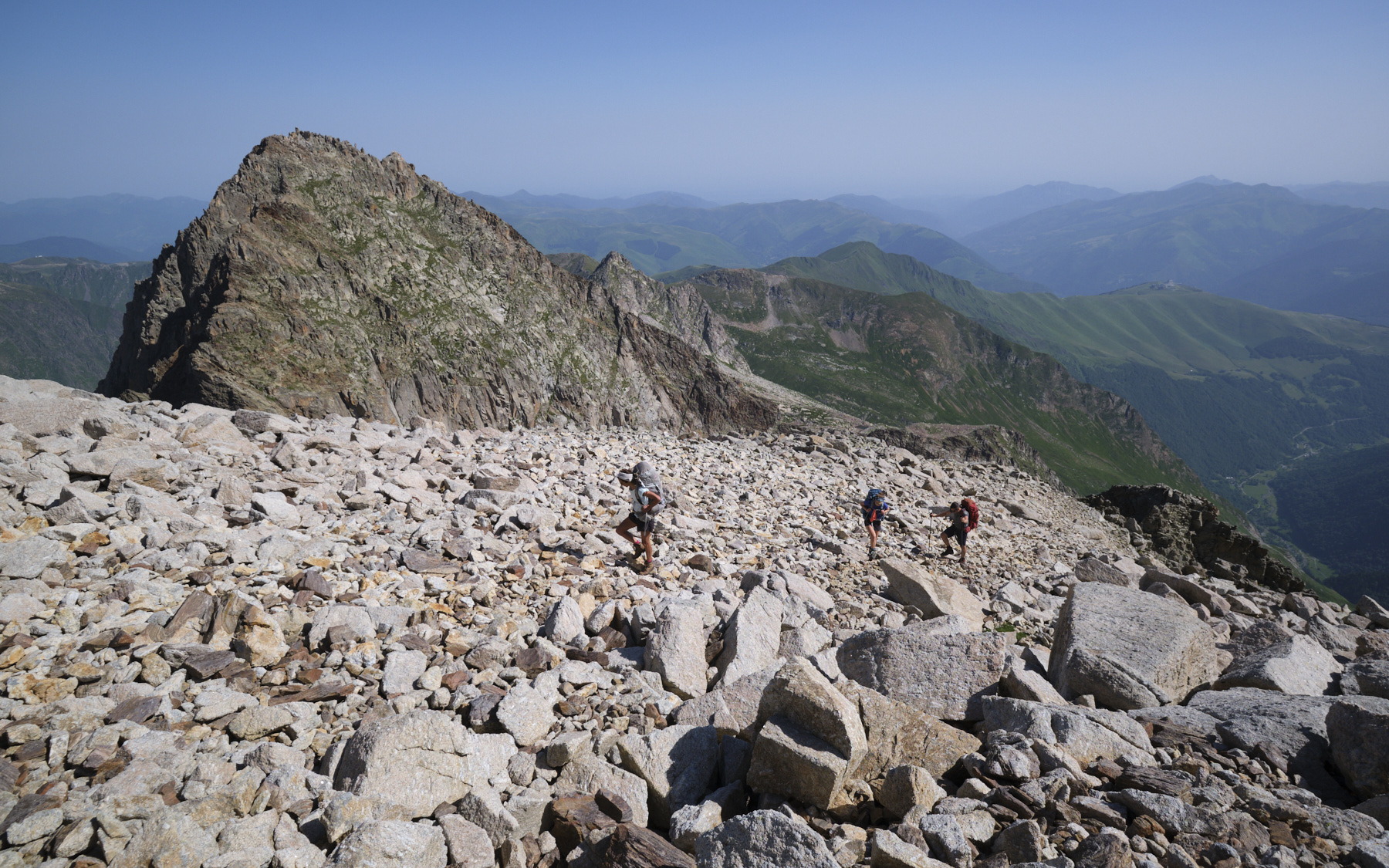
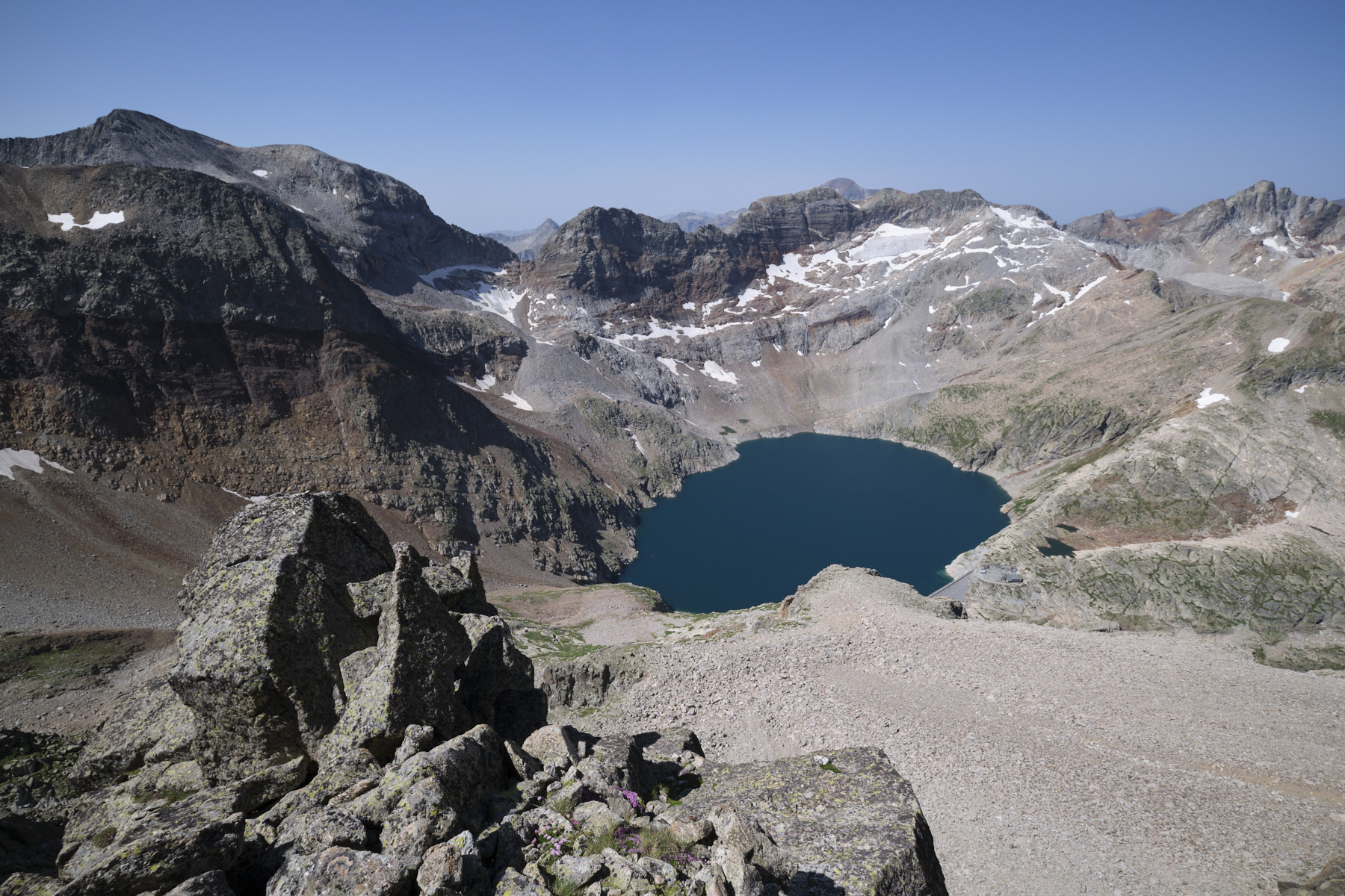
Climb the small spur (III+), then ascend the rocky plateau leading to the summit ridge. Once on the ridge, view of Lac du Portillon. Return north-west along the ridge to the summit of Pic Lezat at 3101m.
Part 3: Lezat summit to Portillon hut (2568m, 1h30 to 2h)
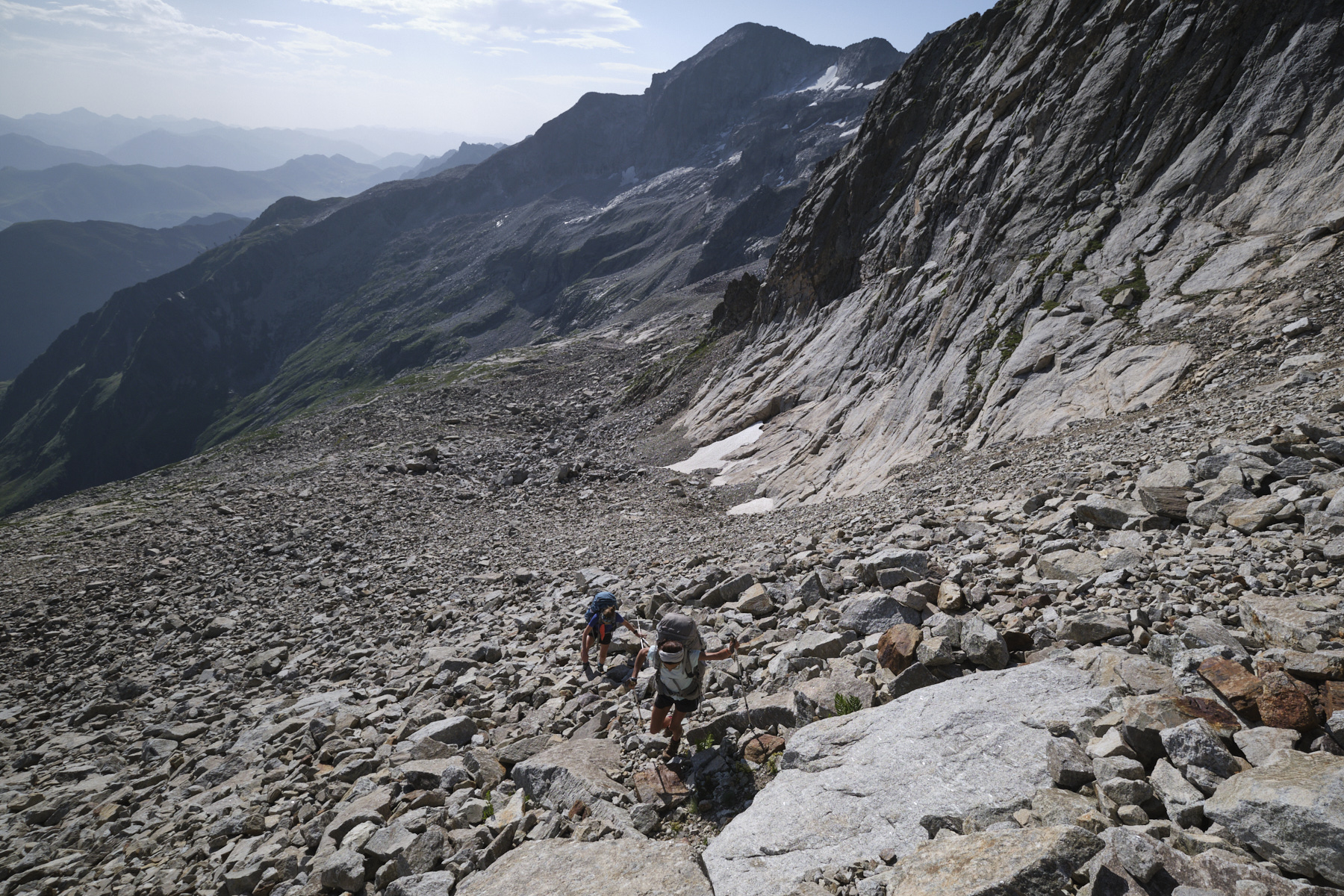
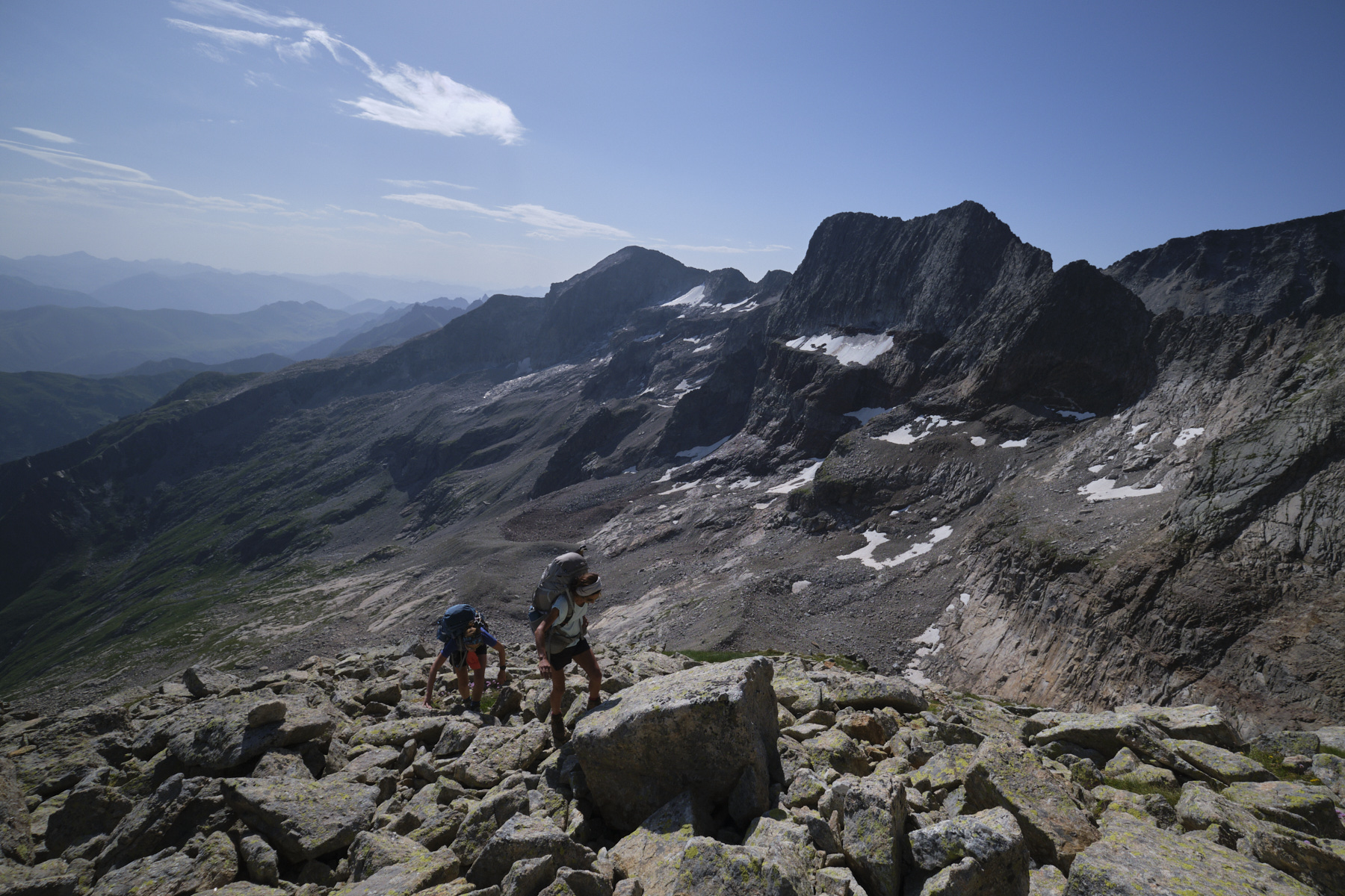
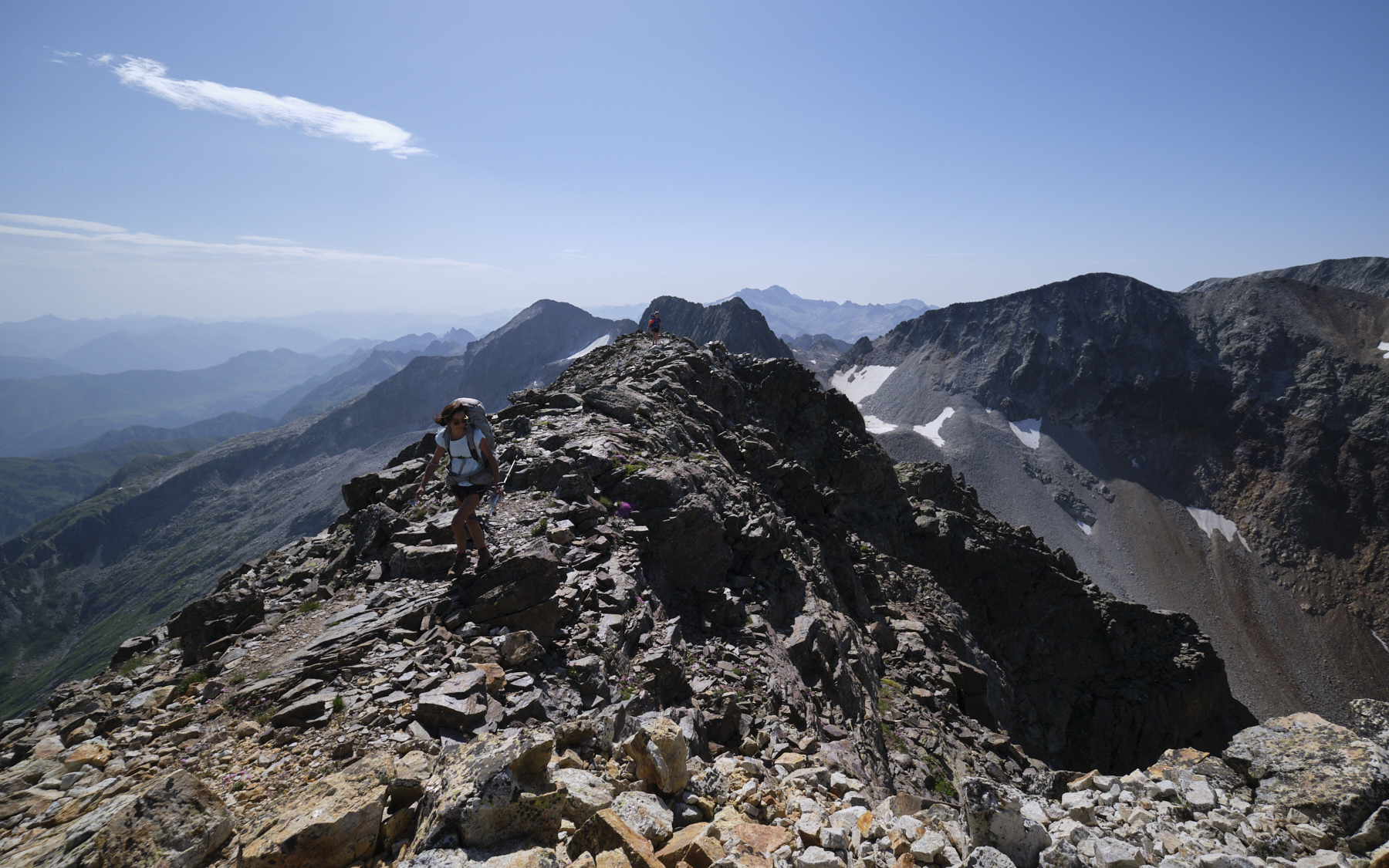
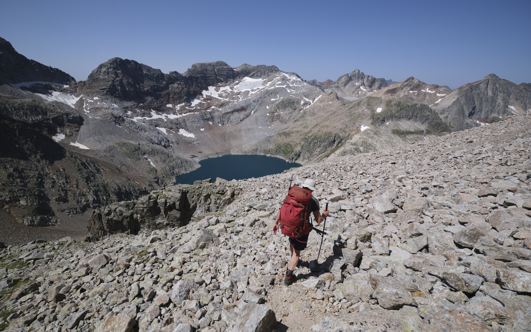
Return to the summit ridge and continue on the south-east ridge, following the cairns. The climb becomes increasingly aerial, with some impressive step-outs. Further on, you'll find the descent corridor on the west side, marked by cairns. The descent is tricky and the terrain unstable, but not too difficult if you're careful. The itinerary quickly heads south-east, changing couloir and finally descending steeply due south.
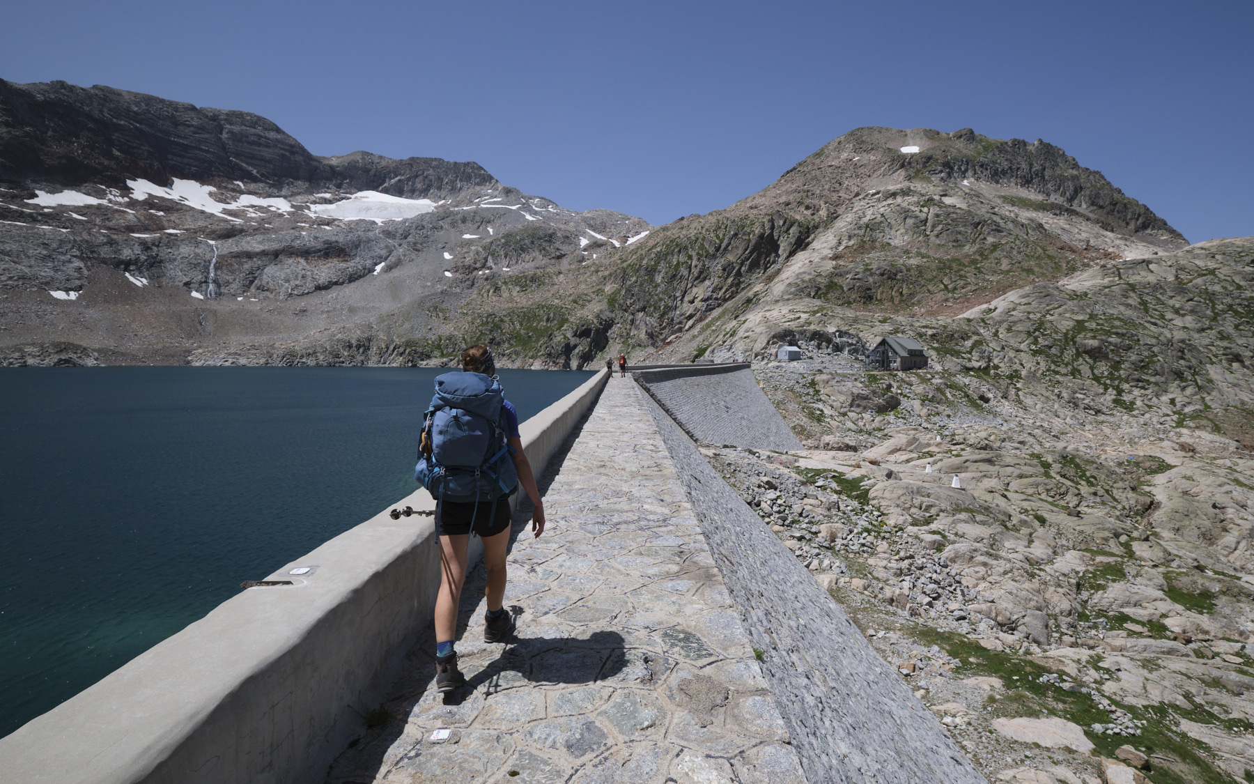
At the bottom, the path veers 90° to the right to join the scree that forms a dome above the lower bars. Cross the scree and take the small corridor marked with cairns that leads down to the normal path of the Litérole valley. All that remains is to finish the descent on more comfortable terrain, ending at the Lac du Portillon, cross the dam and reach the refuge at 2568m.


 Partager sur WhatsApp
 Partager sur Twitter
Partager sur Instagram
Partager sur Twitter
Partager sur Instagram

 Partager sur Facebook
 Imprimer le topo
 Laisser un commentaire


Leave a Reply