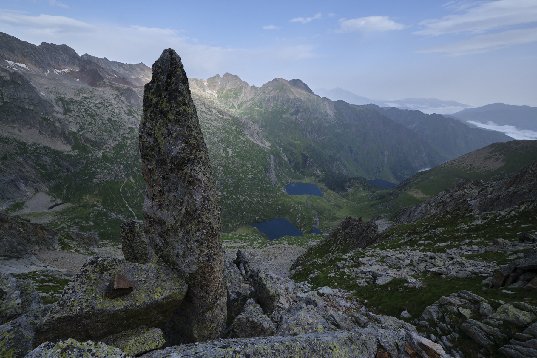
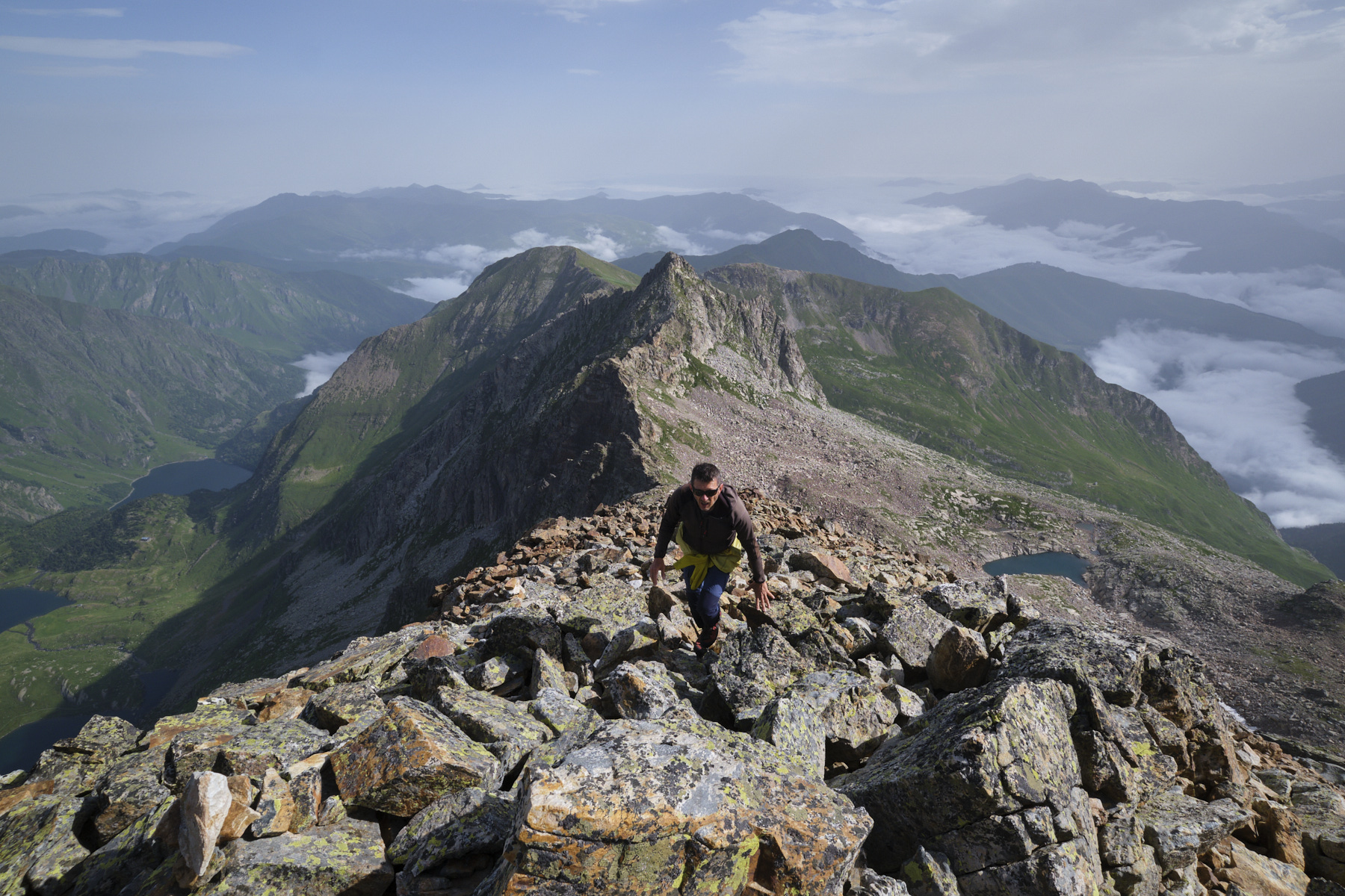
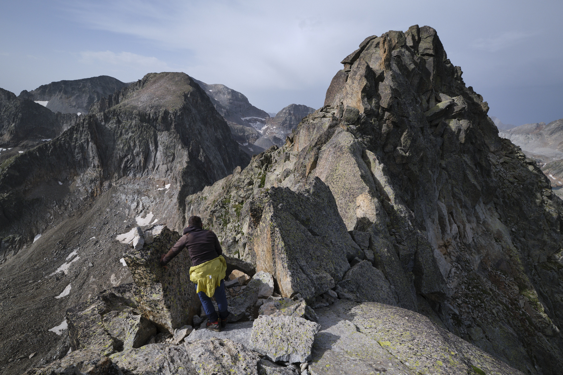
Climbing the imposing Grand Quayrat pyramid via the normal route of the North ridge offers impressive aerial views of the cirque des Crabioules and the Pic du Maupas to the East, and the lakes of Sausat and Espingo to the West. From the Portillon hut (or Espingo hut), access to the ridge is gained by zigzagging a little between the walls and climbing up a long, steep, slabby couloir. The final section between the antecima and the summit requires a little more climbing (III max) and a short, exposed but not too tricky route to the summit, formed by a mass of huge, tangled boulders. Fortunately, the route, which is not very intuitive when you look at the pyramid from afar, is well signposted with numerous cairns to avoid any misdirection.
❱❱ Technical summary
All the data below correspond to a departure from the Portillon refuge and a return to the Granges d'Astau.
■ Departure point: refuge du Portillon, Oô valley
■ Type of route: high-mountain alpine hike
■ Distance: 12 km
■ Cumulative elevation gain: +660 m
■ Cumulative negative altitude gain: -1920 m
■ Estimated total time: 5h to 6h ■ Min and max altitude: 1140 m / 3060 m
■ Marking: frequent cairns and clearly visible path for the ascent
■ Equipment in place: none
■ Equipment required: useful GPS track
Difficulties: very steep and aerial passages, sections to climb (II/III+), exposed ridge finish, scree crossing, unstable terrain
❱❱ Access to the place
Here, we start from the Portillon hut at the top of the Vallée d'Oô, as this follows our route from the Vallée du Lys and Pic Lezat(see previous day's topo). To get there, go to the Granges d'Astau above Bagnères-de-Luchon. You can also (and ideally) start the ascent from the Espingo refuge.
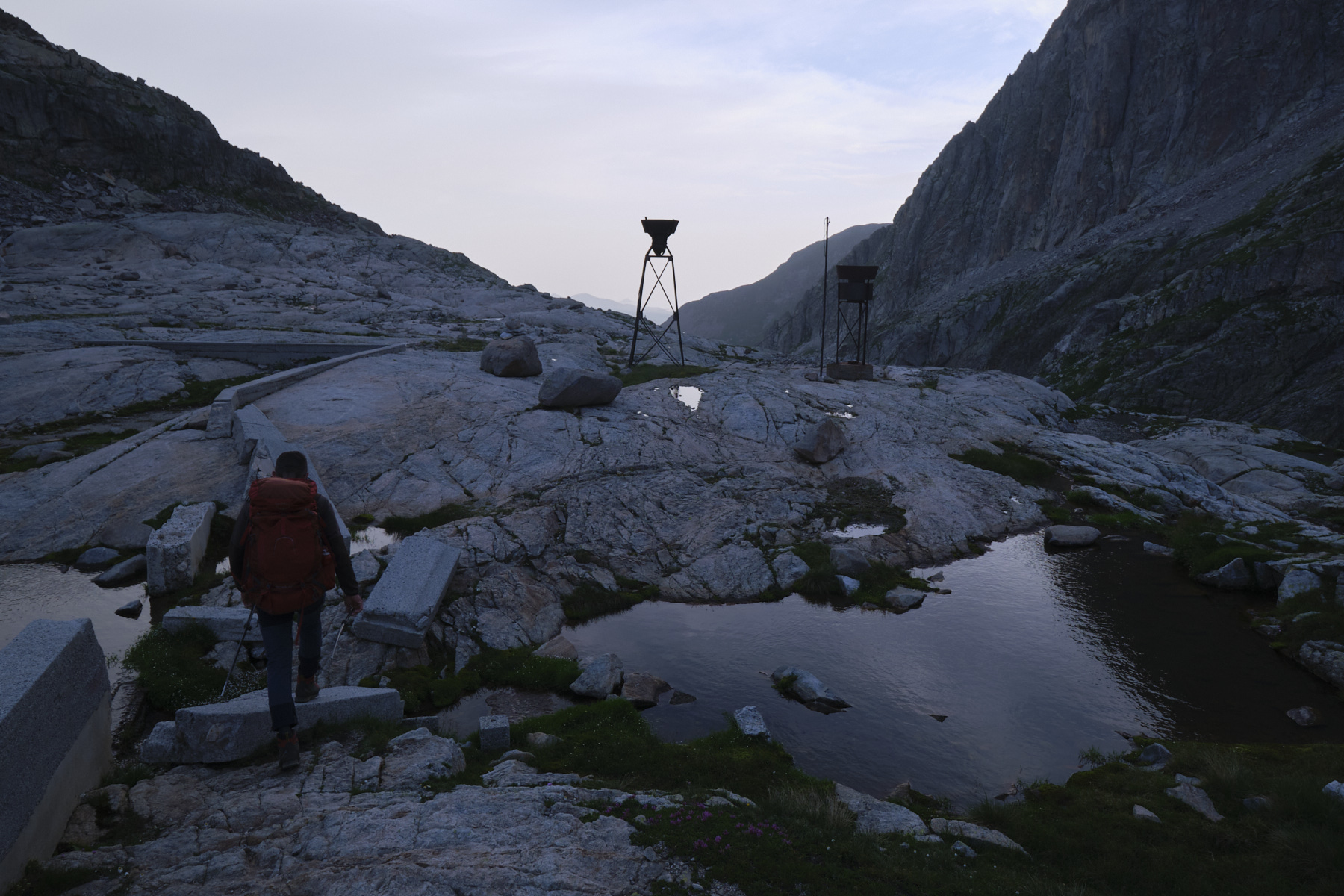
Part 1: from the Portillon hut to the start of the climb (2550m, 1h)
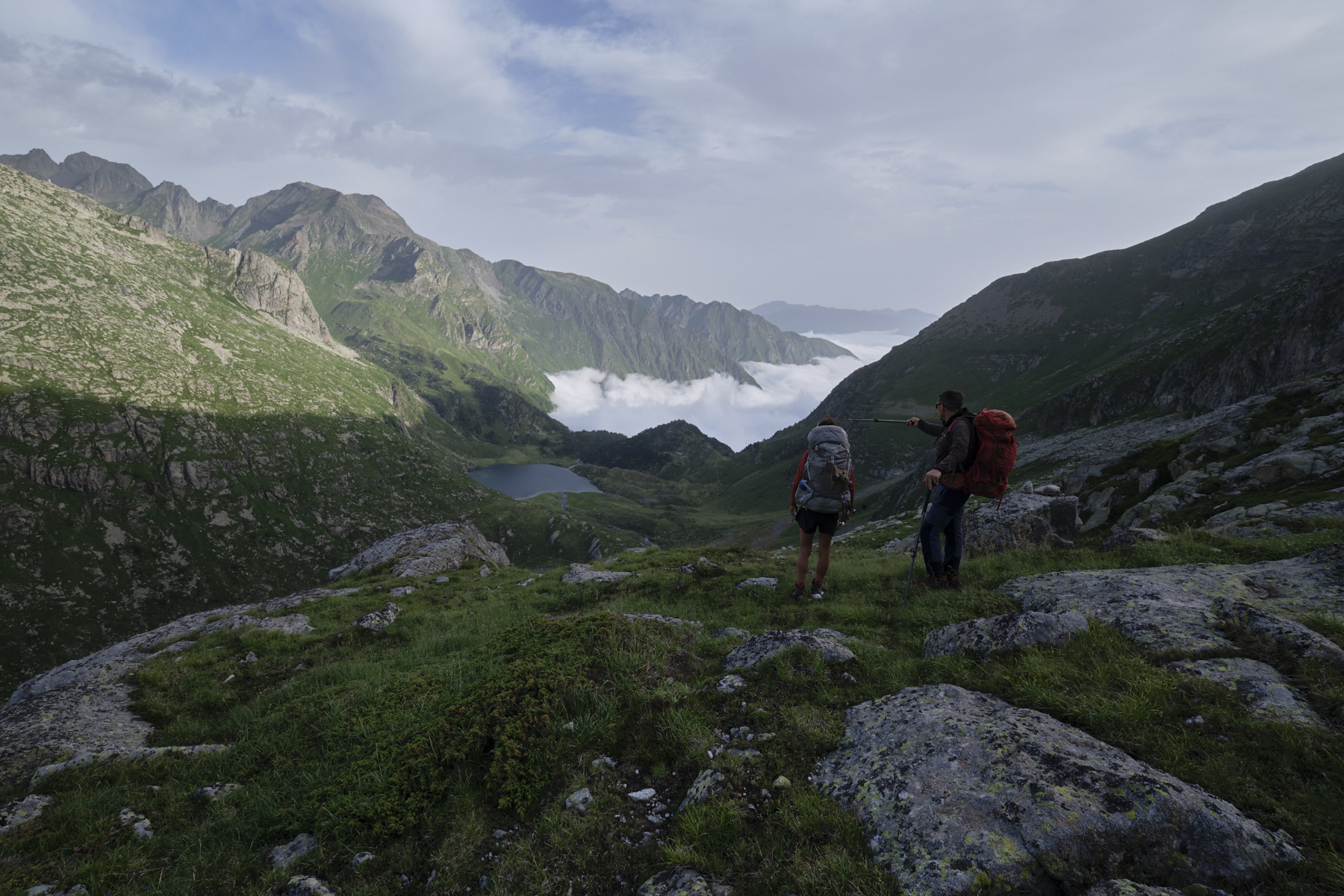
From the Portillon refuge, start the normal descent and quickly, at the level of the small metal towers, turn right to join the small valley of the Neste d'Oô. More or less follow the cairns that cross the torrent bed and continue northwards on the other side. The path continues for a while, crossing a large area of scree, passing a first shoulder and then a second, to reach the half-grassy, half-rocky valley above Lac de Sausat.
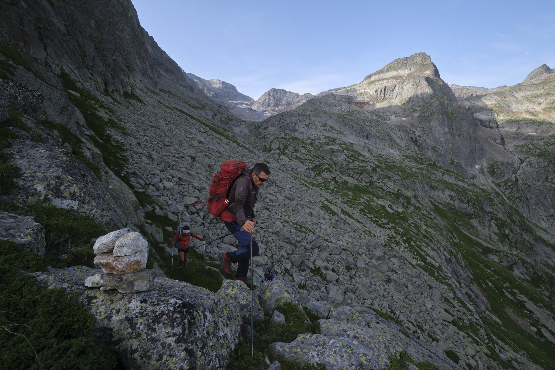
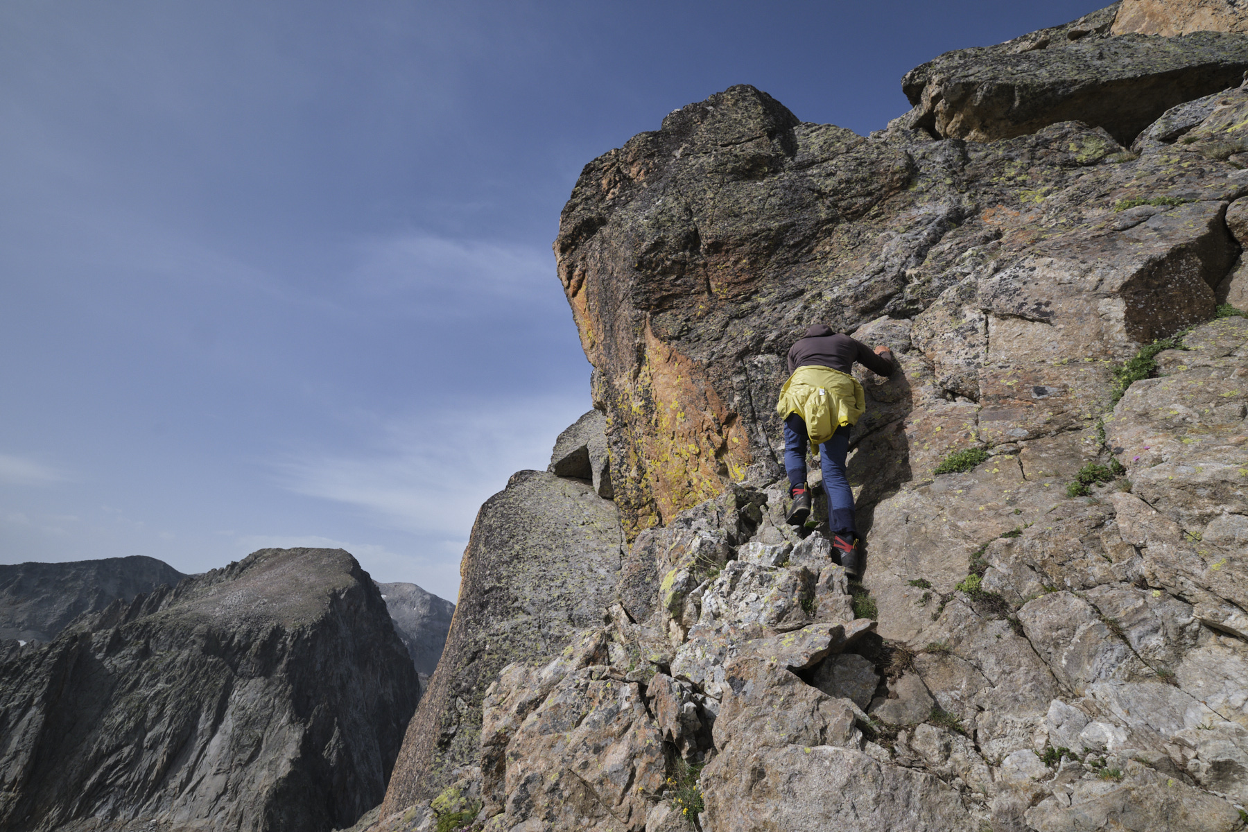
From here, head due east up the slope under the north-west ridge of Grand Quayrat and join the descent path at a sort of characteristic rocky mini-cliff in the middle of the valley. Climb around it to the right and you'll find the start of the ascent, with a small slabby spur (II).
Part 2: climb and de-escalate Grand Quayrat (3060m, 2h)
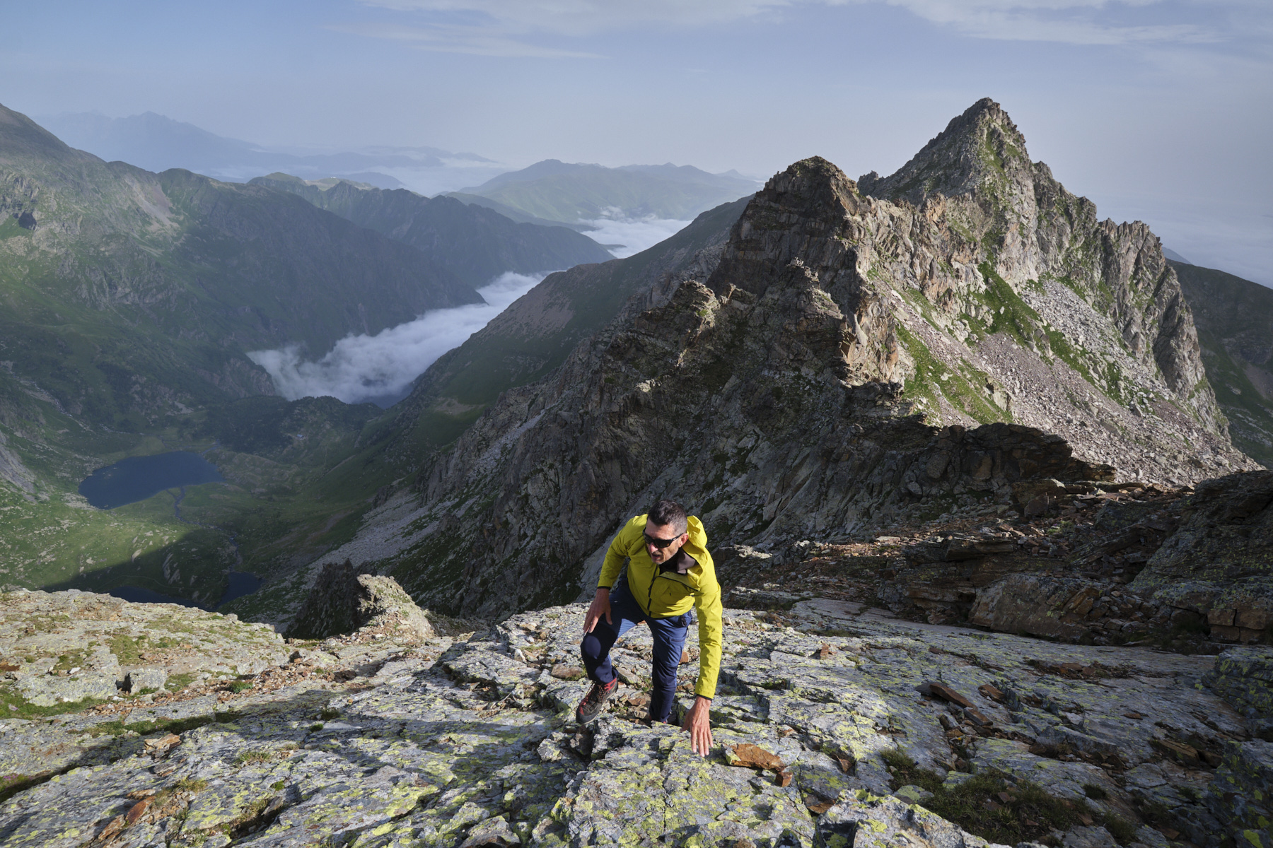
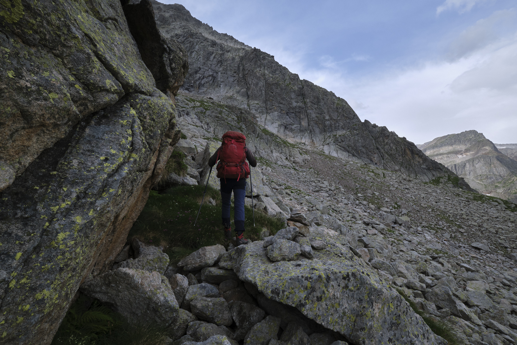
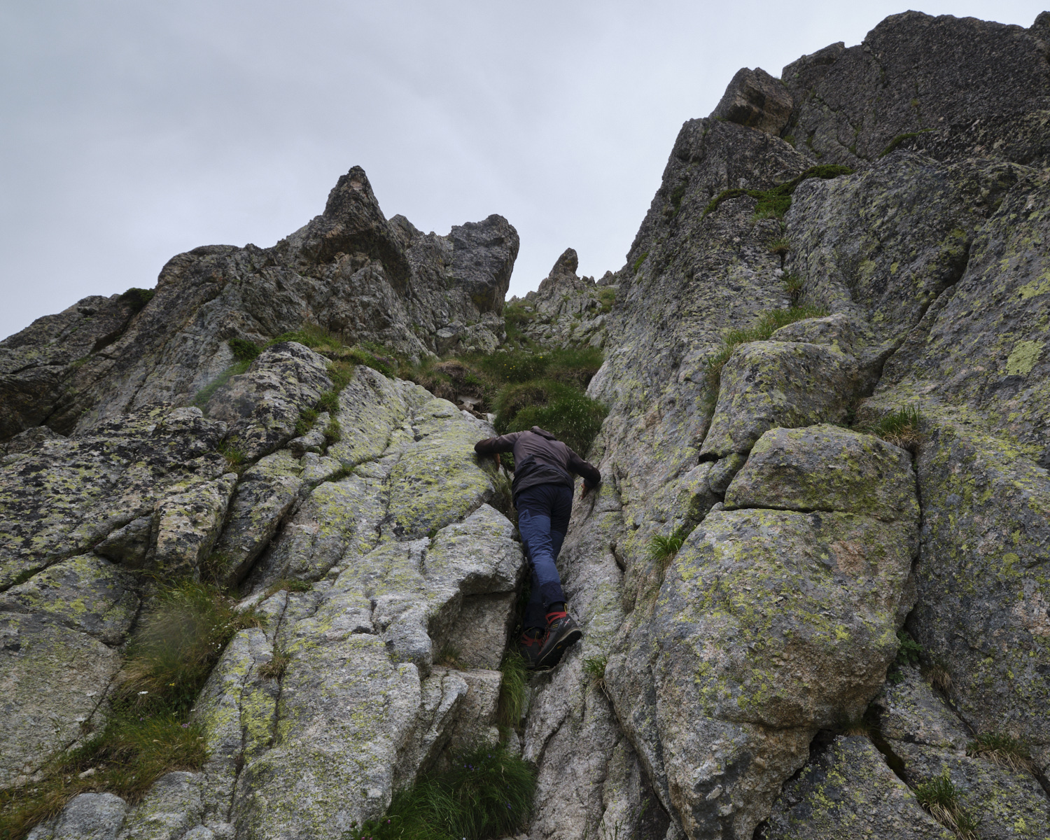
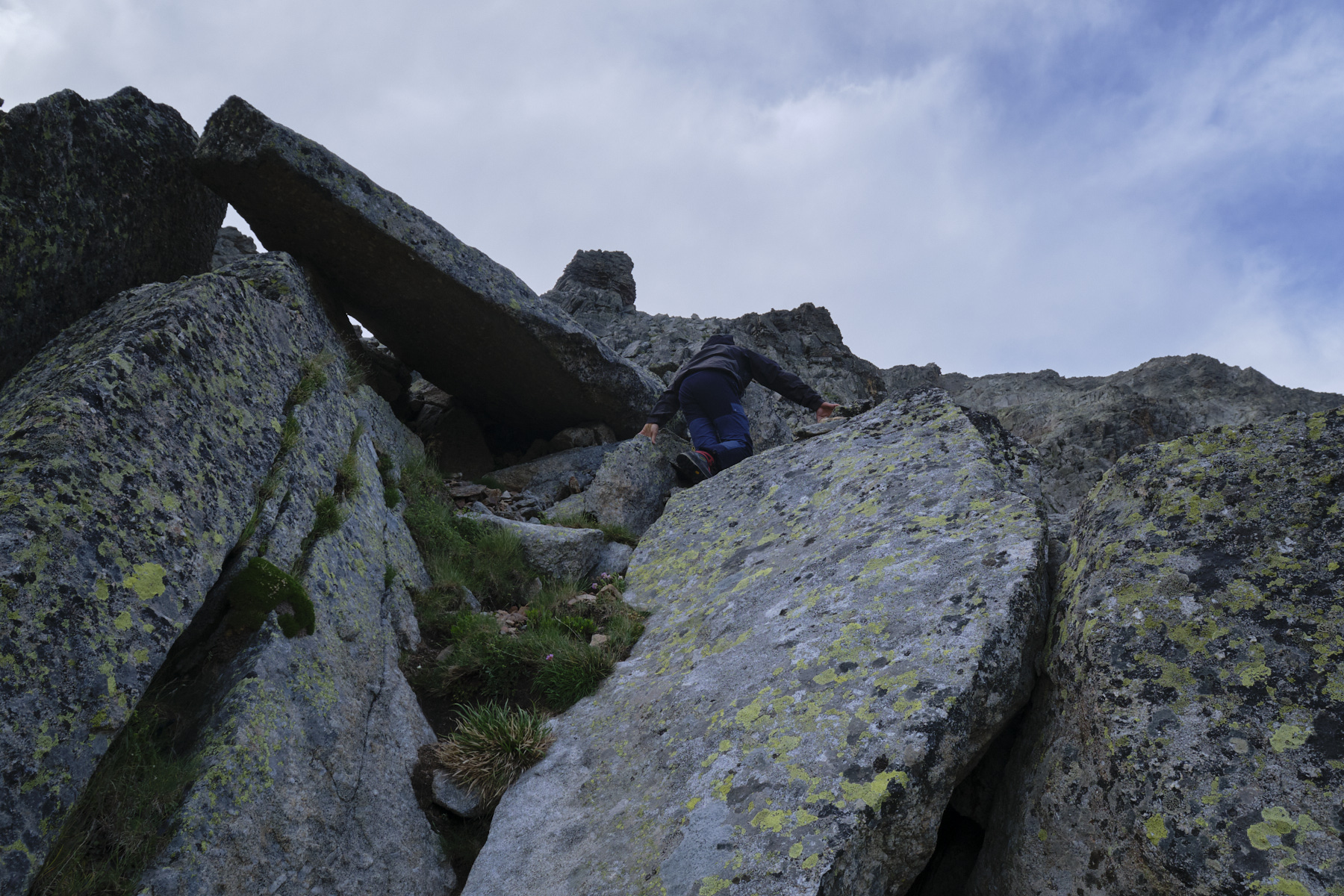
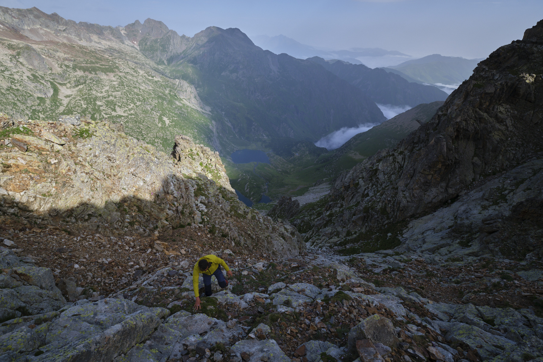
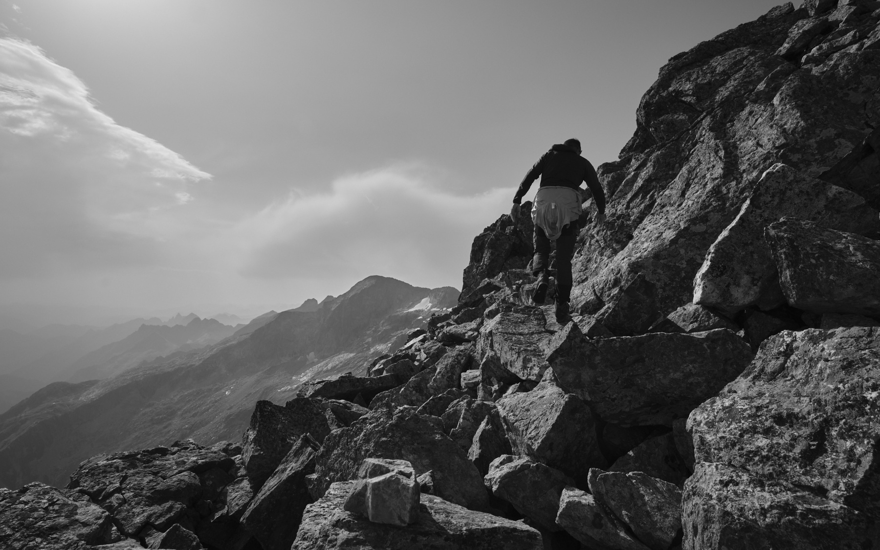
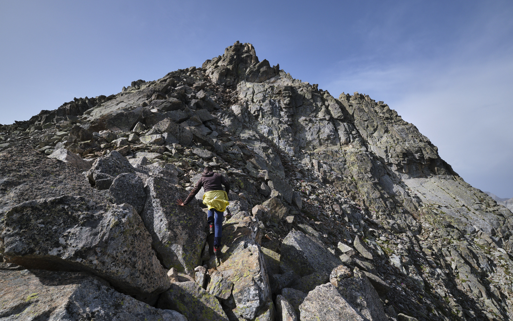
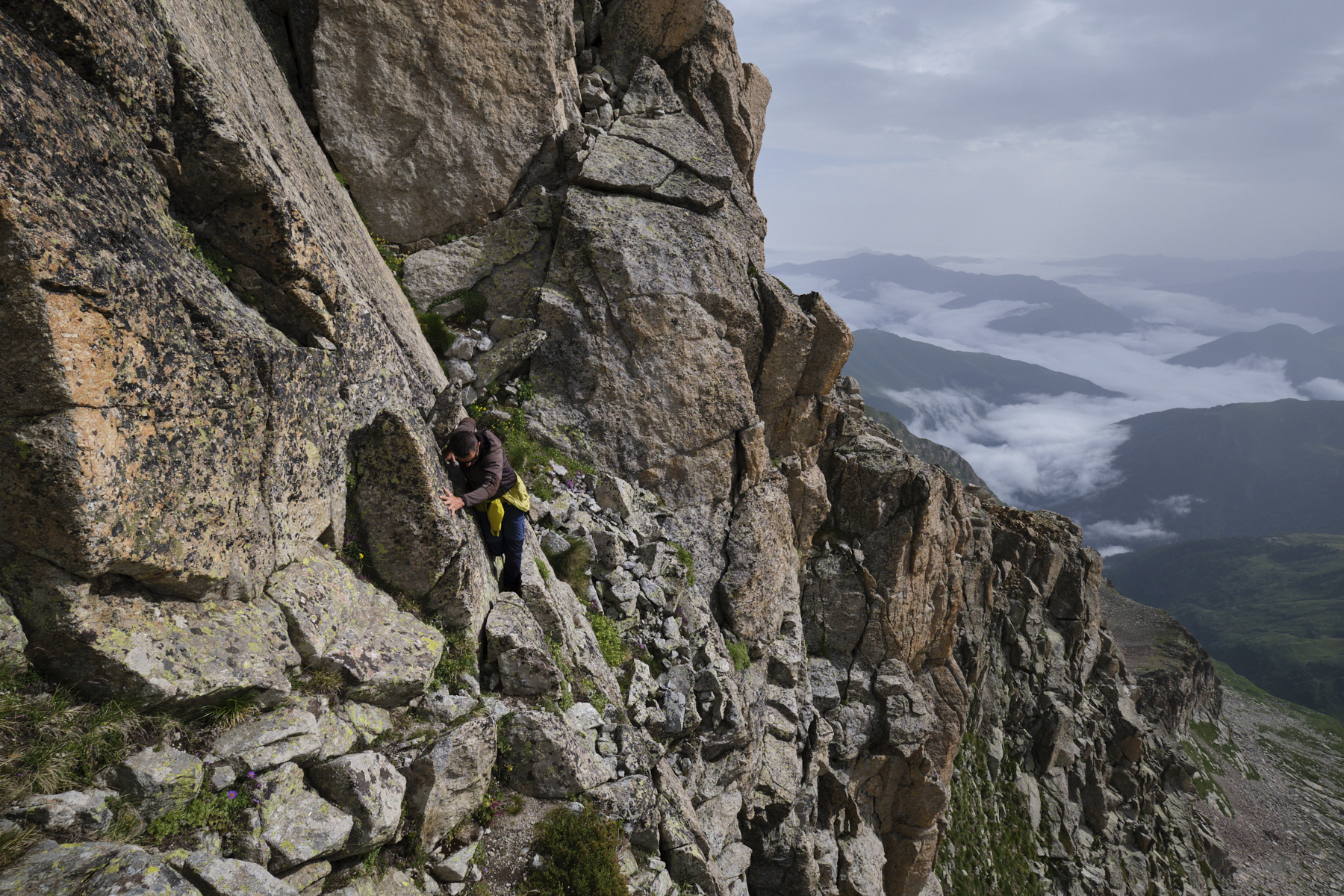
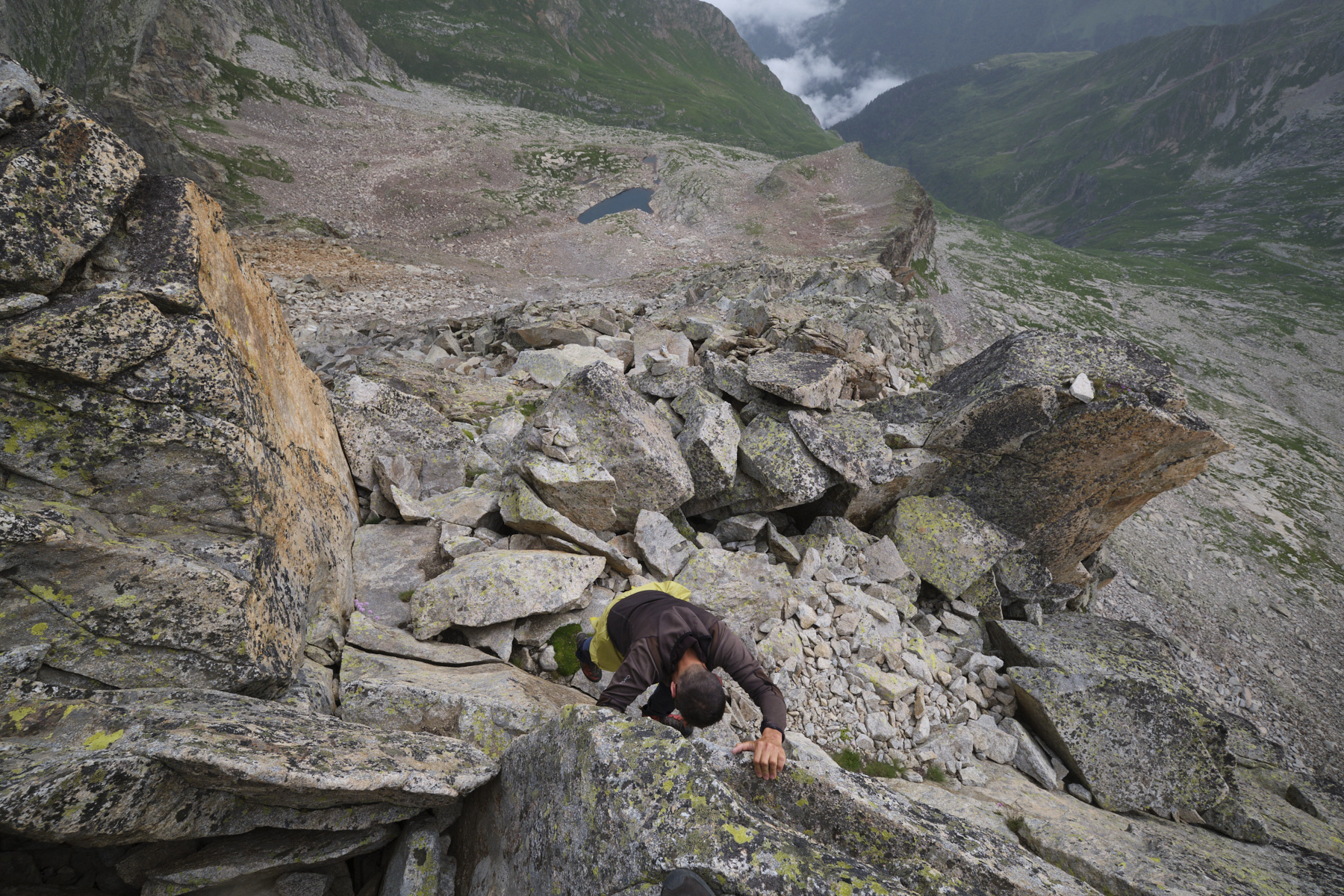
The route follows the weaknesses in the walls to reach the north ridge of Grand Quayrat. There are enough cairns to avoid making a mistake, and the path is well marked on the ground. After the 1st rise, the path heads due north to pass a small couloir to climb (III-) before heading south-east on increasingly aerial and steep terrain. Higher up, we find the stony, flagstone couloir that we have to climb carefully (see photo on the front page) to exit onto the ridge between Petit and Grand Quayrat. We're now on the north ridge of Grand Quayrat.
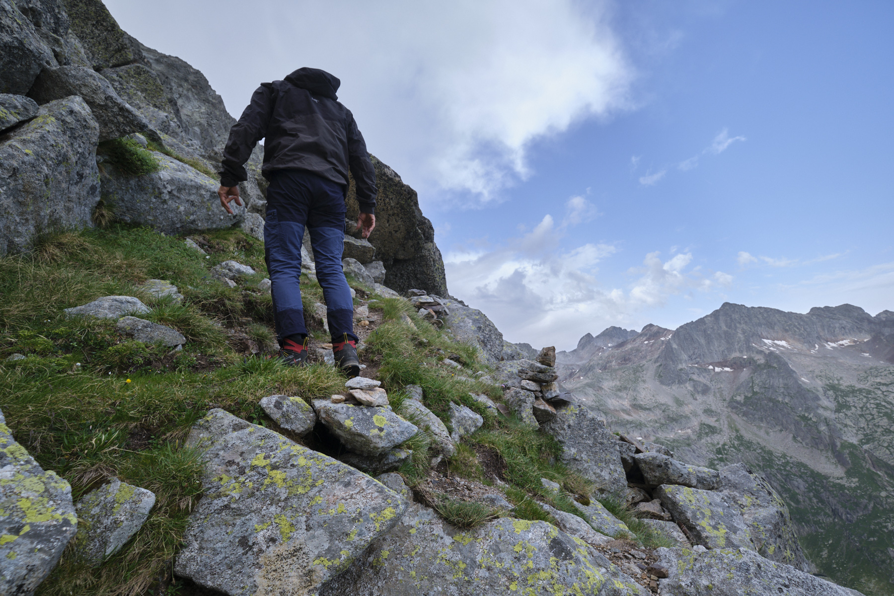
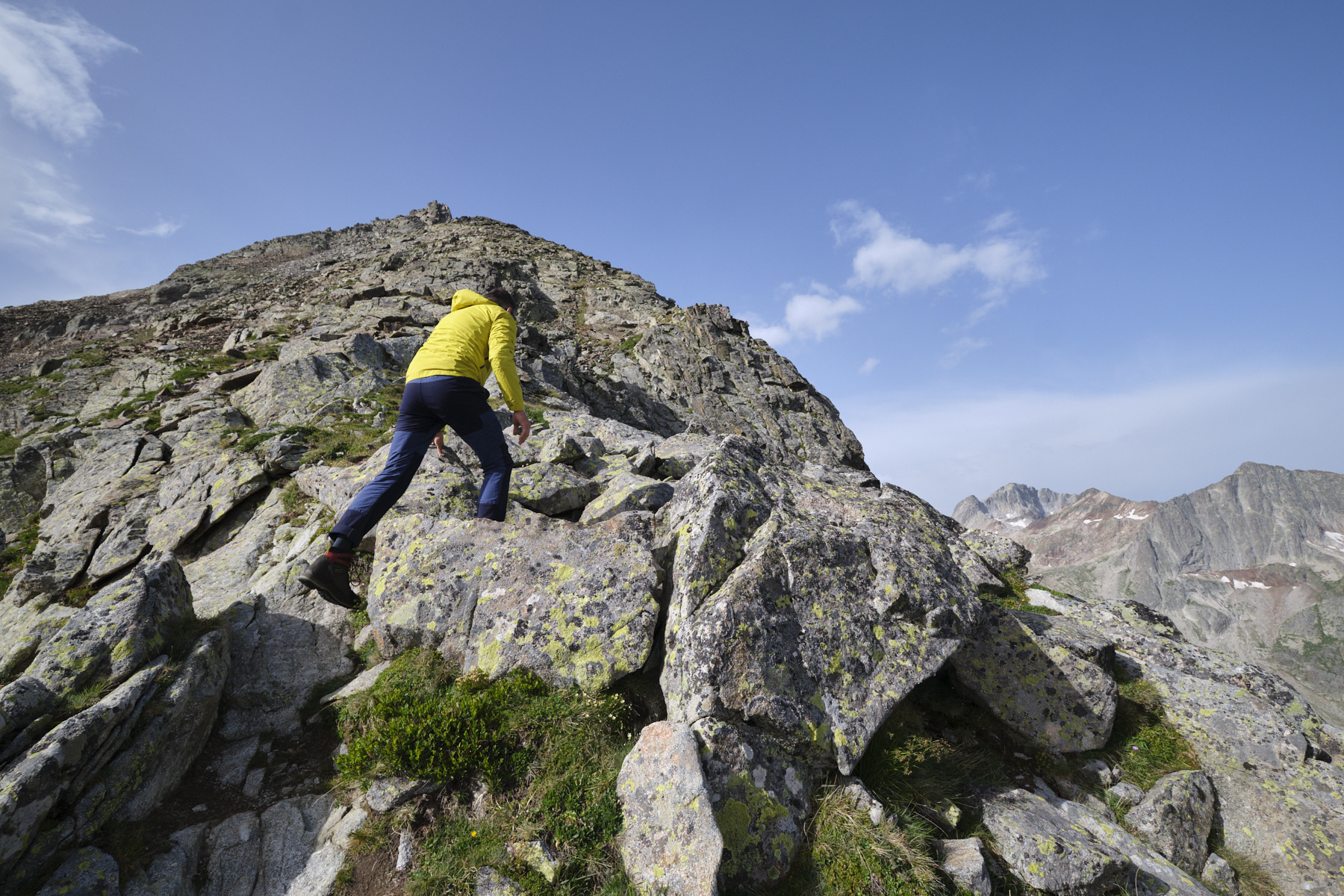
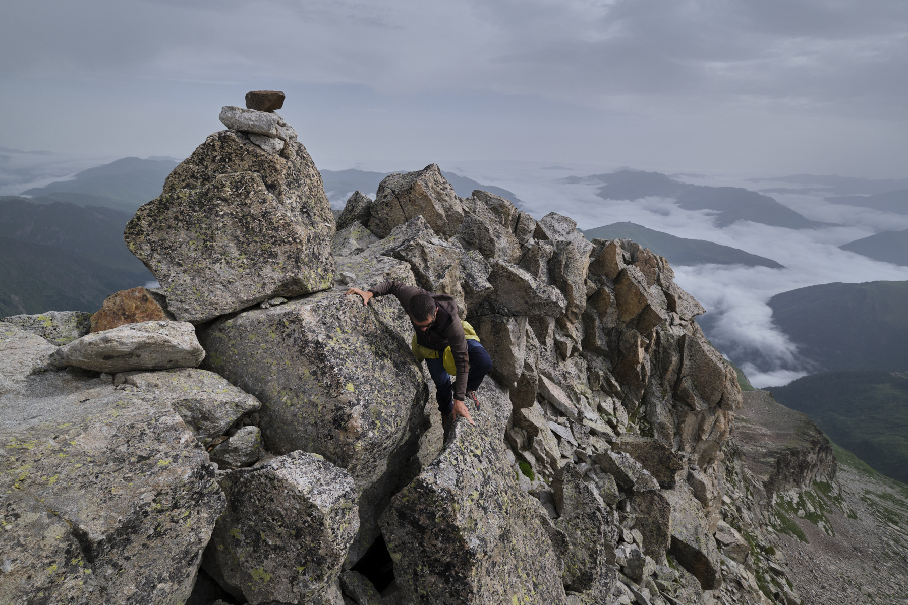
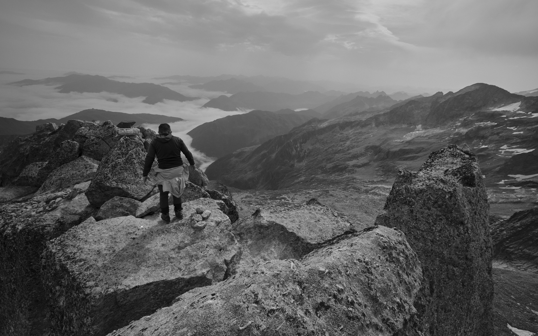
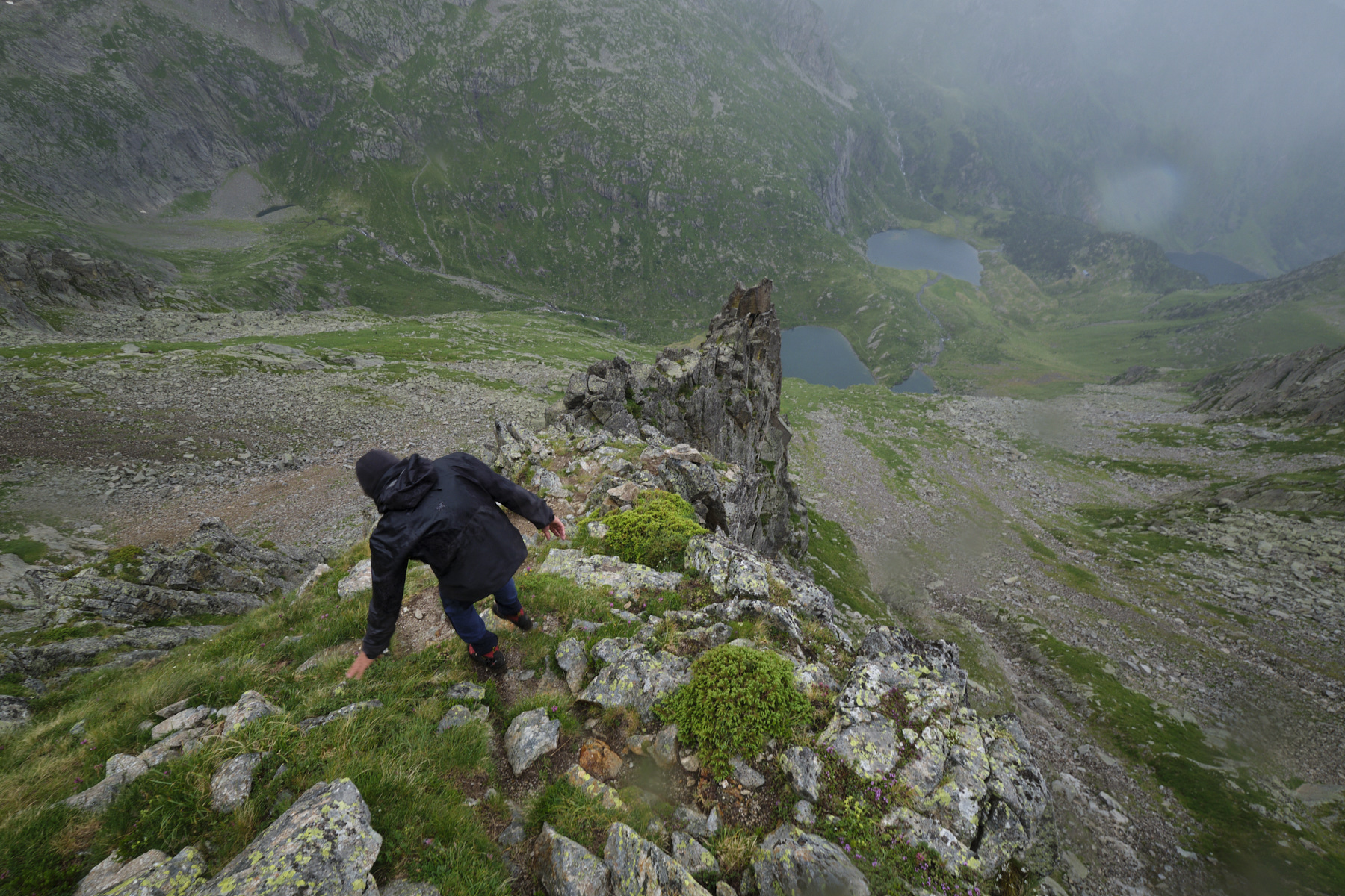
The rest of the way up this ridge is easier, with tons of loose rock piled on top of each other. The final section is the most exposed and aerial. Climb without difficulty to reach the antecima and catch a glimpse of the Grand Quayrat summit at the end of the summit ridge. From here, follow the cairns to de-climb on the left (east), pass over an airy, exposed but not difficult ledge, and climb back up (III-) to reach the summit formed by large stacked granite boulders.
Follow the same route back to the starting point of the climb and take the descent path to the Espingo refuge.
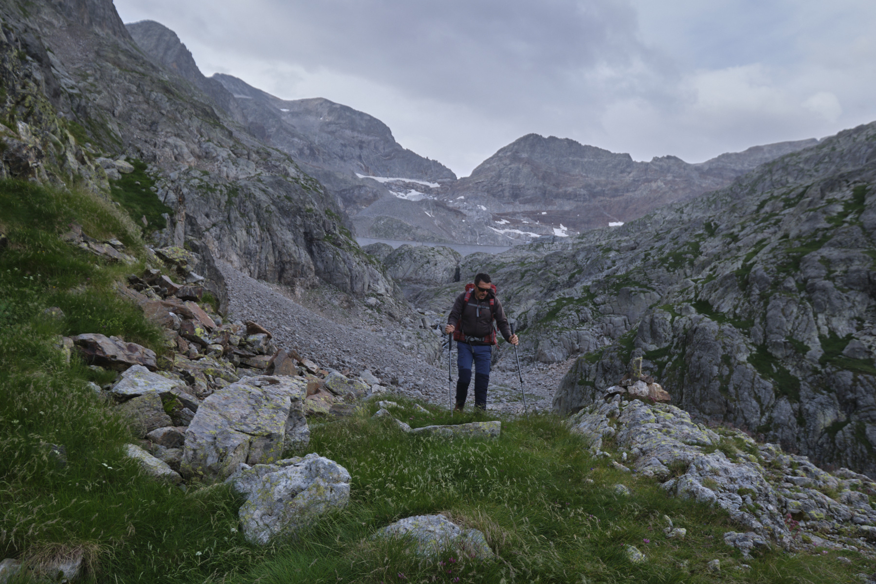
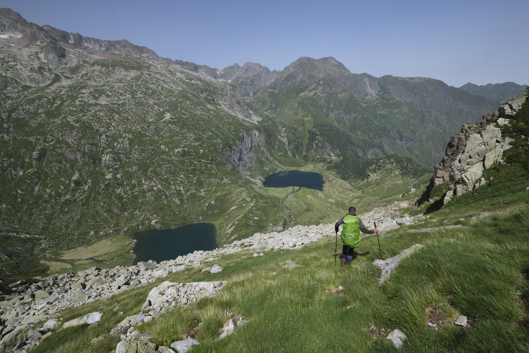
3rd part: return to Granges d'Astau via Col d'Espingo (1140m, 2h30)
The section of path to the Col d'Espingo is particularly challenging, due to the steepness of the slope and the highly unstable terrain, especially in the upper part. Follow the cairns, not always clearly visible, to cross downhill towards the walls on the right. Follow the base of these walls, cross areas of scree, cross a wide grassy shoulder further on and climb down a small spur to reach the narrow valley that drops down to Lac d'Espingo. We finally reach the Col d'Espingo (1h15 from the top).
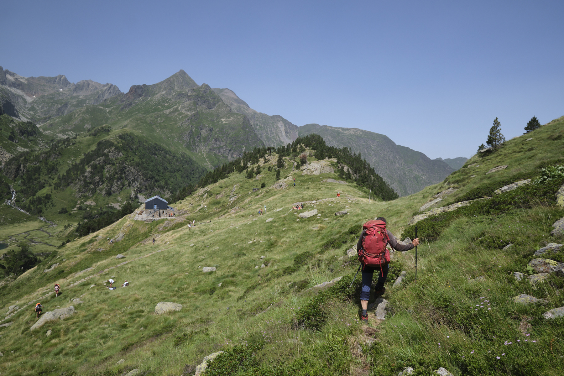
All that remains is to follow the official and increasingly frequented itinerary down to the next level at Lac d'Oô and finally land at the Granges d'Astau in the final parking lot.


 Partager sur WhatsApp
 Partager sur Twitter
Partager sur Instagram
Partager sur Twitter
Partager sur Instagram

 Partager sur Facebook
 Imprimer le topo
 Laisser un commentaire


Leave a Reply