×
Randonnées Escalade Alpinisme Via ferrata Canyoning Ski de rando Raquettes
×

Search Close search

TOPO

West peak of Côte Belle from Col d’Izoard, Arvieux

Publié le |

0 Comments

Depuis le Pic, vue sur la Casse Déserte et les Écrins au fond

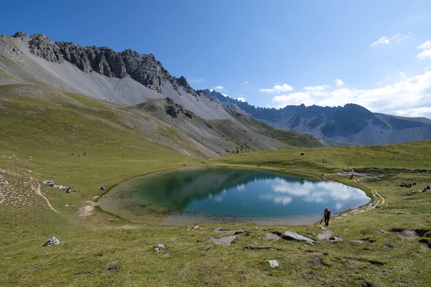
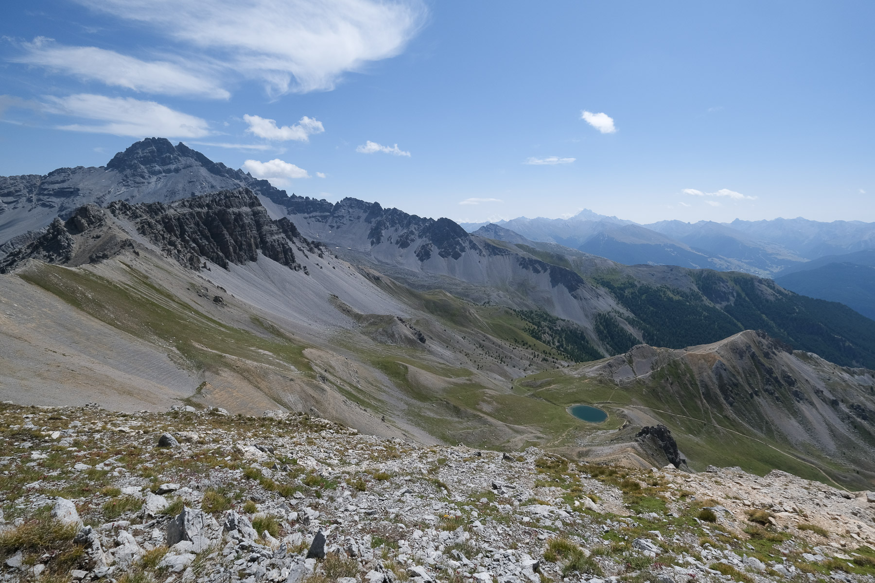
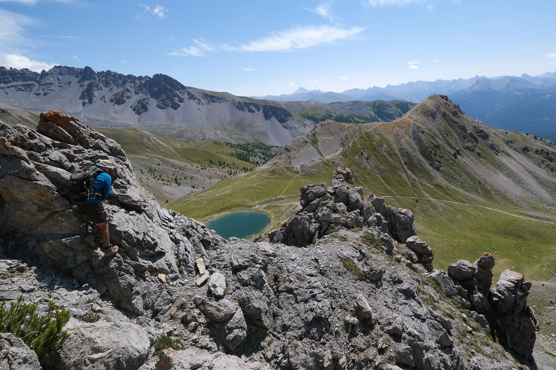
Here's another great hike in the Queyras, and the ascent of the Pic Ouest de Côte Belle above Lac de Souliers is an added bonus: an exceptional aerial panorama of the region and the nearby Écrins massif. Although very popular, particularly the ascent to Lac de Souliers, which is very accessible, the itinerary is varied and offers beautiful views all along the way. Several options are available from Lac de Soulier, depending on your preferences and the effort involved.

Technical summary

These technical data and the difficulty of the guidebook correspond to the complete itinerary with a loop ascent of the Pic Ouest de Côte Belle. The basic route is less difficult (blue label).

Departure point: parking lot below Casse Déserte, Col d'Izoard, Arvieux, Queyras, Hautes-Alpes (05)
Type of route: high-mountain loop hike with optional variation
Distance: 11 km
Cumulative elevation gain: +900 m
Cumulative negative altitude gain: -900 m
Estimated total time: 4h to 5h
■ Min and max altitude: 2200 m / 2854 m
Marking: marked trail on basic itinerary, unmarked trail and off-trail descent for optional variant to Pic de Côte Belle
Equipment in place: none
Equipment required: useful GPS track

Difficulties:

Access to the place

From Guillestre, take the departmental road up to Chateau-Queyras, then turn off towards Arvieux. Pass Arvieux, La Chalp and Brunissard to tackle the emblematic Col d'Izoard climb. Before the pass, you pass under the Casse Déserte. Park in one of the roadside parking lots. The trail to Lac de Souliers starts from the main parking lot.

Map & topo

The itinerary from the Pic Ouest de Côte Belle back to the Lac de Souliers via the Antécime Sud is indicative as it is off-piste.

Voir en plein écran

Itinerary description

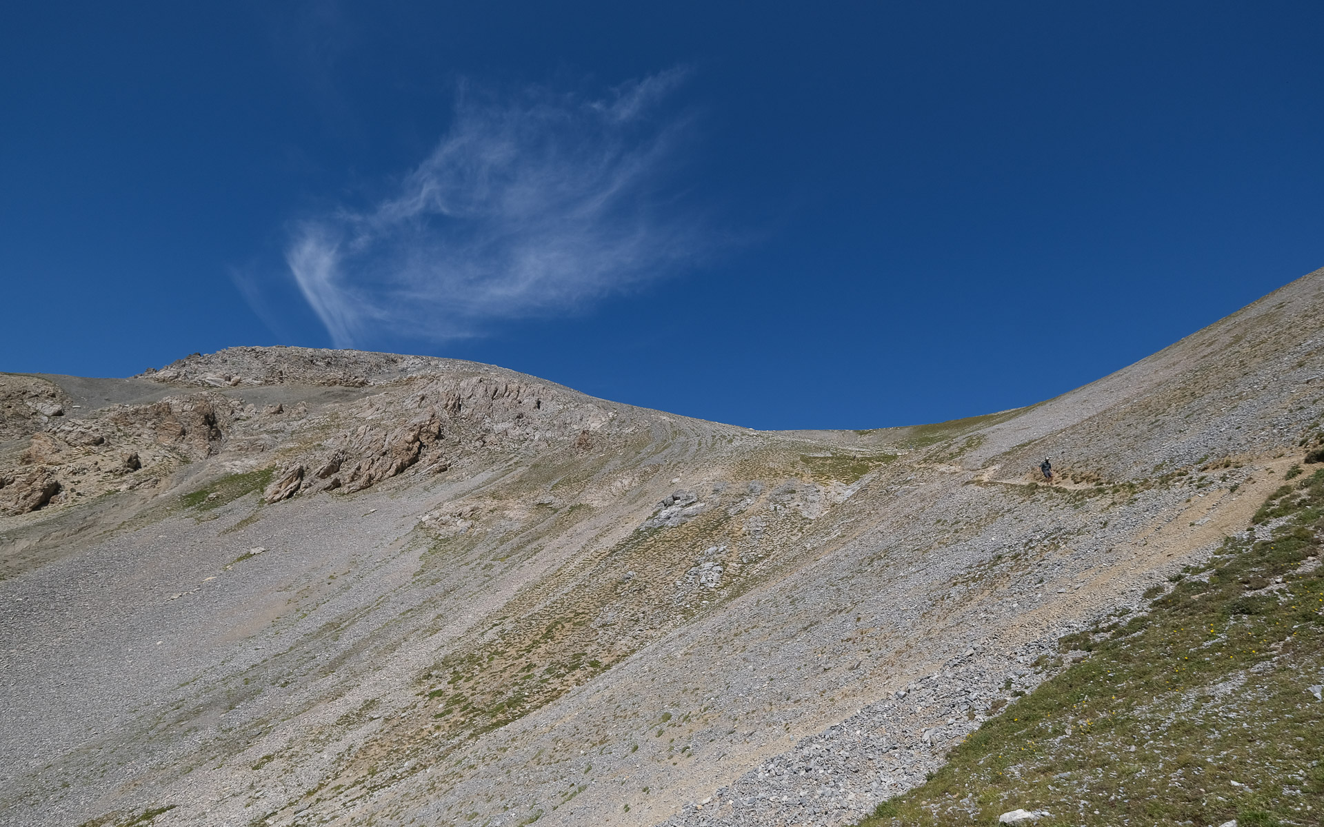
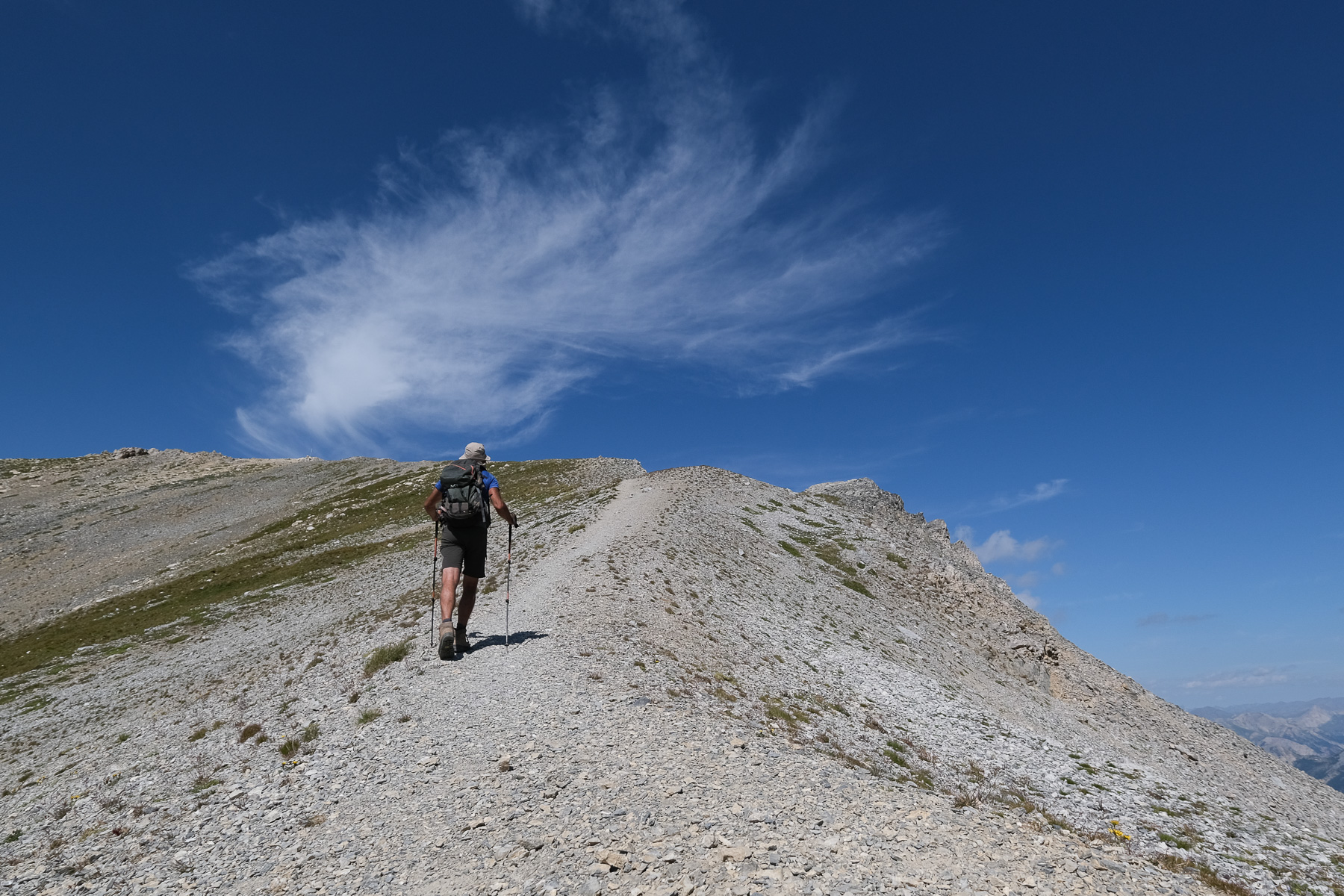
The hike forms a loop that climbs to Lac de Souliers before skirting the Sommet du tronchet on the east side. This is the basic itinerary. It is very well signposted and the trails are well marked. As an option, starting from Lac de Souliers, you can climb the Pic Ouest de Côte Belle either on an out-and-back route (slightly difficult) or with a short off-trail loop (fairly difficult). The latter option is reserved for experienced hikers.

Basic itinerary: lac de Souliers, bergerie de Souliers, col du tronchet (2h to 2h30)

From the parking lot, cross the road and climb through the forest on the wide, well-trodden path towards Lac de Souliers and Col de Tronchet. It climbs gently and crosses to the south-east. Further on, the path skirts a ridge to leave the forest. You can now see the grassy valley between the Tronchet ridge and the Coste Belle ridge. You soon come to a fork with yellow signs. To the right is the path from the Col du Tronchet (return), and to the left as you climb, the route to Lac de Souliers.

Go left up the open valley to reach the beautiful Lac de Souliers, nestled in a small basin. On the west side, you can see the path leading to the Pic de Cote Belle, while on the south side, a path follows an obvious ridge up to the summit of Tronchet.

To continue the route, skirt round Lac de Souliers and follow the path which descends gently to the east and then heads due south. It descends more steeply at the foot of a scree and then joins the forest. Continue downhill until you come to a clearing and a long flat where you'll find a double sail-shaped structure just behind the Bergerie de Souliers.

Descend a little further below the Bergerie, where you'll find a fork in the road leading due west to the Col de tronchet via the Tegneytes ravine. After a rather steep, sustained climb through forest and clearing, the path passes the Col de Tronchet. Switch to the opposite side and cross, remaining more or less level, to finally reach the start of the loop under Lac de Souliers.
Optional loop: Ascent of Pic Ouest de Côte Belle (2854m, 1h30)

Take the clearly visible path up a small valley to the north-west. Higher up, after crossing a large, steep scree, the path soon reaches the ridge between the Pic Est and Pic Ouest. Follow this airy ridge westwards to reach the summit at 2854m without difficulty. Exceptional panoramic views of Casse Déserte below, the Arvieux valley and the Écrins massif in the background. From here, turn around and retrace your steps for a one-way return trip.

To complete the small loop, walk along the ridge from the Pic Ouest and southwards to pass the Antécime. Continue off-piste, staying on the ridge as it descends slightly. At the first shoulder, switch to the east via a steep corridor of grass and small stones. Descend carefully, staying on the right-hand side at the start and crossing below to pass under a characteristic slab. This is off-piste, but the route is obvious as you can see Lac de Souliers below. Below the slab, follow the small ridge to the end and cross the rocky clusters without too much difficulty. Finish by gently unclimbing to avoid falling rocks, on fairly unstable terrain, to arrive above Lac de Souliers.

Ressources

Topo of the ascent of Pic de Cote Belle on altituderando
Topos of the ascent of Pic de Cote Belle on SkiTour

Photos

Commentaires

Leave a Reply

Basic HTML is allowed. Your email address will not be published.

Subscribe to this comment feed via RSS