


TOPO Via ferrata | CLIMBING7.COM
Publié le
 Partager sur WhatsApp
 Partager sur Twitter
Partager sur Instagram
Partager sur Twitter
Partager sur Instagram

 Partager sur Facebook
 Imprimer le topo
 Laisser un commentaire

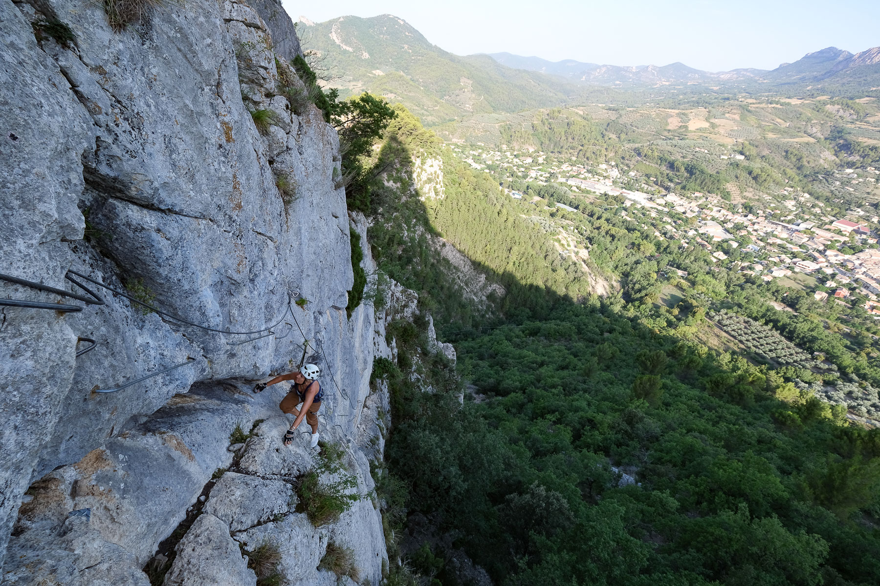
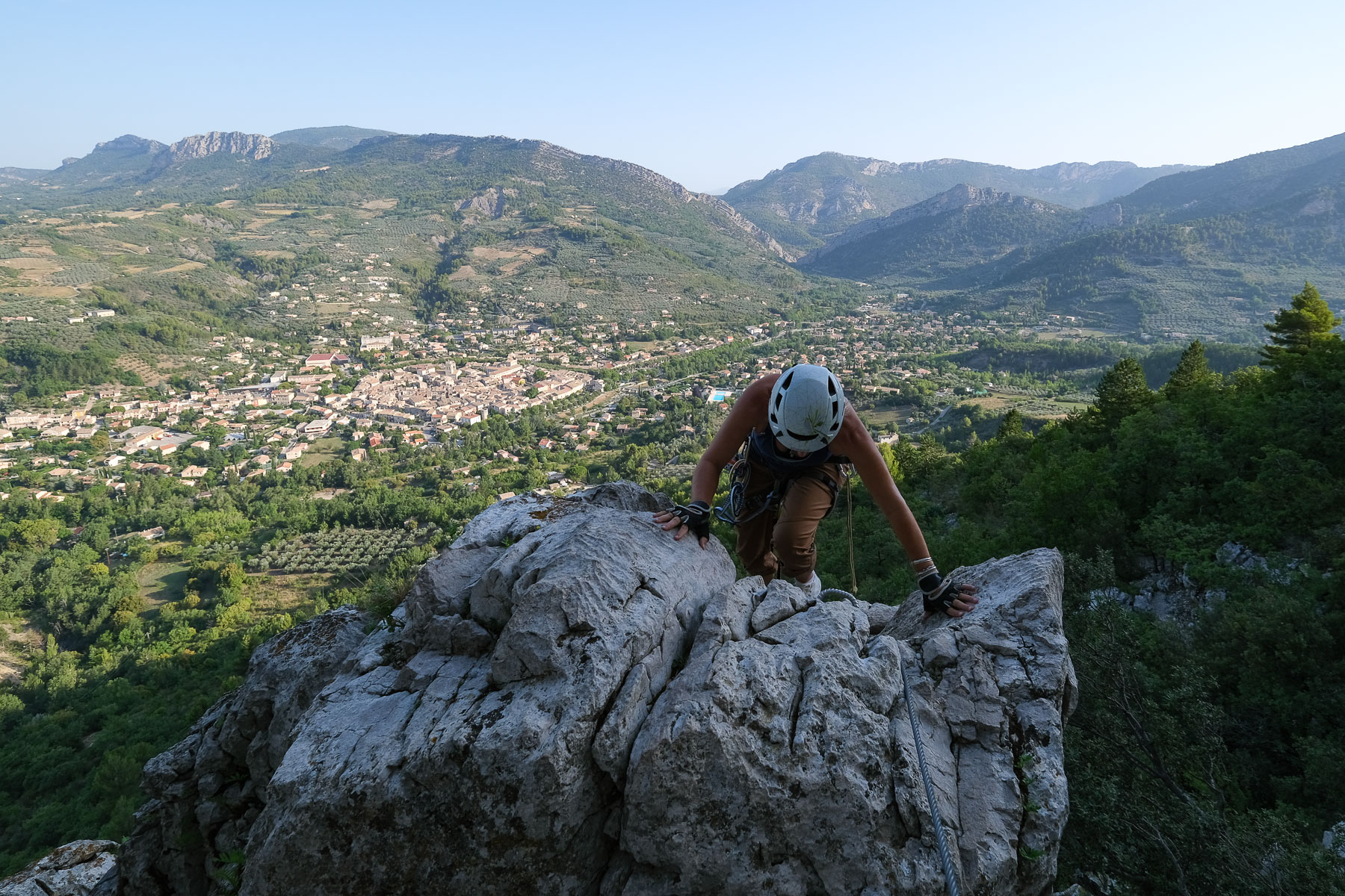
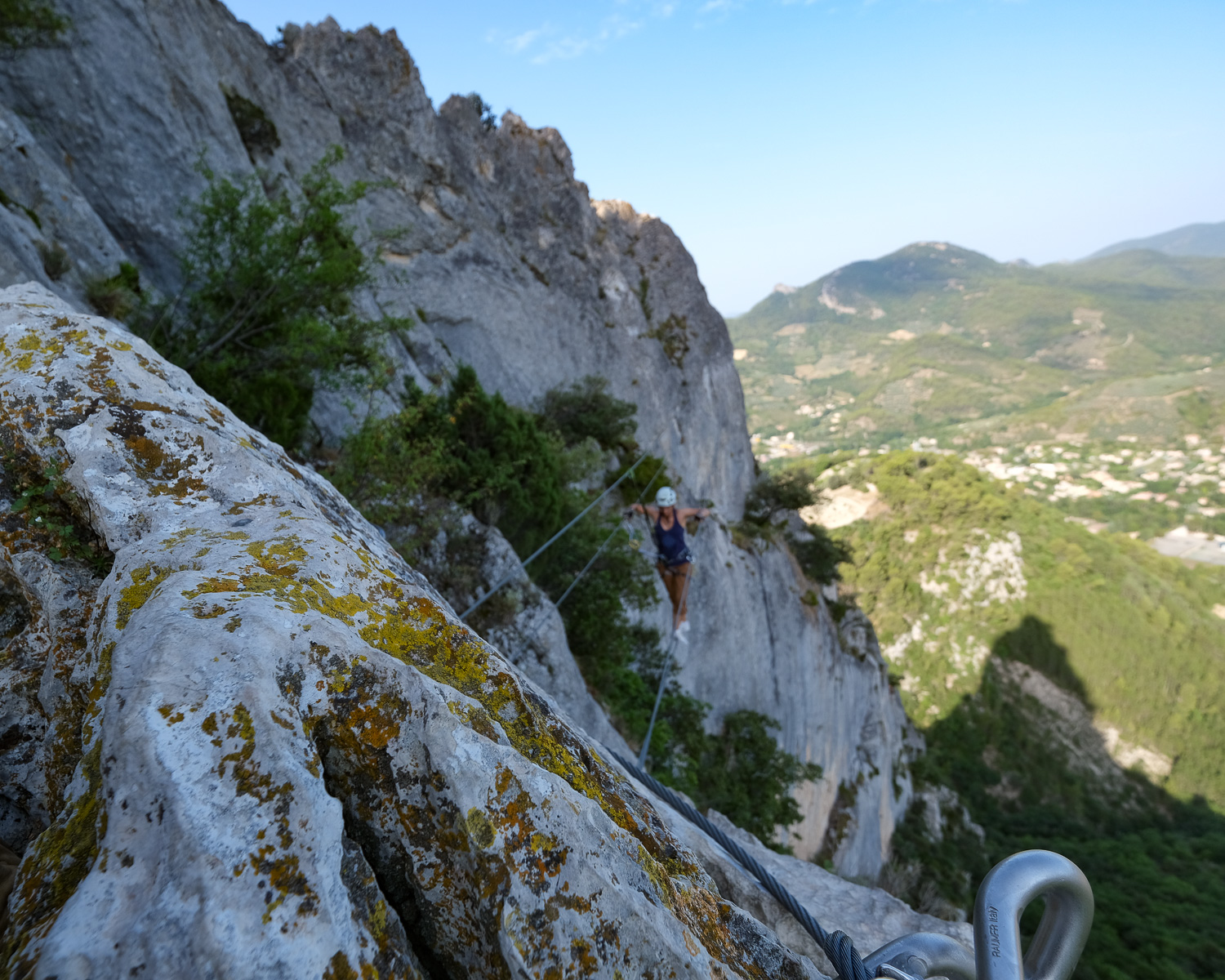
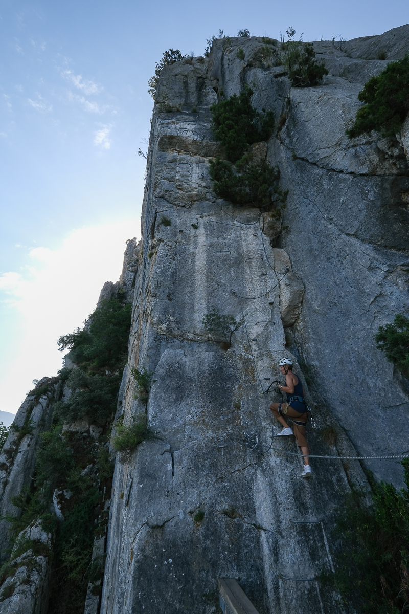
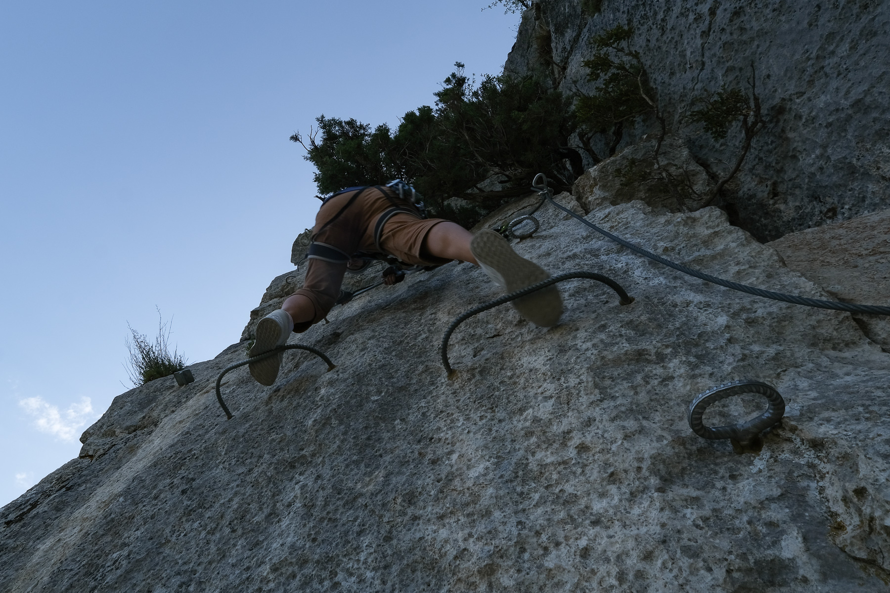
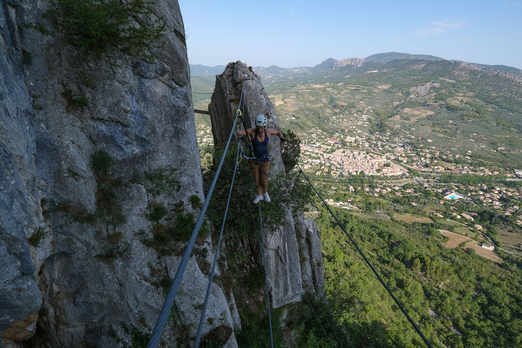
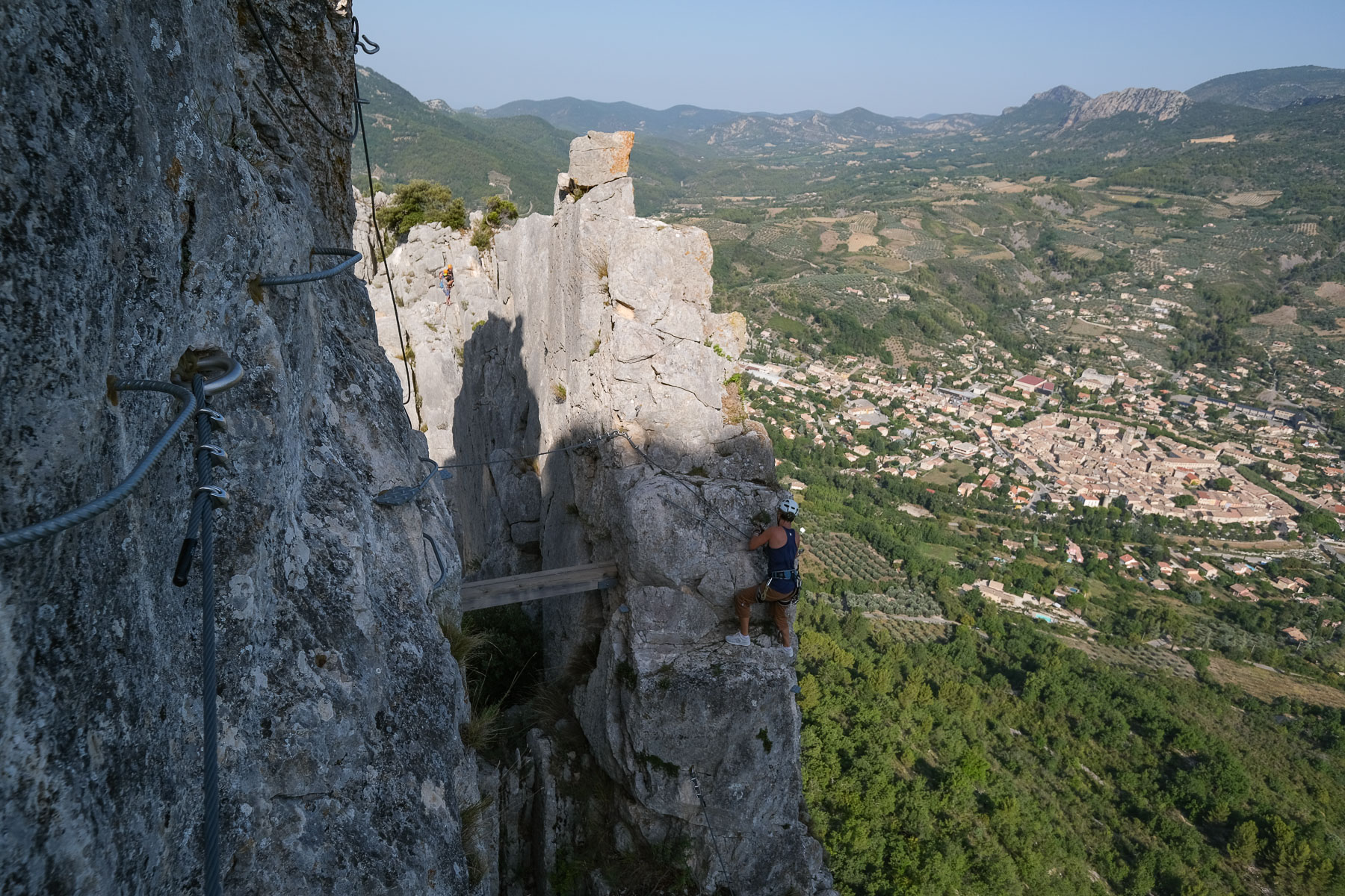
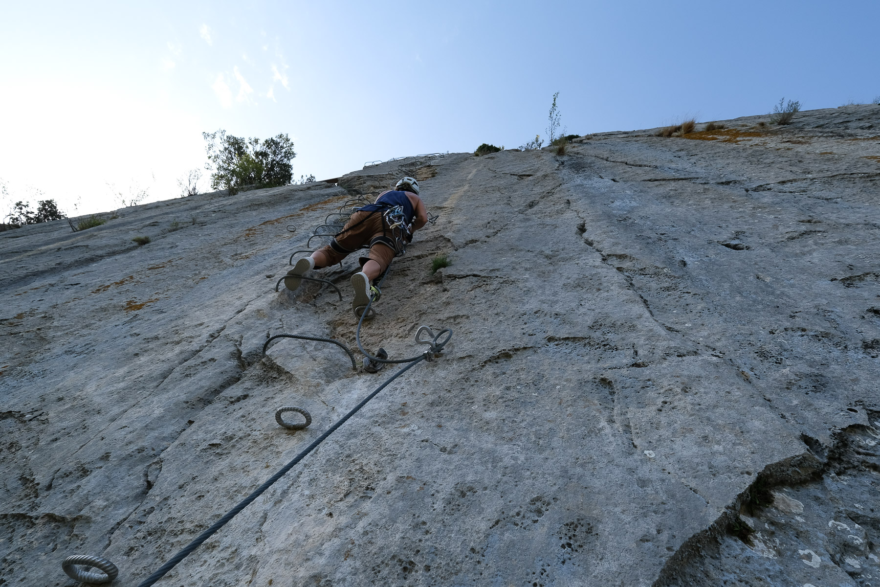
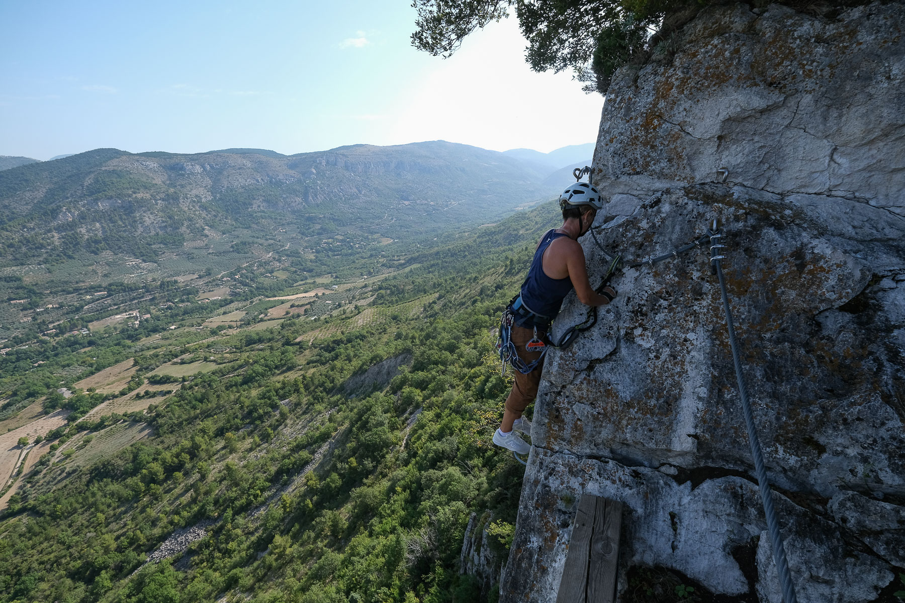
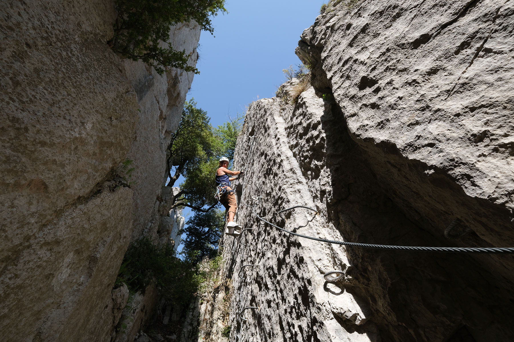
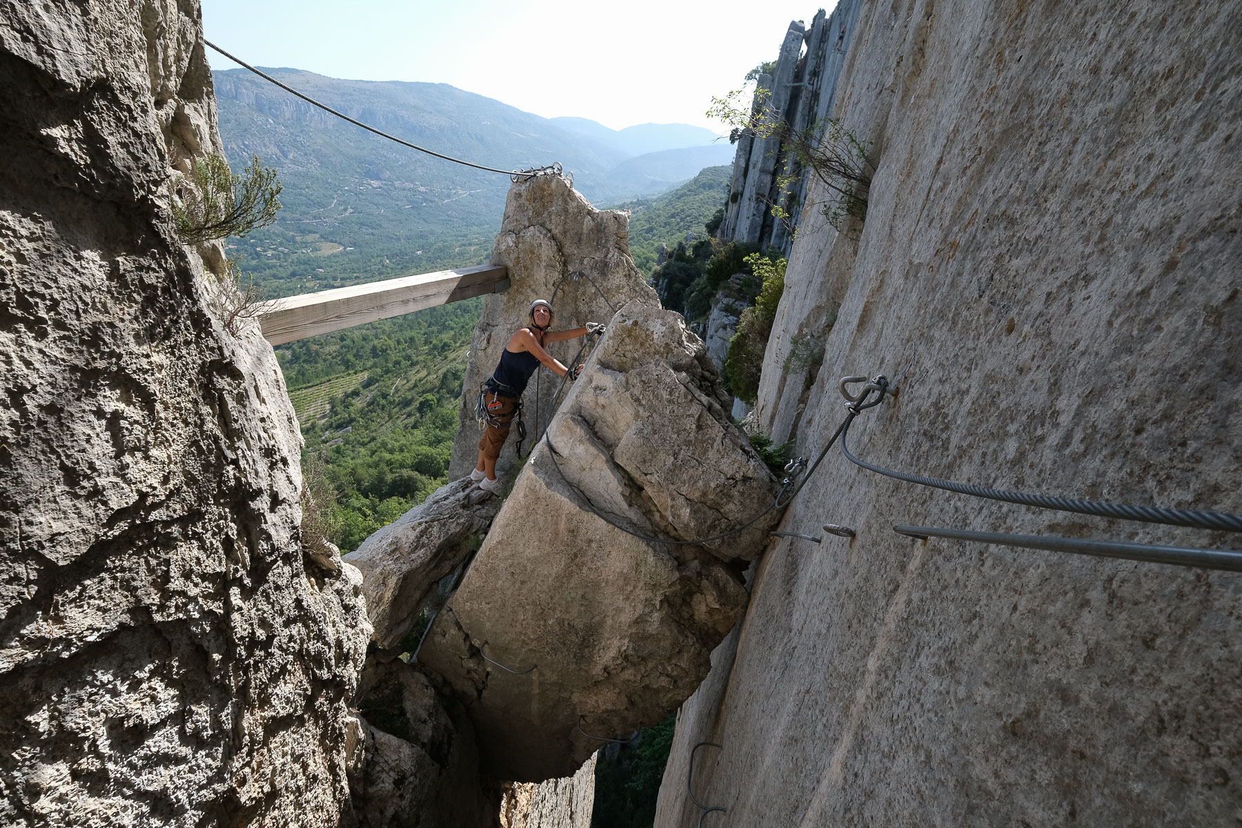
Traced on the Rocher Saint-Julien above Buis-les-Baronnies, 4 itineraries are proposed to take advantage of an exceptional rock and an aerial panorama over the village and the entrance to the Gorges d'Ubrieux: an introductory itinerary and three routes rated Difficult to Very Difficult on the central wall. Starting on the west side, we were able to test the Testouriasso and Roumpo Quiéu routes, for a sporty and sustained sequence of fun, varied and aerial climbs. The 3rd route, the Tihousso, has yet to be discovered and starts on the east side. Steep sections, overhanging traverses, monkey bridges and footbridges are the order of the day, with the help of very generous equipment and in complete safety. The wall is generally north-facing, but in summer, it's best to climb the routes on the west side in the morning and the east side in the afternoon, to avoid drying out in the hot sun.
❱❱ Technical summary
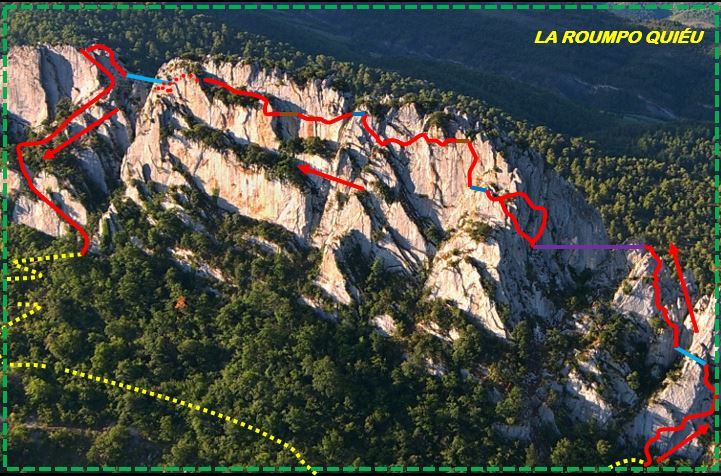
The data below relates to the 2 routes: Testouriasso (blue) / Roumpo Quiéu (black).
■ S tarting point: Rocher Saint-Julien, Buis-les-Baronnies, Drôme (26)
■ Type of route: via ferrata with several routes at different levels.
■ Direction: north
■ Length: 1100 m (460m + 640m)
■ Positive vertical drop: 140m
■ Estimated total time: 4h to 5h
■ Min and max altitude: 480 m / 680 m
■ Equipment in place: excellent, 3 Nepalese bridges, 1 wall beam, 2 beams, 1 monkey bridge, 3 monkey bridges, 1 zip line not mandatory
■ Equipment required: standard equipment
Difficulty: D or K4 / D+ or K4+ (TD or K5 not compulsory)
❱❱ Access to the place
Buis-les-Baronnies lies to the northeast of Vaison-la-Romaine, on the banks of the Ouvèze river, in the southern Drôme region. In Buis-les-Baronnies, climb up to the unmissable Rocher Saint-Julien and park either at the Pitchouno trailhead (limited space) or higher up at the Rieuchaud ravine parking lot.
❱❱ Map & topo


❱❱ Itinéraire
Return to the Pitchouno parking lot and walk a few metres downhill to find the path leading to the start of the Testouriasso, blue route. An information panel at the start. The path climbs steeply and in small switchbacks. Further up, look for the fork in the path leading to the wall.
The 2 routes can be linked, as the end of the Testouriasso route crosses the start of the Roumpo Quiéu. Even though the latter is rated D+ whereas the former is D, we found them to be of comparable difficulty, with the latter a little more challenging, except for the small section of overhanging terrain in the Roumpo Quiéu, rated ED (more like TD for us), but avoidable. The whole route is generally horizontal, with alternating ascents, traverses and descents.
Descend in a couloir, then pass equipped jumps and a small final wall before rejoining the path. Follow it downhill until you cross the road from Buis-les-Baronnies. Follow the road back up to the starting parking lot.
Web page dedicated to the Buis-les-Baronnies via ferrata.


Leave a Reply