A little to the south of Santa Marta, the village of Minca takes advantage of its relative altitude to offer a tropical atmosphere without the heat of the coast. The proposed itinerary leads over the first heights of the Sierra Nevada until reaching a small ridge that juts out to the north to form a viewpoint overlooking the bay of Santa Marta and the Caribbean Sea in the distance. On the way back, the trail plunges back into the rainforest, passing several small fincas before heading for the Pozo Azul, a small pool at the foot of a waterfall, accessible by road and therefore often overcrowded, especially at weekends. Not an unforgettable loop, but ideal for stretching your legs in the cool.
❱❱ Technical summary
■ S tarting point: village of Minca, Magdalena department, Sierra Nevada Massif, northern Colombia.
■ Type of route: mid-mountain loop hike
■ Distance: 14 km
■ Cumulative elevation gain: +675 m
■ Cumulative negative altitude gain: -675 m
■ Estimated total time: 4h to 5h ■ Min and max altitude: 650 m / 1350 m
■ Marking: none, but well-marked trails, occasional signs. GPS tracking is useful, as the route combines several trails that are not always easy to connect.
■ Equipment in place: none
■ Equipment required: useful GPS track, water
Difficulty: 1 or 2 short steep sections before reaching the mirador, where you have to use your hands in the earth or with roots.
❱❱ Access to the place
In Santa Marta, go to the Mercado Publico where the small buses leave for Minca. 45' drive and you'll be dropped off in the village, at the bridge over the Rio Gaira. Tickets cost 9,000 pesos.
It's a long loop that can be shortened by avoiding the round trip to Pozo Azul at the end (unless you're sure no one will be there!). The return trip by road can also be avoided by catching one of the many motorcycles that pass by (2kms of rough road). There are shortcuts to cut you off on the way up, but otherwise there's only one possible route.
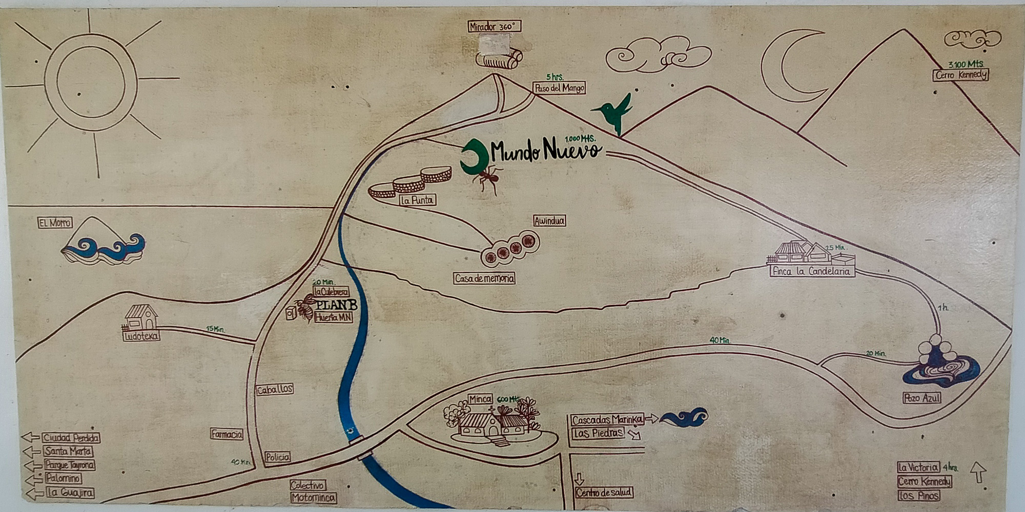
Part 1: from Minca to Mondo Nuevo (45')
From the bridge, walk out of the village towards Santa Marta and take the first right. Climb gently on this track until you come to the 1st big junction, already signposted Mondo Nuevo, Trekker Camping and cascadas Valhalla.
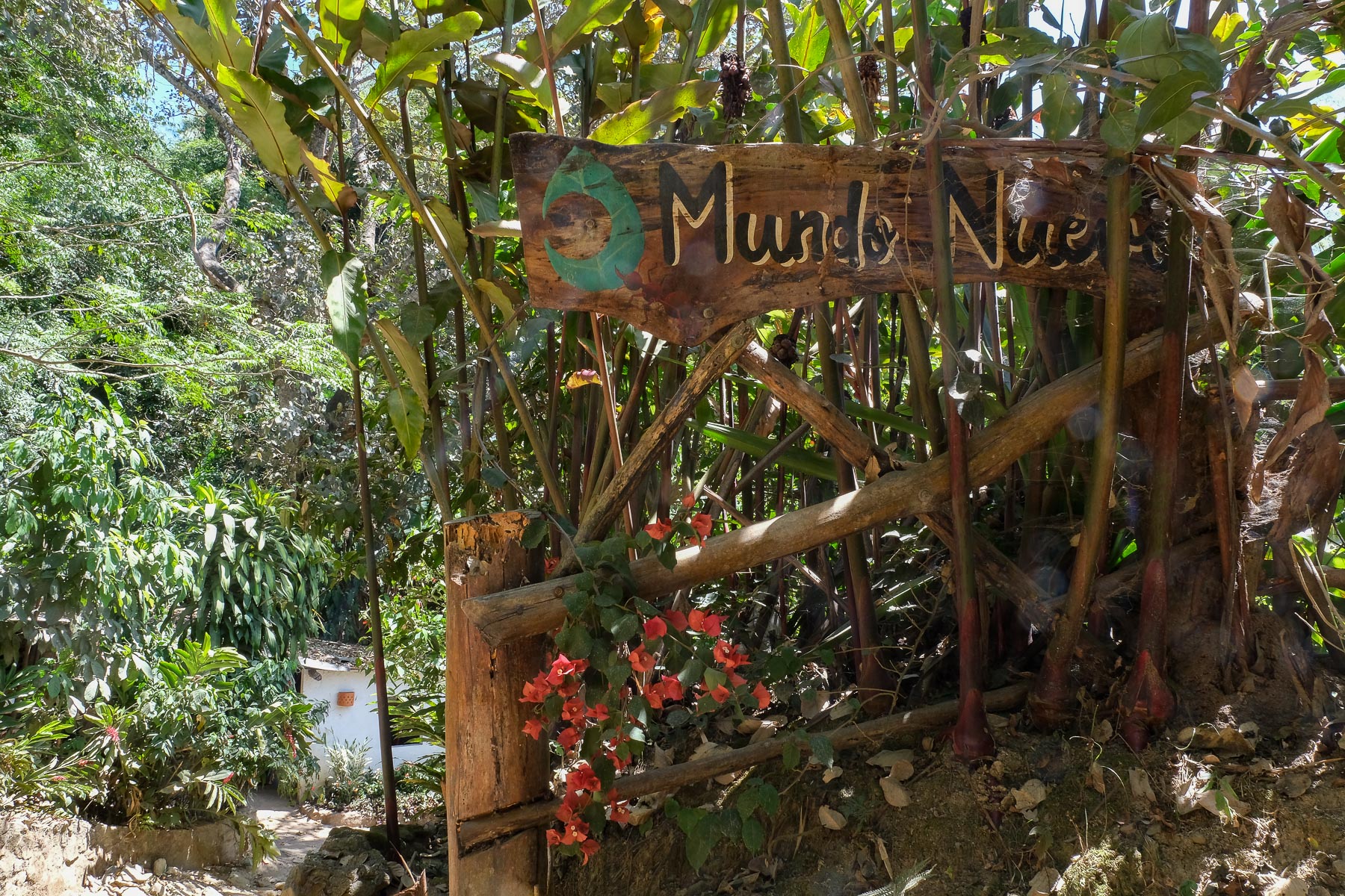
Continue along the track. It twists and turns rapidly upwards, giving you your first view of Santa Marta and the Caribbean in the distance. Before you reach Mondo Nuevo, there's a trail that cuts off to the left to emerge higher up. We end up on the track until we finally find the rather chic finca, with a beautiful view from its terrace. Break available.
Part 2: Mondo Nuevo to Mirador (45')
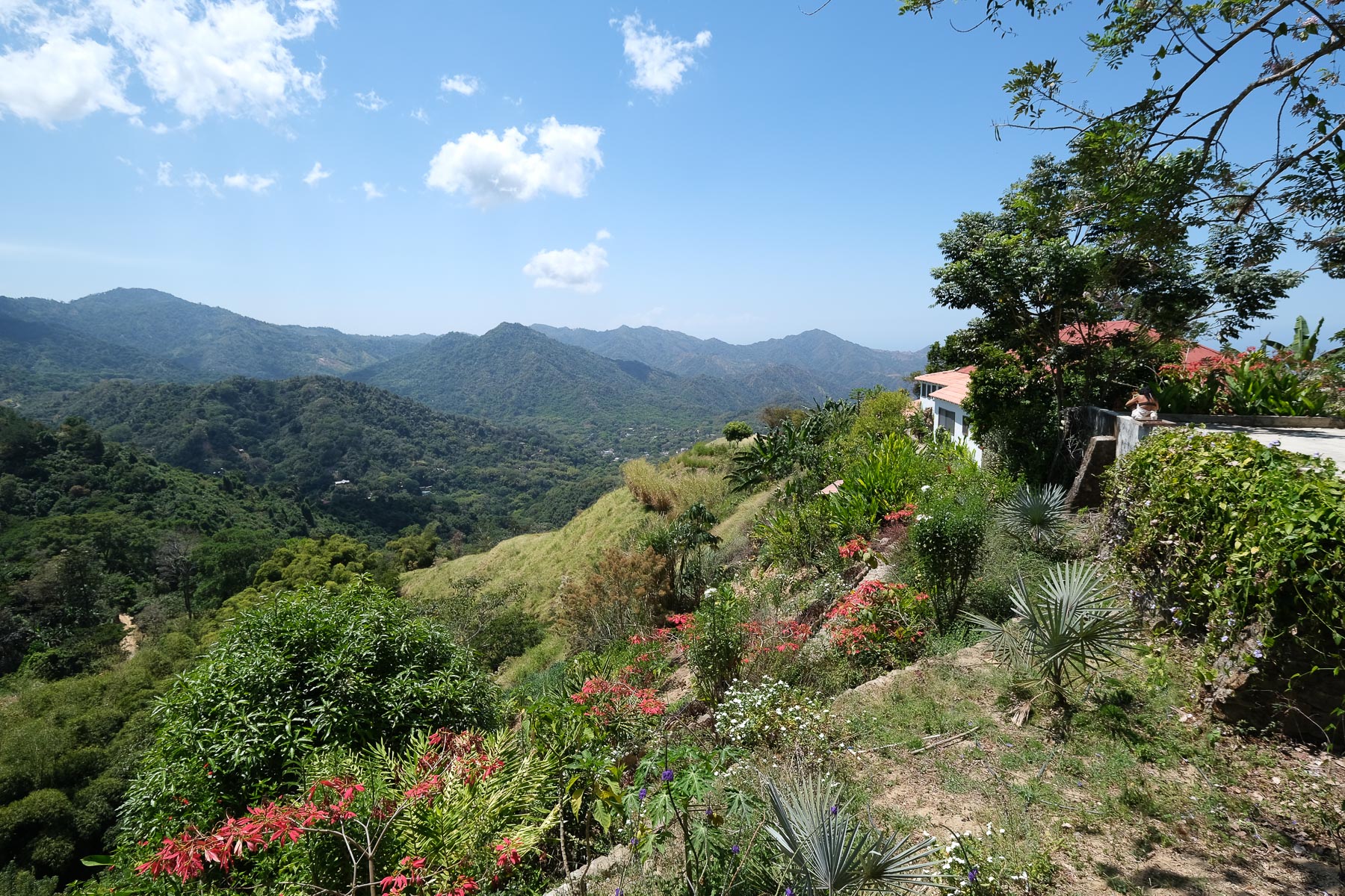
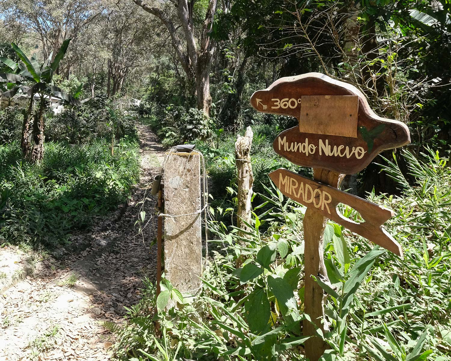
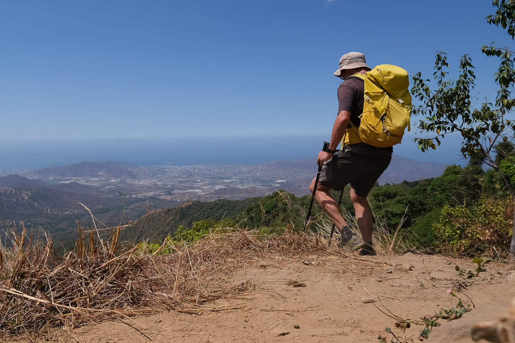
Return to the track and climb a little further to find a shortcut to the Mirador (sign) on the left. Follow a small path that passes between abandoned buildings, then climbs steeply to reach the main trail above. Turn left towards the Mirador, it's flat or nearly so, pass by a house on a bend in the road and continue in a northerly direction. Further on, at the point where the track really starts to go downhill, take the tiny path that climbs up on the left (signposted Mirador). Here, it climbs a little more, with 1 or 2 steep passages where you have to put your hands in the dirt. It ends on a kind of ridge that juts out to the north. At the end, there's a lovely view of Santa Marta Bay.
3rd part: from mirador to Candelaria (1h)
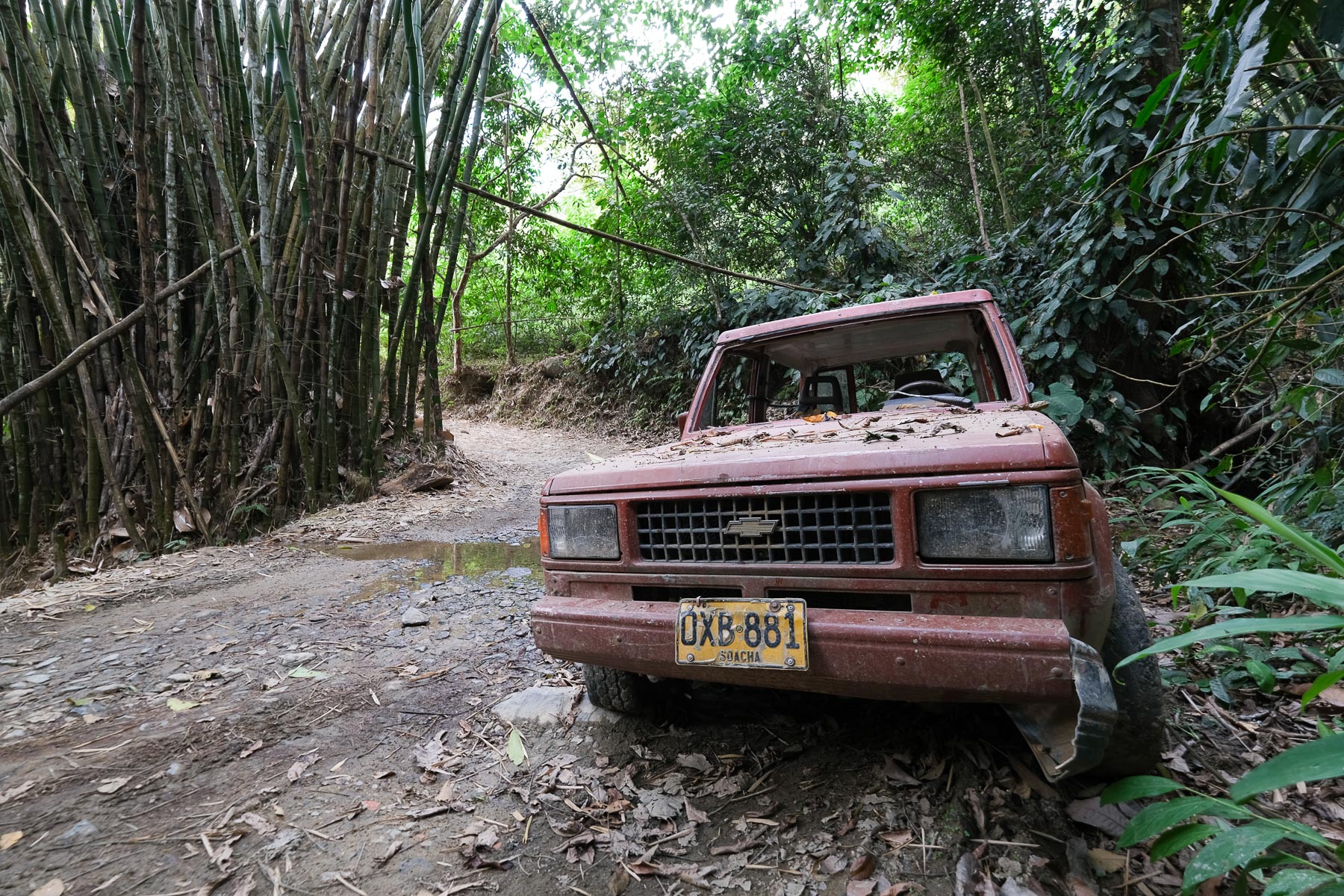
Return to Mondo Nuevo by the same route or avoid the shortcut (stay on the track and turn right at the crossroads). Once back below Mondo Nuevo, don't take the shortcut again, but continue on the trail. Pass several small streams in the forest, pass a 4x4 wreck (photo). Further on, fork left at Paso del Mango and climb up to Finca Candelaria, where you can take a 2nd break for local coffee and chocolate muffins.
Part 4: Candelaria to Pozo Azul (1h)
Leave the Finca and turn right towards Pozo Azul (photo). The little forest path descends steadily, passing through private property (2000 pesos right-of-way fee for 50m!). Just after, take the track towards Valhala. You'll pass through an inhabited area, with slightly aggressive dogs (keep them away by pretending to pick up a stone), where the scent is less visible. Exit on the other side and continue for a while before crossing the Rio Gaira on a minimal bamboo bridge. Climb back up on the opposite side and keep going until you cross the main track leading from the road to Pozo Azul. It's crowded again, lots of people! Another 15 to 20 flat steps to the pozo.
Back to Minca: from Pozo Azul, return on the track to the road (20'), then another 2 km of road. Check out a motorcycle that can get you back to Minca more quickly for a few thousand pesos.


 Partager sur WhatsApp
 Partager sur Twitter
Partager sur Instagram
Partager sur Twitter
Partager sur Instagram

 Partager sur Facebook
 Imprimer le topo
 Laisser un commentaire


Leave a Reply