


TOPO Via ferrata | CLIMBING7.COM
Publié le
 Partager sur WhatsApp
 Partager sur Twitter
Partager sur Instagram
Partager sur Twitter
Partager sur Instagram

 Partager sur Facebook
 Imprimer le topo
 Laisser un commentaire

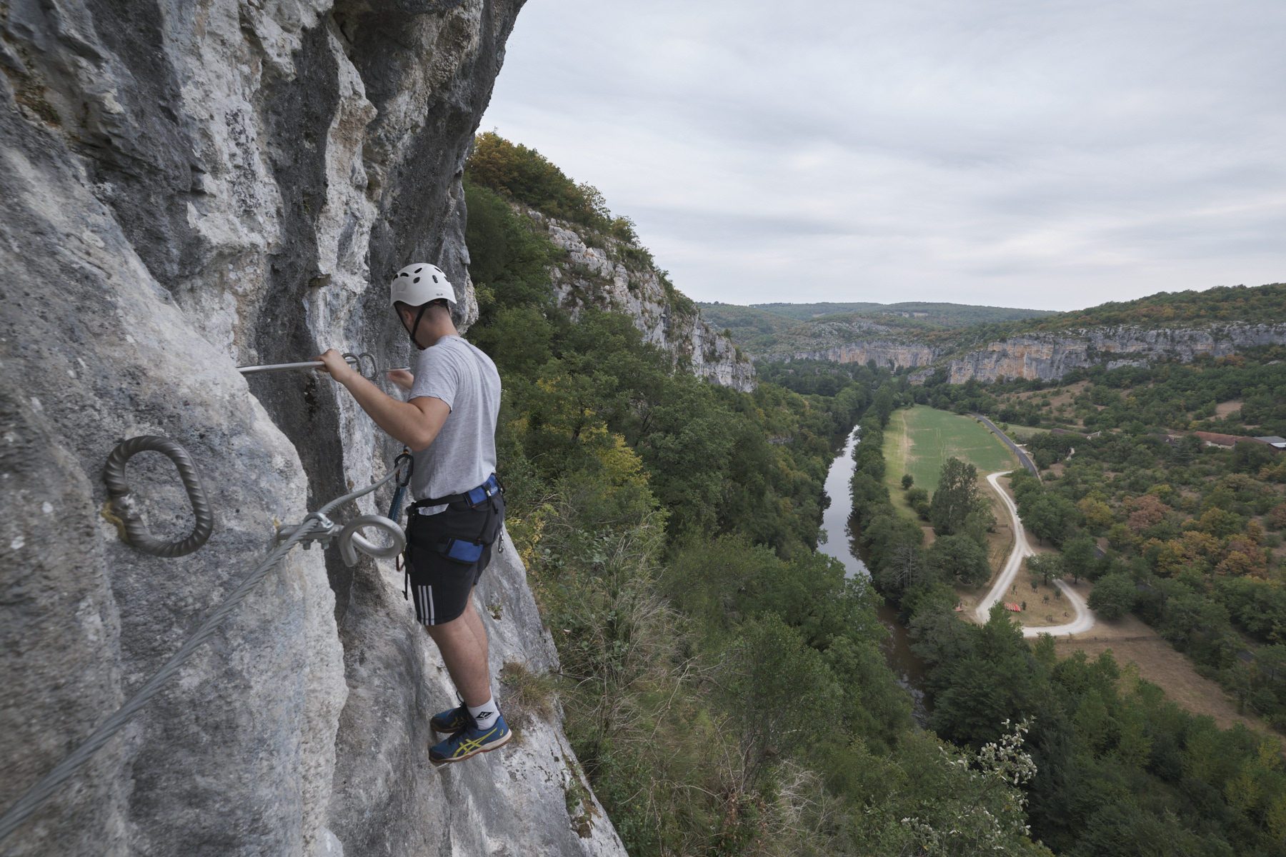
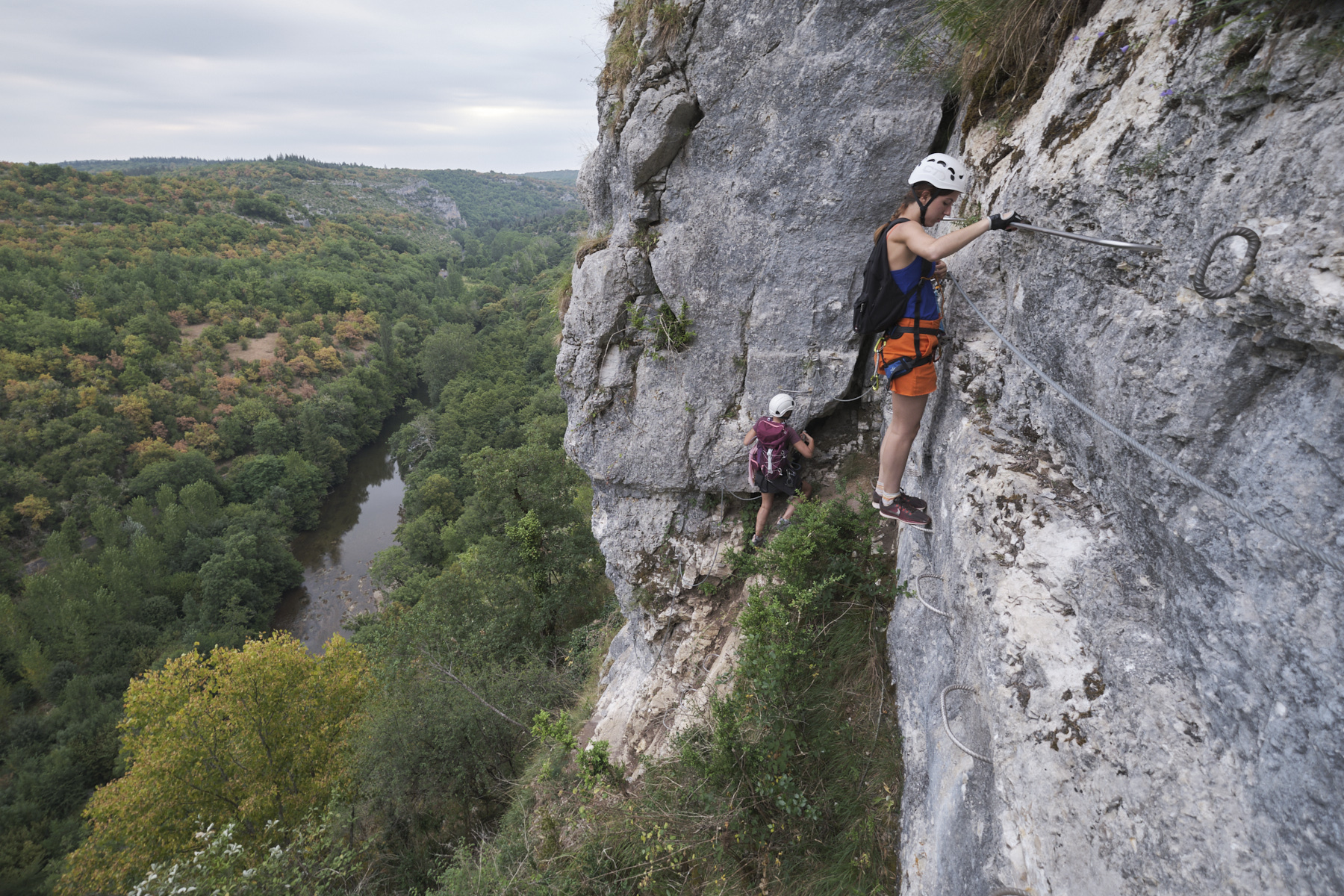
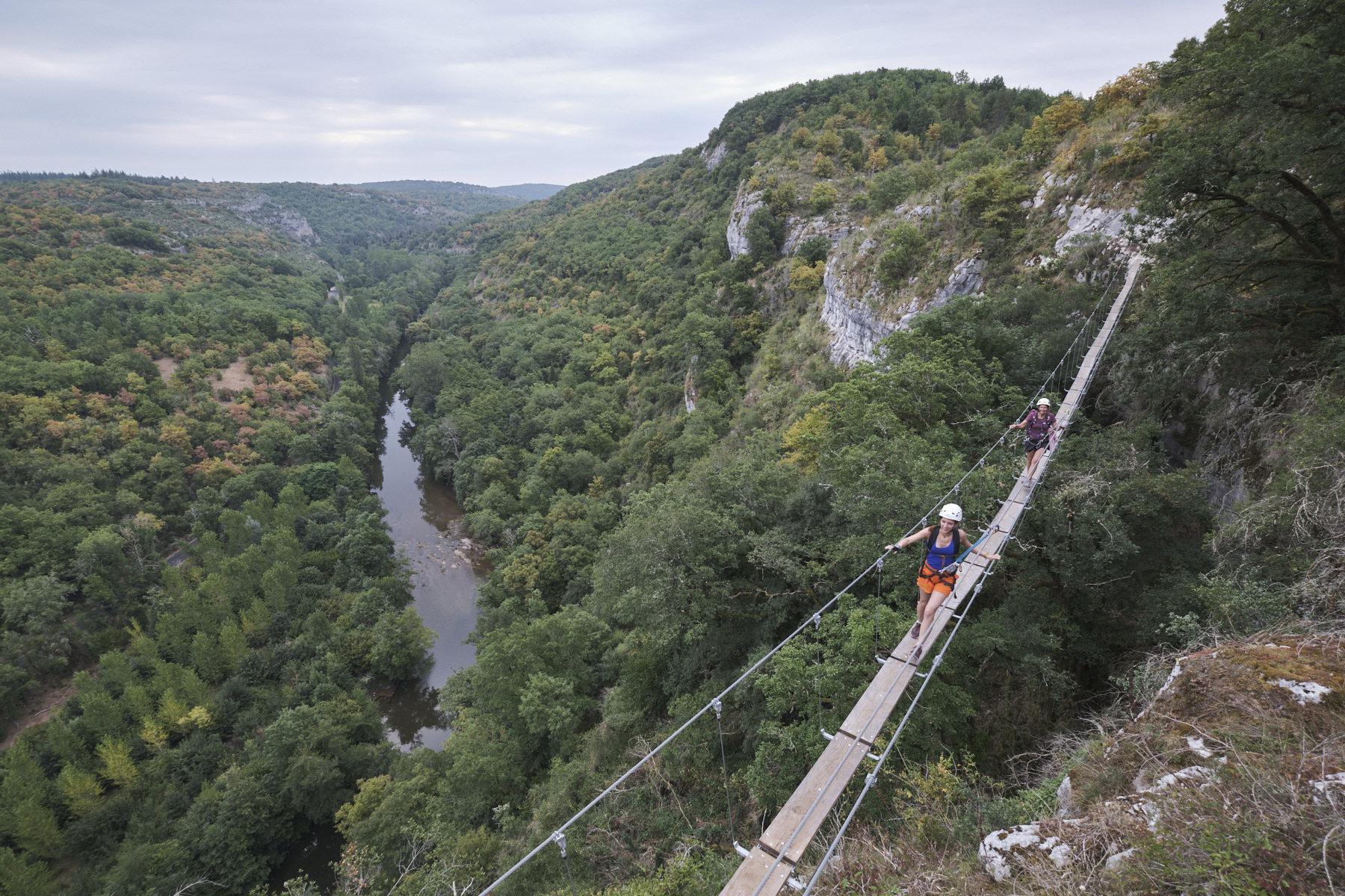
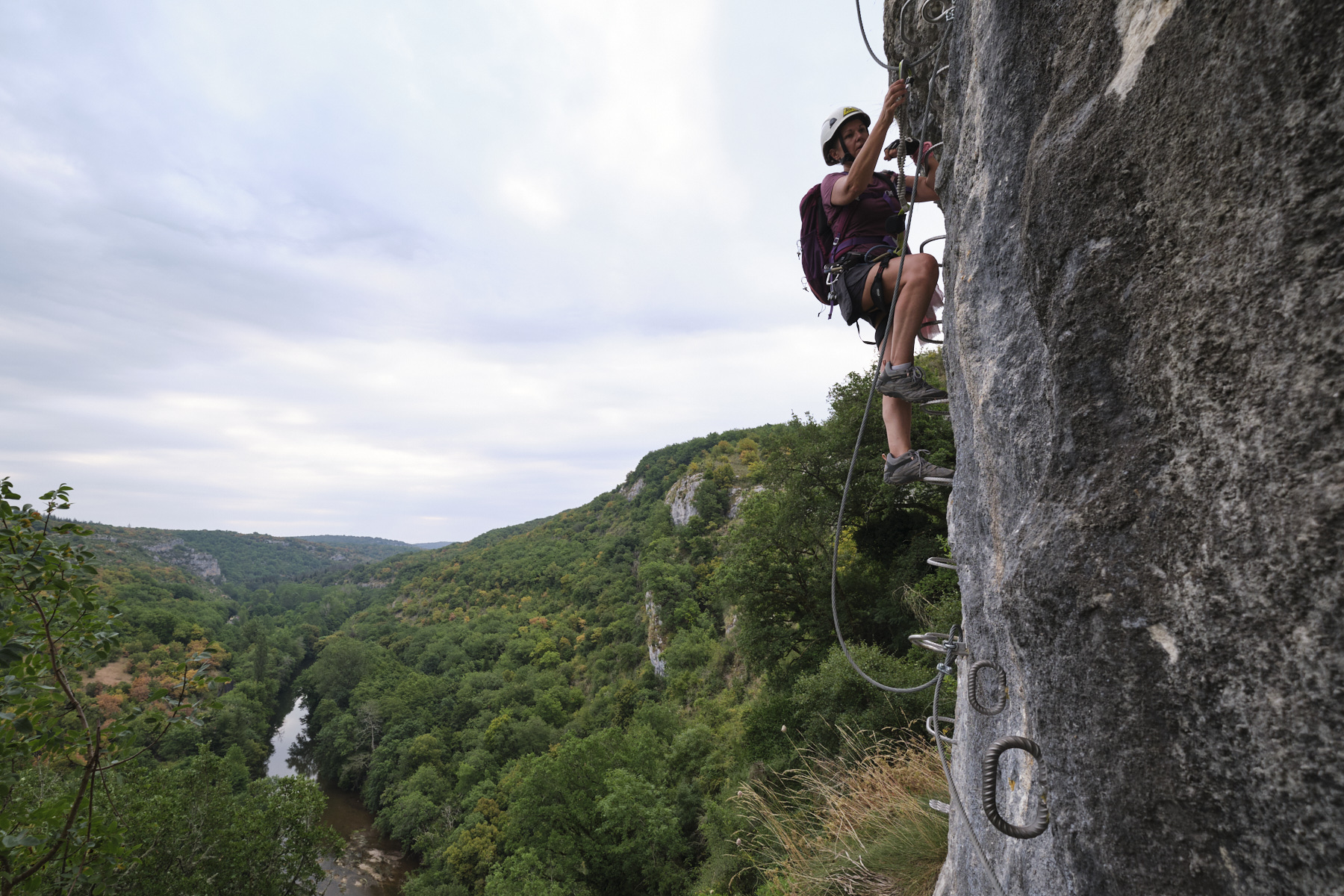
Somewhere between Cahors and Figeac, in the heart of the Lot region, the Liauzu via ferrata was recently opened and offers 2 routes overlooking the Célé valley: the short and not too difficult Perce-Pierres route and the longer and more challenging Dièdre Blanc route. More than generously equipped, the itinerary proposed for the difficult route consists of a long cliffside traverse with a first, not too difficult, main section and a second, shorter but more athletic section with 2 or 3 overhanging, aerial passages that are a real handful. With a large footbridge and a Nepalese bridge almost 30m long, the Dièdre Blanc route is a great option in the region, and can be combined with a kayak trip down the Célé, a visit to the superb medieval town of Figeac or a trip to the village of Saint Cirq-Lapopie a little further south.
❱❱ Technical summary
The guidebook describes the Dièdre Blanc route, the central part of which borrows a section of the Perce-Pierres route.
■ S tarting point: near Cabrerets, north-east of Cahors, south-west of Figeac, Lot (46)
■ Type of route: via ferrata, Perce-Pierres route and Dièdre Blanc route
■ Direction: north-east
■ Length: 210 m (Perce-Pierre) or 490 m (Dièdre Blanc)
■ Positive vertical drop: +130 m
■ Estimated total time: 2h to 3h
■ Min and max altitude: 220 m / 300 m
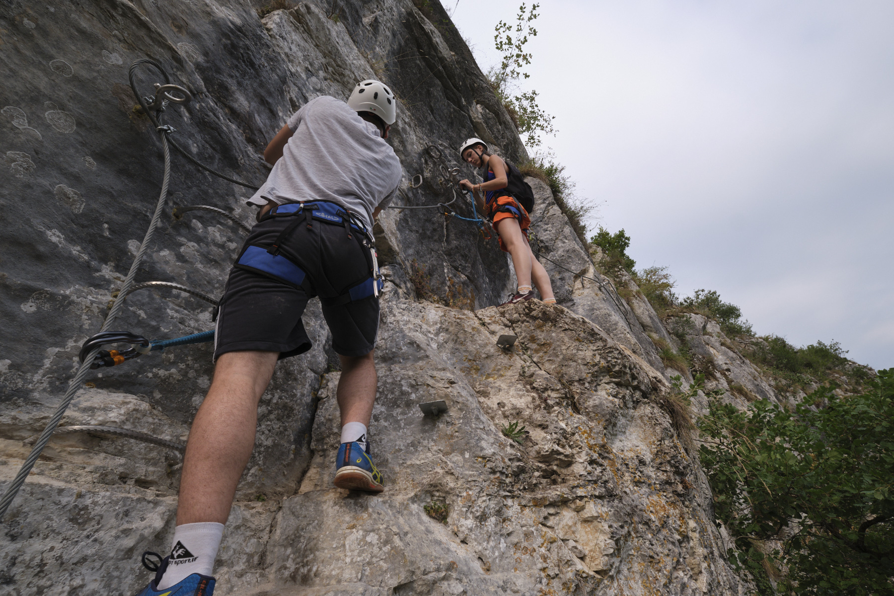
■ Equipment in place: rungs, pedals, wooden platforms, footbridge and monkey bridge
■ Equipment required: standard equipment
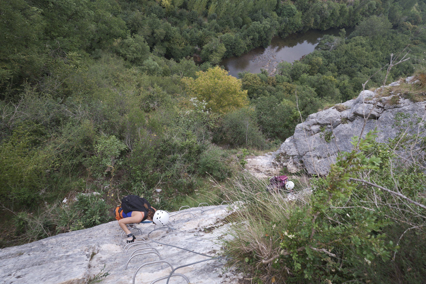
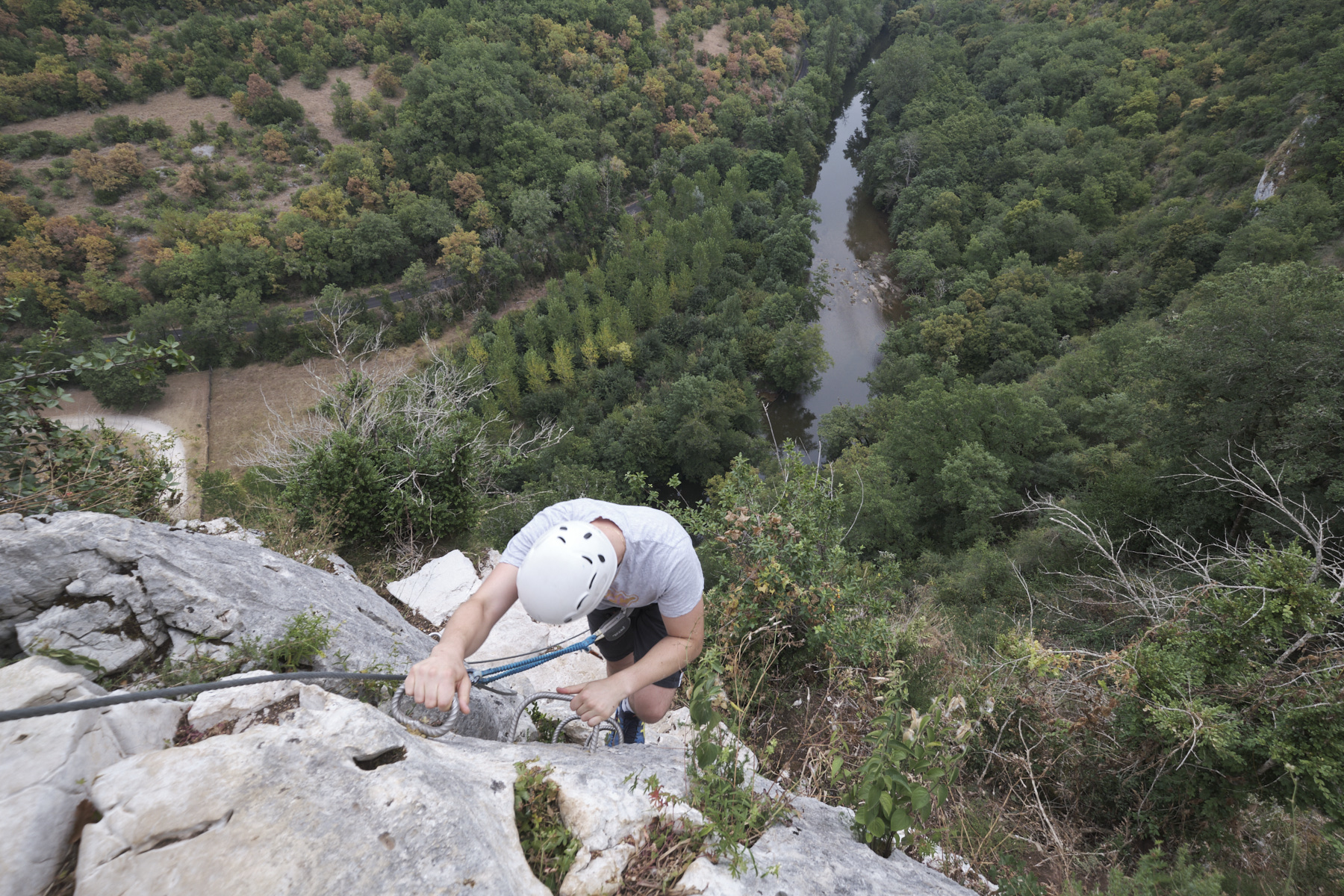
Difficulties: Perce-Pierre route level PD - Dièdre Blanc route level D/D+ with 1 footbridge and 1 Nepalese bridge - 3 short aerial passages with slight overhangs
❱❱ Access to the place
From Figeac, take the D41 along the Célé, passing Boussac, Espagnac, Brengues, Marcilhac then Sauliac-sur-Célé. Continue in the direction of Cabrerets and about halfway along, in a right-hand bend, park in the Liauzu parking lot.
❱❱ Map & topo
Voir en plein écran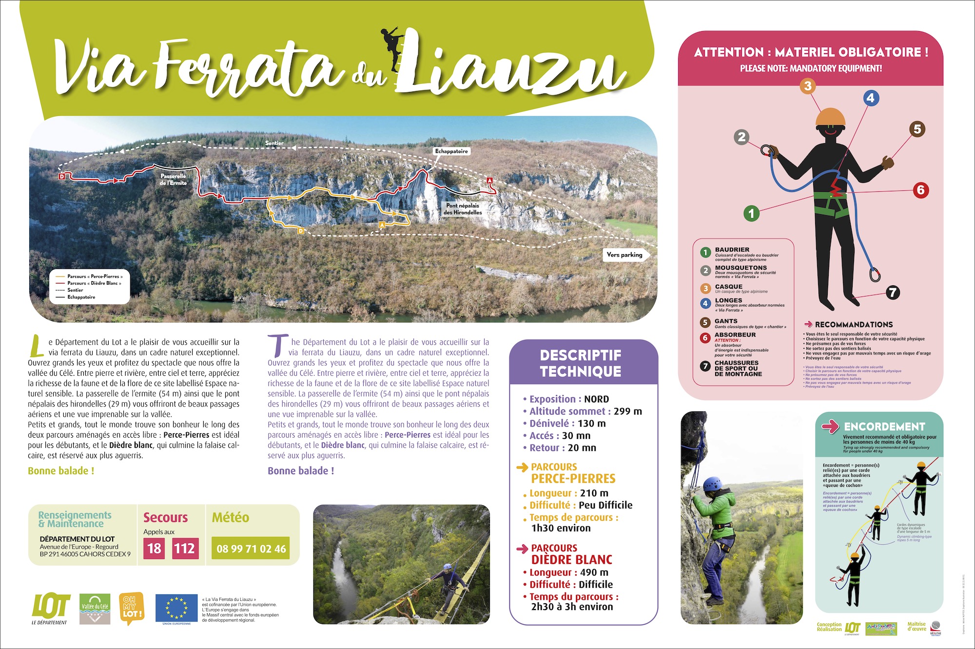
❱❱ Itinéraire
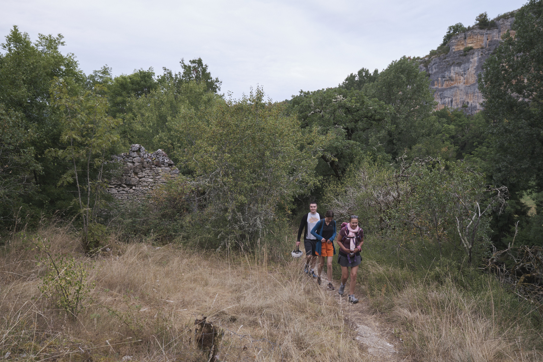
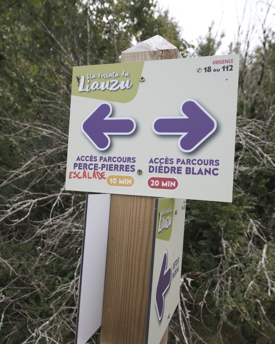
The starting points for the 2 ferratas are well signposted. From the parking lot, cross the Célé by the metal footbridge, where you'll find a sign for the via ferrata on your left. Follow the narrow path alongside the river and, after going up a large field, it climbs a little with 2 or 3 switchbacks. The easy Perce-Pierres route forks off to the left. Continue straight on uphill. After a few twists and turns in a slightly steeper forest, the path finally joins a track. Turn left and walk for a few minutes on level ground or slightly downhill. Keep an eye out on the left for a small path which descends to reach the start of the Dièdre Blanc ferrata in 2'. We're right above the Célé, not yet on the cliff. There's a large information panel and the first equipment.
This section describes the difficult Dièdre Blanc route. It can be divided into 2 parts: the first, long and not very difficult (AD max), which includes the central traverse of the easy route, and the second, shorter but more difficult (D/D+ max) with 3 short, more athletic passages. There's an escape route at the end to avoid the final Nepalese bridge.
From the end of the Dièdre Blanc, follow the path back to the approach trail, just before the junction with the track. Walk back down to the parking lot in the opposite direction.
Official via ferrata page on the Lot website.


Leave a Reply