


TOPO Hiking | CLIMBING7.COM
Publié le
 Partager sur WhatsApp
 Partager sur Twitter
Partager sur Instagram
Partager sur Twitter
Partager sur Instagram

 Partager sur Facebook
 Imprimer le topo
 Laisser un commentaire

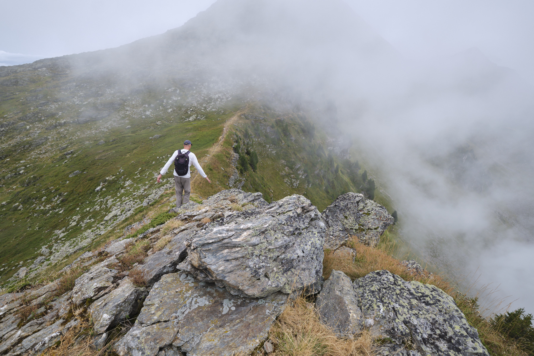
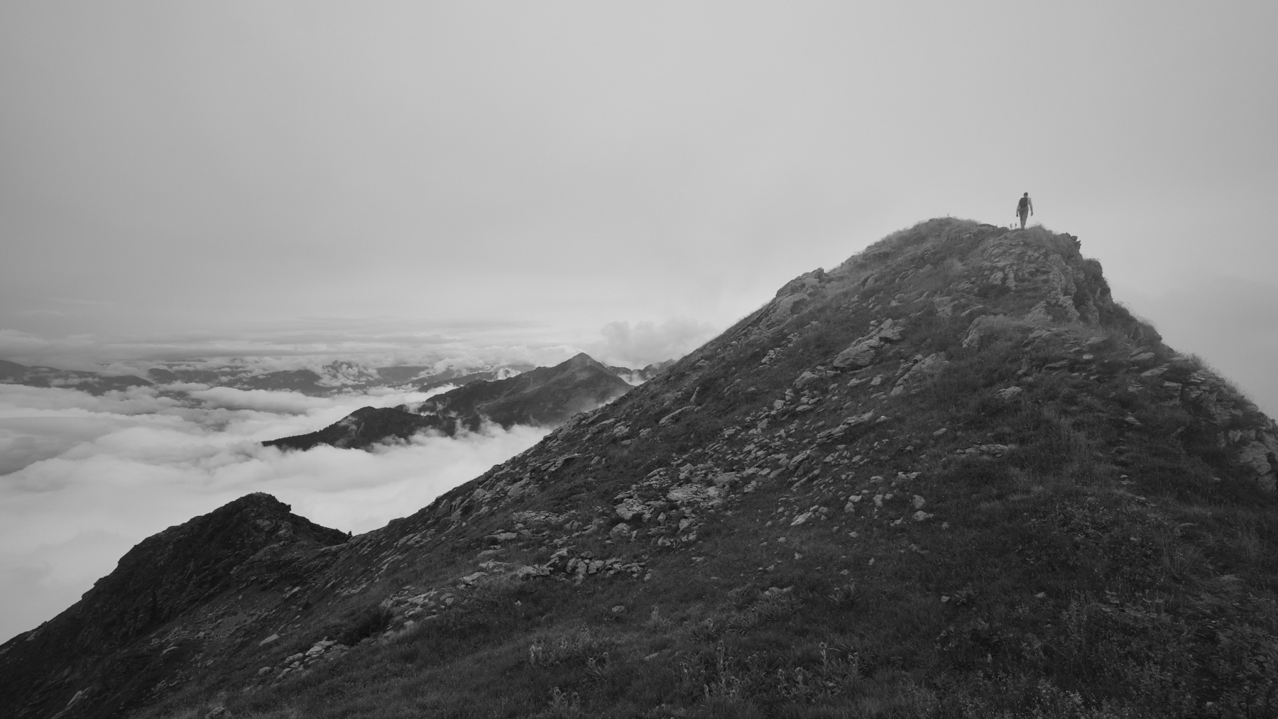
Even if the weather wasn't to our liking, this route along the crest of the Lauzière massif offers spectacular panoramic views of the Bauges, Beaufortain and Tarentaise mountains, and in the distance but clearly visible, the snow-capped dome of nearby Mont-Blanc. The hike also features a long, airy ridge with many short, easy but impressive climbs. Lovely little lakes are also part of the landscape, making this a fine outing which, with more time, can be extended to the Grand and Petit Arc, requiring a return transfer to be organized.
❱❱ Technical summary
■ S tarting point: Chalet de l'Ébaudiaz, above Notre-Dames-des-Millières, Savoie (73)
■ Type of route: high-mountain loop hike
■ Distance: 9.8 km
■ Cumulative elevation gain: +770 m
■ Cumulative negative elevation gain: -770 m
■ Estimated total time: 3h30 to 4h30
■ Min and max altitude: 1630 m / 2284 m
■ S igns: yellow PR for most of the route
■ Equipment: none
■ Equipment required: none
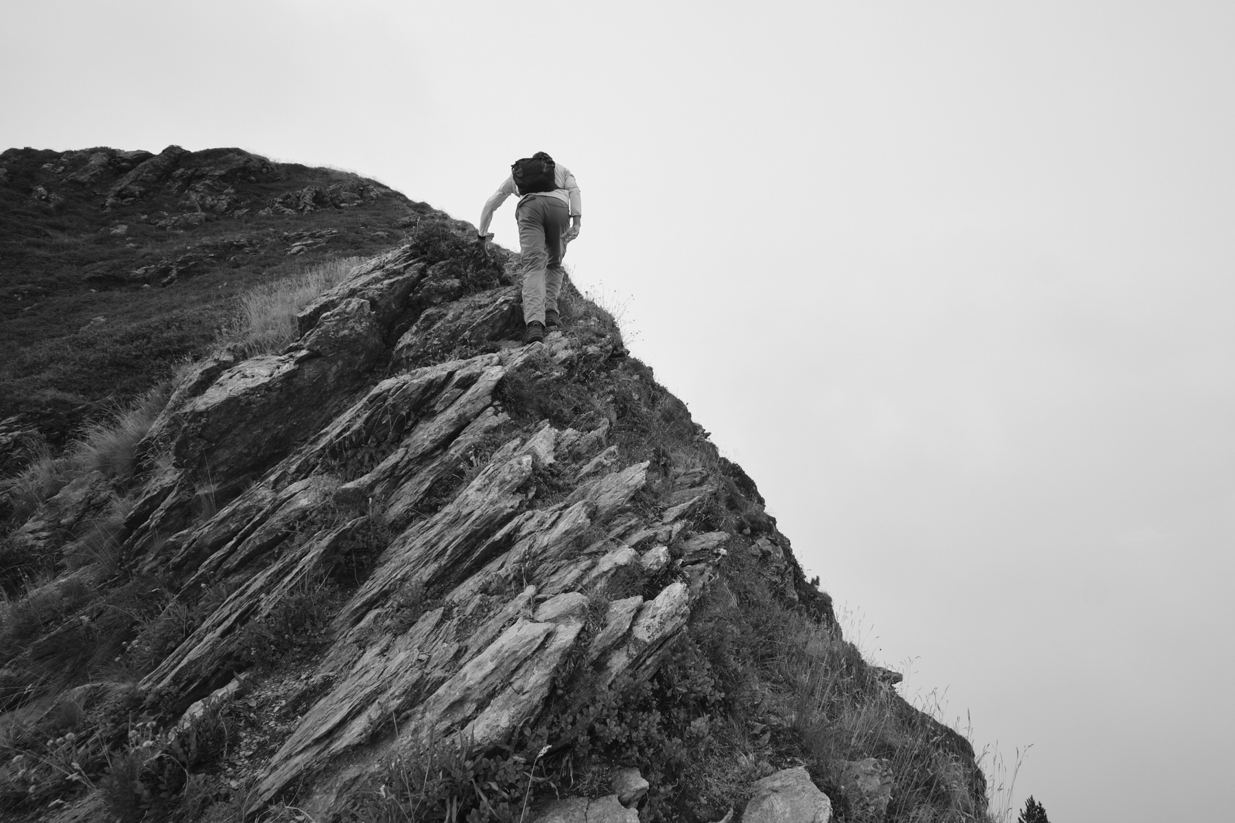
Difficulties: several aerial ridge crossings, hands can be put down in places.
❱❱ Access to the place
Arriving from Grenoble or Chambéry, just before reaching Albertville, enter the village of Notre-Dame-des-Millières. From here, take the bad summer road which, after 36 twists and turns in the forest, takes you up 1300m and out onto the Lauzière mountain pastures at the Chalet d'Ébaudiaz. Park here, the starting point of the loop.
❱❱ Map & topo
Voir en plein écran❱❱ Itinéraire
Leave the small parking lot to the north and follow the track past the Chalets du Séchon. Farther on, leave the downhill track and climb to the right, where you will find the start of the ridge. The trail is marked in yellow.
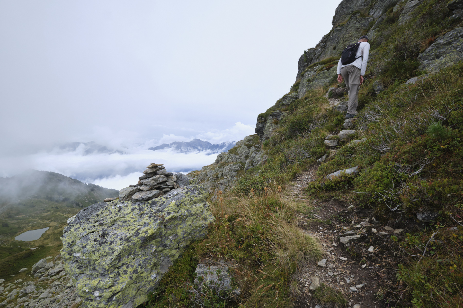
A steep initial ascent leads to the summit of Grande Lanche (2112m). The crest route is clearly visible ahead. Descend gently to the Col de la Lanche, climb a little, pass a second col and tackle the steep, airy ascent to the Dent du Corbeau (2280m). From here, panoramic views of the surrounding massifs, Tarentaise, Beaufortain and the summit of Mont-Blanc jutting out to the northeast.
Descend to Col de Charvan and continue along the ridge to reach a final summit at 2284m just before La Thuile. Descend to the Col de la Thuile, where the ridge route ends. Start of the return journey to Ébaudiaz.
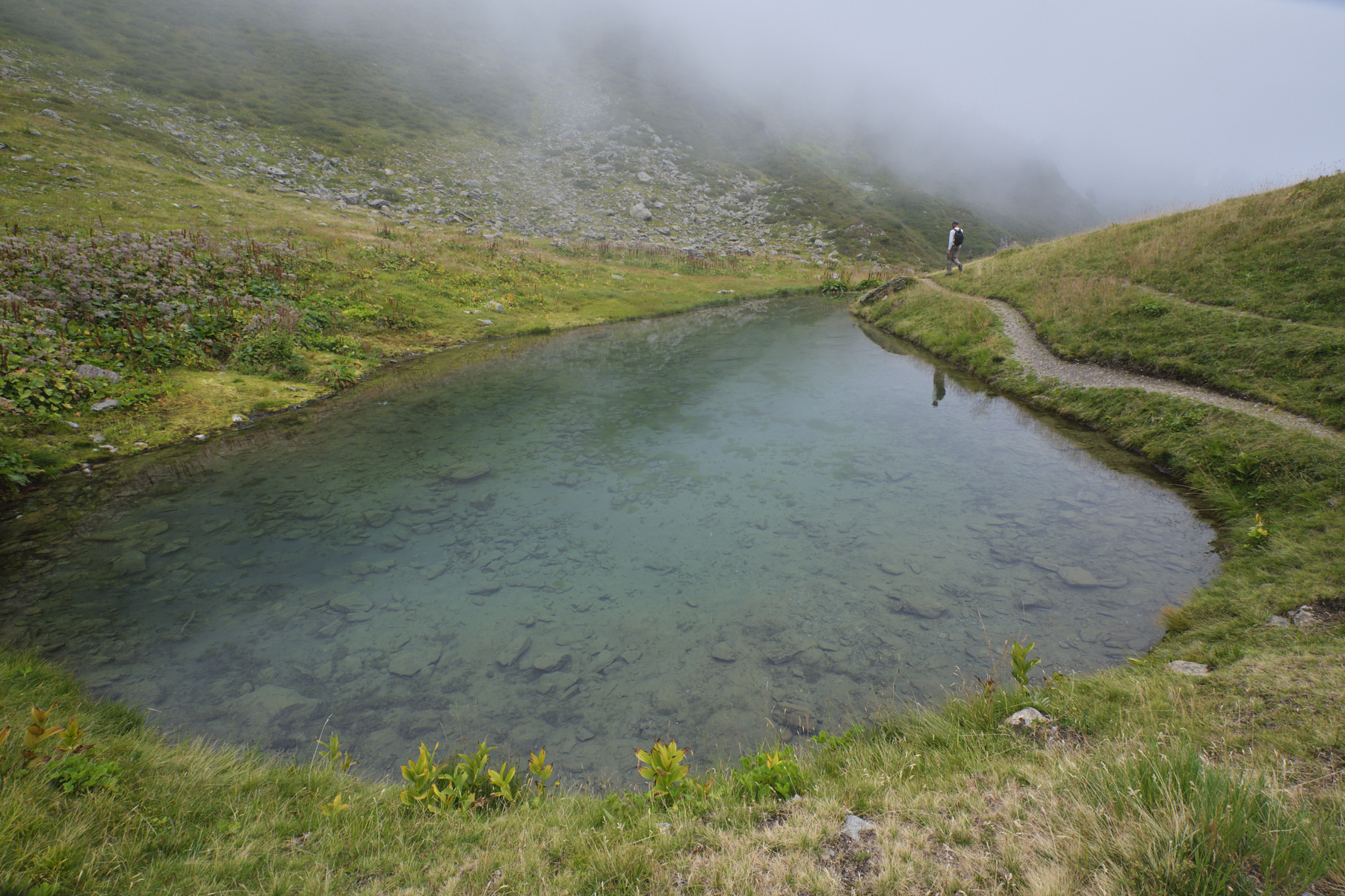
From the Col sous La Thuile, descend on the west side towards the Chalet refuge de la Thuile. Descend to reach the bottom of a basin containing the Fontaine Claire lake. Go alongside the small lake and continue on a track that curves downhill and, just before the refuge, forks right towards Ébaudiaz (2.6 kms away). From here, follow the path, which is not very visible in places, for a long traverse heading north, remaining more or less level, even if there are small rises in 2 places. Finally, the trail crosses a stretch of forest to reach the starting parking lot.


![2017-08-05_13-35-40 [Monte Rotondo]](https://climbing7.com/wp-content/uploads/2017/09/2017-08-05_13-35-40-monte-rotondo-1024x683.jpg "Monte Rotondo, Melo and Capitello, Corte")


Leave a Reply