From the bottom of the Inclès valley, this out-and-back itinerary climbs the border ridges between France and Andorra to reach 2 very close peaks, the Pic de Noé and the Pic d'Escobes. The higher you climb, the more impressive the panoramic view over the small valleys and the many ponds that reflect the light to form beautiful natural mirrors. The program includes the Juclar ponds on the way up, then once on the ridges on the French side, the étang de Joclar, the étang de l'Albe and the étang du Sircar to the southeast. While the approach is fairly long but without difficulty, the route from the Col de l'Albe to the summits is more aerial and exposed in places, ending with a few climbing steps (III/IV max).
❱❱ Technical summary
■ S tarting point: Pont de la Badalosa, Vall d'Inclès, Canillo, Andorra
■ Type of route: high-mountain loop hike, ridge sections
■ Distance: 14.5 km
■ Cumulative elevation gain: +940 m
■ Cumulative negative altitude gain: -940 m
■ Estimated total time: 6h30 to 7h30 ■ Min and max altitude: 1840 m / 2781 m
■ S ignposts: signposted path from Pont de la Badalosa to Col de l'Albe, then cairned trail to ridges and summits
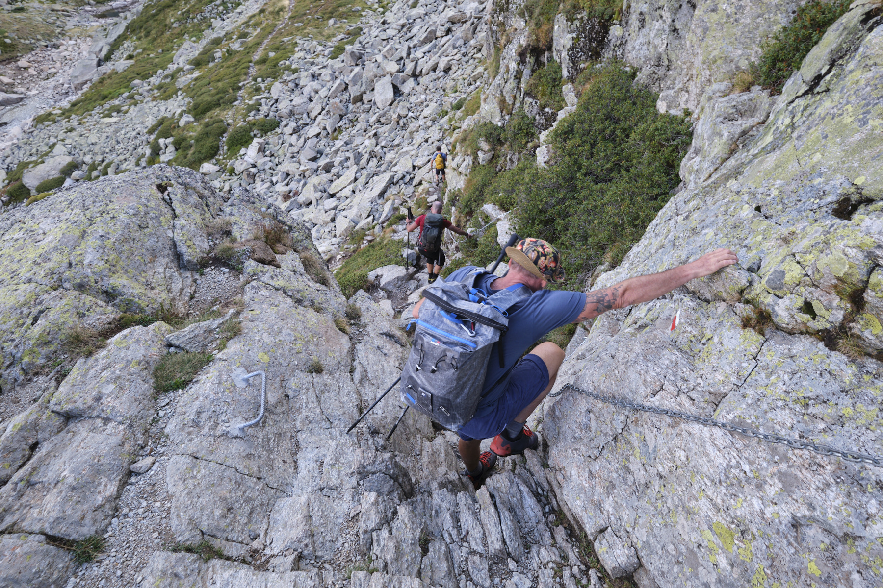
■ Equipment in place: a small equipped passage (chain, bars) after the refuge to descend to the ponds.
■ Equipment required: none
Difficulties: fairly airy ridge passage, moderately exposed final section to climb (III+).
❱❱ Access to the place
On the Pas de la Case road to Andorra la Vella, turn off at Soldeu to enter Vall d'Inclès. Follow the narrow road to the bottom of the valley as far as the Badalosa bridge, where you can park. In summer, access is restricted between 9am and 5pm. Either arrive before and leave after, or take the shuttle bus for 3€.
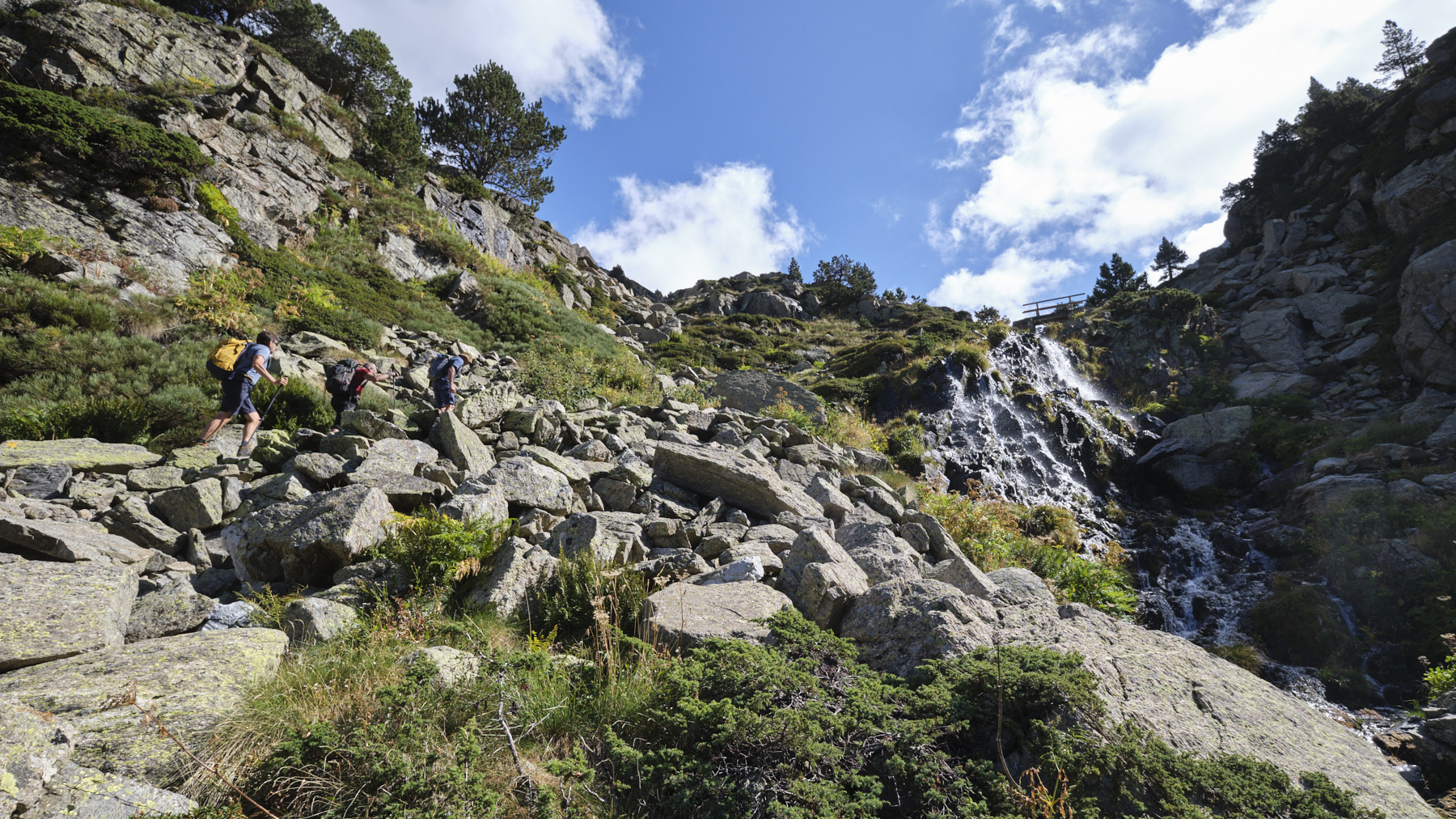
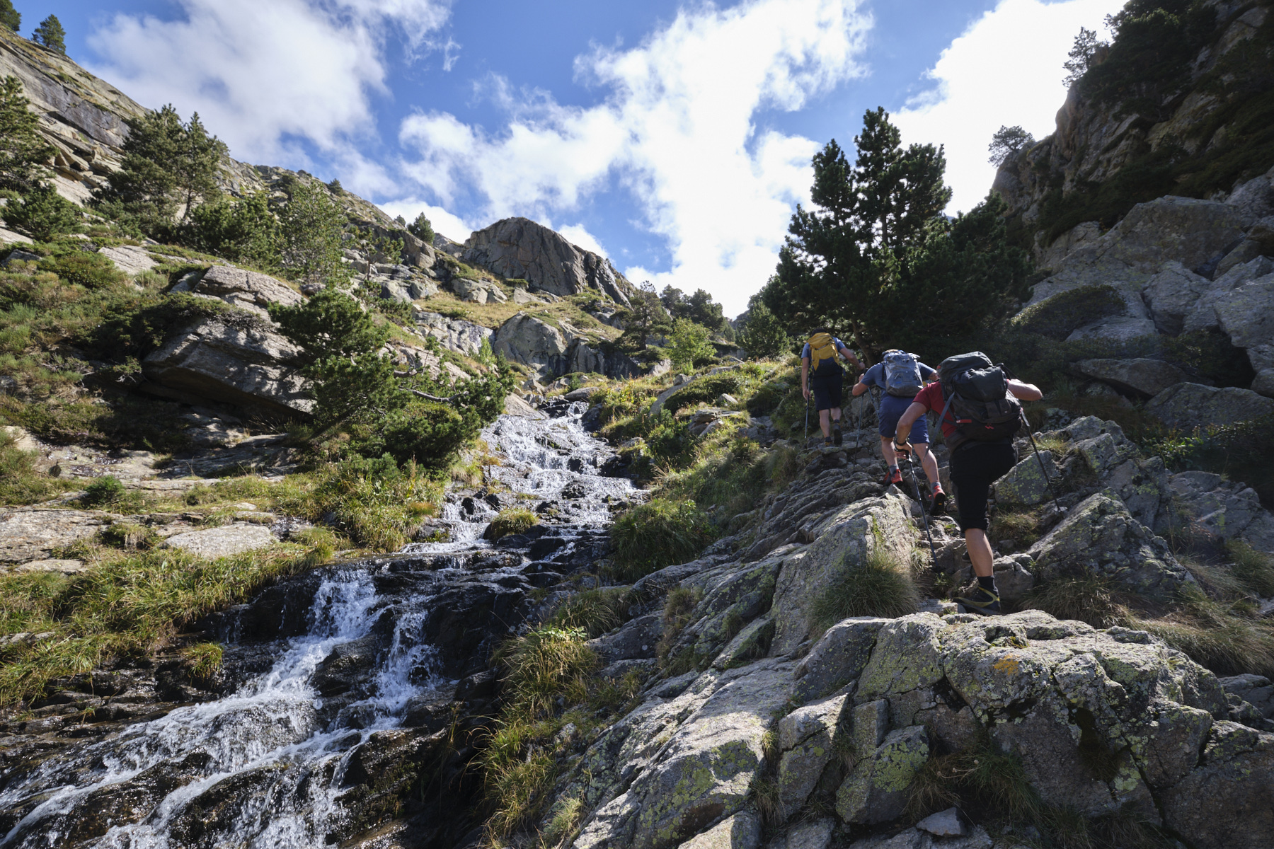
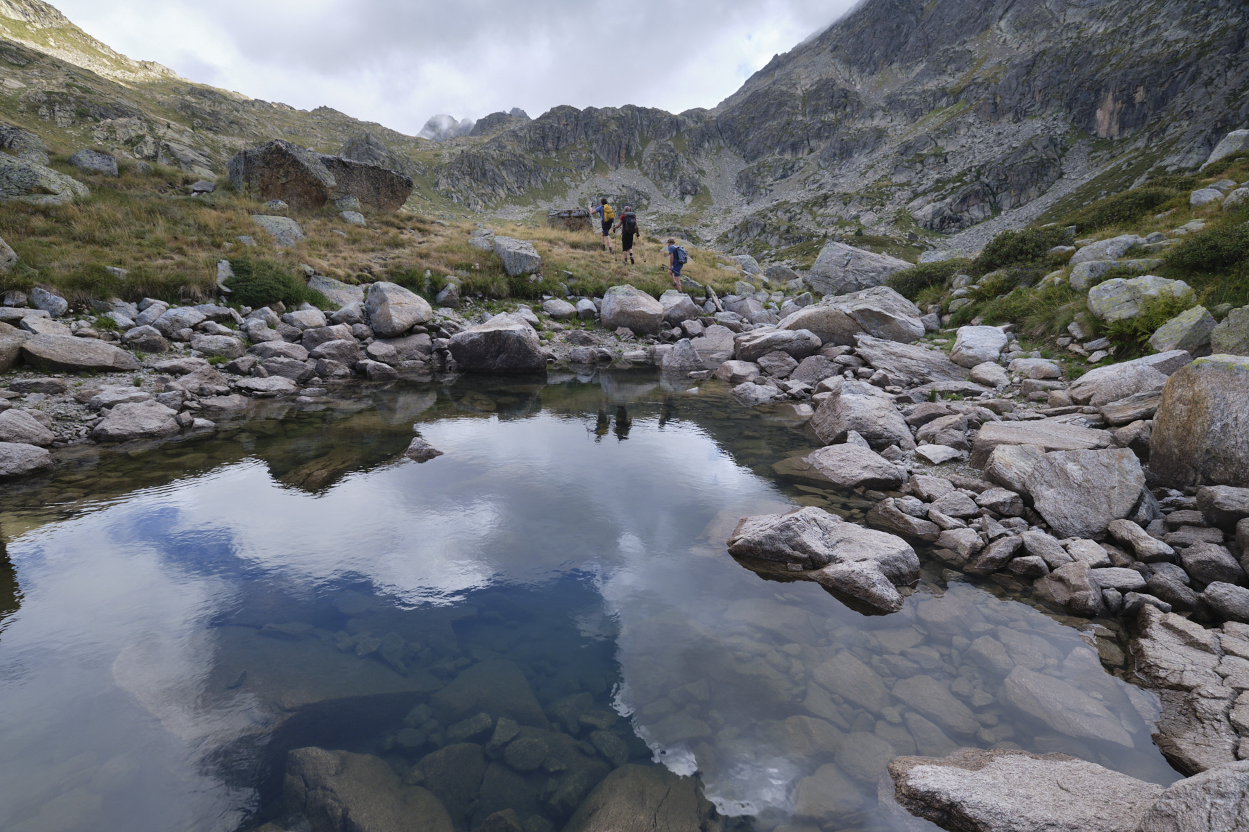
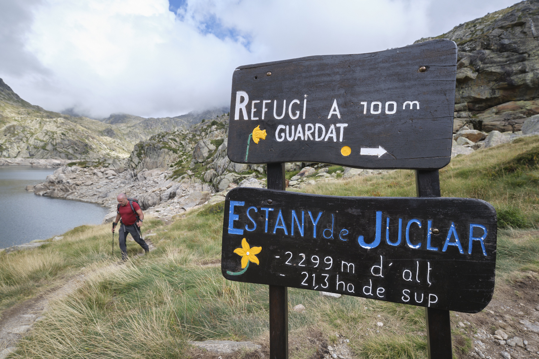
From the Pont de la Badalosa, take the track that climbs quietly along the riu de Juclar, passing the Pont de Travenc at the furthest point. The path then begins to climb more steeply to pass alongside a beautiful waterfall. Above this, a wide flat leads after a final climb to the small dam on the weir of the 1st Juclar pond. Climb just above to discover the Juclar refuge.
Part 2: Col de l'Albe (1h to 1h30, 2539m)
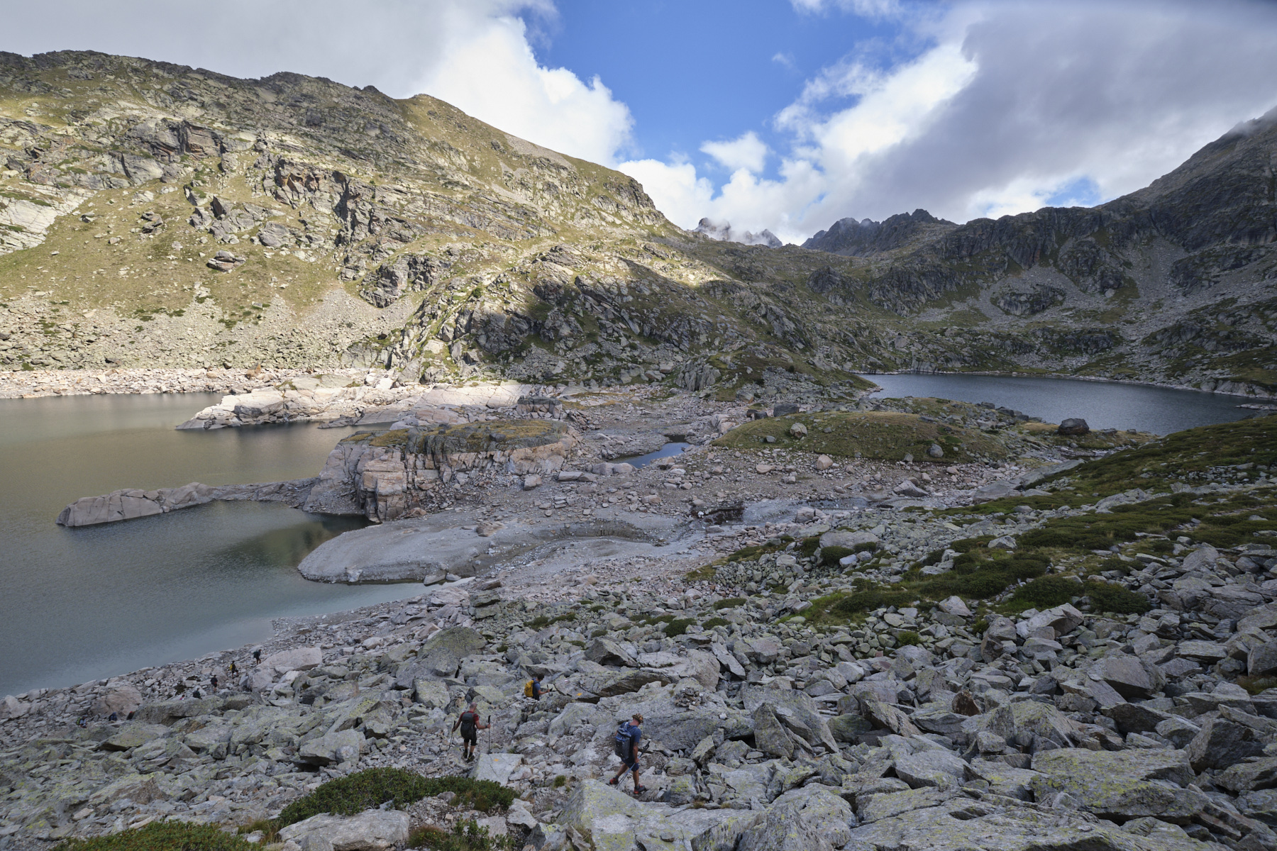
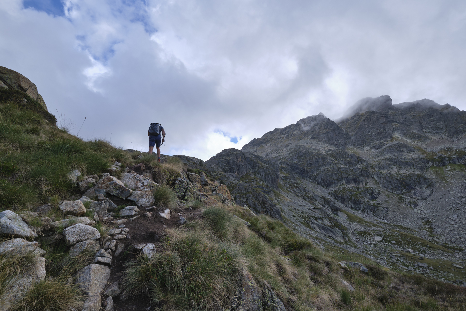
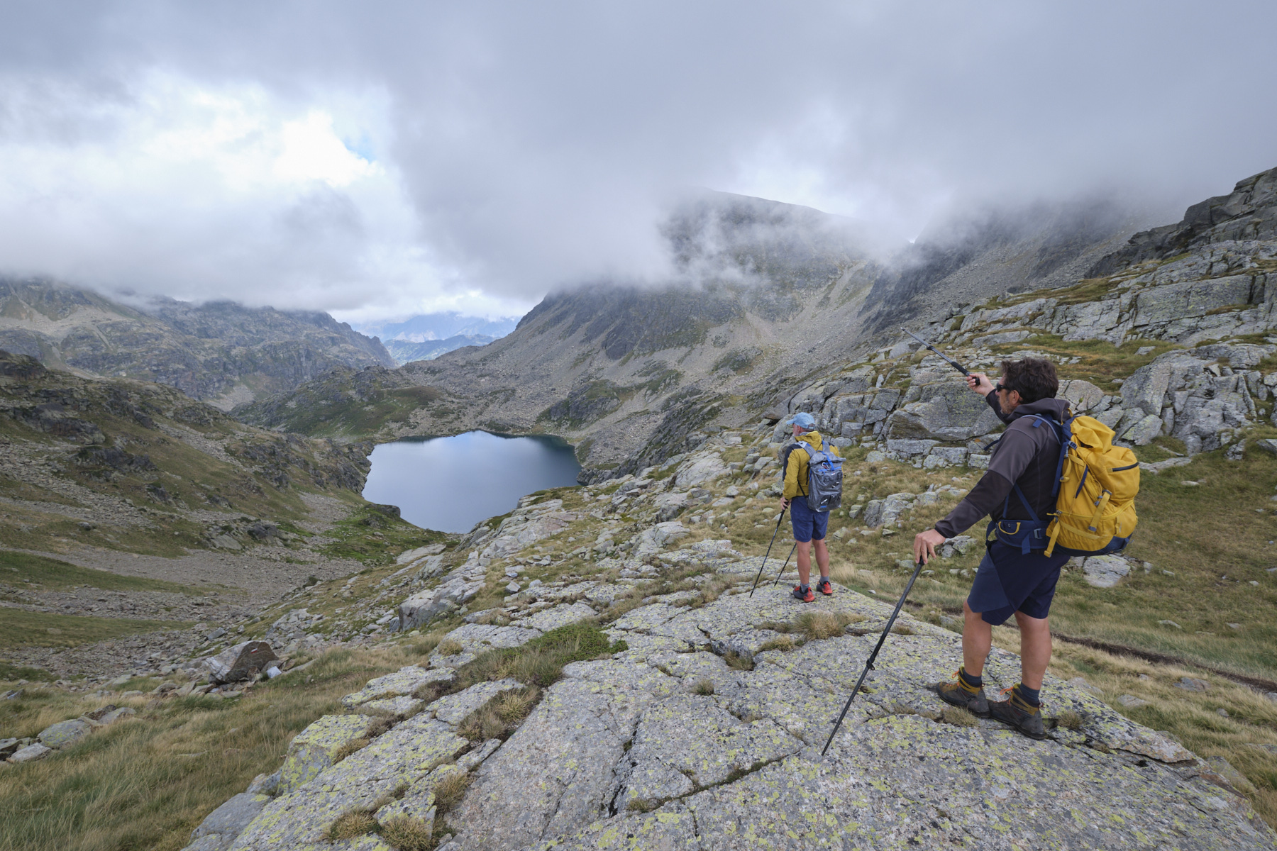
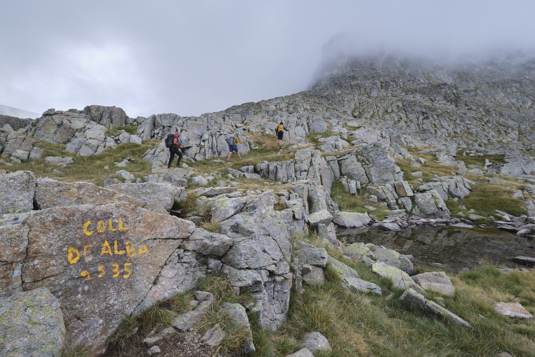
From the refuge, follow the path above (it also passes below, but the view is less panoramic). Cross over the top of the pond before descending with a small passage equipped to pass between the 1st and 2nd Juclar ponds. You then cross a small metal bridge. Climb up the other side and reach the Collada de Juclar at 2450m. From here, head due east towards the Col de l'Albe (indication painted on the rock). The path is well marked and cairned, passing between several small ponds to climb up to the Col de l'Albe at 2539m, the border with France. View of the upper Albe pond.
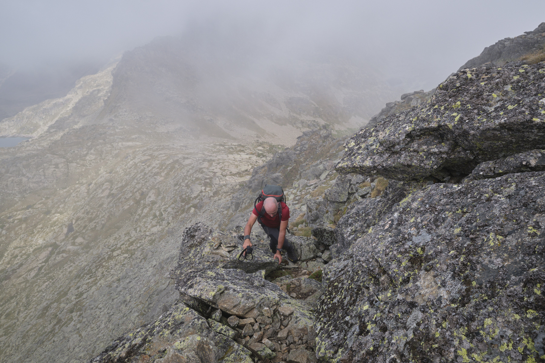
Part 3: Pics de Noé and d'Escobes (1h, 2781m)
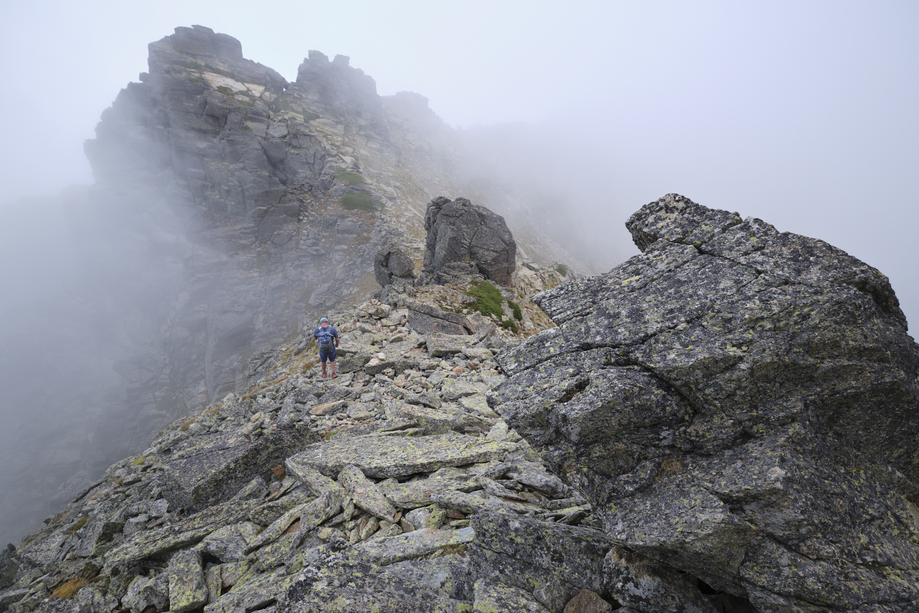
At the Col de l'Albe, we're at the foot of the ascent to the Pics. It looks very rocky and impassable, but a small path leads upwards with frequent cairns. Several routes are possible. Either cross the western slope first, then climb to the ridge between the 2 peaks, or stay as close as possible to the edge of the ridge and exit in front of Pic de Noé.
The summit of Pic de Noé, which rises above Etang de l'Albe, can be reached by negotiating a boulder ridge. It's aerial, with a few small climbing steps (III), but no real difficulty. The view is splendid, also on the south side over the Siscar valley.
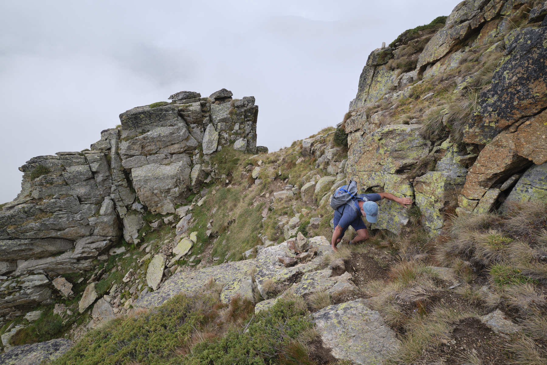
From the Pic de Noé, return to the ridge and reach the base of the Pic d'Escobes via a path that cuts through a steep rocky ridge on the left. You arrive at the foot of the Pic. Here, you can either go around to the left, or go straight on. In both options, the climb is steep, with small cairns and a final 2 or 3 pitches of III/IV- climbing. Exceptional 360° panoramic view.
Part 4: Pic d'Escobes to Pont de la Badalosa (2h30 to 3h)
Descend by the same route. You can cut across the 1st Juclar pond to pass under the refuge before dropping down behind the small dam. Last shuttle bus in summer at 5pm. Otherwise, add 45' to 1h walk on the road.
Monte Rotondo, Melo and Capitello, Corte 5 August 2017 From the Restonica Valley, climb Corsica's second highest peak, Monte Rotondo at 2622m, and return via the…


 Partager sur WhatsApp
 Partager sur Twitter
Partager sur Instagram
Partager sur Twitter
Partager sur Instagram

 Partager sur Facebook
 Imprimer le topo
 Laisser un commentaire


![2017-08-05_13-35-40 [Monte Rotondo]](https://climbing7.com/wp-content/uploads/2017/09/2017-08-05_13-35-40-monte-rotondo-1024x683.jpg "Monte Rotondo, Melo and Capitello, Corte")


Leave a Reply