


TOPO Via ferrata | CLIMBING7.COM
Publié le
 Partager sur WhatsApp
 Partager sur Twitter
Partager sur Instagram
Partager sur Twitter
Partager sur Instagram

 Partager sur Facebook
 Imprimer le topo
 Laisser un commentaire

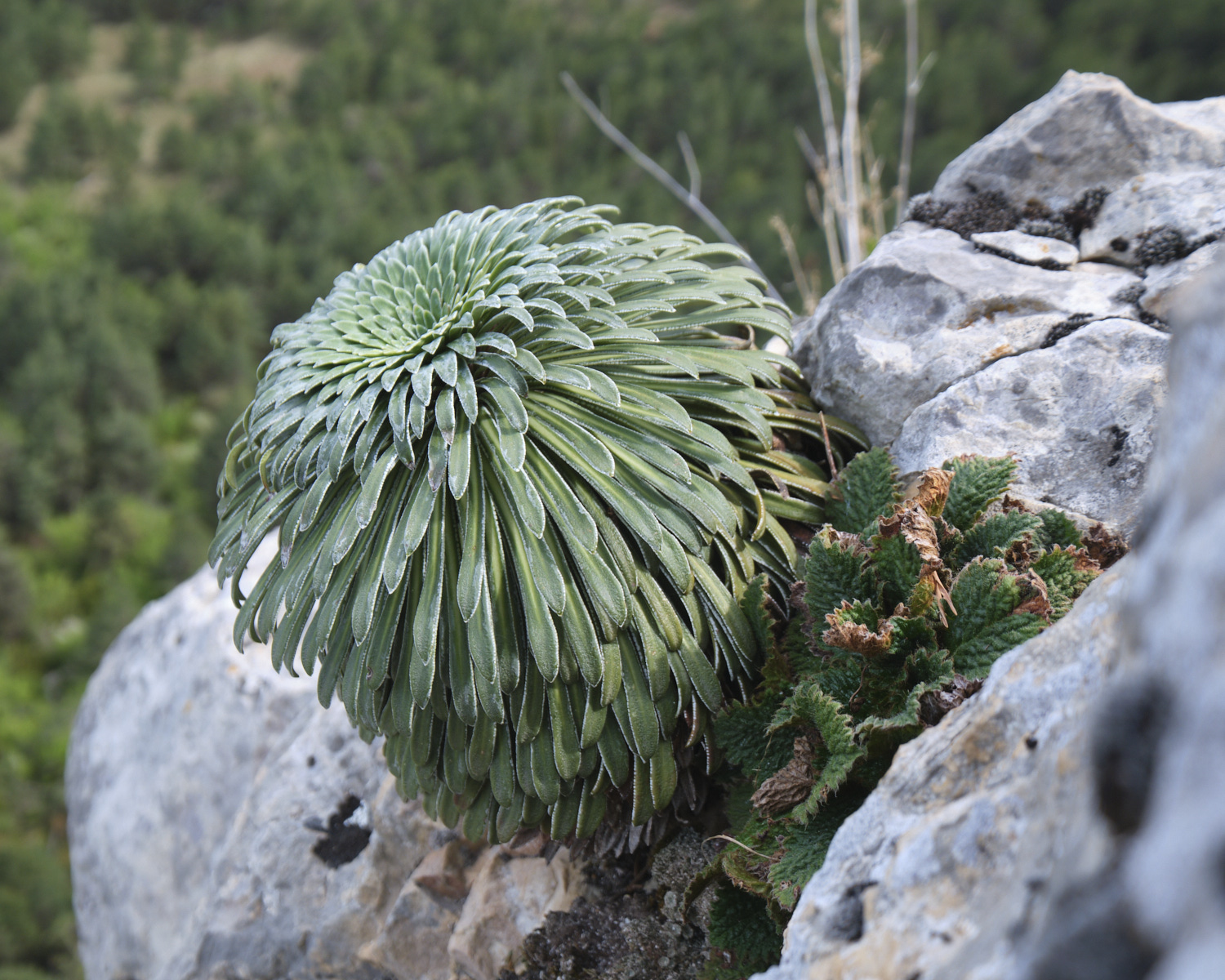
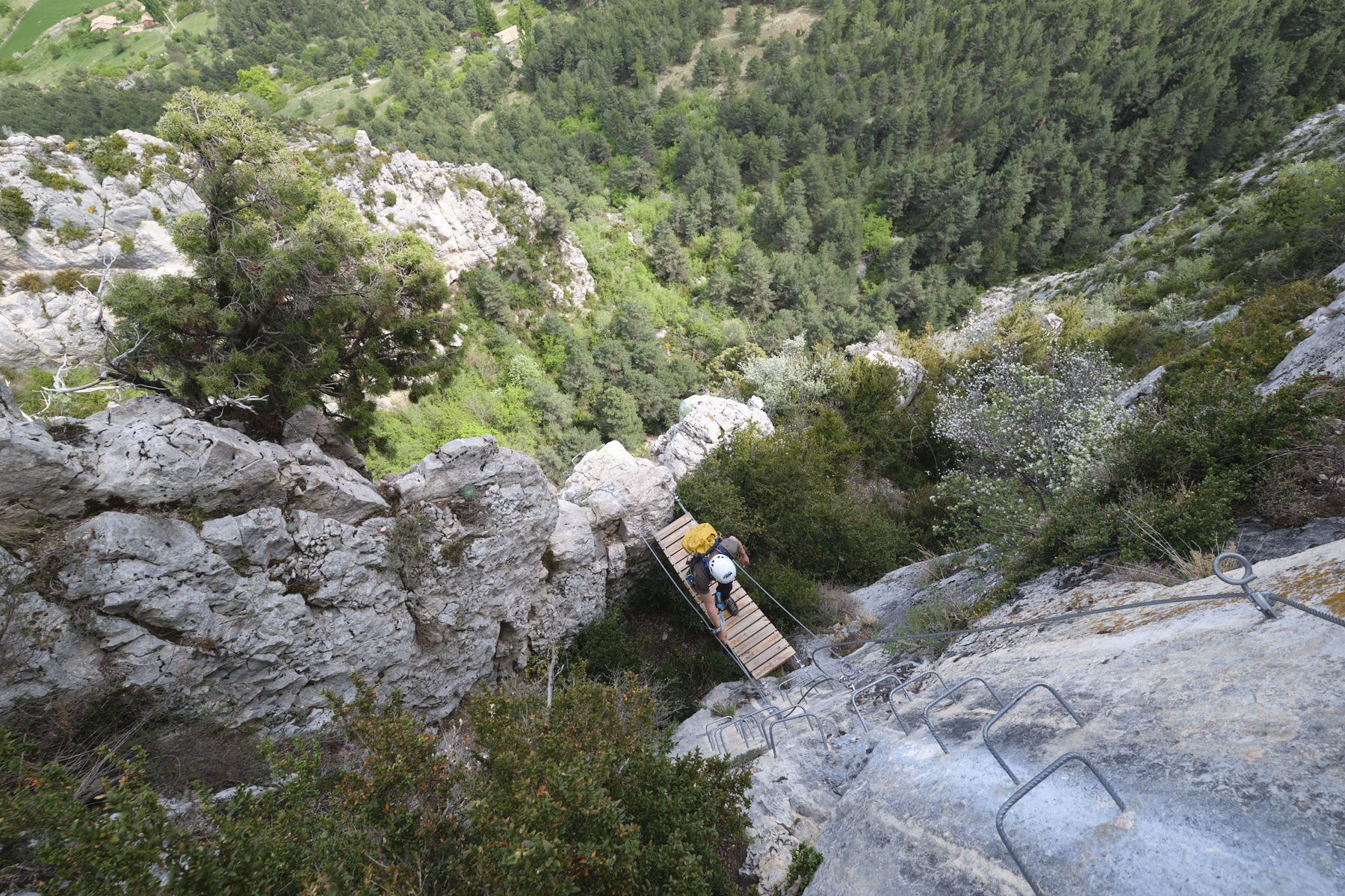
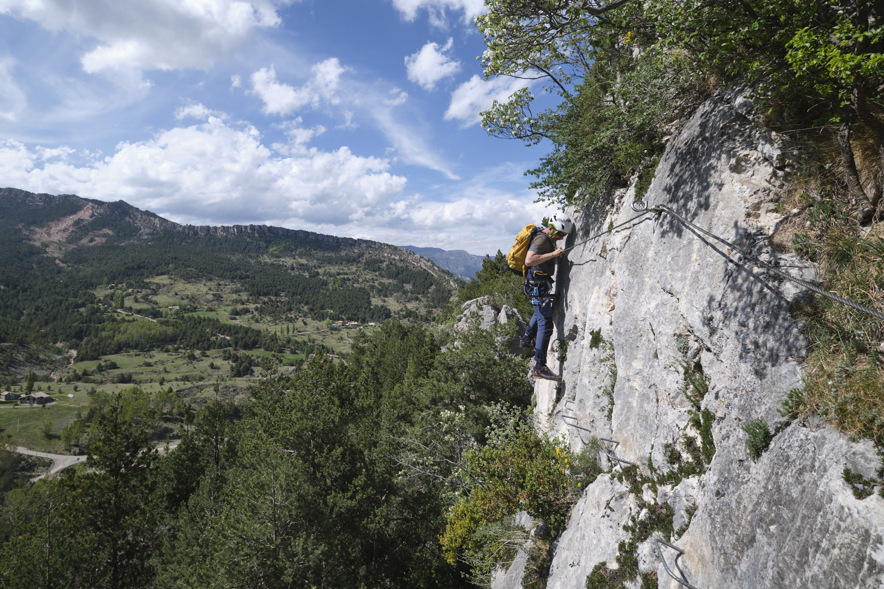
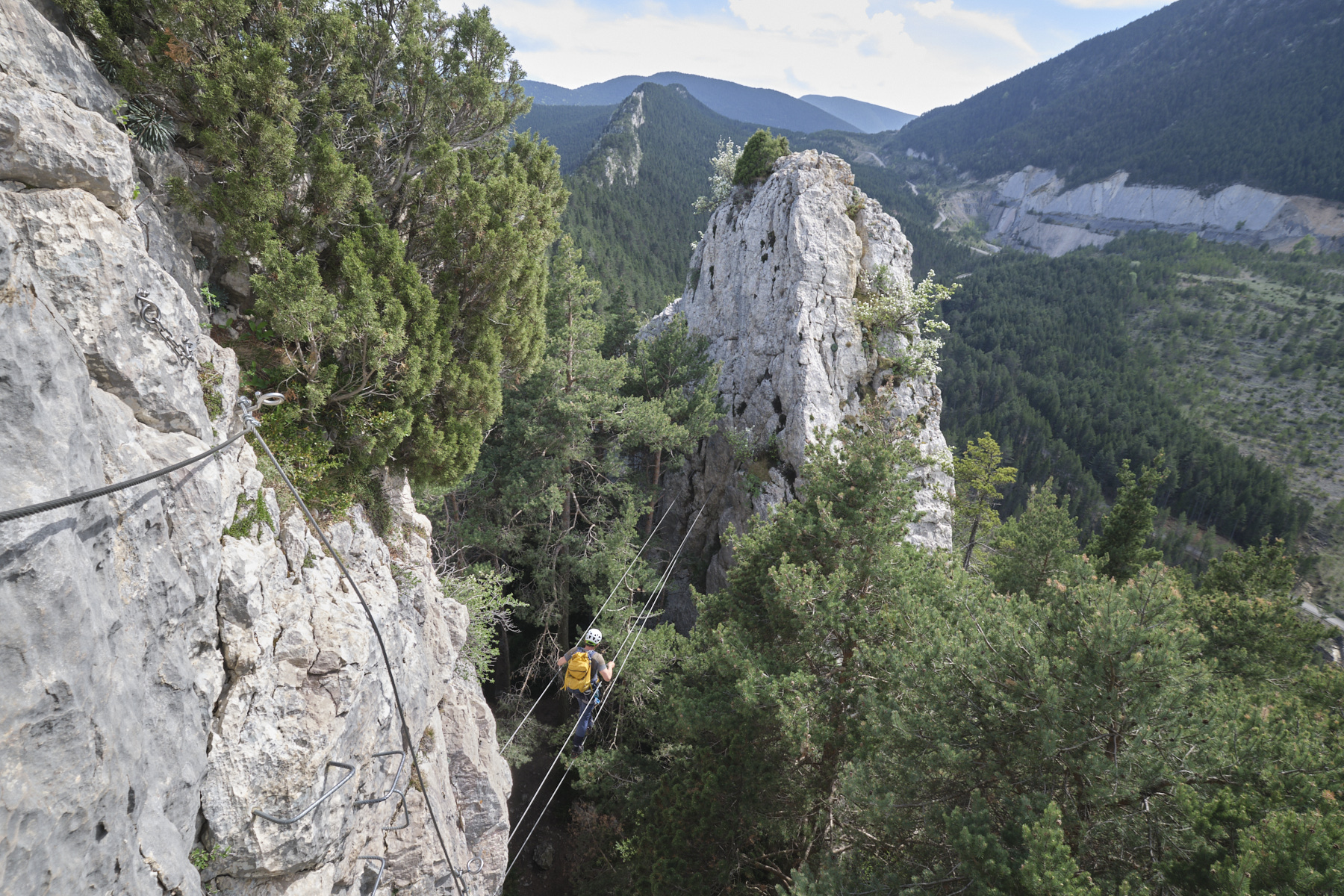
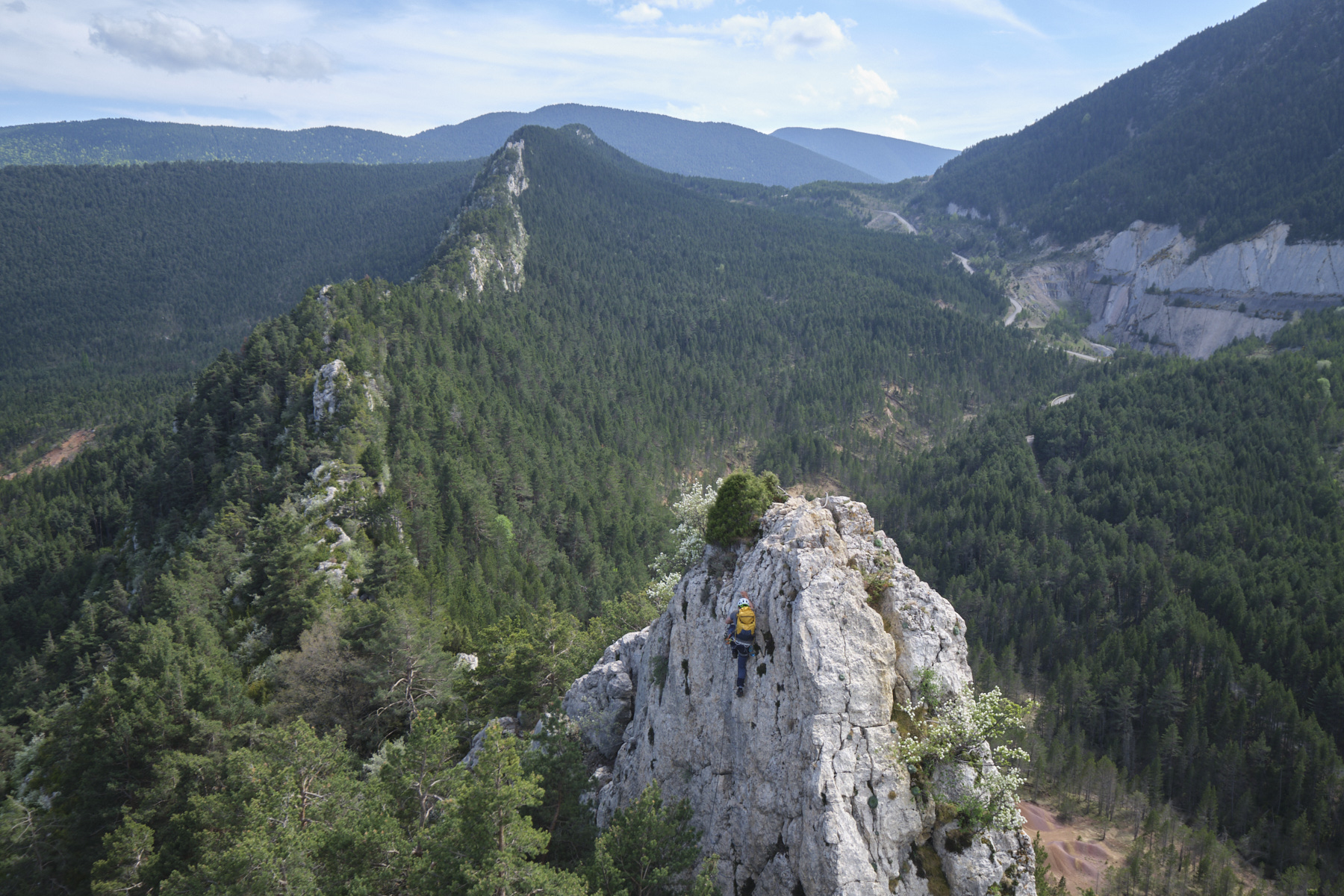
En las estribaciones del Pirineo catalán, bajo la Serra del Cadí, se ha trazado la ruta Roques d'Empalomar en una larga cresta rocosa que emerge de valles bordeados de abetos. En lo alto del pueblo de Vallcebre, la ferrata tiene dos tramos: el primero vertical (K4) para ascender por la cara este de los acantilados hasta la cumbre, y el segundo por la cara oeste, más de travesía para alcanzar la cresta del Cami de l'Aeri (K3). Mantenida por un grupo local, el acceso cuesta 5 euros al día, incluyendo la otra ferrata de la zona, la más difícil Cal Curt (K5), que se puede combinar porque está en el mismo lugar. Un lugar agradable, a un paso de la ruta del Pedraforca y no lejos de la fabulosa Sierra de Cadí.
❱❱ Reseñas técnicas
■ Punto de partida: por encima del pueblo de Vallcebre, Cataluña, España.
Tipo de ruta: vía ferrata
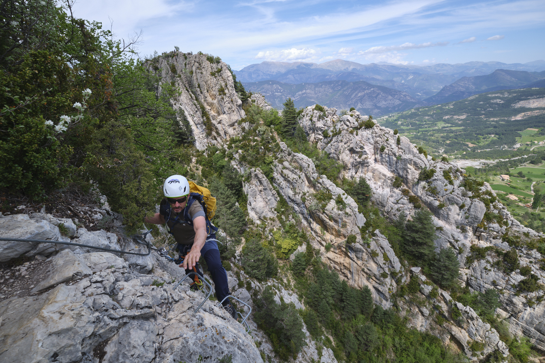
Dirección: este (parte 1) y oeste (parte 2)
■ Longitud ajustada: 300m
■ Desnivel positivo: +130 m
■Tiempo total estimado: de 2h a 3h.
■ A ltitud mínima y máxima: 1350 m / 1482 m
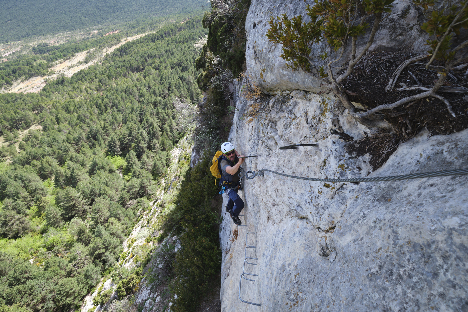
■ Equipamiento en el lugar: excelente: peldaños, cadenas, plataformas de madera y puentes colgantes.
■ Equipo necesario: equipo estándar.
Dificultad: K4 o D, varios tramos ligeramente en voladizo que hay que superar en la primera parte (K4), segunda parte más fácil (K3).
❱❱ Acceso al sitio
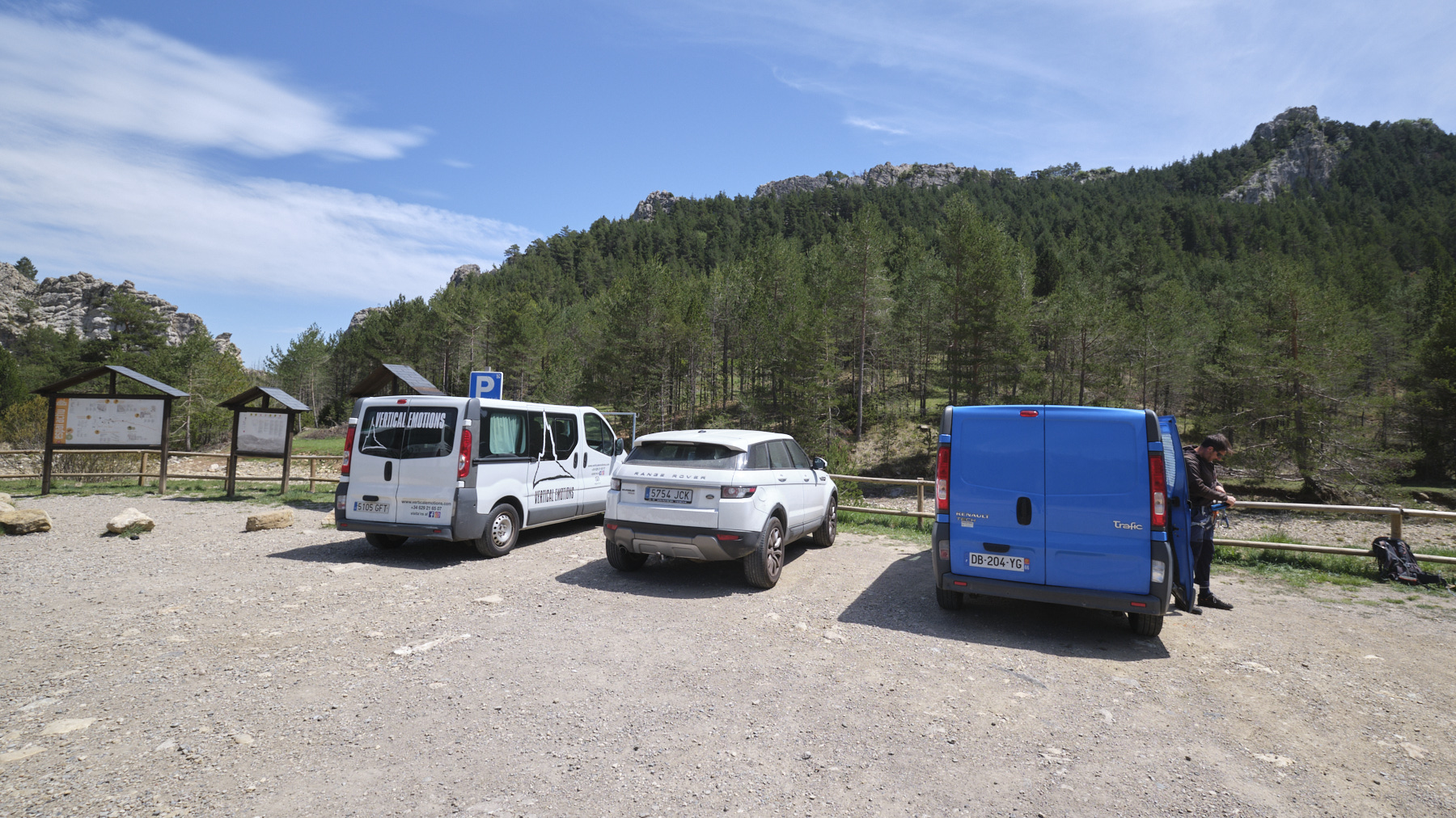
Por la C16 entre Barcelona y Puigcerda, a la altura de Guardiola de Bergueda, desviarse por la B400 hacia Saldes y girar a la izquierda hacia el pueblo de Vallcebre. Atravesar el pueblo y subir hacia Coll de Pradell. Aparcar en el parking reservado, donde hay un panel informativo sobre las vías ferratas de la zona.
Para pagar la tasa, vaya a la página Espai Actiu del ayuntamiento para registrarse y pagar en línea.
❱❱ Mapa & topo
El recorrido del curso equipado es indicativo.
Voir en plein écran
❱❱ Itinéraire
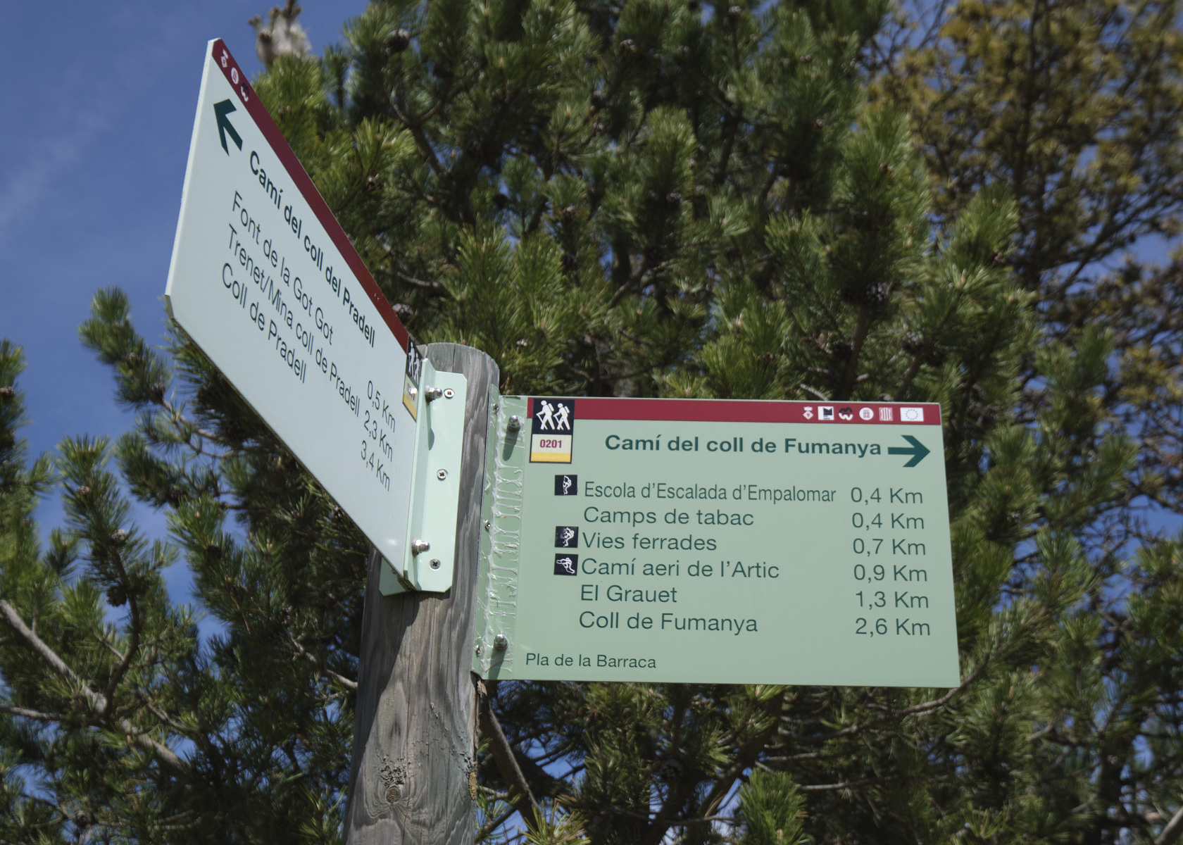
Siga las señales desde el aparcamiento. El sendero asciende para alcanzar la cresta rocosa y cruzar al lado opuesto. Finalmente desciende para encontrar el inicio de la ferrata. La ruta de aproximación está marcada en verde y blanco.
Descienda de la cima para encontrar un poco más abajo el sendero de aproximación, que puede tomar en dirección contraria para volver al aparcamiento.
Topo de la ferrata sur deandar (en español)


Deja una respuesta